

The Central City neighborhood is one of the 20+ neighborhoods making up Salt Lake City, Utah.
It covers the area east of State St to 700 East and between South Temple and 700 South. It has also been called the Salt Lake City East Side Historic District.
Related Posts:
Noteworthy related places located inside the Central City Historic District:
- The 10th Ward Chapel
- Armista Apartments, 1927 555 East 100 South
- Armstrong, Wm. Francis House, 1897 (S.C. Dallas) 667 East 100 South
- B’nai Israel Temple
- Bamberger, Simon House, c.1888 623 East 100 South
- Beattie, Jeremiah House, 1898 (Walter Ware) 655 East 200 South
- Bettles, Alfred J. House 53 South 600 East
- Boxrud, Anton H. House 57 South 600 East
- Congregation Montefiore Synagogue / Saints Peter and Paul Orthodox Church
- Congregation Sharey Tzedek Synagogue
- Cornell Apartments, 1910 101 South 600 East
- Corona Apartments
- Christopher Cramer House
- Davis Deaconess Home
- Dinwoodey Mansion, 1890, 411 East 100 South
- First Church of Christ, Scientist
- First Methodist Episcopal Church
- Fortunato Anselmo House
- Harris Apartments
- Hollywood Apartments
- Lewis S. Hills House
- J. A. Fritsch Block
- Immanuel Baptist Church
- Ivanhoe Apartments
- Kahn Mansion, Emanuel & Fanny
- Kimball, Edwin P. House 124 South 600 East
- Ladies Literary Club Building
- Langton, James & Susan R. House, 1908 648 East 100 South
- Lincoln Arms Apartments
- Frederick A.E. Meyer House
- Millard F. Malin House
- Royle, Jonathon C. & Eliza K. House, c.1875 635 East 100 South
- Rudine, August & Annie House 780 South 600 East
- Eliza Gray Rumel House
- Salisbury, O.J. House 574 East 100 South
- Salt Lake City and County Building (451 S State St)
- Smith Apartments
- St. Mark’s Episcopal Cathedral (231 E 100 S)
- Stratford Hotel
- Trinity African Methodist Episcopal Church
- Trolley Square 600-700 East/500-600 South
- Whitely, Rose Hartwell House 132 South 600 East


From the National Register of Historic Places Registration Form:
Narrative Description
The Central City Historic district is located five blocks east of the Central Business District of Salt Lake City (see attached map). It is a “dumb-bell” shaped district that is unified by a parking median extending the full length of the district on 600 East. The district begins just south of the South Temple Historic District and extends nine blocks south to the northern edge of Liberty Park. The east and west boundaries of the district varies between 500 and 700 East, and is two blocks wide at its widest points. Each of the seventeen blocks within the historic district retains its original ten-acre size, many with courts and through streets which provide access to the interior of the blocks. Single family homes exist today side by side with multiple family apartment complexes, converted single family houses, as well as commercial and office spaces. This combination of functions creates a dense and diverse mixed use/residential area. A commercial strip bisects the district along 400 South Street, serving to visually divide the district into north and south sections. The north and south areas are unified by the significant feature of grass ‘parking’ medians, which are located in the center of 600 East Street and extend the entire nine block length of the district. The housing stock and the period of significance in the district dates from c. 1870-1946. Of the 577 structures/sites within the district 147 (24%) were built between 1870-1900, 347 (59%) between 1901-26, and 28 (5%) between 1927-46. A total of 487 (87%) sites/structures are from the historic period and contribute to the historic character of the neighborhood.
Residential Single Family Dwellings
The Central City Historic District consists primarily of single family residential housing with 70 percent of the total building stock built as single family housing. 1 The range of styles and types of structures is consistent with the popular styles and forms of that era. Victorian, Arts and Crafts Bungalow, Prairie School, and Period Revival cottages are all present in the district. As expected, the types found in the district vary with the styles. Earlier Neo-Classical and Victorian styled buildings exhibit cross-wing, central-block with projecting bay and side passage footprints. The bungalows employ rectangular block and open plans. The period revival cottages in the area employ rectangular plans and variations thereon. There are three examples of single family bungalow courts in the district. Hawkes Court is located at 650 East 200 South, with nine homes built between 1890 and 1911; Vernier Place is located at 350 South 500 East, with all eight of the houses built in 1900 and the fourteen homes on Hawthorne Avenue located at 550 South 500 East were built in 1915. The most common construction materials present in the district are brick and frame, with several adobe structures present. The materials used for foundations varies with the age of the structure chronologically from stone to brick to concrete. Finish materials range from clapboard, brick, shingle, and stucco; to newer additions with aluminum and asbestos siding.
The district contains two distinct areas of residential development, the combination of which serves to characterize the growth of the city. Larger high-style residences are present in the neighborhoods located in the northern portion of the district.
The neighborhoods along 100 South Street developed as somewhat of an extension of the fashionable homes along South Temple Street. Thus, this portion of the district contains several larger architect designed homes. The southern portion of the district contains for the most part less substantial homes such as vernacular cottages typical of early nineteenth-century western America. Carpenters, tradesmen, and individuals built the majority of residences in the south portion of the district, with just a few examples of architect-designed residences. Courts located on the interior of the blocks, such as Hawkes Court in the northern portion of the district and Hawthorne Court in the southern portion of the district, are developed with smaller versions of the vernacular homes popular in the 1870 to 1926 period of development.
The residential areas of the district retain the feeling and association of an urban neighborhood. The ten acre block size of the original Salt Lake City plat is maintained throughout the district. Cohesiveness in the district is also maintained by the dominance of historic residential structures of similar scale. Landscaping features such as uniform set backs, ‘parking’ medians and older, uniform tree plantings also add to the cohesiveness of the district.
Residential Multi Family Dwellings
Existing multiple family dwellings range from converted single family housing to three and four-story apartment blocks. There are a few unique multi-family arrangements such as a two story row house located at 620-632 South Park Street built in 1891; a bungalow court of attached single family dwellings at 661-678 East Green Street built in 1919. Other multi-family dwellings include: Caserio Court – a bungalow court at 614 East 600 South built in 1910; the four story Hyrum Jensen Apartments at 703 South 600 East built in 1912, and the William Van Horbeck Apartments at 651 South 600 East built in 1915. A 1950s era multiple family living complex, the Ambassador Court apartments at 150 South 600 East, has been converted to professional office space. Many of the out of period buildings in the district are multiple family apartment dwellings which are in keeping with the historic scale of the neighborhood.
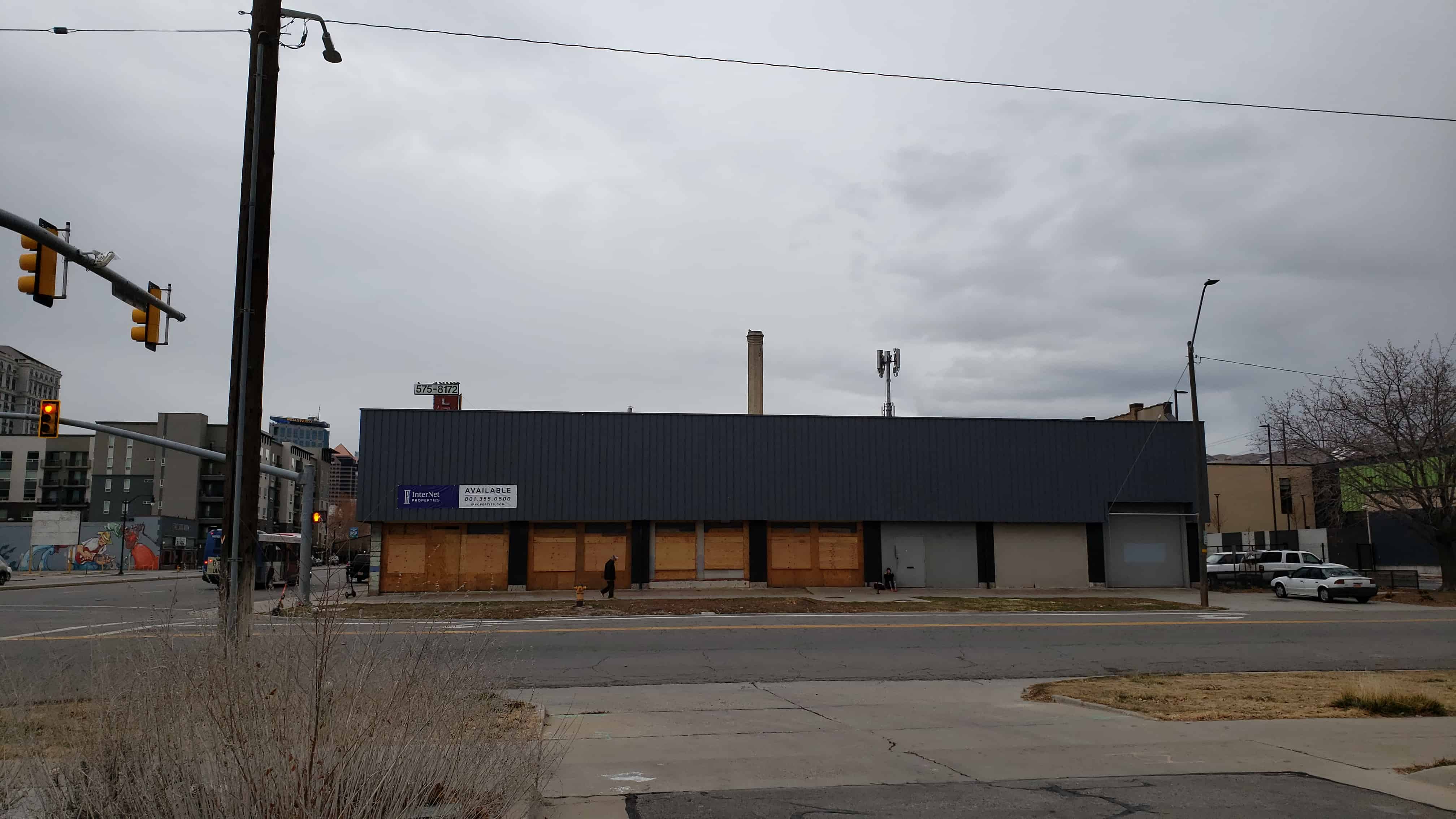
Commercial Buildings
The district contains a commercial locus centered on the shopping and entertainment complex at Trolley Square. Trolley Square is located within an entire block between 500 South and 600 South, and 600 East and 700 East. The square consists of c. 1910 Mission style trolley barns and related structures which, in the 1970s, were converted into specialty retail stores, restaurant and entertainment uses. The Trolley Square historic trolley barn complex contains a water tower which serves as a highly visible landmark in the central city area. When the trolley barns were converted to a shopping center and theaters, the water tower was adorned with neon lights, signage for the shopping center and a movie marquee for the theaters. Historically the water tower served to store up to 50,000 gallons of water for emergency fire fighting Trolley Square is included on the Salt Lake City List of Cultural Resources. Trolley Square is a contributing building in the district and is a good early example of an adaptive reuse project.
The northern portion of the district contains the majority of the small scale commercial structures. Many of these are single family residential houses that have additions built on for the commercial establishment. The 1880 adobe house at 620 East 100 South has a 1924 commercial addition; the Edward Hance House at 580 East 300 South has a storefront addition with a flower shop, and the 1899 two story residence at 509 East 300 South has a one story commercial addition which contains a dry cleaning establishment. In addition, other residential buildings have been fully converted to commercial office space such as the offices in the 1885 Edwin Kimball House located at 124 South 600 East; the 1898 O.J. Salisbury House at 574 East 100 South which has been converted into a funeral home, and the 1881 J. H. Midgely House 515 East 300 South which now serves as an architect’s office. The only remaining commercial building from the historic period is Mario’s Tailors, a one-part-block, one story stone building located at 579 East 100 South and built in 1926. The southern area of the district has four remaining commercial structures from the historic period, the Lloyd Drug Store at 680 South 700 East built in 1900; Bill and Nada’s Cafe located at 479 South 600 East built in 1924; a one story corner entrance building located at 802 South 600 East built in 1911, and a one story commercial building at 567 East 600 South which was built in 1908. There is also a 1910 residence with a commercial addition at 504 East 500 South known as Hales Market.
Structures
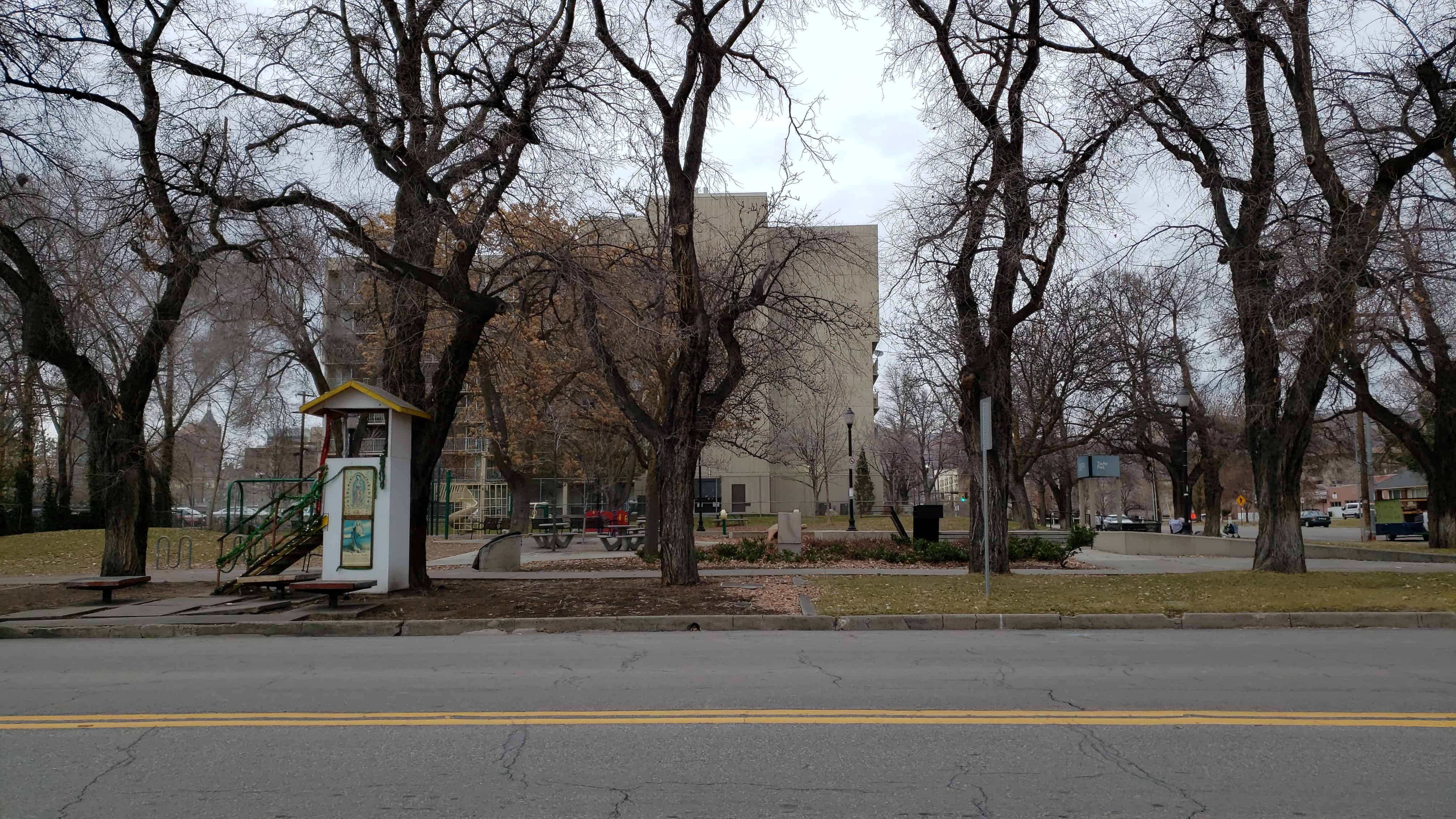
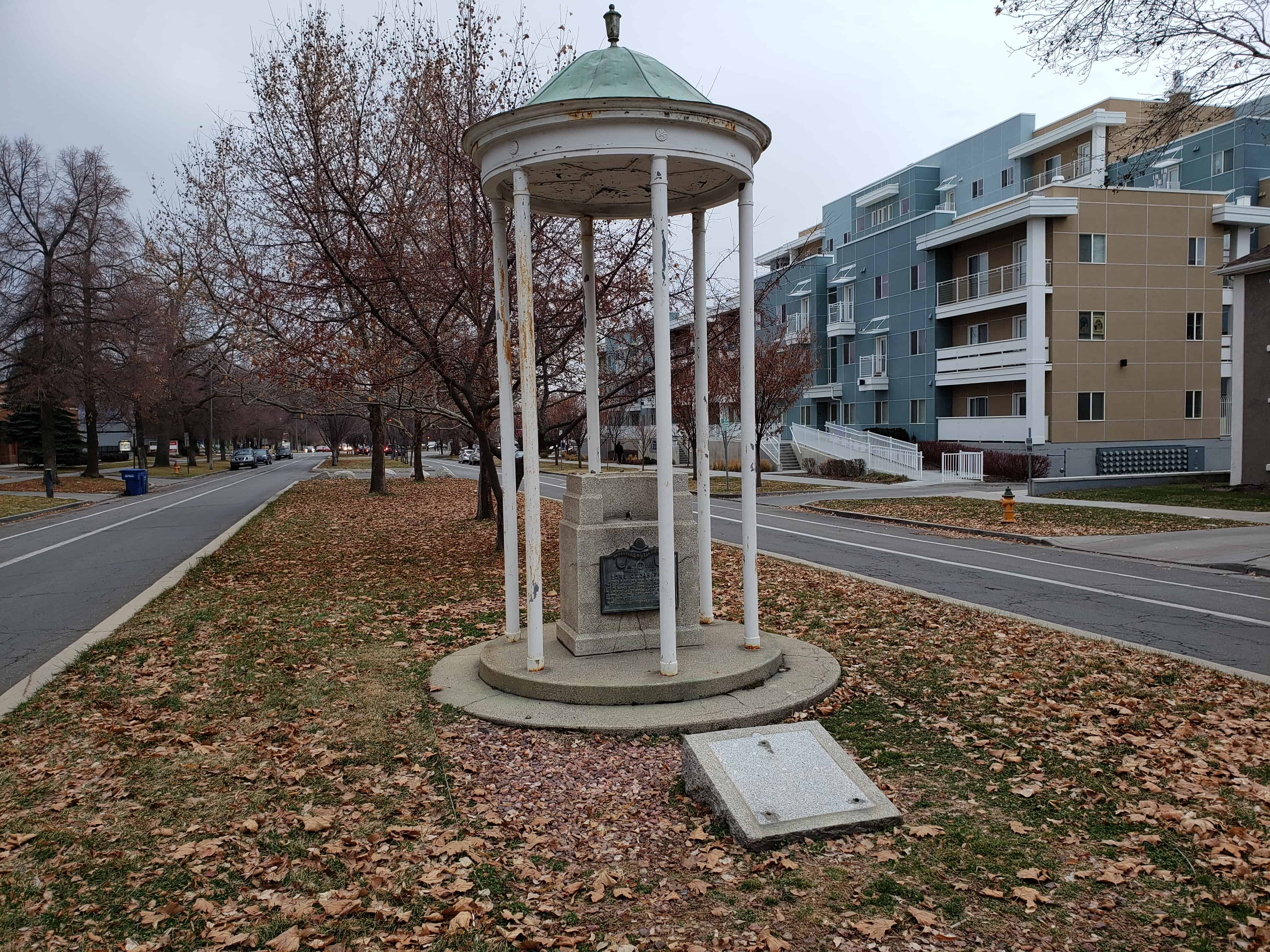
An important unifying element of this district is the grass median or ‘parking’ which runs the length of the district along 600 East Street in a north-south direction between the prominent point of the Kearns (Governor’s) Mansion on South Temple Street and the entrance to Liberty Park on 900 South Street. Several other streets in Salt Lake City were designed with these ‘parking’ medians, with 600 East Street being the first to receive them in 1906. ‘Parkings’ were placed in the center of many even numbered north-south streets, including 700 East, 800 East, 1000 East, 1200 East and 800 West Streets. The 600 East median remains as a continuous intact linear element in the city.
Another structure within the district is the Cedar Tree Monument. This is located on the 600 East median between 300 and 400 South Streets. The monument, a small gazebo, was erected in 1932. The monument commemorates the site of a large cedar tree, which was reportedly the only tree in the Salt Lake Valley when the pioneers arrived in 1847. This tree was important to the pioneers, as it was used as a navigational tool.
Narrative Statement of Significance
The Central City Historic District is significant under National Register Criteria A and C. Under Criterion A, the district reflects the period of growth and changing residential and commercial patterns during a period of industrialization and population growth in Salt Lake City. The period of significance of the district is 1870 to 1946. This period of significance represents a shift in the economic structure of the community from an agricultural based community to that of an industrial and commercial society. As of the first decade of the twentieth century Salt Lake City no longer represented an isolated religious community, but a politically and economically mainstreamed American city. The growth of transportation networks within the city, the circa 1910 construction of Trolley Square by the Utah Light and Power Company, and the quick infill of the subdivisions and interior streets of the blocks in the district stand as architectural testament to the growth of the city at this time.
The district is important under Criterion C due to the large number of excellent examples of the styles popular in Salt Lake City and Utah during the first quarter of the twentieth century. The district contains numerous buildings of both significant as well as modest examples of the work of prominent Utah architects. Most of the buildings display the craftsmanship of design and construction materials associated with the era of the significant period, 1870 to 1946. The range of residential building types include small adobe pioneer homes, Victorian cottages ; bungalows ; prairie style homes as well as urban apartment buildings . The majority of the residential buildings date from 1895 to 1925, representing the end of the Victorian Era and the beginning of the Progressive Era. Residential construction represents the hallmark styles from both eras; Victorian Eclectic; Queen Anne; Period Revival; Craftsman bungalows and Prairie style.
History
Central City Historic District encompasses one of the oldest residential areas existing in Salt Lake City. The original city plan, whose specifications were drawn up by L.D.S. Church founder Joseph Smith and executed by church leader Brigham Young and the Mormon settlers of the Salt Lake Valley in 1847, provided for ten acre blocks, which remain intact in the central city area. These ten acre blocks were intended to provide ample room for eight individual family lots upon which one dwelling, family agriculture and associated outbuildings were to be located.
The land was platted and distributed to the settlers by a lottery system. The plans called for a home centrally located on the lot with fruit trees, chickens with a horse and cow in the rear. The front of the lot was to be planted with trees and trimmed grass lawns. These plans, specified in Mormon Church founder Joseph Smith’s “Plat for the City of Zion”, were intended to create an agricultural village of self sufficiency, so that the Latter Day Saints would be able to maintain their religious, social and economic autonomy. Central city presently maintains the ten acre blocks laid out for the “Plat for the City of Zion”.
Mormon church plans grouped these blocks into cohesive units called wards, providing equal access to civic amenities for all the Latter Day Saints (Mormons), while maintaining in plan an agricultural village. A ward usually consisted of a nine square block area that functioned as a neighborhood unit under the direction of a church official known as a Bishop. The blocks and the lots thereon retained their single family agricultural character for only a brief time, with one and two room adobe and wood structures, barns, and associated agricultural outbuildings surrounded by small scale food production characteristic of the lots in the Central City Historic District. Barn structures continued to be built in the area into the twentieth century. By the late 1860’s the lots were beginning to be being divided and developed, creating more of an urban landscape.
With increases in population and urban development commercial interests began to grow within the city’s boundaries and Salt Lake City took on a denser residential pattern. By the 1870’s residential growth within the city spread east of 300 East and South of 300 South, away from the core of the Temple Block. Outside of the original city plat boundaries other residential areas were developed. The area south of 900 South Street was called the ‘Big Field’, and was planned as an agricultural area to support the population of the city. A 110 acre portion of the ‘big field’ was purchased by Salt Lake City in 1881 to create Liberty park, which borders the Central City district on the south. Liberty Park was developed in the area between 700 East and 500 East Streets; 900 South and 1300 South Streets. This park originally served as a mill and farm for Isaac Chase, and was later part of Brigham Young’s estate. The house and mill still exist and are listed on the National Register. Residential blocks were developed in the ‘Big Field’ at the same time as the development of the park. The block sizes in this area are smaller than the original ten acre blocks and reflect the influence of the developers who by the 1890’s had platted subdivisions on all sides of Liberty Park. This population shift was a response to the growth of Salt Lake City created by the combinations of the transcontinental railroad in 1869; the advances in mining in nearby Bingham Canyon and Park City as well as the development of a permanent military post at Fort Douglas in 1862. Salt Lake City expanded its streetcar services as competing lines within the city vied for passenger loads to the newly developing residential areas just outside the central business district.
Residential Buildings and Development
The period of greatest development within the Central City Historic District occurred between 1890 and 1925. The majority of existing structures in the district, approximately 350, were constructed in this time period. The oldest homes remaining in the district, as well as Utah as a whole, were built of adobe, frame or brick. One such example in the northern portion of the district is the house located at 515 East 300 South. This is the Midgely-Evans house, an adobe Greek Revival cross-wing house built circa 1880. 16 Another example is the Cuthbert home located at 804 South 600 East. This is a one story, adobe, hall-parlor type of vernacular/classical style built circa 1870. These two homes, built in approximately 1881 and 1870 respectively, represent some of the first structures to exist in the Central City Historic District.
Commercial Development
An important commercial structure existing in Central City is the Utah Light and Railway complex on block twenty-five, otherwise known as Trolley Square. Block twenty-five was purchased in 1906 by the Utah Light and Railway Company for the construction of trolley car barns and associated outbuildings. Block twenty-five was the former site of the tenth ward farm, an agricultural center for the residents of the tenth ward neighborhood of the Mormon Church. The urban and industrial shift that Salt Lake City was undergoing at the turn of the century rendered these ward farms no longer practical and in 1865 the land was transferred to the Territory of Utah and used as a Territorial Fairground. The building permit for the Utah Light and Railway complex of buildings was obtained in 1908. These buildings are mission style and built of steel, reinforced concrete and red brick. The location of the trolley barns provided job opportunities in central city. The trolley lines offered convenient public transportation that made commuting to the business district practical for residents of central city. By 1919 street car lines criss-crossed the central city district at 900 South, 400 South, 300 South, 200 South, 100 South and South Temple Streets as well as along 700 East and 500 East Streets. These streetcar lines provided easy access between downtown and outlying areas for those working in locations beyond walking distance of their residences.
The Troy Laundry located at 431 South 600 East (demolished) was also one of the larger employers in the area. The Troy Laundry, a commercial laundry operation, employed 100 people in 1898. 18 The laundry serviced some of the residents of Central City and provided jobs for others. The remaining commercial enterprises in the Central City area consisted mainly of small scale operations such as a carpet cleaning business owned by E. Enyon which was built in the rear of 436 South 700 East.
The southern portion of the district contained several commercial structures which had been built on to houses. Examples of this includes Hyrum Case’s brick combined store and residence on the corner of 500 East and 500 South (demolished) which was built in 1891 for three thousand dollars. The John Rees adobe blacksmith shop was located at 420 South 500 East (demolished) in 1888. The historic attached dwelling and doctor’ office (c.1898) located at 501 East 300 South has been converted to Classic Cleaners, a neighborhood dry cleaning business. Male’s Market located at 511 South 500 East was built in 1924 onto a c. 1906 residence and attached dwelling.
North Central City
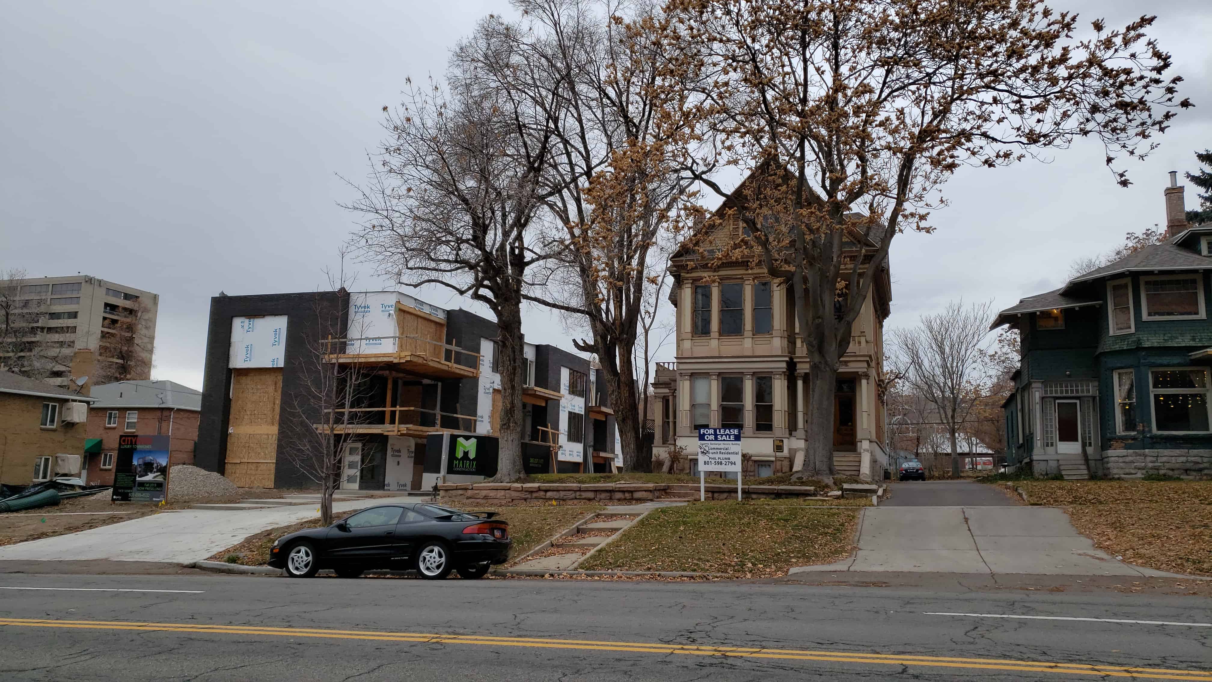
The north portion of the district developed as somewhat of a southern extension of the fashionable South Temple Street Historic District. This portion of the Central City District, particularly along 100 South, contains a good number of homes designed and built by architects. These residents were historically owners of local businesses and individuals who had prospered in the mining and ranching activities of Utah and often were Gentiles (non-Mormons). Several National Register homes exist in the area. (See list of National Register Properties Appendix A).
By the 1890s several of the wealthier residents demolished their small adobe homes to build larger residences on the same site, reflecting the popular building styles of their contemporaries. One such example of this is the O.J. Salisbury house at 574 East 100 South Street, a two story neo-classical stone residence that was designed by architect Frederick A. Hale. This area is reflective of the South Temple Street residential district in the size and high styles of the existing houses. Examples of such substantial architect designed residences are the Armstrong and the Bamberger mansions,22 both of which are located on 100 South street between 600 and 700 East Streets. The Armstrong mansion is of brick, an expensive and substantial building material, with stone and wood decorative detailing in the Victorian Eclectic style. The Bamberger mansion is a frame house decorated with ornate Victorian trim and boasting extended segmented windows.
Development in this area also shows construction of modest brick Victorian eclectic style cottages as well as several Arts and Crafts style bungalows. A number of courts were developed on the interior of the blocks, consisting of more modest housing. The house at 666 East 300 South was commissioned by Stephen Covey in 1899, a prominent developer and business man, and designed by S.C. Dallas, a locally prominent architect. The house at 633 East 300 South was also commissioned by Stephen Covey in 1898 and designed by E.W. Druce, another local architect.
In addition to the architect designed homes in the north portion of the district there also exist a group of fifteen houses constructed by Anderson Real Estate and Investment Company. J.G. Anderson headed the family run operation that was incorporated in August of 1898. This company built speculative housing throughout the city. Fifteen such dwellings were constructed from 1899 to 1900 along 300 South between 600 East and 700 East streets (block 46) and along 600 East between 200 South and 300 South. These residences are of Victorian eclectic detailing, average from eight to thirteen rooms, are two to two-and-one-half stories, and were sold for approximately $3,000 to ‘upscale residents’. Some of the longer term residents of these homes include W.H. Chipman of Chipman Mercantile, a prominent local business man, and W.F. Snyder of Park City’s Snyder Mines Inc.
The Industrial Christian Home Association of Utah was a local organization made up of non-Mormon community members25 who petitioned a Congress sympathetic to abolishing polygamy in the Utah Territory for funds for a new building which would serve as refuge for polygamist women. Congress appropriated $50,000 for the construction of a new three story building which was completed in 1889 and located at 145 South 500 East. The organization did not attract the numbers of women expected and the Industrial Christian Home Association closed its doors on June 15, 1893. The building served as the Ambassador Family Hotel until 1945 when it was purchased as the Ambassador Athletic Club. The Ambassador apartment complex was built in the mid-1950s directly behind the building with access from 600 East. The Industrial Home/Ambassador Athletic Club has since been demolished, but part of the apartment complex to the east still stands and has been converted to office space.
South Central City
The transition to the smaller scale residential buildings which characterize the south portion of the district is made between 500 and 600 South Streets. Continuity is maintained in the district with the era of housing stock, the ten acre blocks, uniform setbacks, and the continuous median along 600 East Street. The development in the south portion of central city shared in local urban advances, reflecting the growth of a commercial based economy and the influx of working class residents to the city. As the lots in the south portion were first divided, small adobe, frame and brick cottages came to dominate the area. Multiple family dwellings and small scale commercial operations were also present in this area. The residents in the south portion of the district at the turn of the century typically were employees of railroads, tradesmen, service employees or small business owners.
The south central city district includes the work of many small scale contractor/builders who contributed greatly to the character and quality of the housing stock in the area. Each developer generally bought lots and continued to subdivide by building two and three contiguous residences, often on speculation. The houses at 843, 845, 847 and 849 Park Avenue (now Park Street) were built and sold by August Rudine and Olof Chytraus between 1903 and 1908.26 August Rudine, a mason, and his partner Olof Chytraus, a carpenter, are responsible for a good amount of the housing stock built in southern portion of the district during the first two decades of the nineteenth century. Other developers in the area include Glenn R. Bothwell, August Matson, Frank Losee, William Hawkes, and Jane Elizabeth Crompton. August Matson is responsible for the unique 1919 bungalow court located at 661 – 680 South Green Street. William Hawkes and Jane Elizabeth Crompton were responsible for the Victorian Eclectic rental housing located on Hawkes Court (635 East) and built between 1898 and 1911. The type of builder’s vernacular speculative and rental housing found on Hawkes Court is also evident in the development of Hawthorne Avenue, located at 550 South 500 East, which is a small interior street of 800 square foot single family bungalows. The work of local architect William J. Camomile is also evident in the southern area. Examples of his work include the residence at 603 East 900 South which was built in 1908 as a speculative house by the Salt Lake Security and Trust Company; the house located at 523 East 600 South built in 1890, and the home at 555 East 800 South which Camomile designed for contractor Olof Chytraus in 1908.
The large blocks with single family homes on acre-and-one-quarter lots were not practical for the growing city. Many of these small scale developers found the solution in dividing up these large lots to build more housing; creating interior courts in the centers of the large blocks, and platting subdivisions and building more multi-family housing. The story of development in the Central City Historic District is a story of adaptation and transition from the pioneer ideal to urbanism and the reality of the twentieth century
Subdivisions
Along the southern district boundary of 900 South several subdivisions had been platted by the 1890s. This area of the district is next to Liberty Park, a large city park laid out in 1882 on the site of the former Issac Chase farm and grist mill. Liberty Park lends a desirable green space to the city and makes the surrounding area attractive for residential development. Subdivisions surrounding all sides of the park were platted in the 1890s, with the majority of development taking place in the first quarter of the twentieth century.
Central City Historic District contains four of these subdivisions. Ehrich’s Subdivision was platted in May of 1888 and consists of seventy-four lots on all of Block Five which is located between 500 and 600 East Streets and 800 and 900 South Streets. The plan of the subdivision included the creation of a new north-south street, Park Avenue (now Park Street) which divided the block in half. This served to open up the ten acre block allowing for greater density and development.
Connor’s subdivision was platted in December of 1889. This subdivision consists of thirteen lots and covers the northeast quarter of Block Four. It is located between Green Street (640 East) and 700 East Street, and extended from 800 South to 900 South Streets.
Hollister’s Subdivision was platted with twenty-eight lots in March of 1890 and is located on the west one half of Block Four, located between 800 South and 900 South Streets, and 700 East and Green Streets. Block Four was also split by a central north-south through street, Green Avenue (now Green Street). Green Street serves to divide the block in half and to separate Connor’s and Hollister’s subdivisions.
The platting of the twenty-six lots in Pearson’s Subdivision on Block Ten, north of Block Four, took place in April of 1890. Pearson’s subdivision extends from 700 South Street 530 feet south and is bounded by 600 East to the East and Yowell Avenue (now Park Street) to the West.
The increased density of this area is apparent when recalling that the ten acre blocks of the original city plat were designed to contain eight lots. This shift in residential density reflects the growth and industrialization taking place in Salt Lake City at the time. The smaller lot sizes and the density of development are characteristic of these subdivisions and coincides with the population as well as commercial growth within the city. The population in Salt Lake City increased between 1900 and 1910 from 53,531 to 92,777. 28 This population boom took place in conjunction with the growth of business and commercial enterprises in the city, making residential development outside of the Central Business District desirable.
Hollister’s Subdivision, Connor’s Subdivision, Ehrich’s Subdivision and Pearson’s Subdivision provided uniform lot sizes and access to the interiors of the ten acre blocks. New streets such as Green and Park Streets were created, with rear alleys providing service access to the dwellings from the interior of the blocks. The north-south axis of these new subdivisions in combination with the ‘boulevard’ pattern established by the grass ‘parking’ medians on 600 East Street served to restructure the original pioneer square grid pattern. This rectangular ‘boulevard’ pattern was more typical of subdivisions nation wide and exemplifies a shift from the ‘Mormon’ city plan to more of an ‘American’ plan.
The visual unifying elements of the north and south portions of the district are the ten acre block size, uniform set backs and the park strip located in the center of 600 East. The park strip creates a boulevard from the Governor’s Mansion (Kearns Mansion, National Register) on South Temple Street to the 900 South entrance to Liberty Park. This ‘parking’ was constructed as a part of a city wide attempt at city beautification and boulevard creation. The ten acre block size of the Plat for the City ofZion as laid out by Joseph Smith is present in the entire district, serving to tie the district together as a cohesive unit. The uniform set backs, as observed in the original plans, and set backs observed in later construction also serve to tie the district and its individual streets as a visually cohesive district. The styles of the housing stock which reflect their era’s of construction, further serve as visual cohesiveness, by tying structures of varying sizes together through similar massing and ornamentation.
In addition to the growing residential density, the urban character of central city was emphasized by civic improvements. Streetcar lines traversed the city beginning in 1872 with electric street lighting appearing in the 1890s. The first decade of the twentieth century saw the removal of utility and transportation poles. These civic improvements occurred in conjunction with a city beautification program which created parkways on several prominent roadways, such as the existing median on 600 East as well as overhead lines to the outside of the streets and underground, in addition to sidewalk and street paving.
The addition of ‘parking’ medians was part of a city beautification program at the turn of the century that included street lighting, sidewalk and street pavement, removal of overhead power lines to the outside of the streets or underground and boulevard creation. 30 In 1906 groups of women and men in Utah, like progressives throughout the United States, who were generally middle- and upper-middle-class citizens, believed in the ideals of the City Beautiful movement. They were inspired by the belief that the construction of parks and boulevards in a setting of competent urban planning, fostered by Frederick Law Olmstead, would improve the quality of life for city people. Salt Lake City Mayor Ezra Thompson and the Improvement League planned to make Salt Lake’s streets beautifully landscaped boulevards by paving and curbing them and planting parks in the median strips. In 1908 the Parks and Playgrounds Association was organized in an effort to improve existing playgrounds and to open new facilities. In 1913 the Salt Lake City Commission organized the Civic Planning and Art Commission to coordinate efforts to create a City Beautiful by proposing and implementing a twenty-year improvement plan to beautify the city with boulevards, parks, playgrounds, street parking, and cleanup. The city adopted comprehensive, citywide plans in the 1920s under the direction of the Planning Commission. 31 Efforts to beautify Salt Lake City were significant in its development during the first quarter of the twentieth century. The parking median along 600 East is a reminder of the City Beautiful movement and the desire to make this a more desirable place to live.
Another important part of the Central City Historic District is its demonstration of broad demographic patterns. The residential architecture includes large, ornate single family homes, small, simple, single family homes, and multiple family duplexes and apartment buildings. There are also commercial and religious structures throughout the district. Many of the buildings were designed by prominent Utah architects and development companies, while many were built from standardized plans. Additionally, the people who lived here during the historic period represent a broad range of economic and social classes, from professionals to laborers.
The development of the southern part of the Central City Historic District where the blocks have been divided by interior streets, alley ways, 32 and courts and where the lots are smaller, also illustrates the economic forces that were associated with its development. The economics of moving into a neighborhood close to downtown where transportation and services are nearby, versus moving out to the suburbs where the cost of living would be increased, was no doubt a factor in the development of this area. The smaller homes that were built in the Central City Historic District followed similar development patterns as others throughout the city. However, the cost of the homes in Central City were somewhat less than those in neighborhoods such as Gilmer Park, Westminister Heights, and Westmoreland Place, subdivisions that were built farther east and south and touted as having better views, being outside the haze and smoke of the city, and appealing to an elite group of middle- to upper-middle-class individuals.
The Central City Historic District is important in describing the trends of development that occurred in Salt Lake City in response to the rapid population growth near the turn of the century. The earliest homes that were built show the traditional patterns established by the Mormon grid system. The bulk of the building occurring between 1901-26 illustrates a boom of suburban-like development. The buildings constructed between 1927-43 illustrates the infill construction that continues to occur.
Pingback: Salt Lake City’s Historic Districts | JacobBarlow.com