
Tags

Hole-In-The-Rock
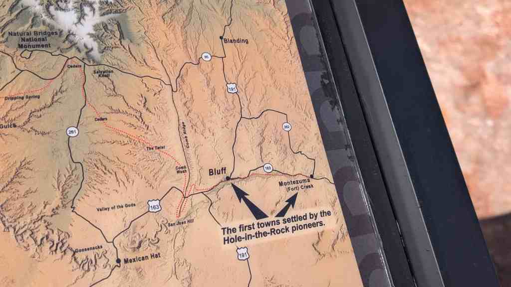
The Hole-in-The-Rock Expedition Trail
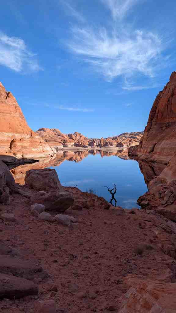
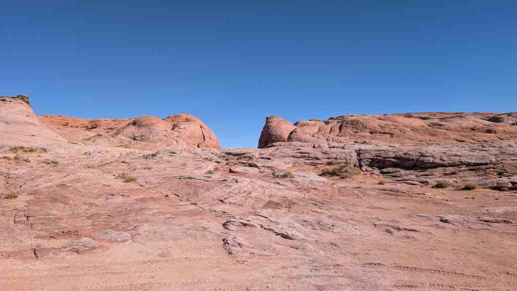
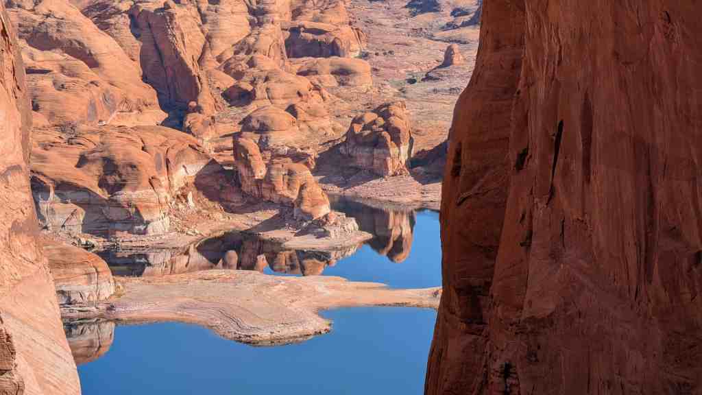
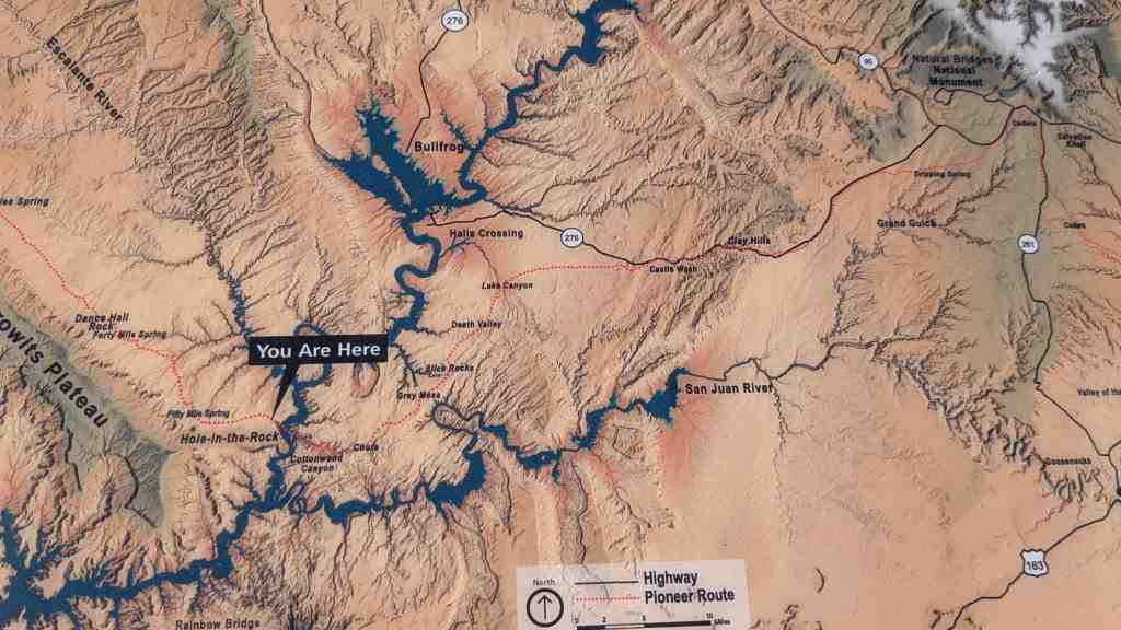
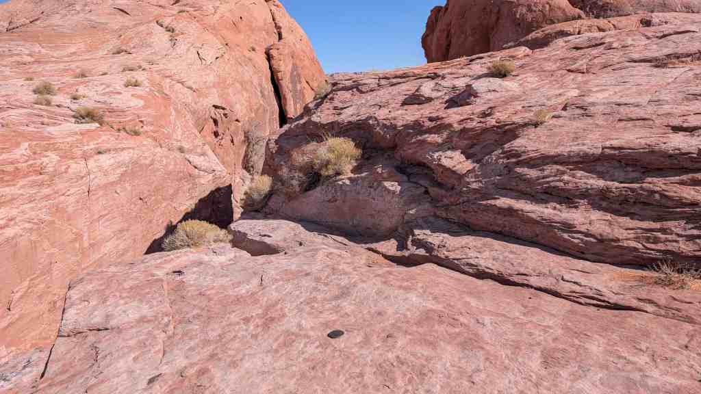
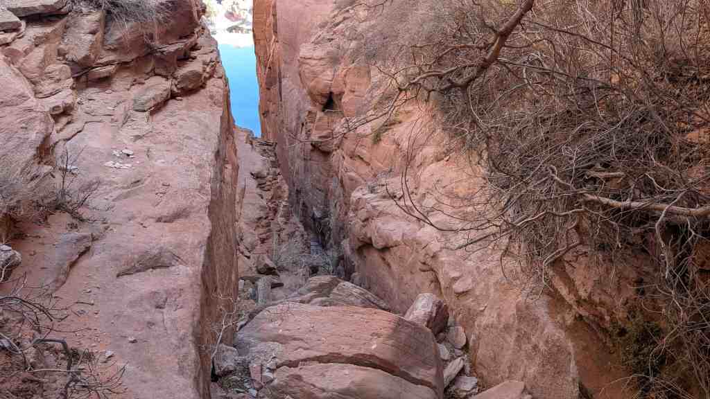
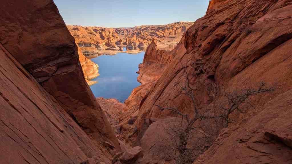
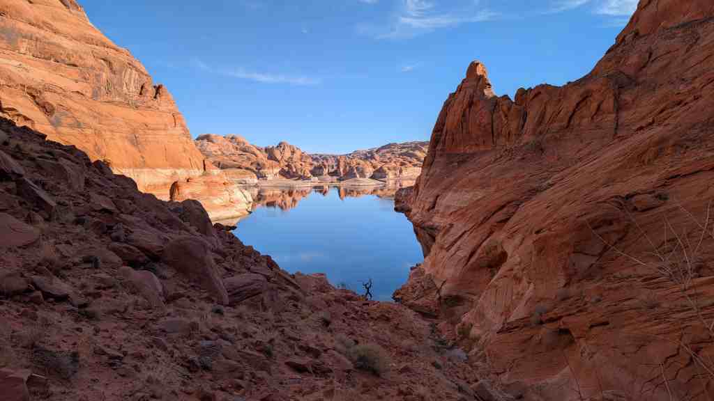
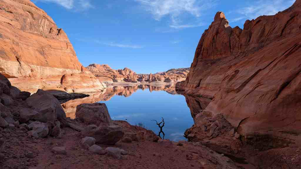
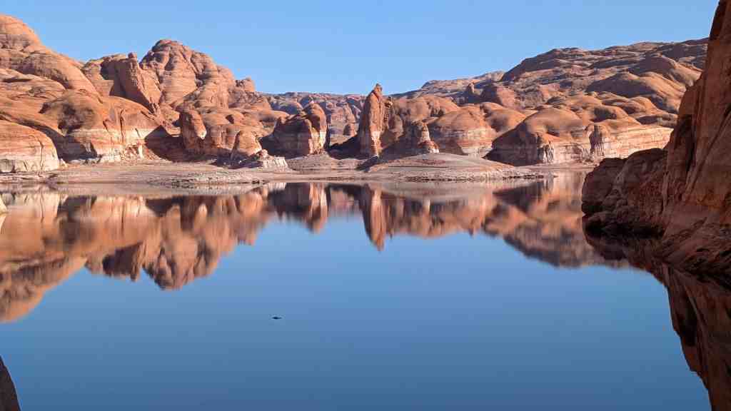
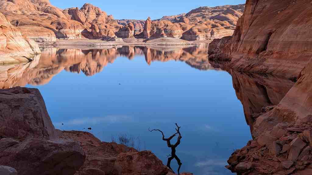
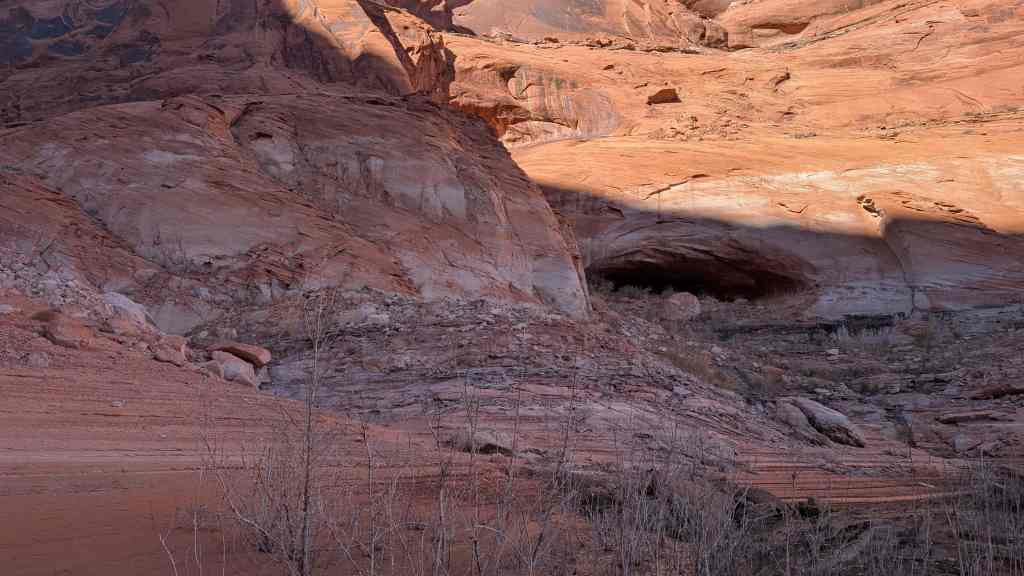
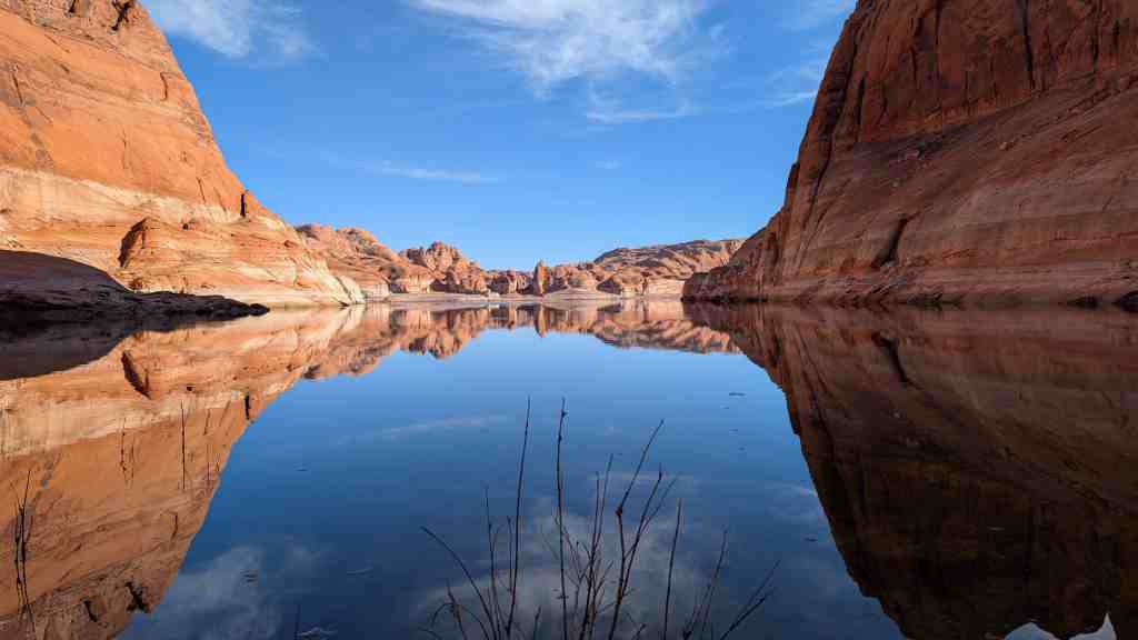
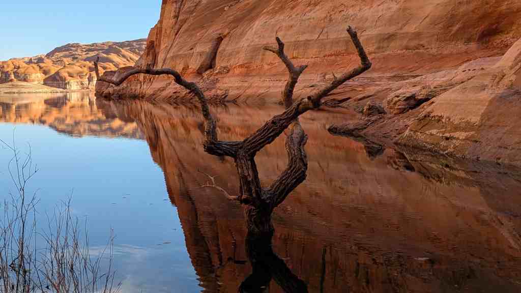
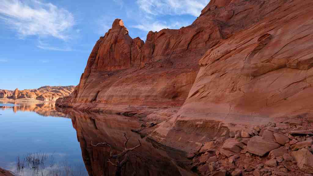
Today, two and one half miles downlake from the mouth of the Escalante River lies a natural fault on the rim of Glen Canyon overlooking Lake Powell. Here during the winter of 1879 a group of about 250 Mormon pioneers widened this “Hole” to accommodate their wagons and were thus able to descend a thousand feet to a make safe passage across the Colorado River.
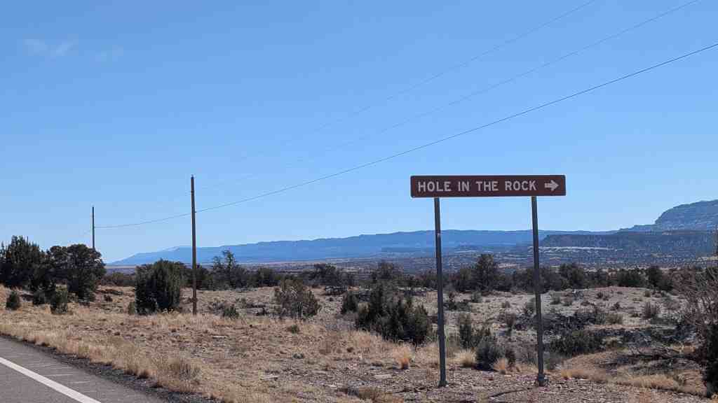
Hole-In-The-Rock is in Kane County, Utah and was added to the National Historic Register (#75000165) on November 3, 1975.
Related:
- Hole-in-the-Rock Trail
- Chimney Rock
- Dance Hall Rock
- Hole-in-the-Rock Arch
- Scout Monument
- “Hole-In-The-Rock” Crossing
During the 1870’s, vigorous colonization efforts were being expended by the Church of Jesus Christ of Latter-day Saints, also known as the Mormon Church. The completion of the transcontinental railroad in 1869, the discovery of gold and silver, plus the reports with maps by the Hayden Survey publicizing the region, helped to bring an influx of non-Mormon peoples into the Four Corners area. Cattlemen, farmers, and prospectors were among the interested people looking at this new area for settling. The Mormon Church saw the desirability of extending their boundaries by vigorous colonization efforts so that they could establish a stronger foothold in the country south and east of the Colorado River.
The Church of Jesus Christ of Latter-day Saints organized a mission to first select a site and then later to found a settlement. In December 1878, at Parowan and in March 1879, at Cedar City, Utah, the Church issued a call. This was a summons for those whos names were read to enroll in the work of the faith. This was a method used by the Church in recruiting missionaries for foreign service, for colonizing missions and for settling regions not like to be occupied in the course of normal frontier expansion.
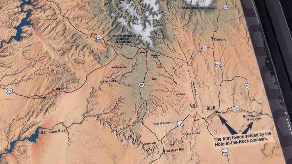
In April 1879, Silas S. Smith led a party from Cedar City in search of a settlement site. Crossing the Colorado River at Lees Ferry and traveling southward to Moenkopi, they continued eastward through the Navajo country to the San Juan River selecting as their site a spot at the mouth of Montezuma Greek. Here they left some of their members and returned to Cedar City by an easier northern route crossing the Colorado at Moab, Utah. Their entire trip had taken them over one thousand miles.
The colonizing party to follow had a choice of either route each of which was about five hundred miles long. Told that a short cut was possible, they decided to open a new route going straight across the Colorado River. From separate towns and by separate routes, the group assembled at Forty Mile Spring, located 40 miles southeast of Escalante. While waiting for their entire party to assemble at this location, a huge sandstone rock was found to be suitable for evening dances. This rock was named by the group, Dance Hall Rock.

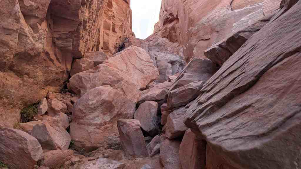
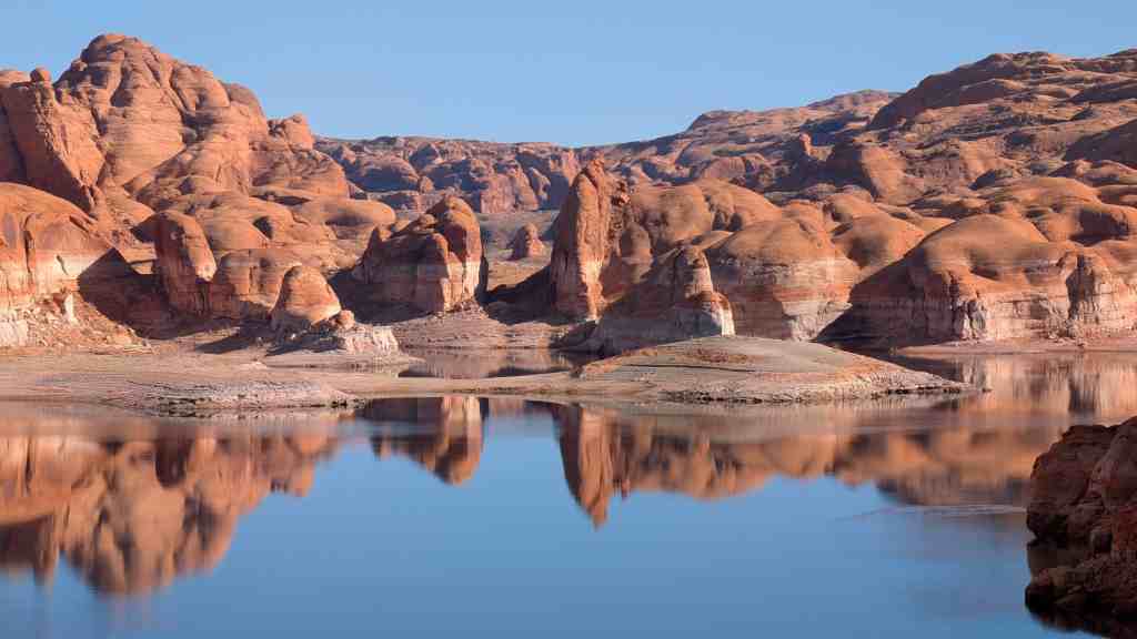
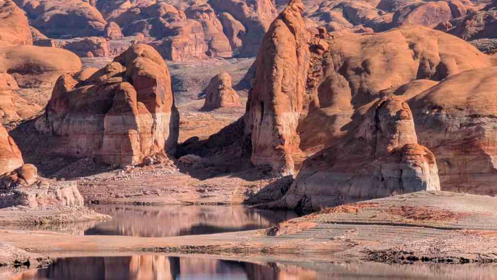
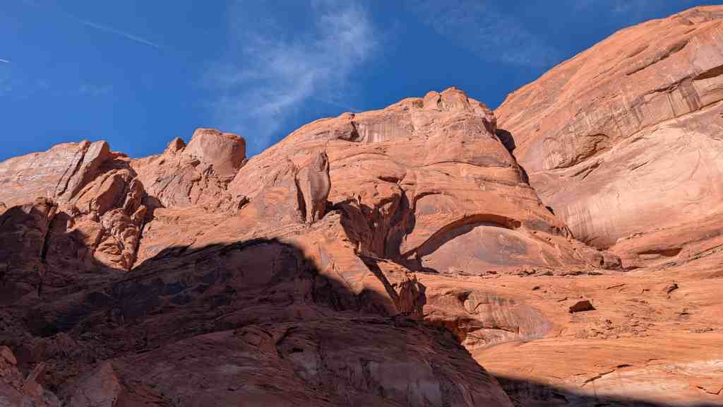
Finally, in November 1879, the expedition of over 250 men, women and children 83 wagons, and a thousand head of livestock was assembled. When early snows in the mountains behind them prevented any further thoughts of turning back, the party began their journey to the rim of glen canyon following almost exactly the straight cliffs of the Kaiparowitz Plateau. Reaching the rim, they found their way blocked by the thousand foot gorge. Two and a half miles south of the mouth of the Escalante River, the party found a natural fault in the rim which opened out below into a very steep but short side canyon of the Colorado. Here was a possible way to get to the river floor below.
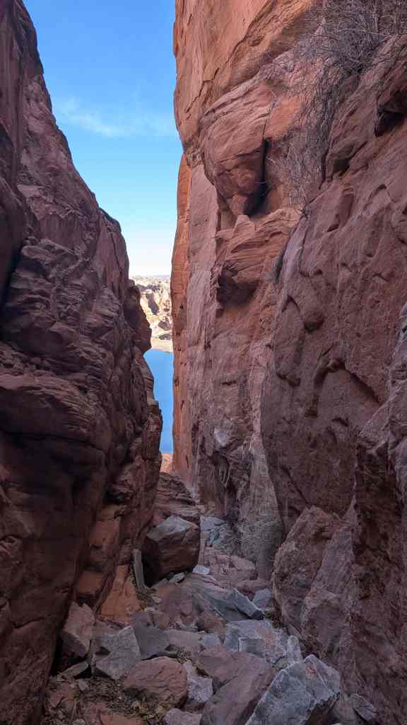
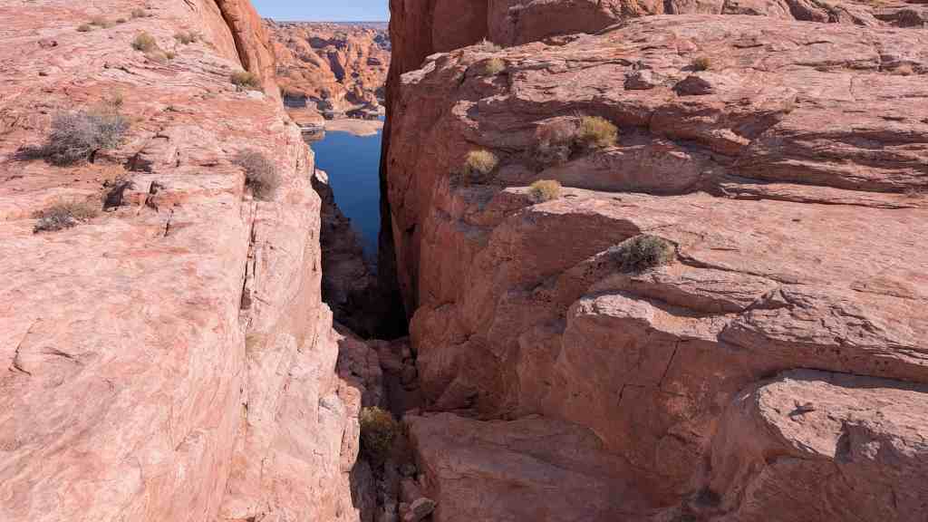
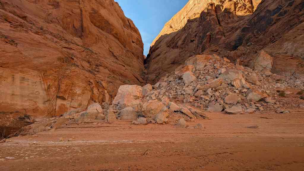
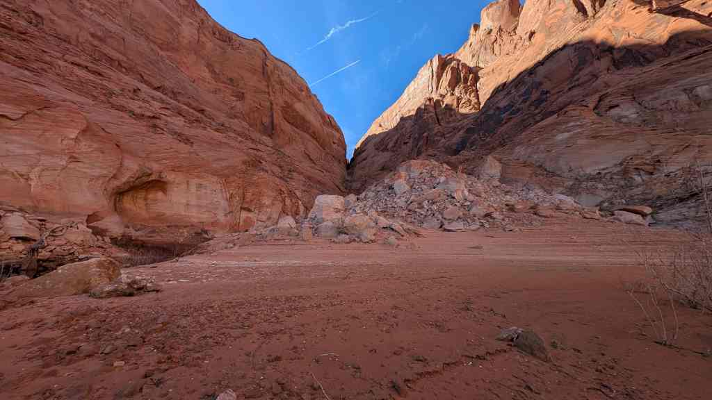
Their descent over the west rim was a serious undertaking, as the winter temperatures were often around zero degrees. The group drilled and blasted back into the solid rock enlarging the natural fault far enough to build a passable grade for their wagons and thus able to compensate for the sheer 45° vertical slope of the cliff. After two weeks of work they tried to get their horses down to the river where there would be more forage for them. Further attempts were postponed after nine animals were lost on the first try. In order to get their wagons down, they resorted to building a dugway. This involved cutting one slanting wagontrack so deep into the rock that it would be impossible for the wheel to come out. Further down the side, they came to a steep, smooth rockface which was too abrupt for a dugway. Having no more black powder, they tried another approach and utilizing drillers, suspended them over the cliff face and had” them drill large deep holes on an even incline all the way to the bottom. Other men went below to the river bottom while others went to the mountains to cut stakes of scrub oak. These stakes were then pounded deep into the drilled holes. Brush and driftwood were laid across these stakes and broken rock was applied as the final coverings.
The vertical drop through the “Hole” to the edge of the Colorado River was about one thousand feet and a distance of three quarters of a mile. The building of the road over this area had occupied six weeks of work, but in late January the entire eighty-three wagon caravan with wheels braked and locked began the downward journey through the “Hole” to the river’s edge. A ferryboat built by Charles Hall took the wagons, two at a time, across the Colorado to the opposite shore.
A dugout road was built on the opposite side leading up Cottonwood Canyon and then out onto Grey Mesa where they found the snow to be a foot deep. The entire group continued on until April 6, 1880, when they camped at a site about eighteen miles from their original destination at Montezuma Creek. Too tired to continue further, they decided to remain there where wood, water, and land were plentiful. Their journey had taken six months. The members of the party named this site Bluff City and their descendants are there today carrying on the proud pioneer heritage left to them by their ancestors.
Here is commemorated the passage of 250 Mormon pioneers, an 83-wagon caravan, and their livestock through the Hole-In-The-Rock. This afforded them access to the Colorado River floor and the opportunity for safe passage across the river toward their original destination at Montezuma Creek. Passage was down the vertical drop of 1,000 feet by way of a dugway they constructed in the dead of winter. That they preserved in this effort is a testimonial to their courage, tenacity, and ingenuity. Hole-In-The-Rock commemorates these qualities, which were in fact shared by all pioneer peoples who in their overland migrations brought America’s civilization and culture to the Far West.
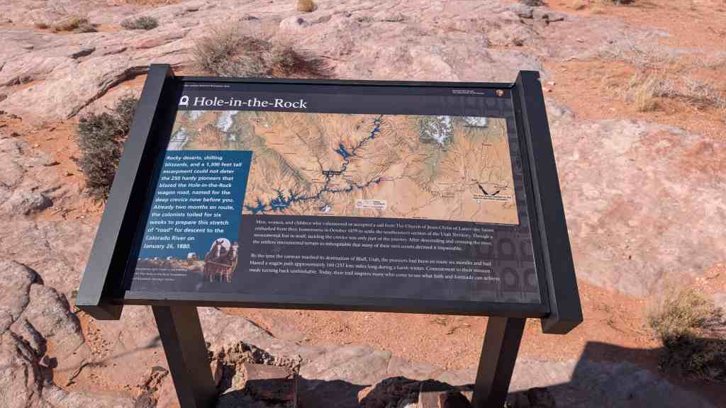
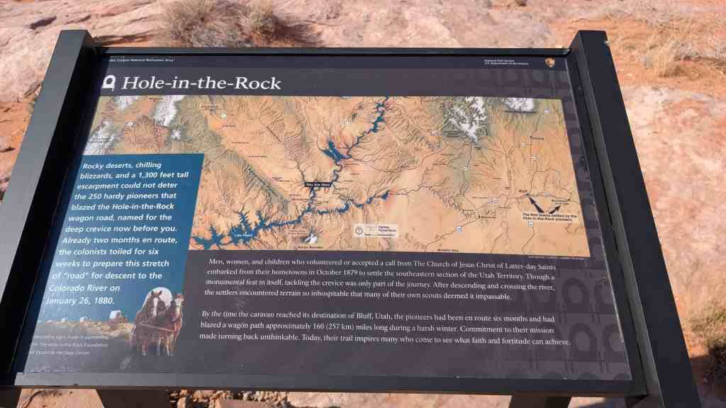
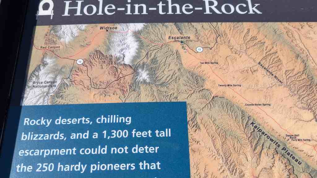

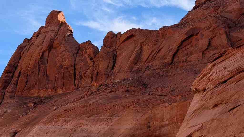
Rocky deserts, chilling blizzards, and a 1,300 feet tall escarpment could not deter the 250 hardy pioneers that blazed the Hole-in-the-Rock wagon road, named for the deep crevice now before you. Already two months en route, the colonists toiled for six weeks to prepare this stretch of “road” for descent to the Colorado River on January 26, 1880.
Men, women, and children who volunteered or accepted a call from The Church of Jesus Christ of Latter-day Saints embarked from their hometowns in October 1879 to settle the southeastern section of the Utah Territory. Though a monumental feat in itself, tackling the crevice was only part of the journey. After descending and crossing the river, the settlers encountered terrain so inhospitable that many of their own scouts deemed it impassable.
By the time the caravan reached its destination of Bluff, Utah, the pioneers had been en route six months and had blazed a wagon path approximately 160 (257 km) miles long during a harsh winter. Commitment to their mission made turning back unthinkable. Today, their trail inspires many who come to see what faith and fortitude can achieve.
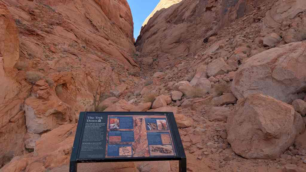
The Trek Down
This 1,300 feet tall escarpment could not deter the 250 hardy pioneers that blazed the Hole-in-the-Rock road. Getting 83 wagons and 1,000 livestock through the crevice took six weeks of preparation. Pioneers labored on different aspects of the wagon road that would drop into Glen Canyon and emerge on the east side of the Colorado River up Cottonwood Canyon. Though time has obliterated the pioneers’ rough trail, signs of their picking, blasting, and other efforts remain evident today.
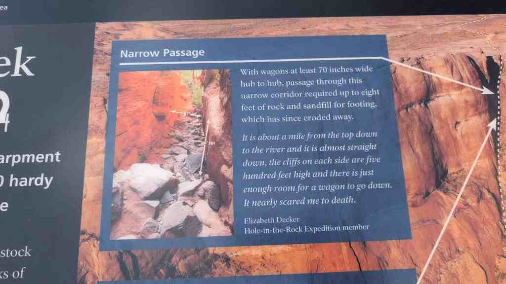
Narrow Passage
With wagons at least 70 inches wide hub to hub, passage through this narrow corridor required up to eight feet of rock and sandfill for footing, which has since eroded away.
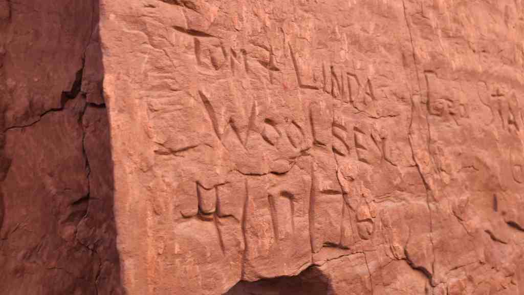
It is about a mile from the top down to the river and it is almost straight down, the cliffs on each side are five hundred feet high and there is just enough room for a wagon to go down. It nearly scared me to death. – Elizabeth Decker Hole-in-the-Rock Expedition member
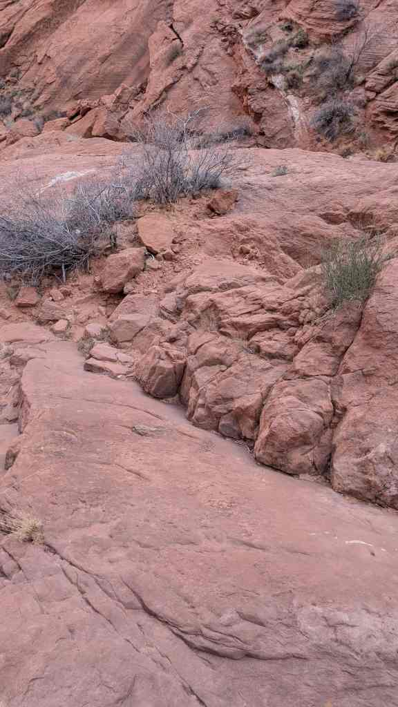
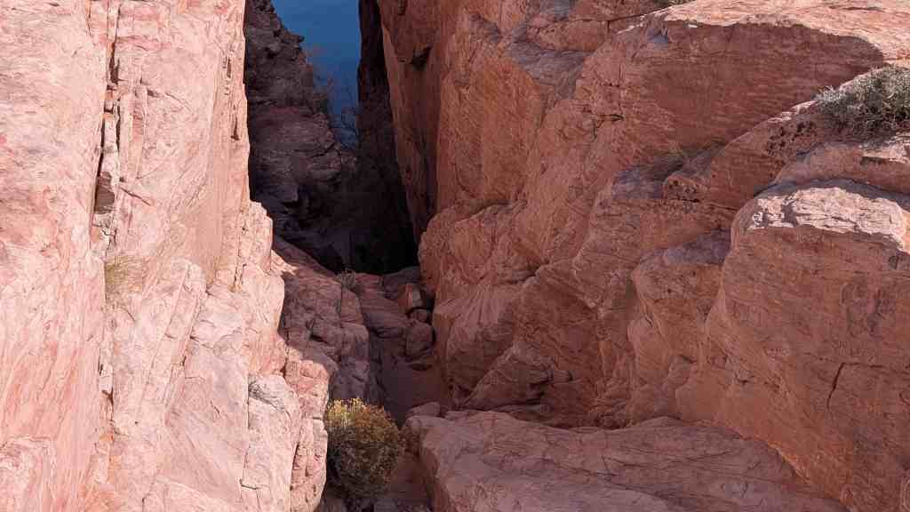
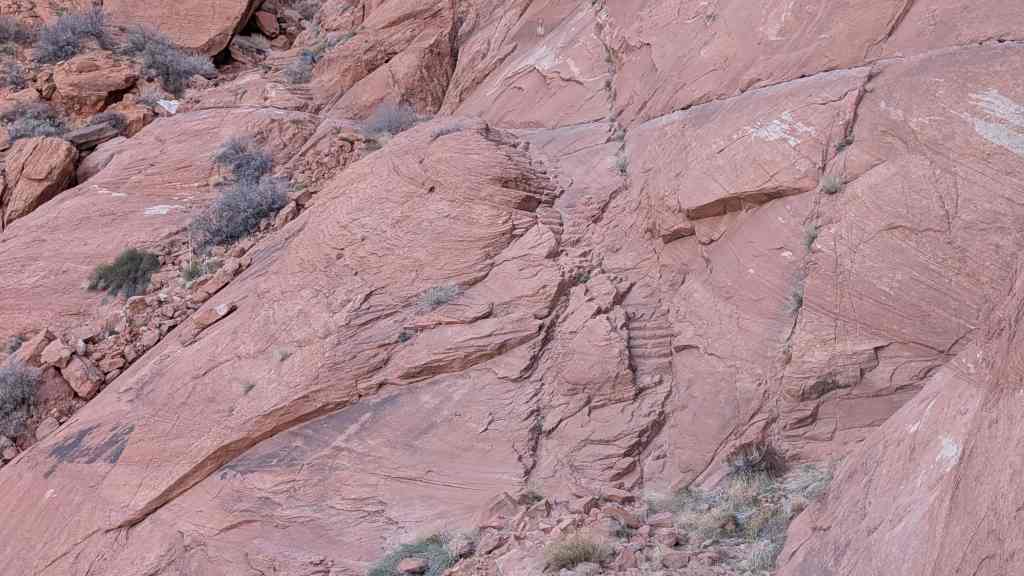
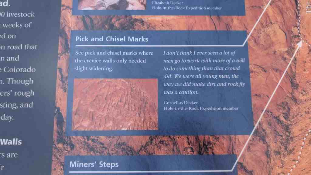
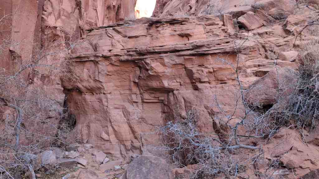
Pick and Chisel Marks
See pick and chisel marks where the crevice walls only needed slight widening.
I don’t think I ever seen a lot of men go to work with more of a will to do something than that crowd did. We were all young men; the way we did make dirt and rock fly was a caution. – Cornelius Decker Hole-in-the-Rock Expedition member
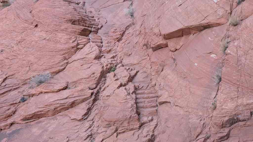
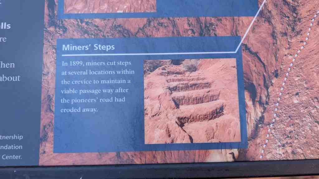
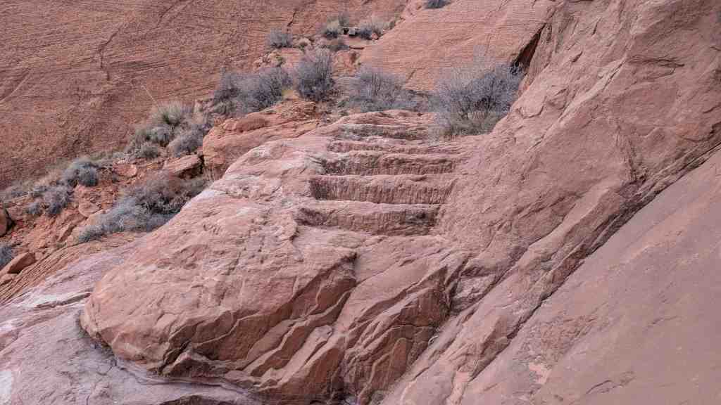
Miners’ Steps
In 1899, miners cut steps at several locations within the crevice to maintain a viable passage way after the pioneers’ road had eroded away.


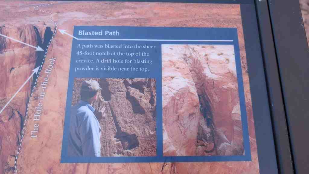
Blasted Path
A path was blasted into the sheer 45-foot notch at the top of the crevice. A drill hole for blasting powder is visible near the top.
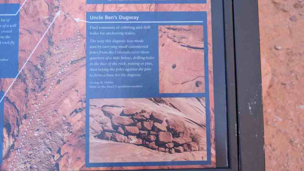
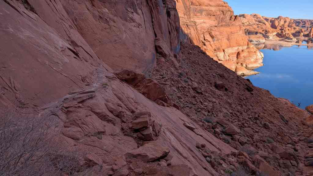
Uncle Ben’s Dugway
Find remnants of cribbing and drill holes for anchoring stakes.
The way this dugway was made was by carrying small cottonwood poles from the Colorado river three quarters of a mile below, drilling holes in the face of the rock, putting in pins, then laying the poles against the pins to form a base for the dugway. – George B. Hobbs Hole-in-the-Rock Expedition member


Pingback: Hole-in-the-Rock Trail | JacobBarlow.com
Pingback: Kane County, Utah | JacobBarlow.com