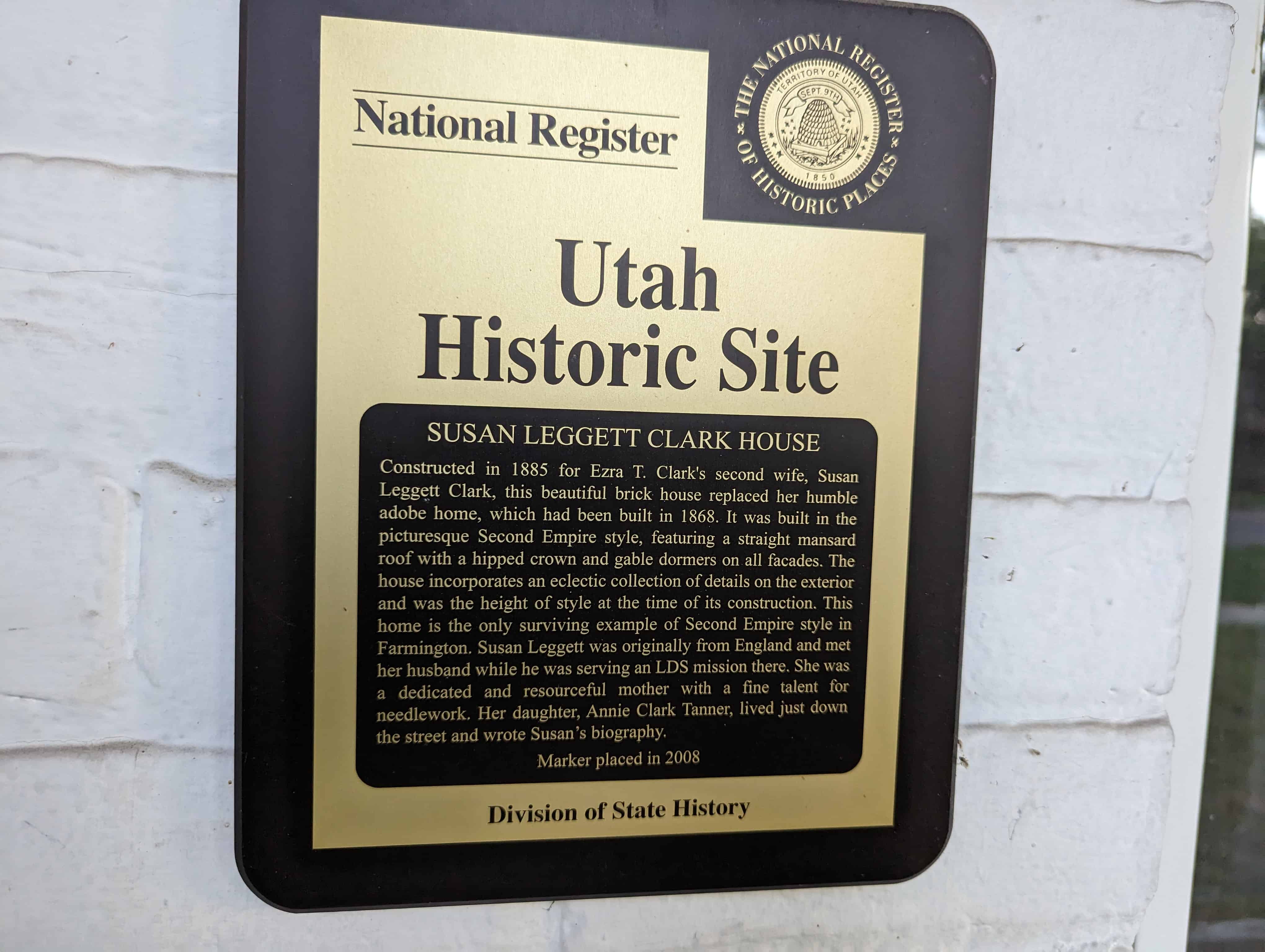
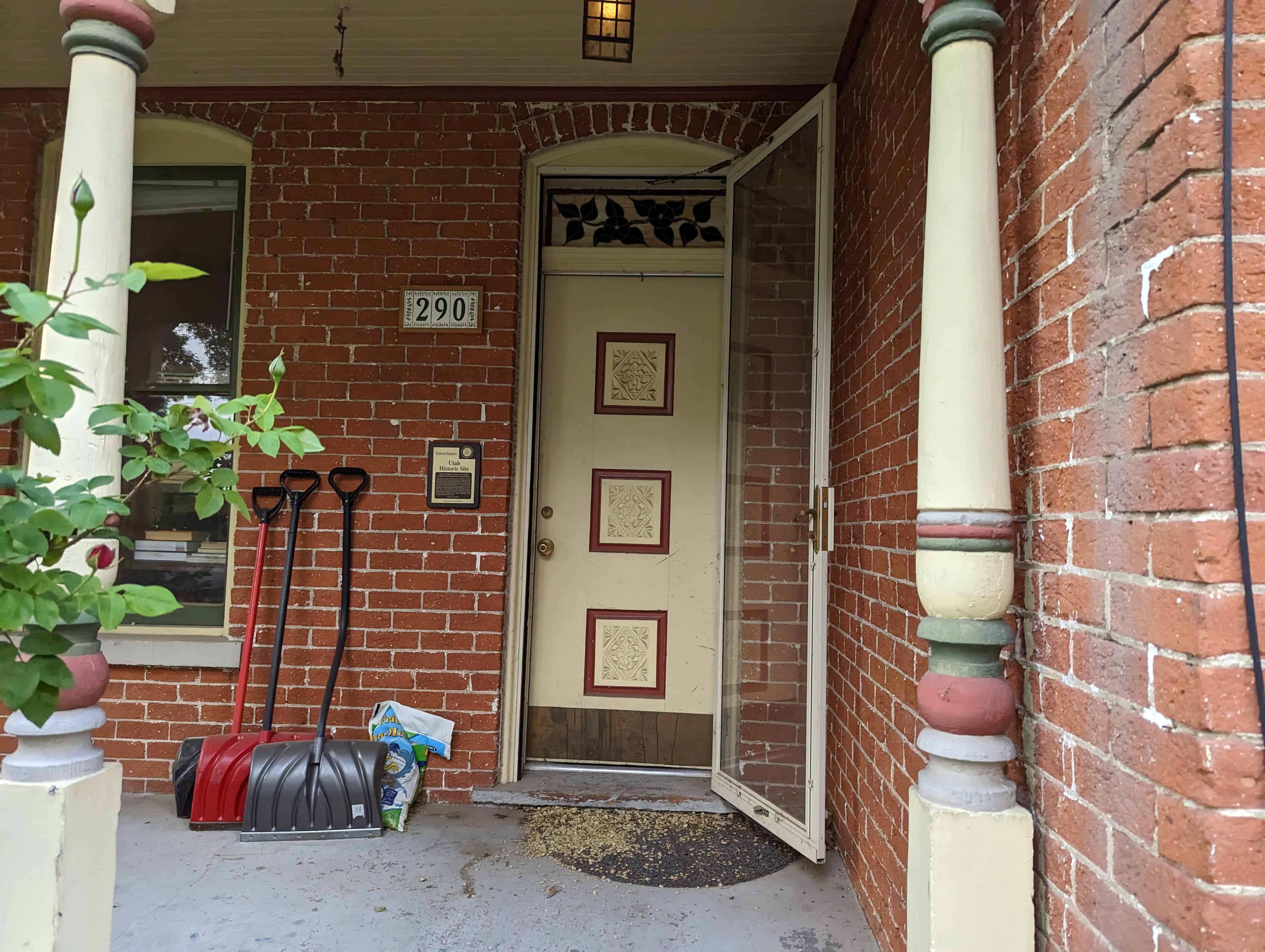
Bountiful Historic District, one of Utah’s Historic Districts, roughly bounded by 200 West, 500 South, 400 East and 400 North in Bountiful, Utah and added to the National Historic Register in 2005. The text on this page is from the nomination form from when it was added.
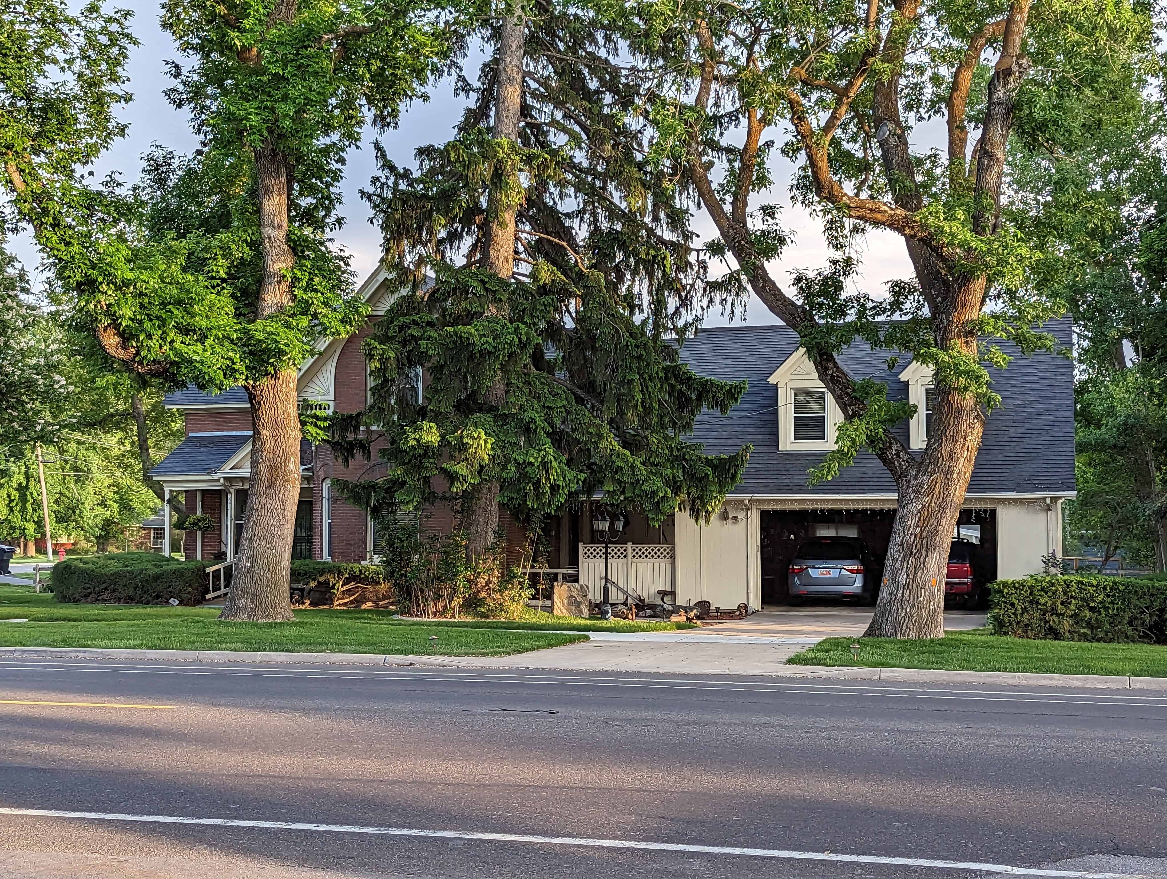
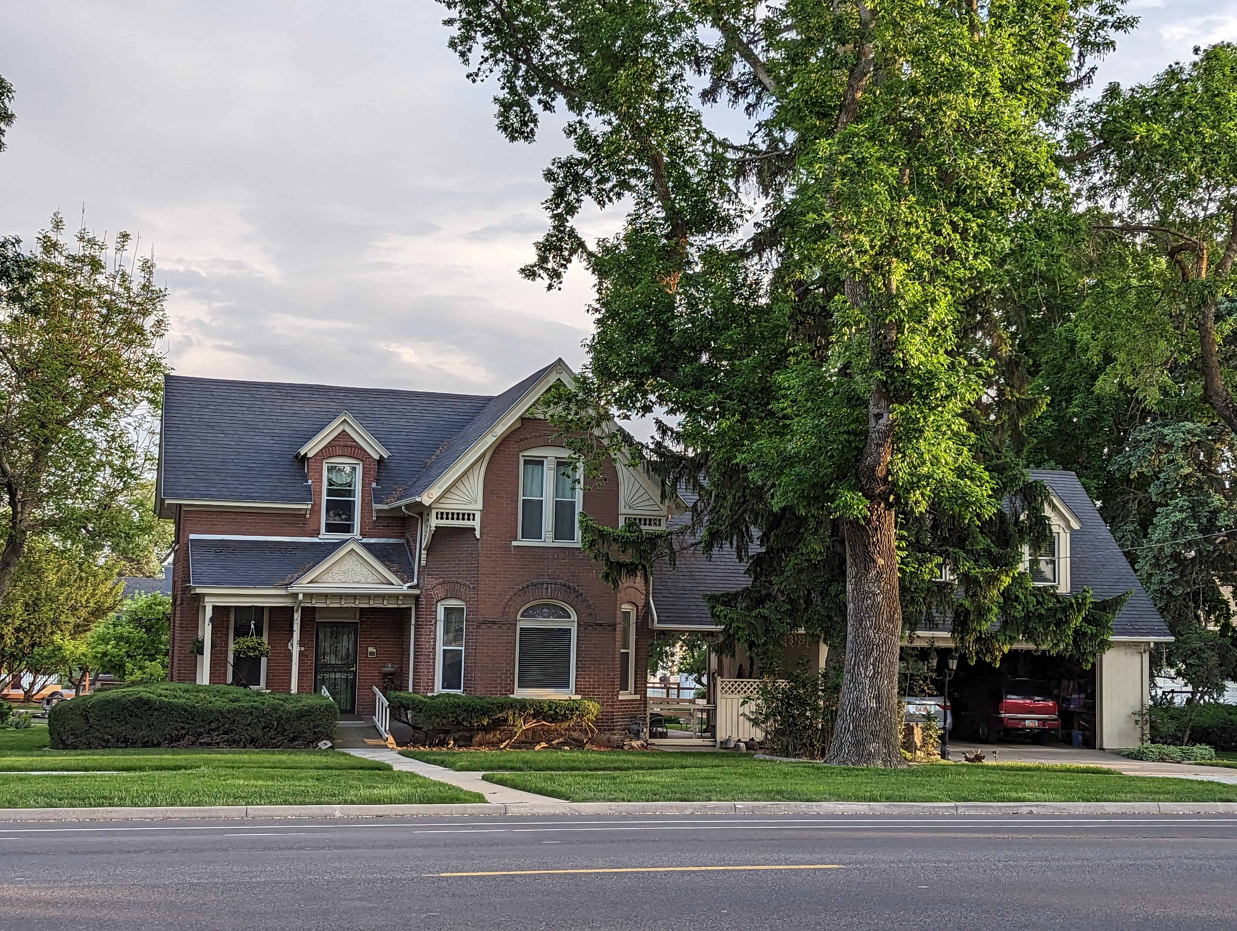
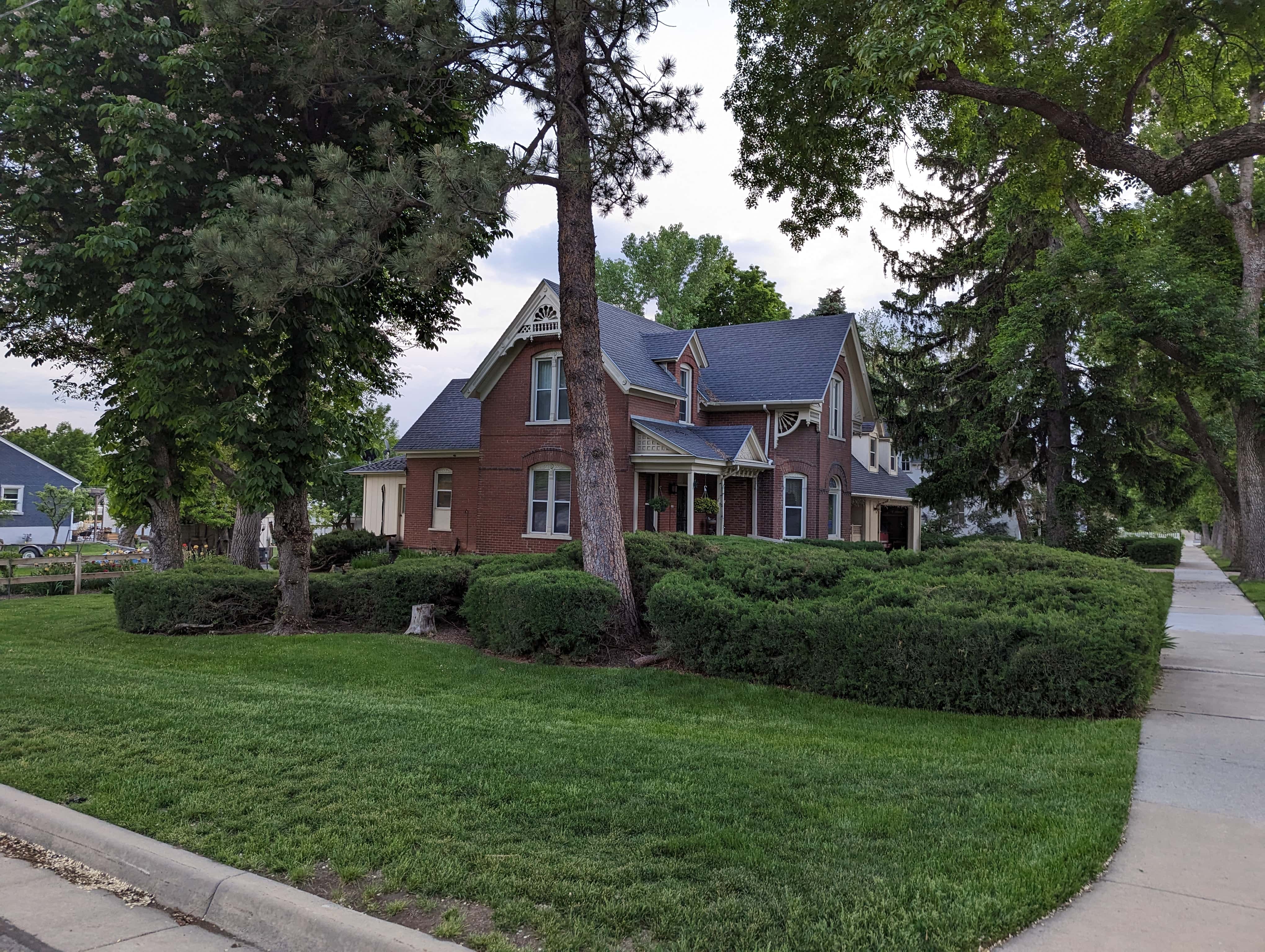
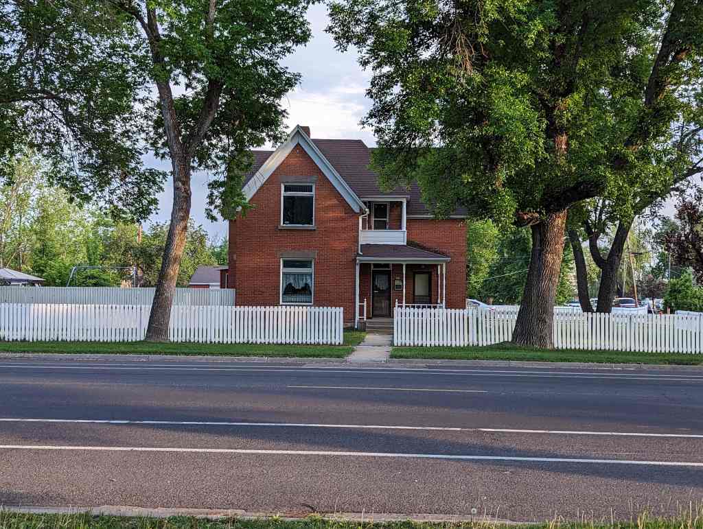
The Bountiful Historic District is located in the historic city center of Bountiful, Davis County, Utah. Bountiful was Utah’s second settlement and is located just ten miles north of Salt Lake City. Bountiful’s historic city center is significant in the architectural, economic and social history of the Bountiful. The historic district is significant under Criterion A for its association with the development of the community from a satellite pioneer settlement to independent suburban center. Bountiful’s proximity and economic ties to Salt Lake City informed the development of the community, but the city center has retained its historic character despite growth pressure, which began in the historic period and continues today. The historic and architectural of the district resources are eligible within the following areas of significance: Community Planning and Development, Agriculture, Commerce, and Social History. The district is primarily residential with a commercial corridor along Main Street and the boundaries follow the outline of the town’s first plat. The area includes 779 contributing buildings, including 520 primary buildings and 259 outbuildings (66 percent of total resources). Despite a high number of out-of-period buildings, the Bountiful Historic District is also significant under Criterion C for an intact concentration of historic buildings, which exhibit a high level of integrity and craftsmanship. The contributing buildings represent Bountiful’s major historic construction phases, which resulted in an impressive range of architectural styles, types, and materials. Prior to this nomination, two buildings within the district were individually listed on the National Register of Historic Places.
Early Settlement Period, 1848-1869
The settlement of Bountiful began with the family of Perrigrine Sessions, who brought a herd of 300 cattle to the area on September 27, 1847, approximately two months after members of the Church of Jesus Christ of Latter-day Saints (LDS or Mormon Church) entered the Salt Lake Valley. He camped in the area near today’s 300 North and 300 West, just outside of the historic district. The Sessions family spent the winter in a dugout on the side of the creek bank, which marked the beginning of what became the second Mormon settlement in the Utah Territory and the first one in Davis County. In March 1848, the herd was given up so the Sessions and five other families could begin farming. Twenty-five families spent the winter of 1848-1849 in the area. In 1849, the Whipple saw mill and a log schoolhouse were constructed in what known as Sessions Settlement. Three years later a public building was built for school, church and socials. At first the settlers lived in wagon boxes, tents, or crude dugouts. Perrigrine Sessions built a log cabin in the spring of 1848. Others soon followed. In 1854, Jeremiah Willey built a log cabin at approximately 495 E. 500 South, which was renovated and displayed at the Bountiful City Park for many years (The cabin was moved to the city hall complex in early 2005 and is no longer within the boundaries of the historic district). The area was organized as an LDS Ward, and in 1850, John Stoker was named as the third bishop. He presided over the community for twenty-three years, and was instrumental in uniting the scattered community of farmsteads under a common name. Bountiful was the name of an ancient city described in the Book of Mormon. Prior to this time the families were scattered throughout the area currently known as Bountiful, Centerville and Woods Cross.
In the 1850s, the community became more organized. Road districts were established in 1853, and a post office designated in 1854. That was the same year as the first town site survey. The boundaries of the first town site, known as Plat A, encompassed the area designated for the Bountiful Fort. Based on early models of Mormon town planning, it was believed that the community’s social, cultural and educational development would be better served by concentrating the residences within the town site with farming in the outlying acreage. The fortified town would also provide protection from the perceived threat of Native Americans, who had previously used the land for hunting and camping. The fort wall was designed as a dirt embankment along the Plat A boundary streets: 200 West, 400 North, 400 East and 500 South. The mud wall, as it was called, was only partially completed and eventually demolished by 1900. The settlers were advised to move into the fortified city and lots were sold for $5.00 to $25.00 per lot. John Stoker was one of the first residents to move his family to the fort. Of the 150 families living in Bountiful in 1855, only 36 had built homes inside the fort.
The settlement was tied to Salt Lake City and the greater community through dirt roads, the Pony Express (1860) and the Desert Telegraph (1867). The dedication of the Bountiful Tabernacle on March 13, 1863, was an impressive two-day event, which brought many visitors to the community. The Bountiful Tabernacle, built of adobe brick on a stone foundation and designed by Bountiful resident Abraham Farnham, is one of the largest surviving adobe buildings in Utah. The National Register-listed buildings is also one of the oldest LDS Church meetinghouses in continual use. [Photograph 10]. The tabernacle replaced an early log building (corner of 400 North and 200 West, demolished) and an adobe schoolhouse (same area, demolished), which had been used for church and community meetings. Hannah Holbrook is credited as the first school teacher in Bountiful.
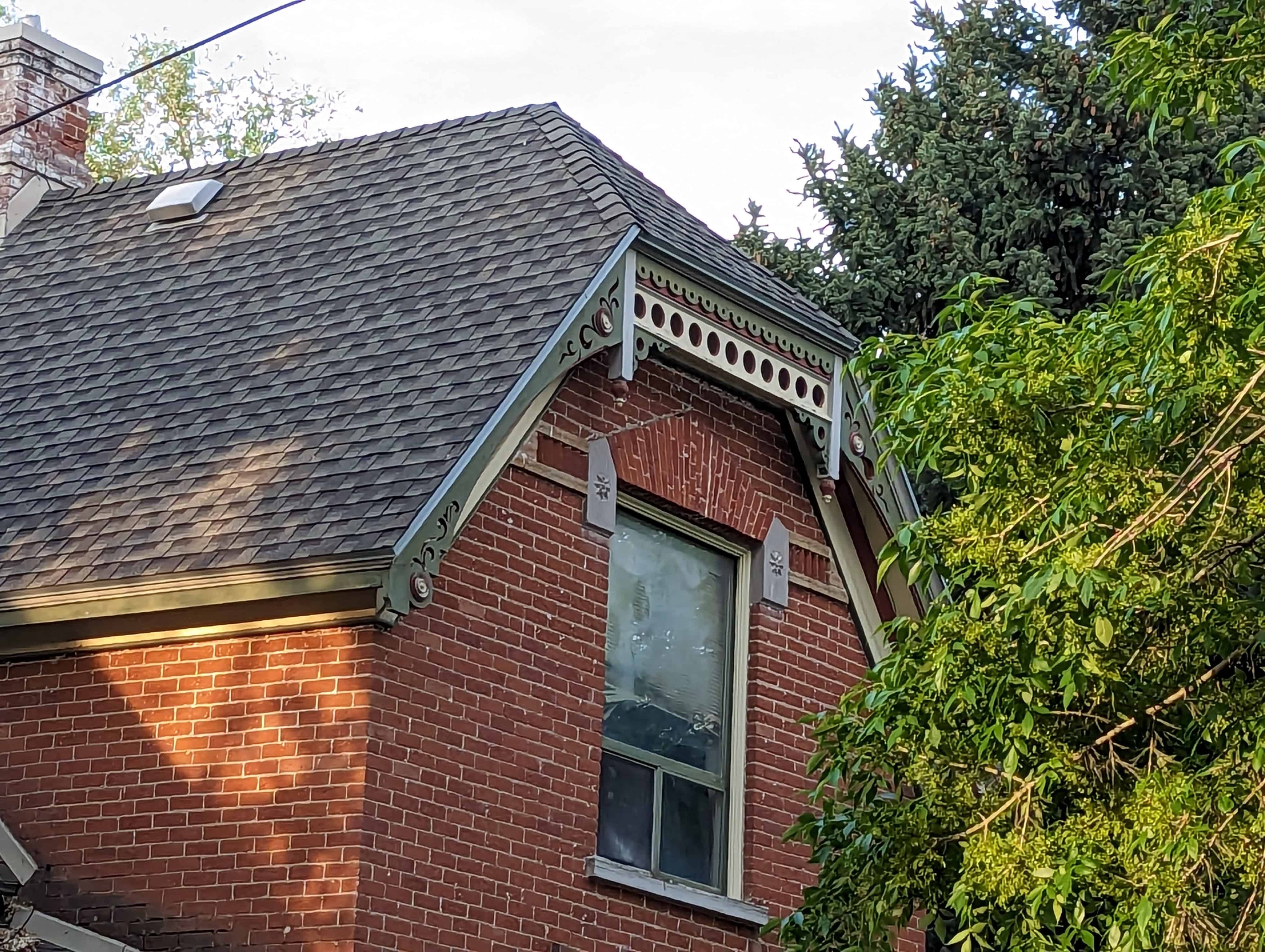
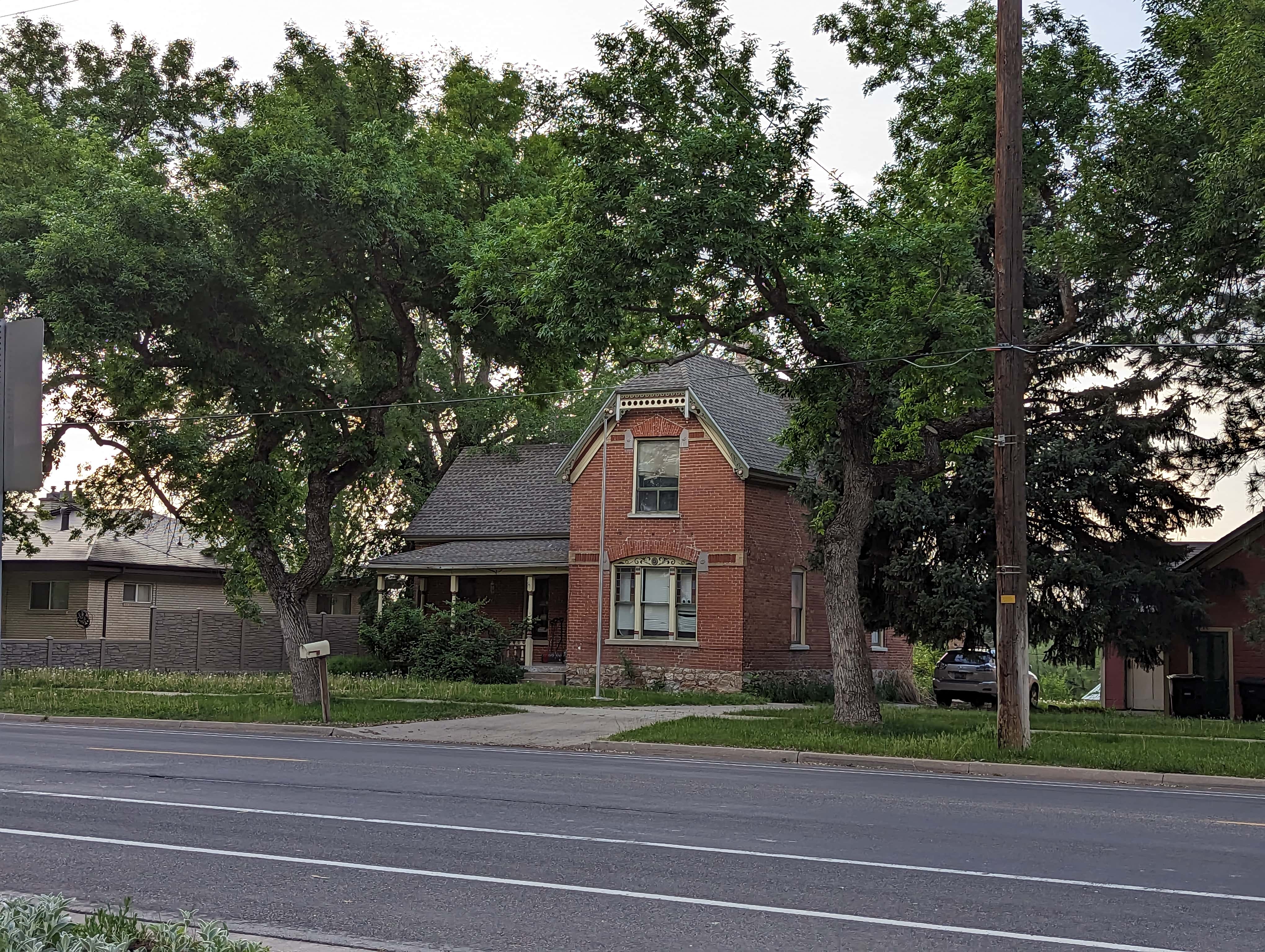
Within a few years, the settlers were able to move from their rough hewn log cabins into more substantial homes made from adobe and stone. In 1850, Sessions built a two-story adobe house in 1850 on the main Territorial Road from Salt Lake to the northern settlements (200 West). Until its demolition around 1900, the house was the home to several families of Sessions and also served the community as an inn, Pony Express stop and post office. The adobe bricks were made from clay in area near today’s 500 North and 100 West. John Crosby, a farmer, and his wife Mary Jane Johnson, had a two-story adobe home on 100 West [Photographs 23 & 1A]. Stone masonry was also favored by early Bountiful settlers. Jeremiah Willey began constructed a stone house in 1868, the year he died. It was completed by his sons, and is occupied by a descendant today [Photograph 25]. The stone barn, located on 200 West, was part of the Daniel and Cordelia Carter farmstead, and is the oldest stone building in Bountiful [Photograph 26]. Brick-making began in Bountiful during this period. Henry Rampton, the town’s most prominent blacksmith and a polygamist, had two of the earliest brick homes built for his wives, Frances Dinwoodey and Ada McDuff [Photograph 34].
Water for irrigation came from the canyons to the east. Barton (later Holbrook) Creek ran diagonally south to north through the platted town. Mill Creek ran just to the south of the town site. Stone and North Canyon Creeks brought water to the lands north and south of the town respectively. Heber C. Kimball built the first grist mill in Bountiful, and there were several lumber mills located, on the creeks. Early industries also included a broom factory, blacksmithing, weaving, and molasses mills. The first store was located at what was called Old Boynton Corner where the Bountiful Third Ward was built (400 North and 400 East). Subsistence agriculture at the family level was the main occupation of Bountiful’s settlers during this period. Those who produced for commodities relied on grain and cattle. But the population grew quickly and a few mercantiles and other businesses began to open shop on Main Street, thus preparing the town for the coming of the railroad, which began a post-pioneer era of growth and economic diversification.
Agriculture, Railroad and Commerce Period, 1870-1891
The coming of the railroad changed the economic base of Bountiful dramatically, and within this period the historic district was established as the commercial and social center of the community. A large number of Bountiful laborers worked on the construction of the Utah Central Railroad, and several men supplied the lumber for railroad ties. The first immigrants to arrive by train were the family of Jacob Gierisch, marking the end of the settlement period. The first non-LDS church was established in Bountiful when the local Protestant congregation stone meetinghouse, known as Bliss Hall, in 1$72 [Photograph 39]. On June 20, 1877, members of the LDS Church were divided into three wards, with the East Bountiful Ward located in center of the city. Richard Duerden, a store keeper, had the first telephone in Bountiful installed in his home in 1883. His store had the first safe. Steven and Alice Hales built Hales Hall, a large building for dances and plays, in 1884-1885 (corner of 200 West and 500 South, demolished). During this period, brick-making became a major industry with five brickyards in Bountiful.
The Main Street commercial business district began to take shape after the dedication of the tabernacle. A large number of enterprises began and had buildings of frame and brick erected during this period. Unfortunately, many have been subsequently demolished or altered. The largest was the People’s Opera House and Mercantile Company, which was built in 1891 between 100 North and Center on Main Street (demolished). The co- operative movement began in Bountiful in 1869 and a two-story brick store was built in 1873 (demolished). The Jack Lewis Hotel and Saloon (built of brick in the late 1880s) still stands at the corner of 200 North and Main [Photograph 38]. The Bountiful Lumber Company was organized in 1890 and continues in business today.
According to Leslie Foy, the first gardening for marketing purposes in Utah was begun in South Davis County. Irrigation and transportation improved during this period, and Bountiful farmers benefited from fertile ground and a ready market in Salt Lake City. The farmers organized a Grower’s Market to help them store and sell their produce in downtown Salt Lake. The vegetables and fruits produced in Bountiful included peas, beans, cucumbers, peppers, onions, carrots, corn eggplants, tomatoes, melons, and cantaloupe. Orchards for apples, pears, peaches, and cherries became so ubiquitous that one east bench road was named Orchard Drive. The Woods Cross Canning and Pickling Company was started in 1891, and although not within the city limits, it was an important employer for many years.
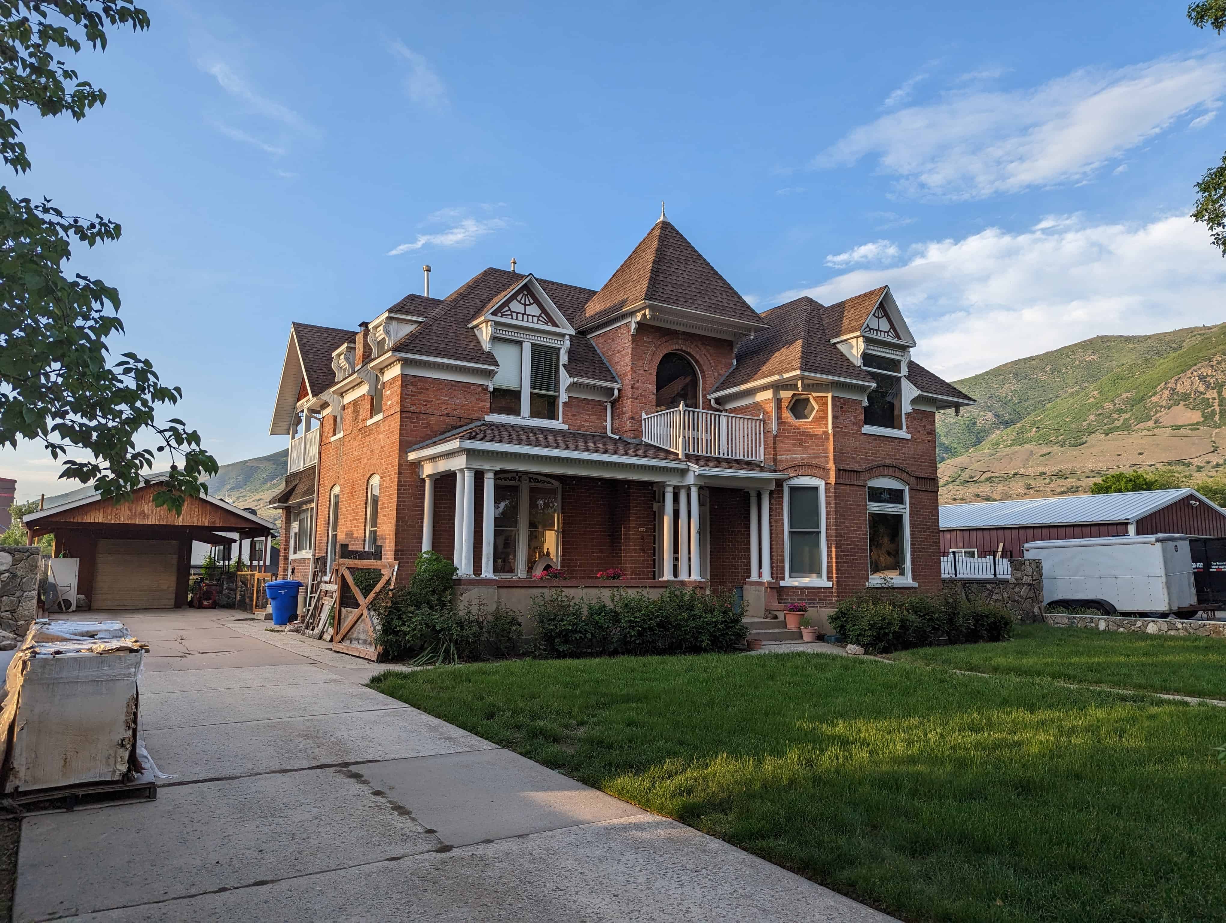
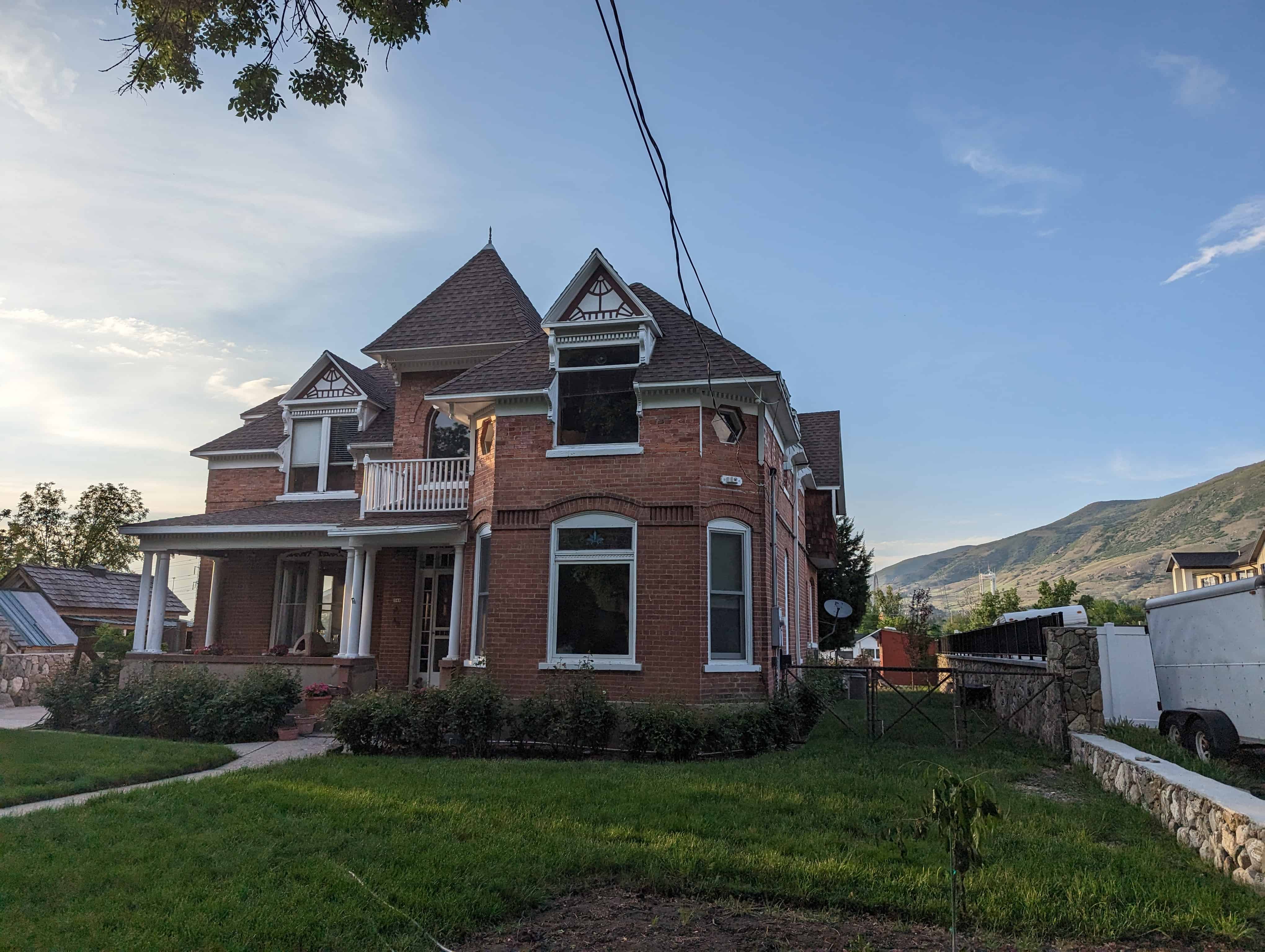
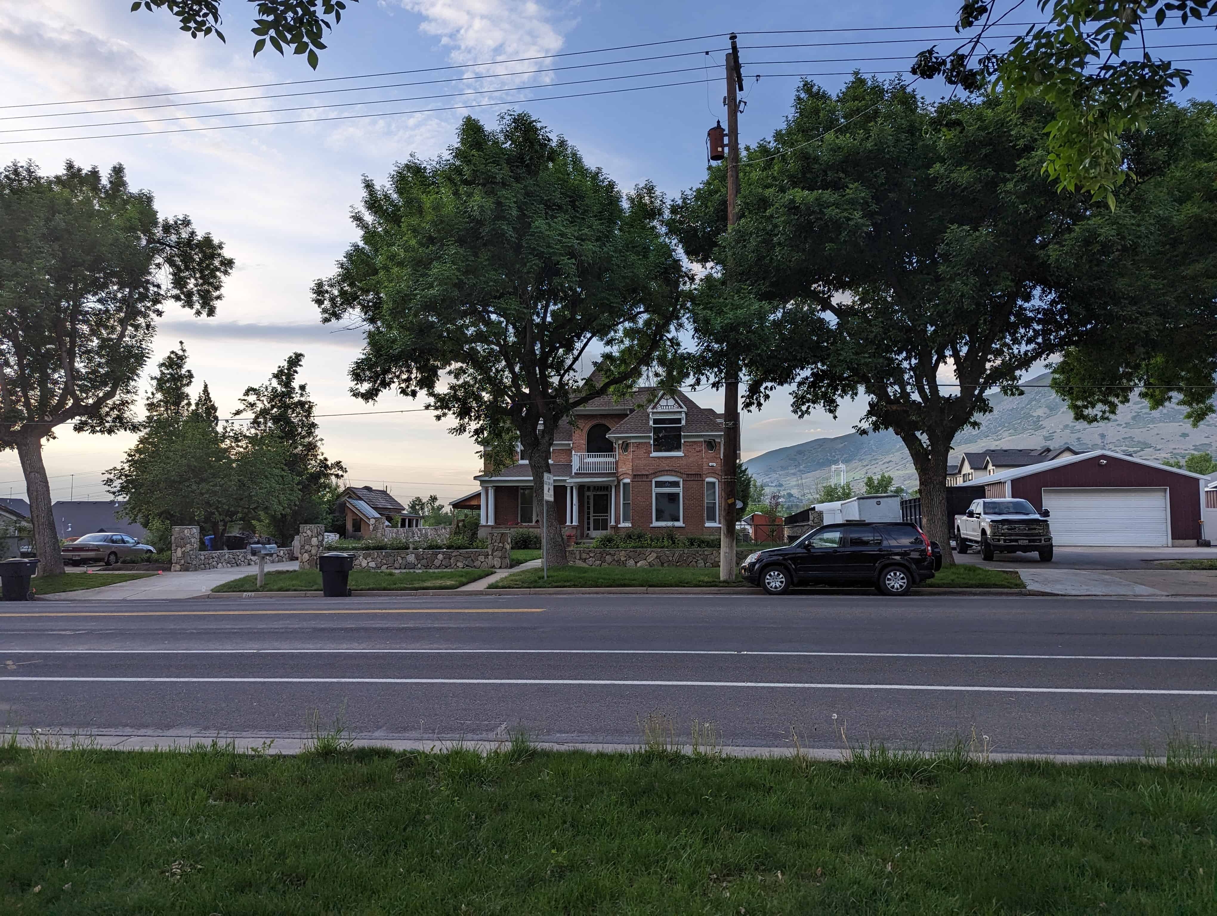
The most important architectural contribution of this period to the historic district is the number of stately residences built, mostly on prominent corner lots, throughout the town site. Joseph Holbrook built a stone house on a parcel of land he acquired in 1872 as the first recorded land transaction recognized by the , government [Photograph 28]. Prior to this time, land was distributed through the LDS Church hierarchy. David Stoker, son of John Stoker, built a fine brick home for his wife, Regina Hogan in 1871 [Photograph 29]. Brick mason, James Green, built a number of residences in Bountiful, including the home he built for his daughter in 1887. Emily Green’s home was a showcase for her father’s talents as a mason and carpenter. The home is listed on the National Register and the property includes an unusual brick smokehouse [Photographs 30-31].
By the end of this period, Bountiful’s population was over two thousand. The 1880 census enumeration gives a glimpse of the demographics. The older population consisted mostly of immigrants from England and the eastern portions of the United States; however the majority of children were born in Utah. The population was white with the exception of Ruth Davids and her children. Ruth was a full-blood Piede Indian. Bountiful resident, Anson Call traded a sack of flour for Ruth when she was a small child in Utah in 1853. Call adopted her and she was raised as a daughter. She married James Henry Davids, an Easterner who came to Utah as a soldier and later worked for the Call family. They lived in Bountiful where James farmed and Ruth became a mid-wife. James and Ruth Davids left Bountiful with several other families to colonize southern Idaho in the early 1880s. The average family size was about six children. There are several female heads of households, mostly widows or wives of the town’s polygamists. Though the practice was not wide spread, a number of prominent Bountiful citizens were polygamists until 1890 when church-sanctioned polygamy was discontinued.
The majority of workers were farmers or farm laborers. At least two men were described in the 1880 census as “market growers.” The large lots found within the historic district allowed for an agrarian overlay that allowed for small gardens, orchards, and even livestock on the family’s plot of land. This was an important part of the community economy, but many also worked at specialized occupations. James Weight was a carpenter and his wife, Dinah was a milliner. Many of the young women were employed. Phoebe Wood and Ellen Muir were dressmakers, while Ann Layton was a telegraph operator. A dozen men were making bricks or in the building trades. Several members of the Thurgood family ran a store. Alfred Putnam made a living as a musician.
Incorporation and City Improvement Period, 1892-1925
The year 1892 was marked by two important events in Bountiful. The first was of the incorporation of the City of Bountiful, on December 28, 1892. The first city council meeting was held at the home of Charles Pearson on that day. Three years later, mainly because of disputes over water rights, the communities of West Bountiful and Wood Cross broke away from Bountiful.
The second was the arrival of the Bamberger Railroad. Simon Barnberger, a businessman who later became governor of Utah, established the railroad as a way to link the numerous farm communities between Salt Lake and Ogden, while promoting his Lake Park resort near Farmington (today’s Lagoon Amusement Park). The railroad was nicknamed the “Dummy” because the steam engines were encased in wood to look like the cars they pulled. The station was located on 200 West and 200 South (demolished). The Dummy was an important factor in the community’s economic growth because it had both freight and passenger service. It allowed Bountiful farmers and merchants to more easily ship commodities and export produce. For ten cents, Bountiful residents could ride into Salt Lake City for work, school, or an outing, allowing the newly formed city to function as a streetcar suburb. The steam railway was electrified in 1910, by which time it was known as the Bamberger Electric Railroad. One of the most popular services, it ran a regular schedule until 1952 when service ended. Along with the Bamberger, Bountiful had streetcar service provided by the Utah Power and ( Light Company. The streetcar ran along Orchard Drive and down the center of Main Street until service was discontinued in 1926.
With only a few exceptions, all of Bountiful’s major public amenities were established during this period, with much of the improvement concentrated in the town site and adjacent neighborhoods. It was an era of firsts: electric power in 1896, sidewalks in 1897, a public watering, trough in 1898, public water system and plumbing began in 1906, and streetlights installed in 1908. The Bountiful Light and Power Company started in 1907. The city also instituted>a library in 1900, a volunteer fire department in 1911, a park system (1918) and a city dump (1922). In 1908, the Bell Telephone Company established the Bountiful Exchange. The sidewalks were laid with cement beginning in 1909. The beginning of the automobile culture was marked by a gasoline, stand (1914), the first street paving (1918), and bus service, which began in 1920.
Business flourished in Bountiful during this period and many of the buildings remain. Two examples still in use by their original occupants are the expansion of the Bountiful Lumber & Supply Company (190 S. Main, built in 1919) [Photograph 51], the Davis County Clipper newspaper building (built in 1906, 1960s façade) and Carr’s Printing (circa 1920, altered). The city also had two banks, the Bountiful State Bank (1906) and the Union Bank (circa 1910). There were three competing furniture stores, two of which also provided mortician services. The furniture stores were consolidated into one company in 1923. There were also four mercantile or general stores, including an early J.C. Penney’s dry goods store. Main Street also included the more urban enterprises: a dentist, a theater, a florist, a drugstore, a confectionary, and a pool hall. By the end of the period, the town also boasted six separate automobile-related businesses.
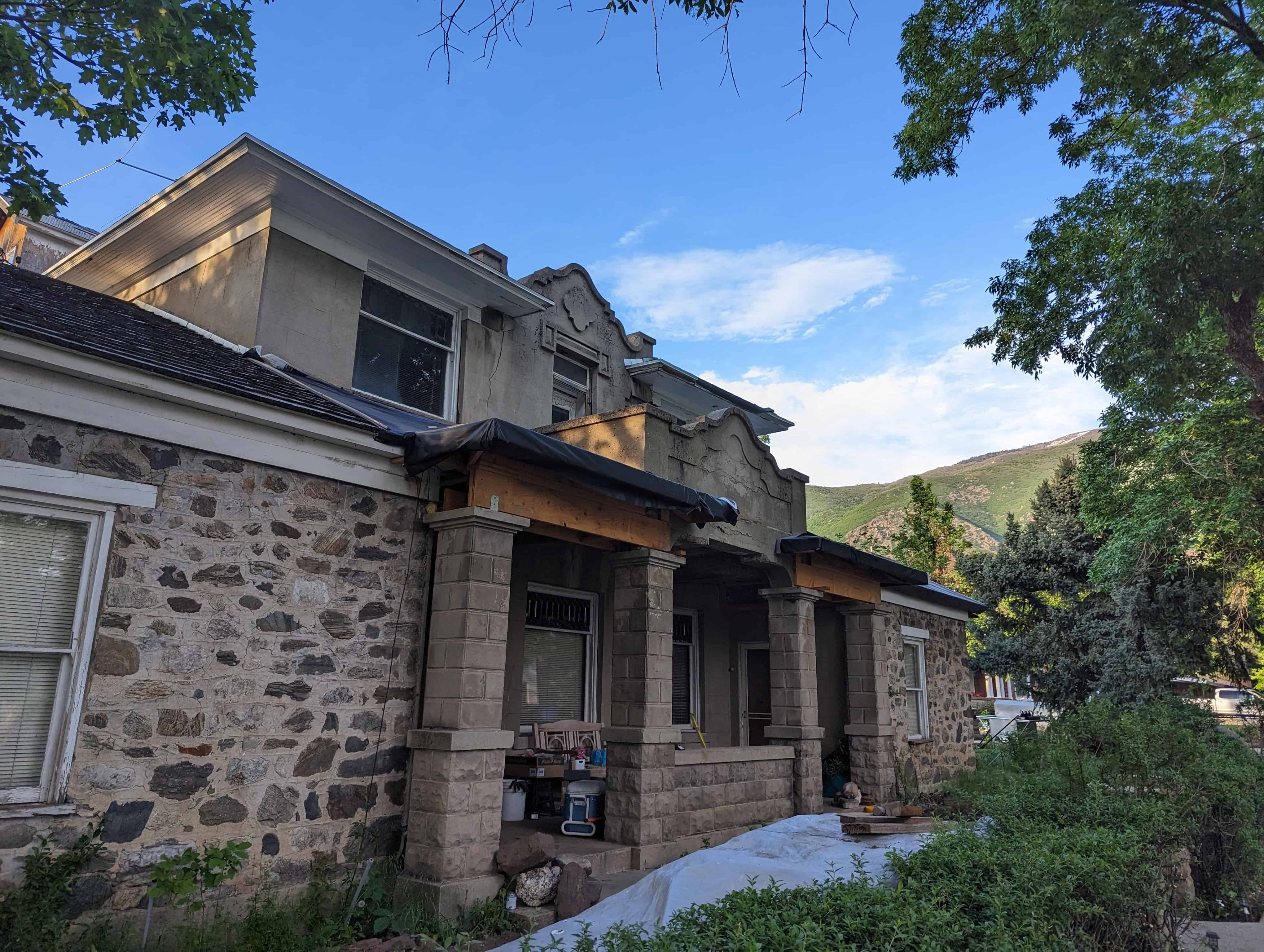
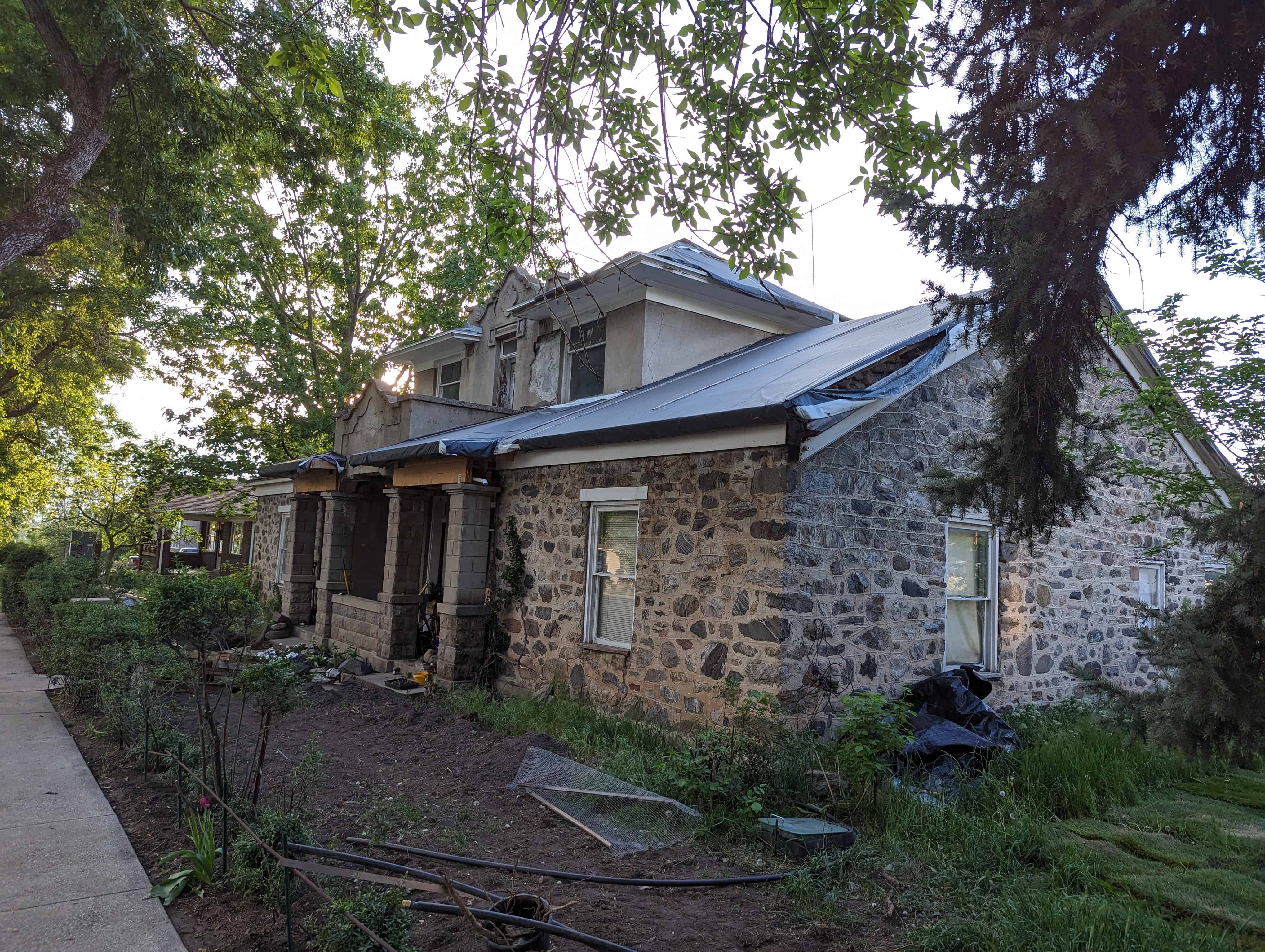
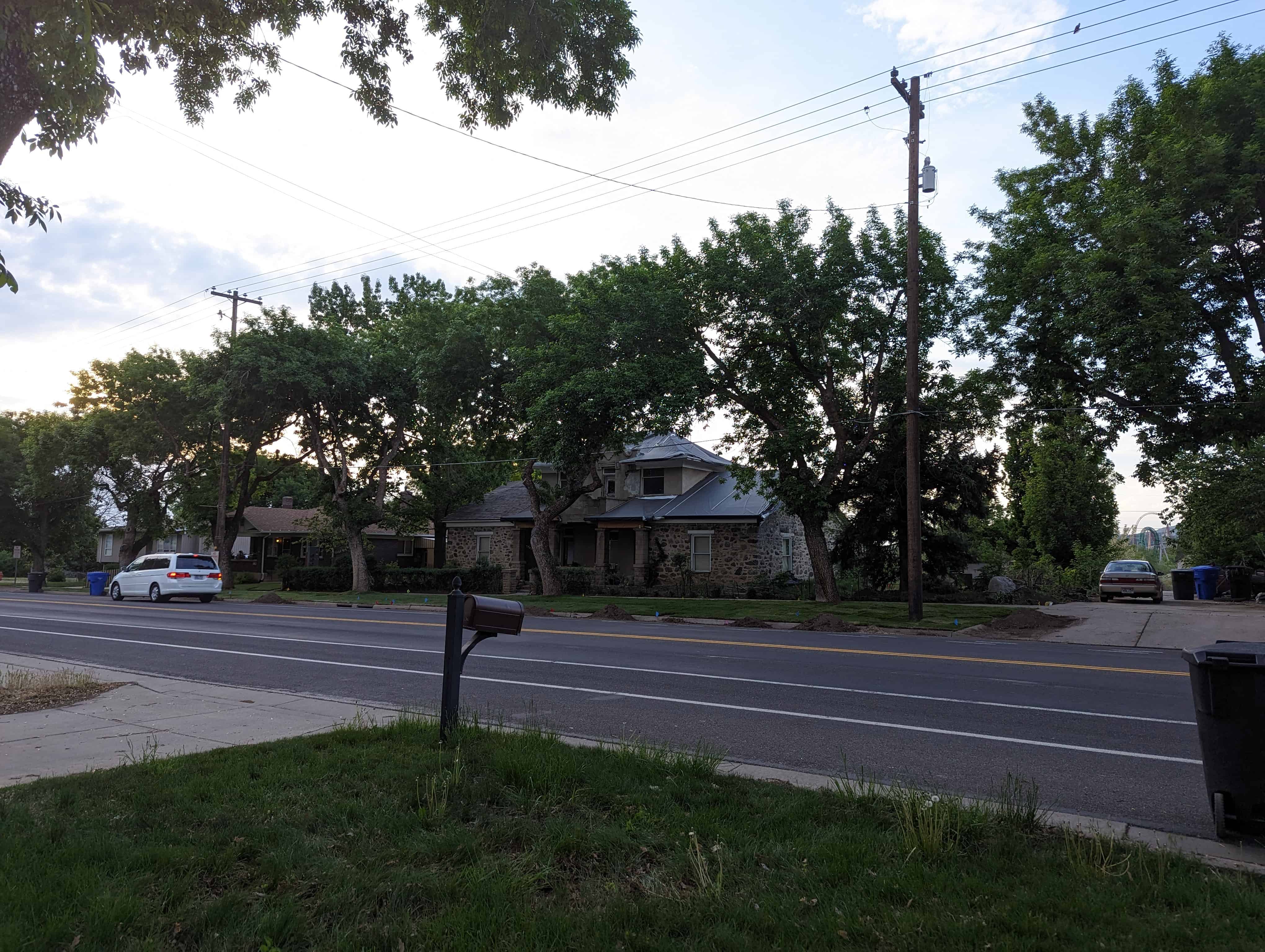
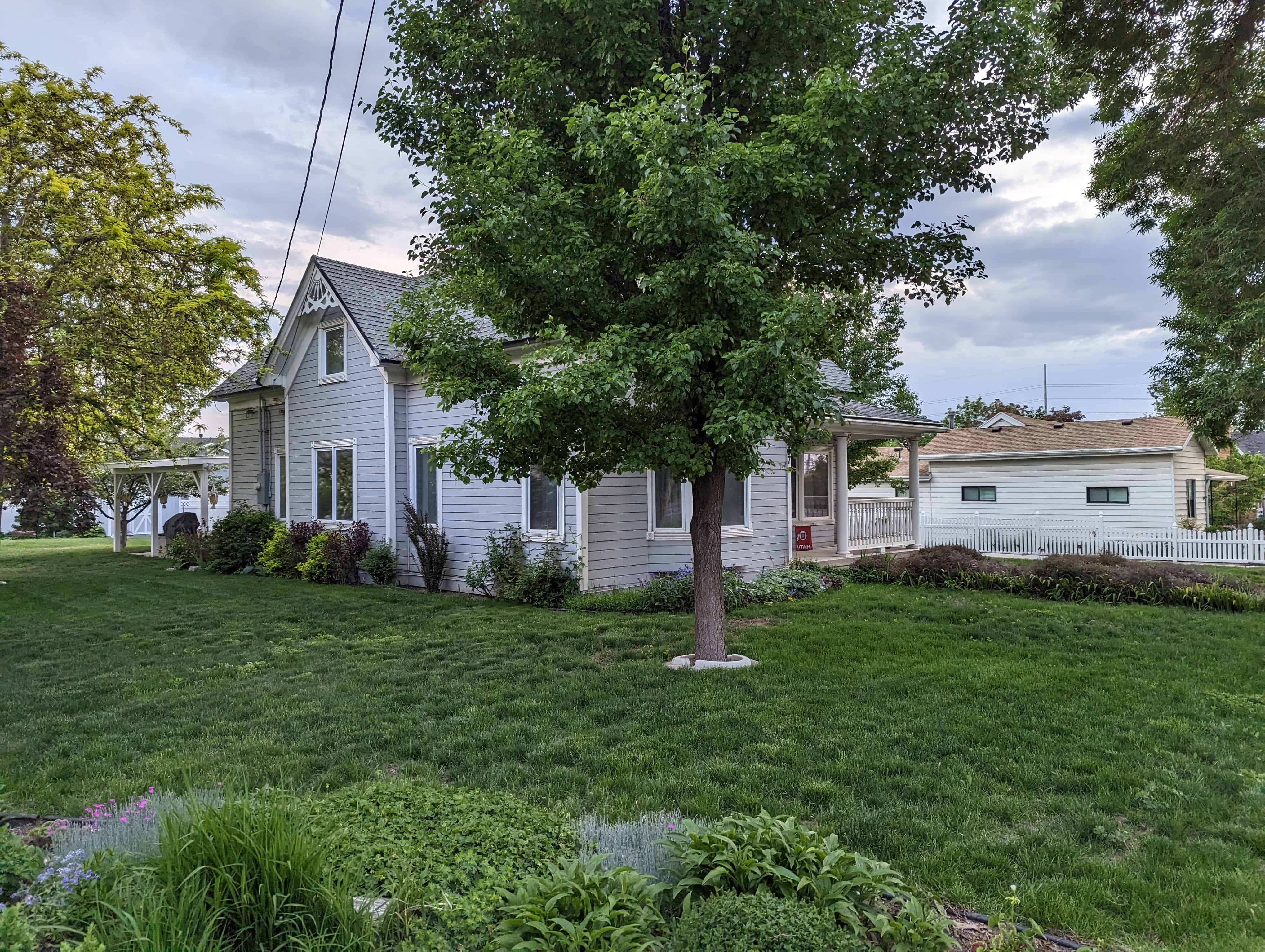
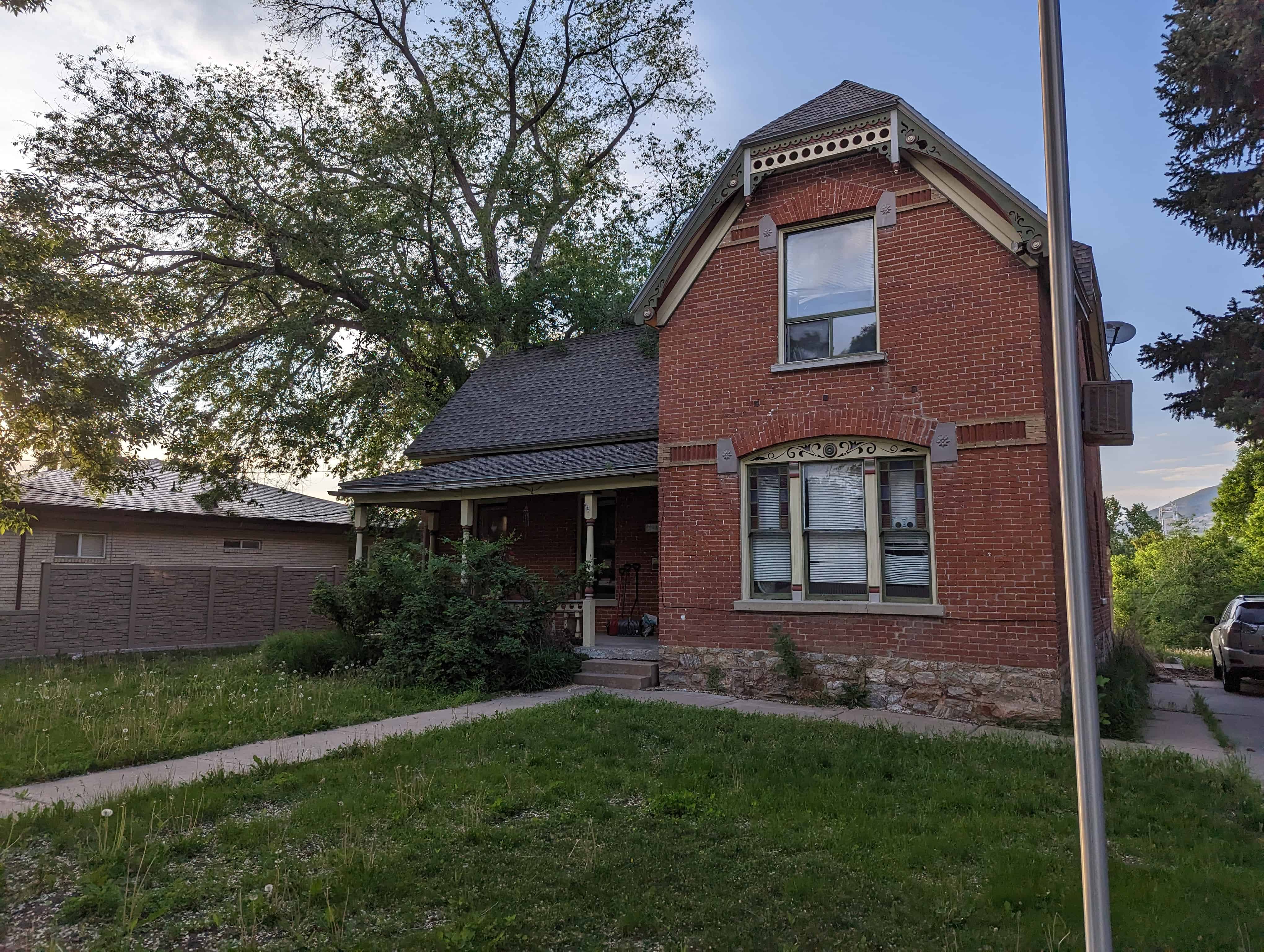
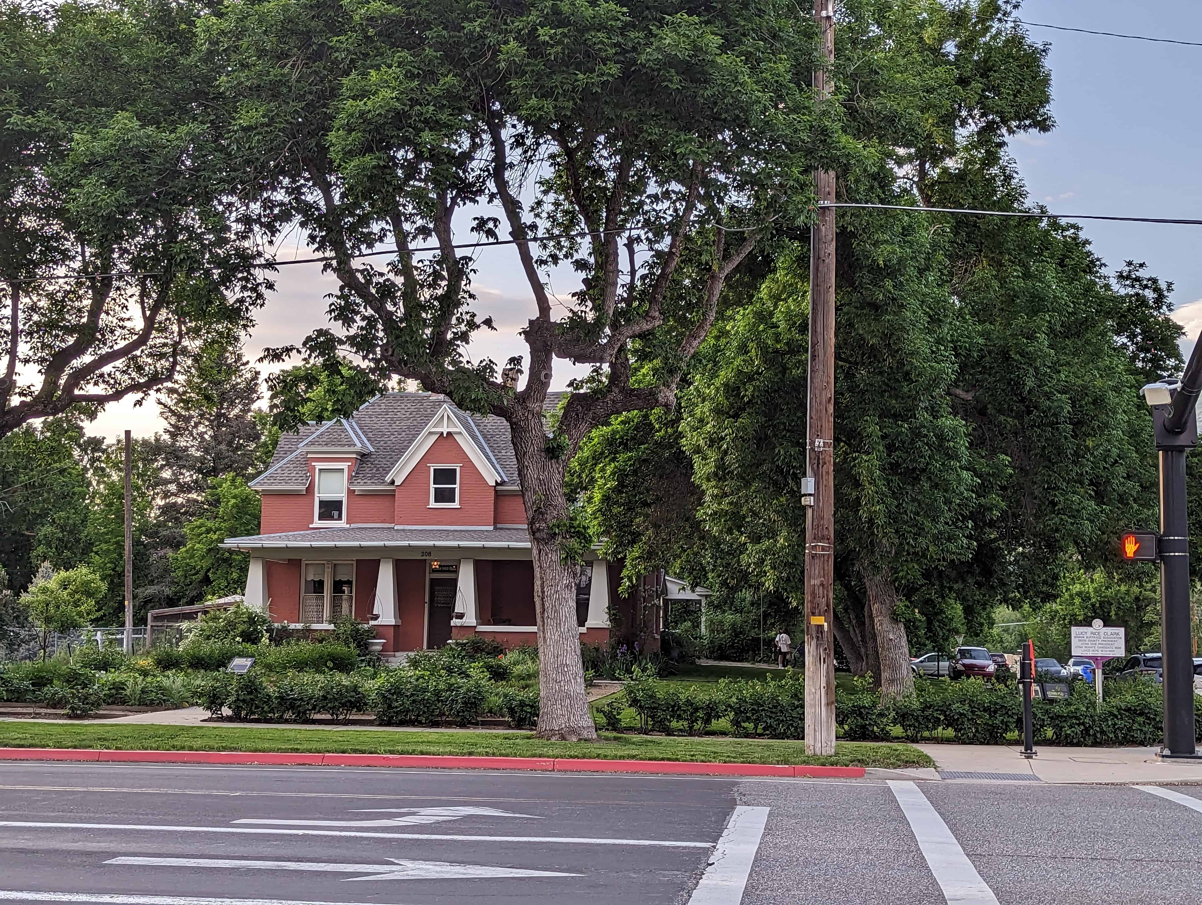
The population of Bountiful doubled in this period. The LDS Church divided the East Bountiful Ward into two new wards on February 14, 1909. The Bountiful First and Second Wards continued to meet in the tabernacle until the Second Ward Meetinghouse was completed in 1914 [Photograph 51]. Many second-generation residents of Bountiful prospered and built large homes [Photographs 16, 36, 43, 45 & 47]. Others, including former Bountiful mayor Charles R. Mabey, who later served as Utah’s governor, had more modest homes [Photograph 44]. The Victorian cottage, and later, the bungalow were the most popular house types of this period [Photographs 46 & 48] for Bountiful’s emerging middle class. The Stoker School located just south of the tabernacle and completed in 1905, was the most prominent building constructed during this period.
Census records for this period show that the popular mostly consisted of Utah natives with only a small immigrant population. The number of common surnames suggests that a large portion of Bountiful residents were descendants of the first settlers. Farming was still the most common occupation, but there was a wide range of specialized workers in retail, industry, and civil service. Economic diversity was particularly apparent within the historic district. Families were much smaller than in previous periods, averaging three to five children per household. The family garden and orchard were still an important part of the landscape, but most of the agricultural outbuildings within the district disappeared during this period and were replaced by garages and tool sheds. The automobile was an important and growing part of Bountiful’s culture as it made the transition from semi-rural streetcar community to the early epicenter of the coming suburban boom in south Davis County.
Community Development and the Rise of the Automobile Period, 1926-1945
The late 1920s to early 1940s was an interesting period in Bountiful’s development. Leslie Foy described the effect Bountiful’s depression years in this way: “For the farm families of Bountiful, the depression was not characterized as much by a lack of food as it was a lack of cash to pay taxes, mortgages, or buy shoes. Person income was low.”8 He also noted that many families banded together to save farms and homes. The community participated in a number of WPA programs, mostly water-related projects. The 1930 census indicates, while farm occupations were still prevalent, many Bountiful residents were laborers or had odd jobs than in the previous enumerations. The ethnic make-up and family size of the community did not noticeably change. The value of the homes in the historic district ranged from $1,000 to $10,000 with a fairly high percentage of home ownership. Rental rates were about $5 to $30 per month. About eighty-five percent of Bountiful residents had radios. This period marked the peak of agricultural activity in Bountiful. The Chamber of Commerce instituted “Cantaloupe Days” to promote and celebrate one of the community’s most prolific crops.
Unlike many of Utah’s small towns, which had little building activity during the 1930s, the statistical count of architectural resources of the historic district indicate that construction activity remained steady. The number of period cottages built during this period rivals the number of bungalows in the previous period, a statistical anomaly compared to similarly sized Utah towns [Photographs 52 & 53]. By the early 1940s, the streets of the historic district were paved, had curb and gutter, and were lined with mature trees. Particularly in the west half of district, the semi-rural lots had been divided and subdivided with hundreds of new houses, including an unusually high number of pre-World War II-era cottages [Photographs 54-55]. In 1931, the period-revival Moss Apartment building was constructed at the corner of 200 North and Main Street [Photograph 56]. Hundreds of these walk-up apartment blocks were built in downtown Salt Lake City, but are rare in smaller communities. The Moss Apartments helped fill a need for housing, for young couples and singles during the depression years and is still occupied today.
Despite the depression years, Bountiful’s Main Street appears to have experienced a small building during this period. This type of 1930s-bopm is unusual for towns of Bountiful’s size, and is probably due the strong economic ties between Bountiful and Salt Lake in the 1930s. The Bountiful Theater and Union Mortuary were built during this period [Photographs 9 & 57]. Not surprisingly, the 1930 Sanborn map shows a high number of auto-related businesses on or near Main Street. The city moved its offices into a new city hall on Main Street. In 1932, the city acquired the privately-owned, Bountiful Light and Power Company. It also took over the operation of the cemetery from the LDS Church in 1939. In 1938, the American Legion built a meeting hall in honor of George R. Day, the only Bountiful man to be killed during World War I [Photographs 8]. Due to a steadily rising population, the Bountiful Third Ward was organized on April 10, 1938, and subsequently built a meetinghouse at the corner of 400 North and 400 East [Photograph 59]. In 1940, Bountiful Mayor Lloyd Riley instigated a numbering system for houses. The city had finally outgrown its rural roots. In addition to its proximity to Salt Lake, World War II defense plants in northern Davis County and Weber County helped attract new residents with convenient employment. With waning rail service, paved streets and stop signs (first installed in 1928), the community was primed to become one of the Wasatch Front’s most popular automobile suburb.
Post-War Expansion Period, 1946-1955
Post-war expansion in Bountiful can be more accurately described as a post-war explosion. For returning GIs ready to begin, families, Bountiful was the ideal location, close to employment center and enough available land for large-lot subdivision development. The population of the city grew from 3,557 in 1940, to 6,004 in 1950,’to 17,039 in 1960. In his history of Bountiful, Leslie Foy titled one chapter “The Challenges of Rapid Growth.” In it he states, “Entire subdivisions grew up almost over night.” Thousands of homes appeared on the land north, east and south of the town site on land which had been previously occupied by orchards and fields. In the early 1950s, the first zoning ordinances were passed. The city worked on numerous water and sewage projects. In 1954, the power plant was modernized and the first city manager was appointed.
Remarkably the historic character remained intact under the onslaught of suburban development. The Sanborn map, covers only a portion of the historic district, but indicates that very few older homes were torn down for new residential development. Post-war cottages and early ranch houses simply completed the infill of lots in the historic city center [Photographs 61-64]. Developers were able to build modest housing tracts (three to five houses) on the subdivided blocks of the town site. In particular, the east half of the district, where there was more vacant land, became very suburban in character, albeit with older stone and brick dwellings on most of the corner lots. Bountiful’s commercial district experienced a second boom during this period. There are numerous example of late 1950s and early 1960s commercial buildings [Photographs 65, 66 & 68]. The Bountiful Community Church at 100 N. 400 East, built in 1954 and expanded in 1961, is a notable institutional building of the period [Photograph 67].
Late-twentieth Century Development, 1956-Present
In the late-twentieth century, the population of Bountiful has continued to increase from 27,853 in 1960 to 41,301 in 2000; In an example of just how quickly the population has grown, when a new LDS church was built in the 1970s within the historic district (a non-contributing building on 200 West), it was designed for the Bountiful 26th Ward. Today, the 26th Ward shares space with the Bountiful 58th Ward. However, most of the residential construction within the district has been low-density multi-family housing, which has not had a great impact on the historic character of the district. More disruptive has been commercial encroachment from the west after 1960 when the Interstate 15 freeway system was built along 600 West. Spreading commercial development from the ramps at 400 North, and especially 500 South, has had a significant impact on the historic city center [Photograph 9]. Large commercial blocks on Main Street and 200 West also detract from the character of the district. The sprawling South Davis Community Hospital complex at the corner of 400 East and 500 South has also impact that corner of the district. The new post office complex [Photograph 21], which takes up nearly an entire block at Main and Center, is somewhat intrusive; but it is also likely to draw more people to the downtown commercial district, which has survived economically with several long-time companies and newer specialty shops. The new fire station on 100 West, a brick structure, has been a more compatible sympathetic addition to the district [Photograph 7]. Most recently, the city has contemplated moving city hall from the complex at 700 South, where it has been since the early 1960s, back to the city center. Hopefully, the new complex will be sympathetic to the neighborhood, which was designated by the city as the Bountiful Fort Historic District in 2004.