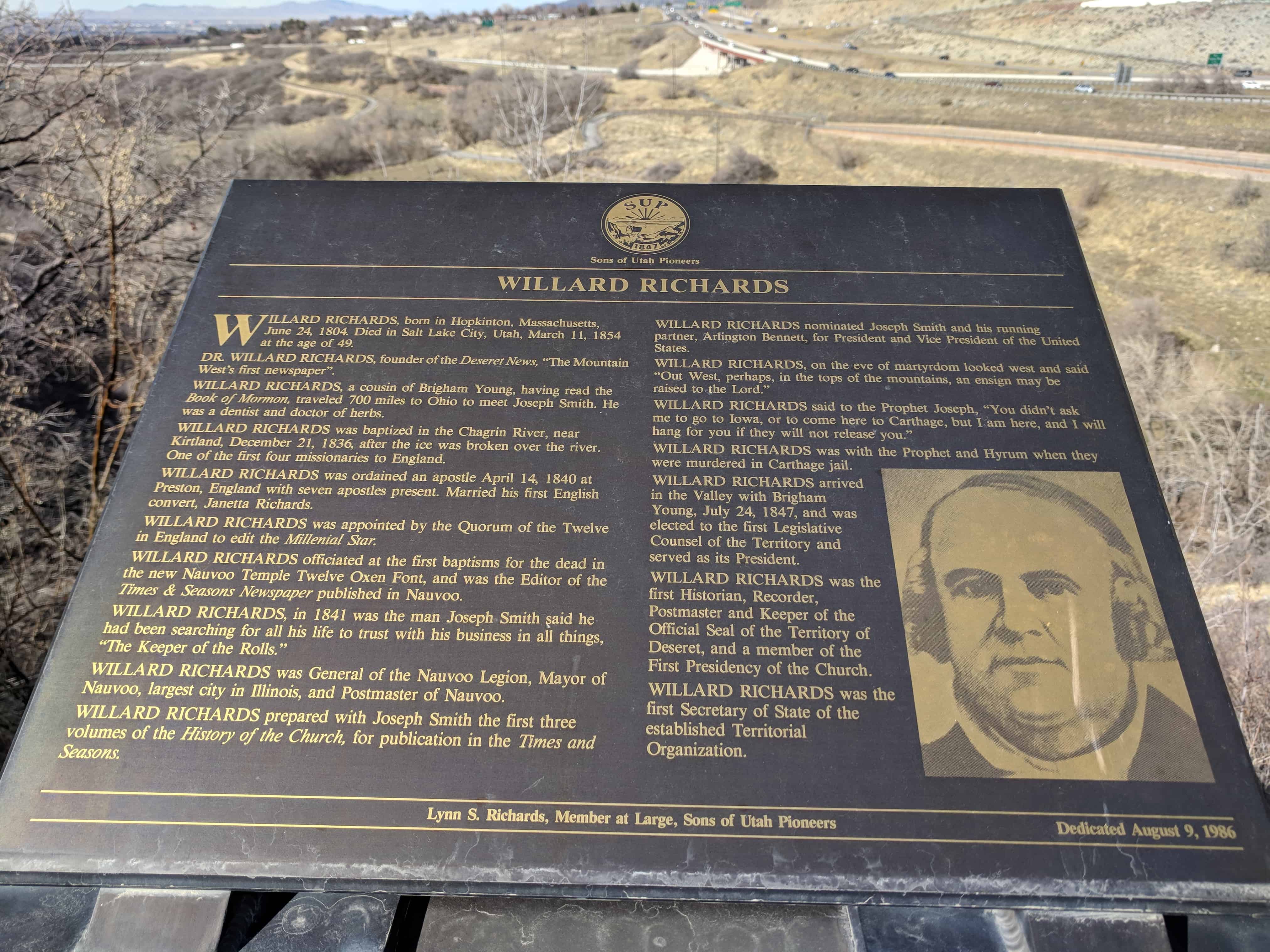
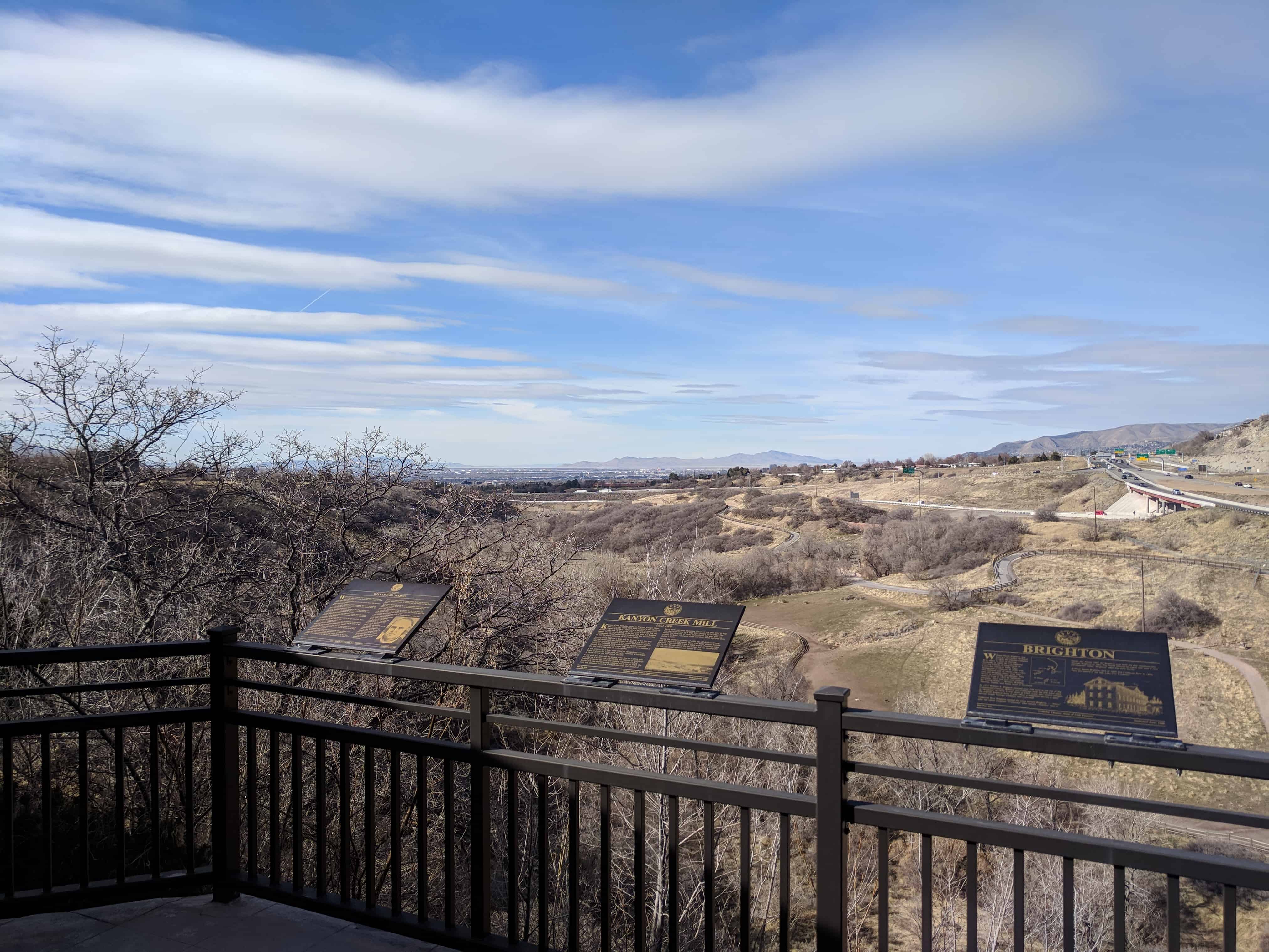
• About JacobBarlow.com
  • Cemeteries in Utah
  • D.U.P. Markers
  • Doors
  • Exploring Utah Email List
  • Geocaching
  • Historic Marker Map
  • Links
  • Movie/TV Show Filming Locations
  • Oldest in Utah
  • Other Travels
  • Photos Then and Now
  • S.U.P. Markers
  • U.P.T.L.A. Markers
  • Utah Cities and Places.
  • Utah Homes for Sale
  • Utah Treasure Hunt

JacobBarlow.com

~ Exploring with Jacob Barlow

JacobBarlow.com

Tag Archives: Salt Lake City

Mormon Pioneer Trail, Centennial Trekkers

10 Saturday Mar 2018

Posted by Jacob Barlow in Uncategorized

≈ Leave a comment

Tags

Historic Markers, Salt Lake City, Salt Lake County, SUP, utah

2018-02-07 13.59.18

Mormon Pioneer Trail, Centennial Trekkers

SUP Marker #224, located at the S.U.P. Building – see other S.U.P. Markers here.

Mormon Pioneer Trail
As traveled by the Sons of Utah Pioneers, July 14-22, 1947
Schedule of Evening Encampments
Nauvoo, Illinois Monday, July 14, 1947
Garden Grove, Iowa Tuesday, July 15, 1947
Winter Quarters (Omaha), Nebraska Wednesday, July 16, 1947
North Platte, Nebraska Thursday, July 17, 1947
Fort Laramie, Wyoming Friday, July 18, 1947
Independence Rock, Wyoming Saturday, July 19, 1947
Rock Creek, Wyoming Sunday, July 20, 1947
Fort Bridger, Wyoming Monday July 21, 1947
In July, 1947 one hundred and forty-eight descendents of Utah Pioneers called themselves “The Centennial Trekkers” and retraced the Old Mormon Trail in commemoration of the Latter-day Saints’ historic exodus from Nauvoo, Illinois in 1846 and the Pioneer Company’s trek from Winter Quarters in Florence, Nebraska to the Valley of the Great Salt Lake in 1847.

Picture Caption:
The twentieth century Trekkers’ special guests, Spencer W. and Camilla Eyring Kimball look down on the July 19th encampment from the top of Independence Rock in Wyoming.
Note: A separate plaque lists the “Centennial Trekkers”

2018-02-07 13.59.22

2018-02-07 13.59.24

Pioneer Industry in Parleys Canyon

10 Saturday Mar 2018

Posted by Jacob Barlow in Uncategorized

≈ Leave a comment

Tags

Historic Markers, Salt Lake City, Salt Lake County, SUP, utah

2018-02-07 13.48.05

Pioneer Industry in Parleys Canyon

SUP Marker #E-1, located at the S.U.P. Building – see other S.U.P. Markers here.

This monument is erected for the purpose of paying tribute and honor to those sturdy pioneers who had the courage and fortitude to establish industry in Parley’s Canyon necessary to the welfare of the pioneers who settled this valley.

2018-02-07 13.48.10

Willard Richards

10 Saturday Mar 2018

Posted by Jacob Barlow in Uncategorized

≈ Leave a comment

Tags

Historic Markers, Salt Lake City, Salt Lake County, SUP, utah

2018-02-07 13.52.24

Willard Richards

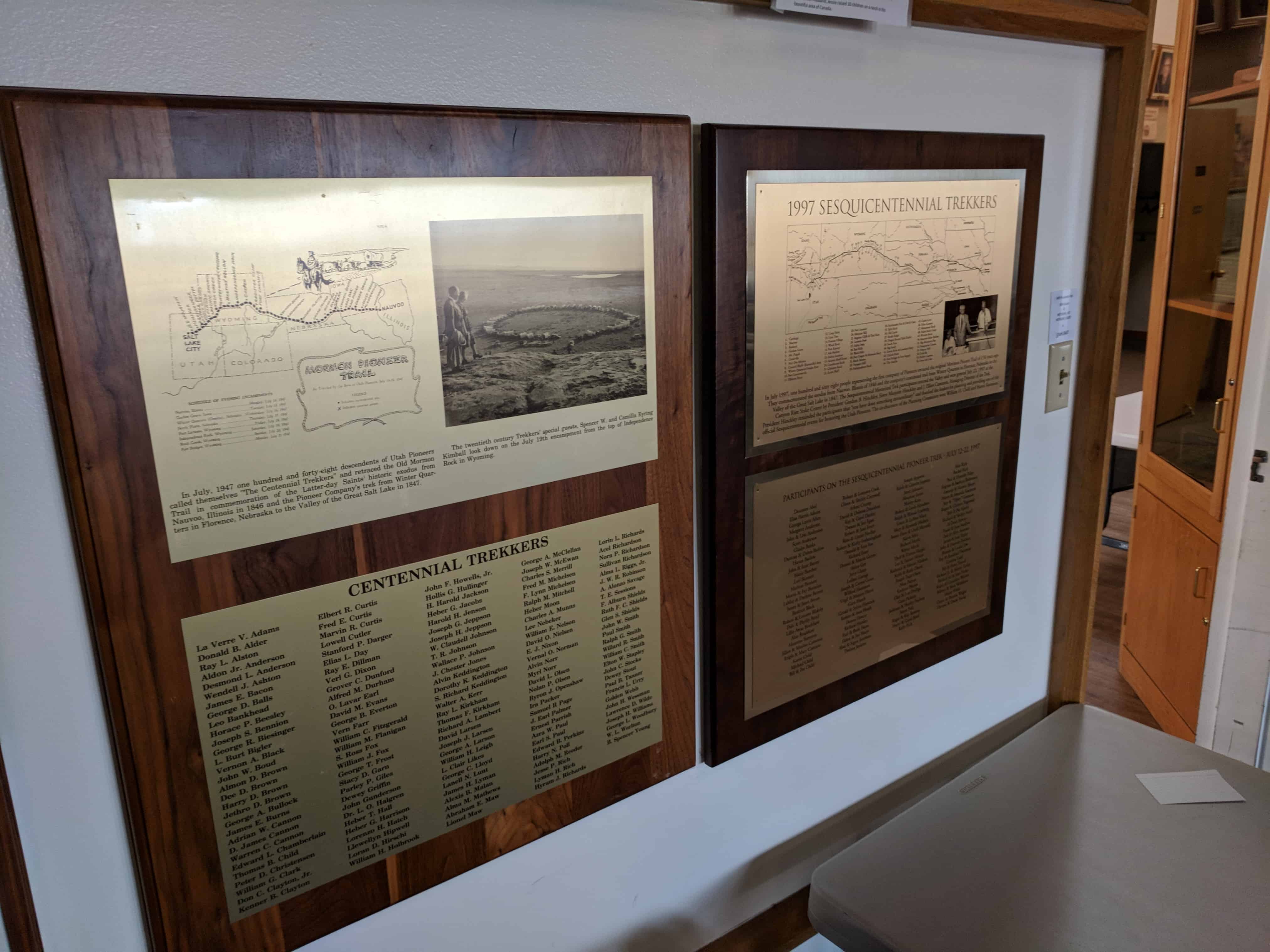
SUP Marker #4-E, located at the S.U.P. Building – see other S.U.P. Markers here.

WILLARD RICHARDS, born in Hopkinton, Massachusetts, June 24, 1804. Died in Salt Lake City, Utah, March 11, 1854 at the age of 49.

Dr. WILLARD RICHARDS, founder of the Deseret News, “The Mountain West’s first newspaper”.

WILLARD RICHARDS, a cousin of Brigham Young, having read the Book of Mormon, traveled 700 miles to Ohio to meet Joseph Smith. He was a dentist and doctor of herbs.

WILLARD RICHARDS was baptized in the Chagrin River, near Kirtland, December 21, 1836, after the ice was broken over the river. One of the first four missionaries to England.

WILLARD RICHARDS was ordained an apostle April 14, 1840 at Preston, England with seven apostles present. Married his first English convert, Janetta Richards.

WILLARD RICHARDS was appointed by the Quorum of the Twelve in England to edit the Millenial Star.

WILLARD RICHARDS officiated at the first baptisms for the dead in the new Nauvoo Temple Twelve Oxen Font, and was the Editor of the Times & Seasons Newspaper published in Nauvoo.

WILLARD RICHARDS, in 1841 was the man Joseph Smith said he had been searching for all his life to trust with his business in all things, “The Keeper of the Rolls.”

WILLARD RICHARDS was General of the Nauvoo legion, Mayor of Nauvoo, largest city in Illinois, and Postmaster of Nauvoo.

WILLARD RICHARDS prepared with Joseph Smith the first three volumes of the History of the Church, for publication in the Times & Seasons.

WILLARD RICHARDS nominated Joseph Smith and his running partner, Arlington Bennett, for President and Vice President of the United States.

WILLARD RICHARDS, on the eve of martyrdom looked west and said “Out West perhaps, in the tops of the mountains, an ensign may be raised to the Lord.”

WILLARD RICHARDS said to the Prophet Joseph, “You didn’t ask me to go to Iowa, or come here to Carthage, but I am here, and I will hang for you if they will not release you.”

WILLARD RICHARDS was with the Prophet and Hyrum when they were murdered in Carthage jail.

WILLARD RICHARDS arrived in the Valley with Brigham Young, July 24, 1847, and was elected to the first Legislative Counsel of the Territory and served as its President.

WILLARD RICHARDS was the first Historian, Recorder, Postmaster and keeper of the Official Seal of the Territory of Deseret, and a member of the First Presidency of the Church.

WILLARD RICHARDS was the first Secretary of State of the established Territorial Organization.

2018-02-07 13.52.32

Kanyon Creek Mill

10 Saturday Mar 2018

Posted by Jacob Barlow in Uncategorized

≈ Leave a comment

Tags

Historic Markers, Salt Lake City, Salt Lake County, SUP, utah

2018-02-07 13.52.24

Kanyon Creek Mill

SUP Marker #4-H, located at the S.U.P. Building – see other S.U.P. Markers here.

1852 – 1900
Kanyon Creek Mill, also known as Brigham Young’s Upper Mill and as the Young-Little Mill, occupied a site where the Country Club Golf Course now is located. It was located almost a mile west of here in the gully below. It was the first, the biggest, and the most valuable of the two flour mills that Brigham Young partly owned and invested in during the first ten years that he and his people colonized the Salt Lake Valley.

Kanyon Creek Mill was a large mill for its time. It was two and one-half stories high and constructed of adobe. It was started in 1849 and completed in 1852. It was owned and built by Brigham Young and Feramorz Little, each of whom owned a one-half interest. Iron initials of each owner, B.Y. and F.L., were fastened to the wall braces that held the ends together.

It was powered by a large water wheel on the northeast corner. Water to power the wheel came through a mill race which began at Parley’s Creek one mile east of the Mill.

It was used as a flour mill for several years, then as a cotton mill, and later as a woolen mill. The woolen mill required an additional building to process the wool. The building was constructed of lumber and was used for sorting, cleaning and dying the wool. The wool was separated according to length and color and cleaned of burrs, sticks and other impurities. The wool was then dyed in large vats that were heated by a large brick furnace in the cellar. The factory had three sets of cards, twelve looms and used girls and women for labor. An expert could tend three looms and earn three dollars a week.

During the smallpox epidemic of 1900, the old Brigham Young Mill was used as a pest house. There were many protests because the creek which ran past it was a major source of culinary water for the city. No one moved the pest house, but one morning the old mill was found mysteriously burned to ruins.

2018-02-07 13.52.37

Brighton

10 Saturday Mar 2018

Posted by Jacob Barlow in Uncategorized

≈ Leave a comment

Tags

Brighton, Historic Markers, Salt Lake City, Salt Lake County, Ski History, SUP, utah

2018-02-07 13.52.24

Brighton

SUP Marker #4-I, located at the S.U.P. Building – see other S.U.P. Markers here.

William Stuart Brighton was born in Lanarkshire, Scotland in 1829. He married Catherine Bow (born in 1827 at Sterling, Scotland) in 1850. He was baptized into the Church of Jesus Christ of Latter-day Saints in 1844. They immigrated to Missouri in 1855 with two children, one of whom was a two-year old daughter, Mary, who was buried at sea during the passage. They came to Utah in 1857 by handcart company. They had four sons born in the United States – Robert, William, Thomas, Daniel, and Janet, born in Scotland.

In 1871 William S. Brighton claimed over 100 acres at the top of Big Cottonwood Canyon. William and Catherine built the first hotel there at “Brighton” in 1874. It was razed in 1945. Later they added cottages, the original Brighton store, a post office, a telephone service, a dairy service, freight haulage, a bakery and a sawmill.

Catherine Bow Brighton named the lakes around Brighton – “Mary” after her infant daughter, “Catherine” after herself, “Martha” after a friend, etc. About 1887 the Brighton sons built the first telephone line through Brighton to Alta. The world famous ski resort and area is now permanently called “Brighton” after this early family.

William Stuart Brighton died in 1895 and Catherine Bow in 1894. They are buried in the Salt Lake City Cemetery.

2018-02-07 13.52.45

The Golden Pass Road – Parley’s Canyon

10 Saturday Mar 2018

Posted by Jacob Barlow in Uncategorized

≈ 1 Comment

Tags

Historic Markers, Salt Lake City, Salt Lake County, SUP, utah

2018-02-07 13.52.56

The Golden Pass Road – Parley’s Canyon

SUP Marker #4, located at the S.U.P. Building – see other S.U.P. Markers here.

“Travel the Golden Pass, Open July Fourth. Immigrants coming into the valley may now avoid the difficult route over Big and Little Mountain by taking the new route. Several thousand dollars have been spent by the proprietor to make the new road possible,” Parley P. Pratt, Proprietor. So ran an advertisement in the third issue of the Deseret News of June 29, 1850.

Parley P. Pratt cut the road through Parley’s Canyon in 1849-50. The beginning (or end) of the road was about Twenty-first South and Eleventh East and thence east to what was called Dell Fork. To defray the cost of construction a toll for passage was charged – “75¢ for a two-horse outfit, ten cents for each additional pack or saddle animal, and sheep a mere cent per head.” The road was described as poor with rocks and stumps. However it opened up the hollow and canyon to industry, farming, and recreation.

From this vantage point, the toll gate was located on the north side of Parley’s Creek directly below the S.U.P. building. Portions of the old dirt road can still be seen going up the hollow around Suicide Rock into the awesome magnitude of Parley’s Canyon.

At sunset one may get a spectacular view of the aureate colored face of the canyon wall from which was derived the original name, “Golden Pass Road.”

Pratt sold the road to finance his mission to Chile. By 1862 the Golden Pass Road, an approximately forty-two-mile long immigrant trail from Sugarhouse east to Silver Creek Junction, through Coalville to the mouth of Echo Canyon was the preferred route into the Valley. The Overland Stage began using it that year.

2018-02-07 13.53.07

Ensign Peak

10 Saturday Mar 2018

Posted by Jacob Barlow in Uncategorized

≈ 1 Comment

Tags

Historic Markers, Salt Lake City, Salt Lake County, SUP, utah

2018-02-07 13.52.56

Ensign Peak

SUP Marker #4-C, located at the S.U.P. Building – see other S.U.P. Markers here.

Elevation 5,441Feet
Monday morning, July 26, 1847, the pioneers resumed their secular labors. Although Brigham Young, leader of the pioneer band, was suffering from Mountain fever, he directed that exploration work be started immediately, one party headed by himself. The party left about 10 o’clock a.m. This party consisted of Brigham Young, Heber C. Kimball, Willard Richards, Wilford Woodruff, George A. Smith, Ezra T. Benson, Albert Carrington and William Clayton.

Messrs. Kimball, Woodruff, Benson and Smith had ascended City Creek Canyon several miles the Saturday evening before. The party now climbed to the hills west of the canyon and proceeded northward, the president still riding. “A good place to raise an ensign,” he remarked … as the party planted their feet upon a prominent peak near the western edge of a mountainous spur projecting in the valley from the northeast. Ensign Peak, the mountain, was accordingly named, which title it still bears . . . from the top of the peak the view was more than ever sublime.

“ENSIGN” in the minds of the Mormon Pioneers concerned not one nation, but all nations; not one epoch or age, but all epochs and all ages; not nationality but humanity, is its scope and concern. It was the sign and ensign of the Empire of the Christ; it was a prophecy of the time to come when the kingdom of this world would become “the kingdom of our Lord, and of his Christ; and he shall reign forever and forever.”

From the earliest days of the settlement of this valley, Ensign Peak has been the site of the official flagstaff; being the point where the national emblem has always been flown on holidays and special occasions.

Ensign Peak related posts:

  • Ensign Peak
  • Ensign Peak Park Monument
  • Ensign Peak Plaque at the SUP Building

2018-02-07 13.53.02

B&K Tannery

10 Saturday Mar 2018

Posted by Jacob Barlow in Uncategorized

≈ Leave a comment

Tags

Historic Markers, Salt Lake City, Salt Lake County, SUP, utah

2018-02-07 13.53.35

B&K Tannery

SUP Marker #4-B, located at the S.U.P. Building – see other S.U.P. Markers here.

The B & K Tannery, also known as the Big Kanyon Tannery, was established in 1852 near this site by Brigham Young, Feramorz Little and John Winder. The area was first called Canyon Creek; then Big Kanyon, and later Parley’s Canyon. By 1862, the Tannery was producing good quality leather, using agents such as oak bark and coal oil in the process.

A small settlement was built nearby to accommodate the tannery workers, which included a school for the children of the manager and the workmen.

The use of coal oil created a softness in the leather that brought exhibitors three out of five of the first prizes in the Territorial Fair of 1862. Leather from this Tannery was used in the shoe shop Brigham Young established on his own premises.

Two things led to the demise of the tannery; the scarcity of the native bark needed for tanning, and the fact that the newly installed railroad brought in leather which was cheaper than could be manufactured here.

2018-02-07 13.53.12

2018-02-07 13.54.47

Early Pioneer Mills

10 Saturday Mar 2018

Posted by Jacob Barlow in Uncategorized

≈ Leave a comment

Tags

Historic Markers, Salt Lake City, Salt Lake County, SUP, utah

2018-02-07 13.53.35

Early Pioneer Mills

SUP Marker #4-A, located at the S.U.P. Building – see other S.U.P. Markers here.

There were twenty-two mills along Millstream giving this mountain water a name and life surviving function. Gardner, Neff, and Osguthorpe were names of pioneer-constructed mills along Millstream.

The Scottish, Welsh, and English Mormon converts provided needed supplies generated by the mill race water power. The grinding wheels of millstones worked the wheat as the mountains and isolated valleys sustained the people. The water turned wheel was depicted in Dr. Richard Gunn’s artistic conception of the mill.

The East Mill Creek chapter appreciates and honors the mill and our ancestors. Both have passed away and are gone.

The Lesson of the Watermill
Listen to the water-mill
Through the live-long day,
How the clicking of its wheel
Wear the hours away.
Languidly the autumn wind
Stirs the forest leaves,
From the field the reapers sing
Binding up the sheaves.
And a Proverb haunts my mind
And a spell is cast – – –
“The mill cannot grind
With the water that is past.”

From the power of the will
came the strength of the mill
To give life to those who settle
from our ancestral foreordained metal

2018-02-07 13.53.17

2018-02-07 13.54.47

Handcart Companies

10 Saturday Mar 2018

Posted by Jacob Barlow in Uncategorized

≈ Leave a comment

Tags

Historic Markers, Salt Lake City, Salt Lake County, SUP, utah

2018-02-07 13.53.27

Handcart Companies

SUP Marker #4-G, located at the S.U.P. Building – see other S.U.P. Markers here.

On the 9th day of June 1856, the first Mormon Handcart Company left Iowa City led by Captain Edmond Ellsworth. There were 52 handcarts with 275 people. On the 11th day of June, the next company led by Captain Daniel D. McArthur, had 48 handcarts, with 222 people and 4 covered wagons.

These companies suffered many hardships, bad roads with hills and mountains to cross, adverse weather conditions and the other problems that were encountered by the pioneers as they crossed the plains coming west. There were frequent breakdowns of the handcarts as they had been made with green wood. Both the handcarts and wagons were overloaded. Many repairs were constantly needed before they could go on.

Some of the children and elderly people died and were buried on the way. Food was scarce at times, so buffalo meat became a source of survival.

Both parties of the Saints arrived in the Salt Lake Valley on the 26th of September 1856 and were met by Governor Brigham Young and his councilmen, the Nauvoo Band and others.

2018-02-07 13.53.47

2018-02-07 13.54.47

← Older posts
Newer posts →

Follow Jacob

Follow Jacob

Blog Stats

  • 2,045,211 hits

Social and Other Links

BarlowLinks.com

Recent Posts

  • Israel and Elizabeth Haven Barlow
  • Anson Call
  • Jane Elizabeth Manning
  • Green Flake
  • Hark Wales & Oscar Smith

Archives


Loading Comments...