“Seven miles brought us where the road forked – the left hand one leading up a ravine towards the mountain. We took it…” – Madison Berryman Moorman, July 27, 1850
“This morning it is raining, it seems so plesent to see it rain as we have not seen it rane since we came in the valey before. We now noon near a salt spring [Horseshoe Springs] we then went on to elbow spring [Hope Wells] fresh water it is vary good to. We then went on twelve miles father to the mountain and found a spring [Redlum Spring], it is rather brackish but good water, we traveled nineteen miles today.” – Sarah Davis, August 26, 1850
“We rose early this morning to get off to finish our 35 miles to the next watter. We had good roads in the for noon, but our road was very rough and rockey in the after noon.”
Philander Powell, August 25, 1860
This is Utah Crossroads Chapter – OCTA’s historic marker #COTNU-4A, located along the old Pony Express Route.
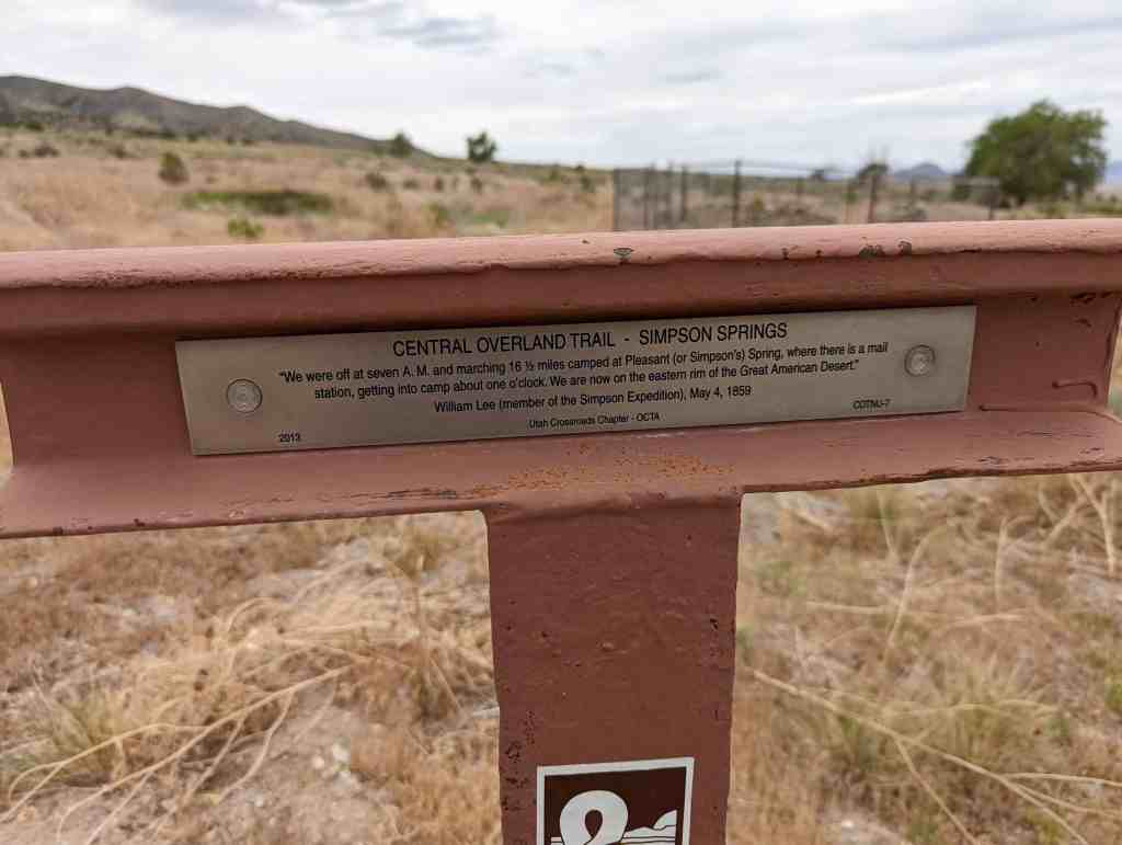
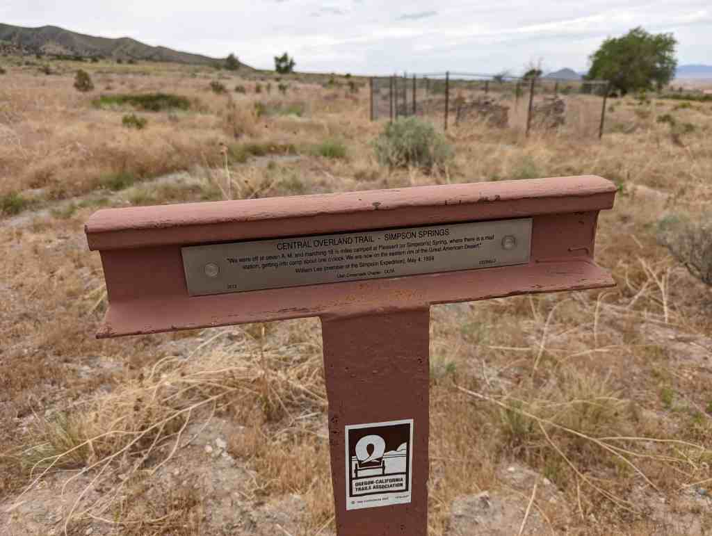
“We were off at seven A. M. and marching 16 1/2 miles camped at Pleasant (or Simpson’s) Spring, where there is a mail station, getting into camp about one o’clock. We are now on the eastern rim of the Great American Desert.”
William Lee (member of the Simpson Expedition), May 4, 1859
This is Utah Crossroads Chapter – OCTA’s historic marker #COTNU-7, located along the old Pony Express Route.
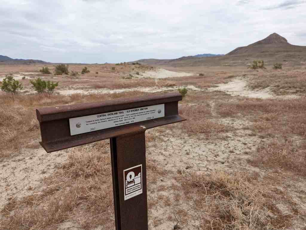
“Camped at Indian Spring in kanyon on Connors Cutoff. … Done a washing and repacked our wagon preparatory for crossing the Desert, started at 12 1/2 pm drove to the river Bed and grazed at 3 oclock.”
Jackson Swank, June 11 & 12, 1864
This is Utah Crossroads Chapter – OCTA’s historic marker #COTNU-7A, located along the old Pony Express Route.
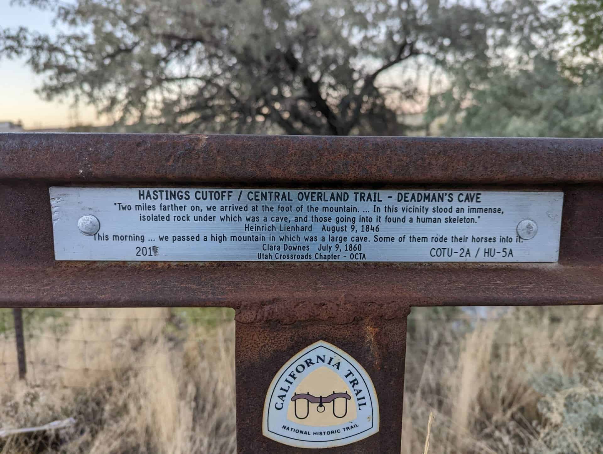
Hastings Cutoff / Central Overland Trail – Deadman’s Cave
“Two miles farther on, we arrived at the foot of the mountain. … In this vicinity stood an immense, isolated rock under which was a cave, and those going into it found a human skeleton.” – Heinrich Lienhard, August 9, 1846
“This morning … we passed a high mountain in which was a large cave. Some of them rode their horses into it.” – Clara Downes, July 9, 1860
“Soon after starting it commenced to rain, which softened the road so much as to cause the wagons to stall … At this point the road doubles the point of the range along which we have been traveling.”
Captain James H. Simpson, May 7, 1859
This is Utah Crossroads Chapter – OCTA’s historic marker #COTNU-10A, located along the old Pony Express Route.
The California Trail was first developed in the early 1840s by emigrants seeking land in the country’s far western frontier. The main route of the trail ran through southern Idaho and joined the Humboldt River in Nevada. However, the trail has been described as a frayed rope with many cutoffs and feeder routes at both ends. The specific routes emigrants or gold seekers used depended on their starting point in Missouri, their final destination in California, the condition of their livestock and wagons, their willingness to take risks with shortcuts, and yearly changes in water and forage.
By 1845, Lansford W. Hastings was convinced that the best route to California lay through the Wasatch Mountains. His route was used from 1846 to 1852 and was then abandoned because of the difficult 83-mile waterless Great Salt Desert crossing. The Donner-Reed party, lagging far behind the majority of the 1846 emigration, following Hasting’s shortcut in a desperate attempt to make up lost time. At the Weber River crossing, just upstream from present-day Henefer, they found a letter from Hastings attached to a sagebrush. He indicated that the trail downriver was very bad for wagons. Camping near the river, at the head of the canyon in the distance, they waited four precious days for James F. Reed and two others to find Hastings and return with news of his new route.
If you had been here on Tuesday morning, August 11, 1846, you would have witnessed the Donner-Reed party moving up Main Canyon, to your left, en route to their destiny in the winter snows of the Sierra Nevadas.
“The most direct route for the California emigrants, would be to leave the Oregon route, about two hundred miles east of Ft. Hall; thence bearing west southwest, to the Salt Lake.” – Lansford Hastings – 1843
“We resumed our journey up a small stream on Reid’s route [James Reed of the Donner-Reed Party], sending in advance of the wagons a small company to make the road passable. … We traveled about 6 miles, and crossing the ridge [The Hogsback], began to descend another ravine.” – Orson Pratt, July 16, 1847
Utah Crossroads Chapter – OCTA
HU-3.2
This is part of the series of California Trail markers I’ve been documenting on these pages:
“The country west looks rough and mountainous,” wrote William Clayton, describing this panorama of the Wasatch Mountains. Modern historians have dubbed this summit “Heartbreak Ridge” to describe the feelings of many early Mormon Pioneers who crested this ridge. After months on the trail, traveling over 1,200 weary miles, it was heart-wrenching to discover that the most difficult part of the journey still lay ahead. Some people must have broken down and wept. Others gritted their teeth with determination and moved southwest down off Hogsback Summit to challenge the mountains and canyon that lay ahead.
“…arrived [July 19] on the summit of the dividing ridge and put a guide board up, “80 miles to Fort Bridger” … The descent is not very steep but exceedingly dangerous to wagons being mostly on the side hill over large cobble stones, causing the wagons to slide very badly. – William Clayton
“After we had encamped Mr. Newman and myself walked down the ravine to examine the road. We found that Mr. Reid’s [Donner-Reed] company last season had spent several hours’ labour in spading, &c., but finding it almost impracticable for the wagons, they had turned up a ravine [Broad Hollow], at the mouth of which we had encamped and taken a little more circuitous route over the hills.” – Orson Pratt, July 16, 1847
Utah Crossroads Chapter – OCTA
HU-3A
This is part of the series of California Trail markers I’ve been documenting on these pages:
Unable to fight through brush and willows down Dixie Hollow, the Donner Party turned right up Broad Hollow at this spot, climbed to Broad Bench above, dropped down into East Canyon just above present dam.
Mormon pioneers follow, as did many others until road was cut through hollow years later.
In memory of the sick detachment of the U.S. Mormon Battalion which traveled north from Pueblo, Colorado to Ft. Laramie, Wyoming and then followed the Pioneer Trail into the Salt Lake Valley, July 1847.
Erected by Scout Troop 152, Syracuse, Utah / June 22, 1985 under the direction of U.S. Mormon Battalion, Inc.