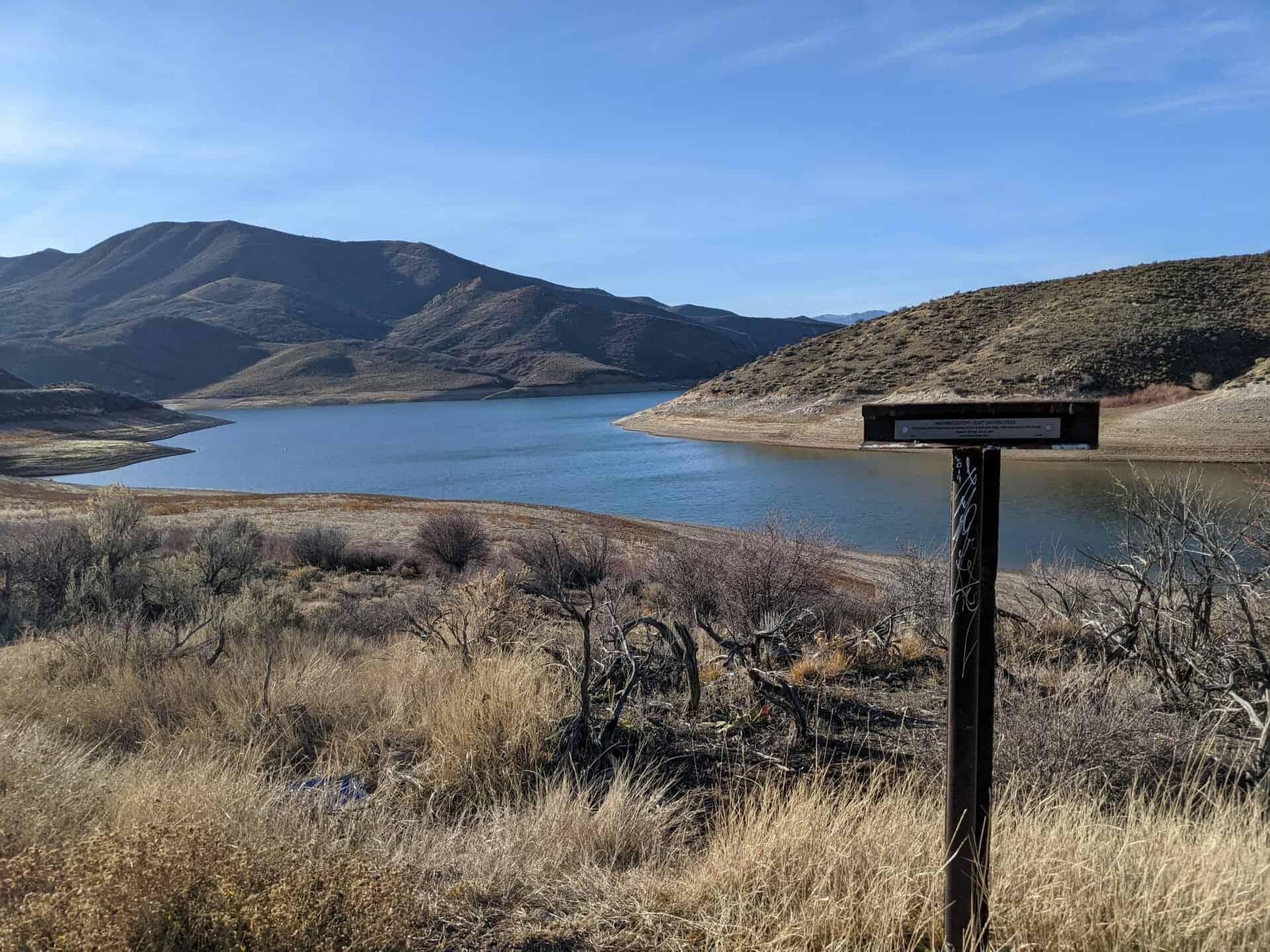
“On the banks of East Canyon Creek are numerous remains of small Indian lodges, hastily constructed of willow boughs.” – Horace K. Whitney, July 22, 1847
Utah Crossroads Chapter – OCTA
HU-3B
This is part of the series of California Trail markers I’ve been documenting on these pages:
“In the rear of this [battery] is a deep narrow gulch leading west towards the big Mountain, it is a good retreat for horsemen, but rather a long race for infantry.” – Colonel Pace [Mormon Militia] November 27, 1857
Utah Crossroads Chapter – OCTA
HU-3C
This is part of the series of California Trail markers I’ve been documenting on these pages:
“We struck the stage road in 5 miles. Good water here. Drove on to the summit of Point Lookout. Here we nooned and drove 1 miles farther to water and camped.”
Albert Jefferson Young, August 9, 1862
This location is the site of Utah Crossroads Chapter – OCTA’s historic marker #COTNU-3. (see other markers here)
Central Overland Trail – Black Rock Hills Southern Route
“Having reached the plain the road ran for eight miles over a broken surface… it then forked. The left, which is about six miles the longer of the two, most be taken after rains, and leads to Devil’s Hole. … We chose the shorter cut and after eight miles rounded Mountain Point, the end of a dark brown vuute falling into the plain.”
Sir Richard Burton, September 29, 1860
This is Utah Crossroads Chapter – OCTA’s historic marker #COTNU-8A, located along the old Pony Express Route and near the Dugway Geode Beds.
“… clearing the willows, repairing the road all the way – we could not find a room for the Camp until we had travelled about 7 1/4 miles – here is a very large Spring of Cold Water – but tolerable grass. This has been a crooked & rough days journey & hard driving thro’ the Stumps & Stones.” – Thomas Bullock, July 20, 1847
Utah Crossroads Chapter – OCTA
HU-3D
This is part of the series of California Trail markers I’ve been documenting on these pages:
“Start at 1/2 past 6. Crossed Kanyon Creek once more then turned to the right, ascending the mountains by a gradual ascent up a ravine. … the road became steeper until we reached the highest point & immediately commenced a very rapid descent, many teams having to lock both wheels.”
-Thomas Bullock, July 17, 1847
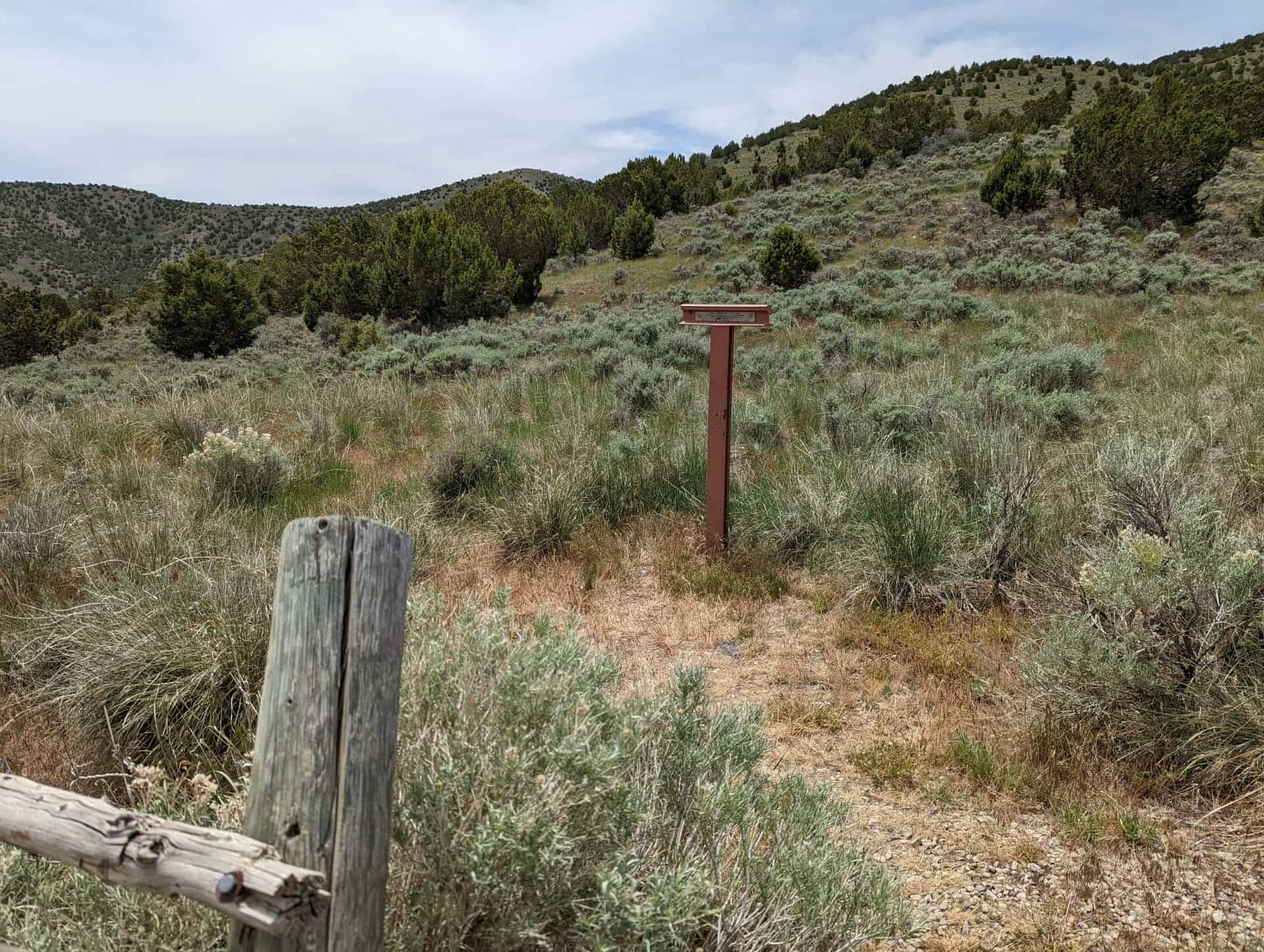
Utah Crossroads Chapter – OCTA
HU-3E
This is part of the series of California Trail markers I’ve been documenting on these pages:
Hastings Cutoff – James Mathers – Weber Canyon Devils Gate
James Mathers recorded on August 2nd, 1846:
*2nd. Went down and examined the pass and found it to be impracticable for waggons to go thro’ although a number of men were at work removing all rocks that were not immovable and digging down the hills to make a way over — an exhibition of most consumate folly.
Marker H JM UT 1 by the Utah Crossroads Chapter – OCTA
This is part of the series of California Trail markers I’ve been documenting on these pages:
Salt Lake to Southern California Road – Point of Mountain
“Took leave of my wife and Br. Brown drove ahead and found a very hard hill to ascend which is a divide between Utah and Salt Lake Valleys… Proceeding down the divide we came in sight of Utah Lake. This is a beautiful sheet of water some forty miles long and lies in a sort of triangle. It is surrounded by a large valley covered with a heavy growth of grass.”
The high, symmetrically shaped mountain seen rising to the north is Pilot Peak, named by John C. Fremont on his expedition of 1845. Previously, the Bartleson-Bidwell party camped here in 1841. These emigrants had traveled one day and night across the Great Salt Lake Desert to find their first water here.
In the period 1845-1850, the peak was a famous landmark and symbol of hope and relief to the Reed-Donner Party and all other wagon train pioneers who traveled the 70-odd miles of deadly, thirst-and-heat-ridden steps across the Great Salt Lake Desert. This desert represented the worst section of the infamous Hastings Cutoff of the California Emigrant Trail.
Imagine Lake Bonneville some 10,000 years ago as a cast lake larger than the present Great Salt Lake. Its eastern boundary would be the Wasatch Mountains at Salt Lake City and its west boundary the Toano and Goshute Mountains to your left.
The last major glacial period in North America began about 23,000 years ago. During that time the water level of Lake Bonneville rose because of colder temperatures and a wetter climate. This freshwater lake was over 1,000 feet deep and covered 51,530 square miles – an area the size of Arkansas. If you were standing in this spot 15,000 years ago, you would be more than 500 feet underwater! Pilot Peak, the pyramid shaped mountain in front of you, was merely a small island surrounded by a freshwater lake teeming with fish.
About 15,500 years ago, water rushing through a break in a natural dam along Lake Bonneville’s northern shore dropped the lake level over 300 feet in just a few months! These raging floodwaters deepened the Snake River Canyon in Idaho. A warmer and drier climate over the next 5,000 years slowly caused the lake to shrink even further. Look carefully at the surrounding hills, especially east toward Wendover. You can still see the beach terraces left at the different high water marks as the lake receded. The Great Salt Lake is all that remains of this once vast lake.
Can Anything Survive Here?
Summer temperatures in this high desert can exceed 100 degrees; winter temperatures may fall below zero. Rain and snowfall total a mere six to eight inches per year. Only drought tolerant plants such as Indian ricegrass, shadscale, and greasewood can grow in the valley around you. The jackrabbit and pronghorn antelope are just two of the many animals that have adapted to living in this harsh environment.
This area wasn’t always a desert. Limber pine trees covered the Leppy Hills to the east from 10,000 to 12,000 years ago. As the climate became drier, pinyon pine and juniper trees replaced the limber pines at the lower elevations. Pinyon pines are relative newcomers to the surrounding mountains. They didn’t arrive until about 7,000 years ago. Today, limber pine and subalpine fir grow only at the higher, cooler and wetter elevations on Pilot Peak and nearby mountain ranges. Animals you might encounter in these forested areas include bighorn sheep, mule deer, elk and mountain lion.
In the fall thousands of raptors (birds of prey) migrate south along this valley. The Great Salt Lake Desert’s lack of food, water and lifting air currents form a migration barrier for these birds. Food, water and roosting sites are easy to find in the Toano and Goshute Ranges. Air rising over these mountains to the west provides the lift these birds need to soar. Conserving energy by soaring as much as possible during their long journey is a key to their survival.
Tough Traveling in the Desert
The Bidwell-Bartleson wagon train was the first emigrant party to see Pilot Peak in 1841. Four years later, Captain John C. Fremont also saw this distinctive landmark, but from the Cedar Range in Utah – some 75 miles away. He wanted to establish a trail from the Great Salt Lake to the existing California Trail along the Humboldt River. Fremont sent Kit Carson, a member of his expedition, ahead towards this peak to scout for a safe passage across the salt flats. Carson’s smoke signals from the mountain assured Fremont of a safe route and that the area contained food for the livestock and water for all. To recognize the importance of this mountain in crossing the desert, Fremont named it “Pilot Peak”.
In 1846 the Reed-Donner Party crossed this valley, following the Hastings Cutoff to the main California Trail. Crossing the salt flats just east of here was extremely difficult. Stock animals perished, wagons broke down, and the emigrants barely reached the life-saving springs at the base of Pilot Peak. This “short cut” slowed their progress and helped to set the stage for the disaster that lat 400 miles ahead of them in the Sierra Nevada Mountains.
As travelers today along Interstate 80, you’re following the same route as these early explorers and emigrants. On a good day, they worked hard to cover 10 to 15 miles through this harsh landscape. In the comfort of your air conditioned vehicle, you can cover in 10 minutes the distance it took these earlier travelers all day to cover!