The name, “Arrowhead Trail” likely originated from the former San Pedro, Los Angeles, and Salt Lake Railroad, which had an arrowhead for a logo. Prior to 1850, New Mexican trading caravans from Santa Fe en route to Los Angeles used this segment of the Old Spanish Trail.
Heading south along this trail toward Bishop Mountain, travelers turned through El Dorado pass, and continued to Nelson, Searchlight, Nipton, Wheaton Springs, and on to San Bernardino.
This section of the trail was popular as an early automobile road (1916-1924) connecting Salt Lake City and Los Angeles. Local communities along the route promoted its construction and the tourism possibilities of Southern Nevada, including the nearby Valley of Fire, Nevada’s first state park.
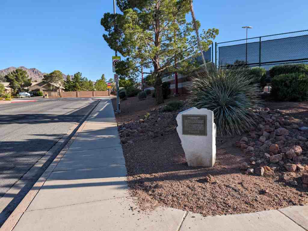
Nevada State Historic Marker #197, located at Mission Hills Park at Arrowhead Trail between Mission Drive and San Bruno Avenue in Henderson, Nevada.
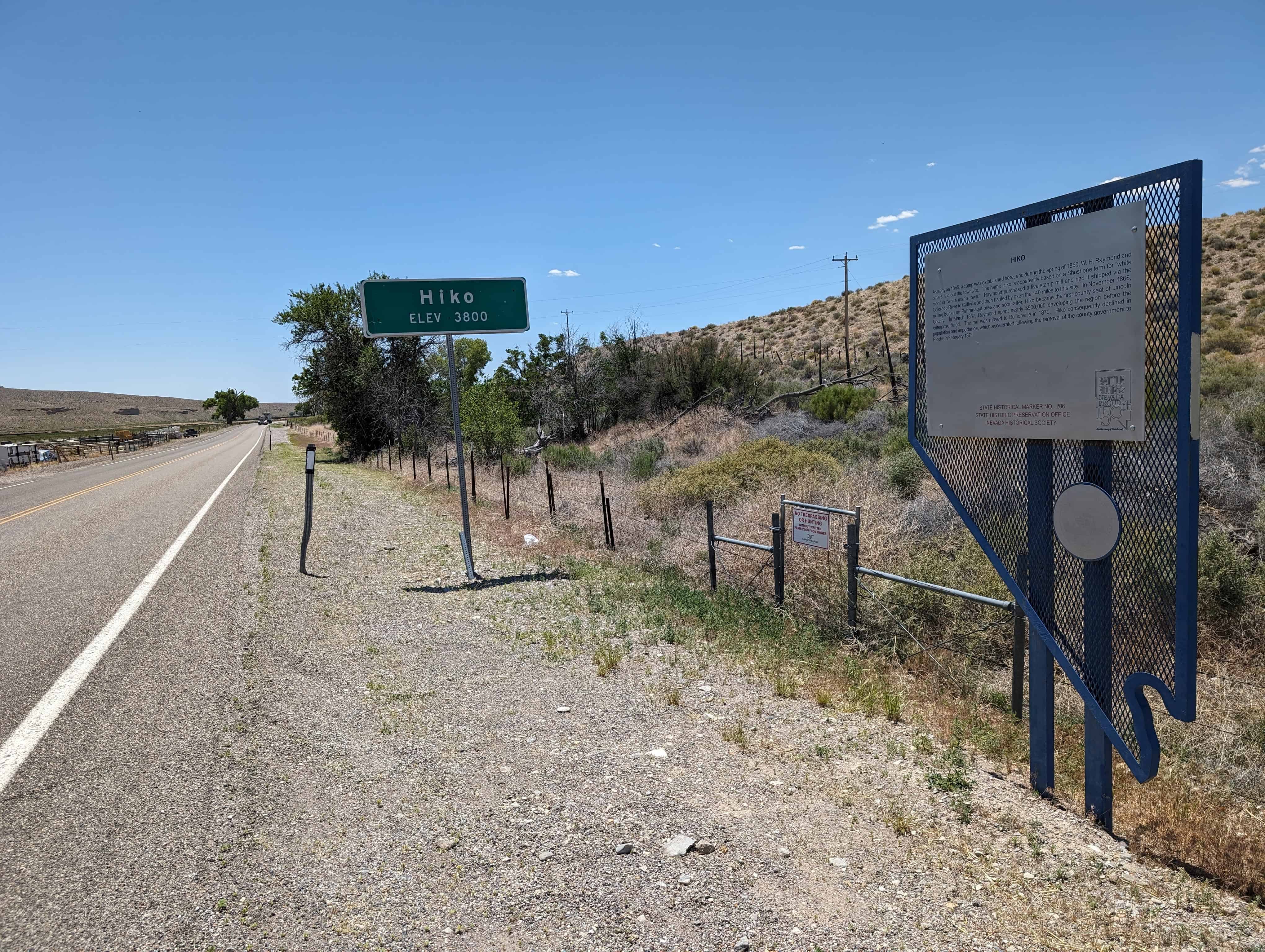
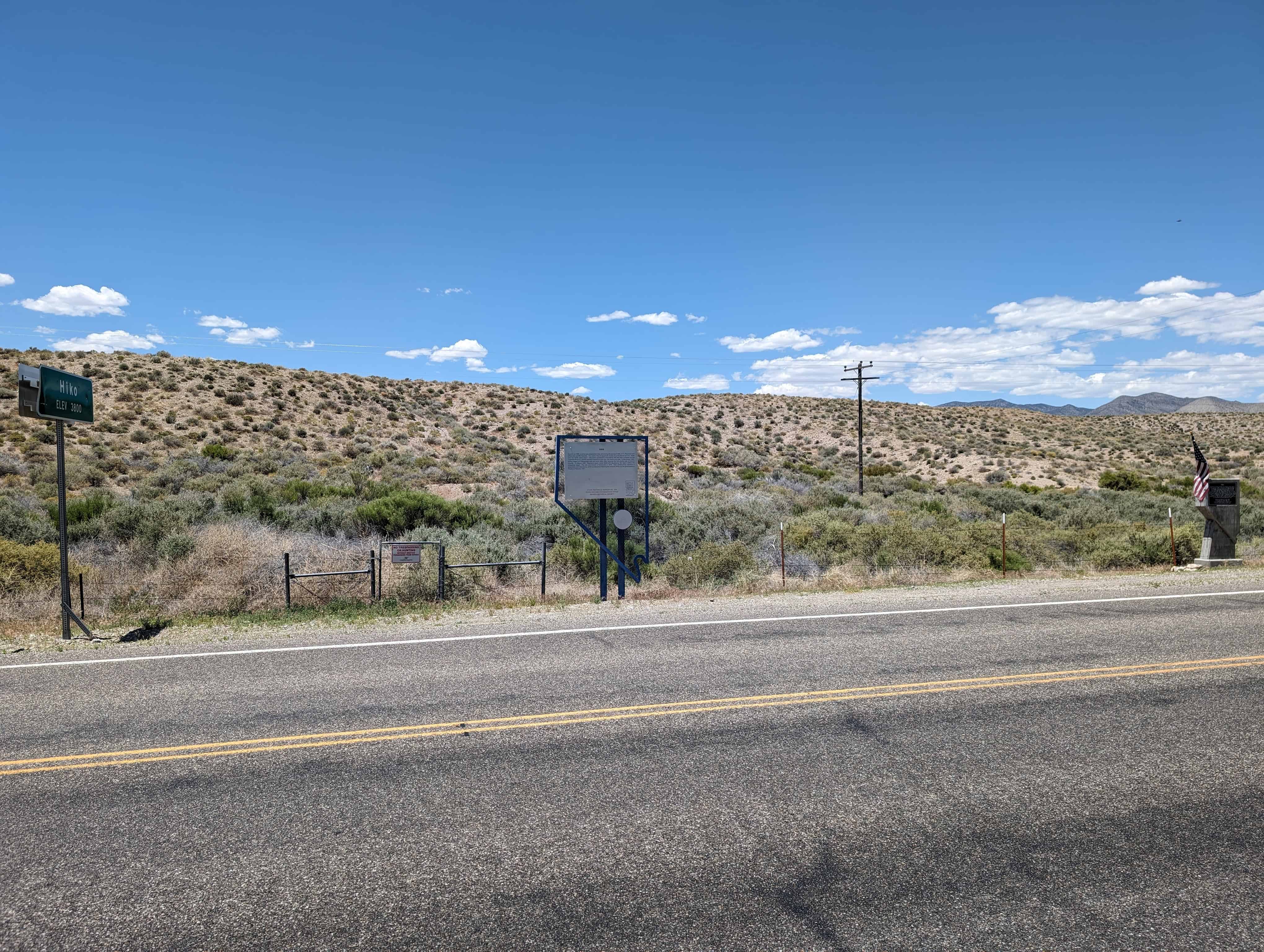
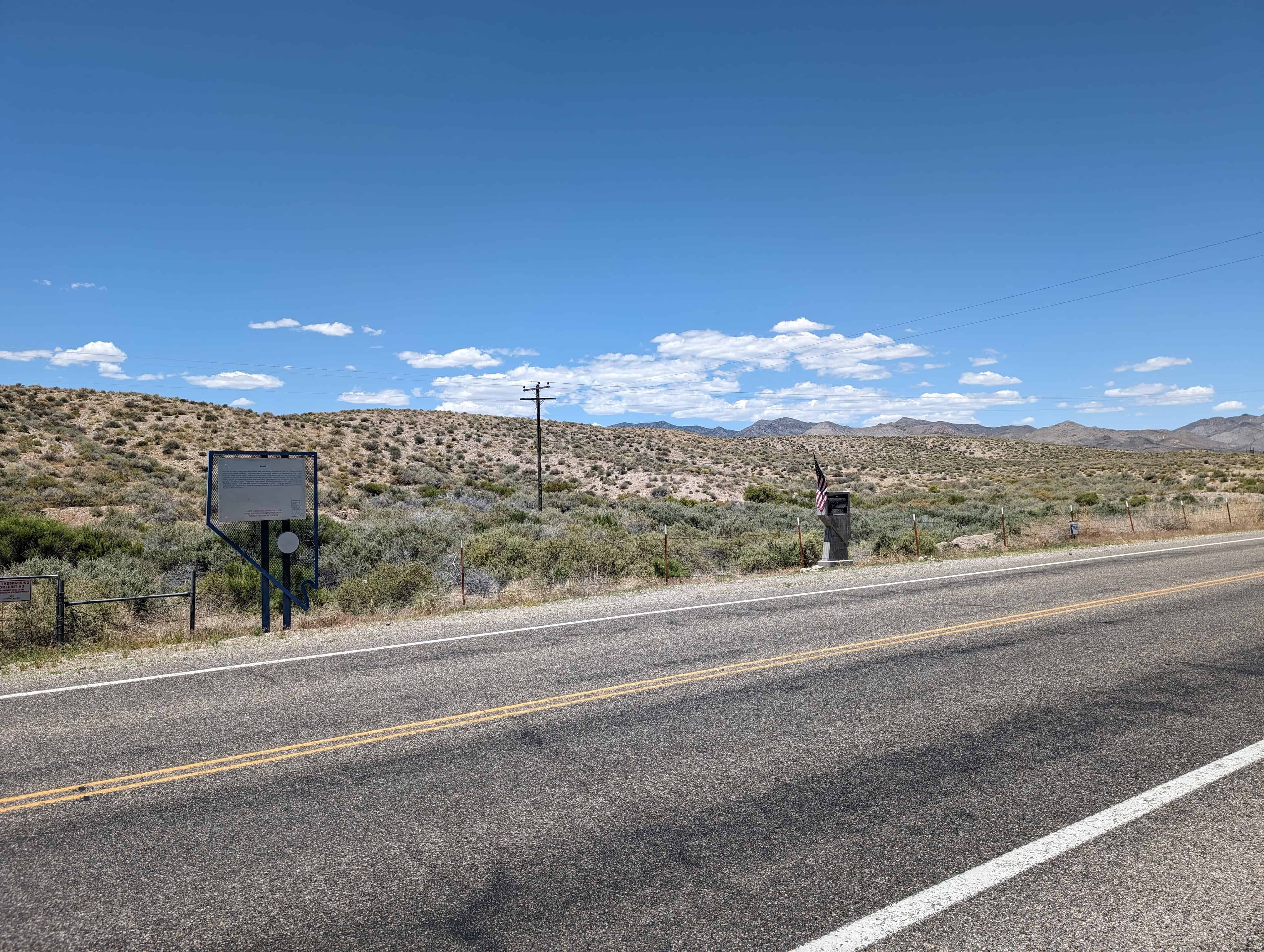
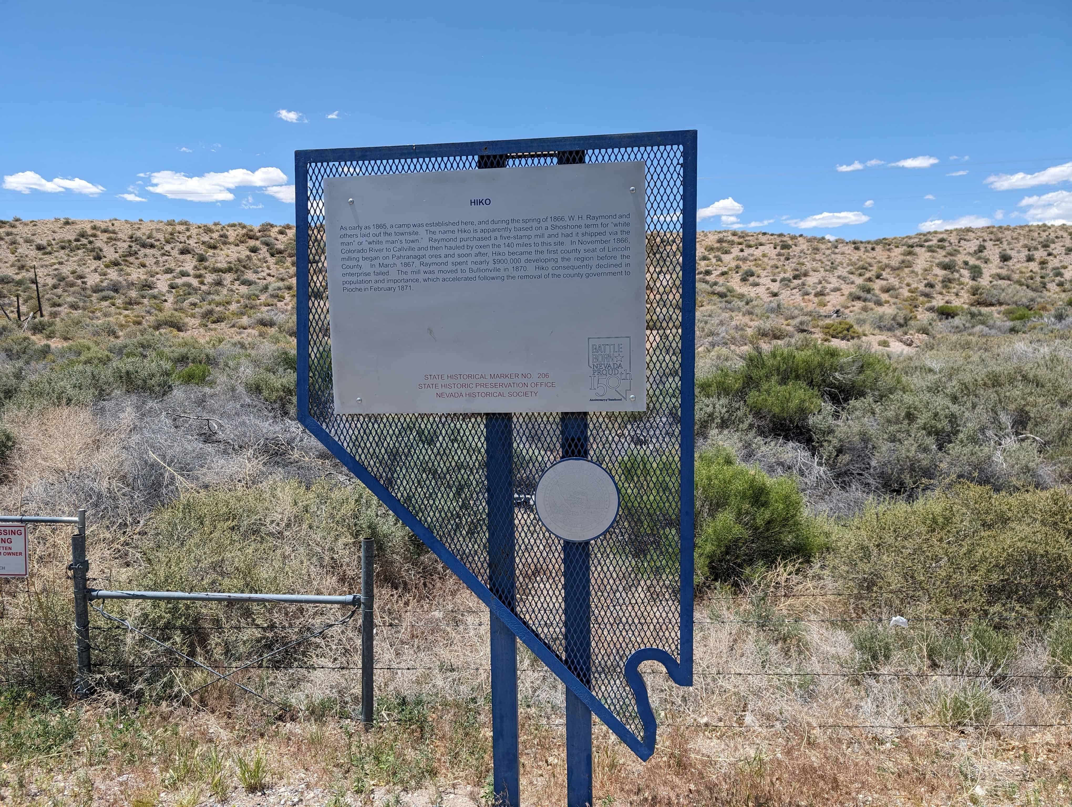
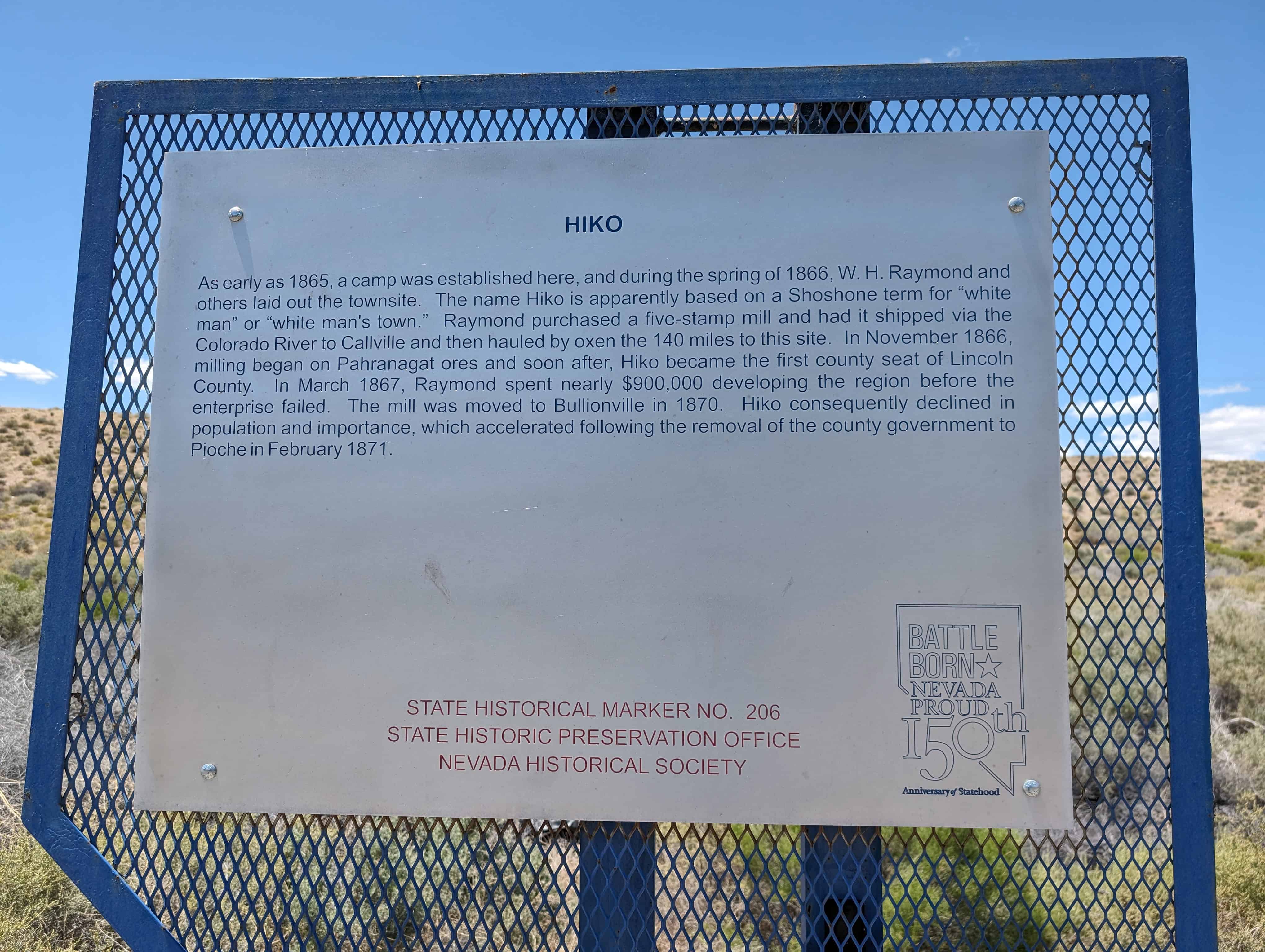
As early as 1865, a camp was established here, and during the spring of 1866, W. H. Raymond and others laid out the townsite. The name Hiko is apparently based on a Shoshone term for “white man” or ‘white man’s town. Raymond purchased a five-stamp mill and had it shipped via the Colorado River to Callville and then hauled by oxen the 140 miles to this site. In November 1866, milling began on Pahranagat ores and soon after, Hiko became the first county seat of Lincoln County. In March 1867, Raymond spent nearly $900,000 developing the region before the enterprise failed. The mill was moved to Bullionville in 1870. Hiko consequently declined in population and importance, which accelerated following the removal of the county government to Pioche in February 1871.
This is Nevada State Historical Marker #206, located on Highway 318.
This historical marker commemorates the valor and service of pioneer scout Rafael Rivera, the first European American of record to view and traverse Las Vegas Valley, who scouted for Antonio Armijo’s sixty-man trading party from Abiquiu, New Mexico. In January 1830, young Rivera ascended Vegas wash twenty miles east of this marker and blazed a route to the Mojave River in California by way of the Armargosa River.
Rivera’s pioneering route became a vital link in the Old Spanish Trail, with Las Vegas Springs an essential stop on this popular route to Southern California. John C. Frémont mapped the trail in 1844. Three years later, following an extension of the course to Salt Lake Valley, the route became known in this area as the Mormon Trail. Today the Old Spanish Trail closely parallels Interstate route #15.
This is Nevada State Historical Marker #214, located on Mountain Vista Street just south of Russell Road in Las Vegas, Nevada.
Las Vegas Old Mormon Fort (Nevada’s Oldest Building)
Las Vegas had its beginning at this location on June 14, 1855, when thirty-two Mormon missionaries arrived from Utah under the leadership of William Bringhurst. They set to work establishing farm fields that summer, and began to build a 150-foot square adobe fort that September, enclosing eight two-story houses. They cultivated small gardens and fields, planted fruit and shade trees, and tried to convert the local Southern Paiutes.
Most of the Mormons departed in 1857, and by 1865, Octavius Decatur Gass began developing the Las Vegas Rancho, using the adobe structures as headquarters. He farmed and raised beef cattle, supplying travellers and miners in the Potosi region.
Helen J. Stewart, owner of the property from 1882 to 1902, expanded the ranch to 1,800 acres, which she sold to the San Pedro, Los Angeles & Salt Lake Railroad for the Las Vegas townsite. The Company auctioned the land on May 15, 1905, starting the process of building the Las Vegas around you today.
This is Nevada State Historical Marker #35, see others on this page: – Nevada Historic Markers
The Las Vegas Mormon Fort was added to the National Historic Register (#72000764) on February 1, 1972 with a boundary increase (#78003379) on December 12, 1978. The text below is from the nomination form from when it was added to the register:
The Church of the Latter Day Saints was instrumental in the early settlement and development of southern Nevada with the establishment of Mormon colonies. The Las Vegas Mission was the first of these settlements to be established, and was selected by the church to: (1) Raise crops which could not be raised in the colder northern Utah climate; (2) Find new homes for the numerous Mormons coming to Salt Lake Valley area; and (3) To establish a halfway station on the Mormon trail between San Bernardino and Salt Lake. A thirty man mission group left Salt Lake City on May 10, 1855, and arrived in Las Vegas on June 14, 1855. After touring the Las Vegas Valley on horseback, the decision was made to establish the permanent location on the site of the original stopping place, and work was commenced immediately on the Las Vegas Mormon Fort. The fort was located adjacent to one of the two clear streams of water flowing from the nearby Las Vegas springs which nurtured native grasses, and created lush meadows in the valley near the Sunrise Mountain.
The natural oasis of meadow and mesquite forest was the winter homeland of the Paiute Indians, who spent their summers in the Charleston Mountains. The valley and the meadows were first known to the Spanish, who named Las Vegas “The Meadows” and marked it as such on maps of the southwestern desert.
Antonio Armijo stopped at the springs in 1829-30, traveling the route which became known as the Old Spanish Trail. After 1830 the route was traveled by Spanish traders, emigrants and frontiersmen who rested beside the springs. On one of his western exploration trips, John C. Fremont camped here on May 3, 1844.
On about August 3, 1855 the missionaries started to build the walls 14 feet high, two feet thick at the bottom, and one foot at the top. The adobe fort, enclosed eight two-story houses. Outside the fort the missionaries cultivated small gardens and fields, two and one half acres being assigned to each of the party; they planted fruit and shade trees, and established friendly relations with the Paiutes. Near the fort was also built the first smelter west of the Missouri River. This was used by the Mormons in their Potosi lead-silver mine venture.
After the Mormons departed in 1858, called back £o Utah by their leader Brigham Young, Octavius Decatur Gass established the Las Vegas Rancho, using the adobe structures as headquarters. He farmed 800 acres in field crops, orchards, and grazed many cattle, supplying produce to miners and travelers.
In 1882 the Archibald Stewart family bought the ranch. Soon thereafter Mr. Stewart was killed in a feud with one of his neighbors. Mrs. Stewart, with children, continued to operate the ranch as an oasis in the desert, expanding it, from 800 acres to 1,800 acres. For 20 years Helen J. Stewart was known as a gracious, intelligent hostess to those who traveled the southwest. She exemplified the best of pioneer characteristics Initiative, determination, steadfastness, plus compassion for “those less fortunate. Her story ranks equally well with that of the earlier Mormon missionaries.
Mrs. Stewart sold her ranch in 190^ to the San Pedro, Los Angeles and Salt Lake Railroad Company for the Las Vegas townsite, which was auctioned in lots to buyers on May 18, 1905, starting contemporary Las Vegas.
A further note of interest, on January 10, 1856, the Las Vegas Mission was notified by the U.S. Post Office Department that the town would henceforth be known as Bringhurst, New Mexico Territory, and thus the7 Las Vegas Mormon Fort became the first Las Vegas post-office building. Las Vegas became a portion of the territory of Arizona, and finally became a part of Nevada on January 18, 1867, the state then firming up what are today’s boundaries of Nevada.
A note about Fort Baker. Fort Baker was apparently a fort in name only. It was a name assigned to the Las Vegas area, as a diversionary tactic during the Civil War in an effort to divert the attention of Confederate spies and sympathizers in California from the real objectives of getting Col. James H. Charleston’s command of the 1st California Volunteers across Arizona to New Mexico (Los Pinos). Information was released to the effect that a portion of the command would be assigned to Fort Yuma, Arizona. Three companies of infantry would go to Fort Mojave, Arizona, and one company of infantry and three of cavalry would go to Fort Baker at Las Vegas, at that time also in Arizona Territory. In reality, none of Carleton’s command ever reached, or served at Mojave or Baker nor was it designed that they should.
The fort as Las Vegas retains the name “Mormon Fort” as it was built by the Mormons assigned to the Las Vegas Mission, and was used by them as a fort during their sojourn at Las Vegas, 1855-1858.
Another note of significance, Las Vegas Mormon Fort is the oldest inhabited building in Nevada today.
Soon after the Chinese laborers graded this section during the summer of 1871, track gangs commenced laying rail south, reaching Steamboat Springs by late October. To celebrate the occasion numerous residents rode an excursion train to Steamboat on November 7. Nine months later Superintendent Henry M. Yerington drove the last spike a mile west of Carson City on August 24, 1872, connecting Virginia City with Reno by rail. Although regularly scheduled passenger service didn’t begin until October 1, the first through train traversed the 52 mile route on September 1, 1872 – the last steamed by here on May 31, 1950.
This is Nevada State Historical Marker #248, located at the in Reno, Nevada. See others on this page:
Silver ore was discovered in this range of mountains in 1864, but no important development took place until 1869 when mines were opened and the town of Pioche was founded. Pioche soon became the scene of a wild rush of prospectors and fortune seekers. It gained a reputation in the 1870s for tough gunmen and bitter lawsuits. Miners had retrieved over five million dollars in ore by 1872, but by 1900, Pioche was nearly a ghost town.
Designated as the seat of Lincoln County in 1871, Pioche survived hard times as a supply and government center for a vast area. Beginning in 1937, Pioche enjoyed two decades of profitable lead-zinc mining.
This is Nevada State Historical Marker #5, located just in Pioche, Nevada.
The 37th degree north latitude marked at this point the dividing line between the territories of Utah and New Mexico under the provisions of the Compromise of 1850, which originally organized the land ceded by Mexico in 1848.
When the territory of Nevada was carved from western Utah in 1861, this line became the southern boundary of the new territory and continued to serve as such when the territory and state were enlarged by extensions to the east in 1862 and 1866, respectively.
In 1867, the Nevada legislature approved the action of Congress to add the portion of the territory of Arizona which lay to the south of this line, west of the 114 degree west longitude and the Colorado River, and to the east of the boundary of California. This action, taken on January 18, 1867, gave the state of Nevada the permanent boundaries as they are today.
This is Nevada State Historical Marker #58 on the plaque, there is another #58 with the same text, also marking the old boundary seen here, the list of markers the state has calls this one #57 – probably to differentiate even though it says #58 on it. See others on this page:
The large constant flow of warm water from this spring created the desert oasis of Meadow Valley. First noted by Manley’s ill-fated Death Valley Party in 1849, the site was cultivated in 1858 by Brigham Young’s White Mountain Mission Men, who sought a desert refuge should a federal invasion of Utah occur. The site was abandoned that same year, when the federal government quelled the Mormon resistance.
Dependent on these spring waters, Mormons built the first permanent settlement in southern Nevada at Panaca in 1864. For 80 years, all domestic needs depended on this water.
The Meadow Valley Mining District, including the Pioche area, was organized in 1864 with its center at Panaca Spring.
This is Nevada State Historical Marker #160, located at Pioneer Park at 397 North 5th Street in Panaca, Nevada.
Southern Nevada’s first permanent settlement was established as a Mormon colony by Francis C. Lee and others in 1864. Poor in resources, but rich in people, Panaca has changed little through the years. Although mining at nearby Bullionville and Pioche has had its effect, Panaca remains an agricultural community.
The post office was established in 1867, moved to Bullionville in 1874, and returned in 1879. During the 1870s, coke ovens produced charcoal here for the smelters at Bullionville.
Originally located in Washington County, Utah, Panaca became part of Nevada by an act of Congress, dated May 5, 1866. As the boundary was not then surveyed, a dispute arose over taxes levied by Lincoln County, Nevada. The matter settled in favor of the Panaca citizenry on December 4, 1871, after a long period of bitter litigation.
This is Nevada State Historical Marker #39, located in front of the post office at 1046 East Main Street in Panaca, Nevada.
One of the oldest buildings in Lincoln County, the Panaca Ward Chapel was constructed of adobe from the swamps west of town in 1867-1868.
Built as a Mormon chapel, the building was also used as a school and recreation hall. The chapel is typical of the development in small Mormon pioneer communities in the intermountain West during the mid-1800s.
This is Nevada State Historical Marker #182, located on the Bishops’ Storehouse behind the chapel at 1065 East Main Street in Panaca, Nevada.