Tags
Chapels, Churches, historic, Historic Chapels, Historic Churches, Jewish, NRHP, Salt Lake City, Salt Lake County, Synagogues
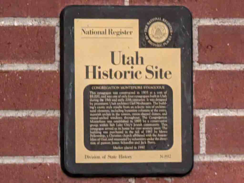
Congregation Montefiore Synagogue
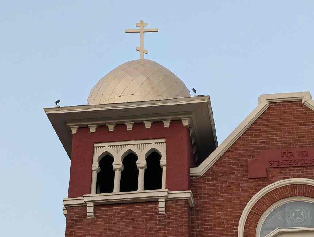
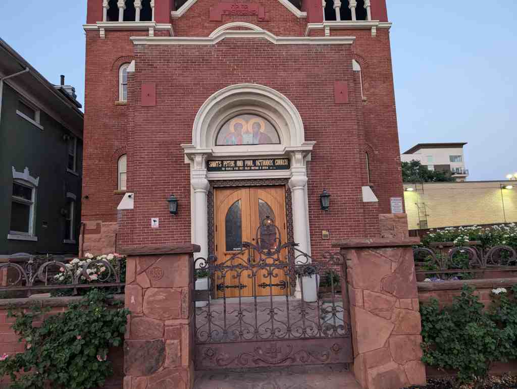
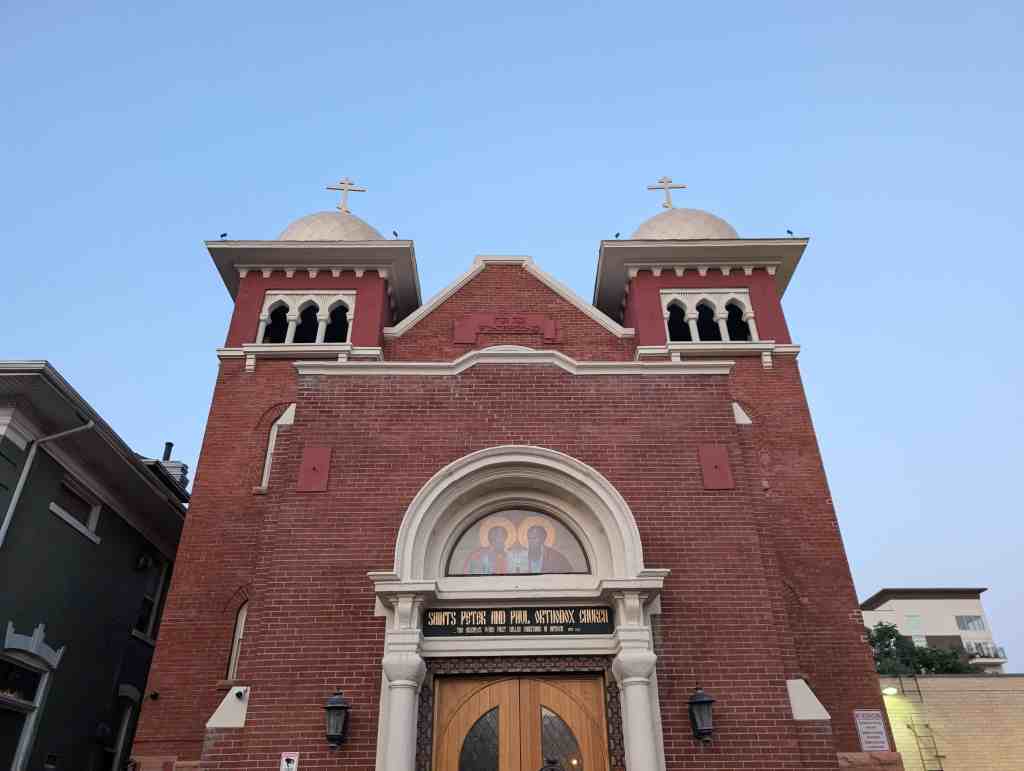
This Synagogue was constructed in 1903 at a cost of $9,000, and was one of only 4 synagogues built in Utah during the 19th and early 20th centuries. It was designed by prominent Utah architect Carl Neuhausen. The building’s exotic style results from an eclectic mix of architectural elements, including Byzantine columns at the entry, Moorish arches in the towers, onion-shaped domes, and round-arched windows throughout. The Congregation Montefiore was established in 1895 by a conservative group within Salt Lake City’s Jewish community. This Synagogue served as its home for over 70 years. The building was purchased in the fall of 1987 by Metro-Fellowship, a Christian Church affiliated with Assemblies of God, and renovated by volunteers under the direction of Pastors James Schaedler and Jack Perry.
The Synagogue is located at 355 South 300 East in Salt Lake City, Utah and was added to the National Register of Historic Places (#85001395) on June 27, 1985.

Text below is from the national register’s nomination form:
The synagogue of the Congregation Montefiore is significant for its association with Utah’s conservative Jewish population. The third Jewish house of worship to be constructed in two decades, the 1903 Moorish Revival synagogue is testimony to the diversity in religious practices within Utah’s Jewish community. The conservative or ‘Modern Orthodoxy,’ as it was then known, grew in numbers as a direct result of Utah’s development from territory to statehood. As Utah became part of the nation, national trends in emigration acted towards augmenting Utah’s Jewry, particularly in the conservative fold.
Since 1884 when Issidore Morris left the congregation B’nai Israel in disagreement over the adoption of the Reform practices, tradition oriented Utah Jews have met to celebrate festivals and holidays. Usually they met in members’ homes because their numbers were too few to support a synagogue. An 1892 estimate placed the entire Utah Jewish population at 1,050, over half of which were conservatives. The conservatives appealed to the Board of B’nai Israel to use their new synagogue for traditional services to no avail. Yet, the financial situation at B’nai Israel was so desperate by 1895 – they had gone through three rabbis in three years and were then without one—that a motion to dissolve the congregation was raised. The incident is indicative of the animosity, real or imagined, which existed between the two groups. With their numbers growing as a direct result of the influx of Russian and eastern European immigrants, who were more likely than not to be traditional, the conservative population met in 1895 to incorporate as the Congregation Montefiore.
Named after the 19th Century British Jewish philanthropist, trouble shooter and financial adviser to the queen, Moses Montefiore, the congregation planned to raise another synagogue in Utah. They were given a parcel of land by their fellow congregant, Morris Levy, located on Third East between Third and Fourth South in Salt Lake City. With the cornerstone laid in August, 1903, in the presence of L.D.S. Church President Joseph F. Smith, it was largely the completed by the end of the year. The building was designed by local Salt Lake architect Carl Neuhausen and cost $9,000. The benign respect extended by Mormon authorities towards particularly Montefiore’s members was a way of thanking the Jews for Issidore Morris’ key role in securing the release from the federal penitentiary of Mormon polygamous Bishop William Smith. The congregation was financially aided by the Mormon church which gave $2,000 toward the construction of this building. Built without central heat, the basement was also unfinished. The congregation joined the United Synagogues of America National Union in 1966. Finally in 1972 the congregation voted for merger with B’nai Israel. An addition housing religious school activities was added to the rear after World War II.
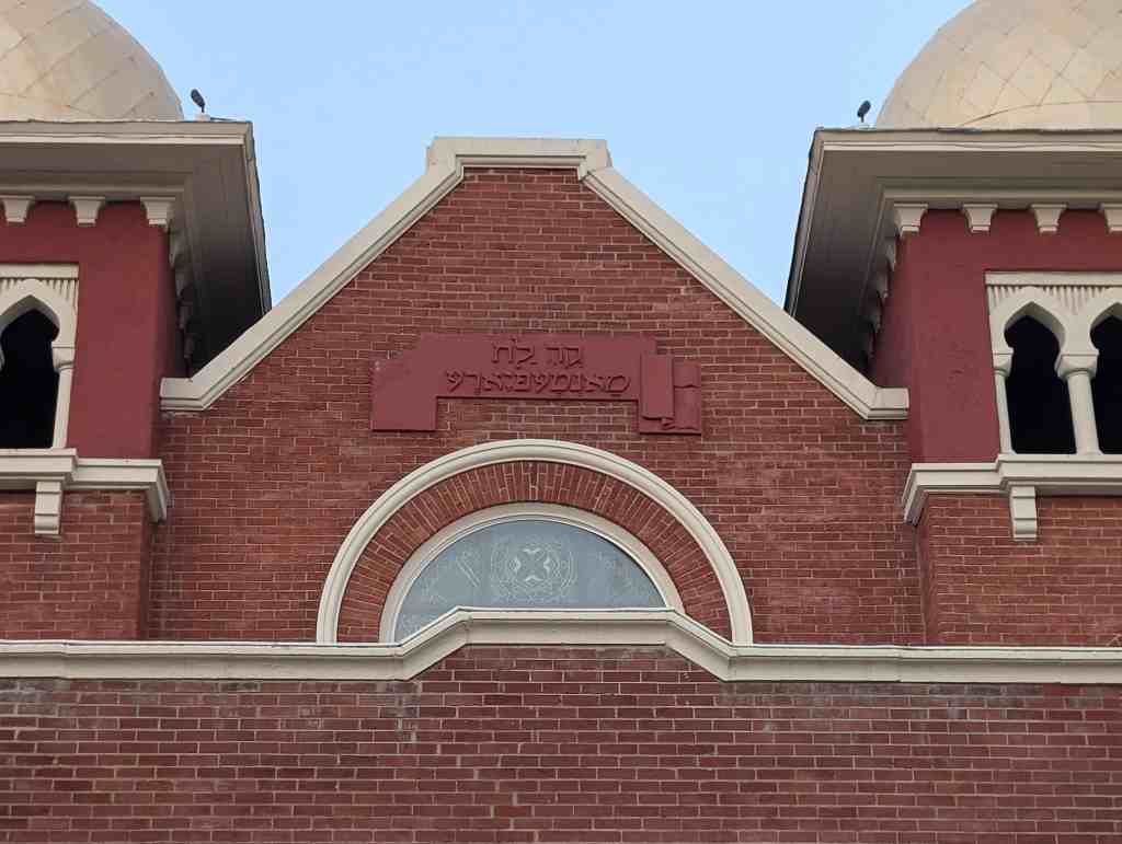
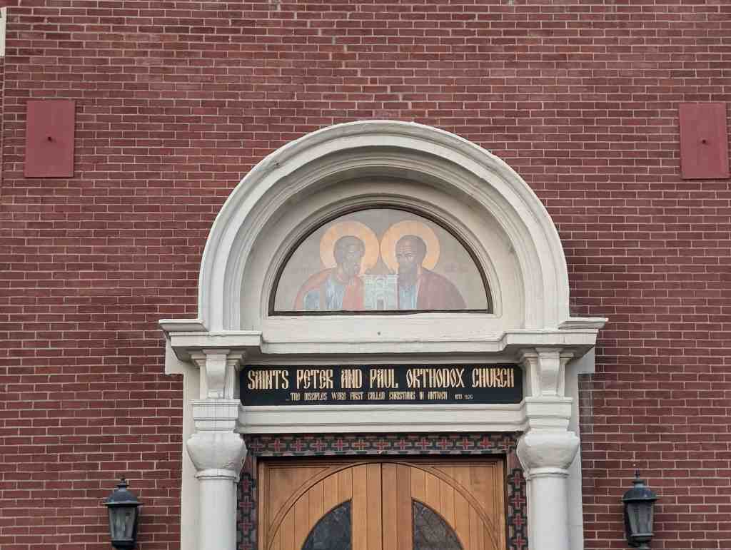
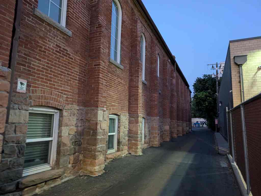
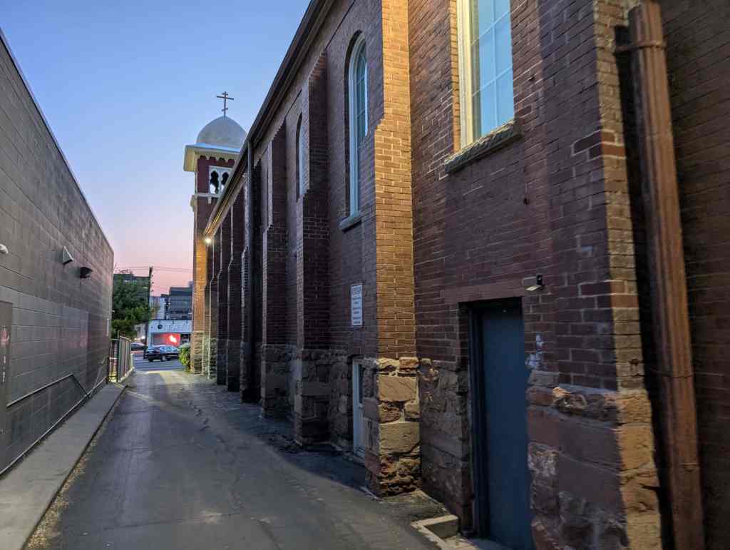
The synagogue is a long rectangular building, the primary portion of which is defined by brick gabled walls facing east and west. The north and south walls, also of brick which appear to have been painted from the start are divided into nine bays – each containing a tall round arched window – by projecting pilasters. It is not known whether the pilasters serve to brace load bearing walls or whether they conceal steel columns which in turn might be attached to steel roof trusses. At both ends of the west facade are square towers with onion shaped domes atop broad bracketed cornices below which are arcades of Assyrian arches on columns. The tower shafts are brick; their bases and the entire original building base is of rusticated Ashlar stone, to the water table. In the center of the east gable wall is a metal plaque with a raised Hebrew inscription. Below the plaque is a round window with a six-pointed star pattern. Below this is a projecting entry vestibule with a flat roof and parapet walls. The west wall of the vestibule has an elaborate entrance composed of double doors surmounted by a transom and flanked by Byzantine columns which support a projecting semi-circular pediment. The Tympanum is glass, with diagonal and horizontal divisions. The rear addition is of masonry construction, probably with a steel frame. There is a flat roof on steel bar joists. The brick is the same color as the painted brick on the original building. The brick vestibule on the facade is an early, well-matched addition.
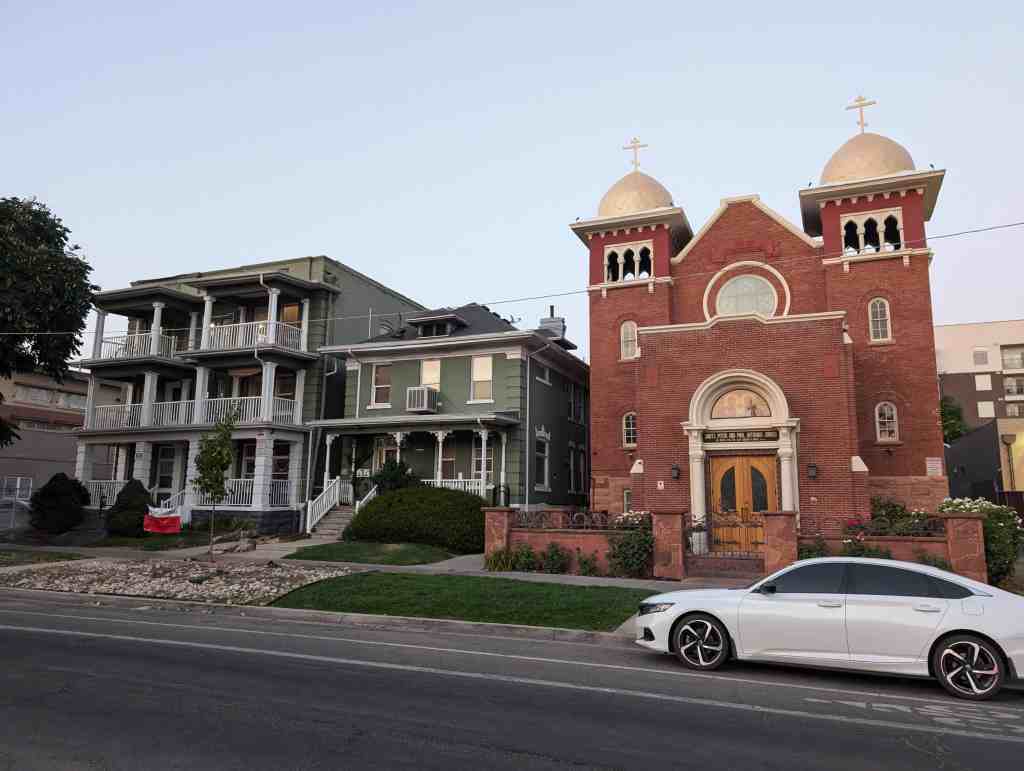

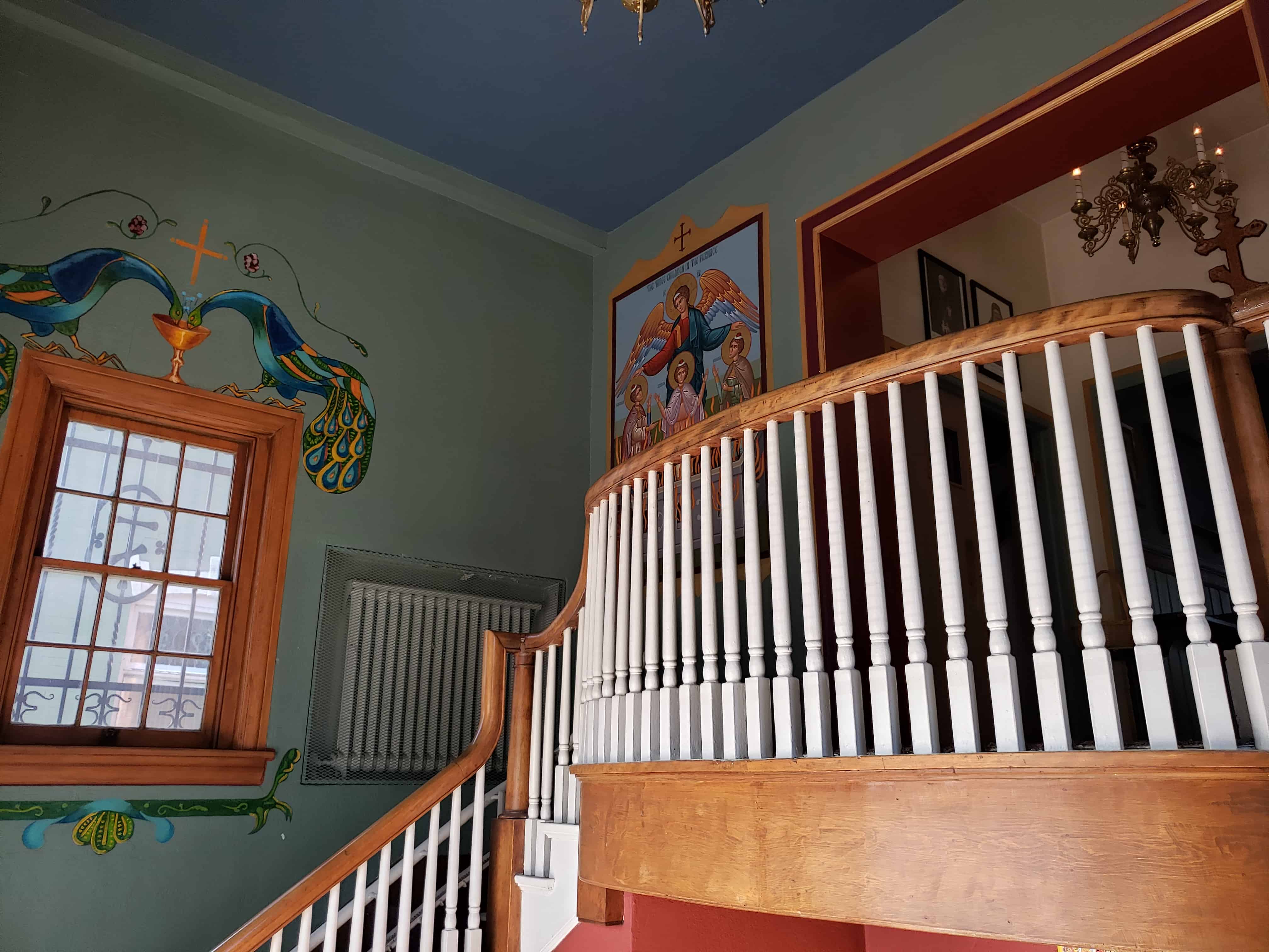
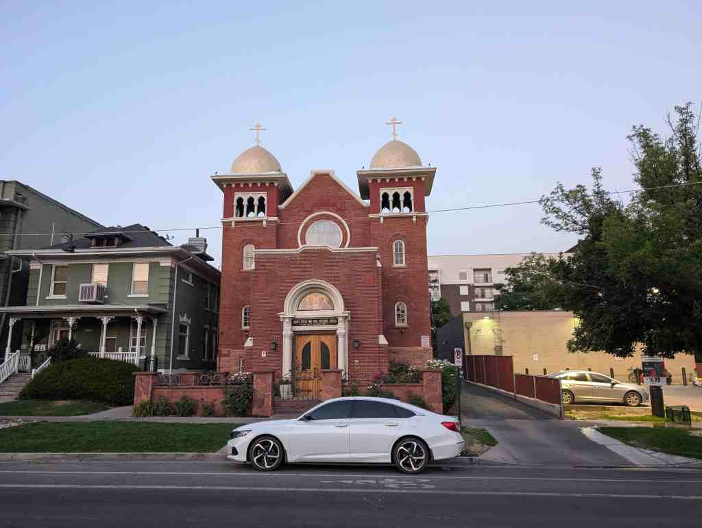
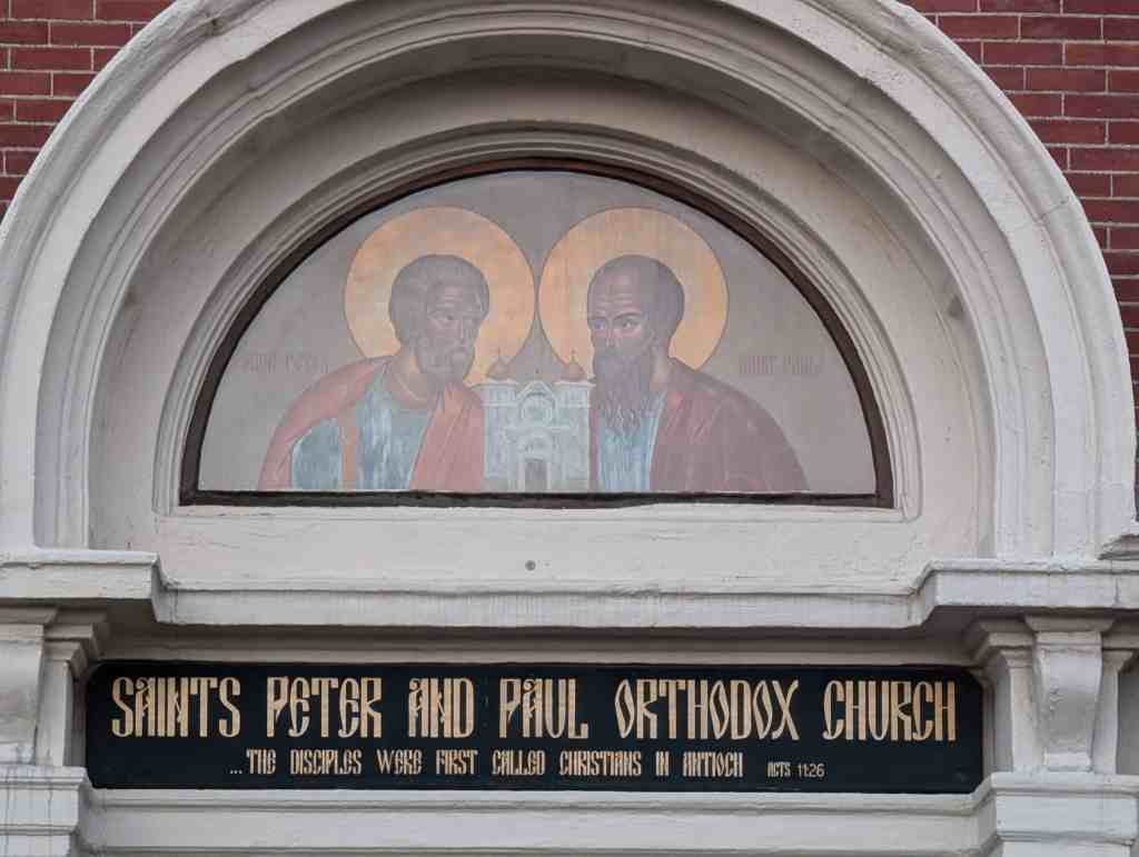
Saints Peter and Paul Orthodox Church
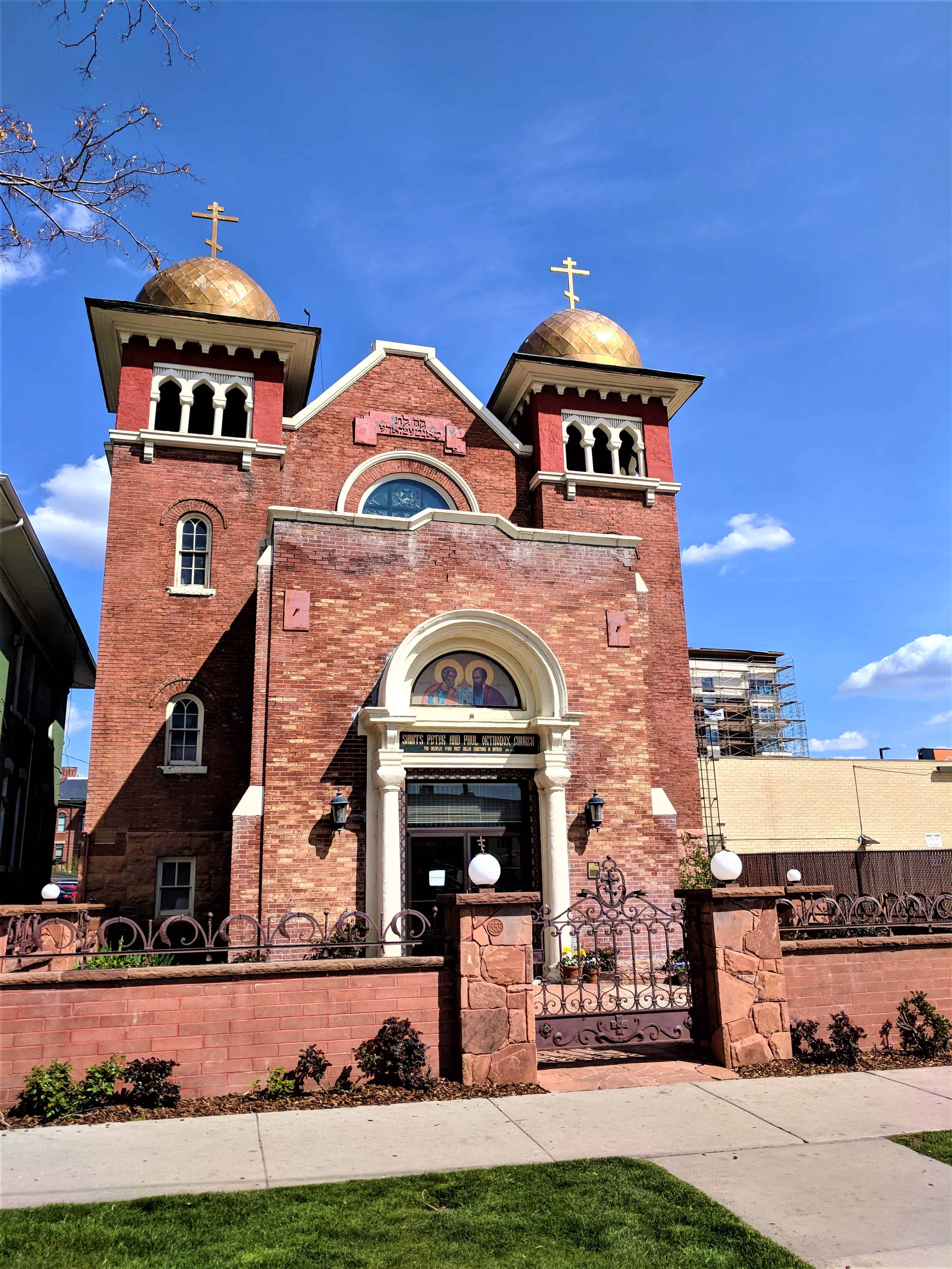
Saints Peter and Paul Orthodox Church
For other Historic Churches in Salt Lake City visit this page.