Tags
Fort Pearce
Fort Pearce was built during the Blackhawk War of 1865-1868, a period of conflict with the Ute Indians in central and southern Utah. This was Utah’s last major Indian conflict. During this time the Navajo Indians also raided the settlements of southern Utah. The Navajos used Fort Pearce Wash as a means of gaining entry into these Mormon settlements. The fort was built in 1866 to keep out the Navajo raiding parties. No battle was ever fought with the Indians at the site.
Also during this period the farmers fields were not fenced and the fort with its large corral was used to hold cattle to keep them from destroying the crops in the fields. This holding of cattle at Fort Pearce was a common practice and continued long after the Indian unrest ceased.
The fort and the wash upon which it is situated is named for Captain John D. L. Pearce, noted military leader and Indian fighter from St. George, Utah, who took part in the Blackhawk War and other Indian conflicts in southern Utah.
At the present time, the area is visited by the local people, scouting groups and historical societies as a means of conveying an awareness and interest in the pioneer heritage of this part of southern Utah.
Fort Pearce was built and occupied by Mormon settlers desirous of maintaining agricultural communities in that part of southern Utah. Although the direct purpose in building the fort was to keep Navajos from raiding settlements, its corral proved to be its most useful asset, in keeping livestock from destroying valuable crops.
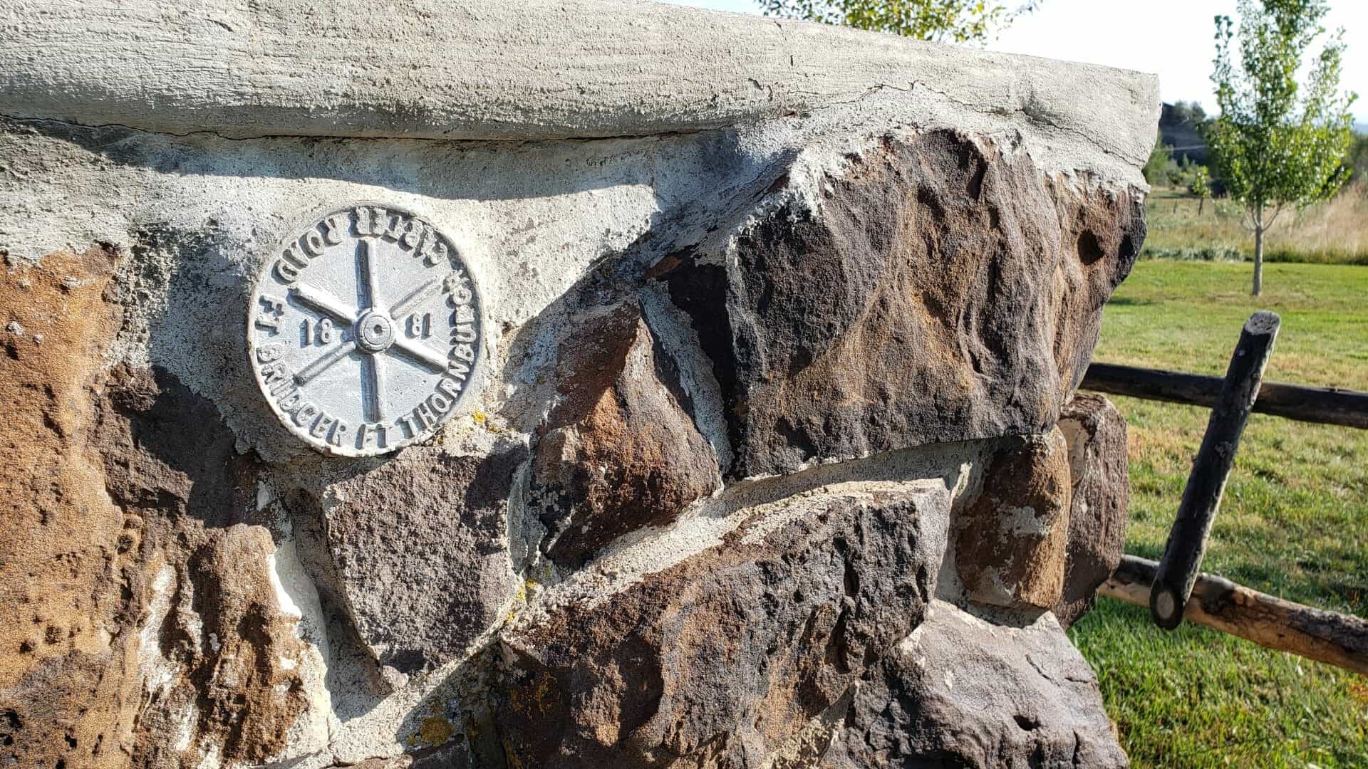
Fort Pearce is located in Washington County, Utah and was added to the National Historic Register (#75001834) on November 20, 1975. The text on this page is from the nomination form for the national register.
Fort Pearce, situated on the edge of Fort Pearce Wash, is a rock-walled structure that at present has walls standing approximately six feet high. The single story structure is over thirty feet long and the gunports are now a part of the irregular outline of the top of the walls. There are also the remains of a rock corral a short distance to the south of the fort. The walls of this corral are only a few feet high at one corner and usually consist of piles of rock rubble. Much of the corral’s walls has eroded away due to its location in the wash. The fort itself is situated on exposed rock and is not in danger from soil erosion.
In Immortal Pioneers, Albert E. Miller states that originally the walls of the fort were about eight feet high. The structure was never roofed. This fort was fashioned in the shape of a cross with two portholes in the front of each of the four projecting ends, and one porthole in each side of each projection, making in all sixteen portholes. This arrangement gave the guards a crossfire from all directions. From looking at the present outline of the fort, it is doubtful whether the fort actually was in the shape of a cross as stated above.
Building of the fort started on December 4, 1866, as noted in the diary of Charles L. Walker of Washington, Utah. In 1869., the Washington Ward Tithing Ledger indicated that at least six men were given credit for work done on the repair of the fort and the building of corral. It is also noted in the diary of Charles L. Walker that he and other men of the area did repair work on the fort and built a corral in late 1869.
In Red Hills of November, A. K. Larson states that four days of hard labor (December 20-24, 1869) by nineteen men produced a corral with walls five and one-half feet high on a base two and one-half feet wide. This corral is just south of the fort and appears to have crossed the wa;Sb,5.nd included ground on both sides.