There had been trouble with Indians in the south and central section of the territory, so an edict came out from Brigham Young that each town should build a fort for protection. Early in the spring of 1854 Jesse W. Fox, Church Surveyor, came to Kay’s Ward for the purpose of laying out the fort, which was later to become the center section of the town, about midway between the two main roads. It encompassed approximately 15 square blocks, between what is now Main Street and 600 West and 200 North and 100 South. The Spanish adobe wall was to be built of clay (dug from the outside forming a ditch) which was shoveled by hand into lumber forms. The plan of the wall was five feet at the base, tapering to three feet at the top, with a height of six feet. Each able-bodied man would be assigned to build a certain section of the wall himself or hire it done. Only part of the project was ever finished and that was on the south and west sides. The entrance to the fort was located about where Barnes Bank now stands.*
During the Meeker (Colorado) Incident of September 1879, provoked and infuriated White River Utes killed a dozen soldiers and Indian Agency employees. The incident so badly frightened the white settlers scattered throughout this area that they decided to band together and build a fort for protection. The settlers, most of whom were only recently arrived in Ashley Valley, dismantled their newly built cabins, numbered the logs, and reassembled them here on the fort site, building cedar post buttresses between them.
Original plans called for building a square fort, but by the time the people have completed three sides of the square, government forces had gained control of the Utes and construction stopped on what was sometimes called “Fort Scared-to-Death.”
The south row of houses ran one block west from the middle of the present Main Street/Vernal Avenue intersection, in front of you, nearly to 100 West. The east row ran a half block north of the intersection along Vernal Avenue and connected with the north row, which ran from there again due west, forming the third side of a “U.”
Although there were no further incidents with Native Americans that hall, in hindsight, it was fortunate the people had “forted up.” The following season, which came to be known as the Hard WInter, was so harsh that solitary families might have perished had it not been for the fort. In early spring 1880, the settlers chose several of their number to travel on horseback and foot to Green River, Wyoming, for supplies. Despite severe hardships, they were successful and brought life back to the valley.
This is #10 of the 21 stop history walking tour in downtown Vernal, Utah. See the other stops on this page:
This monument marks the site of the Grantsville Fort built in1853 as protection against the Indians. The fort was thirty rods square with walls twelve feet high five feet thick at the base ad eighteen inches thick at the top. The north wall was one hundred forty three feet north of this point.
About fifty people lived inside the fort during the early settlement of the town of Grantsville, which was named in honor of George D. Grant, one of its pioneers.
This historic marker is located at the Grantsville First Ward Chapel at 297 West Clark Street in Grantsville, Utah. It was erected July 24, 1934 by the Grantsville Chapter of the Daughters of Utah Pioneers and by the Utah Pioneer Trails and Landmarks Association.
As winter gave way to spring in 1855, twelve missionaries were sent to southern Utah by Brigham Young to colonize this region. Fearing an attack by Indians, they began the ambitious project of building a fort. Their energies were initially directed at hauling stone which was plentiful and nearby. Local Indians, whom they trained and who were willing to help in exchange for food, assisted them. As soon as enough stone had been gathered, the work on Fort Santa Clara began in earnest. Four stone masons from Cedar City directed the work which took approximately three weeks to complete. While inspecting the fort during one of his visits south, Mormon Leader Brigham Young pronounced it, “the best fort in the territory.”
Because of the efforts of the missionaries, there was great peace among everyone who lived in this area. The fort was never attacked by Indians. The fort became the focal point for the Swiss Settlers who arrived in November 1861.
“On Christmas Day 1861, it started to rain. We were known to have a skiff of snow about this time of year, but this year it rained, and it rained for about a month and a half. The ground became completely saturated, and the small creeks feeding the Santa Clara became streams, and the Santa Clara became a torrent. Some small trees and other debris washed down from above, backed up the Santa Clara, and during the night of 4 February 1862, the Santa Clara ran over its bank and started entering the fort from the north gate. Sarah and I awoke with water in our cabin, and we rushed out into the night in our bed clothes to warn others. By then the water was washing away our cabin on the southwest corner of the fort. The women and children were carried to safety. Two hundred bushels of the Indian’s wheat was carried from the northwest cabin to safety before that wall collapsed. We were all exhausted from the effort. Sarah and I lost everything we had except for my horses and saddles. We rushed out into the night without taking time to dress. Many miraculous events took place that night. It was dark and raining, the fort was washing away. Wheat was saved, children led and carried to safety. Some were able to save some valuables, but most was lost. But God was good to them, not one life was taken.
At conference, 22 March 1862, Jacob Hamblin was called to be the new President of the Indian Mission. With the importance of his new position and the disaster of losing the fort in the flood, Jacob started building a new home. Most of Jacob’s garden area and orchard by the fort were destroyed, so he started again. The stone from the north wall of the fort was used in building the structure, and the Swiss people used the rest, so the last of the fort wall disappeared.” – Ira Hatch, Indian Missionary, by Richard Ira Elkins
Today, within the walls of some of the homes in our community, these rock walls still stand as a shelter to the inhabitants of this beautiful city of Santa Clara. Jacob Hamblin’s home, now registered as a historical site and open for public visits, is a reminder of the courage of those who fought the vagaries of nature and made this part of the world their garden.
How Would You Build a Fort?
A single community cabin was the starting point for the fort. The fort was to be one hundred feet long on each side with stone walls twelve feet high and about two feet thick. The plan called for seven cabins on each side of the fort. Each cabin was about twelve and one-half feet wide and twenty feet deep and had one door and one window. Stone fireplaces, placed in the center back wall of each cabin, provided a good portion of the outside wall of the fort. The inside cabin walls were of logs, except for the end cabins which had two walls of rock. The cabin roofs were supported on logs set into the rock on one end and on log walls on the inside of the fort. Protective gun ports were built into the outside rock walls. On the east and west side of the fort, defenders would lie on the roof tops to fire from the gun ports. Wooden ladders gave access to the raised platforms on the north and south sides. The main gate faced south; a smaller cattle gate was built into the center of the north wall. Entrance into the fort was gained by two doors on the south side which faced the road. These doors swung on heavy iron hinges built into the rock; heavy cross members, about three inches thick, were bolted to them for strength. The doors were locked with four by six inch beams placed into carriers. A large iron hasp held them closed when the beams were not needed.
The Stockyard
In 1996, the foundation of the Fort Santa Clara Stockyard was unearthed. The original stockyard was located some distance away from Fort Santa Clara so the animals would not be a nuisance to those living in the fort. The animals could be easily watched from the fort which was south from here toward the Santa Clara River.
The Missionaries
The monument is dedicated to the following men who colonized the Santa Clara area.
The five missionaries were:
Jacob Hamblin
Ira Hatch
Samuel Knight
Thales Haskell
Missionaries called at October 1853 General Conference to the Indian Mission, Southwest Territory:
Numerous fortifications were erected in Central and Southern Utah in 1865 and 1866 during the Black Hawk Indian War to protect small settlements against attack by bands of Ute, Paiute, and Navajo Indians. Most were built around the towns themselves, and generally by the local citizens, but Fort Sanford was unique in design, construction, and purpose.
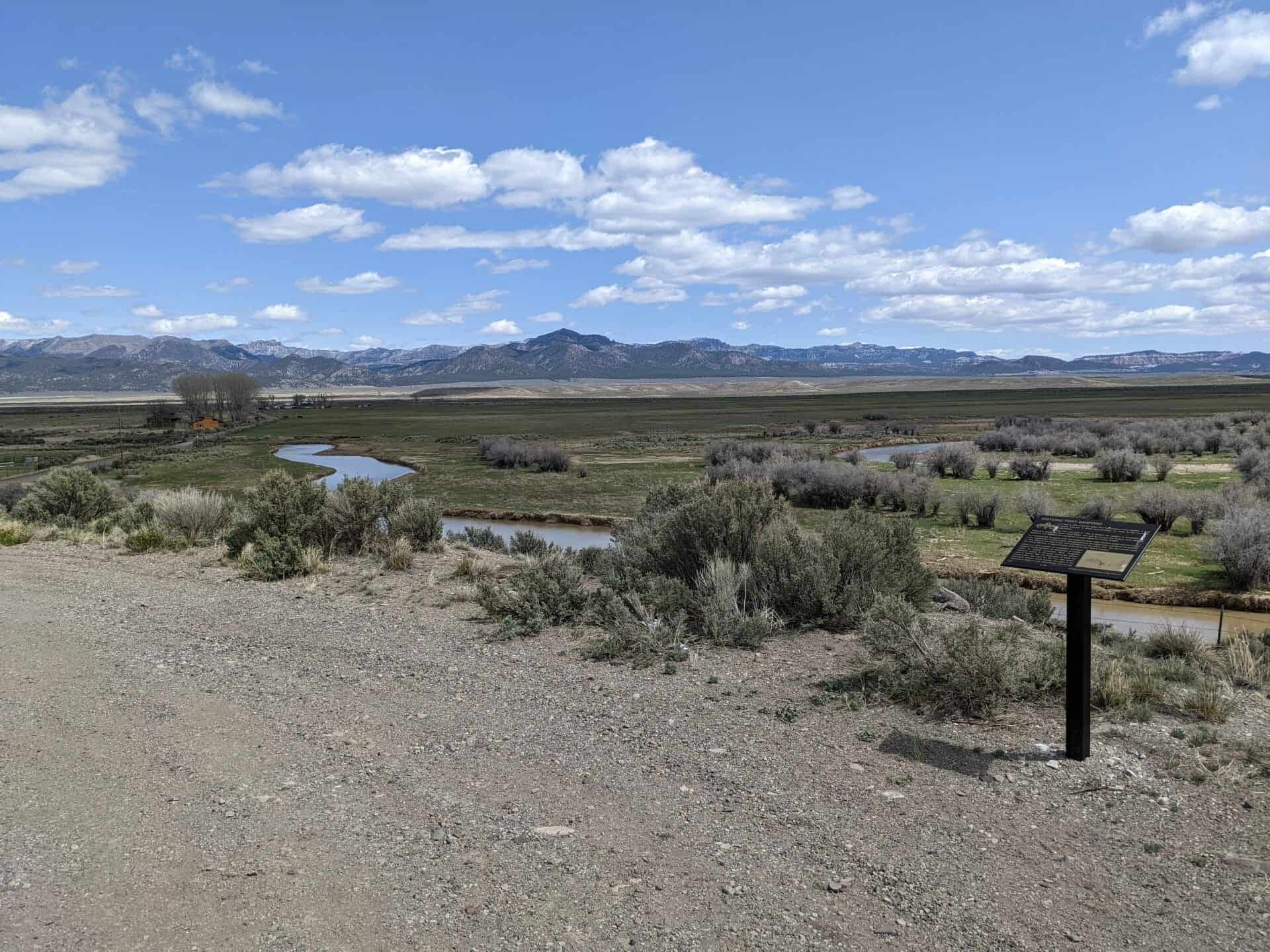
By orders from the commanding officers of the Territorial Militia and the Iron Military District, Major Silas Sanford Smith was directed to raise a force of fifty well-armed men to help protect the settlements of Circleville and Panguitch and to construct a fortification near the confluence of Bear Creek and the Sevier River. This was a strategic location commanding the Ute Indian Trail as well as the north-south route taken by pioneer settlers traveling through the area and along the Old Spanish Trail. Each provided access to the western regions.
Although Fort Sanford was in operation for a relatively short period of time, it represented a unique chapter in the history of this area. This monument is a tribute to the soldiers who built the Fort and the pioneers it protected.
There are two monuments/plaques that are both Daughters of Utah Pioneers historic marker(s) #588, the first is seen above and the second, below.
There is little evidence today that Fort Sanford once existed. A land survey indicates it stood approximately 1.5 miles to the south of this marker.
The Fort was built in 1866 to protect the settlers in Circleville and Panguitch during the Black Hawk Indian War and to prevent the Indians from stealing livestock. Fort Sanford also served as a supply depot for cavalry troops.
Fort Sanford was designed, built, and named by Major Silas Sanford Smith and his troops. It was constructed entirely of cedar (juniper) pickets that stood eight feet above the ground. A deep ditch at the base of the wall encompassed the entire Fort. The dimensions were 363 feet by 363 feet, or approximately three acres with “block houses.”
Within just three months of completion, President Brigham Young directed the evacuation of smaller towns for great protection. Most Panguitch residents moved to Parowan; Circleville settlers went to Beaver. With the evacuation of these two communities, the need for the Fort also ended. Eventually farmers would salvage the poles of the stockade to build houses, outbuildings and fences.
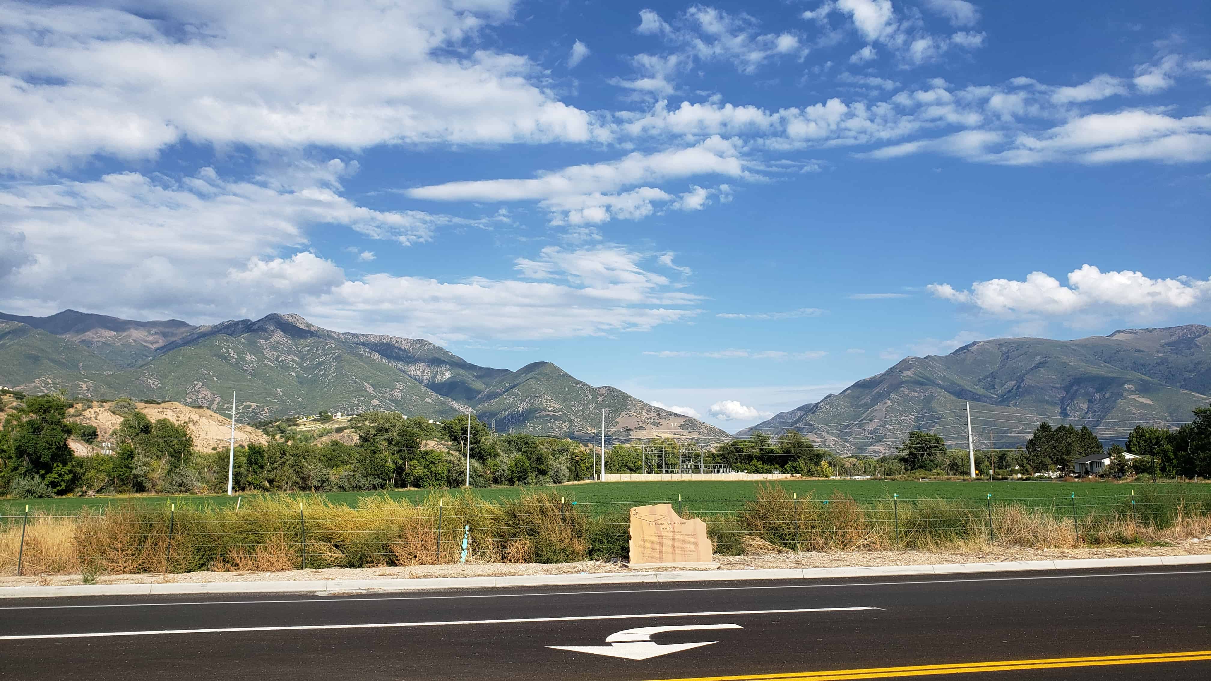
The Kington Fort-Morrisite War Site This monument was placed here to commemorate a three day, little known battle that occurred 13, 14, and 15 June 1862
The Kington (Kingston) Fort a 645 foot by 645 foot enclosure, was built on this site in 1853 to protect the early settlers from possible Indian attacks. Since there were no Indian problems in South Weber, the fort was deserted in 1858.
In early 1862, the fort was taken over by Joseph Morris, an excommunicated member of the Church of Jesus Christ of Latter Day Saints, who had founded a church commonly known as the Morrisites. At one time the Morrisite fort population exceeded 200 men, women and children. In June 1862 three men, who no longer believed in Morris’ teachings, attempted to leave the fort. They were captured by a Morrisite posse and forcefully returned to the fort. Responding to a report by observers of this action, the sheriff and a small posse approached the fort with the intention of taking the men for a formal hearing on the charges of which they were accused. The request was denied and further attempts were blocked. As a result, acting governor Frank Fuller ordered a militia under the command of Robert T. Burton to proceed to the fort. Even this large, heavily armed group failed to free the imprisoned men. A cannon ball fired into the fort killed two women and seriously wounded a teenage girl. As the army assaulted the fort and breached the gates, two militiamen were killed. In the ensuing confusion, Morris, his second in command, John Banks and two more women were killed. In all, eleven people died.
After the death of their leaders, the Morrisites scattered, with most going to Soda Springs, Idaho. Others settled in Carson City, Nevada and Deer Lodge Montana. A few other members were rebaptized into the Church of Jesus Christ of Latter Day Saints and remained in South Weber.
This monument is SUP Marker #128 (see others in the series on this page), it was erected in August 2006 by:
Daughters of Utah Pioneers – South Weber Chapter
Sons of Utah Pioneers – Ogden Pioneer Chapter
All Build Construction and Landscaping
Site by Douglas B. Stephens
The location is N 41.14677 W 111.96884, at 6600 South on 475 East in South Weber, Utah.
This monument marks the S.E. corner of fort built by Anson Call and associates in 1855 under direction of President Brigham Young as protection against Indians. The fort was the most northerly outpost in Utah. It was one hundred twenty feet square, with walls eight feet high and three feet thick, built of rock, part of which is in this monument. The circular stones were taken from one of the first burr flour mills built in northern Utah, in 1852, owned by Omer and Homer Call. The three Call brothers were early pioneers and builders of northern Utah.
This monument marks the site of Fort Herriman built in 1855 by Thomas Butterfield, Henry Herriman, Samuel Egbert, Robert Petty, and John Stocking, as protection against the Indians.
The Fort was abandoned in 1858, under instructions from Brigham Young upon the approach of Johnston’s Army. Some of the settlers returned a few years later and established the Town of Herriman. The Fort was named for Henry Herriman and Butterfield Canyon nearby for Thomas Butterfield, pioneers of this section.
In 1866 a group of Scandinavian Latter-day Saints entered the area that would become Bear River City. Their first homes were dugouts on the west bank of the Bear River. These dugouts were roofed with poles, willows, straw, and dirt. The fall of 1867 saw these early pioneers moving from the river dugouts to establish the Bear River Fort as a protection from the Indians. The fort was built on this ten acre block with log and adobe cabins surrounding the entire area.
The doors and windows of all 44 cabins in the fort face the center, making the cabin walls the walls of the fort. In the center area, they erected a flagpole on which Old Glory was unfurled, not only on state occasions, but to call the people to church, the children to school, or as a signal that the cow herd was ready to start for the pasture.
On three corners of the fort, wells were dug for the water supply, and the animals were corralled outside the fort. A house for public gatherings was erected on the west wall where church, school, dances, and meetings were held. Irrigation from the Malad River was introduced when the area northwest of the fort was farmed.
This is DUP Marker #496 located at Bear River City Park at 4470 West 5900 North in Bear River City, Utah