Tags
Ammon, Idaho
16 Monday Dec 2024
Posted in Uncategorized

16 Monday Dec 2024
Posted in Uncategorized
Tags
26 Wednesday Jun 2024
Posted in Uncategorized
Tags
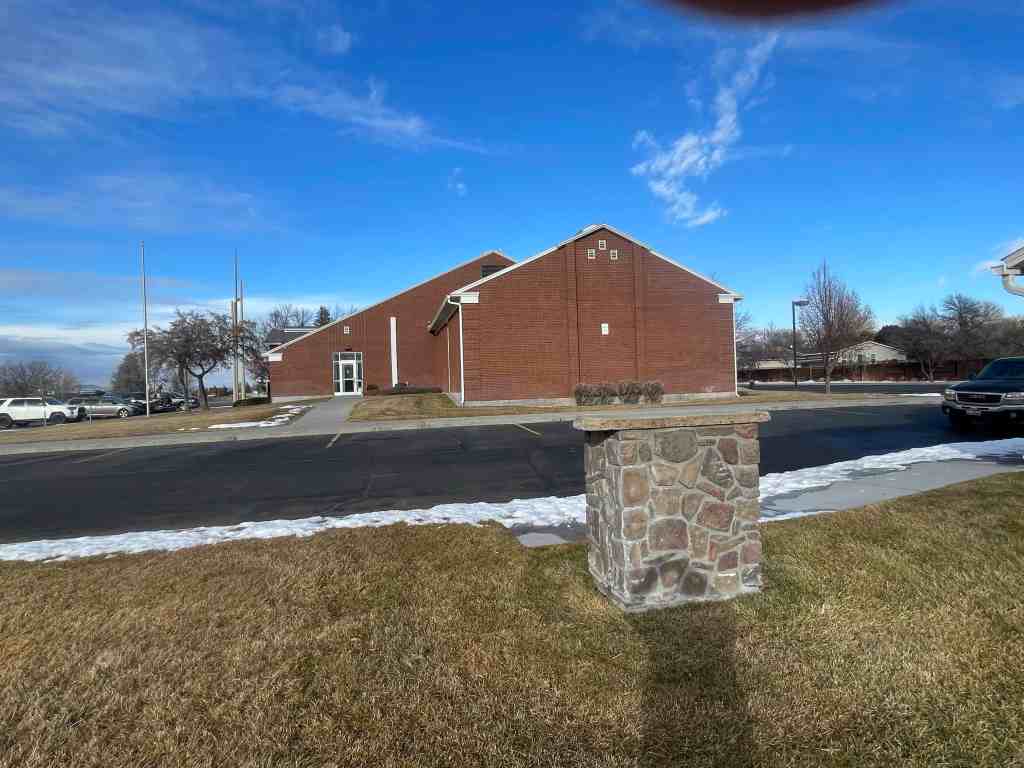
North Bingham County Historical Park
The park, among other things has 4 of the Sons of Utah Pioneers Historic Markers:
10 Monday Jun 2024
Posted in Uncategorized
Related:
04 Thursday Apr 2024
Posted in Uncategorized
Tags
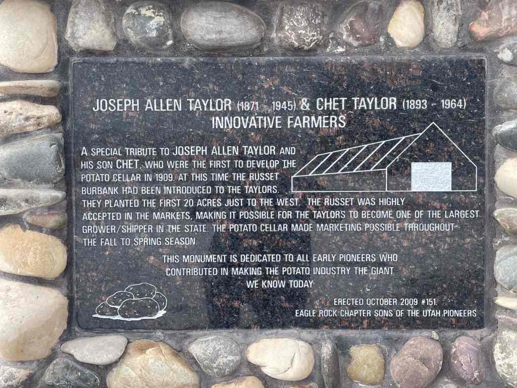
Joseph Allen Taylor (1871-1945) & Chet Taylor (1893-1964)
Innovative Farmers
A special tribute to Joseph Allen Taylor and his son Chet, who were the first to develop the potato cellar in 1909. At this time the Russet Burbank had been introduced to the Taylors. They planted the first 20 acres just to the west. The Russet was highly accepted in the markets, marking it possible for the Taylors to became one of the largest grower/shipper in the state. The potato cellar made marketing possible throughout the Fall to Spring season.
This monument is dedicated to all early pioneers who contributed in making the potato industry the giant we know today.
This monument was erected by the Eagle Rock Chapter of the SUP in October, 2009 and is Sons of Utah Pioneers historic markers #151, located at 1851 East 97th South in Idaho Falls, Idaho.
Related:
These photos were submitted by Marshall Hurst:
04 Thursday Apr 2024
Posted in Uncategorized
Tags
Blackfoot Land Office
The Blackfoot US. Land Office was located here during the land rush of 1902. All staked claims for land in the Upper Snake River Valley were filed in this office.
20 East Pacific Street in Blackfoot, Idaho.
The photos below were submitted by Marshall Hurst:


09 Saturday Mar 2024
Posted in Uncategorized
Tags
09 Saturday Mar 2024
Posted in Uncategorized
Preston, Idaho
05 Monday Feb 2024
Posted in Uncategorized
Tags
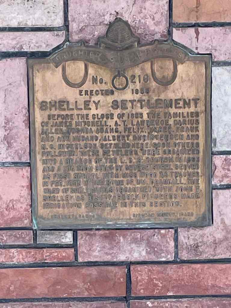
Shelley Settlement
Before the close of 1885 the families of James Mitchell, A.T. Lawrence, Darius Allen, Joshua Adams, Felix, Heber, Frank and Ann Husband, Albert Christiansen and N.G. Mickelson settled here. Soon other followed. These settlers were organized into a branch of the L.D.S. church in 1893 and a log room built by George Steel served as the first school with Miss Wood as teacher. In Feb. 1895 in the home of Wm. Crandall, the Ward of Shelley was organized with John F. Shelley as bishop. Early pioneers made irrigation possible in this sector.
The above text is from the monument (Daughters of Utah Pioneers historic marker #216) located at 219 South Milton Avenue in Shelley, Idaho.
The photos below were submitted by Marshall Hurst:


04 Sunday Feb 2024
Posted in Uncategorized
Tags
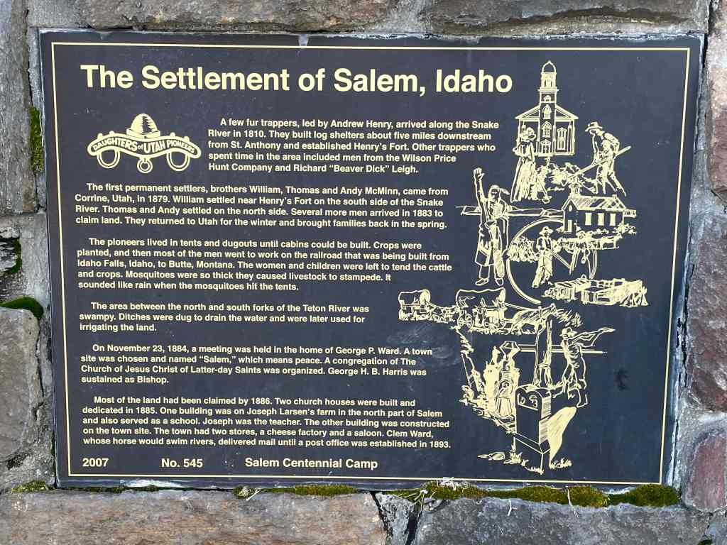
The Settlement of Salem, Idaho
A few fur trappers, led by Andrew Henry, arrived along the Snake River in 1810. They built log shelters about five miles downstream from St. Anthony and established Henry’s Fort. Other trappers who spent time in the area included men from the Wilson Price Hunt Company and Richard “Beaver Dick” Leigh.
The first permanent settlers, brother William, Thomas and Andy McMinn, came from Corrine, Utah, in 1879. William settled near Henry’s Fort on the south side of the Snake River. Thomas and Andy settled on the north side. Several more men arrived in 1883 to claim land. They returned to Utah for the winter and brought families back in the spring.
The pioneers lived in tents and dugouts until cabins could be built. Crops were planted, and then most of the men went to work on the railroad that was being built from Idaho Falls, Idaho to Butte, Montana. The women and children were left to tend the cattle and crops. Mosquitoes were so thick they caused livestock to stampede. It sounded like rain when the mosquitoes hit the tents.
The area between the north and south forks of the Teton River was swampy. Ditches were dug to drain the water and were later used for irrigating the land.
On November 23, 1884, a meeting was held in the home of George P. Ward. A town site was chosen and named “Salem,” which means peace. A congregation of The Church of Jesus Christ of Latter-day Saints was organized. George H.B. Harris was sustained as Bishop.
Most of the land had been claimed by 1886. Two church houses were built and dedicated in 1885. One building was on Joseph Larsen’s farm in the north part of Salem and also served as a school. Joseph was the teacher. The other building was constructed on the town site. The town had two stores, a cheese factory and a saloon. Clem Ward, whose horse would swim rivers, delivered mail until a post office was established in 1893.
The above text is from the monument (Daughters of Utah Pioneers historic marker #545) located at3462 North Salem Road in Rexburg, Idaho.
The photos below were submitted by Marshall Hurst:
03 Saturday Feb 2024
Posted in Uncategorized
Tags
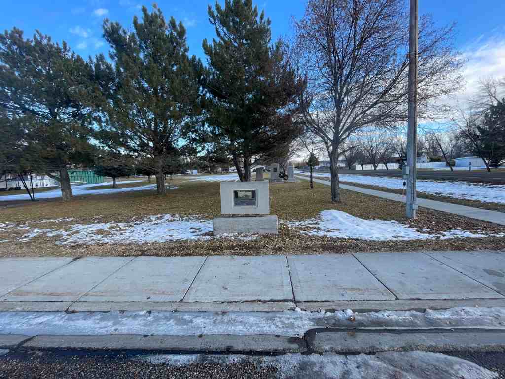
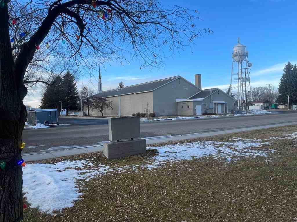
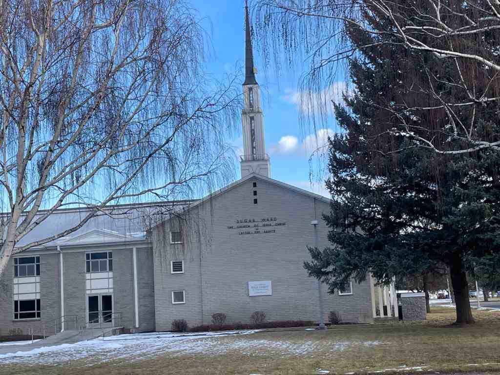
Sugar City Sugar Beet Factory
In August 1903, Mark Austin negotiated the purchase of a section of land here, the south half to be used as this town site and the north half, about 1/2 mile northeast, to be used for a sugar beet factory for the Fremont County Sugar Company. By October 1903, E.H. Dyer had contracted to build the $750,000 factor. Early in 1904, the company signed an additional contract with Dyer providing for the erection of an auxiliary plant at Parker, bringing the total to nearly $1 million.
On December 8, 1903, President Joseph F. Smith, elected president of the company, laid the cornerstone of the factory which processed 35,000 tons of beets the next fall. The Church of Jesus Christ of Latter-day Saints sent 3 chemists from Germany to teach the people how to make sugar. Growing beets required very hard labor. Planting, cultivating, and digging were done with horses, but the difficult thinning, weeding, irrigating, toping, and loading were done by hand by the farmer and his family. In 1906 the company paid laborers and growers $3/4 million. The town grew and 20 businesses flourished here.
At the slicer in Parker, beet juice was extracted and pumped almost 6 miles away through a pipeline to the factory in Sugar City. The slicer was closed in 1913 because of difficulties incident to the extremely cold weather. Juice would freeze in the pipeline, and the water and beets would freeze in the flume.
Because of limitations of acreage and labor, the factory was closed in 1940 and 1941 but reopened for the last campaign in 1942. The factory was dismantled in 1947.
The above text is from the monument (Daughters of Utah Pioneers historic marker #525) located at Park Avenue and Center Street in Sugar City, Idaho.
The photos below were submitted by Marshall Hurst: