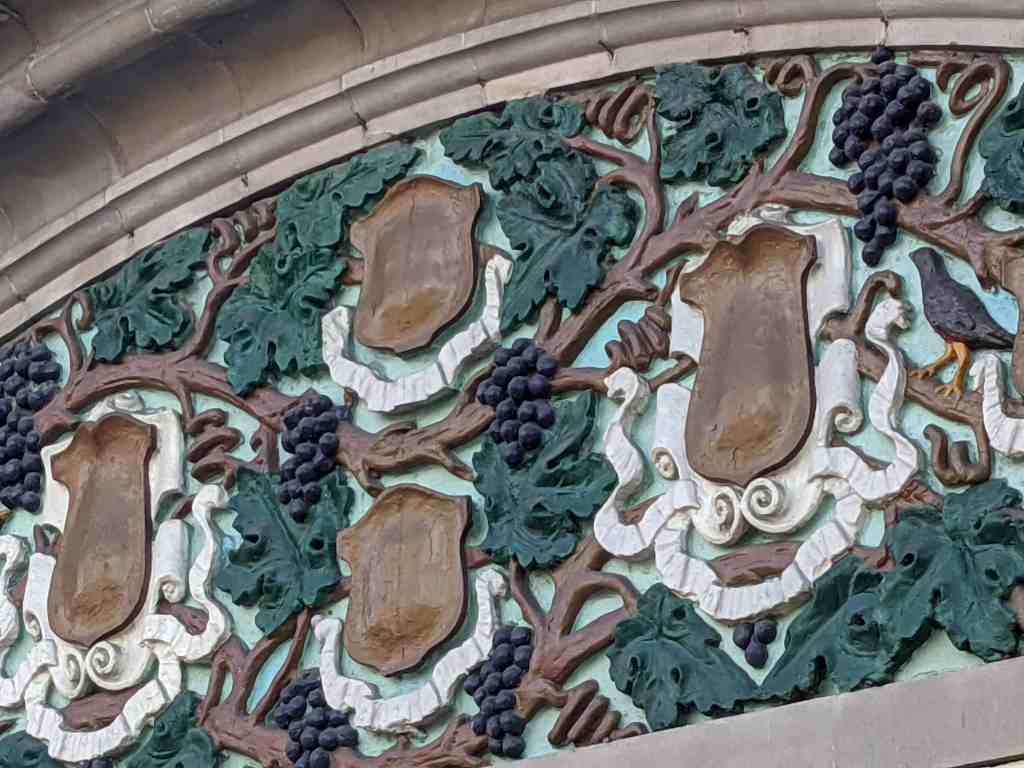
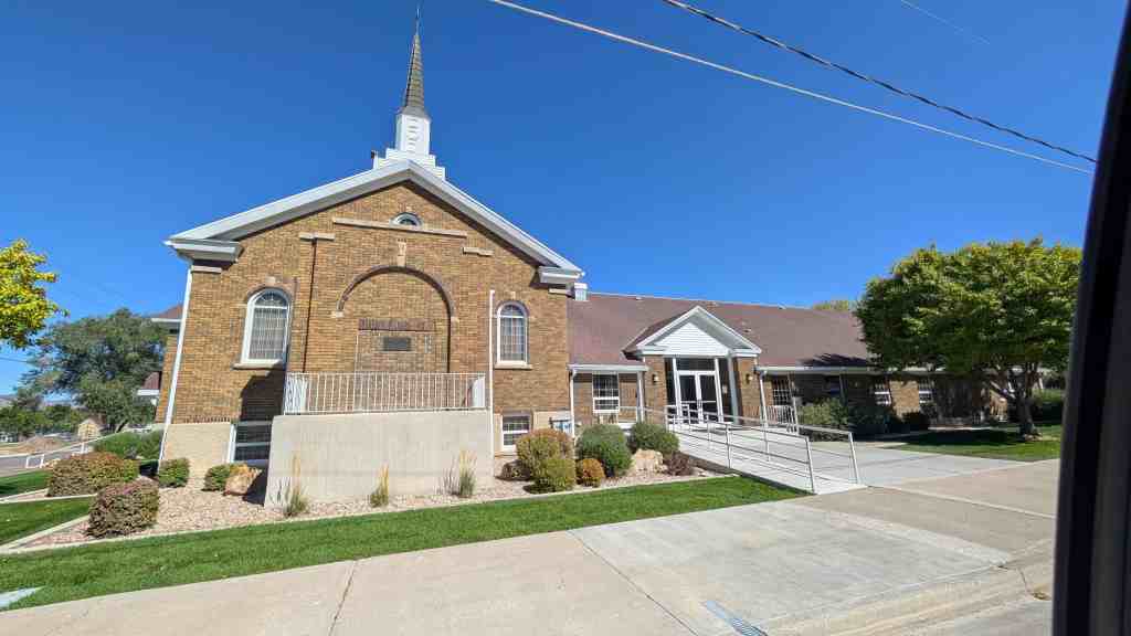
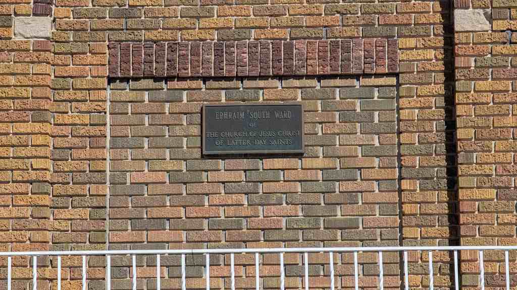
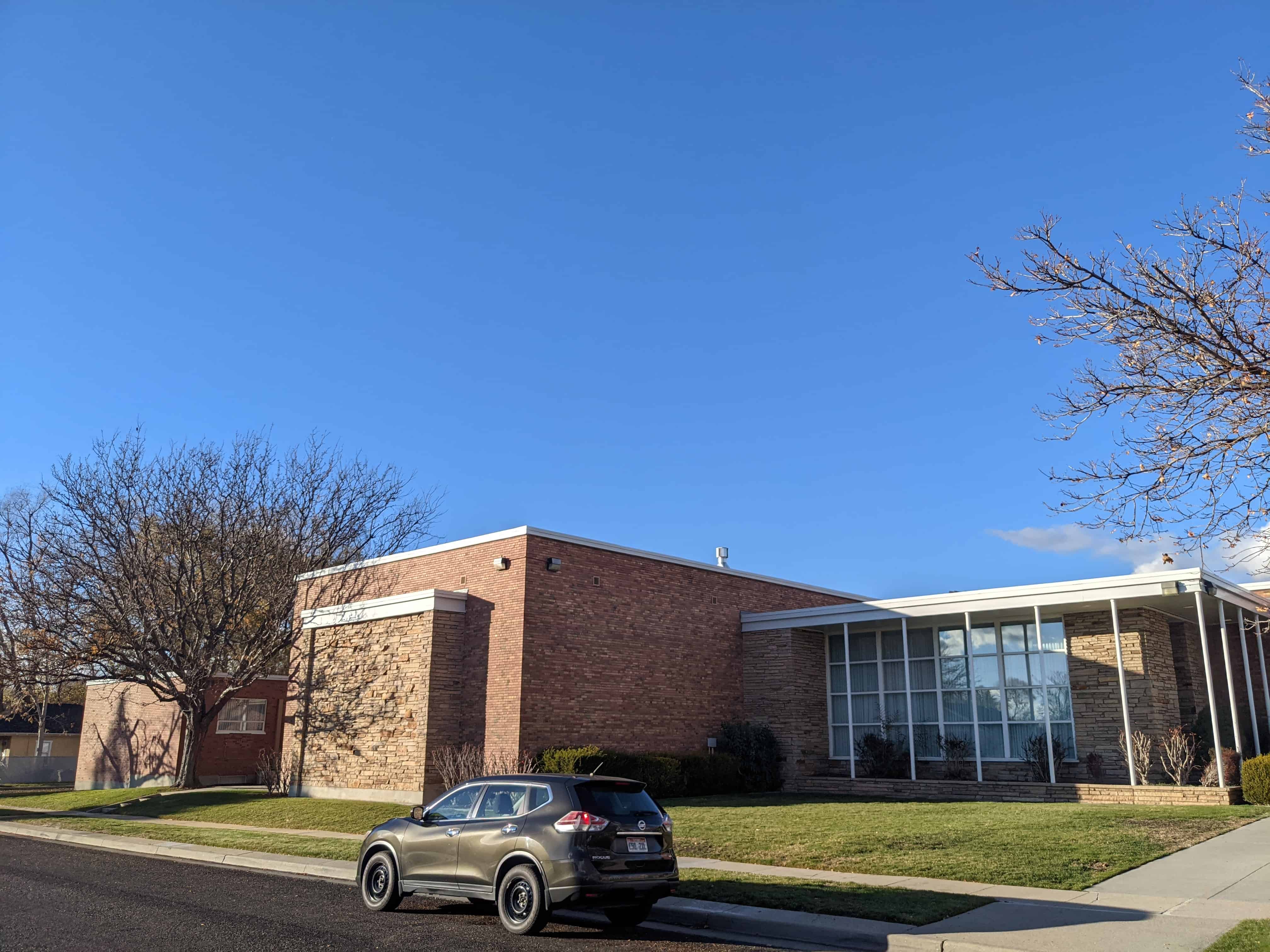
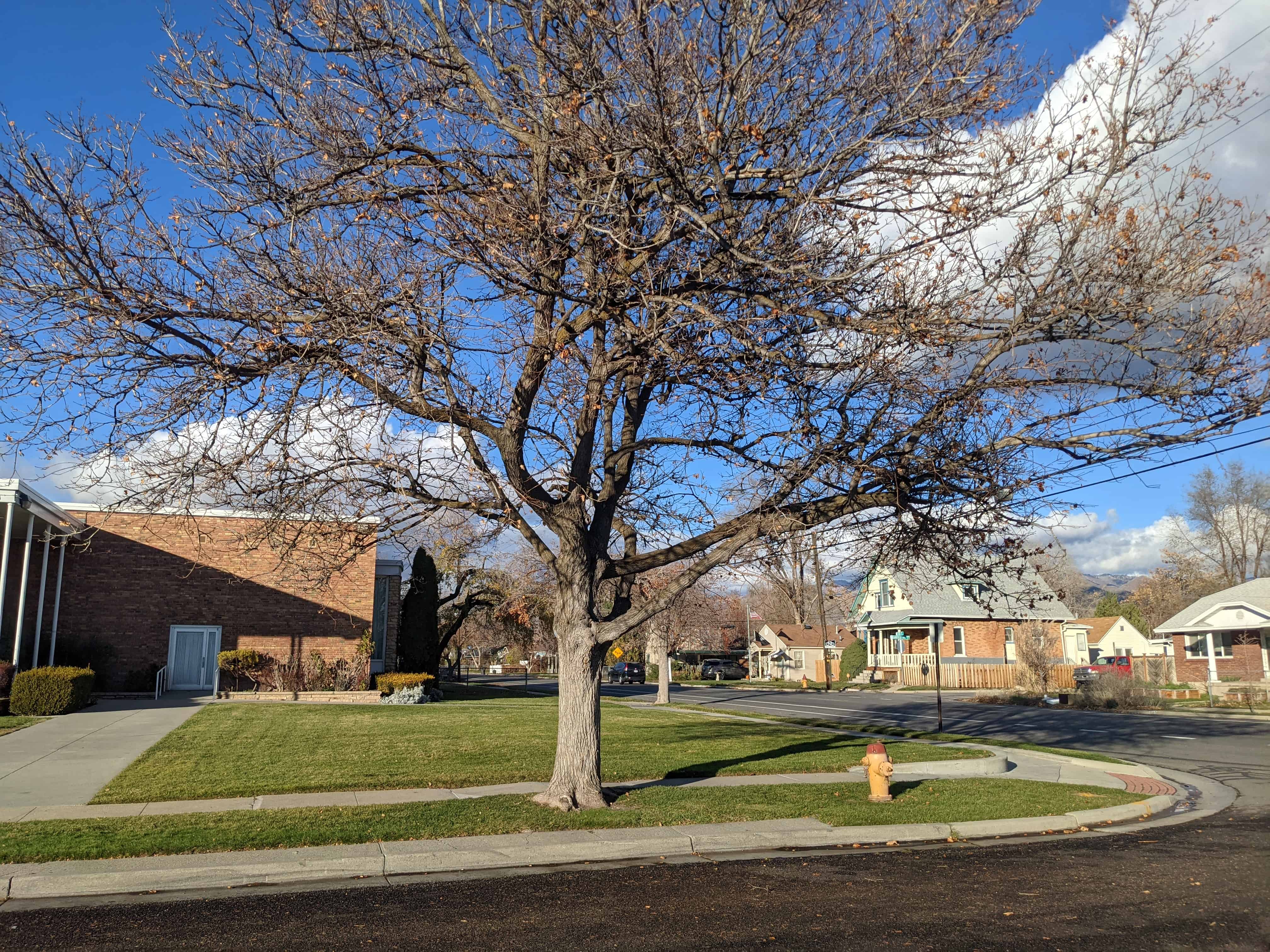
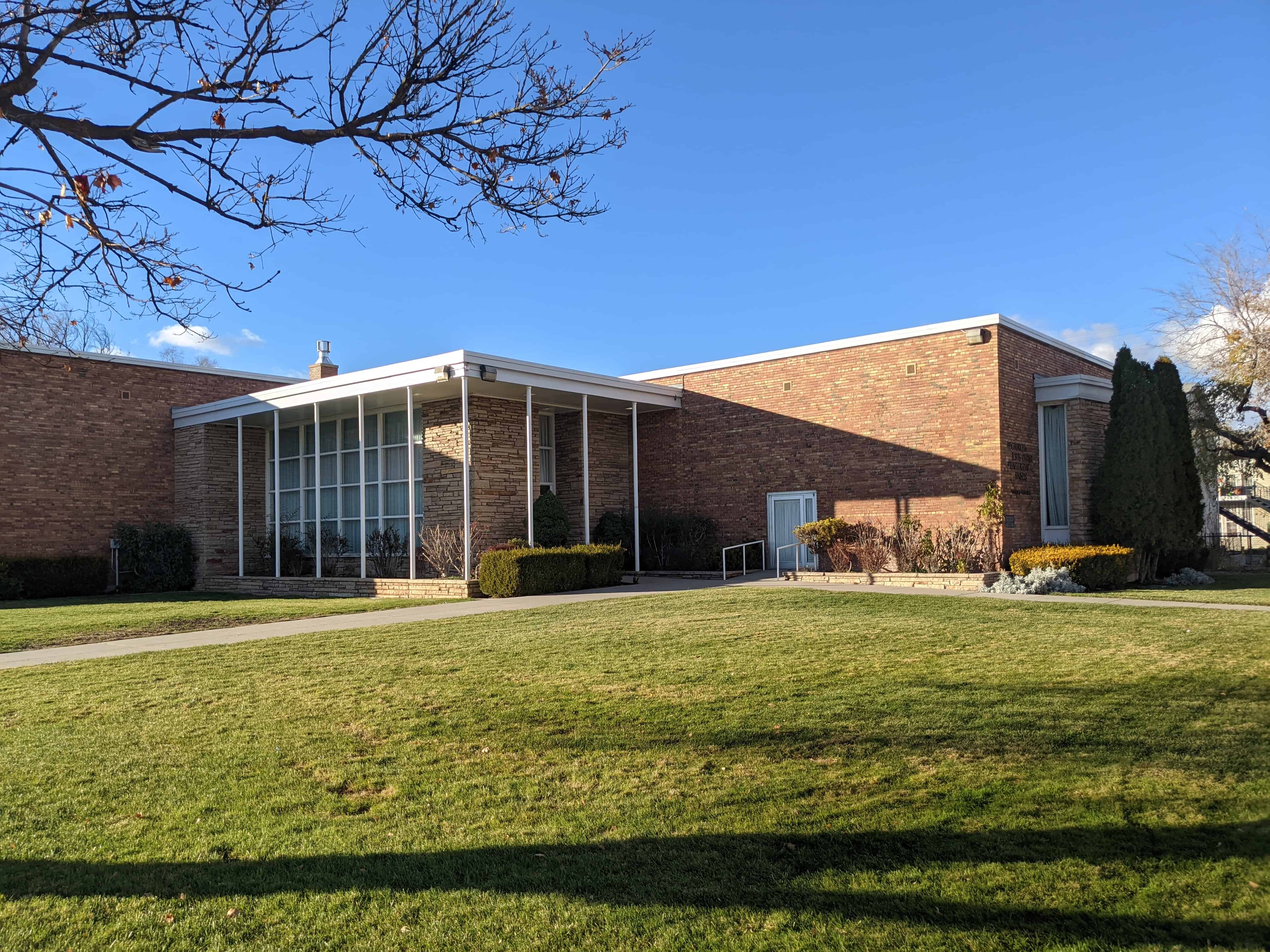
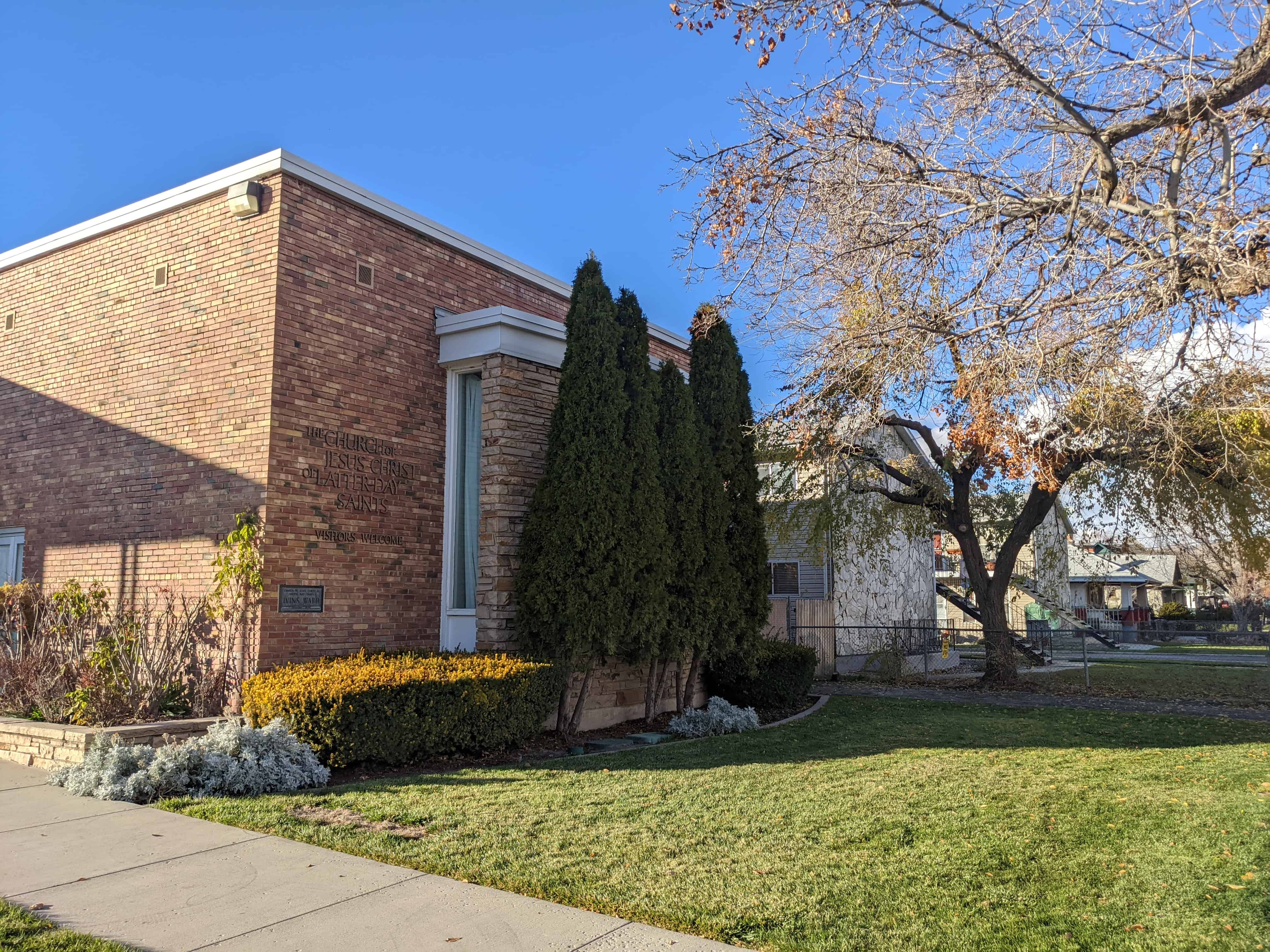
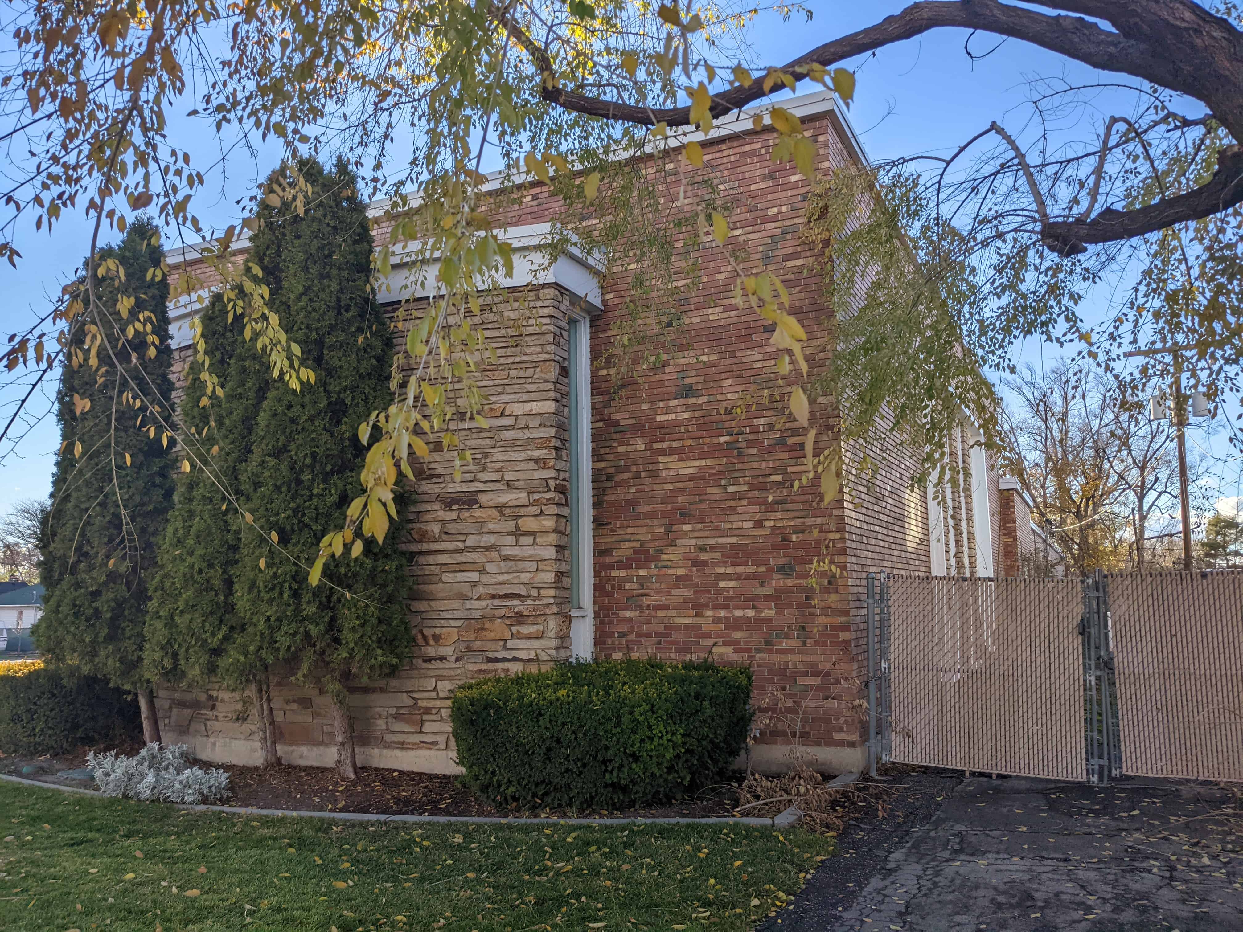
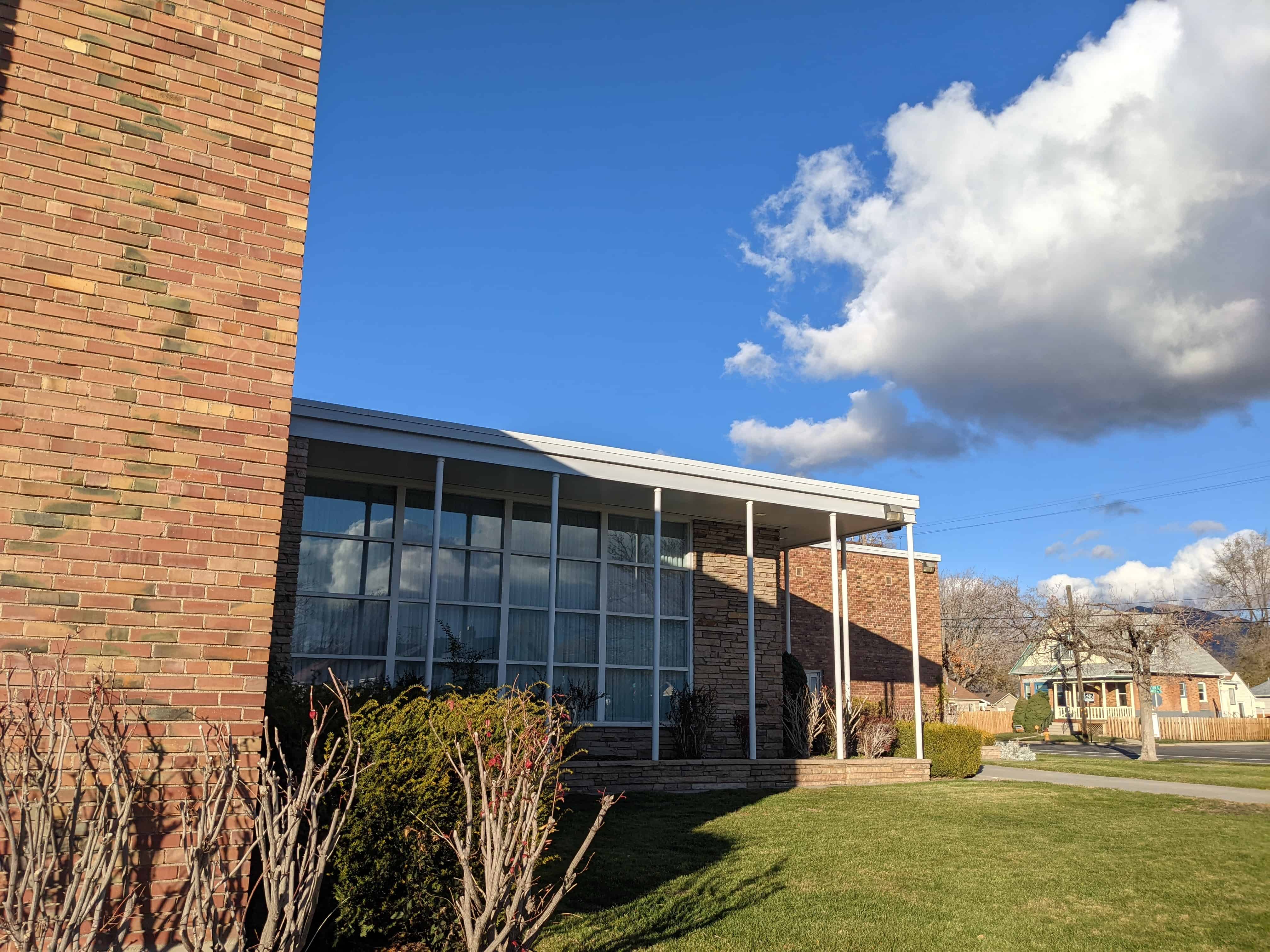
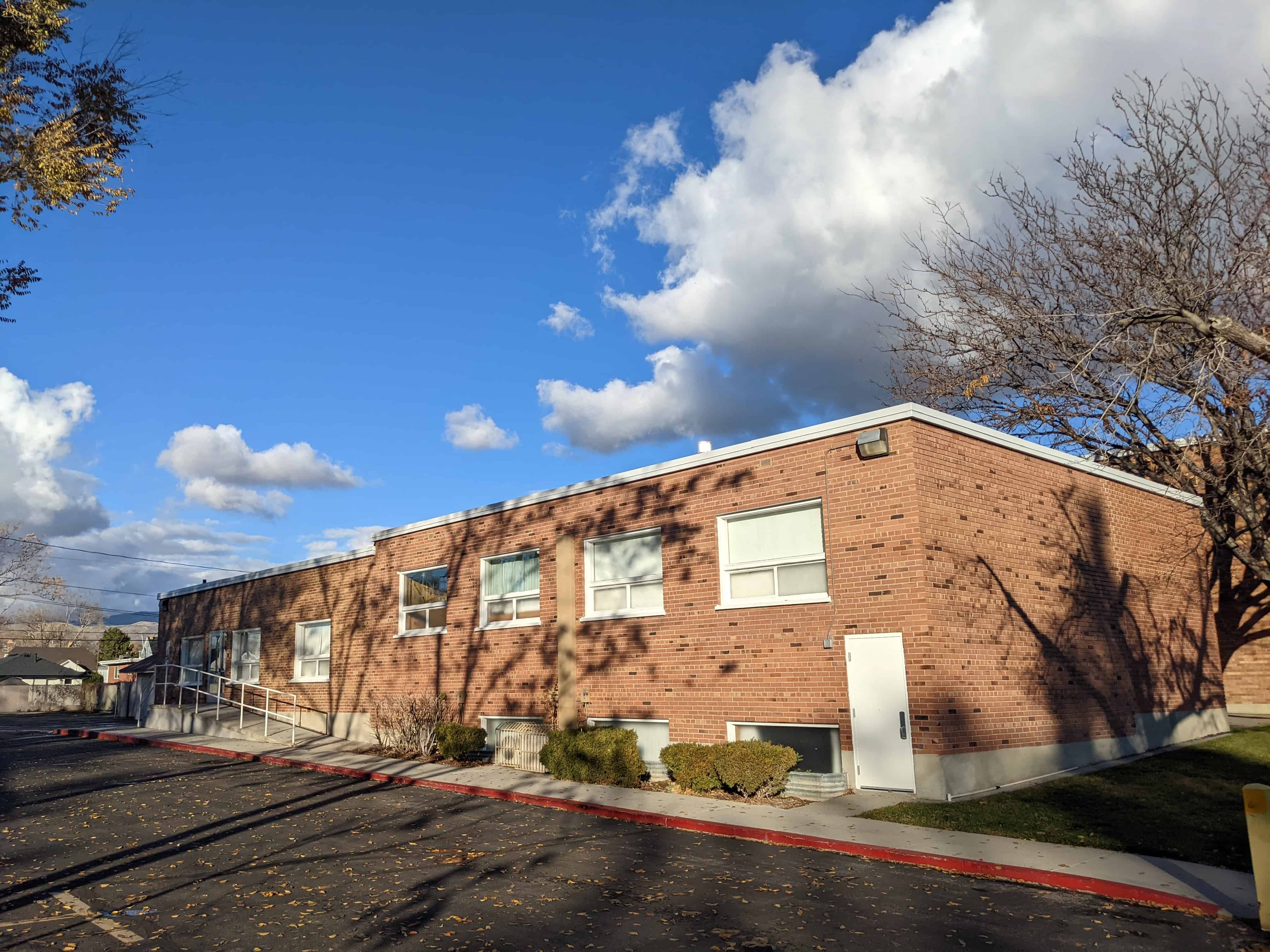
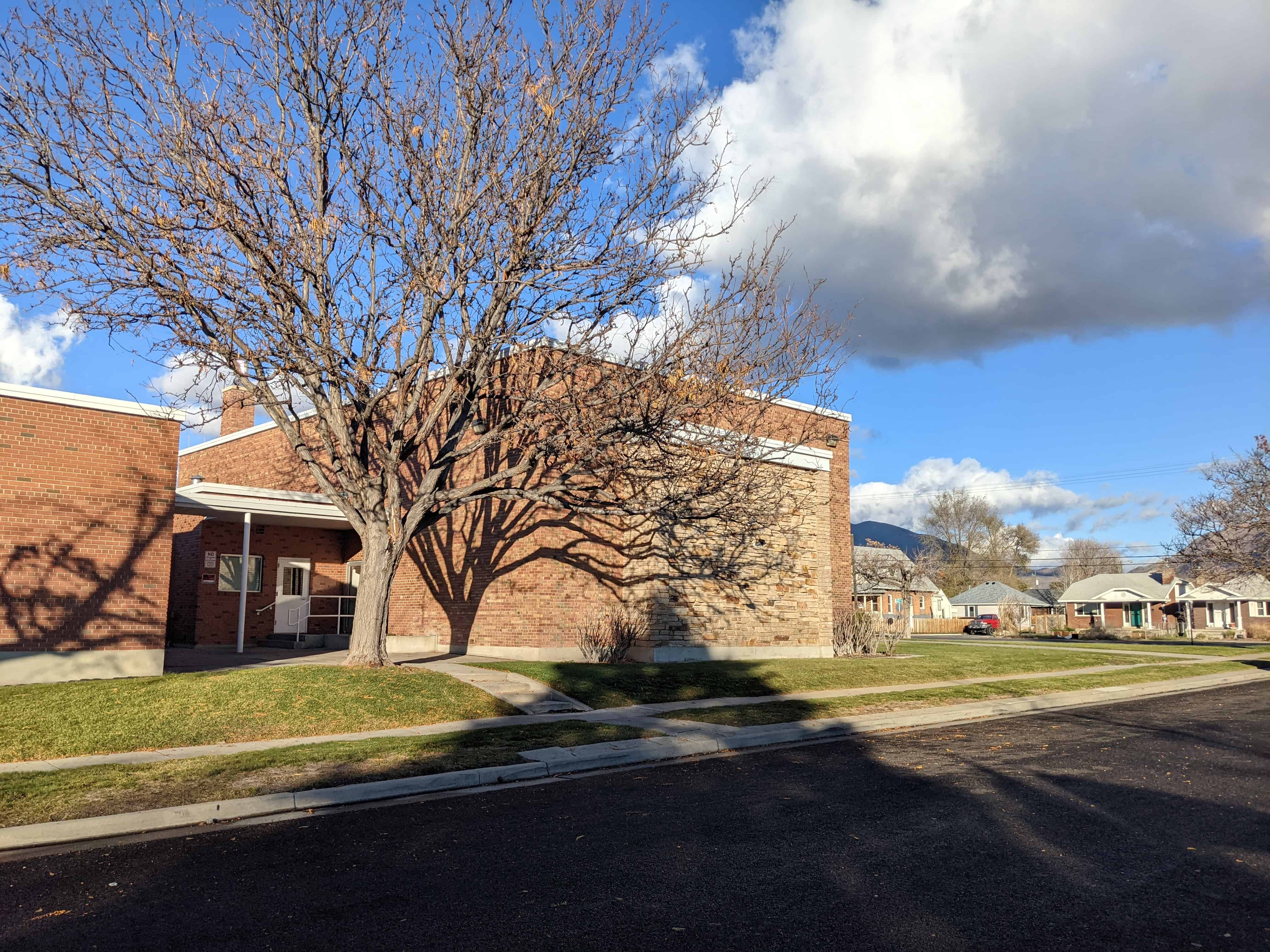
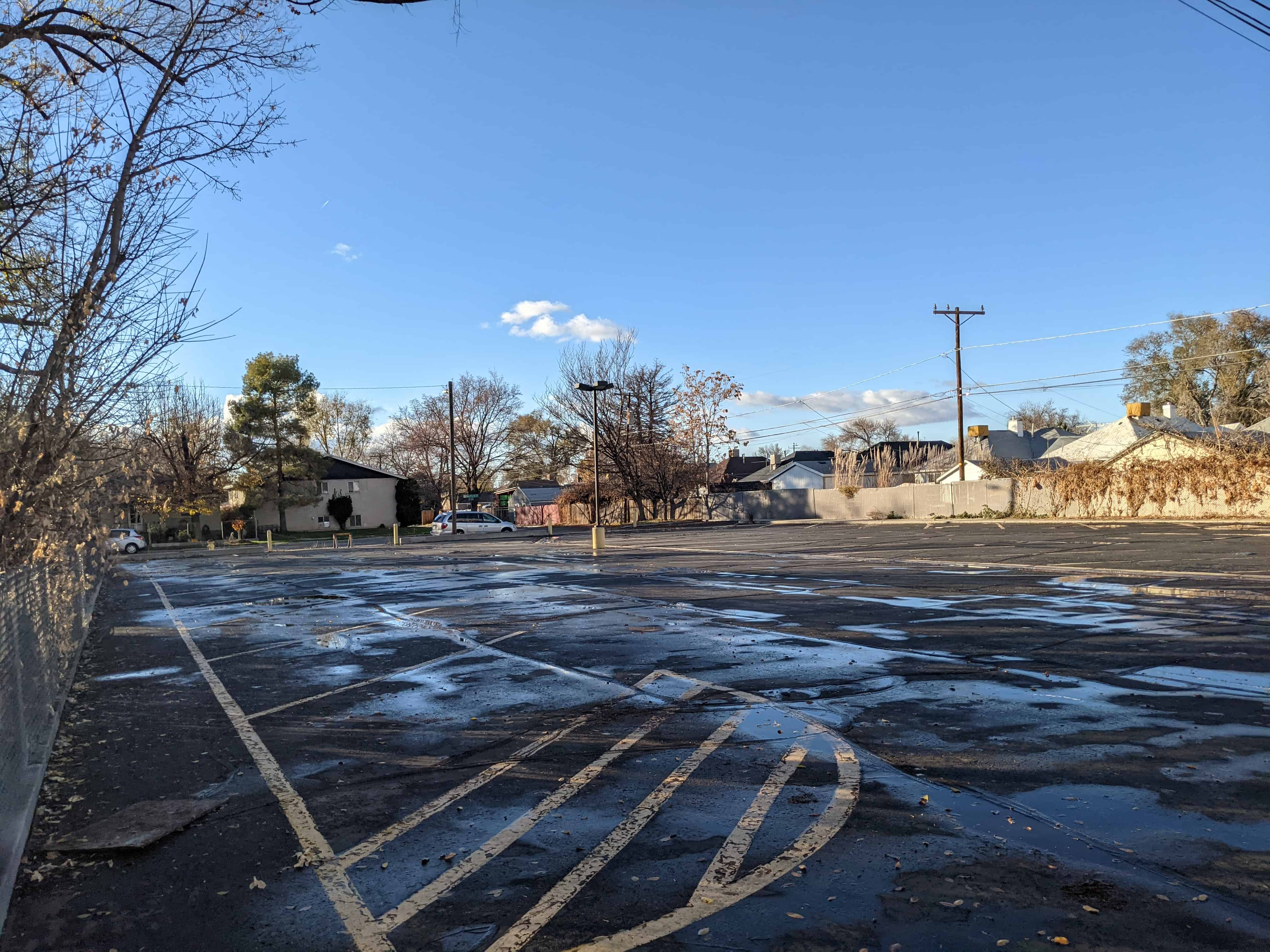
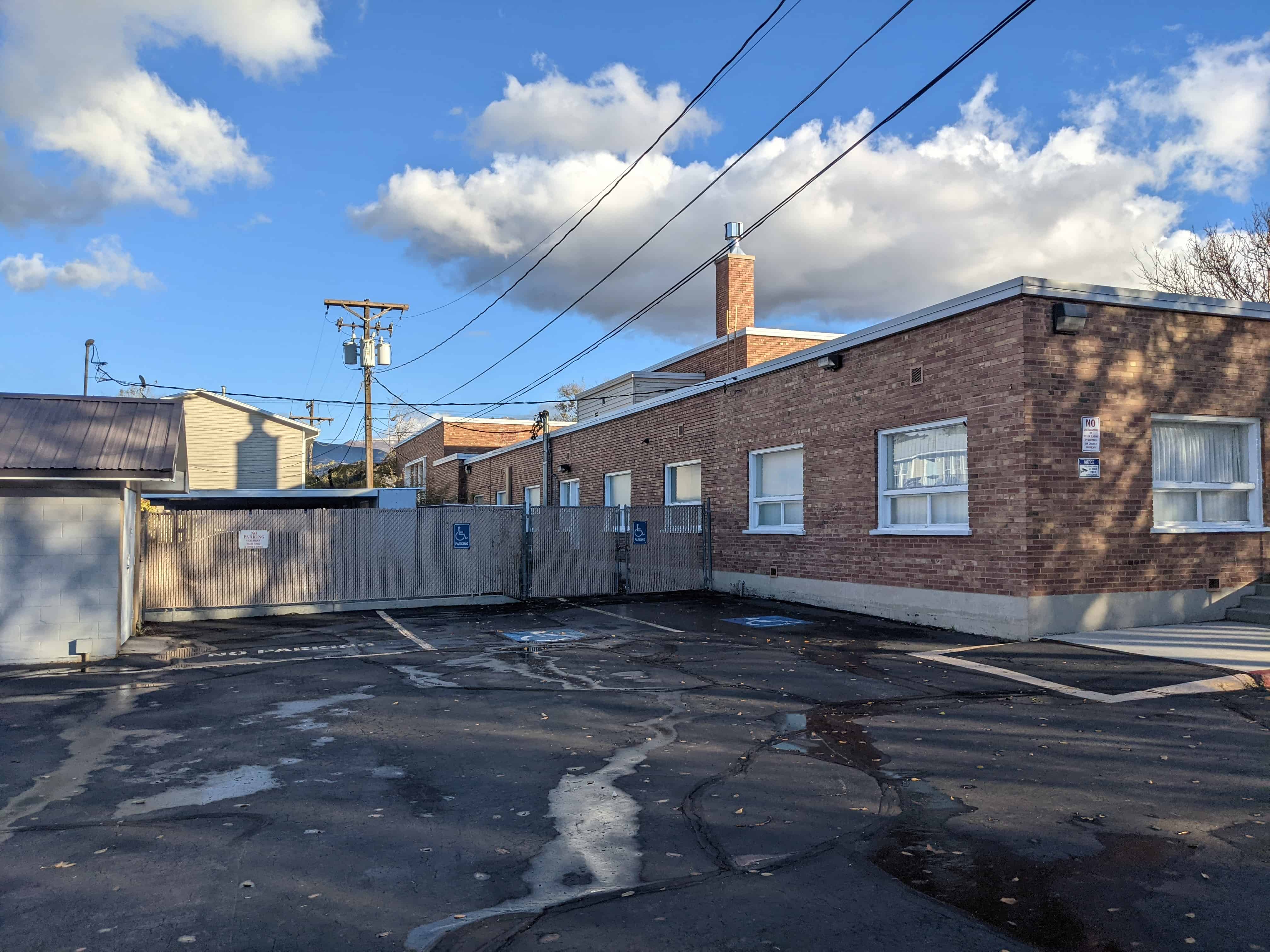
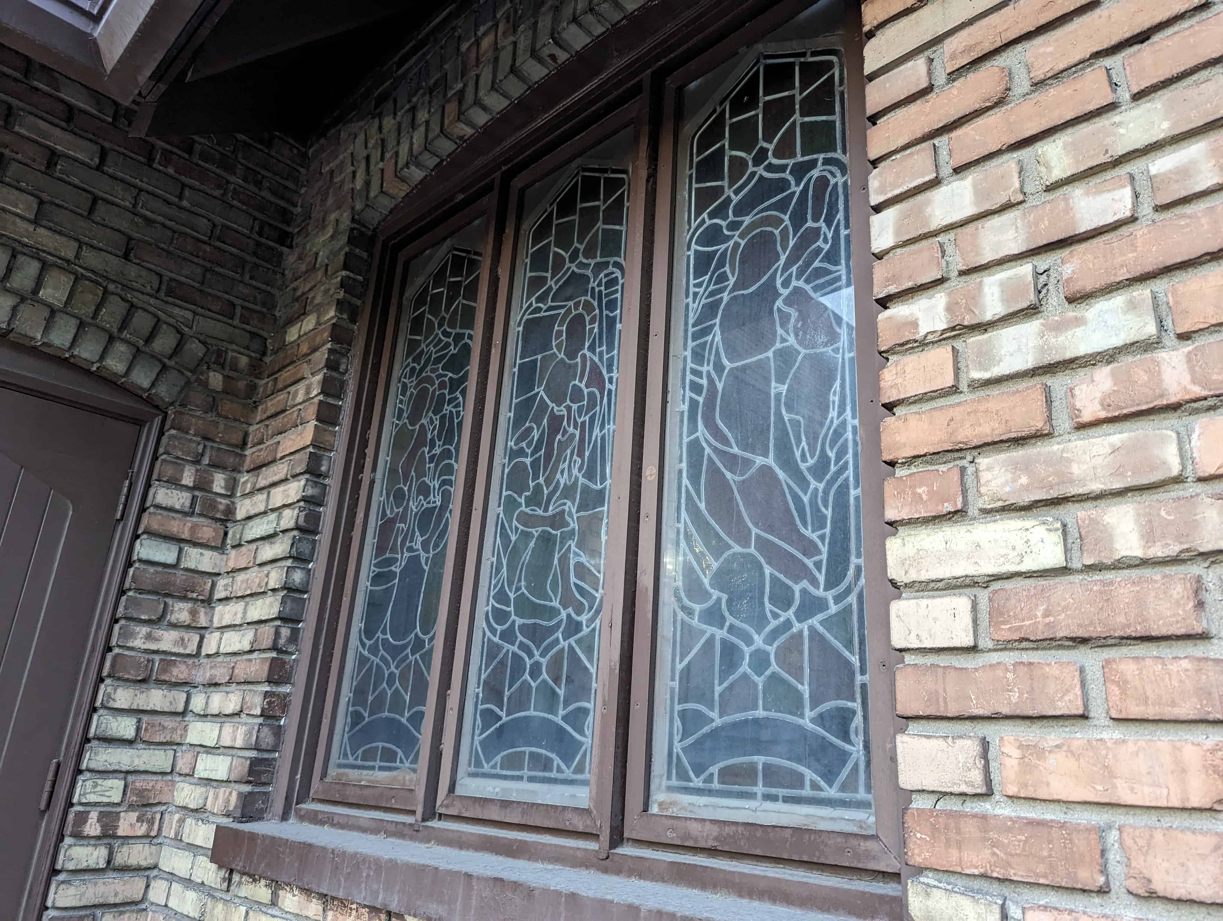
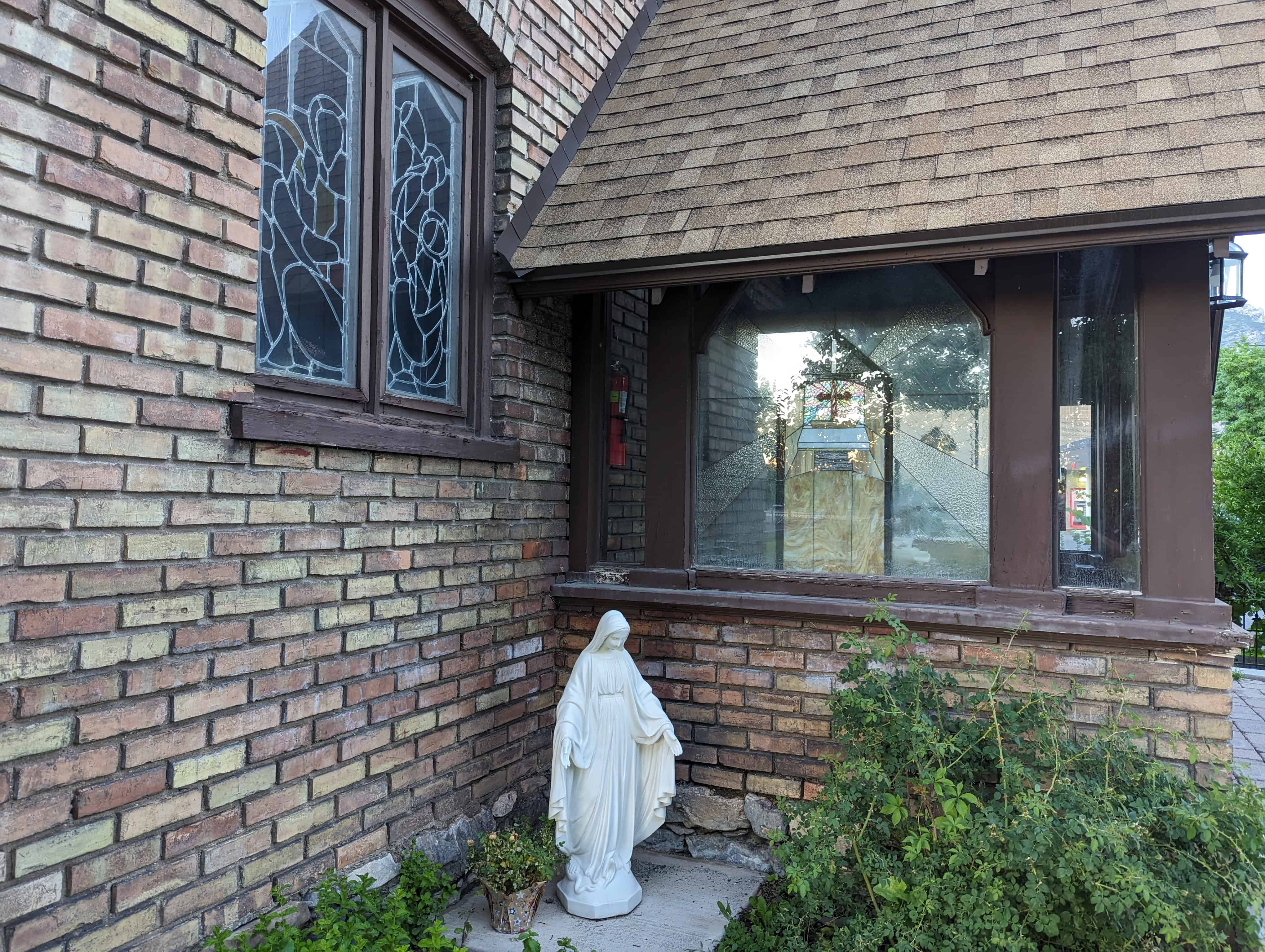
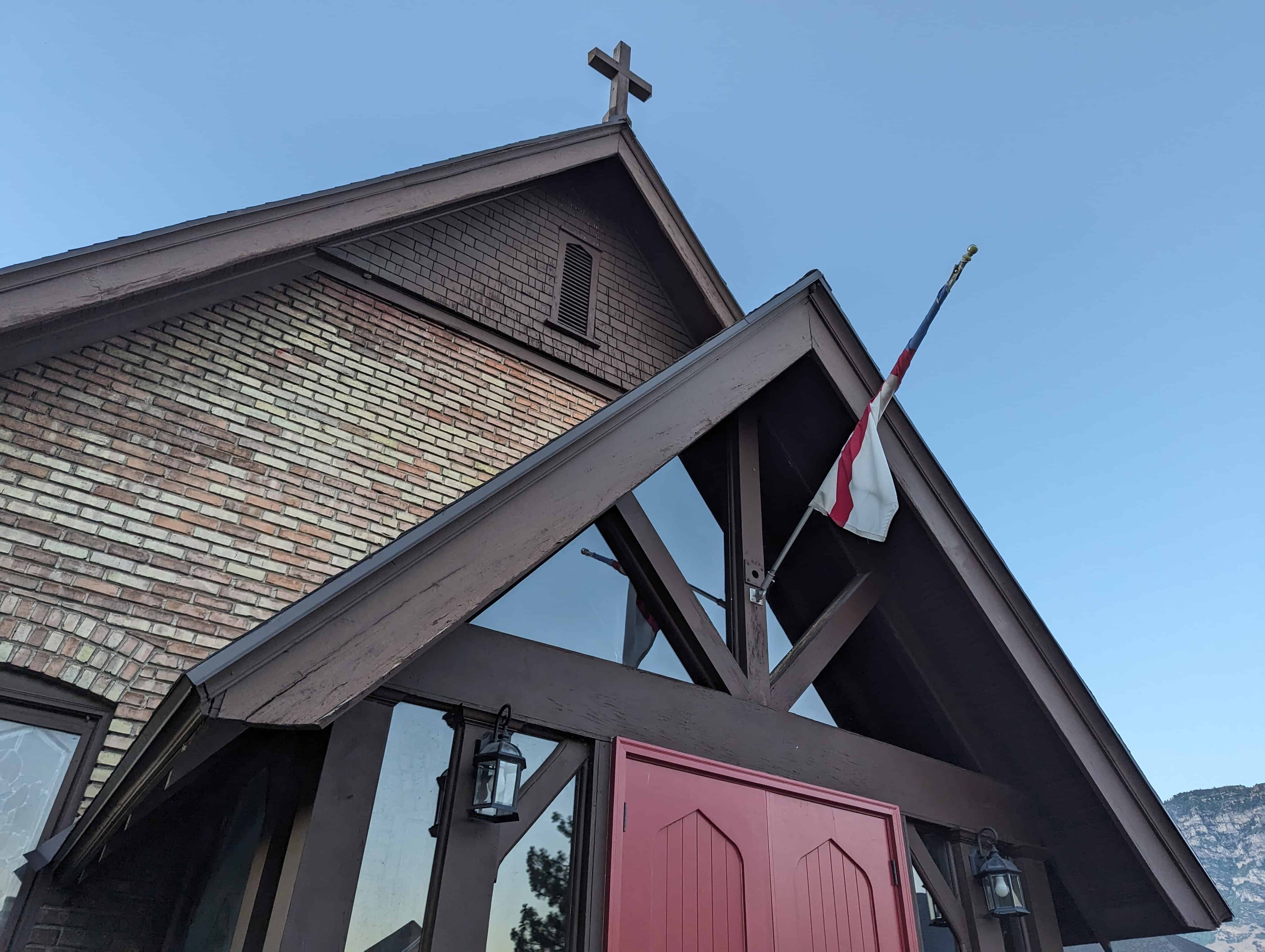
Ephraim South Ward Chapel
26 Friday Dec 2025
Posted in Uncategorized

26 Friday Dec 2025
Posted in Uncategorized
03 Friday Oct 2025
Posted in Uncategorized
Tags
Chapels, Churches, historic, Historic Chapels, Historic Churches, Jewish, NRHP, Salt Lake City, Salt Lake County, Synagogues
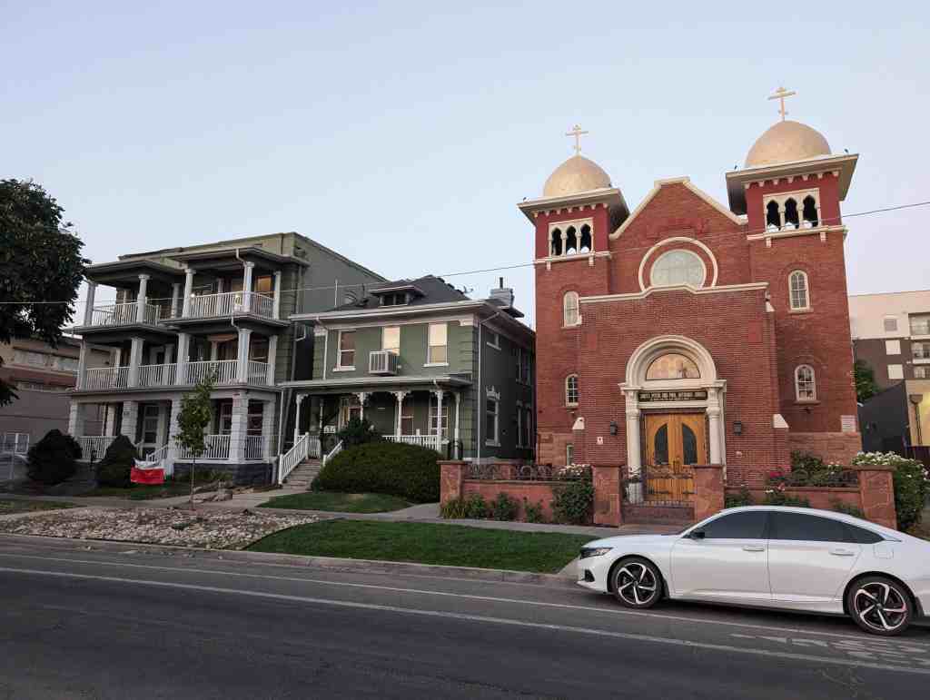
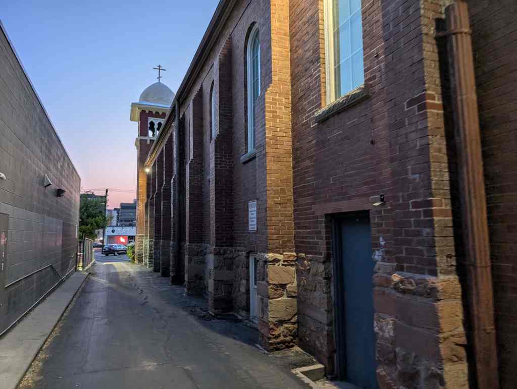
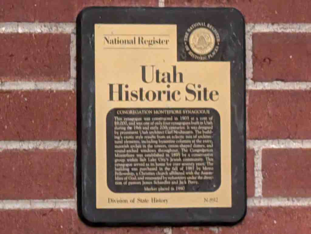
Congregation Montefiore Synagogue
This Synagogue was constructed in 1903 at a cost of $9,000, and was one of only 4 synagogues built in Utah during the 19th and early 20th centuries. It was designed by prominent Utah architect Carl Neuhausen. The building’s exotic style results from an eclectic mix of architectural elements, including Byzantine columns at the entry, Moorish arches in the towers, onion-shaped domes, and round-arched windows throughout. The Congregation Montefiore was established in 1895 by a conservative group within Salt Lake City’s Jewish community. This Synagogue served as its home for over 70 years. The building was purchased in the fall of 1987 by Metro-Fellowship, a Christian Church affiliated with Assemblies of God, and renovated by volunteers under the direction of Pastors James Schaedler and Jack Perry.
The Synagogue is located at 355 South 300 East in Salt Lake City, Utah and was added to the National Register of Historic Places (#85001395) on June 27, 1985.

Text below is from the national register’s nomination form:
The synagogue of the Congregation Montefiore is significant for its association with Utah’s conservative Jewish population. The third Jewish house of worship to be constructed in two decades, the 1903 Moorish Revival synagogue is testimony to the diversity in religious practices within Utah’s Jewish community. The conservative or ‘Modern Orthodoxy,’ as it was then known, grew in numbers as a direct result of Utah’s development from territory to statehood. As Utah became part of the nation, national trends in emigration acted towards augmenting Utah’s Jewry, particularly in the conservative fold.
Since 1884 when Issidore Morris left the congregation B’nai Israel in disagreement over the adoption of the Reform practices, tradition oriented Utah Jews have met to celebrate festivals and holidays. Usually they met in members’ homes because their numbers were too few to support a synagogue. An 1892 estimate placed the entire Utah Jewish population at 1,050, over half of which were conservatives. The conservatives appealed to the Board of B’nai Israel to use their new synagogue for traditional services to no avail. Yet, the financial situation at B’nai Israel was so desperate by 1895 – they had gone through three rabbis in three years and were then without one—that a motion to dissolve the congregation was raised. The incident is indicative of the animosity, real or imagined, which existed between the two groups. With their numbers growing as a direct result of the influx of Russian and eastern European immigrants, who were more likely than not to be traditional, the conservative population met in 1895 to incorporate as the Congregation Montefiore.
Named after the 19th Century British Jewish philanthropist, trouble shooter and financial adviser to the queen, Moses Montefiore, the congregation planned to raise another synagogue in Utah. They were given a parcel of land by their fellow congregant, Morris Levy, located on Third East between Third and Fourth South in Salt Lake City. With the cornerstone laid in August, 1903, in the presence of L.D.S. Church President Joseph F. Smith, it was largely the completed by the end of the year. The building was designed by local Salt Lake architect Carl Neuhausen and cost $9,000. The benign respect extended by Mormon authorities towards particularly Montefiore’s members was a way of thanking the Jews for Issidore Morris’ key role in securing the release from the federal penitentiary of Mormon polygamous Bishop William Smith. The congregation was financially aided by the Mormon church which gave $2,000 toward the construction of this building. Built without central heat, the basement was also unfinished. The congregation joined the United Synagogues of America National Union in 1966. Finally in 1972 the congregation voted for merger with B’nai Israel. An addition housing religious school activities was added to the rear after World War II.
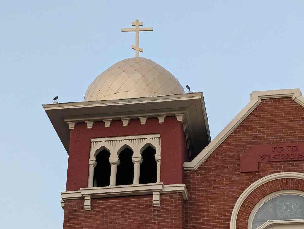
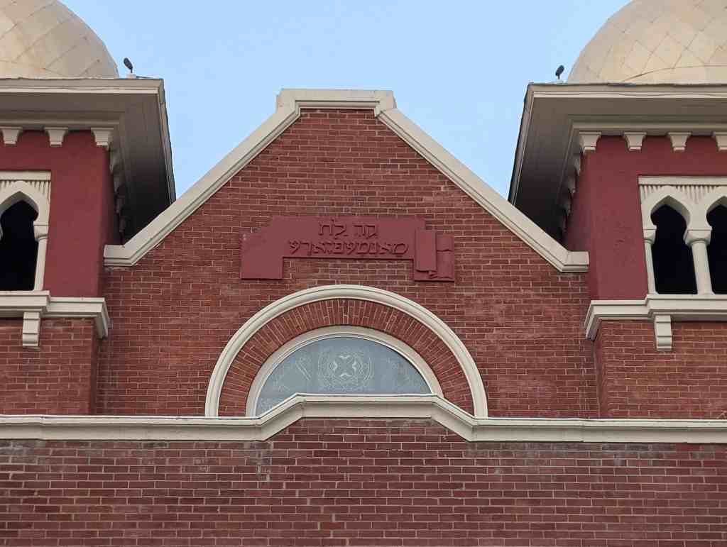
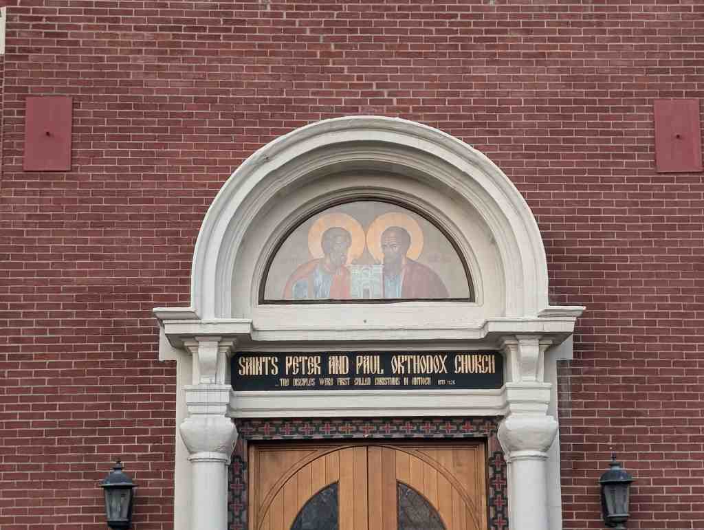
The synagogue is a long rectangular building, the primary portion of which is defined by brick gabled walls facing east and west. The north and south walls, also of brick which appear to have been painted from the start are divided into nine bays – each containing a tall round arched window – by projecting pilasters. It is not known whether the pilasters serve to brace load bearing walls or whether they conceal steel columns which in turn might be attached to steel roof trusses. At both ends of the west facade are square towers with onion shaped domes atop broad bracketed cornices below which are arcades of Assyrian arches on columns. The tower shafts are brick; their bases and the entire original building base is of rusticated Ashlar stone, to the water table. In the center of the east gable wall is a metal plaque with a raised Hebrew inscription. Below the plaque is a round window with a six-pointed star pattern. Below this is a projecting entry vestibule with a flat roof and parapet walls. The west wall of the vestibule has an elaborate entrance composed of double doors surmounted by a transom and flanked by Byzantine columns which support a projecting semi-circular pediment. The Tympanum is glass, with diagonal and horizontal divisions. The rear addition is of masonry construction, probably with a steel frame. There is a flat roof on steel bar joists. The brick is the same color as the painted brick on the original building. The brick vestibule on the facade is an early, well-matched addition.

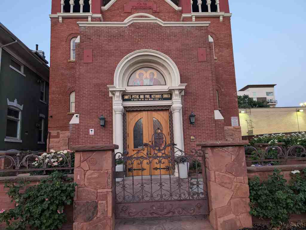
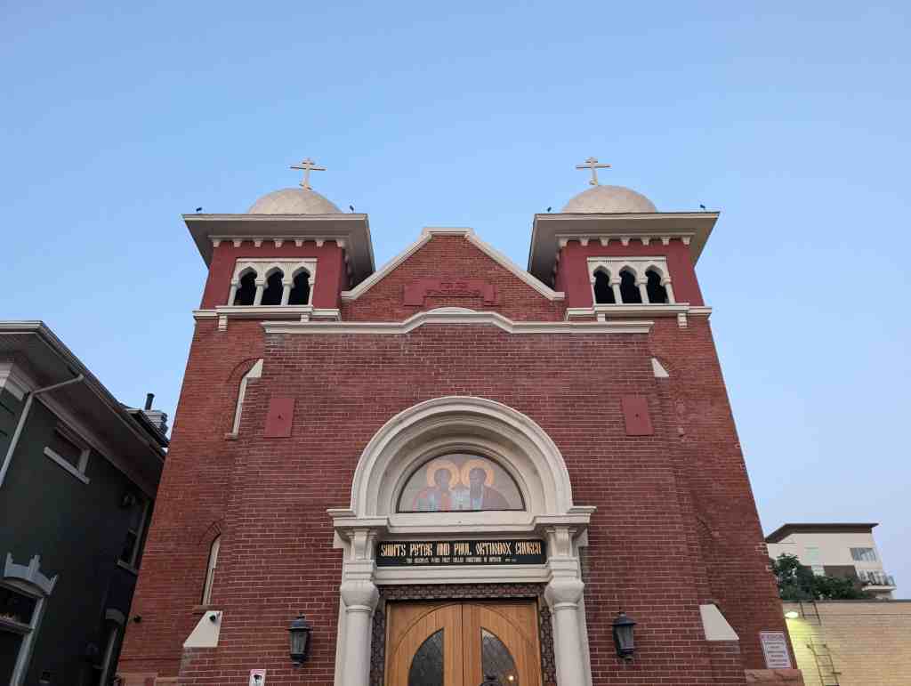
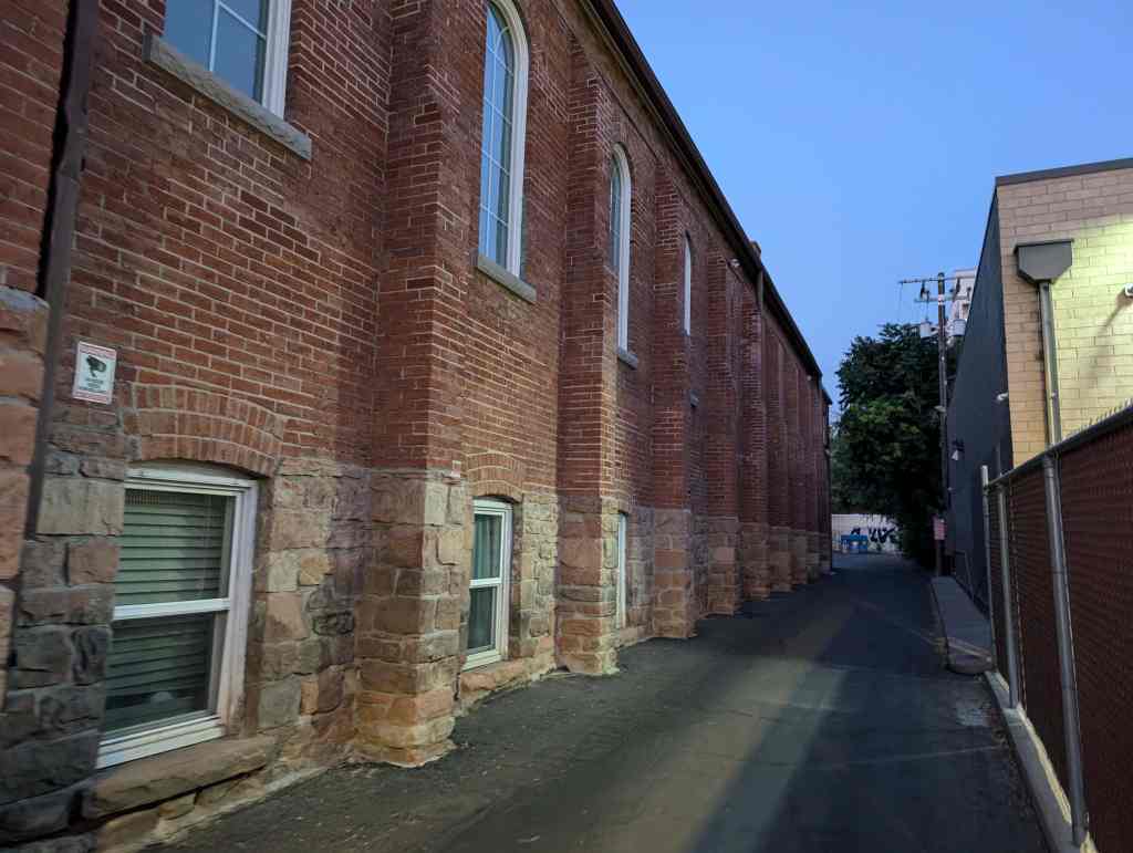
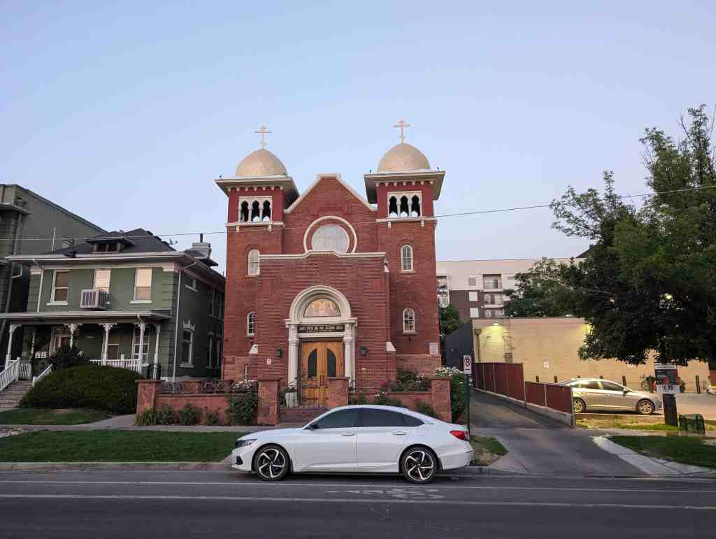
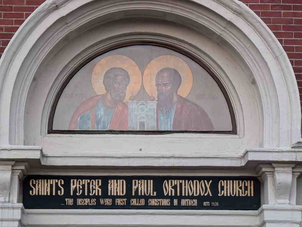
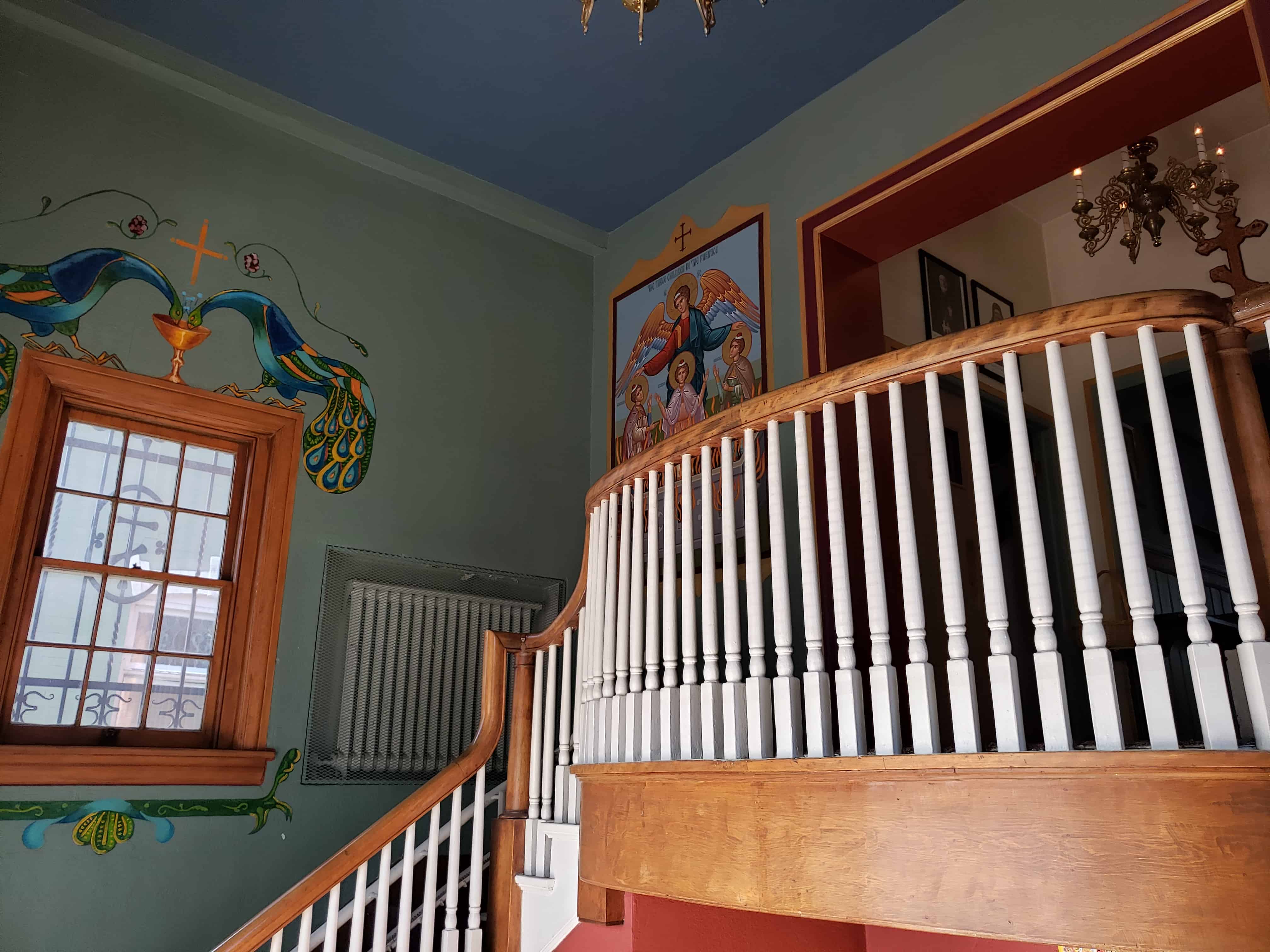
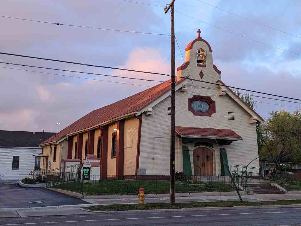
Saints Peter and Paul Orthodox Church
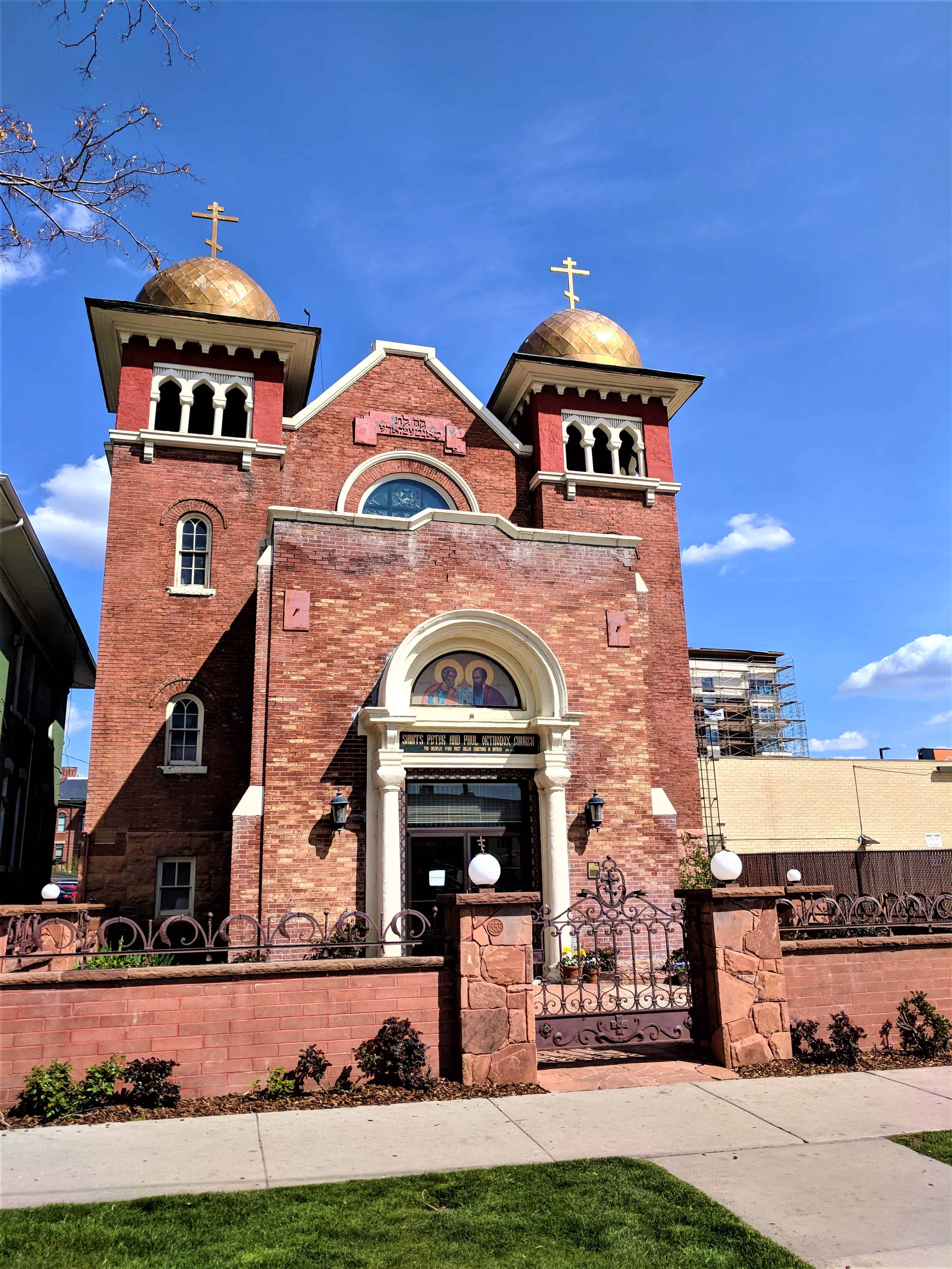
Saints Peter and Paul Orthodox Church
For other Historic Churches in Salt Lake City visit this page.


28 Tuesday Jan 2025
Posted in Uncategorized
Tags
Brick American Gothic Revival Ecclesiastical, Chapels, Colorado, Historic Churches, Idaho Springs, Methodist, NRHP
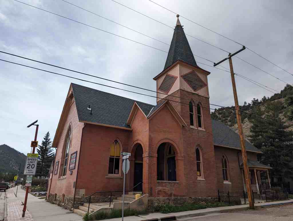
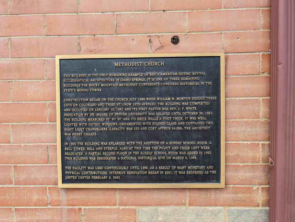
Methodist Church
This building is the only remaining example of Brick American Gothic Revival Ecclesiastical Architecture in Idaho Springs. It is one of three remaining buildings the Rocky Mountain Methodist Conference considers historical in the state’s mining towns.
Construction began on the church July 1880 when William H. Morton deeded three lots on Colorado and Third St. (now 15th Avenue). The building was completed and occupied on January 16, 1881 and its first Pastor was Rev. J. F. White. Dedication by Dr. Moore of Denver University was delayed until October 30, 1881. The building measured 52′ by 32′ and its brick walls a foot thick. It was well lighted with Gothic windows, ornamented with stained glass and contained two eight light chandeliers. Capacity was 220 and cost approx $4,000. The architect was henry Choate.
In 1905 the building was enlarged with the addition of a Sunday School room, a bell tower, bell and steeple. Also at this time the pulpit and choir loft were relocated. A partial second floor in the Sunday School room was added in 1965. This building was designated a National Historical site on March 5, 1998.
The facility was used continuously until 1990. As a result of many monetary and physical contributions, intensive renovation began in 2001; it was reopened as the United Center February 8, 2003.
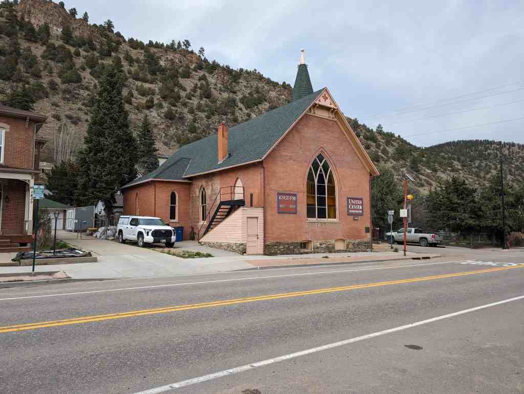
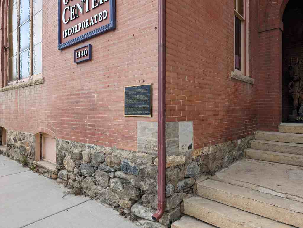
1440 Colorado Boulevard Idaho Springs, Colorado


10 Sunday Nov 2024
Posted in Uncategorized
Tags
25 Monday Dec 2023
Posted in Uncategorized
Tags

731 East Center Street in Lindon, Utah
01 Friday Dec 2023
Posted in Uncategorized
Tags
30 Sunday Jul 2023
Posted in Uncategorized

Saint Mary’s Episcopal Church
Built in 1907 and located at 50 West 200 North in Provo, Utah
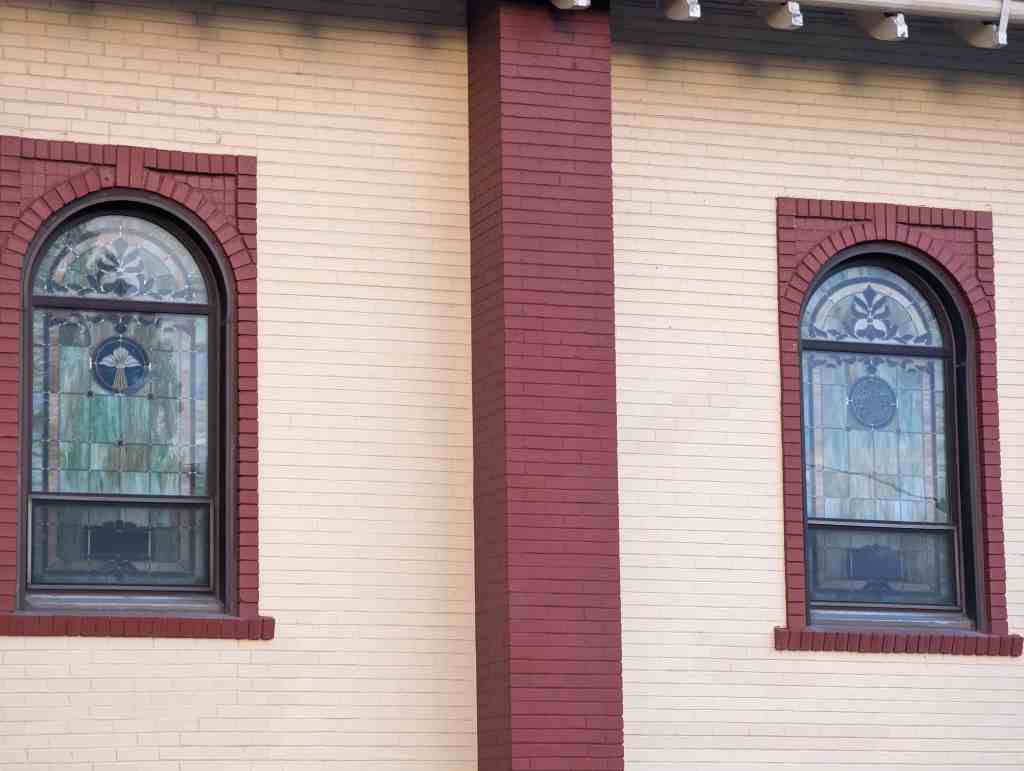
In 1907, the property where St. Mary’s is now located, was purchased and under the direction of Rev. George Townsend the present building was erected. The story is told that Father Townsend drove to the brickyard with his horse and wagon once a week and was given the imperfect bricks, those with corners chipped off, cracked, or rejected for any other reason. The cracks, chipped corners, difference in colors, which add to the beauty of the church, the story is very believable. The corner stone was put in place and the church formally consecrated by Bishop Tuttle, the Third Missionary Bishop of Utah on September 12, 1907. The Rev. Townsend was the Vicar with a congregation consisting of 11 communicants and 18 children in the Sunday school. St. Mary’s started to grow and over the succeeding years several different Priests served as Vicar. By 1920 the size of the congregation had more than tripled. In 1937 the Rev. John Howes came to St. Mary’s. He is especially remembered, for it was during his stay that the ordinary glass windows in the church were replaced with beautiful stained glass windows. These windows are some of the most outstanding and beautiful stained glass in Utah County.


21 Wednesday Jun 2023
Posted in Uncategorized

1058 West 400 South in the Poplar Grove neighborhood in Salt Lake City, Utah
(technically on the parcel of 340 South Goshen Street)


12 Wednesday Apr 2023
Posted in Uncategorized
Tags
Chapels, Churches, Episcopal, Episcopalian, Historic Churches, NRHP, Uintah County, utah, Vernal

St. Paul’s Episcopal Church
Built in 1901, St. Paul’s Episcopal Church was the first building constructed in Vernal by the Episcopal Church and the second to be built in the Uintah Basin; the first was the Indian Mission church at Randlett. Designed by John P. Hill, an architect from Salt Lake City, the building is a good example of the Gothic Revival style. St. Paul’s Lodge was constructed in 1909 as a home for girls who came to Vernal to work or attend school. It also served as the center of the auxiliary activities of the Episcopal Church in the community and, from the late 1920s until 1947, as the major hospital in the Uintah Basin. During the past forty years it has continued in use as the center of church and community activities.
Located at 226 West Main Street in Vernal, Utah and added to the National Historic Register (#85000049) on January 3, 1985.

St. Paul’s Episcopal Church, built in 1901, and St. Paul’s Lodge, built in 1909, are significant for their historical role as the center of the Episcopal church activities both in Vernal and in the entire Uintah Basin of northeastern Utah. Both buildings are also architecturally significant. St. Paul’s was the first building constructed by the Episcopal Church in Vernal, a predominantly Mormon town, and the second church con- structed by the Episcopal church in the Uintah Basin; the first was the Indian Mission church at Randlett, which has been moved from its original location in recent years. St. Paul’s is second only to the church at Randlett as the oldest church building of any denomination in the Uintah Basin. The building documents the spirit of expansion and missionary activity that characterized the Episcopal church in Utah at that time. Architecturally, it is significant as a good example of the Gothic Revival style. St. Paul’s Lodge, which was constructed as a home for girls who came to Vernal to work or attend school, is significant for its central role in the auxiliary activities of the Epsicopal Church in the community. The building also served as one of the early hospitals in the Uintah Basin and was the major hospital in the area between
the late 1920s and 1947. It is architecturally significant as a good example of the Craftsman style.

The Reverend O. E. Ostenson arrived in Vernal on September 20, 1900 to begin the work which would lead to the building of St. Paul’s. Regular services began on September 30, 1900 in Jake Workman’s Opera House, but were moved on October 22 to the Odd Fellows Lodge room. The first church committee was appointed by the missionary, Reverend Ostenson, on April 23, 1901.
Property was purchased by the Corporation of the Episcopal Church in Utah for $325 on the H7th of February, 1901 for construction of the church in Vernal. On May 16 of the same year, plans for the building had been completed by Salt Lake architect John P. Hill. Very little is known about Hill or his career in Utah. The church committee let the brick and stone work contract to Andrew Burkley and the carpentry work to William Cook on July 18, 1901. Ground was broken for the church on July 26. Three weeks later on August 20 the Rev. Ostenson, assisted by Indian missionary M.J. Hersey of Randlett, laid the cornerstone for the new church. With the permission of the rector, Miss Anna Forrest named the church that same day. It was named St. Paul’s after St. Paul’s Church in Washington, D.C.
Another building on the site is the parish house. Built in 1909, it was originally called St. Paul’s Lodge and was built by the Girl’s Friendly Society of New York as a home for girls who came to Vernal to attend school or to work. It also served as a center for civic activities and club meetings. In 1928, St. Paul’s church was closed because of inactivity. Four years later the lodge was sold and served for the next several years as the major hospital in Uintah County. Dr. Parley G. Eskelson ran the hospital, and even built his own house next door so that he would always be nearby. At the time that the building was converted into a hospital, its interior was renovated and remodeled in order to meet the needs of a medical care facility. The building had previously been used temporarily as a hospital during the flu epidemic of 1918, and was reportedly used again for a short time in the late 1920s under the direction of Mrs. Jane Murray.
St. Paul’s was reactivated in January of 1947 when Rev. Walter F. Cable was sent to be Deacon-in-charge by the Bishop of Utah. Two years later the lodge was repurchased by the church and has since served as the parish house with apartments for the vicar and meeting rooms for the church. The church building itself has continually remained in the hands of the Episcopal Church.
St. Paul’s Church is the second oldest religious structure still standing in the Uintah Basin. An Indian mission church of the Episcopal Church was built in Randlett in 1896, but it has been moved from its original location. St. Paul’s was completed prior to any of the existing religious buildings in the Vernal area – including LDS structures. The relatively late construction dates of church buildings in Vernal can be attributed to the fact that permanent settlers were not established in Vernal until after 1870.

St. Paul’s Episcopal Church is a small town parish church designed in the Gothic Revival style. It is a rectangular building and has a steeply pitched gable roof, brick exterior walls, and sandstone sills, foundation, and water tables. A large, pointed arch window is centered in the gable end wall facing the street, and it features ornate stained glass and wooden tracery elements. Two brick buttresses flank the stained glass window. The buttresses are decorative and are not repeated on the rear of the building, which has wood shingle siding instead of brick exterior walls. There are five buttresses along each side of the building which appear to be structurally supporting the roof trusses that are exposed on the interior. Pointed-arch, stained glass windows are evenly spaced on the sides of the building between the buttresses.
Alterations to the building are minor and do not detract significantly from the original integrity of the building. A small, concrete block addition was built on the rear of the church (n.d.), but it is not visible from the front or public views. The original wood shingles on the roof were replaced by asphalt shingles a number of years ago. On the interior, carpet has been added in the center aisle and in the altar area, and an entry cubical has also been added (n.d.). In recent years, in order to protect the stained glass windows on the building, sheets of transparent, hard plastic have been fitted into the window openings on the outside of the stained glass.
St. Paul’s is an excellent example of a small Gothic Revival church building. Elements which distinguish the church as a Gothic Revival building are the steeply pitched gable roof, the buttresses, and the pointed arch stained glass window with tracery and colored glass. It is probably the best example of the Greek Revival style in both the city of Vernal and the Uintah Basin.
St. Paul’s Lodge is a two-story, brick Craftsman style house with a gable roof and a full-width, one-story front porch. Elements of the Craftsman style include the broad gable roof, the half timbering in the upper portion of the gable end, and the exposed rafters and purlins, and the exposed woodwork in the gables of the wall dormers and porch on the west side of the building. The four symmetrically spaced windows on the upper story of the façade have pointed relieving arches. There is a bay window on the west side of the building. The foundation is constructed of coursed sandstone. There is a one-story gabled section on the rear of the building, which, judging from its appearance and materials, was probably built at the same time as the main portion of the house.
Alterations that have been made on the exterior of the house are minor and do not significantly detract from its original appearance. The exterior brick walls have been painted (n.d.), and the openings on the front porch have been filled in with windows (n.d.). The interior of the house was altered somewhat when the building was converted into a hospital.
Houses designed in the Craftsman style in Utah are quite limited, based on the results of the partially completed state survey of historical and architectural sites. The Craftsman influence, however, was profound, especially in the first two decades of the twentieth century. Broad gable roofs, exposed rafters and half timbering are the most prevalent evidence of the Craftsman influence and occur on bungalows in most Utah towns. Even though St. Paul’s Lodge is not a premier example of the style in the state, it is significant as one of the few houses that were specifically designed in the Craftsman style.

31 Friday Mar 2023
Posted in Uncategorized

Located at 1990 South 500 East in Salt Lake City, Utah
Designed by Rutherford & Ashton and built in 1926 (the Amusement Hall portion was built in 1920.)