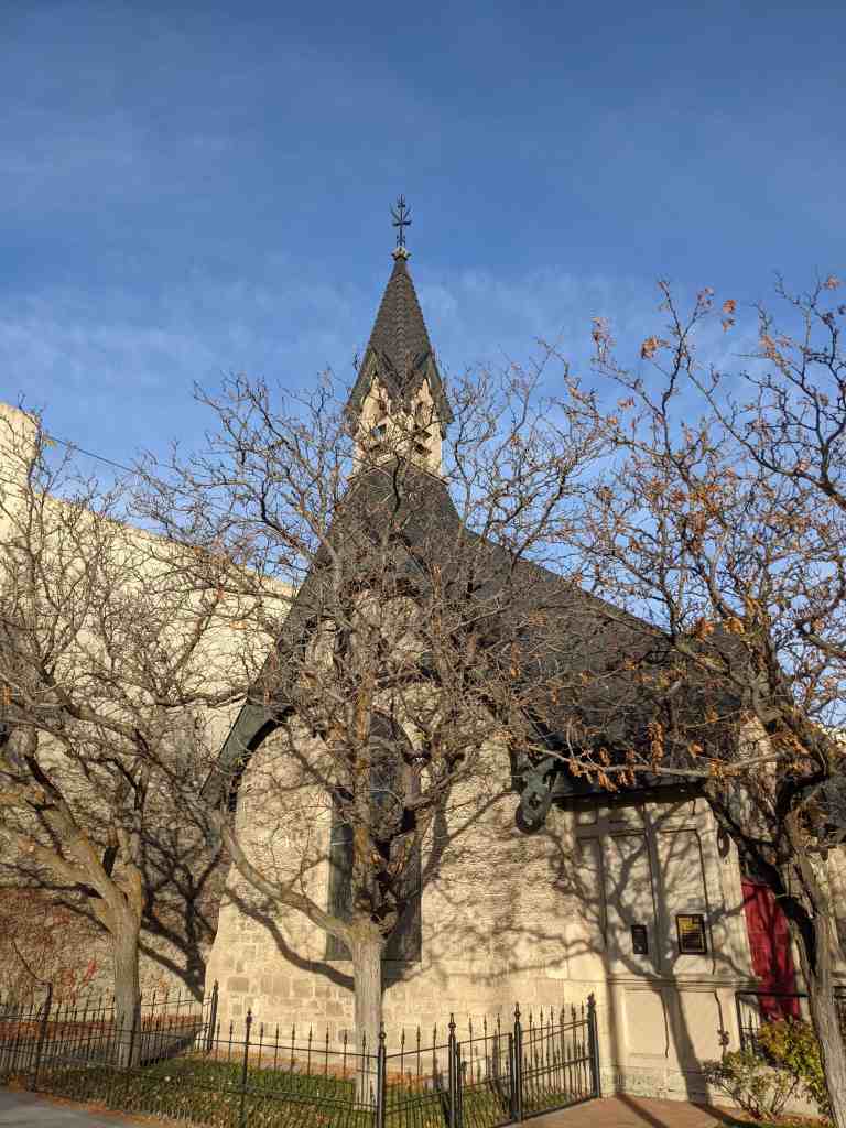
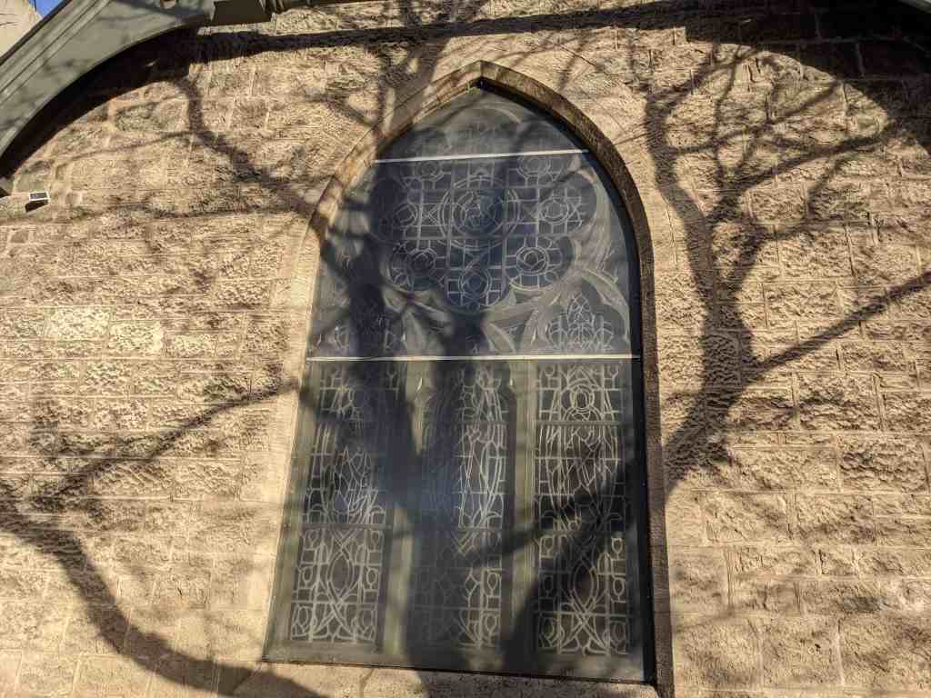
The Episcopal Church of the Good Shepherd is an example of “Carpenter Gothic” style of architecture. Some of the buildings defining features are the stained glass contained in the Tudor windows, the bell tower which contains the first church bell ever to be rung in Ogden, and the wrought iron fence across the front of the courtyard.
The Episcopal Church was the first Protestant religion to locate in Utah. Bishop Daniel Tuttle arrived in Utah in 1867. Three years later, in 1870, Reverend James Lee Gillogly was sent to Ogden as a resident missionary. In 1874, Bishop Tuttle obtained a $4,000 donation from John W. Hammersly of New York for the erection of a church in Ogden in memory of his daughter, Mrs. Catherine L. Livingstone.
The cornerstone was laid April 29, 1874 and the building was consecrated on February 6, 1875. It stands today as a reminder of the pioneering work of the early Episcopalians in the west.
Located at 2374 Grant Avenue in Ogden, Utah and added to the National Historic Register (#73001864) on April 3, 1973.
Twenty years after the arrival of the first Mormons in Utah other religious groups began to make inroads into the Mormon Zion, The first Protestant group to set up a permanent organization in Utah was the Episcopal Church. The Episcopalians did not come West with the express purpose of making converts of the Mormons but rather to find its members and offer services to them.
Brigham Young said that he did not expect any “abuse and detraction from an Episcopal bishop. They are men of education and better sense; they are gentlemen, and any gentleman is welcome here, no matter what his creed.” (Daniel Sylvester Tuttle, Reminiscences of a Missionary Bishop, p. 59-60)
Bishop Daniel Tuttle arrived in Utah in 1867, Three years later, in 1870, Reverend James Lee Gillogly was sent to Ogden as a resident missionary. Church services were first held in the passenger room of the Ogden train station. That same year an old building which had been used as a saloon was secured for church and educational purposes.
In 1874 Bishop Tuttle obtained a $4000 donation from John W. Hammersley of New York for the erection of a church in Ogden in memory of his daughter, Mrs. Catherine L, Livingstone, The designs for the church were provided by Gordon W. Lloyd of Detroit, Michigan.
The cornerstone was laid April 29, 1874 and on February 6, 1875 the church was consecrated. The total cost was near $11,000 and Mr. Hammers ley willingly provided the extra money.
From the time of his arrival Mr. Gillogly assumed an attitude of strong and square opposition to the Mormons, As a result antagonisms did develop between the two churches. In this sense the Church of The Good Shepherd serves as a reminder of that conflict, but even more so it stands as a monument to the pioneering work of the early Episcopalians in the West.
Church of the Good Shepherd (Episcopal)
Congregation established 1870. Cornerstone laid April 29, 1874 by Bishop Daniel S. Tuttle. Consecrated February 6, 1875. Funds donated by John W. Hammersley of New York.
Dedicated to the Glory of God Tuttle Hall In memory of The Rt. Rev. Daniel Sylvester Tuttle First Bishop of Utah
This Classical Revival structure was built by Joseph Don Carlos Young, noted LDS Church architect, in 1921. Andrew Hansen, a local farmer and builder, supervised the construction. The cost of the chapel was $20,000. It was dedicated December 11, 1927, by LDS Apostle George Albert Smith.
The Sandy Second Ward Chapel was built during a time of emphasis on multiple-use buildings and architectural experimentation. The building combines a large chapel area, classrooms, and recreation space. The building was converted to a Baptist church in 1962 and is still being used for religious worship. It retains its historic integrity and remains in excellent condition.
Located at 8630 South 60 East in Sandy, Utah and added to the National Historic Register (#97000638) on July 9, 1997
The Sandy Second Ward Chapel, built in 1921, is being nominated under two contexts: 1) Mormon Meetinghouses and Tabernacles in Utah, 1847-1936; and (2) Historic Resources of Sandy City: Specialized Agriculture, Small Business and Community Development Period, 1906-1946. The Classical Revival structure combines a large chapel area, classrooms, and recreation space. The chapel represents the third phase of Mormon (LDS) meetinghouse building during which there was an emphasis on multiple-use buildings and architectural experimentation. The architect, Joseph Don Carlos Young, was serving as the official LDS Church architect at the time he designed this building. The chapel is of local significance as the only surviving historic LDS chapel in Sandy. The building was converted to a Baptist church in 1962 and is still being used for religious worship. The chapel retains its historic integrity and remains in excellent historic condition.
The Sandy Second Ward Chapel is located near State Street, northwest of Sandy’s historic downtown. The area was originally collection of small farms. The property was purchased from LeGrande Young by Josephine Jensen in October 1893. She sold it five months later to M.L. Freed. The taxes were not paid so it was taken over by the county until sometime before 1921 when Morinda Lundberg, a postmistress in Sandy redeemed it and donated it to the Sandy Second Ward.
At the turn of the century, the congregation of Church of Jesus Christ of Latter-day Saints (LDS or Mormon) church members had only one meetinghouse, a gothic revival style structure completed in 1897. As the town’s LDS population grew, mostly due to the number of second generation church members, it became necessary to divide the congregation. On January 1, 1921, church officials decided to create the Sandy Second and Third Wards. The First Ward continued to meet in the 1897 meetinghouse, and the Second Ward began to hold their meetings in the local school.
The Second Ward began almost immediately to build their own meetinghouse. The cost of the structure was $20,000. The architect was Joseph Don Carlos Young, LDS church architect. Local farmer and builder, Andrew Hansen supervised construction.
The chapel was dedicated December 11, 1927 by George Albert Smith. James P. Jensen was the first Bishop with counselors, A.R. Gardner and Robert Larsen. G. Leonard Ohlson was clerk. Clyde Swenson was chairman of the building committee. The first bishopric served sixteen years.
As an LDS meetinghouse, the building saw little modification. On December 17, 1924, an electrical fire reportedly caused $1,000 damage to the chapel. 19 Additional lots with residences were acquired in 1950. The residences were perhaps used by the Second Ward for additional meeting space. Within a decade, the building was considered inadequate for the growing congregation. A new building was constructed large enough to house both the First, the Second and the 13th Wards, and was officially dedicated on March 27, 1966.
The building and grounds of the old Second Ward Chapel were deeded to the Anchor Baptist Church on May 7, 1962. The Anchor Baptist Church used for six years, during which time, they were constructing a new building on 5600 South near Highland Drive. They could not handle the financial obligations of both buildings. On May 17, 1968, the property was deeded to the Baptist Mid Missions Inc., and a congregation of Berean Baptists currently uses the building.
Architecture:
The Neoclassical, or Classical Revival, style enjoyed many years of popularity in Utah and the rest of the United States. Between 1900-1925, buildings such as banks, courthouses, post offices and churches employed the Greek and Roman classical motifs.
More conservative than the contemporary Beaux Arts Classicism, neoclassical buildings were usually symmetrical, monumental forms with facades highlighted by colonnades and porticos. The Sandy Second Ward Chapel is a relatively simple version of the style, but the building includes several distinguishing elements: the raised basement, the Tuscan columns at the entry, the arched windows, the parapet and the accentuated keystones. 22 The chapel is a unique interpretation of the style with an asymmetrical curving façade (which pre-dates the Art Moderne movement by nearly a decade).
Architect:
Joseph Don Carlos Young was born on May 6, 1855. He was the son of Brigham Young and Emily Dow Partridge Young, and was one of the first native Utahns to be formally educated in architecture. He attended the Rensselear Polytechnic Institute in New York. Joseph Don Carlos Young designed a number of commercial and residential buildings in Salt Lake City, but is primarily remembered as one of the official architects of the LDS Church (c. 1883-1930). He directed the completion of the interior of the Salt Lake Temple and designed the LDS Church Office Building (now known as the administration building). He took a part in designing several LDS Chapels. Young utilized a variety of styles, but primarily designed Neo-Classical and Renaissance Revival buildings. The Sandy Second Ward Chapel represents a relatively simple and refined statement of his work. Joseph Don Carlos Young died in 1938.
Narrative Description:
The Sandy Second Ward Chapel, built in 1921, is located at the corner of 8640 South and 60 East in Sandy City. The current address of the building is 8630 South 60 East. The building is located on the southeast corner of a 0.77 acre property. Two residences are also on the property, but do not contribute to the historic significance of the chapel. The building has received only minor exterior and interior alterations since its original construction.
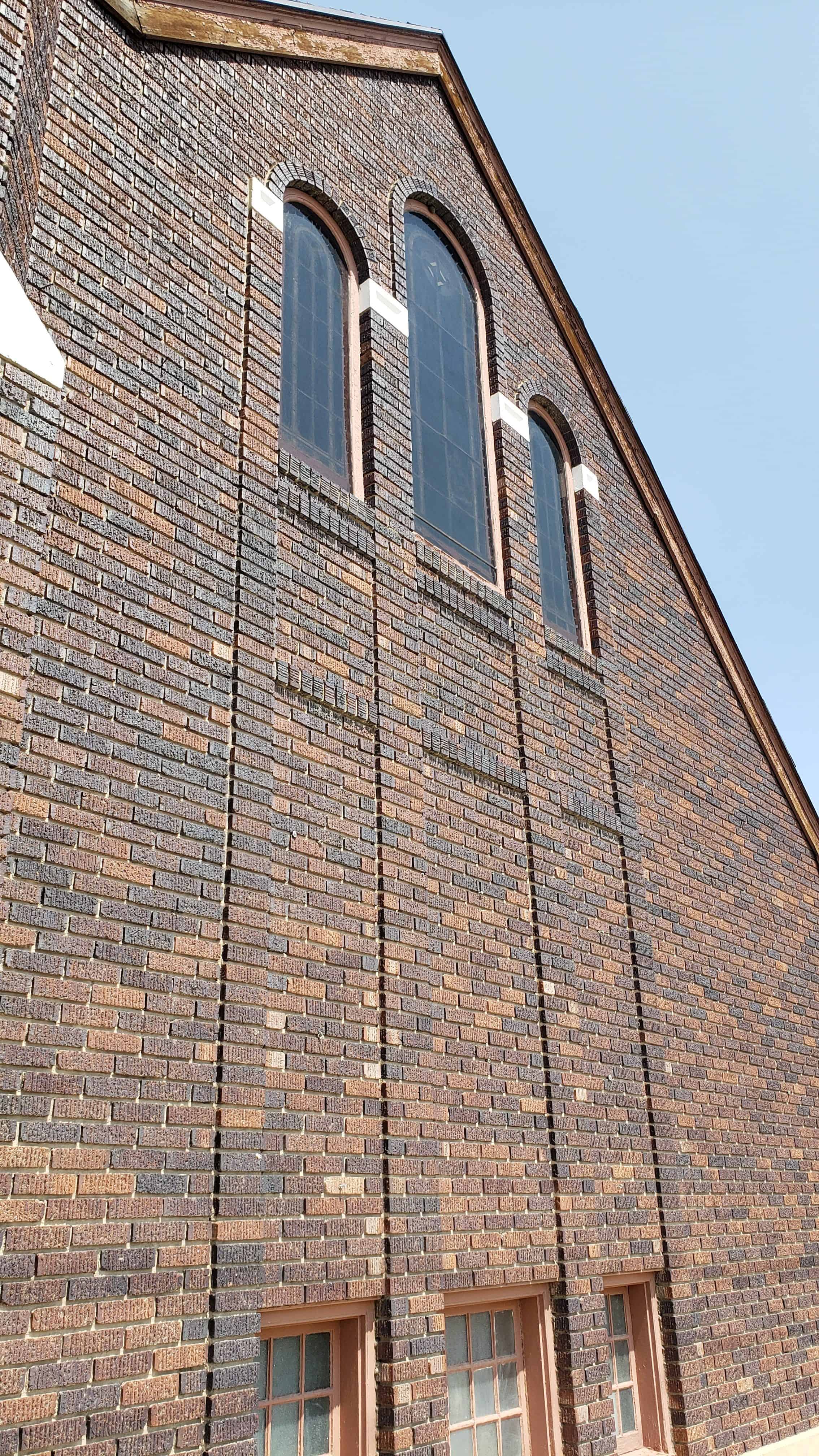
The building is constructed of dark maroon brick on a concrete foundation. In plan, the structure is L-shaped, with the longer end, approximately 90 feet, running parallel to 8640 South. The shorter end is approximately 45 feet and is parallel to 60 East. The main entrance is at the curved intersection of the two sides, and is accessed by ten curvilinear concrete steps. The exterior brick walls rise from a plastered concrete foundation and water table to a parapet which runs along the street facades of the building. The parapet hides the two intersecting gables of the asphalt-shingled roof.
The parapet is capped by a coping of rowlock brick. Two feet below the parapet is a metal cornice. A rowlock course of brick is found directly belong the cornice. A second cornice extends over the main entrance and is supported by four columns. The visual line of this cornice is continued around the building by a course of soldier brick. Three courses of brick, one header and two stretcher, are “punched out” and circle the building at the window arches.
The building elevation is divided into bays by thirteen large round arched windows. The window arches are of rowlock brick and accented by lug sills, impost blocks, and keystones made of a cast aggregate resembling granite. The original windows had sixteen panes and hinged at the bottom to open inward. The semi-circular windows were “spoked” with wooden muntins. The windows were replaced in the 1980s by one-over-one fixed windows and the arches have been filled in with vinyl lap siding. The main entrance was originally two doors under an elliptical arch, also accented with a keystone and impost blocks. They have been replaced by a single door with sidelights. The fanlight over the doors was replaced by a single sheet of glass in 1980s, but has been more recently covered by plywood.
The most prominent Classical elements on the building are the four columns at the main entrance (two of which are currently hidden by a pair of large evergreens). The columns are made of the same granite-like cast aggregate and are Tuscan with a slight entassis. The only other decorative elements are two signs which read “Berean Baptist Church”. One is above the main door and the other is on the otherwise blank west wall under an elliptical arch. According to the Pastor Wesley Clem, the original stained glass window in that space was removed (date unknown).
Another blocked window is also on the west side at basement level. The other basement windows are used, though the glass and frames have been replaced. Two exterior doors, one on 8640 South and the other at the rear, access the basement level.
The main floor of the building is above a raised basement and has three sections: foyer, classrooms and chapel space. The main entrance originally opened to a wedge-shaped vestibule and a foyer with a high ceiling. The vestibule was partitioned to make closet space and a pair of windowed doors was installed at the foyer entrance in 1995. Access to the chapel from the foyer is through a pair of doors to the west. At the south is a staircase with one landing to the lower level, while on the east wall is a door leading to a small office. On the north side of the foyer are two doors leading to classrooms. Some type of door, possibly a folding door, originally allowed the rooms to be made one large room, but the opening has been blocked. One corner of each room has been converted to a closet.
Entrance to the chapel from the foyer was through a large, arched opening now enclosed by two doors, installed in the 1980s. The chapel floor slopes two feet from the back to the front of the chapel. The space of the chapel has changed little since the original construction, although a major remodeling of the pulpit area took place when the Baptist congregation modified the chapel for their worship services in the 1960s. The original pews were removed and replaced by others in the 1980s. Drywall has been applied to the interior walls of the chapel and the windows no longer appeared arched from the inside. The drywall also covers a row of stenciling which decorated the chapel. The ceiling has been sprayed with asbestos and the lighting fixtures have been updated. Insulation materials were added to the majority of the main floor rooms at the same time the drywall was applied during the 1980s.
A second arch spans the podium area. The original molding and a plaster dove in relief at the center of the arch are still intact. The arched opening was originally flanked by dark wood Tuscan columns and a pair of heavy curtains. The columns have been removed and the sides enclosed as dressing rooms for the baptismal font. An original staircase down to the basement level is now accessed from the south dressing room. Another staircase leads to the rim of the baptismal font. The font area was constructed in 1969. Previous to that date, the building had no font. The baptismal font was built at the back of the podium and can be partially viewed by the congregation through a arched opening. The back of the font, as well as the floor and walls of the dressing rooms, is tiled in squares of beige.
Above the font is a Latin cross tiled in a slightly darker color. The ceiling above the font has a latticework screen which is original.
The basement runs the full length of the building. The balustrades of both staircases are original, as are the doors and much of their hardware. There was originally one restroom, with a dirt floor, at the east end of the basement. The room was enlarged by excavation and made into two restrooms. Under the foyer area are two classrooms and two closets, all finished in drywall. Similar work is in progress in the classrooms and hallway under the chapel. A large room, probably recreational space, is at the west end. This space originally could be enlarged by some type of folding door leading to the classrooms, now blocked as well.
The ceiling of the basement was originally sloped to match the floor above. A drop ceiling is currently being installed to give a space a uniform ceiling height. Under the podium and font are storage rooms.
The building occupies the southeast corner of a 0.77 acre property. Associated with the building currently, but not during the historic period, are two residences at the northwest corner. The front building (8595 South 40 East) is a 1950s cottage used as housing for the Berean Baptist missionaries. The back building (8597 South 40 East) is reportedly from the 1880s and is currently the home of the associate pastor. This building has been altered substantially. Both are white with lap siding.
There are two small aluminum sheds next to the back residence. A large gravel parking area adjoins the houses. The rest of the property is landscaped with grass. An irrigation ditch runs along the north side of the site. A smaller, disused ditch is on the east. Sidewalks are found on the south and west sides. Four large evergreens flank the entrance. A row of poplars has recently been planted along the east side of the site.
Historic Context: Mormon Meetinghouses and Tabernacles in Utah, 1847-1936
The history of Utah is closely tied to the Church of Jesus Christ of Latter-day Saints. More commonly known as Mormons, members of the church played a significant role in the early settlement and subsequent growth of the state of Utah. It is not surprising therefore that the religious buildings of the Mormons comprise one of the principal segments of the state’s architectural heritage. Within the larger theme of Mormon religious architecture, eight specific historic contexts have been identified [See the Multiple Property Submission, Mormon Church Buildings in Utah. 1847-1936]. The Sandy Second Ward Chapel is significant within the third phase of the context “Mormon Meetinghouses and Tabernacles, 1847-1936”.
The most common types of nineteenth-century Mormon religious buildings were the meetinghouses and tabernacles. Designed as assembly halls for regular Sunday services, these buildings differed principally in size and scale. Tabernacles were typically large buildings with a seating capacity sufficient to accommodate the membership of several LDS wards, with wards being the smallest unit of ecclesiastical jurisdiction within the LDS Church. Smaller Mormon towns consisted of a single ward, while the larger communities were subdivided into several such districts. Every ward had a meetinghouse, or ward meetinghouse. Wards were further organized into larger geographical groupings called stakes, and usually (though not always (each stake had its own tabernacle. Tabernacles and meetinghouses were generally placed in a central location within the gridiron plan of the Mormon town. There are approximately 20 tabernacles and 237 meetinghouses remaining in Utah that were constructed prior to 1940.
Tabernacle and meetinghouse design went through five significant periods of historical development. The first period is associated with the early years of Mormon western settlement and begins with the arrival of the Saints in the Great Salt Lake Valley in 1847 and extends until around 1870. During this phase, the smaller meetinghouses were likely to serve a variety of functions such as schoolhouses, city halls, and social centers.
A second period of LDS Church tabernacle and meetinghouse architecture was ushered in by the ecclesiastical reforms of the late 1870s. A significant number of new religious buildings appeared throughout the state during the years between 1870 and about 1885. These buildings were generally larger and more substantial than those of the settlement period. At this time also it became characteristic of Mormon communities to have separate buildings for different functions. Another result of this increased building activity was that many of the first-period structures were demolished to make way for the new ones.
The expansion activities of the LDS Church were curtailed during the 1880s and 1890s as the leadership’s attention was increasingly consumed by the struggle with the U.S. Government over the doctrine of polygamy. Under pressure from Congress, The Mormons disavowed the practice of plural marriage in 1890 and the way was paved for Utah to become a state in 1896. Nearly twenty years of political conflict, however, had left the church in confusion and disarray. Beginning in about 1898, a serious revitalization program was launched that included, among other things, a restructuring of the hierarchy, a return to financial solvency, a revival of faith and commitment among the membership, and a rebuilding of the church architecture.
As a symbol of rededication, a massive church building effort was initiated in 1898 that lasted until the end of World War I and into the 1920s. This period of architectural development may be considered one of “activation”, as the church moved to strengthen its institutional base in Utah and surrounding states. It was during this time that the first “modern” meetinghouses appeared. These multi-functional buildings gathered all the activities of the local church under one roof. Ward buildings now included an assembly hall or chapel, the offices of the bishop, a room for the women’s auxiliary, and classrooms for Sunday school. Designs varied. On one side, a conservation faction within the church hierarchy favored the Neoclassical and Colonial Revival, while on the other, progressive groups championed Prairie School and Arts and Crafts designs. All in all, the early years of the twentieth century mark one of the richest periods in LDS Church architectural history.
The fourth period in tabernacle and meetinghouse development spans roughly a thirty-year period between 1925 and 1955 and represents a time of both consolidation and experimentation. The multi functional building became the mainstay of the building program, but designs ranged from the Moderne to the Colonial Revival. The LDS Church grew rapidly during the 1940s and 1950s and the need for new meetinghouse construction was even greater. Standardization increased, and there was a drive toward architectural efficiency that eventually lead to the creation of the LDS Church Building Department in 1954. The work of building department architects remains the final and fifth stage in the development of Mormon religious architecture in Utah.
The Sandy Second Ward Chapel is significant within the third phase of meetinghouse development. There are currently 29 meetinghouse buildings remaining in Utah from the third phase. The construction dates of these buildings ranged from 1899 to 1925. Sandy Second Ward Chapel represents the multi-functional and architecturally rich meetinghouse of the third phase, but it was also designed by an official church architect, a practice which would become more common in the fourth phase. The building was used by the LDS Church until the 1960s when it was replaced by a non-historic chapel.
The remaining Period III meetinghouses are as follows:
American Fork Second Ward Meetinghouse, Utah County (Historic District)
American Fork LDS Third Ward, Utah County
Clearfield Ward Chapel, David County
Clinton Ward Meetinghouse, Davis County
Enterprise Meetinghouse, Washington County (National Register listed)
Eureka LDS Wardhouse, Juab County (Eureka Historic District)
Hanksville Meetinghouse School, Wayne County (National Register listed)
Heber First Ward Meetinghouse, Wasatch County (major addition)
Heber Second Ward Meetinghouse, Wasatch County (National Register listed)
Hyrum First Ward Meetinghouse, Cache County (National Register listed)
Kaysville Tabernacle, Davis County (State Register)
Leamington LDS Church, Millard County
Levan Ward Chapel and Amusement Hall, Juab County
Logan Sixth Ward, Cache County (Logan Historic District)
Moab LDS Meetinghouse, Grand County (altered)
Moab Star Hall, Grand County (National Register listed)
Murray First Ward, Salt Lake County (NR documentation started)
Murray Second Ward Meetinghouse, Salt Lake County
Murray Tenth Ward (formerly Grant Ward House), Salt Lake County
Prove Third Ward Chapel and Amusement Hall, Utah County (National Register)
SLC 453 S 1100 E, Salt Lake County (University Historic District)
SLC 160 S University, Salt Lake County (University Historic District)
SLC Cannon Ward LDS Church, Salt Lake County
SLC Fifth Ward Meetinghouse, Salt Lake County (National Register listed)
SLC Ensign Ward Meetinghouse/Amusement Hall, Salt Lake County (Avenues H.D.)
SLC Guadalupe Center (LDS 16th Ward), Salt Lake County
SLC Miracle Rock Church (LDS 34th Ward), Salt Lake County
SLC New Hope Center, Salt Lake County
Sandy Second Ward Chapel, Salt Lake County (NR documentation started)
History of Sandy:
The first half of the twentieth century was a period of transition for the city of Sandy. The mining, smelting and small farm era was being replaced by a more diversified economy. In some ways the town still resembled the earlier predominantly agricultural community founded by Mormon settlers in the 1860s, especially as the “boom town” economy created around the mining industry waned. The population of Sandy remained around 1,500 for the four decades between 1900 and 1940. However, the city was defining itself as the political, economic, civic and social center for a major portion of the southeast Salt Lake Valley. This period of Sandy’s history laid the groundwork for city’s eventual transformation from small town to suburb.
The transition began with the failure of several canyon mines which fed Sandy’s economy. As sampling and smelting plants shifted to other locations, Sandy’s impact as a mining town diminished.
While the dominant force in the economy of Sandy during the 1870s, 1880s and 1890s was undoubtedly that of mining, the local agricultural community had not ceased to develop. The local agricultural economy saw Sandy through the mining boom and subsequent depression.
The community was also seeing a great deal of civic development. The city of Sandy was incorporated on September 26, 1893. By 1911 the city was managing its own water resources and had a volunteer fire brigade of twenty-five, complete with two fire trucks. Utah Power and Light began servicing Sandy in 1913, and by 1914 the city was managing a park and a cemetery.
Economically, the city was changing dramatically. The depletion of the mineral resources in the Alta area and the loss of the smelting and sampling industries had changed the economic structure of Sandy City significantly. Moreover, a series of national and local depressions beginning in 1893 and continuing to the onset of World War II had made small-scale single-crop agricultural enterprises nearly impossible. Sandy farmers had an especially difficult time, needing to overcome the additional challenges of water scarcity and the arid, sandy soil.
Fortunately irrigation methods improved steadily through these years, and several Sandy farmers were able to successfully continue to raise hay and grain. Despite the success of these specialized agricultural industries, most farming in Sandy during the first half of the twentieth century was purely subsistence level. Between 1900-1920, the number of farms doubled, but nearly all were very small scale. Eighty-five percent of the farms were smaller than forty-nine acres. Six farms were between two hundred and one-thousand acres, and one farm was 1,217 acres.
During the first half of the twentieth century, the majority of Sandy residents continued to live on their farms. Most managed to survive economically by combining subsistence farming with other occupations, primarily cottage industries and mercantilism. The majority of occupations were highly diversified. Sandy appeared to have at least one resident involved in occupations associated with early urbanization: a physician, a dentist, a barber, a plumber etc. The most common business listed was dry goods. The Sandy City Bank founded in 1907, employed four, and had the largest deposits of any bank in the southern portion of the Salt Lake valley. Several residents listed their civic responsibilities: city treasurer, postmaster, marshal, justice of the peace.
As the non-Mormon or “Gentile” population moved out of Sandy with the decline of the mining industry, Mormonism continued to be the dominant religion. By the 1920s, the LDS population had grown large enough to require the construction of two new ward buildings. The Sandy Second Ward meetinghouse was completed in 1921 and the Third Ward in 1926. In addition to the three LDS wards, the 1927-28 gazetteer lists two other congregations: the Sandy Congregational Church and the Inter-Mission (Swedish/Lutheran) Church.
Before the 1900s, transportation between Sandy and other towns in Salt Lake County had been limited to pedestrian or horse traffic on rutted, dirt roads. Several railroad lines and mining related spurs had converged at Sandy by the 1880s, but the service they performed was primarily freight. The extension of the State Street streetcar line from Murray to Sandy on July 4, 1907 gave Sandy residents easier access to the shops and recreations of Salt Lake City.
A few residents may have commuted to work in Salt Lake, but the city generally remained self-contained. Buses began to replaced streetcars in the 1920s, at about the same time State Street’s south end was paved for automobile traffic. The last streetcar to operated in the Salt Lake Valley was discontinued in the 1946. By that time, automobiles were becoming increasingly more common, even in Sandy.
The original township of Sandy had expanded to the west of the railroad tracks with the boom of the mining industry. After the turn of the century growth was slower. At the west boundary of the city, commercial buildings as well as bungalows and period cottages appeared along State Street, the main artery to Salt Lake City. The institutional buildings, both civic and religious, were also made of brick and exhibited a variety of popular styles and decorative elements. Of the remaining large commercial and institutional buildings, examples ranged from the Renaissance Revival to PWA Moderne.
The Specialized Agriculture, Small Business, and Community Development Period in Sandy was a time of transition from farmlands and mining industries to quiet neighborhoods and small town civic pride. The architecture of the historic square mile of Sandy, as it is called, illustrates this transition, and stands in marked contrast to later development. In the years since World War II, Sandy has plated nearly 300 subdivisions and annexed over 10,000 acres, making it one of Salt Lake’s largest “bedroom” communities. Though Sandy’s city center has been moved adjacent to the mall, the city’s historic downtown is a distinctive reminder of Sandy’s small town past.
Constructed of adobe in 1889, the Moab L.D.S. Church was built nine years after the establishment of Moab in 1880. Angus Stocks supervised the laying of the foundation and adobes. Within a few years of the original construction, an addition was made to the rear of the building. The church was used by the Moab Ward until 1925 when a new church was built and this church deeded to the Grand County School District. In 1937 the Grand County Camp of the Daughters of the Utah Pioneers began holding meetings in the building and have continued to use the building, with the exception of a ten year period between 1954-1964 when it was used for classrooms.
The Moab L.D.S. Church is located at 45 North 200 East in Moab, Utah and was added to the National Historic Register (#80003907) on November 28, 1980.
This 1889 stuccoed adobe structure is emblimatic of the LDS origins of Moab and the continuing importance of religion in the life of that community and is significant as a late example in Utah of a church building which exhibits the Greek Revival influence. It is of typical pioneer architecture, constructed of locally-available materials through the efforts of many local citizens, and its T-shape plan reveals the rapid growth of LDS Church membership during Moab’s early years of settlement. This structure was also the only religious building in Moab until 1910, when the Baptist chapel was formally dedicated.
The Moab area was long of interest to many groups because the Colorado River could be easily crossed at that point. Moab (then unnamed) was on the Old Spanish Trail, it became the site of the Mormon Elk Mountain Mission in 1854-55 and was sporadically used as grazing lands for cattlemen from both Utah and Colorado in the 1860s and 1870s. Both Utes and Piutes claimed the land, and were partially responsible for the quick demise of the Elk Mountain Mission.
The present town of Moab dates its official founding from the establishment of the post office on March 23, 1880. The town served as a regular stop on the mail route from Salina, Utah to Ouray, Colorado, the first and only route in southeastern Utah and much of western Colorado. As a fragile link to the outside world, it was of tremendous importance to settlers in the area who tended to congregate at mail stops, hence increasing the population of towns like Moab. Most of those early settlers of Moab were Mormons, and on February 15, 1881, visiting church officials organized the Moab Ward with Randolph H. Stewart, bishop, Alfred G. Wilson, first counselor, and Orlando W. Warner, second counselor.
At the time of the Ward’s founding, Moab was part of the Emery Stake. However, in 1884 the Moab ward became part of the San Juan stake and began acquiring property. The Church lot was sold for $100 by the patentee, Leonidas L. Crapo, to Bishop Stewart and Counselor Warner in 1884. The bishop, a polygamist with three wives, was sorely pressed by the “raids” of the time and in 1885 transferred the land solely to Warner for $500. The following year Warner deeded all of Lot 1 to the Moab LDS Church Trustees-in-Trust: Henry Holyoak, Jefferson A. Huff and David A. Johnson.
In 1888 the building program began. “For the first part of the building, O.W. Warner, Henry Holyoak, and O.D. Allan were appointed as the building committee. Labor, money, and building materials were donated by the Church members. Angus Stocks supervised the laying of the foundation and the adobes (which) were made in the Jonathan Huff place.. .Hyrum Alien supervised the hauling of rock…from the canyon east of Moab. J.H. Staniford supervised the carpenter work. Lumber, shingles, windows and doors were ordered from Salt Lake City. Everyone with a team and wagon helped with the hauling.. .Bill Bliss cut the stones for the foundation and Angus Stocks laid them. Mr. Bliss helped make adobes on the Huff place. John Holyoak, Mrs. Mary Murphy, and their two oldest boys hauled the adobes to the Church site.” “Grandpa” Henry Holyoak cut logs from Pack Creek to make lumber at his sawmill. Many other community members aided in construction.
However, even as the church building rose, the town population also increased. When church members congregated for the first service in 1889 the building proved too small to hold them. Builders added another room sometime prior to 1900, giving the building its present “T” plan. For many years children attended Sunday school in the basement.
In 1902 the Moab LDS Church incorporated, and the Trustees-in-Trust deeded the land to the bishop, David A. Johnson, who immediately deeded the land to the Moab Corporation of the LDS Chruch, all in that year. Until 1925 this building continued serving as a church, until the population of the faithful increased beyond the capacity of this structure. A new church was built at a cost of $30,000, and a newer one for $200,000. In 1925 the first church was deeded to the Grand County School District, who still retains ownership.
From 1925 to 1937 this building remained vacant. On November 3, 1934 the Grand County Camp of the Daughters of Utah Pioneers was organized and began meeting in private houses and in the Relief Society rooms of the newer LDS Church. As their membership expanded, they needed more space, and in 1937 the School Board allowed them to begin meeting in the original IDS Church. At their first meeting there, on May 26, 1937, “Daughter Mary presented the Daughters with an Organ” which still remains at the Hall. On October 28, 1937, “Daughter Mabel Johnson donated a stove for the rooms of the DUP. It was decided that members would take turns in furnishing coal and kindling for the fires and should also take turns in starting the fires, on meeting nights.” Finally, the Daughters installed linoleum removed from the local hospital, for which they had made curtains. At the April 28, 1938 meeting the Daughters organized a committee for gathering relics.
Since that time the original church has served as the DUP meeting rooms and Relic Hall with the exception of a ten-year period from 1954-64. During this period of Moab’s uranium boom, the school district reclaimed the building for use as classrooms and added the door at the left rear of the building to permit easy access. They also installed a new, lower ceiling in the front part of the structure in a room then used for band class.
The Moab L.D.S. Church is a one story, gable roof building, originally built with an I plan, but later extended to a T plan. It was built of adobe with a rock foundation and later stuccoed over. A belfry is mounted on the ridge of the roof over the main entrance. Slender chimneys with decorative brick coursing occur at each end of the extension. Greek Revival influence is evident in the orientation of the church with the gable end to the road, and in the boxed cornice which returns on the gable ends. The single door on the façade has a Greek Revival-type of pediment. According to an old photograph, a small circular window was centered over the door which no longer exists. There are three two over two double hung sash type windows on each side of the original building. With two exceptions the same type of window was used on the extension. A six over six double hung window with a transom has been used on the rear and on the north wall of the extension. Alterations to the original structure include the major rear addition, the elimination of the circular window, and the lowering of an interior ceiling. A rear door with a frame extension over it was added to the rear extension and the larger windows also may not be original. The stuccoing of the entire building dates later than the construction of the original building and its extension.
The Washakie LDS Ward Chapel, constructed in 1939, represents the zenith of the Washakie community, an American Indian farming settlement established in 1880 by the Church of Jesus Christ of Latter-day Saints (LDS or Mormon church) for a group of about 200 Shoshoni Mormons. Washakie was both a religious and social experiment. The Mormon church, by providing farmland, training in agriculture, and religious instruction, hoped to bolster the faith and the economic self-sufficiency of this group of Northwestern Shoshoni. Implicit in this plan was their adoption of “white” ways. The Shoshoni viewed Washakie as a haven where they could live together and practice their adopted religion. Washakie provided them a lifestyle preferable to reservation life, ongoing conflict with whites, or assimilation with the larger society. Coinciding with the completion of this new chapel in January 1939 was the appointment by Mormon church leaders of an all-Native American bishopric to lead the Washakie Ward-the first in the history of the church. This was the culmination of almost 60 years of effort to help Washakie residents achieve ecclesiastical and economic self-sufficiency. For the Shoshoni, it also symbolized their acceptance as equals by their Anglo Mormon neighbors. Church officials and residents alike viewed the events of 1939 as the beginning of a new era for the community. The success was short-lived however. The onset of World War II in 1941 drew away many Washakie residents to jobs related to the war effort. By 1945 the Washakie Ward once again had a non-Indian bishop, and by the late 1960s, after years of out-migration and a shift of emphasis by the Mormon church, the congregation was discontinued, the community virtually abandoned, and the property sold.
On Sunday, January 22,1939, two significant events occurred in the small, northern Utah community of Washakie. First, the newly finished LDS ward chapel was dedicated by authorities from church headquarters in Salt Lake City. The older frame chapel it replaced was converted to a gymnasium (it has since been demolished). Construction of the new building had begun June 26,1937. Typical of the period, ward members with construction skills may have helped with some of the work. The completed building features “a commodious auditorium and class rooms for the holding of all Church services.” The residential-scale building is much smaller than typical ward houses, containing only 1,343 square feet of floor space. This is probably due to the small size of the potential congregation (approximately 125 at the time). The building was probably designed by Edward O. Anderson, who was listed as “Church engineer and architect” among the dignitaries at the dedication. George Albert Smith, a member of the church’s governing body the Council of the Twelve, was on hand to preside over the dedication services.
The second event that day was the appointment of four “full blood Indians” to the bishopric (leadership) of the ward (congregation). From 1880 to 1939, the ward had been led by non-Indian men. Under the reorganization, Moroni Timbimboo was named bishop, Nephi Perdash and Jim John Neaman were appointed counselors, and Henry Woonsook was sustained as ward clerk. The local newspaper noted, “This was the first time in the [109-year] history of the L.D.S. church that an entire Indian bishopric will preside over a ward.” Bishop Timbimboo not only served as head of the ward, but was also responsible for keeping up the condition of the meeting house.
These events marked the culmination of over 90 years of Mormon/American Indian relations in Utah, and, more specifically, efforts by the Mormon church to convert American Indians and foster them in the faith. When members of the Church of Jesus Christ of Latter-day Saints (Mormon or LDS church) relocated to Utah in 1847 under the direction of church president Brigham Young, they found the territory inhabited by various Indian tribes: Ute, Shoshoni, Goshute, Paiute, and so forth. Brigham Young encouraged his followers to feed the Indians rather than fight them, though at the same time he directed the establishment of over 300 permanent settlements on land previously used or occupied by the local Indians.
The Northwestern Shoshoni have been residents of what is now northern Utah and southern Idaho since at least A.D. 1300. As hunter/gatherers, they moved around the area frequently, often favoring locations near the Bear River and its tributaries which flow from the north into the Great Salt Lake. The arrival of Mormon pioneers in 1847 brought the first permanent Anglo settlements to the area. Tens of thousands of other emigrants passed directly through Shoshoni country along the California and Oregon trails, and the completion of the transcontinental railroad north of the Great Salt Lake in 1869 attracted ever more people and enterprises.
Though the Mormons practiced their “feed rather than fight” policy, conflicts between the Shoshoni and both their Mormon and non-Mormon neighbors were inevitable. The most notable altercation occurred in January 1863, when U.S. Army troops led by Col. Patrick E. Connor attacked a band of Shoshoni camped along the Bear River just across the Utah/Idaho border. Approximately 200-250 Shoshoni were killed, including most of the male population of this particular band. The entire population of the Northwestern Shoshoni numbered only about 1,500 at the time, divided among ten bands, so the loss of life was especially devastating. Though Col. Connor and his troops from Fort Douglas in Salt Lake City received praise at the time, history has since deemed their attack an unwarranted massacre-one of the most severe in U.S. history.6 One of about 20 Shoshoni males to survive the Bear River massacre was Chief Sagwitch Timbimboo, who, in the 1870s, led the conversion of large numbers of Shoshoni to Mormonism. His grandson, Moroni Timbimboo, would become bishop of the Washakie Ward in 1939.
The Treaty of Box Elder in July 1863 brought an end to Shoshoni warfare, but did little to help them establish a stable lifestyle. Government assistance was inadequate, and without land of their own they became a “lost tribe,” wandering the Utah/Idaho border and relying heavily on Mormon communities in the area for their subsistence.
The Mormon church felt a special affinity toward American Indians, viewing them as a lost and benighted branch of the biblical “Twelve Tribes of Israel.” According to Mormon scripture, The Book of Mormon, American Indians are descended from Israelites who fled the Old World and settled in the Americas beginning around 600 B.C. Internecine warfare wiped out the last of the “believers” around 400 A.D., leaving only the non-believers-the ancestors of the American Indian–on the American continents.
One method used by the Mormon church in working with American Indians was to teach them “white” agriculture techniques and try to convert them to Mormonism. The church established “Indian farms” at various locations in Utah and assigned missionaries to help teach the Indians to farm, raise livestock, construct buildings, and so forth. In 1873, the church assigned missionaries to the Northwestern Shoshoni for this dual purpose.7 After moving the location of the farm a couple of times, they finally settled on a site in 1880 in northern Utah near the Idaho border for a group of over 200 members of the Shoshoni tribe. The farm community was called Washakie, in honor of a respected Shoshoni chief.
Within a few years the community seemed well on its way to fulfilling the church’s long-range program of helping the Shoshoni become self-sustaining members of Mormon and American society. The 1,800 acre farm boasted 1,500 sheep, 150 acres of irrigated land, 450 acres of dry farm, a cooperative store, a school, a church, and a 14-mile canal to provide water to the farms. In addition, some of the Indians started filing homestead claims for themselves. A newspaper correspondent in 1886 noted that the 250 Indians at Washakie owned their property in common, stayed on their farms year around, and were “a temperate and industrious people.” Over 25 years later, the community was still receiving positive reviews. A 1912 report filed by an agent with the federal government’s Office of Indian Affairs noted that the Washakie residents were “indeed well off” in comparison with groups at other locations in Utah.
However, “All was not perfect in the little Zion,” notes historian Brigham D. Madsen. “The missionaries met a lot of frustrations in their attempt to make the Indians into carbon copies of themselves.” Indian agents were also concerned that the Washakie Shoshoni were not performing entirely as they saw fit. Problems noted by the Indian agents during the 1920s and ’30s included the lack of tribal organization (church organization had taken precedence), the need for home management training to the women, inadequate school facilities, and the need for local courts to take responsibility “to preserve proper order in this community.” Despite these minor problems, Washakie continued to prosper.
By the 1920s, the population of Washakie had stabilized at about 125, less than half the number that had started with the community 40 years earlier. In addition to attrition from death, some had moved to the reservation at Fort Hall, Idaho, and some had merged into the white culture. Those who remained were, with few exceptions, active Mormons.
As the twentieth century progressed, the Mormon church continued to direct the community. It still assigned a non-Indian bishop to head the ward, though by at least 1923 two Indian counselors (Moroni Timbimboo and Quegembitch) were assisting him. In 1935, two Indian men were called to serve as short-term missionaries to the Fort Peck Reservation in Montana to gain converts. The church also continued to own the 1,800 acres of farmland and the community itself. The issue of property ownership would become a substantial problem after the 1940s, when families who thought they owned their homes were displaced. Most of the homesteads (29 of 40)filed on surrounding land by Washakie residents were lost either because of nonpayment of taxes or “through fraud or other irregular means” to white men. This left the community almost entirely dependent on the church-owned lands.
Beginning in the late 1930s, the church renewed its efforts to improve the viability of the Washakie farm so it would better fulfill the needs of the town’s residents. They improved the irrigation system, purchased new machinery, upgraded and expanded the livestock herd, and experimented with various crops to find the most productive use of the land. For example, raising wheat proved quite profitable around World war II. According to one ecclesiastical leader at the time, these efforts “proved to be very beneficial and very helpful for the whole of the property.”
The completion of the new brick ward house and appointment of the all-Indian bishopric in 1939 were a culmination of these renewed efforts at Washakie. They also marked “the beginning of a new era for these Indians,” according to the Mormon-church published Deseret News. The community had apparently reached a point of religious self-sufficiency, having already achieved a level of economic stability. The occasion also launched the beginning of a new initiative in the community: the improvement of living and sanitary conditions. The newspaper noted that “this Indian community has made great forward strides intellectually and spiritually, but their temporal advancement, noted by their homes and living conditions, has not kept in step.
The Washakie Project Committee, comprised, ironically, entirely of non-Indian Mormon men, was appointed by church leaders to direct the effort. By 1942, improvements were already being noted: “Many things have been accomplished in the past two years. Electricity has been brought to the homes. The new chapel has been built. Three new homes were constructed…. A large barn has been rebuilt and fences erected….” While the Washakie project “presents many varied problems and discouragements,” the article noted that it “gives promise of a happy completion in the years to come.”
Whatever momentum the Washakie Ward and community had gained during this new era was lost during World War II. Better-paying war related jobs in nearby Brigham City and in the Ogden and Salt Lake City areas drew away many. In addition, a number of young men who returned from the war decided to take advantage of the schooling they were entitled to through their military service. According to Samuel Hendricks, stake president at the time, “It seemed that the things that we were trying to do [at Washakie] was in competition with the government and with the schools.” Eventually, Hendricks noted, “it got so the old ladies, the young folks’ grandmothers or somebody who were taking care of babies was about all that was left in Washakie.” By 1945 a white man was once again bishop of the Washakie Ward. The ward was downgraded to a branch in 1960, and in 1966 was discontinued. The few remaining members were transferred to the ward in the nearby town of Portage.
At some point during this decline, the LDS church apparently decided to abandon the Washakie project. According to property records, the church was the owner of all the property; the residents of the town were simply tenants. Clearing the land for other purposes became the church’s new priority. Accordingly, many of the vacant homes were burned, much to the shock and chagrin of their former occupants when they returned. Some received compensation from the church for personal property that had been destroyed. Those who refused to leave their houses received eviction notices. The church helped relocate some of those who remained, but it was a sad and confusing time for many. Some felt betrayed by the church. Though most of the residents had moved elsewhere, their roots and sentiments were in Washakie. The identity of the band was also tied to the community. Eventually 184 acres of property, including their burial site located west of town, were returned to the tribe by the church. The remainder of the property was sold to a private party and is currently operated as a ranch.
Washakie’s success was mixed. Its longevity, over 80 years of existence, indicates the community achieved a substantial measure of stability and viability. This is countered by the dwindling population into the 20th century and, of course, the eventual demise of the town. Samuel Hendricks, offering his opinion as a white Mormon church official on Washakie’s success, observed that “there were times when it was good and times when it wasn’t.” While the community enjoyed some success as a segregated Indian community, he felt “that the integration and the mixing in and the training for the amalgamation process [with the larger society] is the way to go…, but I think you have got to give a certain amount of respect for their history, for their culture and their beliefs, their ideals…. We haven’t done too good a job on that.”
The small brick chapel is the most notable of the few structures remaining from Washakie’s historic period. The Craftsman bungalow style school, located south of the church, is still standing, but has been altered on the exterior. At least one of the c.1940 concrete-block houses is also extant; it is located on the north side of the road into town. A canal, apparently the historic canal, is located directly west of the church property. Other historic features of the community probably exist as well, including cultural landscape features (fields, ditches, cemetery, etc.). These features may be dealt with in the future as part of a more comprehensive study, but for now only the church is being considered for National Register designation.
Constructed in 1939, the Washakie LDS Ward Chapel is a one-story brick church with a concrete foundation and modest Colonial Revival stylistic features. It is located on a fenced lot in the heart of the small, unincorporated, mostly abandoned northern Utah town of Washakie. Though currently vacant and in disrepair, the building retains its historic integrity.
The primary façade of the building faces east, despite the fact that the road runs to the north. The east façade is dominated by a gable end wall with a tall, narrow, round-arched panel centered under the gable. The panel is slightly recessed and features a basket-weave brick pattern. The double-door entrance is set to the side of the gable under a lean-to like extension of the roof. It is slightly recessed from the plane of the gable end wall, allowing for clear definition of the south corner of the symmetrical gable end wall.
The brick exterior walls are laid in a common bond pattern, with every seventh course being a header course. A row of soldier bricks accents the bottom of the walls. Colonial Revival style features include multi-pane windows, symmetrical placement of windows, and a flared cornice effect on the gable ends created by corbeled brickwork. The roof consists of an east/west running gable over the chapel area on the north, intersected by a cross-gable that extends south over the classroom section.
The interior features a central hallway with a rectangular chapel area to the right and three classrooms/offices and a closet to the left (see enclosed floor plan sketch). At the west end of the hall is a steep stairway down to the furnace room in the basement. Most of the stairs in that stairway have been removed. The walls and ceiling appear to be plaster over metal lath (visible in deteriorated sections). The original stained wood trim and doors are still in place. The floors are covered primarily with what appears to be asbestos tile. Carpet (a later installation) covers the front (east) of the chapel and the raised platform or “stand” where church leaders conducted services. Leaks in the roof have caused water damage to several parts of the building, evidenced by stains, peeling paint, and even holes in a few areas of the ceiling.
The building sits near the middle of a large, fenced lot, and is accessed by a concrete sidewalk from the road on the north. Behind the church (to the west) is a grove of trees arranged in rows approximately 18 trees aligned in three rows. There are no other structures on the property.
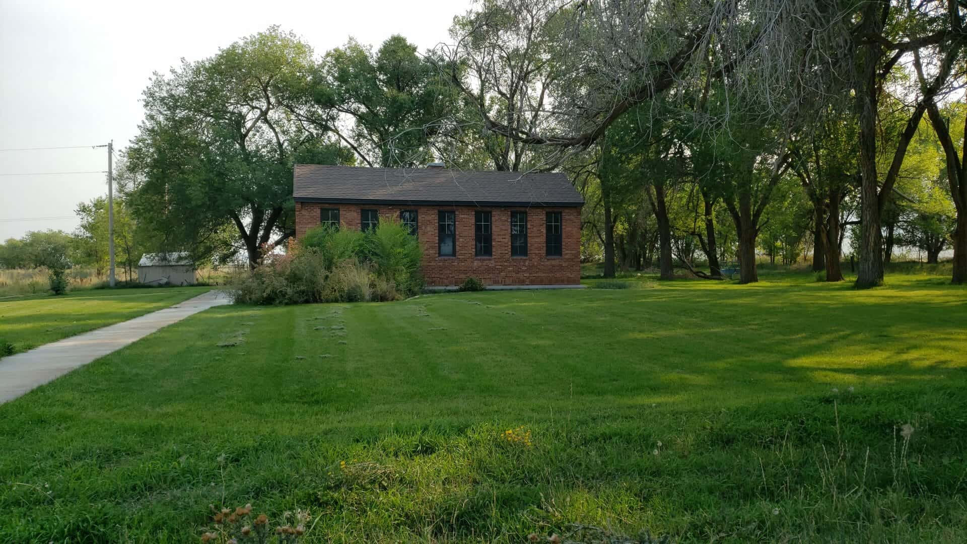
Price Community Methodist Church Built in 1899, rededicated 100 years later in 1999. Grand Lodge F. & A. M. in Utah C. F. Jennings Commandry #6 Carbon Lodge #16 Joppa Lodge #26 10 North 200 East in Price, Utah
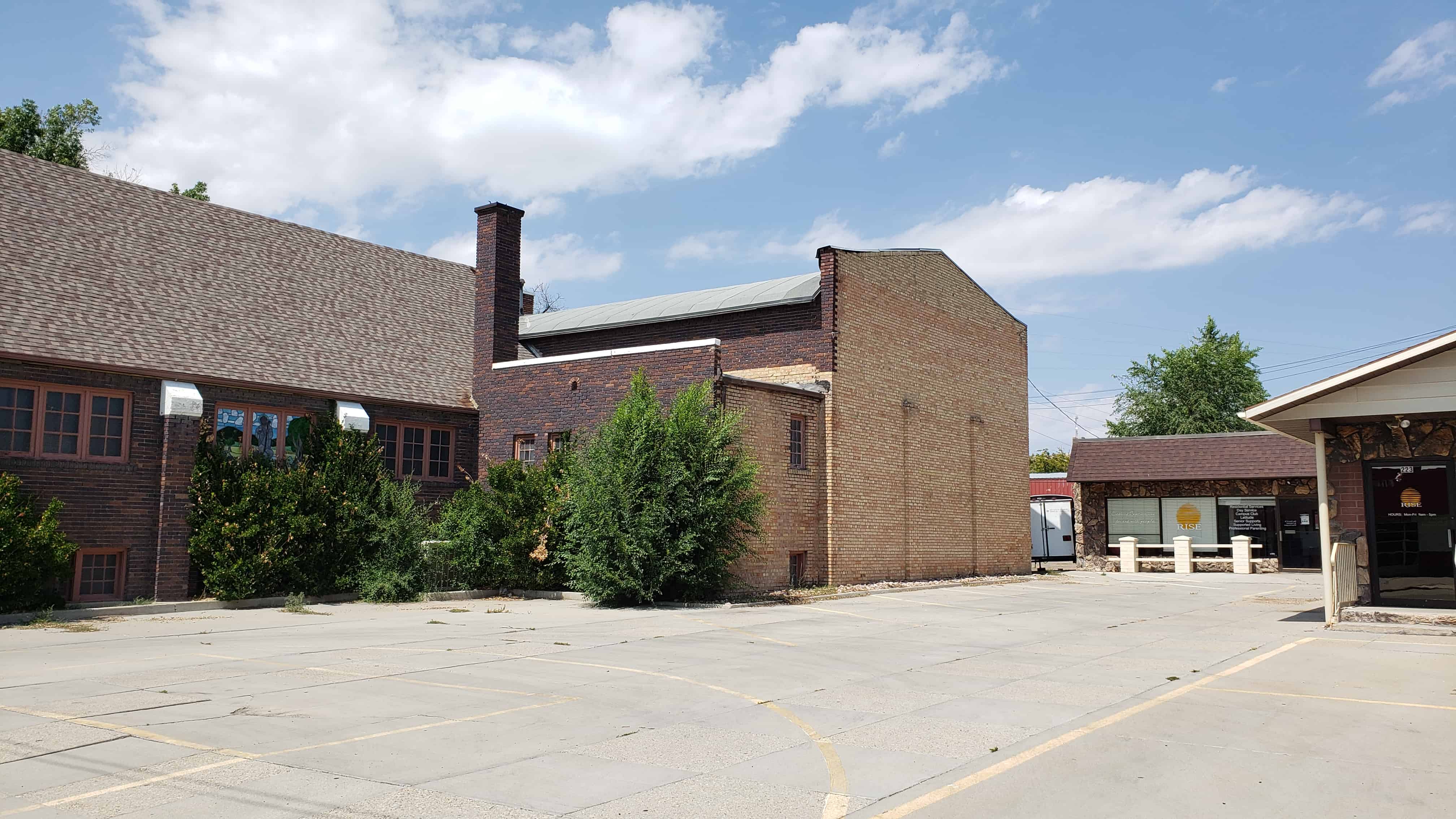
The Princess Recreation Hall/Lynndyl LDS Meetinghouse is locally significant in the areas of entertainment/recreation and religion. Lynndyl Town was established during the railroad expansion era and the Princess Recreation Hall was built to meet the needs of the citizens for a social gathering center. Originally constructed in 1914 as a social and recreation place for the community, is was used for sporting events, dances, public meetings, a school house, a movie theater, and even a hospital during the influenza epidemic of 1917-1918. During its time as a recreation hall, the building also concurrently served as the meetinghouse for the LDS Lynndyl Ward from 1915-1985. It its 100 year history the Princess has never been empty and has remained a community center for social gathering from the beginning. It has been used as the Lynndyl Town Hall since 1982.
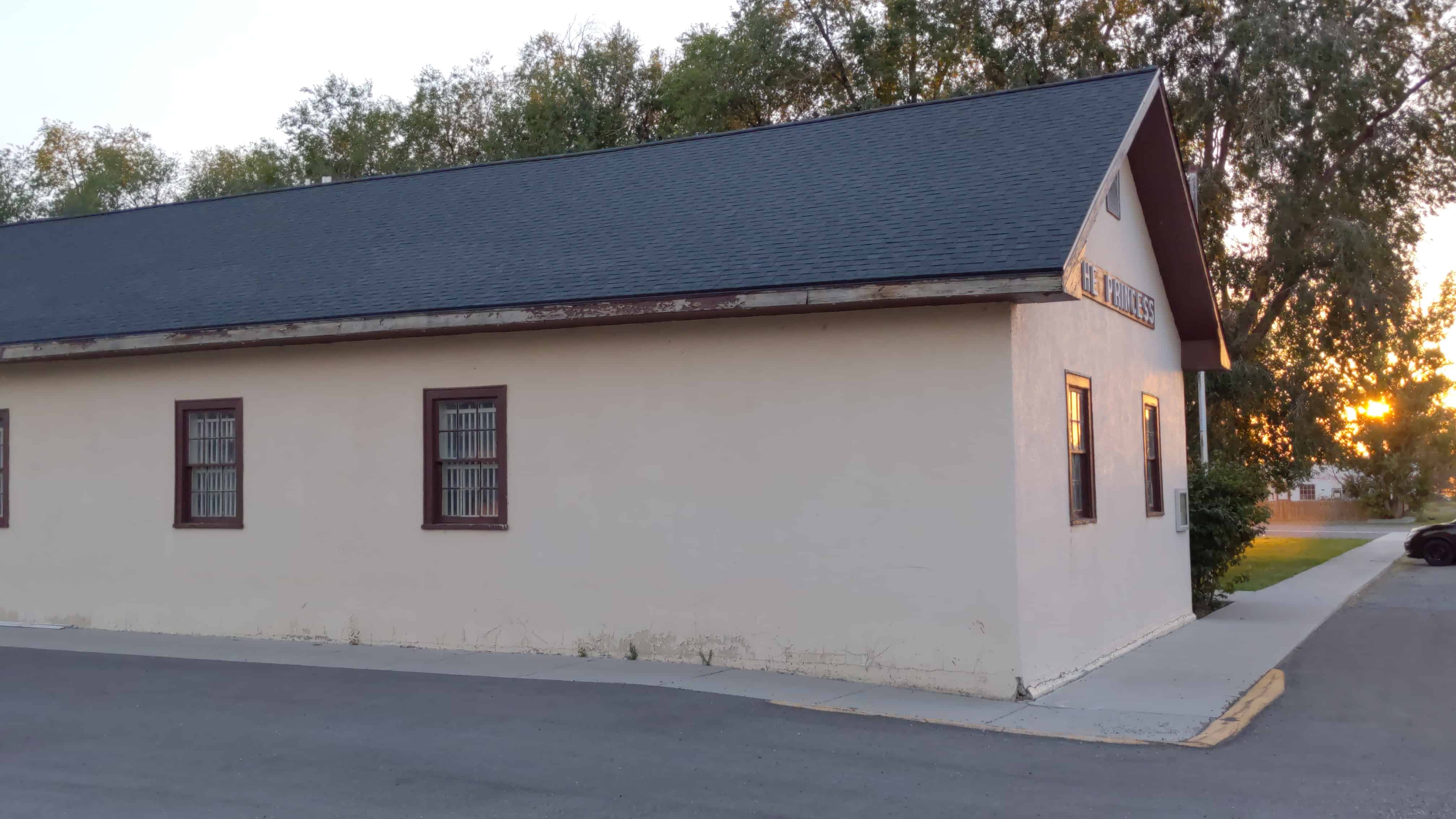
From the National Register nomination form: Located within the town of Lynndyl, the Princess Recreation Hall/Lynndyl LDS Meetinghouse is a one-story wood frame and stucco building with minimal detail, located at 98 East Center Street. It is situated in the north-east corner of the community park, with a sports court to the west and a grass sports field to the south and west. The original 1914 building was a recreation hall constructed of wood frame and wood siding, with a basketball court and stage. In 1936-38, an addition was constructed to the west of the building for classrooms and other meeting space to accommodate the needs of The Church of Jesus Christ of Latter- day Saints’ membership in the town. The structure now took on an “L” shape, with projecting entryways. The original building and the new addition were finished with a more modern stucco appearance, although it maintained a vernacular classical appearance. In 1983, a fire station was added to the south of the building, creating a “T” shape. And, although the outside was finished to match the 1936 stucco exterior, the inside of the new section was modern. However, the interior of the 1914/1936 church remodel was not altered. As of 2014, the interior still retains this layout and architectural detail, such as stained wood molding and interior wood doors. The structure has very simplistic features such as the wood decorative eaves and the original wood frame six over six double hung windows, which helps the structure to retain its historic integrity.
Located within Millard County, in the small town of Lynndyl, Utah, The Princess Recreation Hall/Lynndyl LDS Meetinghouse is currently being used for the town hall. In spite of a 1983 addition, the structure has kept its historic integrity by retaining much of the original work from 1914 and the 1936-38 addition. The building was constructed on the corner of Center Street and 100 East, in the north east corner of the public community park. Ball fields can be found south of the building and a sports court is found to the west, divided by a row of several large deciduous trees separating the building from the sports court. Other vegetation around the building includes shrubs and grass. A concrete sidewalk is found along the road on the north and east sides of the building, with unmarked gravel parking adjacent to the concrete sidewalk.
The building was originally constructed in 1914 as a rectangular plan recreation hall with gymnasium and auditorium. The original structure was built on a concrete slab with wood framing and covered with wood siding. The vernacular building was constructed with simplistic detail that was functional rather than decorative. In 1936, the Church of Jesus Christ of Latter-day Saints responded to the demand for a larger place of worship by constructing an addition to the west portion of the building. The new structure used a concrete block foundation which raised the main level of the addition up one-half story and allowed for a full basement. This basement had a coal furnace and coal storage room along with classrooms. The new addition was built using wood framing. It did not keep to the original exposed wood siding of the original, but was finished with stucco. The exterior of the original recreation hall was also finished with stucco to match the new exterior. Other simple details were added to the wide eaves to give the building a slightly more formal appearance, with an understated Classical feeling. When completed in 1938, the new Lynndyl LDS church building had an L-shape plan and increased space for meetings and classes, yet the social hall remained open as a community gathering area with wood floors and plaster covered walls. When completed the finished space was approximately 3,620 square feet.
From the primary entrance on the north side of the 1936-38 wing, one enters a vestibule then proceeds to the interior of this section. The interior of the addition was designed in a split level format with a full set of stairs to the basement and a half flight to the upper level. The basement below this section has rooms for storage, classrooms a coal furnace and a coal room.
The upper level of the addition has a large room on the west side that was originally used as chapel for church services. Another room to the east of this is divided off by an accordion wall and served as a classroom. There is a small window on the south elevation that provided light to this room. However, this was covered on the exterior when the fire station was added. To the east of this room, and separated by another accordion wall is the back stage area from the gymnasium. The east wall of this area has large built-in cupboards and a single window. A doorway at the northeast corner, next to the stage curtains, provides access to a small stairway leading down north to the gymnasium floor. The gymnasium is to the north of this area and is a large open hall with maple flooring. A basketball hoop is on the north end. The ceiling is coved and has fairly old acoustic tile. The gym has a separate exterior entrance through the projecting vestibule on the west side described above. Another doorway at the southwest corner of the gymnasium provides access to an interior stairway leading up to the hall/landing area and a small kitchen. All of the original plaster walls, doors, wood trim and finishes are retained in the 1914-1938 part of the building and very little has been changed or updated except for carpeting on the floors, accordion doors, and light fixtures.
The building remained in this plan until 1983 when Lynndyl Town moved into the building creating a new use as the town hall. Although no structural changes took place within the existing building, a fire station was constructed at the south end as an extension of the gymnasium/auditorium section and was built using wood frame construction and covered with stucco to match the rest of the structure.
The 1983 fire station addition is accessed from the interior by a doorway from the classroom section of the 1936-38 addition. The door leads to a landing with stairs (behind a door) that go up to the second story of the addition, and a half-flight of stairs that leads to the ground-level hall and rooms of the addition. Two restrooms at the north end of the addition are separated from the garage/vehicle storage area of the fire station by an east/west running hallway. At either end of the hall are exterior exits. At the west end of the hall are located the stairs to the second floor and a second stairwell to the basement rooms. The fire station garage area is a single large, open area with room for two vehicles and equipment.
The building has undergone two building campaigns since the original construction that have seen two major sections added to the building. The first one, 1936-38, made major alterations to the original structure in both form and use. The second, in 1983, added a new use and major addition while making little alteration to the overall appearance. In spite of the non-historic addition, the building still retains historical integrity of the 1930s appearance and is a contributing historic building in the small town of Lynndyl.
The Princess Recreation Hall/Lynndyl LDS Meetinghouse is locally significant under Criterion A in the areas of Entertainment/Recreation and Religion, as well as Criteria Consideration A for its historical use as a religious meeting place. Lynndyl Town was established during the railroad expansion era and the Princess Recreation Hall was built to meet the needs of the citizens for a social gathering center. Originally constructed in 1914 as a social and recreation place for the community, it was used for sporting events, dances, public meetings, a school house, a movie theater, and even a hospital during the influenza of 1917-18. During its time as a recreation hall it also concurrently served as the meetinghouse for The Church of Jesus Christ of Latter-day Saints’ Lynndyl Ward from 1915-1982. Therefore, it is significant in relation to its contribution to the social and religious aspects of Lynndyl. Within the 1914-1964 period of significance, the building had two distinct construction periods: 1914, when the original wood framed building housing the gymnasium and stage was built, and 1936-38, when the meetinghouse expansion was completed. In its one hundred-year history the Princess has never been empty and has remained a community center for social gathering from the beginning. It is currently being used as the Lynndyl Town Hall, and has been since 1982 when the Lynndyl LDS Ward was disbanded. In 1983 a section was added to the rear of the building to house the town fire station. In spite of the new construction, the historic portion of the building retains its historical integrity and remains a contributing historic building in the small town of Lynndyl.
The Princess Recreation Hall is significant in the area of Entertainment/Recreation as it was the center of all social life for the community. In 1914 the town’s people desired a social hall to be constructed for their gatherings and events. F.L. Copenham, Walter Johnson and other community members helped construct the hall. Prior to completion, the first ball was held and was recorded as being a “grand affair”. The hall was used for a variety of social and sporting purposes and events. These included a movie theater, a dance hall, and a sporting events center which included a basketball court and collapsible boxing and wrestling ring. According to the Polk and Co.’s Utah Gazetteer, the Princess had several recorded managers, Elmer A. Jacob (1918-1919), GW Sudbury (1924-1925) and Elmer Banks (1927-1928).
The Princess truly served as multi-functional building in this small town. During the day it was used as the school house and at night a dance hall with music provided by a piano, fiddle and banjo, and later, the Lynndyl Town Band. The building was mostly used as a gymnasium where a collapsible platform could be set up for boxing and wrestling. According to a poem written by Lynndyl resident, Roberta Dutson, boxer Jack Dempsey and wrestler Ira Dern, visited the Princess for an exhibition.
Along with the role as a dance hall and gymnasium, the building also served as the local movie theater. According to local historian, Mary Greathouse: “The first picture show was run by Elmer Jacobs. Sometimes the film would break and the audience sat in the dark until Elmer climbed down [to] find a woman who would loan him a hairpin to make repairs. At other times, the film would catch fire and Mr. Jacobs would toss it down from the projecting booth for someone to stamp out. The film would be sliced and the show would go on.”
The building was heated by two large stoves, located in opposite corners of the gym. Prior to 1928, when electric power infrastructure was brought to Lynndyl, the power for lights and the projector was provided by a generator powered by an “old Ford motor”
During the influenza pandemic of 1918, the population of Lynndyl was devastated. Because of the population size and isolation of the town, there was no hospital to serve the health needs of the community. In order to deal with the many sick who required increased observation the Princess was put into use as a makeshift hospital. The building’s use as a hospital was short-lived, as was its former use as a place of education. When the flu threat was over a new school was constructed adjacent to the hall and opened for students in 1919.
The Princess Recreation Hall/Lynndyl LDS Ward Building is significant in the area of Religion under Criteria Consideration A because of the dual role of the building as the primary social and religious-use space in the community. Although there were some informal Sunday schools being held in different homes, there were no other formally established religious organizations in Lynndyl other than the Church of Jesus Christ of Latter-day Saints (which was typical of most communities in Utah). The Lynndyl LDS Ward, which met in The Princess, was the only ward (parish) found in the area.
In 1915, not long after the recreation hall was completed and put into use, the LDS Church purchased the building to use as a meetinghouse. This did not end its use as a recreation hall, however. Even though the ward used the space as a meetinghouse, the structure remained significant in regard to the social aspect of the community as a whole. From its inception, the LDS Church championed recreational activity in all the communities it settled in Utah and the surrounding region. Particularly after the turn of the twentieth century, when the Church’s building program became more formalized, it was common to construct “cultural halls” near its meetinghouses which had functions similar to the Princess Recreation Hall, with a basketball court and stage area. Perhaps because of the small population of Lynndyl, the LDS Church deemed it more feasible to purchase the existing hall and make it a multiple-use building.
For many years the simple gymnasium and stage was used as the chapel and classrooms, with curtains hung on wires to divide up the space. As the population of the community increased, more space was needed for the expanding Lynndyl Ward. In 1936, approval was granted by the school board for the ward to meet in the school building while Princess Hall was enlarged to include a formal chapel and classrooms. In 1938, construction was completed and on Saturday, September 10, a celebration was held that included sporting events followed by a banquet and program. Some 700 people were in attendance for the events which ended with a dance in the hall. On Sunday, the building was dedicated by LDS Church President Heber J. Grant. At this time the membership for the Lynndyl Ward was 248 people.
The town continued with stable population for a few years longer, but as steam locomotives switched to diesel, the railroad no longer found it necessary to stop in Lynndyl. As a result jobs decreased and with it, the population. Although population declined over the decades, the building continued in shared public and religious use for several decades.
On Sunday, November 22, 1981, the LDS Stake President announced the Lynndyl Ward would most likely be abandoned at the beginning of 1982. This was a shock to many of the members and devastating to think of their community without a place to worship and meet with friends and neighbors. The ward continued on for another eleven months and on October 20, 1982, the last meetings were held in the Lynndyl Ward Meetinghouse. Alpha Nielson, who wrote the history of the Relief Society2 in Lyndyll, stated the following: “No more Lynndyl. No more meeting place. No more cultural hall or public building. A little town with no identity. No heart or soul”.
Although the Lynndyl Ward no longer met in the building, it did not remain empty for long. Soon after the ward moved out, Lynndyl Town set up offices in the building. Along with the new use, the town established a local fire department and constructed permanent quarters for their emergency vehicles in 1983. Along with Town functions, the building continues to be used as a public meeting space for the community, with the gymnasium and stage put in use at various times of the year.
When the nearby IPP power plant finally opened, the population saw a small increase; however it has always remained below 150 residents. In 1990 C.B. Tolbert became mayor and pushed for a beautification of the community. He had the town hall repainted and placed letters on the outside that stated once again “The Princess” (Greathouse 207). Being the town hall, it has remained a community gather place. Public meetings continue to be held at the building along with recreational activities, dances, pancake breakfasts, holiday turkey dinners, bingo games, basketball and other recreational activities. The Princess Hall has remained throughout Lynndyl’s history the most significant and prominent structure within the community, and remains a contributing historic resource.