Simmons Ranch
The Simmons (Remund) Ranch has significance as an intact, excellent, and representative example of an early Homestead; quite possibly the first Homestead, in Duchesne County. As such it is the oldest surviving site of European/American settlement, in this area, formerly part of an Indian Reservation, which was opened to such settlement in the early twentieth century. This site has additional significance since the homesteader succeeded while most others in the locale failed in similar endeavors.
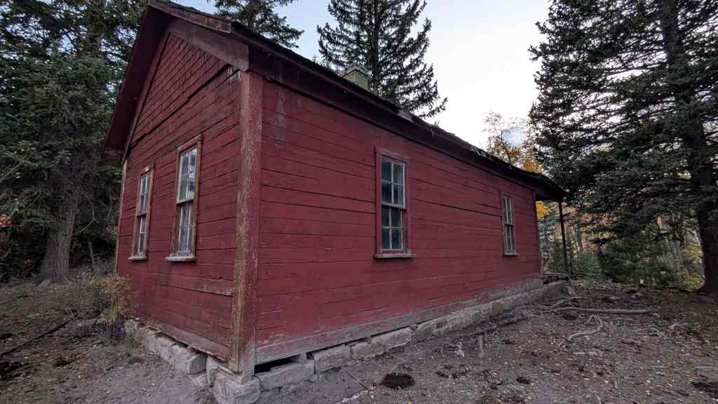
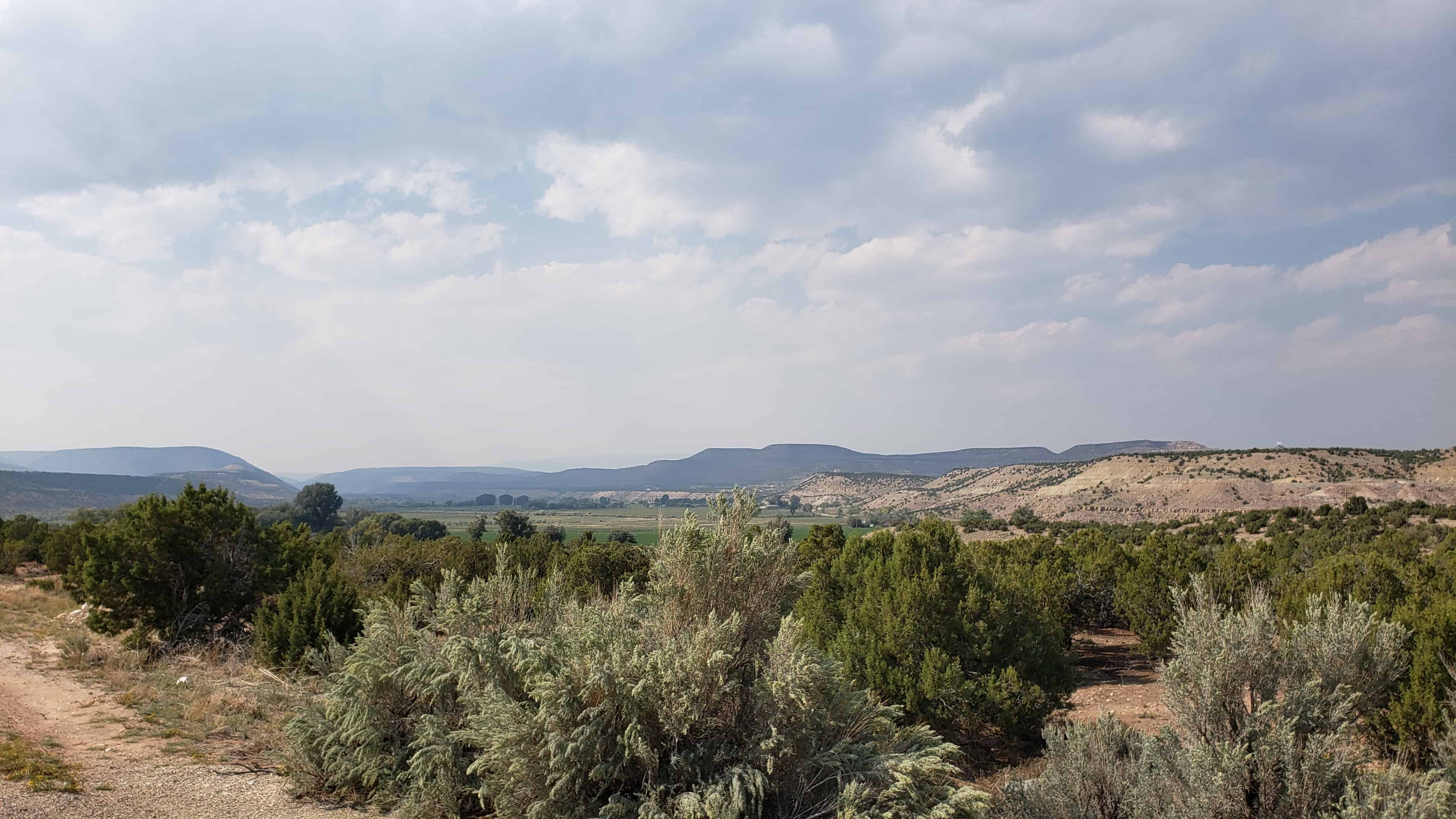
The Simmons Ranch is located along the Strawberry River in Duchesne County, Utah and was added to the National Historic Register (#92000463) on August 18, 1992.
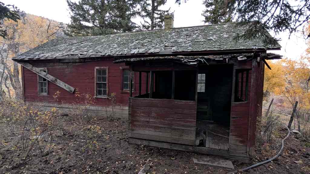
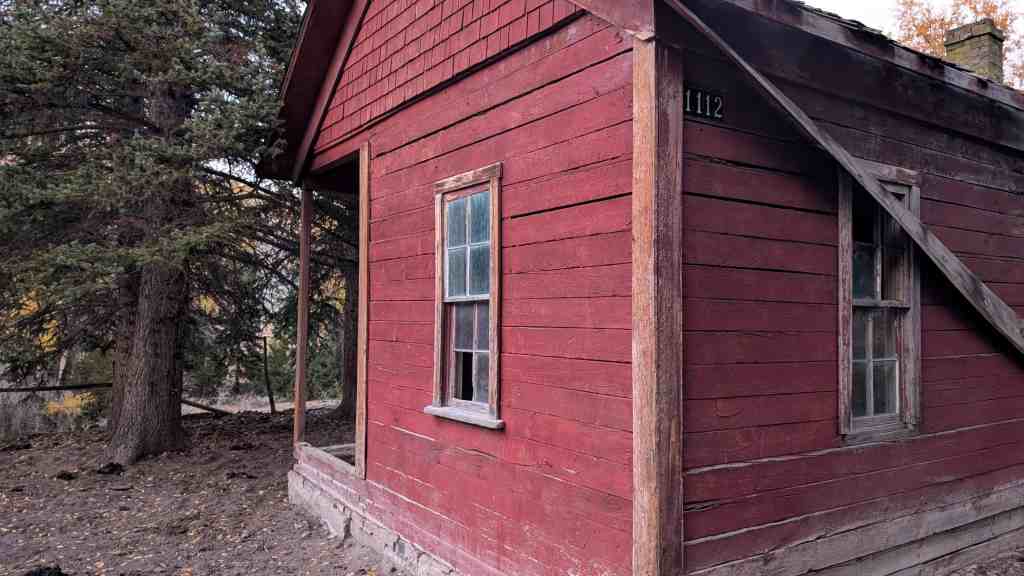
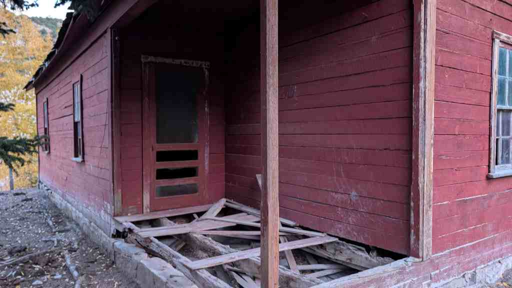
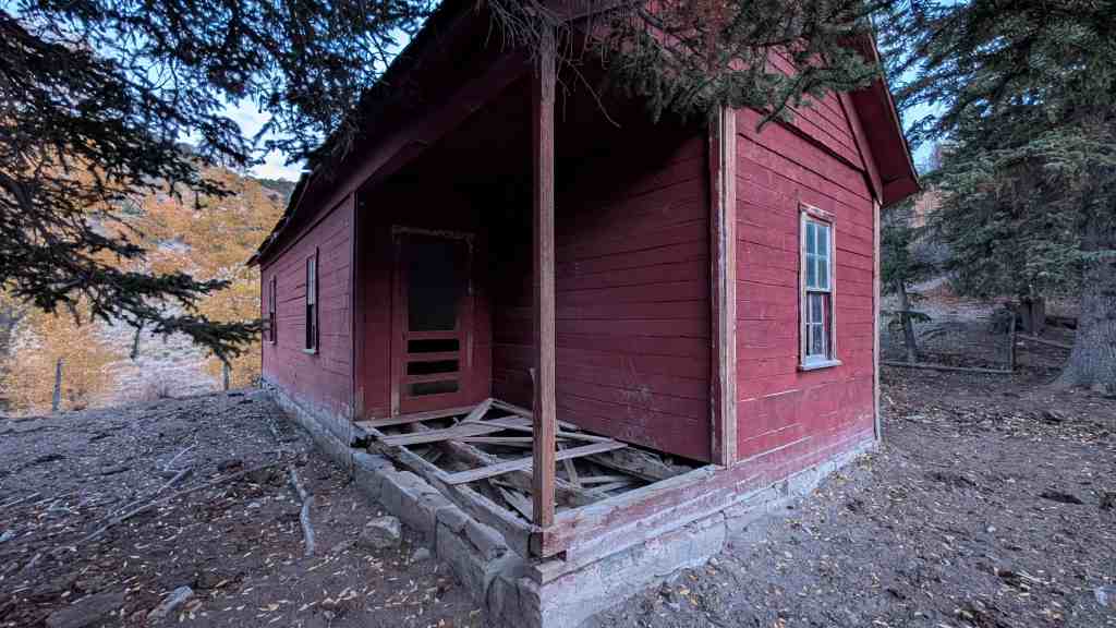
An archaeological team from Brigham Young University examined the Simmons (Remund) Ranch complex (district) in late 1990 and prepared a report on buildings and structures extant at that date. They found an older part that consists of five buildings of “log cabin” construction, as well as a system of corrals, a pavilion, an underground storage facility, an irrigation ditch, and a barbeque pit. The last five items fit into the category of structures. In the western part of the area stand three other cabins and one house of “poverty siding construction,” a external wallboard or plywood material. These cabins and house were transported to the present location, hence they are “noncontributing” though they were a later part of the functional ranch.
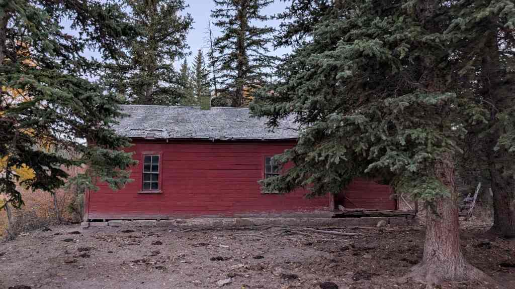
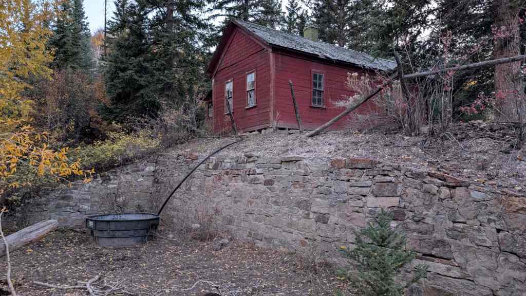
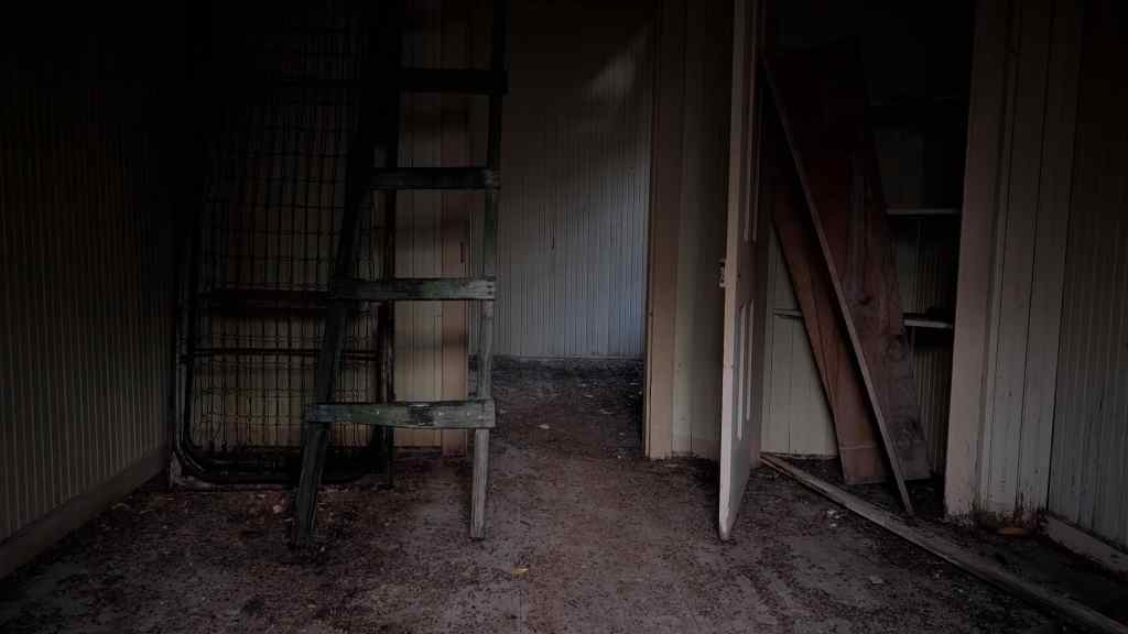
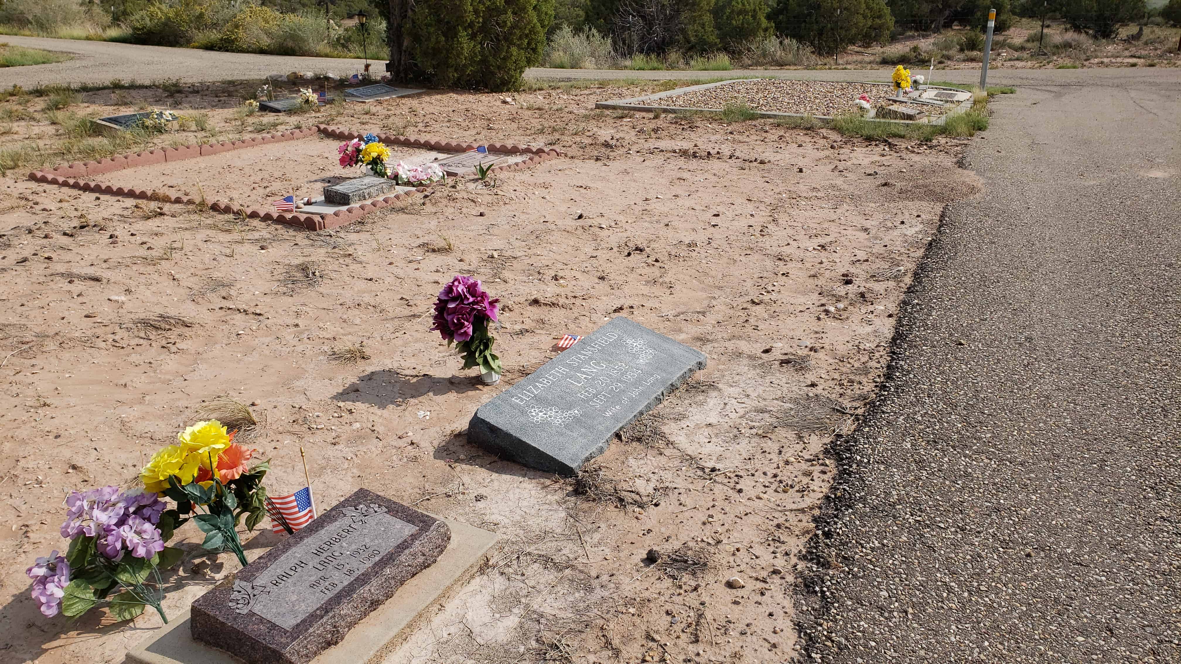
The largest of the buildings of the “log cabin” construction stands at the southeast cornpr of the group of buildings of the ranch and measures 30 ft. by 15 ft. and consists of two rooms. This building includes a front porch, gabled roof, and stone foundation. The roof is of planks with a tin exterior added to the east side only. A loft or attic with exterior opening for entry is present which is accessable from a ladder on the outside of the cabin. The hand hewn and notched logs suggest an early date of construction. The cabin has two doors into the two rooms from the exterior on the west side and two windows on that side. One of the doors is partially missing but was a solid exterior door. The other is missing completely but a screen door is still in place on the outside. A single door on the east side is gone completely. One window on the first floor is on the north side below the opening to the loft. The county tax assessor’s office has a record which indicates that the cabin may date from as early as 1910 but the best estimate, as described below, is that it dates from approximately 1920.
A second “log cabin” appears on the map sketch as having additions on both the north and south. An original portion of this second “log cabin” of 15 ft. by 13 ft. provided the basis for the building with the portion on the north side marked “addition” on the map representing an extension of the interior. The addition made the entire “log cabin” some 28 ft. by 13 ft., not counting a plywood porch 10 ft. by 10 ft. shown on the map as a second “addition.” The original cabin had only an entry door but the plywood porch also has a door and three windows across the south end and one window on the west end. the addition on the north end simply lengthened the original building with no more doors and windows. A plywood façade of later date covered the logs but has fallen away enough to reveal underlying logs. The roof consists of dirt and sod materials, which are now bearing grasses. The additions are more than 50 years old so they are considered “contributing” to the nomination. Neither of the two larger “log cabins” designed for residence (nor any of the later poverty sided cabins) include any heating facilities.
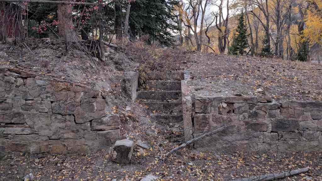
Three additional “log cabins” are described as connecting storage sheds, each 13 ft. by 10 to 12 ft. The two sheds at the ends of the group probably originated as separate buildings. Logs placed between the original sheds formed the third shed. The eastern most of the three sections is of construction suggesting use as a granary with a door opening about 1 and 1/2 feet (the width of three logs) above the ground. The door itself is simply planks nailed to braces. The cabin at the west end has a single door opening which is at ground level with another door consisting of planks. The roofs of all three sections consist of dirt and sod materials. However, the logs of the middle shed show clear evidence of machine sawing, implying a somewhat later date, though, as described below, all three can be reasonably documented as having been on the site by 1913. The middle shed has no exterior doors but is entered through a door opening from the western most shed. A small door covering a hole in the ground stands just east of the three connected cabins.
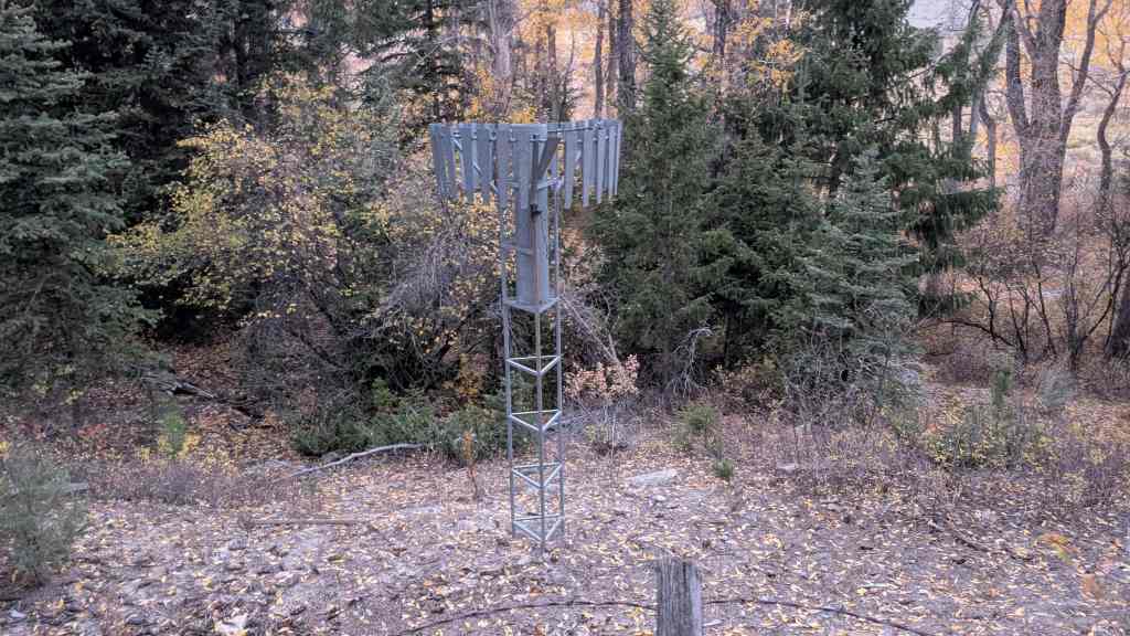
A system of corrals at the north end of the complex is also of axe hewn log construction as is a fence which encompasses the entire ranch complex. The western portion of the corrals, in a circular shape, suggests that is was designed for horses. The eastern portion of the corrals which consist of parallel logs suggests use for cattle or other livestock. A portion of an irrigation ditch runs along the southern edge of the corral just north of the log sheds. All of the log construction is of hardwoods which were of the same species currently present along the stream. The most important is the box elder, a member of the maple family and quite common in the area. However, cottonwood trees, less useful for construction, are also present in numbers.
A small structure noted as a pavilion of 20 ft. by 15 ft. has a gabled roof of wooden frame construction, supported by upright logs, but no walls. Next to the pavilion is a circular plaza approximately 15 ft. in diameter which consists of flat stones. The stones surround a porcelain bathtub sunken to the ground level which served as a barbeque pit. A proper description of this feature is also that of a structure rather than a building. Neither the pavilion and the barbeque pit appear on any records of the Assessor’s office but the cattle operators added them, probably in the 1940s. Hence both are non-contributing to the nomination though present in the area.
Charles Simmons completed an application to take legal ownership of the lands under Homestead Laws, on February 10, 1913. This process is also called going to patent with the document showing the government’s grant of ownership called the final patent. He presented an inventory of the improvements that he had made on the land. Two other witnesses also appeared, as required by the Homestead Laws, who substantiated the inventory and other items in Simmons’s statement. In fact, they valued the improvements at $700; Simmons himself only gave $650. Also they noted the existence a lateral irrigation ditch, that Simmons omitted. Otherwise, they gave identical inventories.
Log House, 15′ x 15′
” Barn, 12′ x 20′
Cellar, 8′ x 10′
Log shop, 10′ x 12′
Pole corral, 30′ x 50′
Chicken house, 8′ x 8′
Hog-pen, 8′ x 10′
Log stable, 14′ x 16′
Pole fence, 1/2 mile,
900-1000′ lateral irrigation ditch.
A correlation of the above listing with the buildings and structures evident on the property is useful. The later owner of the ranch who had memory of it from a very early date stated in oral interviews that nothing had been removed except the chicken house and log stable, though other buildings were added later. Hence the inventory on the patent application needs to be reconciled with the observable earlier buildings on the site. With this fact in mind it is safe to say that the cabin on the 1913 inventory of 15′ x 15′ is probably the smaller log cabin as noted with additions from later times, though the actual measurement is 15′ x 13′, the number is close enough considering the nature of the records. Records at Duchesne Co. Assessor’s Office imply that the changes were made prior to 1940, a date substantiated by a later owner of the ranch. The Barn is probably the shed designated as a granary with the shed next to it. The dimensions of 24 ft. by 13 ft. are close enough to the measured dimensions of 20 ft. by 12 ft. in the original patent.
The third shed is probably the improvement noted in the 1913 inventory as a log shop since it fits the dimensions almost exactly. The covered hole just east of the sheds may well be the cellar. The pole fence of 1/2 mile is represented by several segments of wooden fence in the area, though some may have been replaced over the years. The Pole corral is still represented by the existing corral, though, again, some portions may have been replaced and the entire structure expanded. Conceivably the Hog pen of 8′ x 10 J was also in this area at the north end of the ranch. Even a portion of a 900 J to 1000′ lateral irrigation ditch probably survives along the south end of the existing corral, though only 50 J today. Presumably the original ditch extended farther to the east into fields of various crops. The only items from the 1913 inventory which can not be readily correlated with anything still present are the Log Stable and Chicken house, though a chicken yard is present on the eastern edge of the area next to the smaller log cabin.
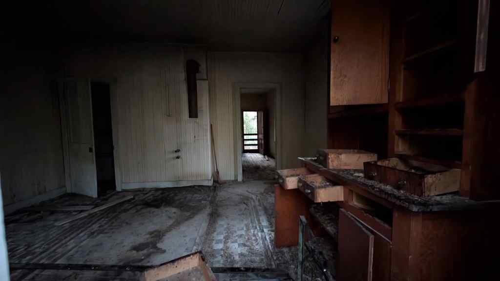
The inventory does not list the larger log cabin, but the later owner of the ranch stated that the cabin dates from the time of occupancy by Charles Simmons, certainly to the 1920s and possibly earlier. The Assessor’s Office listed it from 1910 but that was obviously too early. The later owner also noted that his family had brought in and occupied the “poverty sided” ranch house and smaller “poverty sided” cabins in the 1940s. Hence this group of buildings are listed as “noncontributing” to the nomination though they were a functional part of the ranch at a later date and may be added to the site as “contributing” when time requirements are met within just a few years. (Indeed, a case can be made that these additional buildings could be designated as contributing at this time since they were part of the functional ranch for many years and date before 1940; quite possibly some years before 1940.
As a final listing, the following existing items are contributing as part of the original homestead as representing the first permanent European/American settlement in the area:
- two room log cabin, c. 1920
- one room log cabin, c. 1913, with porch addition, c. 1940
- log granary, c. 1913
- log shop, c. 1913
- log storage shed, c. 1913 (counted as one building with the shop and granary)
- log corral, c. 1913
- irrigation ditch, c. 1913
- cellar, c. 1913
The significance of the Remund Ranch as the oldest surviving European/American residence in the area of northwest Duchesne County, Utah, is documented by the records filed by Charles Simmons in the Homestead process which ultimately led to a full patent (grant of private ownership) by the U.S. General Land Office on June 26, 1913. (Rather typically, the owners did not file a copy of the patent document, no. 344144, with the Duchesne County Recorder until June 25, 1928, but it had legally been their property for fifteen years.) This is the earliest patent granted by the General Land Office under Homestead, Sale, or any other method in the entire region of the county, as revealed by the Recorder’s Office and a master file book of land patents in the National Archives. The area had been a part of the Uintah Reservation of the Ute Tribe until the early twentieth century when the General Land Office opened it to entry under the various land distribution laws. However, the Land Office did attach some additional restrictions directly into the patent that were not part of patents on typical federal lands.
The opening of previously withdrawn lands to Homestead is a major theme in the history of the Western U.S. A series of major “Land Rushes” in Oklahoma, formerly known as “Indian Territory,” have defined much of that State’s character. (Even the nickname “Sooner State” reflects the trick of a few slipping into an area “too soon” before legal opening to claim choice lands.) The U.S. Congress opened a portion of the Ute Tribes Uintah Reservation to non-Indian Homesteads by an Act of May 27, 1902. Members of the tribe selected lands: 80 acres per head of family, 40 for all other members. The purpose of opening the lands was to raise additional cash for the tribe which was “land poor.” The same act allotted some $70,064 to the tribe for various medical expenses then current. Further the Act specified that those entering the lands for the purpose of Homestead would have to fulfill the normal requirements under the famous Act of 1862 by constructing a cabin, residing on the site for five years as the only residence, and productively farming or ranching the land. However, in the case of former Ute Lands (and other former Reservation Lands opened under a variety of Acts of Congress), a Homesteader had to pay a fee of $1.25 per acre after the five years residency. In cases of “ordinary” Homesteads, the filing party could secure the land by paying the $1.25 fee per acre at anytime prior to completion of the five years but after that time the party had a two year period to file final paperwork and pay processing fees as the only monetary expense.
Though the Act opening the Uintah Reservation took effect on October 1, 1903, actual administrative enforcement of the provisions was delayed until July 1, 1905, when the General Land Office finally opened a facility to service the area. This office, at Vernal, Utah, administered a variety of government lands in the area. In the Utah case there was no dramatic “Land Rush” as had marked at least five openings in Oklahoma which have been recreated by Hollywood with claimants madly dashing over a starting line at an appointed time. In Oklahoma, large tracts of prairie with excellent wheat potential attracted large numbers of claimants from the start. On the former Ute lands, rugged topography made the great majority of the acreage useless for farming or ranching. However, there were some exceptions, including the site selected by Simmons, which was along a stream bottom. Claimants drifted into such sites over the ensuing years. Simmons was clearly one of the first to file a claim, on January 27, 1906, and take residency on June 25, 1906. It is impossible to state if he was the first to do so in the area, however, he was the first in what is now Duchesne County to actually complete the patent process, as noted above. In 1907 a large group of families arrived from Nebraska and began to improve homesteads. The Nebraskans were not alone. From July 1, 1906, to June 30, 1907, various claimants filed 331 documents for entry into former Ute lands. It should be noted that this area was considerably larger than that part of the Reservation which was ultimately placed in Duchesne County. The fact that few of these actually went to patent adds to the significance of the Simmons Homestead in this context.
The “log cabins” contribute to the theme of the site as intact, excellent, and representative examples typical of the dwellings of most early European/American residents. Though several other “log cabins” on other properties are known in Duchesne County, they have been removed from their original locations or are not as old. The prevalence of hand hewn logs in the two cabins that served as residences and two of what are now the log storage sheds is unusual for log cabins constructed by the twentieth century and is important physical evidence of the early date of settlement in the local area. Subsequent use of sawed logs at the Ranch emphasizes the significance.
The Simmons (Remund) Ranch proved successful from farming and, subsequently, from open range ranching. The popular media have frequently portrayed open range ranches, loosely described as operations which graze livestock on open, unfenced lands. However, there are relatively few such facilities in the Western States which have been so well preserved. The fact that the Ranch operated in such a capacity from its first settlement until relatively recently also adds to this aspect of its significance. The success of the Simmons (Remund) Ranch is most striking when contrasted to the operations of other immigrants who came to the area at about the same time. The Nebraska group noted earlier is particularly striking in this regard. Several families with origins in Nebraska are listed on the 1910 U.S. Census at the same time Simmons lived there. Even though the group included some well-to-do families for the times, with doctors and lawyers among the contingent, their efforts were mostly unsuccessful. Virtually the entire group returned to Nebraska before living on the parcels of land for the five years required for Homestead. Thus the date 1913 by which Charles Simmons had lived on the land long enough to fulfill the requirements for the full patent provision of Homestead, represented the approximate time that the Nebraska group was abandoning such ultimate prospect.
When Charles Simmons filed for his final Homestead in February, 1913, he listed himself as single, 31 years of age. By the time the officials in Washington approved the application in June, 1913, they issued the final patent to Charles and Hanna Simmons. This is a further testament to the success of Charles Simmons development of the ranch. The Simmonses went so far as to acquire additional adjacent lands under the Act of Congress of 1820 which allowed outright purchases (instead of the five year occupancy for Homestead). They filed for these purchases in 1917 but the Land Office did not issue their final patents until 1921, possibly because of the restrictions of release of former tribal reservation lands. The fact that the Simmonses had enough capital to make a land purchase, and chose to do so on adjacent lands, is further evidence of success.
Yet another suggestion of the success of the original Homesteader appears in his original patent application of 1913. In addition to the inventory of improvements noted in Sect. 7, Charles Simmons also presented a list of crops and acreages that he had cultivated over the years immediately prior to his final application. It should be noted that his application was for a total of 160 acres of land, considerably more than the area immediately around his cabins. He grew the following crops on the acreages noted, which totaled 25 ac. cleared and ready by 1912:
The steady increase in production is inescapable evidence of success.
The Simmonses may have leased the Ranch, or a portion of it, to a man named Hays in the 1920s or early 1930s. The recorder’s office shows a 1938 sale to H. Ray Knox and a 1946 resale to the Remund brothers, hence the Ranch name on the USGS topographic map.
However, Lloyd Remund stated that he and his brother had occupied the ranch as early as the 1930s though he could not provide an exact date. (A time lag of some years in recording of a property transfer is quite consistent with the earlier history of this particular parcel and of general practice in Duchesne County. Such a lag may also show final payment of a mortgage after some years.) The Remunds ran from 60 to 180 head of cattle. Earlier Hays had run as many as 300 goats for mohair production. Lloyd Remund stated that Hays was the builder of the circular portion of the corral since he also had horses, though some corral facilities existed in the area from the first Homestead. However, some corral facilities were clearly present earlier as shown by Simmons application. Both Hays and the Remunds had operated the ranch only in the summer. However, Lloyd Remund stated that the Simmonses had lived on the ranch year round at some times but had lived in town at others. He was uncertain as to whether they ultimately had any livestock production, though they grew crops from the initial entry. This seems consistent with the crop records through the years listed in the patent application. If Charles Simmons had produced livestock he would have listed it as well.
A final point from contemporary records on the original homesteader, Simmons, is of some interest. Charles Simmons listed himself as arriving on his homestead from Theodore, Utah. Two other homesteaders on nearby sites in 1906-1907 also listed themselves as arriving from the same community. They could well have been a loosely organized group but no conclusive support documents are available.