• About JacobBarlow.com
  • Cemeteries in Utah
  • D.U.P. Markers
  • Doors
  • Exploring Utah Email List
  • Geocaching
  • Historic Marker Map
  • Links
  • Movie/TV Show Filming Locations
  • Oldest in Utah
  • Other Travels
  • Photos Then and Now
  • S.U.P. Markers
  • U.P.T.L.A. Markers
  • Utah Cities and Places.
  • Utah Homes for Sale
  • Utah Treasure Hunt

JacobBarlow.com

~ Exploring with Jacob Barlow

JacobBarlow.com

Tag Archives: Ranches

Tule Springs Ranch

27 Sunday Oct 2024

Posted by Jacob Barlow in Uncategorized

≈ Leave a comment

Tags

Clark County, Las Vegas, Nevada, NRHP, Ranches

Floyd Lamb State Park / Tule Springs Ranch

The subject project is an architectural/historic assessment and evalution of the architectural resources of the Floyd Lamb State Park. The Division of State Parks of the State of Nevada currently plans to develop the Park into a facility providing for greater intensity of public use, offering a variety of recreational activities. The report will also provide an assessment of the effects of the proposed park development upon existing resources.

The Park served as a city park for the City of Las Vegas from 1964 to 1971, as a private commercial entity from 1959 to 1964, and as a working ranch/guest ranch from 1941 to 1959, during which period most of the existing structures were built. The property possesses some historical values due to its uses during these periods as well as prior eras, and some architectural values due to the construction, planning, and design of the ranch complex.

The purpose of this report is to assess the architectural/historical significance of the park and its structures in order to provide a basis for the development of appropriate plans for new facilities and modifications of existing park structures or facilities,

Tule Springs Ranch was added to the National Register of Historic Places (#81000383) on September 23, 1981. It is now the site of Floyd Lamb Park in Las Vegas, Nevada.

The history of Tule Springs prior to its first permanent settlement includes its use by Indian tribes, early settlers, prospectors, and a transport company. Historic discussion will focus primarily on ownership eras that may involve the addition of structures to the property.

Ownership: (from first permanent settlement of site):

  • Nay: 1916-192S
  • Hefner: 1928-1941
  • Gournond: 1941-1959
  • Tule Springs Investment Company: 1959-1964
  • City of Las Vegas: 1964-1977
  • State of Nevada: 1977 to present

Tule Springs’ history apparently began as an occasional early watering place for Indians traveling back and forth between the desert and the mountains in pursuit of seasonal food sources. Although they utilized the spring at Tule it apparently was not as favored a location for their uses as spring at either Las Vegas or the Redrock area.

Tule Spring may next have been used by Mormons as a camping place on their way to obtain timber from the northeast for construction purposes, having €stablishe3 a settlement in the Las Vegas valley in 1855.

In the late 1860’s, a reconnaissance trip through the area by Lt. George Wheeler of the U.S. Army Corps of Engineers noted that Tule Springs was one of the stops on a road traveled by prospectors from Elko Nevada to Prescott, Arizona. Tule Springs was described as having good water but no wood or grazing.

In 1876 a man named Kiel built a sawmill near Las Vegas and an 1886 map shows a road leading to the sawmill past Tule Springs. Although there was some local traffic in the late 19th century and a few prospectors, the majority of travel in the area occurred on other roads that did not pass by Tule Springs.

By 1904, the imminent coming of the railroad assisted by mining discoveries in the Bullfrong region, provided a remarkable sudden population growth for Las Vegas. Tule Springs became a watering place on the Bullfrog stage route. A photograph, report, and a radio broadcast prepared by Charles P. Squires asserts that an establishment did exist at Tule by 1905, and was located just east of the main spring at Tule (possibly near the present swimming pool). The establishment appears to have been named the U.S. Hotel and was operated by a man known simply as Levandowski.

Squires discussed the freight road that passed by Tule at that time, where two or three freight outfits might be stopping at once with from 40 to 80 head of horses and mules in various corrals clustered about the Springs. An automobile stage line running past Tule from Las Vegas to the Bullfrog mine was also operating at that ‘time but ceased the following year when it was determined to replace it with a railroad line.

It is not known whether anyone lived at the Springs during the next 8-10 years or whether any structures existed on the property at that time.

The next individual known to have settled at the Springs was a Mormon, Bert Nay, who filed on the water rights in 1916. Nay’s application states that the property had never had any development work done on it. Apparently the U.S. Hotel, if it existed, had disappeared by then. The Nay family may only have spent summers at Tule Springs, living in tent houses and camping out of a wagon when following the stock.

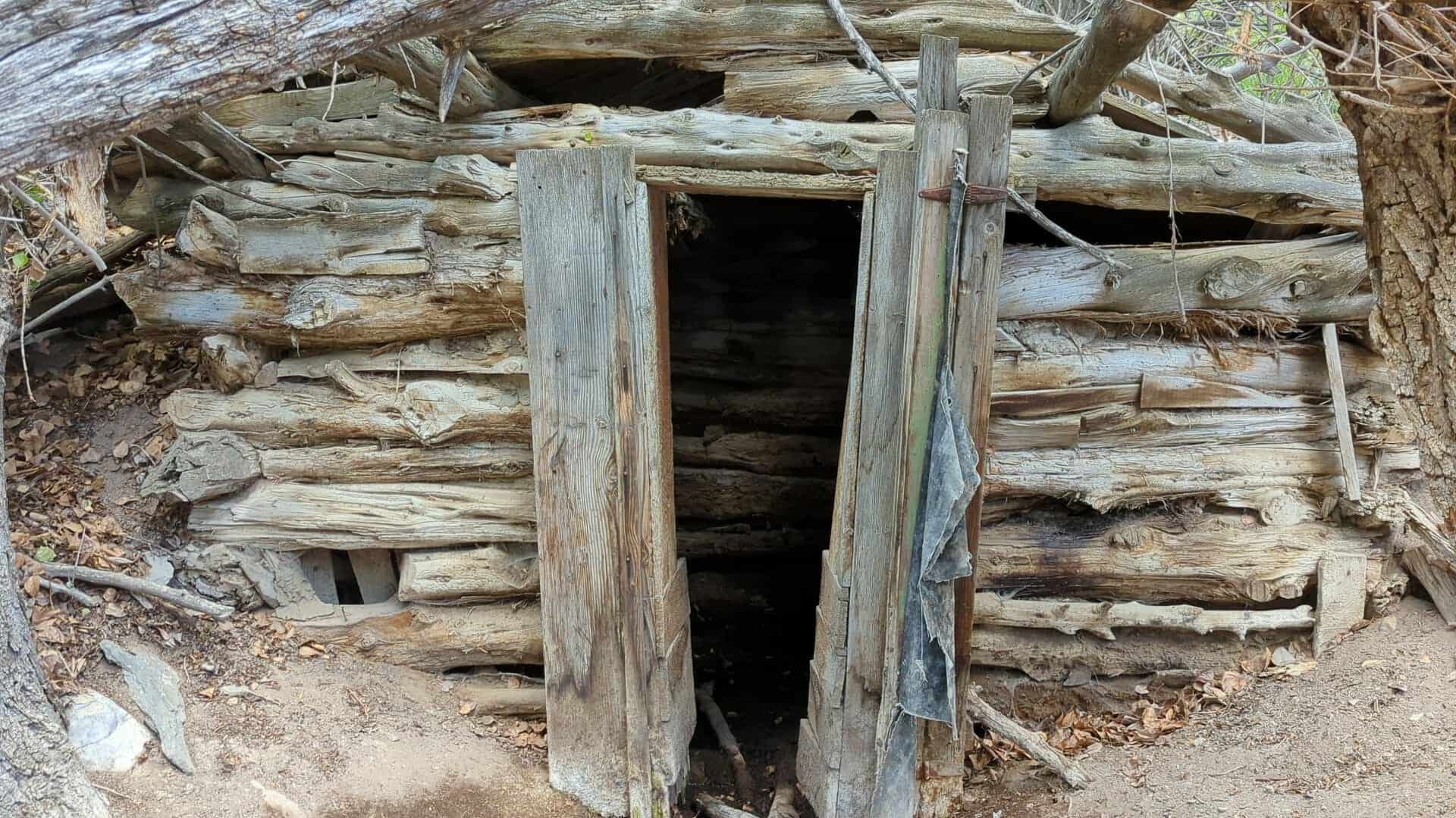
The Ritenour report states that the smali adobe building (Building #13, Vhay & Ferrari Building Inventory) was probably built by Nay between 1914 and 1918, as a blacksmith shop and storage facility. Nay would have needed such a facility there on the ranch readily accessible for the care of stock.

However, according to the Nevadan, March 13, 1977 article, “The Nays return to Tule Springs”, Bert and Anne Nay actually lived in the old adobe building still standing at Tule Springs. The Georgia Lewis article states that “Indians or early traders built the adobe as a shelter and Bert added a roof, doors and windows. The adobe bricks came from large clay beds, later diked by Prosper Goumond in the 1940’s to form a lake.”

Nay also built a dam reservoir and apparently a small frame house near the Springs that apparently burned in the 1930’s.

Apparently the next owner of the property, Gilbert Hefner, was not responsible for the addition of any structures of the area. At this writing, after further conversation with Ms. Ritenour, the existence of a bootlegging operation on the ranch during Hefner’s ownership appears questionable. The Hefners did not develop the property further and it lay vacant until purchased in 1941 by the individual who sold it the same year to Prosper Goumond.

History: Goumond Era

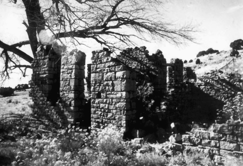
By far the major portion of the Tule Spring Ranch, Floyd Lamb State Park complex was planned, developed and built by Prosper Goumond after his acquisition of the property in 1941. Goumond acquired the Tule Springs property on the day Pearl Harbor was attacked in 1941, and gradually added surrounding land until his total ownership involved 880 acres. Only two structures apparently remained on the property when Goumond purchased it, the adobe hut, and a deteriorated wooden structure, located at the end of the original entry between the Concessions Building and the Foreman’s House. He removed it when he began to develop the property.

The first structure built on the ranch by Goumond was the so-called Cook House, later known as the Club House. The structure ultimately experienced. several alterations but was originally built with 2 bedrooms, a fireplace, a living room and a kitchen. Its first addition was a large dining room to the east for ranch cowboys. This addition later became the kitchen, and a large guest dining room and bar were added to the southern part of the building. The bar had a decorative fireplace and yellow upholstery with a studded brass rail design, executed by Goumond’s grandaughter. This structure burned and was removed during the city’s ownership. A contemporary concession building, #15 of the Vhay/Ferrari Inventory, stands approximately at the former location of the Cook House.

The Cook House served as lodging while the other portions of the ranch were under construction. The next principal structure to be built was the Ranch House which became the residence of Goumound’s daughter, Pat Goumond De Vaney, Cliff De Vaney, and Pat’s daughter, Margo. (Prosper Goumond did not reside at the ranch, but lived in town.)

The original entrance road ran between Buildings #15 and #16, the Cook House and the Ranch House. The traditional square-framed “ranch” entry with gate and hanging signs marked the entrance to the ranch. The road that now extended east and west bet wen the stable row and the Hay Barn, and parallel to them, did not exist at that time.

The construction of the other ranch buildings took place on through the 1940’s. The initially rural residence rapidly evolved into a working ranch complex. At its height of operation, Goumond’s Tule Spring complex encompassed a considerable variety of ranch activities.

Goumond bred and raised a particular crossbreed of cattle termed “Brangus”, involving the mating of an Angus Bull and Brahma Heifer. Cattle were butchered on the ranch and hung in large walk-in butcher’s refrigerator. A concrete-walled enclosure in back of the Dairy Building, #6 in the Vhay/Ferrari Inventory, was fitted with a cement slab, built-in trough and a large wood framework with pulley for slaughter purposes. A network of corrals engulfed the area by the stable buildings.

The ranch also kept pigs. The hog house or pig pens and enclosures were located in Building #10 on the Vhay/Ferrari Inventory. Pigs were also slaughtered in the enclosure by the Dairy Building. The room at the west end of this structure held a butcher block table, stainless steel sinks, and various pieces of dairy machinery.

The ranch maintained a small dairy herd as well. Building #6, the Dairy Building, still contains the ramped concrete stanchions that held cows for milking by machine. A complex arrangement of pipe created stalls on a 3 1/2 foot tall concrete platform and held cows for milking by electric machine. (The process and its machinery were not always completely effective. The efficient modern procedure provided a display of intent sometimes followed by the actual milking of the cows down behind the barn.)

Hay and alfalfa for ranch livestock were stored in the large hay barn by the lake. The ranch cultivated and farmed alfalfa in acreage to the northeast of the lake and south east of the pool area thus providing fodder for its cattle.

Stock included horses, both working and ‘dude’, cattle, and dairy cows. Chickens were kept in Buildings #4 and #5, pigs in Building #10 and possibly Building #8, and turkeys were also raised on the ranch. Peacocks, and both domesticated and wild ducks and geese co-existed on the ranch. The water fowl populated both the pond spanned by the suspension bridge and the lake.

The lake itself was stocked by bass, crappie, and blue gill fish, and provided a setting for canoeing or boating. A boathouse, now gone, housed lake canoes and was fitted on the interior with a system for lifting them out of the water.

A swimming pool surrounded by a white picket fence stood near the suspension bridge and pond, also edged in white pickets. The pool was originally built as a reservoir. It was filled with sand to provide a children’s play area during the city’s ownership. A fenced horse pasture (for the better horses) lay below the pool to the east.

The original spring lies beneath the northeastern edge of the Duplex Building #19. A cistern still exists under its foundation. The gazebo sheltered a drinking foundation and a refrigerated unit containing ice.

A large wood water wheel spanned a small masonry lined channel that carried water from the Pump House. The Pump House, Building #18, stands over the first well drilled on the property by Goumond.

The Spring House, Building #26, was occupied by Margo Goumond, Prosper’s granddaughter. Other accommodations existed in the Cook House and Bunk House, but apparently were mainly occupied by employees of the ranch. Maid quarters were located in the water tower, which had apartments also in the rear addition and at the second floor level.

An orchard with a wide variety of fruit trees stood to the north of the Guest House, Building #17. A truck farm provided fresh produce for the ranch and its guests, Products of both were summer-canned and stored for year round ranch use in the root cellar.

Green laws stretched between picturesque green and white structures, pools and graceful willows, tall cottonwoods and fruit trees, creating a garden oasis that contrasted sharply with the dry surrounding land.

A large Fairbanks-Morse diesel engine served by diesel fuel stored in a large tank embedded in the earth next to the Generator Building, #24, provided power for the ranch until diesel fuel became too expensive, Goumond also built his own operating telephone and power lines.

Essentially, the ranch was planned and managed, to the greatest degree possible, as a self-sustaining unit, virtually in the middle of a desert.

An interesting adjunct to the basic ranch operation in the late forties and early fifties was its evolving additional function as a guest or “dude” ranch. While dude-ranching in the west has a history that extended back into the 19th century, a combination of legal changes in Nevada and changing societal attitudes towards marriage created a climate that rather suddenly popularized the state as a combination divorce and guest ranch destination for the entire country,

A notable factor in this phenomenon was the reduction of the residency requirement for divorce in Nevada to only six weeks, the shortest term of any state at that time. Accordingly, the guests that came to Tule Springs were predominately potential divorcees, often women from the east, wealthy, well educated, and “social”.

Some additional apartments were created in order to accommodate this function, notably Buildings #17 and #19. Guest capacity at the ranch could apparently range up to 10 or 12 persons depending on various factors. Additionally, the proprietor of guest/divorce facilities like Tule Springs played the important role of “witnessing” the continuity of residence of divorce-seeking guests, according to state law.

Sandstone Ranch

29 Sunday Sep 2024

Posted by Jacob Barlow in Uncategorized

≈ Leave a comment

Tags

Clark County, Nevada, NRHP, Ranches, State Parks

Sandstone Ranch / Sand Stone Ranch / Spring Mountain Ranch State Park

Sandstone Ranch was added to the National Register of Historic Places (#76001141) on April 2, 1976.

From the national register’s nomination form:
This property is of state historical significance because of its location athwart several important trails and because of the part it played in the economy of southern Nevada over an extended period of time. By the mid-1830’s a campsite on an Old Spanish Trail alternate route through Cottonweed Valley had been established at the creek on the ranch site. In 1844 the area was visited by an exploring expedition under the command of Captain John C. Fremont of the U.S. Army Topographical Corps. The Mormon Trail, in use from the 1840’s until the early 1900’s, also passed through the ranch site and in the 1850’s the area was a stopover on the route between the lead mines at Potosi and the Mormon Mi^ssion at Las Vegas.

A survey party under the leadership of Lieutenant George M. Wheeler visited the area in 1869, by which time several ranches had been established, most importantly that of Bill Williams. Two structures graced the property at that time, a small stone cabin and a blacksmith shop. Williams ran a few cattle on the property to supply meat to the mining camps in the vicinity and raised hay, fruit and vegetables which were sold to camp commissaries.

By the mid-1870’s Williams had abandoned the property and it had been taken over by James B. Wilson who constructed a bunkhouse and added on to the cabin. Wilson continued the small-improvements on the property, most notably the ranch’s irrigation system and a small earthen dam. These latter improvements date from the 1890’s.

With the coming of the railroad in 1905, extensive cattle markets were developed in California and for the first time the ranch became an important cattle operation. Following Wilson’s death in 1906, his two half-Paiute sons ran the ranch, but made some bad investments during World War 1 and nearly lost it to creditors.

Wilard George, a family friend, paid off the mortgage in 1929 and gave the two Wilson brothers a home on the ranch as long as they lived. In addition to continuing the cattle operation, George attempted to raise chinchillas for his fur business. In 1944 George leased the ranch to Chester Lauck of radio’s “Lum and Abner” fame and four years later he purchased it. Newly named the Bar Nothing, Lauck used the ranch largely as a vacation retreat, although he continued to raise cattle and, in addition, opened a boys’ camp. Lauck built the main house on the ranch and the large reservoir to the west.

In 1955 Vera Krupp, the wife of the German industrialist, purchased the ranch. She continued the cattle operation on the 400,000 acre grazing allotment and lived there until 1964. In 1967 the property was sold to the Hughes Tool Company. Two Las Vegas businessmen, Fletcher Jones and William Murphy, purchased the property as a real estate speculation in 1972, but opposition from Las Vegas residents precluded the planned home and country club development. The property was subsequently offered for sale to the State of Nevada and the transaction was finalized in the spring of 1974. Guided tours and environmental education programs are currently offered on the property and recreational programs are currently awaiting the development of a master plan.

Starr Ranch

19 Monday Aug 2024

Posted by Jacob Barlow in Uncategorized

≈ Leave a comment

Tags

Garfield County, NRHP, Ranches, utah

Al Starr entered the Henry Mountains as an early prospector in the 1880’s He started a mine on Mt. Killer which he worked a few years. Evidently the mine was not a paying operation and in 1890 he settled at Starr’s Spring to start a cattle operation. This operation too succumbed to economic disaster and by 1900 the ranch was abandoned.

The significance of the site lies not in its role in history, but in the unique form of construction of the ranch house and smoke house. As mentioned, it is now a scenic attraction at Starr Springs Campground.

The site is of local significance since Al Starr was not a major figure head in the early settlement of the Henry Mountains or the West.

Local legend has it that the ranch was often visited by Butch Cassidy and his cohorts.

A short lived venture, Starr Ranch failed probably because of overgrazing. Today, the region’s primary economic base is ranching, and the Starr Ranch represents an early effort at this occupation in the south end of the Henry Mountains,

Of unusual construction for the area, the ranch house, was built of dressed granite (diorite) and chinked with mud. Much time and care was taken in the construction of the building in relation to its relatively short use span.

The smoke house, too, is uniquely built. A dugout, its only visible support is the earthen sides of the structure, and its arched roof. The only wooden posts found in the building are two pole stringers used as meat drying racks.

Starr Ranch is located in Garfield County and was added to the National Register of Historic Places (#76001816) on April 23, 1976.

The site represents the first permanent ranch in the southern end of the Henry Mountain in 1890. The site consists of a ranch house and smoke house. The smoke house appears to have been the residence while construction of the house was taking place. The roof of this subterranean structure was made of fitted granite rocks in an arched form of construction. There is no internal or external form of support for this roof. No mortar was used in construction of either the smoke house or the ranch house. The ranch house was also constructed of closely fitting granite rocks with soil used for sealing of the rock walls. The walls were about two feet thick.

The site is now protected by a fence. Vandalism is evident on the main ranch house, with many of the interesting sculptured window sills removed. The smoke house is still intact.

The terrain is rolling hills to flats, near a large spring which bears Starr’s name, The surrounding area is now a developed recreation area and is one of the points of interest in the southern end of the mountains.

The buildings have been altered by deterioration and vandalism

Simmons Ranch

13 Wednesday Mar 2024

Posted by Jacob Barlow in Uncategorized

≈ Leave a comment

Tags

Duchesne County, NRHP, Ranches, utah

Simmons Ranch

The Simmons (Remund) Ranch has significance as an intact, excellent, and representative example of an early Homestead; quite possibly the first Homestead, in Duchesne County. As such it is the oldest surviving site of European/American settlement, in this area, formerly part of an Indian Reservation, which was opened to such settlement in the early twentieth century. This site has additional significance since the homesteader succeeded while most others in the locale failed in similar endeavors.

The Simmons Ranch is located along the Strawberry River in Duchesne County, Utah and was added to the National Historic Register (#92000463) on August 18, 1992.

An archaeological team from Brigham Young University examined the Simmons (Remund) Ranch complex (district) in late 1990 and prepared a report on buildings and structures extant at that date. They found an older part that consists of five buildings of “log cabin” construction, as well as a system of corrals, a pavilion, an underground storage facility, an irrigation ditch, and a barbeque pit. The last five items fit into the category of structures. In the western part of the area stand three other cabins and one house of “poverty siding construction,” a external wallboard or plywood material. These cabins and house were transported to the present location, hence they are “noncontributing” though they were a later part of the functional ranch.

The largest of the buildings of the “log cabin” construction stands at the southeast cornpr of the group of buildings of the ranch and measures 30 ft. by 15 ft. and consists of two rooms. This building includes a front porch, gabled roof, and stone foundation. The roof is of planks with a tin exterior added to the east side only. A loft or attic with exterior opening for entry is present which is accessable from a ladder on the outside of the cabin. The hand hewn and notched logs suggest an early date of construction. The cabin has two doors into the two rooms from the exterior on the west side and two windows on that side. One of the doors is partially missing but was a solid exterior door. The other is missing completely but a screen door is still in place on the outside. A single door on the east side is gone completely. One window on the first floor is on the north side below the opening to the loft. The county tax assessor’s office has a record which indicates that the cabin may date from as early as 1910 but the best estimate, as described below, is that it dates from approximately 1920.

A second “log cabin” appears on the map sketch as having additions on both the north and south. An original portion of this second “log cabin” of 15 ft. by 13 ft. provided the basis for the building with the portion on the north side marked “addition” on the map representing an extension of the interior. The addition made the entire “log cabin” some 28 ft. by 13 ft., not counting a plywood porch 10 ft. by 10 ft. shown on the map as a second “addition.” The original cabin had only an entry door but the plywood porch also has a door and three windows across the south end and one window on the west end. the addition on the north end simply lengthened the original building with no more doors and windows. A plywood façade of later date covered the logs but has fallen away enough to reveal underlying logs. The roof consists of dirt and sod materials, which are now bearing grasses. The additions are more than 50 years old so they are considered “contributing” to the nomination. Neither of the two larger “log cabins” designed for residence (nor any of the later poverty sided cabins) include any heating facilities.

Three additional “log cabins” are described as connecting storage sheds, each 13 ft. by 10 to 12 ft. The two sheds at the ends of the group probably originated as separate buildings. Logs placed between the original sheds formed the third shed. The eastern most of the three sections is of construction suggesting use as a granary with a door opening about 1 and 1/2 feet (the width of three logs) above the ground. The door itself is simply planks nailed to braces. The cabin at the west end has a single door opening which is at ground level with another door consisting of planks. The roofs of all three sections consist of dirt and sod materials. However, the logs of the middle shed show clear evidence of machine sawing, implying a somewhat later date, though, as described below, all three can be reasonably documented as having been on the site by 1913. The middle shed has no exterior doors but is entered through a door opening from the western most shed. A small door covering a hole in the ground stands just east of the three connected cabins.

A system of corrals at the north end of the complex is also of axe hewn log construction as is a fence which encompasses the entire ranch complex. The western portion of the corrals, in a circular shape, suggests that is was designed for horses. The eastern portion of the corrals which consist of parallel logs suggests use for cattle or other livestock. A portion of an irrigation ditch runs along the southern edge of the corral just north of the log sheds. All of the log construction is of hardwoods which were of the same species currently present along the stream. The most important is the box elder, a member of the maple family and quite common in the area. However, cottonwood trees, less useful for construction, are also present in numbers.

A small structure noted as a pavilion of 20 ft. by 15 ft. has a gabled roof of wooden frame construction, supported by upright logs, but no walls. Next to the pavilion is a circular plaza approximately 15 ft. in diameter which consists of flat stones. The stones surround a porcelain bathtub sunken to the ground level which served as a barbeque pit. A proper description of this feature is also that of a structure rather than a building. Neither the pavilion and the barbeque pit appear on any records of the Assessor’s office but the cattle operators added them, probably in the 1940s. Hence both are non-contributing to the nomination though present in the area.

Charles Simmons completed an application to take legal ownership of the lands under Homestead Laws, on February 10, 1913. This process is also called going to patent with the document showing the government’s grant of ownership called the final patent. He presented an inventory of the improvements that he had made on the land. Two other witnesses also appeared, as required by the Homestead Laws, who substantiated the inventory and other items in Simmons’s statement. In fact, they valued the improvements at $700; Simmons himself only gave $650. Also they noted the existence a lateral irrigation ditch, that Simmons omitted. Otherwise, they gave identical inventories.

Log House, 15′ x 15′
” Barn, 12′ x 20′
Cellar, 8′ x 10′
Log shop, 10′ x 12′
Pole corral, 30′ x 50′
Chicken house, 8′ x 8′
Hog-pen, 8′ x 10′
Log stable, 14′ x 16′
Pole fence, 1/2 mile,
900-1000′ lateral irrigation ditch.

A correlation of the above listing with the buildings and structures evident on the property is useful. The later owner of the ranch who had memory of it from a very early date stated in oral interviews that nothing had been removed except the chicken house and log stable, though other buildings were added later. Hence the inventory on the patent application needs to be reconciled with the observable earlier buildings on the site. With this fact in mind it is safe to say that the cabin on the 1913 inventory of 15′ x 15′ is probably the smaller log cabin as noted with additions from later times, though the actual measurement is 15′ x 13′, the number is close enough considering the nature of the records. Records at Duchesne Co. Assessor’s Office imply that the changes were made prior to 1940, a date substantiated by a later owner of the ranch. The Barn is probably the shed designated as a granary with the shed next to it. The dimensions of 24 ft. by 13 ft. are close enough to the measured dimensions of 20 ft. by 12 ft. in the original patent.

The third shed is probably the improvement noted in the 1913 inventory as a log shop since it fits the dimensions almost exactly. The covered hole just east of the sheds may well be the cellar. The pole fence of 1/2 mile is represented by several segments of wooden fence in the area, though some may have been replaced over the years. The Pole corral is still represented by the existing corral, though, again, some portions may have been replaced and the entire structure expanded. Conceivably the Hog pen of 8′ x 10 J was also in this area at the north end of the ranch. Even a portion of a 900 J to 1000′ lateral irrigation ditch probably survives along the south end of the existing corral, though only 50 J today. Presumably the original ditch extended farther to the east into fields of various crops. The only items from the 1913 inventory which can not be readily correlated with anything still present are the Log Stable and Chicken house, though a chicken yard is present on the eastern edge of the area next to the smaller log cabin.

The inventory does not list the larger log cabin, but the later owner of the ranch stated that the cabin dates from the time of occupancy by Charles Simmons, certainly to the 1920s and possibly earlier. The Assessor’s Office listed it from 1910 but that was obviously too early. The later owner also noted that his family had brought in and occupied the “poverty sided” ranch house and smaller “poverty sided” cabins in the 1940s. Hence this group of buildings are listed as “noncontributing” to the nomination though they were a functional part of the ranch at a later date and may be added to the site as “contributing” when time requirements are met within just a few years. (Indeed, a case can be made that these additional buildings could be designated as contributing at this time since they were part of the functional ranch for many years and date before 1940; quite possibly some years before 1940.

As a final listing, the following existing items are contributing as part of the original homestead as representing the first permanent European/American settlement in the area:

  • two room log cabin, c. 1920
  • one room log cabin, c. 1913, with porch addition, c. 1940
  • log granary, c. 1913
  • log shop, c. 1913
  • log storage shed, c. 1913 (counted as one building with the shop and granary)
  • log corral, c. 1913
  • irrigation ditch, c. 1913
  • cellar, c. 1913

The significance of the Remund Ranch as the oldest surviving European/American residence in the area of northwest Duchesne County, Utah, is documented by the records filed by Charles Simmons in the Homestead process which ultimately led to a full patent (grant of private ownership) by the U.S. General Land Office on June 26, 1913. (Rather typically, the owners did not file a copy of the patent document, no. 344144, with the Duchesne County Recorder until June 25, 1928, but it had legally been their property for fifteen years.) This is the earliest patent granted by the General Land Office under Homestead, Sale, or any other method in the entire region of the county, as revealed by the Recorder’s Office and a master file book of land patents in the National Archives. The area had been a part of the Uintah Reservation of the Ute Tribe until the early twentieth century when the General Land Office opened it to entry under the various land distribution laws. However, the Land Office did attach some additional restrictions directly into the patent that were not part of patents on typical federal lands.

The opening of previously withdrawn lands to Homestead is a major theme in the history of the Western U.S. A series of major “Land Rushes” in Oklahoma, formerly known as “Indian Territory,” have defined much of that State’s character. (Even the nickname “Sooner State” reflects the trick of a few slipping into an area “too soon” before legal opening to claim choice lands.) The U.S. Congress opened a portion of the Ute Tribes Uintah Reservation to non-Indian Homesteads by an Act of May 27, 1902. Members of the tribe selected lands: 80 acres per head of family, 40 for all other members. The purpose of opening the lands was to raise additional cash for the tribe which was “land poor.” The same act allotted some $70,064 to the tribe for various medical expenses then current. Further the Act specified that those entering the lands for the purpose of Homestead would have to fulfill the normal requirements under the famous Act of 1862 by constructing a cabin, residing on the site for five years as the only residence, and productively farming or ranching the land. However, in the case of former Ute Lands (and other former Reservation Lands opened under a variety of Acts of Congress), a Homesteader had to pay a fee of $1.25 per acre after the five years residency. In cases of “ordinary” Homesteads, the filing party could secure the land by paying the $1.25 fee per acre at anytime prior to completion of the five years but after that time the party had a two year period to file final paperwork and pay processing fees as the only monetary expense.

Though the Act opening the Uintah Reservation took effect on October 1, 1903, actual administrative enforcement of the provisions was delayed until July 1, 1905, when the General Land Office finally opened a facility to service the area. This office, at Vernal, Utah, administered a variety of government lands in the area. In the Utah case there was no dramatic “Land Rush” as had marked at least five openings in Oklahoma which have been recreated by Hollywood with claimants madly dashing over a starting line at an appointed time. In Oklahoma, large tracts of prairie with excellent wheat potential attracted large numbers of claimants from the start. On the former Ute lands, rugged topography made the great majority of the acreage useless for farming or ranching. However, there were some exceptions, including the site selected by Simmons, which was along a stream bottom. Claimants drifted into such sites over the ensuing years. Simmons was clearly one of the first to file a claim, on January 27, 1906, and take residency on June 25, 1906. It is impossible to state if he was the first to do so in the area, however, he was the first in what is now Duchesne County to actually complete the patent process, as noted above. In 1907 a large group of families arrived from Nebraska and began to improve homesteads. The Nebraskans were not alone. From July 1, 1906, to June 30, 1907, various claimants filed 331 documents for entry into former Ute lands. It should be noted that this area was considerably larger than that part of the Reservation which was ultimately placed in Duchesne County. The fact that few of these actually went to patent adds to the significance of the Simmons Homestead in this context.

The “log cabins” contribute to the theme of the site as intact, excellent, and representative examples typical of the dwellings of most early European/American residents. Though several other “log cabins” on other properties are known in Duchesne County, they have been removed from their original locations or are not as old. The prevalence of hand hewn logs in the two cabins that served as residences and two of what are now the log storage sheds is unusual for log cabins constructed by the twentieth century and is important physical evidence of the early date of settlement in the local area. Subsequent use of sawed logs at the Ranch emphasizes the significance.

The Simmons (Remund) Ranch proved successful from farming and, subsequently, from open range ranching. The popular media have frequently portrayed open range ranches, loosely described as operations which graze livestock on open, unfenced lands. However, there are relatively few such facilities in the Western States which have been so well preserved. The fact that the Ranch operated in such a capacity from its first settlement until relatively recently also adds to this aspect of its significance. The success of the Simmons (Remund) Ranch is most striking when contrasted to the operations of other immigrants who came to the area at about the same time. The Nebraska group noted earlier is particularly striking in this regard. Several families with origins in Nebraska are listed on the 1910 U.S. Census at the same time Simmons lived there. Even though the group included some well-to-do families for the times, with doctors and lawyers among the contingent, their efforts were mostly unsuccessful. Virtually the entire group returned to Nebraska before living on the parcels of land for the five years required for Homestead. Thus the date 1913 by which Charles Simmons had lived on the land long enough to fulfill the requirements for the full patent provision of Homestead, represented the approximate time that the Nebraska group was abandoning such ultimate prospect.

When Charles Simmons filed for his final Homestead in February, 1913, he listed himself as single, 31 years of age. By the time the officials in Washington approved the application in June, 1913, they issued the final patent to Charles and Hanna Simmons. This is a further testament to the success of Charles Simmons development of the ranch. The Simmonses went so far as to acquire additional adjacent lands under the Act of Congress of 1820 which allowed outright purchases (instead of the five year occupancy for Homestead). They filed for these purchases in 1917 but the Land Office did not issue their final patents until 1921, possibly because of the restrictions of release of former tribal reservation lands. The fact that the Simmonses had enough capital to make a land purchase, and chose to do so on adjacent lands, is further evidence of success.

Yet another suggestion of the success of the original Homesteader appears in his original patent application of 1913. In addition to the inventory of improvements noted in Sect. 7, Charles Simmons also presented a list of crops and acreages that he had cultivated over the years immediately prior to his final application. It should be noted that his application was for a total of 160 acres of land, considerably more than the area immediately around his cabins. He grew the following crops on the acreages noted, which totaled 25 ac. cleared and ready by 1912:

The steady increase in production is inescapable evidence of success.

The Simmonses may have leased the Ranch, or a portion of it, to a man named Hays in the 1920s or early 1930s. The recorder’s office shows a 1938 sale to H. Ray Knox and a 1946 resale to the Remund brothers, hence the Ranch name on the USGS topographic map.

However, Lloyd Remund stated that he and his brother had occupied the ranch as early as the 1930s though he could not provide an exact date. (A time lag of some years in recording of a property transfer is quite consistent with the earlier history of this particular parcel and of general practice in Duchesne County. Such a lag may also show final payment of a mortgage after some years.) The Remunds ran from 60 to 180 head of cattle. Earlier Hays had run as many as 300 goats for mohair production. Lloyd Remund stated that Hays was the builder of the circular portion of the corral since he also had horses, though some corral facilities existed in the area from the first Homestead. However, some corral facilities were clearly present earlier as shown by Simmons application. Both Hays and the Remunds had operated the ranch only in the summer. However, Lloyd Remund stated that the Simmonses had lived on the ranch year round at some times but had lived in town at others. He was uncertain as to whether they ultimately had any livestock production, though they grew crops from the initial entry. This seems consistent with the crop records through the years listed in the patent application. If Charles Simmons had produced livestock he would have listed it as well.

A final point from contemporary records on the original homesteader, Simmons, is of some interest. Charles Simmons listed himself as arriving on his homestead from Theodore, Utah. Two other homesteaders on nearby sites in 1906-1907 also listed themselves as arriving from the same community. They could well have been a loosely organized group but no conclusive support documents are available.

Orr’s Ranch

10 Sunday Sep 2023

Posted by Jacob Barlow in Uncategorized

≈ Leave a comment

Tags

Abandoned, Corrals, Ranches, Tooele County, utah

Orr’s Ranch was a stop along the Lincoln Highway.

Clyde Ranch

30 Thursday Jun 2022

Posted by Jacob Barlow in Uncategorized

≈ Leave a comment

Tags

Abandoned, Clyde Ranch, Cow Hollow, Juab County, Ranches, utah

Clyde Ranch, at Cow Hollow in Juab County, Utah

Stewart Ranch

15 Tuesday Dec 2020

Posted by Jacob Barlow in Uncategorized

≈ 1 Comment

Tags

Historic Buildings, NRHP, Ranches, Wasatch County, Woodland

The formation of Stewart Ranch began in 1900 when William M. Stewart purchased 160 acres of land in the northern end of Pine Valley. Included on the property was this house, built c. 1890 by Ethelbert White, a homesteader, who had sold it in the 1890s to Emil and Anna Zachreson. William encouraged his three brothers to also purchase property in the valley, which they did a few years later. Eventually, virtually the entire valley and much of the surrounding land was bought by the Stewart brothers and incorporated into Stewart Ranch, which, at its peak, totaled 2,262 acres. Cattle and sheep were raised on the ranch, as well as hay and grain for feed, and a ranch foreman was hired to manage the operations since the Stewarts had homes and occupations in Salt Lake City and were away from the ranch most of the year. Although Stewart Ranch was a working ranch and a business venture, for the Stewarts it served perhaps more importantly as a recreational retreat to which they could bring their families in the summer.

The notable buildings remaining on the ranch and when they were built:

  • Ethelbert White/William M. Stewart Ranch House (1890)
  • Barnard J. Stewart Ranch House (1911)
  • Samuel W. Stewart Ranch House (1913)
  • Charles B. Stewart Ranch House (1918)
  • Stewart Ranch Foreman’s House (1929-30)
  • Lester F. Hewlett Ranch House (1912?)
  • Verner Hewlett Ranch House (1929-30)
  • Stewart-Hewlett Ranch Dairy Barn (1935)

The Oscar Swett Ranch

28 Wednesday Oct 2020

Posted by Jacob Barlow in Uncategorized

≈ Leave a comment

Tags

Daggett County, historic, NRHP, Ranches, utah

The Oscar Swett Ranch consists of three pioneer homesteads–the first settled by Sanford Green in 1907, the second in 1909 by Mr. Swett’s mother and the third by Oscar Swett in 1913. The consolidation of the three homesteads was completed in 1928 when Oscar Swett bought the Sanford Green Homestead. The 397 acre ranch was operated with only horse-drawn equipment for 60 years until it was purchased by the United States Forest Service in 1970.

Located at N 40.87808 W 109.48809

The Swett Ranch was added to the National Historic Register (#79002492) on July 10, 1979.

The historic marker/plaque is located at N 40° 52.350 W 109° 29.758

Stewart Ranch Foreman’s House

18 Sunday Oct 2020

Posted by Jacob Barlow in Uncategorized

≈ 1 Comment

Tags

Historic Homes, NRHP, Ranches, utah, Wasatch County, Woodland

Stewart Ranch Foreman’s House

This house was constructed in 1919 to replace the original ranch foreman’s cabin that was built soon after Stewart Ranch was established c. 1902. The builder and first foreman to occupy this house was Randolph Fife, a nephew of the four Stewart brother who founded the ranch. Subsequent occupants include Alex Murphey (1923-c. 1930), Herman Cooley (c.1938-1955), and Arvin and Ardean Anderson (1955 to at least 1986). Stewart Ranch functioned first as a livestock operation (c.1902-1931) then as a dairy ranch (1931-1955). It concurrently served as a recreational retreat for its owners – the Stewarts then the Hewletts – who were successful business and professional men in Salt Lake City. Stewart Ranch was probably the largest and longest lived of the “recreational ranches” that were established in this area during the early twentieth century by prominent families from Salt Lake City.

Part of the Stewart Ranch, the Stewart Ranch Foreman’s House is located off highway 35 near Woodland, Utah and was added to the National Register of Historic Places (#85001135) on May 23, 1985.

Follow Jacob

Follow Jacob

Blog Stats

  • 2,061,344 hits

Social and Other Links

BarlowLinks.com

Recent Posts

  • Arthur Miles Home
  • Navajo Shadehouse Museum
  • Impossible Canyons
  • The Old Hurricane Bell
  • Goulds Shearing Corral

Archives

Loading Comments...