• About JacobBarlow.com
  • Cemeteries in Utah
  • D.U.P. Markers
  • Doors
  • Exploring Utah Email List
  • Geocaching
  • Historic Marker Map
  • Links
  • Movie/TV Show Filming Locations
  • Oldest in Utah
  • Other Travels
  • Photos Then and Now
  • S.U.P. Markers
  • U.P.T.L.A. Markers
  • Utah Cities and Places.
  • Utah Homes for Sale
  • Utah Treasure Hunt

JacobBarlow.com

~ Exploring with Jacob Barlow

JacobBarlow.com

Tag Archives: Carbon County

Oliver John Harmon House

31 Friday Jul 2026

Posted by Jacob Barlow in Uncategorized

≈ Leave a comment

Tags

Carbon County, NRHP, Price, utah

Oliver John Harmon House

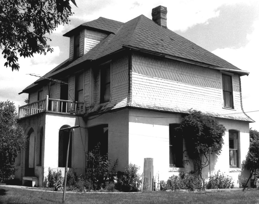
The Oliver John Harmon House is architecturally significant as one of the best examples of the Queen Anne style in Price. The Queen Anne style was popular throughout Utah from 1885 to 1905. Though over 20 Queen Anne and Victorian Eclectic (1885-1910) style houses remain in Price, less than half retain their architectural integrity and the majority of these eligible houses are of masonry. The Harmon House is a very late example of the Queen Anne style and remains as perhaps the best example. The original segmental hip roof above the short, second floor-level windows, above the north bay window, is also a very uncommon architectural feature both locally and state-wide.

Located at 211 South 200 East in Price, Utah and added to the National Register of Historic Places (#92001058) on August 18, 1992.

Price, located about 120 miles southeast of Salt Lake City and named for Bishop William Price of Goshen, who explored the area in 1869, was originally settled in 1877 by a few pioneers and converts to the Mormon or IDS Church (Church of Jesus Christ of Latter-day Saints). Additional Mormon settlers arrived in 1879 from the Spanish Fork area. From 1881 through 1883, the Denver and Rio Grande Railroad constructed a rail line though Price Canyon. The community grew from railroad workers, additional Mormon settlers, and later, from immigrants, many non-Mormon, who came to the recently created Carbon County to mine coal. With the railhead in place, Price became the transportation and economic center for the communities of the area, as well as the adjoining counties.

Oliver John Harmon was the third child of Levi Nehemiah and Eunice Chidster Harmon. He was born 16 March 1859 in Parley’s Park, Salt Lake County, Utah. About 1863 his family relocated to help colonize southern Utah, settling in the town of Washington, five miles northeast of St. George. He attended school in St. George and Beaver, Utah.

In 1879 Oliver apprenticed to an English cabinet maker, Joseph Judd, and served for three years. On 4 May 1881 he married Almira (Allie) Terry in the St. George LDS Temple. They built a small house in Washington and remained there until the completion of his apprenticeship. In 1883 they moved to Provo so Oliver could further study carpentry and cabinet making. Because of his ability, he was quickly given supervisory responsibilities. While in Provo, he reportedly built at least one house. [The location and status of this house are unknown.] About 1886 he left Provo for Castle Valley (Emery County) in southeastern Utah.

Oliver became a successful businessman, as well as a master carpenter and cabinet maker. He helped operate two successful co-op mercantile stores, one in Huntington (1890) and the second in Price. The 1903-1904 Utah State Gazetteer lists O.J. Harmon as the manager of the Huntington Co-operative Mercantile Institute. At the time, Huntington, located about 22 miles from Price, had a population of 950. He built a 2-story brick house in Huntington which is no longer extant.

The 1912-1913 Gazetteer shows Oliver in Price as a partner with Levi N. Harmon in “Harmon Bros, general merchandise.” By this time, Price, with a population of over 2,000, had become a center of commercial activity in this coal-mining region of Carbon County. The 1924-1925 Gazetteer reveals a change in business activity: “O.J. Harmon & Sons” is first listed with Oliver J., Melvin T. f Wilford G., John H., and Joseph W. Harmon, but the type of business is not listed. However, there is also a listing for “Price Casket & Cabinet Works (O.J. Harmon & Sons).” Perhaps this enterprise was formed in response to the nearly 200 deaths in the nearby Castle Gate Mine explosion in 1924. The 1924 Sanborn fire insurance map shows a small (approximately 27 by 30 feet), one story carpentry shop located behind the Harmon house, facing north onto G Street (now 200 South Street). [This carpentry shop is no longer extant.] This enterprise continued for several years, with the 1927-1928 Gazetteer also listing O.J. Harmon & Sons as undertakers.

On 3 March 1908, Oliver had purchased two building lots along the west side of block 52 (facing 6th Street, now known as 200 East) from Alexander and Hazel MacLean for $1200. (It appears that the southern lot was later sold as the 1924 Sanborn map shows a house built on this second lot. The eastern portion of the original lot has also been subdivided and houses built c. 1950.) The c. 1910 photograph indicates Harmon built the 1-1/2-story wood frame house and the additions within a relatively short period of time. He lived in the house with his family of eight children until his death on 19 December 1937. There have been several subsequent owners. The house continued to function as a single family residence, but has also housed a dance studio, two apartments and currently, professional offices. Michael Harrison is the current owner, having purchased the house in February 1988.

The Harmon House in Price has remained relatively unaltered from the historic period and exhibits Oliver’s skill as a carpenter. Residential examples of the Queen Anne style are characterized by their asymmetrical facades, irregular plans, and varied silhouettes resulting from dormers and gables. The Victorian Eclectic style, actually an amalgamation of elements from several Victorian and late Picturesque styles, was popular in Utah from 1885 through 1910. Since the styles and their characteristics overlap, the Harmon House has been compared to examples of both styles identified in the partial reconnaissance survey of Price. The Harmon House remains perhaps the best preserved example in this comparison.

The north bay window and segmental hip roof with floor-height windows on the second level is a curious, documented historic feature. It appears to have been modeled on a similar, perhaps original, two story bay window on the c. 1890 Bryner House, located at about 90 South 100 East in Price. [The Bryner House is potentially eligible for the National Register.] These are currently the only known historic examples of multi-story bay windows with segmental, hip roofs attached to a gable end of a house. The addition of this rare and locally unique feature to the Harmon House was perhaps an attempt to incorporate some of the respectability of the more substantial Bryner House. Rather than affecting integrity, this change actually increases the local architectural significance of the Oliver John Harmon House.

James W. and Mary K. Loofbourow House

30 Tuesday Jun 2026

Posted by Jacob Barlow in Uncategorized

≈ Leave a comment

Tags

Carbon County, Historic Homes, NRHP, Price, utah

James W. and Mary K. Loofbourow House

Built in 1911, the James W. and Mary K. Loofbourow House is significant as one of the very few remaining large and elaborate residences constructed in Price during a period of considerable building activity around 1910. The robust local economy at that time encouraged the construction of some of the most substantial commercial and public buildings in the community, as well as a number of residences. This house, with its two stories and its distinctive eclectic styling, represents the upper range of residential architecture in a community consisting primarily of one-story pyramid cottages and bungalows. Its well-preserved interior, particularly the elaborate woodwork on the main floor, contributes to the architectural significance of the house.

Located at 187 North 100 East in Price, Utah and added to the National Register of Historic Places (#86000722) on April 10, 1986.

James W. and Mary K. Loofbourow purchased the property upon which this house was built in April 1910, but it was not until the spring of 1911 that construction of the house actually began Brief newspaper accounts described the house as “an eight room frame building…modern in every way,” and as “one of the costliest [residences] in Eastern Utah.” By September 1911 the house was “about ready for occupancy.” Local tradition holds that the house was built by Lars Gunderson, a prominent local contractor, but there is no evidence from the newspaper accounts to support that claim.

James Wilbur Loofbourow was born in Columbus, Ohio in November 1859 and came to Utah with his wife, Mary K., and son, John S., in the early 1890s. By 1900 he was a resident of Price and was serving as manager of J.C. Weeter Lumber Company, a Park City-based company. It was the first lumber company established in Price and one of the longest lived. Mr. Loofbourow’s involvement in the lumber business may account for the elaborate woodwork in this house. In addition to his business activities, James W. Loofbourow served as county treasurer in 1903-04, and he was elected mayor of Price in 1924, serving one two-year term. Around 1936, the Loofbourows, accompanied by their daughter and her son, moved to Long Beach, California, where they remained for the rest of their lives. Mary Loofbourow died in the late 1930s or early 1940s, and J. W. Loofbourow died in 1946.

Marie and Riley E. Moss purchased this house in 1918 from the Loofbourows, and it remained in the Moss family for the next 51 years. The Mosses operated a jewelry business and clothing store in Price for many years. Other owners of this house include Dr. Orrin Selman, a professor at the College of Eastern Utah, who eventually rented out some of the rooms to college students, and Wayne and Carolyn Erickson. The current owners, David L. and Shauna F. O’Brien, bought the house in 1980. In 1983 they commenced renovation of the house which resulted in the restoration of many of the original features as well as the addition of a garage and living area on the rear.

This house is one of the Loofbourow’s two principal residences in Price. They lived there from 1911 until 1918, then in 1921 had a bungalow constructed one block away at 205 N. Carbon Avenue, where they lived until at least 1930. Their married daughter, Ruth Southworth, purchased that home from them at that time, though it is possible that they continued to live there with her after that. While living in that house James W. Loofbourow was elected mayor of Price, serving one two year term, 1924-25. Of these two Loofbourow houses, the bungalow on Carbon Avenue is more closely associated with Mr. Loofbourow’s significant contributions in the community. He lived in that house for a slightly longer period, and while living there he served as mayor.

The Loofbourow House is architecturally unique in Price, and it is one of the few large, elaborate houses constructed in the city during the early twentieth century. Only two other well preserved houses of similar size and vintage have been identified in the community, and neither of them exhibit the degree of both interior and exterior architectural quality found on the Loofbourow House. One of those houses, the Moynier House, was determined eligible for the National Register in 1982. Unlike the eclectic styling of the Loofbourow House, the Moynier House is a straightforward example of the Box Style. Similarities between the two houses include their construction dates, their two-story box-like form, and the narrow horizontal siding on their exteriors. The vast majority of houses in Price are one-story bungalows or pyramid cottages constructed during the early years of the twentieth century.

In addition to substantial residences such as the Loofbourow and Moynier houses, a number of important commercial and public buildings were constructed in Price during the period around 1910. They include the Price Carnegie Library, the Carbon Stake Tabernacle of the LDS church, the Carbon County Courthouse, the Weeter-Parker/Mahleres-Siampenos Building (National Register 1982), and the Hellenic Orthodox Church (National Register 1973). The growth and vitality of the community at that time can be attributed to the robust local coal industry, which has served as the primary economic force in Price and Carbon County for the past century.

Camillo Manina House

30 Tuesday Jun 2026

Posted by Jacob Barlow in Uncategorized

≈ Leave a comment

Tags

Carbon County, NRHP, Spring Glen, utah

Camillo Manina House

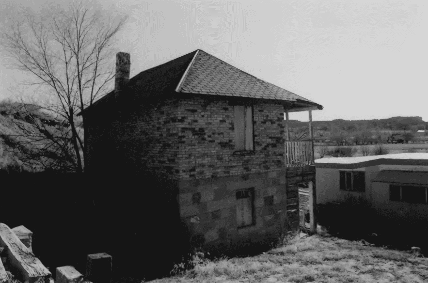
The Camillo Manina House, built c.1928, in Spring Glen, Utah, is significant under criteria C as a unique type of domestic dwelling in Utah. The design of the building appears to have been derived from typical vernacular housing in the northern-Italian hillside country from where Camillo Manina immigrated. Spring Glen, and nearby Helper, in Carbon County, Utah, have perhaps the largest per-capita Italian-American population in the state. In spite of the large number of Italian immigrants, this house is the only residence of its type in Carbon County, and the only known house of its type in Utah. Constructed by Camillo Manina, the Italian vernacular house form and site design represent the continuation of Italian traditions transplanted to a new land.

The Topolovec Farmstead is located at approximately 1756 West 4000 North in Spring Glen, Utah, it was added to the National Register of Historic Places (#99000618) on May 20, 1999.

Spring Glen is a small town in central Utah located between Helper and Price, the two principal towns in the area. The city of Helper, located 120 miles southeast of Salt Lake City, in Carbon County, was first settled in the early 1880s by Teancum Pratt and his two wives, Annie and Sarah. However, it wasn’t until the Denver and Rio Grande Western Railway was introduced in 1881-82 that the population became established and started to increase. Possibly one of the most ethnically diverse communities in the state at the time, Helper attracted immigrants from several Mediterranean and Eastern European countries. Most of the settlers came to Helper to work for the railroad (which built several frame houses for employees), or to mine coal. Helper (so named for the “helper” locomotives that assisted freight trains up the steep grade northwest of town), received an influx of Italian immigrants in 1903-04, who were blacklisted from the nearby Castle Gate mines because of an unsuccessful strike. After settling in Helper, many of them planted fruit orchards, thus providing a much-needed commodity to the area. Several Italian-owned businesses were established up until the Depression. Since that time, the mining industry has seen fluctuations in the market that have affected the population of Helper and surrounding communities such as Spring Glen. Much of the Italian and Eastern European populations remain and continue to have a strong cultural influence in the area.

Camillo Manina (also spelled Mannina) was an Italian immigrant who was born August 12,1885 at Susa Novalese in the Torino province of northern Italy in the Italian Alps. He grew up in a small town surrounded by hilly, terraced fields. Because the land barely yielded a living, he immigrated to the United States in the early 1900s, settling first in Dawson, New Mexico, where he learned to mine coal. He later came to Carbon County, Utah (probably around 1920) and worked in the coal mines there for the remainder of his life. He first lived in the Peerless Coal Camp, and in 1924 bought this small farm in Spring Glen from Elnora Miller Davis. Camillo never married, but worked the farm with the help of other Italian bachelor neighbors, Domenic Conca, John Manina (a distant cousin of Camillo), and also Virginio Marzo, a widower, and his four children. All of these families were originally from the same part of Italy and provided the sort of family ties typical in their Old World villages

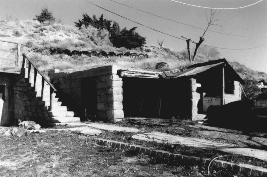
Camillo Manina, in following with the traditional customs of his homeland, determined the design of the house and directed its construction, though the whole group worked together to build it. They first collected stones from the surrounding farm land by rolling them on a stone boat1 and dragging them to the house site with a team of horses. The older men had learned to cut stone in their native Italy and shaped the rocks at the site to fit into the walls. After the first story was completed, Manina lived in the building for awhile. In 1930 the Helper roundhouse for the Denver and Rio Grande Western Railroad was abandoned and later demolished. Manina and the others took their wagon and team to collect some of the bricks from that structure which were used to build the second story of the house. For mortar they had to go down to the Price River near the present Carbon County golf course to get the sand and gravel. The stone retaining wall at the front of the property and the steps leading up to the house were added at an unknown later date by Camillo Manina and Domenic Conca.

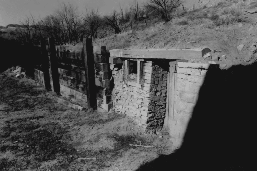
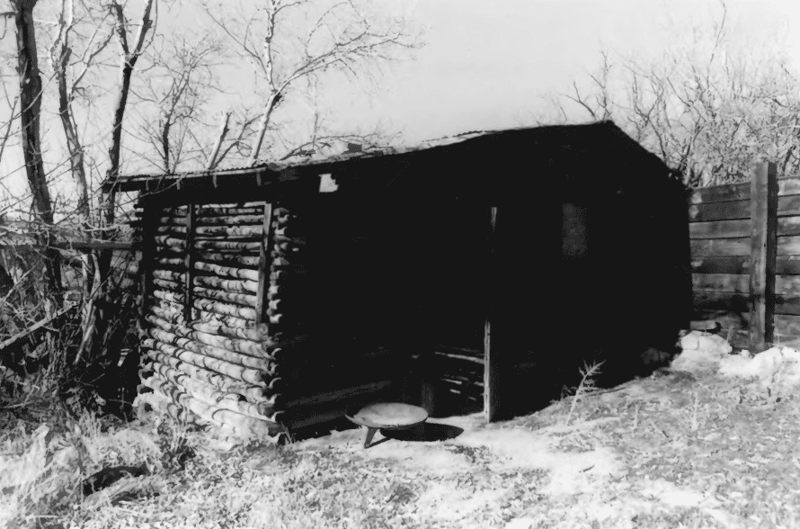
When the mines were idle during the summer months, Manina devoted himself to farming. He terraced the land behind his home using techniques learned in the Alps of his native Italy. There he planted a big orchard with all sorts of trees: peaches, pears, apricots, plums, apples, and cherries. The men also grew their own grapes and made their own wine. They had their own cellars which are still remaining on the property. Manina and his neighbors cooperated in the tilling and harvesting the fields so together with Conca, John Manina, and the Marzos, their adjoining property resulted in a virtually self-sufficient farm. In later years Manina went to live in a boarding house in Helper, but his property remained in excellent condition until his death in 1974, after which it was left vacated and undisturbed. The present owner has left it in this condition for nearly a quarter of a century.

Architectural Significance

This house is typical of those in the farming areas of northern Italy from where the builders immigrated. The pattern of construction followed closely that of the architettura populare, or vernacular architecture of Italy, where materials were often collected for the construction of buildings. In this case it would be the collection of cast-off brick for the construction of the second story, or the collection of used railroad ties for the retaining wall.

The layout of the house also corresponds to regional Italian vernacular architecture. |n the hillside architecture of northern Italy, the main living quarters were on the second floor and cows were kept on the first floor (which was kept very clean, just as the second floor was). During the cold days the whole family went downstairs where the men talked or played cards and the women knitted, spun, shucked corn, or did other chores. They sat on benches that were set into walls while the children played in the manger under the watchful eyes of the parents. At night, the body heat rising from the animals helped somewhat to warm the sleeping quarters on the second floor. It was also traditional for these houses to have a second-floor balcony forming a porch on the first floor so people could sit in the shade outside in the warmer weather.

Although the Manina House is possibly the only one of its type constructed in Utah, the main floor plan is similar to the hall-parlor house which was the most popular type built in the state during the 19th century. As Utah became less socially isolated from the rest of the country with the introduction of the railroad in the early 1870s, Victorian forms became more popular and the hall-parlor type (usually with an austere, classically inspired exterior) fell out of favor. Scattered examples remain that were constructed in the early 20th century, but for the most part the hall parlor is a 19th century type with roots in Medieval England. The late-hall-parlor plan combined with northern Italian hillside architectural influence truly makes this a unique vernacular structure on the Utah landscape.

Clerico Commercial Building

30 Tuesday Jun 2026

Posted by Jacob Barlow in Uncategorized

≈ 1 Comment

Tags

Carbon County, NRHP, Spring Glen, utah

Clerico Commercial Building

The Clerico Commercial Building, constructed c.1914, is significant under criteria A and C. Under criterion A it is significant for its association with the commercial development of Spring Glen, Utah. The original owners of the building, Battista and Gabriella Clerico, were Italian immigrants who greatly contributed to the business and social life of the surrounding mining communities. The Clericos’ (and particularly Gabriella’s) entrepreneurship and hard work allowed them to succeed despite several set- backs. Because of their determination, the Clericos were able to construct this building, which housed various businesses, and succeed economically. The building is also architecturally significant, under criterion C, as one of the best preserved of only a few remaining historic commercial buildings in Spring Glen. The town did not turn into a commercial center like many had hoped. Buildings to house the few commercial ventures in town were scattered throughout the community, and of the few that were actually designed as commercial buildings , the Clerico Building is in the best state of preservation and retains the most historical integrity.

The Topolovec Farmstead is located at 4985 North Spring Glen Road in Spring Glen, Utah, it was added to the National Register of Historic Places (#99000619) on May 20, 1999.

Spring Glen is a small town in central Utah located between Helper and Price, the two principal towns in the area. The city of Helper, located 120 miles southeast of Salt Lake City, in Carbon County, was first settled in the early 1880s by Teancum Pratt and his two wives, Annie and Sarah. However, it wasn’t until the Denver and Rio Grande Western Railway was introduced in 1881-82 that the population became established and started to increase. Possibly one of the most ethnically diverse communities in the state at the time, Helper attracted immigrants from several Mediterranean and Eastern European countries. Most of the settlers came to Helper to work for the railroad (which built several frame houses for employees), or to mine coal. Helper (so named for the “helper” locomotives that assisted freight trains up the steep grade northwest of town), received an influx of Italian immigrants in 1903-04, who were blacklisted from the nearby Castle Gate mines because of an unsuccessful strike. After settling in Helper, many of them planted fruit orchards, thus providing a much-needed commodity to the area. Several Italian-owned businesses were established up until the Depression. Since that time, the mining industry has seen fluctuations in the market that have affected the population of Helper and surrounding communities such as Spring Glen. Much of the Italian and Eastern European populations remain and continue to have a strong cultural influence in the area.

The property on which the Clerico Commercial Building was constructed in 1914 first belonged to Francis M. Ewell, who received a patent for it on September 2,1890. Francis and his wife, Fanny M., were among the first settlers in Spring Glen. On February 3, 1906, Fanny deeded a portion of the land to Jennie Sonberg for $200. Jennie and her husband, Charles, then conveyed another portion of the land by warranty deed to J.C.H. Sonberg on February 1, 1908. Two and one-half years later, on June 28, 1910, J.C.H. and Karen Sonberg deeded a large portion of the farmland to Clerice Battista1 for $3,500.

Battista and Gabriella Clerico, a young couple living in Italy, were seeking better economic conditions than what their country had to offer and in 1897, along with thousands of other Italians, immigrated to the United States. After immigration processing at Ellis Island, New York, they traveled by railroad boxcar to Diamondville, Wyoming, where Battista contracted to work in the coal mines. Things did not go well for them in Wyoming, so they moved on to a mine in Castle Gate, Utah. Here they lived in an earthen dugout at Gentile Wash in nearby Willow Creek.

Gabriella was distraught in the downturn of their standard of living and about having to give birth to their first-born daughter under these conditions, so she decided to return to her hometown of Turin, Italy, to be re-employed by her former patrona. Besides working for her patrona, she worked for three other households as well and saved a large amount of money. Battista, by this time, had also saved enough money to buy some land, but unfortunately he was injured, being crushed in a mine cave-in. Although he survived, he would no longer be able to perform heavy labor, and much of his savings was used to cover his medical bills. When Gabriella learned of her husband’s accident, she and her daughter Mary returned to Castle Gate to care for him.

In 1904, Gabriella had her first son, Albert. In her frustrations in 1906, she began looking for a farm. She had to go by foot, and after hours of walking she collapsed from exhaustion and hunger. This occurred in the area of Spring Glen, a small agricultural area just south of Helper. After a difficult time trying to find a landowner who would sell some property to her (which was further frustrated by differences in language), Gabriella managed to purchase with cash, several acres of land that included a well. To be certain of the bargain she consulted her banker, lawyer, doctor, priest, and the marshal.

The land they purchased began east of the current property, on the east side of Spring Glen Road (State Route 139) and the Denver and Rio Grande Western Railroad, and extended from the west end of the property, across the Price River and continued on the west side of where Highway 6 & 50 is now. There they constructed a small log cabin with a wood plank floor, one door, two rooms, and one window. There was also an outhouse they called “the office.” The log cabin was eventually destroyed by fire so the Clerico’s built a brick bungalow.3 They also hired the builder “Diego Mike” Pesseto to build a large barn. Also on their property was a wash house which doubled as a bath house. Inside was a coal stove and a copper-tub washing machine. The wash house also served as an apartment for men who worked on the farm. They worked for $1.00 a day and room and board during the Depression. The property Gabriella had purchased came with a horse and buggy, and the land had several fruit trees. They raised all their own cows, chickens, and pigs from which they made their own butter, cheese, sausage, salami, ham, and bacon. They also grew hay and grain, and with their hay baler they contracted out baling throughout the county.

Gabriella became one of the few women in the area who was heavily involved in peddling produce and home-baked bread at the coal camps, for this was one of the few acceptable economic activities in which immigrant women could engage. She traveled to the various coal camps around the Helper area, including Spring Glen, Kenilworth, Spring Canyon, Standardville, Latuda, Mutual, Rains, Helper, and Castle Gate. She would not return until she had sold everything in her wagon. Gabriella would also knit sweaters and socks for everyone. With her treadle Singer sewing machine, she would sew Portland Cement sacks into towels, Semolina flour sacks into petticoats and bloomers for the girls, or Utah & Idaho sugar sacks into sheets. She was a model of heroism in adversity and taught her progeny industriousness, honesty, cheerfulness, frugality, and abundance of appreciation for the bountiful blessings of life in America. Her motto was “Sempre Avante” (Always Forward) It carried her from poverty to prosperity. She was a real planner and a good record-keeper. With a ten cent notebook and pencil, she kept track of all receipts and expenditures, paying her bills ahead of time (for a discount) and was particularly prompt with property taxes. She was always ahead of time for appointments .

The Clerico’s fortunes would eventually expand from the farm to the development of two commercial buildings and five rental homes. They additionally financed several farms for their friends and helped establish their sons in businesses of their own. The Clerico’s believed that Spring Glen Road, then known as the Public Highway, would someday be a busy commercial area, as Helper’s Main Street was. So, along this road they decided to build their commercial buildings. In April 1914, they mortgaged their tract of land for $2,000 and began to build this, their first commercial building.5 Battista Clerico hired Italian-immigrant rock masons as laborers to construct the building. They had no English language skills and were staying with the Clerico’s at the time, so they built the structure in exchange for room and board.

Around 1933, Maude Domico turned the basement of the Clerico’s first commercial building into a dance hall with a bar, and dinners were served to their patrons. Afterwards, Tom Anast and his girlfriend, a Ms. Horning, ran the bar. Lastly, Paul Butler managed the bar and dance hall. During this period while the coal mining was at its most prosperous the building was known to house a brothel. But for a time during the Depression the Clerico’s could not find a business tenant and the building sat vacant.

Battista and Gabriella had six children all together, Mary, the eldest, Albert(July 1904-June 1968),7 John (Oct. 1906-March 1974), Peter (Sept. 1911-July 1963), and Margaret (Paluso). One died of pneumonia at 6 months. Battista lived from 1878 to May 3,1941. He was a well-known member of the community and was noted for his ambitious nature and progressive attitude. He was a member of the Stella Di America Italian Lodge of Helper. At age 63, he died from complications following amputation of a leg. Gabriella lived from January 1877, to August 1,1959. She lived 18 more years after Battista’s death and died after a series of strokes at age 82 leaving her 5 children, 11 grandchildren, and 14 great-grandchildren.

After Battista Clerico’s death in 1941 there was a decree of distribution (April 1942) and title of property was given to his wife, Gabriella. On November 18, 1946, Gabriella Clerico passed title of a large parcel of land (2.4 acres), which includes this property, by warranty deed to her eldest daughter, Mary, and her son-in-law, Michel “Mike,” reserving for herself a life estate. But following a property dispute, on September 12, 1950, the property was conveyed by corrected warranty deed to her widow daughter Mary Erramouspe. Michel “Mike” lived from 1895 to July 9,1949 and Mary lived from 1903 to 1973. They had three children, Margaret Turcasso, Katherine and Gene Erramouspe.

On January 31, 1964, when Mary Erramouspe sold the property by Warranty Deed to Jose E. and Floy E. Torres for $4,000. Jose Torres worked for the Denver & Rio Grand Western Railroad and Floy was a homemaker. Jose Torres passed away on February 26, 1982, soon after his retirement from the railroad, at age 60; consequently, the title went solely to Floy E. Torres who now resides in Salt Lake City, Utah. The Jose Torres family made many renovations to their new property and home (described in the narrative description). On April 27,1987, Floy E. Torres sold the property the current owner, Karen Jean Torres-Flemett (no relation to the previous owner).

Architectural Significance

A majority of the commercial buildings in the region (including Helper and surrounding towns) are of brick construction. The Clerico Building, although lacking in extraneous architectural detail, relies on its masonry work as its greatest visual asset. Because it was constructed of stone by Italian-American stonemasons, the Clerico Building is a unique structure in the community. There is one other building similar to the Clerico Building in another part of town. However, the building has been abandoned for decades, is smaller, and does not have the rock-faced stonework of the Clerico Building. The asymmetrical five-bay facade of the Clerico Building does not ascribe to the tenets of typical store-front commercial architecture, but was probably adapted for the needs of the businesses which did not require large display windows. (The original businesses, according to Margaret Turcasso, the Clerico’s granddaughter, were an ice cream factory on one side and cigar factory on the other). Despite the nontraditional storefront and the facade’s skewed layout, the interior bilateral division is implied by the placement of the two front entrances next to each other. Although no longer completely divided by a wall inside, the doors still open into separate rooms.

Commercial buildings as an architectural type have only recently, within the past one and one-half decades, been the object of serious research and typological classification.9 Because of the endless variation of commercial floorplans, classification is mainly based upon the appearance of the front facade. The facade is most commonly the only area that is visible from the street, particularly when a row of buildings are constructed abutting one-another. Interior layout of commercial structures was purposely left open to allow for flexibility in partitioning based on individual requirements. For this reason any type of broad-based classification based on interior plans is not possible.

The Clerico Commercial Building most closely fits the typology of the one-part commercial block. This type of commercial building is usually a one or two-story structure that commonly has a row of large, plate-glass display windows and an open area above the fenestration for signage. The one-part commercial block is found throughout the state, from very small communities to larger cities. This type of building is commonly associated with the false-facade, wood-frame architecture of many frontier settlements, but is just as frequently found in examples constructed of more-permanent materials with full-height exterior walls on all facades.

Topolovec Farmstead

30 Tuesday Jun 2026

Posted by Jacob Barlow in Uncategorized

≈ Leave a comment

Tags

Carbon County, NRHP, Spring Glen, utah

Topolovec Farmstead

The Topolovec Farmstead, originally built in 1913 and enlarged in 1925, is primarily significant for its local association with the early twentieth religion science sculpture social/ humanitarian theater . . transportation other (specify) century immigrant cultural experience in the Carbon County coal mining region of southeastern Utah. Purchased by August Topolovec, a Slovenian miner, in 1922, the large two-story residence represents both a symbol of immigrant success and an architecturally unique dwelling in the community of Spring Glen. The house served as one of two main social centers for South Slav activity in this multi-ethnic community. Combined with the Millarich Hall (MR), the Topolovec Farmstead figured prominently in the cultural life of the Slavs, as Topolovec served as the treasurer for the local lodge of the Western Slavonic Association. This insurance/mutual aid society eased the transition of the Slavic immigrant into the rigors and demands of an industrial society; and as treasurer, Topolovec held a responsibility in accounting for the funds used by the immigrants for insurance, medical benefits, and to provide for the descent burial of their people. Topolovec’s buying of the farm also symbolized the evolution of immigrant intent from that of a temporary status in the United States to one of permanence. The purchase of a substantial home sustained this commitment to stay, and further acted as an outward sign of security and success. In addition, the house is also significant because it represents the new wealth injected into the area after the arrival of the railroad and the creation of the nearby town of Helper as a main division point in the 1890s. The residence was constructed in 1913 by Frank Jerome, an entrepreneur from Helper, who had the resources to build this unusually extravagent house in a community of camp houses and bungalows — a house that would later serve the changing needs of the Spring Glen community.

The Topolovec Farmstead is located at 4323 North 2000 West (Main Street) in Spring Glen, Utah, it was added to the National Register of Historic Places (#82004117) on August 9, 1982.

The history of Spring Glen (Ewell), Utah can be divided into three stages. The first settlers of the area were Mormon pioneers whose initial concern was to bring water to the land and to provide the necessities of life for the community. The first owner of the property on which the Topolovec farm stands was Heber John Stowell, the first Mormon bishop of Spring Glen (ordained in 1889). He arrived in the region in May 1886, helped to organize the Spring Glen Canal Company in December of that year, settled down on this land, and finally patented it in 1894. With the help of his neighbors he dug the first ditch, started in 1887 and completed seven years later. The Stowell ditch is still in use and waters the property of the Topolovec farm and others in the immediate vicinity. During this initial period of settlement, agriculture was the main form of local subsistence.

The second stage in the growth of Spring Glen was linked to the development of the Denver & Rio Grande Railroad, and the growth of Helper, a railroad town two miles to the north. During the late nineteenth century rail expansion occurred throughout the western United States, and the D&RG was completed through this area in 1883. In 1890 Helper was designated as a division point on the railroad’s main line, between Grand Junction, Colorado, and Salt Lake City. Here “helper” engines were coupled onto trains to power them over the steep grade and summit (Soldier Summit) to Salt Lake City. Without these helper engines the commerce of the entire Intermountain West would have suffered. The creation of Helper as a main terminal encouraged settlement into the area, especially those involved in the service industries. The railroad had opened-up the vast coal deposits of southeastern Utah, and with this industry came professionals, merchants, immigrants, and laborers.

Frank Jerome entered the region at the turn of the century. The Jeromes had migrated from Kansas or Nebraska, and arrived in the Spring Glen area where Mr. Jerome entered into the Saloon business, opening one saloon in Helper and reportedly another in Spring Glen. Both concerns were in partnership with other individuals. Thus, he represented the rising merchant class of the area. In 1913 he erected the present structure in Spring Glen, probably due to the existence of large tracts of land in that community. Jerome furnished it with some of the finest furniture then available, including a desk, full-length mirror and stand, brass bed, and other items which still remain in the house.

The house represents the largest and most architecturally unique residence in Spring Glen. A majority of the other dwellings are of the rectangular pyramid-roofed type (four rooms) or bungalows, and lack the scale, ornamentation, and design present in this structure. After 1906, when independent coal producers broke the monopoly of the D&RG’s Utah Fuel Company, new coal camps emerged. With this development came a transition of Spring Glen and surrounding towns where coal miners, railroad section hands, and merchants came to settle. The Jerome residence stood in stark contrast to the camp-type houses of Spring Glen.

Oral testimony places Jerome as one of the wealthiest men in Spring Glen. His first wife, Ella, bore him one living son before she died in 1918,, For reasons unknown he left Spring Glen and sold the land to the present owner, August Topolovec, in 1922. It is reported that Jerome probably moved to Helper where he still remained a Justice of the Peace for Spring Glen from 1922 until 1928.

The third and final stage of growth in Spring Glen was due to the influx of immigrants. The United States as a whole had experienced an increase in immigration beginning in the late 1840s. It continued and increased, with the influx of southern and eastern Europeans, until nativism (anti-foreign sentiment) led to the immigration restriction legislation of the early 1920s. By then, most of the immigrants had come to Carbon County with the result that the area is the most ethnically diverse in Utah. These peoples were drawn to the county by labor opportunities in the coal mines and for the railroads. August Topolovec, the present owner of the farmstead, was part of this movement to the “New World.” An immigrant who had mined coal for seven years in his native Yugoslavia, he came to the United States in 1910. 6 had worked in several mines in Utah and Colorado, exhibiting the He characteristic fluidity in geographical mobility evident among many of these immigrants. He was at Standardville, Carbon County, when the nation-wide coal strike erupted in 1922. During the strike August Topolovec bought the farm from the Jeromes, probably to provide some security in the face of the instability of the coal mines. In addition, the purchase of a house, especially one of this scale, represented a mark of economic success, as well as the fulfillment of a dream not easily attained in Topolovec’s native land. In fact, in order to make faster payments on the property, the Topolovecs rented the house for the first year, but after the renter was forced to leave the family immediately took up residence in the house and have lived there since that time.

During Topolovec ownership of the residence and land two important factors emerged that illustrated the farmstead’s importance to community development. First, the property was transformed into a working farmstead, providing nearby coal camps with needed produce and goods. August Topolovec and his sons continued to work in the coal mines while farming part-time. Such was often the case among the peasants of southern and eastern Europe; thus, this pattern was continued and maintained in Spring Glen.

In 1925 two Slovenian brothers, George and Leonard Mahorich, sought a place to live, and with August’s permission they constructed the small frame house at the rear of the main house. Leonard paid board and continued working in the mines, while George ran the farm. In 1926 Leonard built the barn, and the other outbuildings were erected at about this same time. Eventually, the farm produced wheat, alfalfa, corn, hay, and all varieties of vegetables and fruits. The family also raised milk cows, horses, pigs, chickens, turkeys, ducks, and bees. During the summer months, when work in the mines eased, the Topolovec boys peddled their farm produce in the surrounding coal camps of Kenilworth, Consumers and National, and to those in the Spring Canyon area. Customers also stopped by the house to purchase food, with Julia Topolovec handling the sales from the front room. Mrs. Topolovec also made butter and cottage cheese for sale, and often sold milk to the Blue Hill Dairy, a Spring Glen enterprise owned by the Italian Fazzio family.

This aspect of the Topolovec experience is of particular importance since the family now represented one entering the business sector of the economy, partially leaving the ranks of labor. This transition from the proletariat to the local bourgeois occurred among many Carbon County immigrants. Those involved were most conscious of the change and the acquisistion of the Jerome residence may have been a way in which August Topolovec expressed this to the rest of the community.

The second factor illustrating the farm’s importance to the community is found in its role as a cultural and social center for the Slavic peoples of the area. By the 1920s Spring Glen contained numerous Italian and South Slavic peoples. The town was to serve as a main center for South Slav activity. In this regard, people were drawn to the Topolovec farmstead primarily by the Western Slavonic Association (Zapadni Slavenski Savez), an insurance/mutual aid organization headquartered in Denver, Colorado, which served all Slavs in the western United States. Such organizations were started to help mitigate the ill effects of employment in industrial occupations, and served as fraternal lodges for immigrants living in a strange environment. August Toplovec served as the secretary-treasurer for the local lodge and members came to him in order to pay monthly dues. The first meetings of the Spring Glen lodge were held at this site, and in the future were also held here as well as at Millarich Hall(NR). They were usually conducted at the frame house in the rear, where lodge parties were also held. These social gatherings usually involved food, drink, and a general informality reminiscent of traditional folk socials. In addition, the Topolovecs boarded local school teachers, sometimes upstairs in the main house or in the smaller frame house after the Mahorich brothers moved out in 1928.

In 1939 August married his present wife Mary, after his first wife and only daughter were killed in an accident in 1936. With Mary’s four children and brother living in the house, the residence was again fully occupied. At this time (1939) the main house underwent its only major remodeling. A bathroom was added on the ground floor, the kitchen was modernized, and the old heating stoves were removed. Part of the front porch was also removed in 1939, but the house otherwise remains unchanged since 1913.

The farm remained in operation until 1945, when the last of the live stock was sold. In 1949 most of the land was subdivided among all the children of August and Mary, and the youngest Topolovec boy, Sylvester, was granted joint title to this property with his father. Sylvester intends to retain the house and eventually restore it to its original external appearance by replacing the rest of the front porch. This plan is strongly supported by his brothers and other relatives who remain in the area. In the meantime, however, the peace of the elder Topolovecs will remain undisturbed by construction.

The preservation of this site should definitely be encouraged by its inclusion in the National Register of Historic Places. It was identified as significant through an architectural and historic survey of Spring Glen and Carbon County, and is only the third known site in the state of Utah considered as significant in documenting the lives of South Slav immigrants (the Millarich Hall/Slovenian National Home (NR) and the Anton “Tony” Skriner barn in Spring Glen (to be nominated) are the others). With the current energy demands and the revitalization of the coal industry, Carbon County is undergoing rapid change and new development. National Register listing is seen as an important tool in ensuring the preservation of this cultural resource. The farmstead not only retains its integrity, but the main house has unique and beautiful architectural features. The property as a whole provides an important visual record of the growth and change of the town of Spring Glen, and the existence of the South Slavic immigrants in Carbon County, Utah.

Martin Millarich Hall

30 Tuesday Jun 2026

Posted by Jacob Barlow in Uncategorized

≈ Leave a comment

Tags

Carbon County, NRHP, Spring Glen, utah

Martin Millarich Hall

The significance of the Martin Millarich Hall/Slovenian National Home lies in the important role it has played in the life of the South Slavic community of Carbon County, Utah; and in the history of the Utah labor movement, having served as a focal point for striking miners during the coal strikes of 1922 and 1933. The Home remains one of various Homes throughout the U.S. It is the only Slovenian Home in Southeastern Utah,

Martin Millarich Hall is located at 4323 North 2000 West (Main Street) in Spring Glen, Utah, it was added to the National Register of Historic Places (#80003894) on October 31, 1980.

Utah’s coal industry was greatly stimulated by the completion of the Denver and Rio Grande Western Railroad between Denver and Salt Lake City in 1883, and by the discovery in the late 1880s that Southeastern Utah coal would produce a high quality of coke. In order to meet the demand for coal, a large number of foreign miners, especially Finns, Italians, and South Slavs, were encouraged to settle in Utah to meet the need for labor.

South Slavs, that is, Slovenes, Croats, and Serbs lived in the Austrian provinces of Kustenland and Carniola, located in the kingdom of Croatia-Slavonia, and in the Vojvodina (all later to become part of Yugoslavia). In the late nineteenth and early twentieth centuries South Slavs, as many other southern and eastern Europeans, were involved in a general population movement their immigration to Utah was but one manifestation of this experience.

The first South Slavic workers arrived into Utah in the late 1890s, laboring in the Carbon County coal fields. Such initial settlements were temporary, in the sense that they were exclusively male, who were highly mobile, willing to move wherever better wages were available. A second wave of immigration occurred during the period prior to World War I. According to the leading authority on South Slavs in Utah, the bulk of Slovenes who came to Utah at this time settled primarily in the Carbon County coal camps. More stable communities were established during this phase.

One of these immigrants was Martin Millarich (Mlinaric). He had first gone to Wyoming in 1900, but by 1903 was residing in Sunnyside, a coal camp in Carbon County, Utah. Around 1906 he settled in Spring Glen, acquiring title to two pieces of land adjacent to the present Slovenian National Home; one to the north in 1907 and one to the west in 1908. The land where the home stands was owned at that time by George Shefflar (Sheffnar), another Slovene. A wooden tavern was built on the site of the home with the cooperation of the Slavonic community, and Martin became the manager. He was Pabst Blue Ribbon distributor for the area, and a railroad spur ending right behind the tavern was used to bring in carloads of beer. He also had an ice cellar on the property directly to the north in order to keep the beer cold.

According to family tradition, the local Mormon Bishop John Thompson Rowley came to call on Martin Millarich soon after the tavern opened. When Bishop Rowley told him that the Mormons didn’t approve of his having a tavern there, he replied, “You know, Mr. Rowley, the road out front runs right past this place, and the door swings open and shut for whoever wishes to enter, but I do not go out into the street and grab people by the arm and force them to come in.”3 He had no problems from any of the community after that. The hall served as a kind of social center for the Slavic miners who had begun to acquire property and build homes in the Spring Glen area and the Slavic miners who lived in the nearby coal camps until it was destroyed by fire in 1919.

In 1922 a strike situation again occurred. Local miners joined the nation-wide coal strike and were forced out of company housing. They set up a “tent city” on Millarich 1 s property and all along the lane to the north and south, and several became his patrons. To pay off their debts and in return for the use of the land, the striking miners aided in the construction of a new brick building on the site of the old wooden one. The passage of Prohibition (1920) precluded opening another tavern, so by 1924 the Spring Glen Bottling Works, owned by Martin Millarich, was bottling soda water in the present brick building. He later added living quarters to the rear, another bottling works was erected to the north, and the brick building was converted back into a tavern called “Martin’s Place” after the repeal of Prohobition in 1933.

In 1923 Martin Millarich acquired half interest in the Spring Glen Bottling Works/Slovenian National Home property, sharing the title with Frances and John Vimpolsek, also of Slovenian descent. The Vimpolseks were killed by a train at a crossing in Carbonville around 1930, and Martin Millarich gained complete title to the present Slovenian National Home.

Being a place of business, “Martin’s Place” was one of the first buildings to have indoor plumbing and a telephone. The bar fixtures presently in use in the Slovenian National Home were purchased and installed by Martin Millarich when he reopened the tavern in the 1930s. The pink “vanity” desk in the ladies rest room was built by Leonard Mahorich, another Slovene, many years before that. Leonard had done quite a bit of carpentry work for many families in the area throughout the 1920s.

The early 1930s were a desperate time for miners. In 1928 began the first in a series of wage reductions, and the lower wages became coupled with fewer days work. Unionizing activity, unsuccessfully tried by the United Mine Workers in 1903-1904 and 1918-1922, was again resumed. The exhausted U.M.W. had abandoned their efforts in Utah, but a rival union, the National Miner’s Union, was gaining strength.

The National Miner’s Union was organized in 1928 by disgruntled United Mine Worker members who claimed they had been sold out by John L. Lewis and the U.M.W. during the 1927-1928 strike in Pennsylvania and Ohio. The National^ Miner’s Union adopted a much more militant and socialistic approach to Unionism than the United Mine Workers. The National Miner’s Union aim, as stated in its fundamental principles, was to organize and lead “. . . the miners’ struggles against the capitalist owners of the mining industry, . and their agents, for better working and living conditions . . to participate in the struggle for abolishing the capitalist system and replace it by socialism.”

During May 1933 National Miner’s Union organizers, Paul Crouch and Charles Guynn, arrived in Carbon County and began organizing activities. The Millarich Hall was rented as headquarters for the union. Miners were encouraged to visit the union leaders at the hall, a women’s auxiliary and youth section were also organized there and the hall was used for some of the Sunday meetings and Saturday night dances sponsored by the National Miner’s Union. At one of the first meetings held in Millarich Hall the Union leaders openly showed their communist sympathies by displaying a red banner with hammer, sickle, and a sheaf of wheat. However, communism was not warmly regarded by most of the community, and the National Miner’s Union members later tried to hide their sympathies.

Millarich Hall served as headquarters for the National Miner’s Union until the first part of August 1933, when a change was made to the Radiant Roller Rink, also in Spring Glen. As the strike progressed, National Miner’s Union militancy increased. In the mean time, upon learning of the National Miner’s Union presence in Carbon County, John L. Lewis ordered an immediate organizing campaign by the United Mine Workers.

Coal operators found the more moderate approach by the United Mine Workers much more acceptable and within a short time the United Mine Workers and coal operators had formed an alliance aimed at driving the National Miner’s Union out of Carbon County. They were ultimately successful but not until a summer of tension, fights, and near riots had passed.

During the late 1920s and early 1930s the Millarich Hall was often used for purposes other than unionizing. Members of the Church of Jesus Christ of Latter-day Saints (L.D.S. or Mormons) of whom Martin’s second wife was one, would hold meetings there. The church members would bring chairs from the church or school and meet in the then vacant front part of the present Slovenian National Home. In addition, dances were held for the various “lodges” of the S.N.P.J. (Slovenian National Benefit Society). The band would perform on a raised platform by the front windows, or perhaps there would just be an accordianist, such as the popular “Matika.” Slovenes from all over the area would attend, and everyone had a good time.

In 1963 the National Slovenian Home in Spring Glen was privately purchased from Martin Millarich’s daughter, Dorothy Losik, by some of the local Slovenian Community. These included the Tomsics, John and Charlie Bezyack, and Valentine Vouk and his family. It is unaffiliated with any of the National Slovenian organizations, but is used by several of the nationally affiliated local lodges to hold parties and dances. The participating lodges are the S.N.P.J. (Slovenian National Benefit Society), the Western Slavonic Association and the Croatian Fraternal Union. The lodges continue to provide the insurance and death benefits for which they were organized at the beginning of this century, and the Martin Millarich Hall/National Slovenian Home continues to serve as a meeting place for the Slavic community, foster the preservation of Slavic customs and provide the social and recreational activity that it always did in Carbon County.

Flat Canyon Archeological District

31 Sunday May 2026

Posted by Jacob Barlow in Uncategorized

≈ Leave a comment

Tags

Archeological, Archeological Districts, Carbon County, NRHP, utah

Flat Canyon Archeological District

Flat Canyon Archeological District is located Desolation Canyon in Carbon County, Utah and was added to the National Register of Historic Places (#78002654) on December 12, 1978.

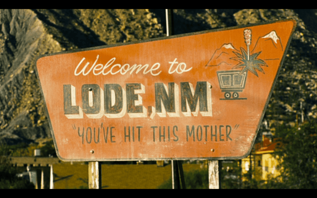
Welcome to Lode – Adventures of Power Filming Location

09 Thursday Oct 2025

Posted by Jacob Barlow in Uncategorized

≈ 2 Comments

Tags

Carbon County, Filming Locations, Helper, utah

Welcome to Lode – Adventures of Power Filming Location

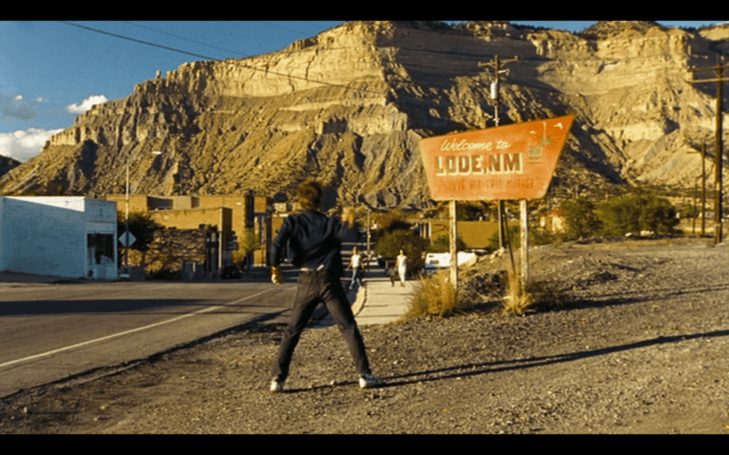
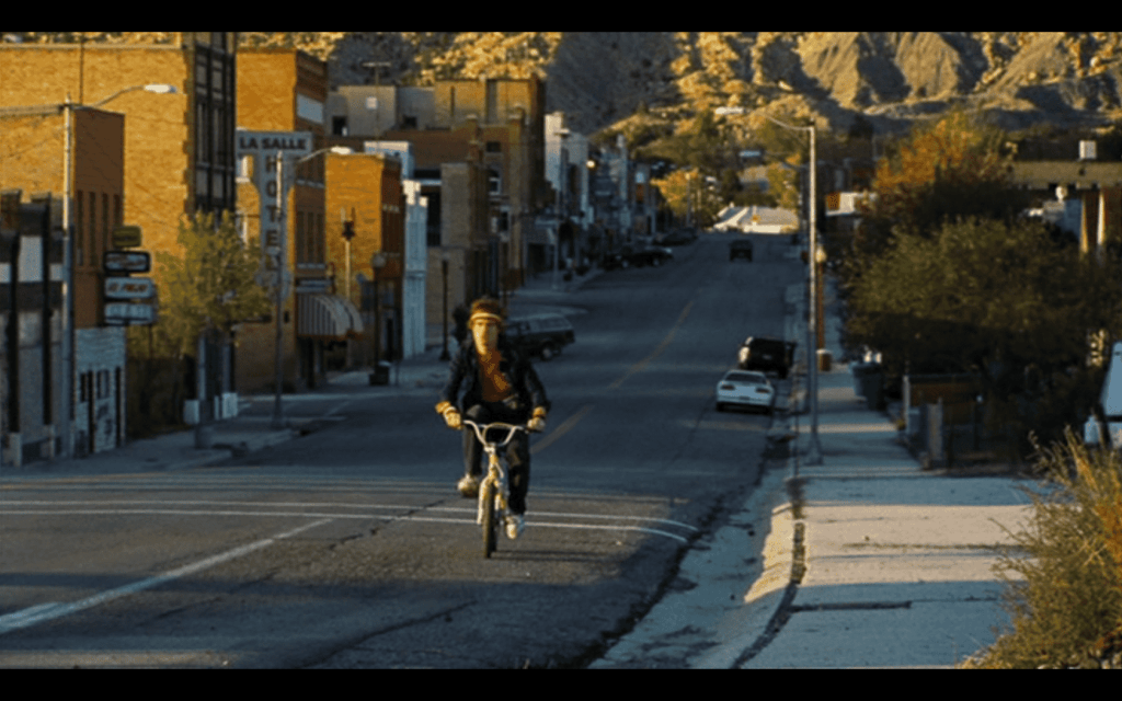
This is the location for multiple scenes on the movie showing the entrance to the fictional town of Lode, New Mexico from the movie Adventures of Power (2008).

It was filmed in Helper, Utah.

Related:

  • Adventures of Power Filming Locations
  • Movie/TV Show Filming Locations

Price Main Street Historic District

08 Sunday Dec 2024

Posted by Jacob Barlow in Uncategorized

≈ Leave a comment

Tags

Carbon County, Historic Districts, NRHP, Price, utah

Price Main Street Historic District is a historic district covering Main Street from 100 West to approximately 215 East.

Related:

  • Price Main Street Historic District
  • Price, Utah

The text below is from the nomination form (#08000383) to the National Historic Register.

The City of Price is the county seat of Carbon County in east-central Utah, and is approximately 120 miles southeast of Salt Lake City. The Price Main Street Historic District, with a period of significance dating from 1910 to 1960, contains the greatest concentration of commercial buildings in the city and is the de facto commercial center for both Carbon and Emery counties. In addition, the City of Price is a key regional transportation hub, with the Denver & Rio Grande Western (now merged with the Union Pacific Railroad), US Highway 6 and State Highway 10 all converging in town. Due to its geographic location and influx of immigrants, early development in Price did not follow the pattern established by the early LDS (Mormon) colonies, principally along the Wasatch Front. Consequently, Price is unique in Utah for its early association with the railroad and coal industries and for its sectarian history.

The town of Price did not develop as most early Utah communities had; its growth was not due to an influx of Mormon settlers but was largely the result of industrial development in the region, specifically from the coal and railroad industries. The arrival of European immigrants, especially from Greece and Italy, accounted for much of the community’s early population growth. The earliest commercial district in Price, representing the early period of settlement and growth, from 1877 to 1910, was centered on the railroad yards at the west end of town. The Main Street Historic District began to develop as businesses moved away from the railroad district and concentrated to the east along Main Street, from 200 West to 100 East. These later businesses were often owned or managed by immigrant settlers, and to the present day many of the Main Street buildings and businesses bear the names of their immigrant founders, such as Silvagni, Oliveto, and Georgides.

The Price Main Street Historic District is a concentration of historic buildings on Main Street that are representative of the commercial prosperity and growth that characterized the town of Price through the first half of the 20th century. The district is bounded by 100 West and 200 East, and also includes the United Methodist Church at the northeast corner of Main Street and 200 East. The Price Municipal Building and the Carbon County Courthouse, together with the United Methodist Church , define the eastern end of an otherwise largely commercial district. West of 100 West the early commercial buildings have either been demolished or no longer retain their integrity; East of 200 East the concentration of commercial buildings is far less than the concentration within the district boundaries and includes few buildings from the historic period. The streets immediately north and south of Main Street never experienced the kind of commercial growth that sets apart Main Street. The district boundaries, therefore, include the two blocks with the largest concentration of extant historic commercial buildings in Price, together with the two most substantial public buildings, and an historic church.

Period of Significance 1910-1960

No buildings from the earliest period of development remain on Main Street (1877-1909). Some of these early buildings were destroyed by fire; others were demolished to make way for the structures that we see today. The Period of Significance ( 1910-1960) began with rapid growth and development on Main Street. Although it was destroyed by fire in 1965, the Savoy Hotel, constructed in 1910 at the southwest corner of 100 West and Main Street was representative of this rapid growth. The years from 1910 to about 1915 also saw the construction of many other extant buildings within the district (historic names are given if known):

  • Paternoster Building, 5 East Main (c. 1910),
  • 5 West Main (1912),
  • Eko Theater. 34 West Main (1912),
  • Parker & Weeter Block, 85 West Main (1913),
  • Franks Building (Oliveto’s Furniture), 48 East Main (c. 1913),
  • 63 East Main (c. 1915),
  • 9-17 East Main ( c. 1915),
  • 36 West Main ( c. 1915),
  • 40 West Main (c. 1915),
  • 44 West Main ( c. 1910),
  • 60 West Main (c. 1915),
  • 70 West Main ( c. 1915),
  • 75 West Main (c. 1915),
  • 69 West Main (c. 1915),
  • 67 West Main (c. 1915),
  • 63 West Main (c. 1915),
  • 41-47 West Main (c. 1915),
  • 39 West Main (c. 1915),
  • Boecker Electric Store (Eastern Utah Electric Company), 11 West Main (c. 1915),
  • Silvagni Building, 4-14 East Main (c. 1915).

These 20 buildings account for nearly one-half of the buildings within the district that date from the period of significance.

Based on the Utah SHPO criteria, of the 46 buildings within the district ~ the Price Main Street Historic District contains 28 contributing resources ( 60 percent) and 18 noncontributing resources ( 40 percent). Of the contributing resources, three are individually listed in the National Register. These are:

  • Price Municipal Building (Price City Hall), listing number 78002652 (2/17/1978);
  • Star Theatre, listing number 82004116 (8/9/1982);
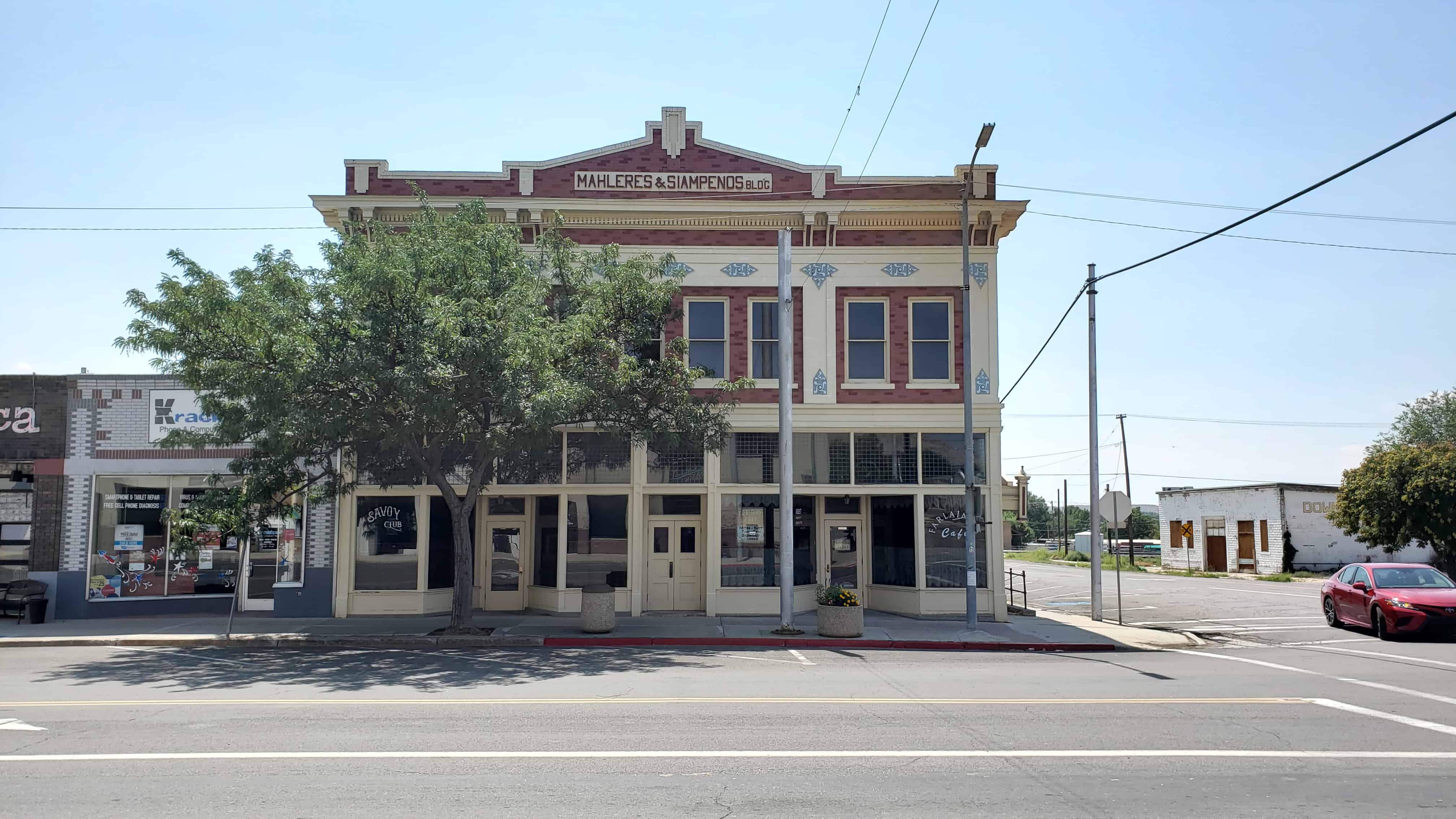
  • Parker & Weeter Block/Mahleres-Siampenos Building, listing number 82004115 (3/9/1982).

individual building s within the district consist mainly of a variety of commercial structures, from boarding houses and hotels with ground-floor business or retail space to single-story commercial blocks. The district includes three non-commercial buildings: the United Methodist Church , Carbon County Courthouse , and Price Municipal Building (City Hall), all three of which are significant, contributing resources within the district.

As exterior “windshield” visual survey results only, RLS criteria address the age and historic integrity of the Main Street façade, and do not address other criteria such as structural condition or integrity of historic interiors. A number of resources that date from the period of significance have been remodeled, such as the Silvagni Building , con structed about 1915. The existing aluminum “skin” was applied c. 1960 and has gained significance in its own right. Similarly, exterior alterations such as those on the Elk Theater (Crown Theater) date from the period of significance such that these buildings represent very different styles and dates of construction, yet still retain integrity as examples of the perpetual adaptation of commercial buildings with regard to use and style. The district includes only one out-of-period intrusions, the building at 6 W. Main.

Survey results indicate a variety of styles and periods of construction, from late 19th century varieties to mid- 20th century styles. A handful of earlier buildings show elements of late Victorian eclectic styles, with decorative brickwork , decorative trim and deep, classically adorned cornices. The most common style in the district is also eclectic: early 20th century commercial style with varying degrees of decorative elements and vernacular interpretations of popular styles of the day. These buildings may include Prairie Style influences, Arts and Crafts and/or Art Nouveau influences, or other fanciful or eclectic details However, only where a given style is dominant has the building been indicated as having a given style. The relevant periods , approximate dates of construction and architectural styles include those shown below, have the number of contributing resource s within the district representative of each period /date/style (approximate dates are indicative of the buildings within the district and not necessarily representative of the style itself). A few representative buildings of each style are shown below. Those that are both stylistically significant and retain their historic character are indicated with an asterisk(*):

Victorian Period, Beaux Arts Style:

  • *40 West Main

Victorian Period, Eclectic/Commercial Style:

  • *70 West Main

Revival Period, English Tudor Style:

  • *United Methodist Church, 10 North 200 East

Revival Period, Italian Renaissance Style:

  • *Star Theatre, 20 East Main
  • *Boecker Electric Store (Eastern Utah Electric Company), 11 West Main

Revival Period, Spanish Colonial Revival Style:

  • *Eko Theater, 34 West Main

20th Century Period, Commercial/Eclectic Style:

  • 63 East Main
  • 29-43 East Main
  • 82 West Main
  • *Parker & Weeter Block, 87 West Main
  • 41-47 West Main
  • Redd Building, 21 West Main
  • *Paternoster Building, 5 West Main
  • Franks Building (Oliveto’s Furniture), 48 East Main

Modern Period, Art Deco Style:

  • Price Theater, 30 East Main
  • Lewis Jewelry, 46 East Main

Modern Period, WPA Moderne Style:

  • *Price Municipal Building, 185 East Main

Post WWII Period, Other/undifined Style:

  • *82 West Main
  • *J.C. Penney Company, 78 East Main

Late 20th Century Period, Other/undifined Style:

  • *Carbon County Courthouse, 120 East Main

As indicated above, the Price Main Street Historic District also includes a number of altered, non-contributing resources (17) and one out-of-period building (1).

The estimated date of construction of the earliest building from the period of significance, at 5 East Main Street, is 1910. The earliest buildings with actual documented dates of construction include the Paternoster Building, 5 West Main (1912), Eko Theater, 34 West Main (1912), and the Parker & Weeter Block, 85 West Main (1913).

While 1910 is an estimate for the building at 5 East Main, this year is nonetheless chosen as the beginning date for the period of significance. Additionally, in December, 1910, a successful election was held to upgrade Price’s standing to a third class city. Thus, 1910 was a symbolic end to the period of early settlement and growth that began in 1877 and also heralded the establishment of Price as the comn1ercial center of a larger region.

Narrative Statement of Significance

The Price Main Street Historic District is locally significant under criterion A, and ”is associated with events that have made a significant contribution to broad patterns of our history.” The historic resources within the Price Main Street Historic District represent a period of local economic growth and prosperity that paralleled the expansion of the region’s coal and railroad industries. As described below, under criterion A, the development of Utah’s coal and railroad industries and their relationship to the growth of the city of Price are a significant regional and national historical development of which Price’s Main Street commercial district is an integral part.

The District is also architecturally significant under criterion C. Of the forty six (46) buildings within the district boundaries, twenty eighty (28), or 60 percent, are contributing. At least a dozen of the extant buildings are important examples of distinct architectural periods and styles, including the three that are already listed in the National Register: Price Municipal Building/Price City Hall, listing number 78002652 (2/17/1978); Star Theatre, listing number 82004]] 6 (8/9/1982); Parker & Weeter Block/Mahleres-Siampenos Building, listing number 82004115 (3/9/1982). In addition, under criterion C, the physical development of Price’s Main Street and the types and styles of individual buildings within the district embody the spirit of growth and prosperity that were largely a consequence of the region’s growth and industrial development.

The period from 1910 to 1960 is chosen as the period of significance. Not only is 1910 the estimated date of the earliest building in the district, it was also the date of the establishment of Price as a third class city that commenced a couple of decades of rapid growth, as represented by the commercial buildings on Main Street. This period also saw relatively consistent prosperity for Price, even as other communities in the region suffered through economic downturns such as the Great Depression. Not until the decline of the coal mining industry and railroad traffic in the early 1960s did Price experience any significant corresponding economic decline. This period ended with the construction of the most significant “modern” building within the district, the Carbon County Courthouse, constructed 1958-60.

The commercial sector of Main Street included within the historic district boundaries is the best representation of the growth, both commercially and architecturally, of Price during the early to mid twentieth century. The character and setting of the district retain a high degree of integrity and contribute to the history of Price.

Price Early Settlement and Growth: 1877-1910

The first permanent Anglo settlers in the Great Basin region of the Intermountain West were members of the Church of Jesus Christ of Latter-day Saints (LDS, or Mormons), who first arrived in the valley of the Great Salt Lake in July of 1847. The early leaders and members of the church considered this region their “Zion” and began organized colonization efforts immediately after their arrival. The first settlements were founded along the north-south corridor of the Wasatch Front, but soon communities were established in regions in the central and southern areas of the territory, as well.

As a largely agrarian culture, the LDS settlers preferred areas that were well-watered and advantageous for raising food crops and livestock. The Wasatch Front and central valleys of the territory, such as the Sanpete and Sevier valleys, met these criteria, and early settlements were established in these fertile areas. “Missions” or settlements were also established in less favorable environments, such as the desert southwest comer of the territory and the Uinta Basin to the east, but not until the 1870’s did Mormon pioneers begin settling eastern Utah in relatively large numbers. By the time of the death of the LDS prophet and colonizer Brigham Young, in 1877, the more fertile parts of the territory had been colonized, and the systematic pattern of settlement established by Brigham Young had largely run its course.

For territory residents or later immigrants seeking land or less-crowded conditions than the earlier settlements afforded, opportunities existed mainly in the less-favored regions, and thus it was that some of these adventurous individuals settled in the Price River Valley, beginning in 1877. In contrast to the well-planned grid-like town planning of the earlier Mormon communities, early Price-area residents settled along the Price River, where water could be readily obtained for crops. Within only two years, however, the completion of the first railroad in Carbon County altered the character of the region, and instead of an isolated farming community, Price quickly became a planned community with regular streets, and rapidly rose to also become the dominant commercial center in the area.

The discovery of coal in the mountains north, east and west of Price prompted the construction of the first railroads in the region. The Utah and Pleasant Valley Railroad, organized in 1875 and completed in 1879, connected Utah Valley with Pleasant Valley, northwest of Price. In 1881, the Denver & Rio Grande Western Railroad proposed to construct a line through the area to connect Denver with Salt Lake and Ogden. Consequently, the D&RGW purchased the Utah and Pleasant Valley Railroad, and in May, 1883 arrived in Price with much fanfare. The railroad made the extraction and transportation of coal from the region commercially viable, and Castle Valley Junction, as Price was then known, experienced its first economic boom as an important regional transportation hub. The railroad and coal-mining industries significantly shaped the development of Price as a community, from the early settlement years into the latter half of the 20th century.

With the coal mines and railroad came immigrants from many countries, particularly Italy and Greece. While most lived and worked in the mining towns, or “coal camps,” some became merchants and businessmen and established themselves in Price. Early immigrants also included a number of French, who were mainly sheepherders and wool growers. The business district was the center of activity for railroad workers, coal miners, and other transient inhabitants, most of whom were not Mormons, while the more permanent residents tended to be Morn1on fanners and ranchers. However, the two groups learned very early to tolerate one another, and cooperation became a hallmark of Mormon and non-Mormon relations in Price.

Another early influence in the commercial development of Price was the freighting, or “forwarding” business, as Price residents called it. In 1886 a road through Nine Mile Canyon east of Price was completed, connecting the town to Fort Duchesne, about 60 miles to the northeast, and the lucrative hauling of freight between Price and the Fort began. Prior to 1886 only four general merchandising businesses were known in Price, while by 1888 town businesses included two contractors, four mercantile or general merchandising establishments, a blacksmith, a hotel, two saloons, a butcher, a baker and a restaurant.

Early commercial activities in Price in essence created two distinct communities. The industrial and business district was centered on the railroad yards and depot at the west end of town and also included hotels and saloons, while four blocks to the east were the church, school and town government buildings. As commercial and business activity increased, business interests began to expand west from the railroad district to the east along Main Street, toward the civic and religious center near 200 East. Sanborn insurance maps clearly show this pattern of growth. In 1908 commercial interests were clustered on either side of the railroad tracks and the densest grouping of buildings occurred on Main Street between 100 and 200 West. By 1924 wall-to-wall commercial buildings had been extended along Main Street almost as far as 100 East.

Price residents organized in 1892 to create a town government. By then, the population of Price had grown to 245, with businesses that included an attorney, a bank, two blacksmiths, a butcher, three hotels, two saloons, a livery and stable, four mercantile businesses, and a publisher.

Price was clearly becoming the dominant commercial center in the region, and shortly after the organization of the town, residents tried to have the Emery County seat moved from Castle Dale to Price. Although this attempt failed, the effort helped persuade residents that they should separate themselves from Emery County. With a more diverse population and a very different economy in the northern po11ion of the county, the proposal seemed to make sense, although residents in some communities, sucl1 as Huntington, opposed the plan. Subsequently, petitions were circulated among the communities in the northern part of Emery County to convince the territorial legislature to create a new county. In spite of some opposition, the petition was finally delivered to the legislature, which enacted a bill on February 17, 1894 to create the new county. Territorial Governor Caleb B. West signed the bill into law on March 8, and Carbon County officially came into being, with Price as the new county seat.

As noted above, early business establishments were largely clustered around the railroad depot and yards. In 1892 these included the Mathis Hotel, the Oasis Saloon, the Emery County Mercantile Institution, Price Trading Company and tl1e D.J. Williams General Merchandise. Early Main Street businesses were also located near the railroad, mostly between 100 West and 200 West. By 1908 these included a saloon, office, grocer, printer, cobbler, barber, and the Price Cooperative Mercantile Institution on the north side of the street, and a saloon, general store, drugstore, restaurant. barber and billiards on the south side. The Price Cooperative Mercantile Institution had relocated to Main Street, in 1906, from a building nearer to the railroad. Its relocation was indicative of the growing tendency for businesses during this period to locate on Main Street rather than in the railroad district. The J C. Weeter Lumber Company, located on the opposite corner of 100 West and Main Street, a bank across the street from it to the north and the Price Cooperative Mercantile Institution anchored what was then the east end of the Main Street business district. Three blocks away, at the northwest corner of 200 East and Main Street was the City Hall.

The growing importance of the community and the substantial business and retail activity “downtown” led to improvements in the construction and maintenance of streets, sidewalks, utilities and other community services. Street were at first graded, and then graveled to accommodate horses, wagons, and a gr wing number of automobiles. The 1912-1913 Polk Business Directory predicted that Price would soon have paved streets. By October, 1910, the town had even constructed its own electric power plant, and had extended electric service to both businesses and residences, a major undertaking for a town of only 1,000 residents.

The progressive spirit demonstrated by the settlers and early residents of Price was firmly established in the developing community, and its residents determined to become a third class city. (Third class cities could assess more taxes and could also provide more services.) An election was held in December, 1910, and the measure to change Price’s status easily passed. Price’s residents celebrated its new standing on March 24, 1911.

Main Street Period of Significance: 1910-1960

ln the early years of the period of significance, building construction, especially along Main Street, continued to increase. Although no longer existing, 1910 saw the construction of the Price Commercial and Savings Bank and the First National Bank, both on the north side of Main Street near 100 West. The following year, the Miles Building was completed, and one of the early merchants near the railroad, Louis Lowenstein, relocated to a new business building and hotel, the Savoy, at the southwest comer of 100 West and Main Street. These, too, have since been demolished. Other important Main Street businesses established during this period of growth included the Eastern Utah Telephone Company. Established in 1905, the telephone company constructed its new building in about 1912. On the southeast comer of Carbon Avenue and Main Street, Pietro Silvagni constructed a substantial office building, in 1913. Across the street to the west, the Paternoster Building, consisting of a drugstore and hotel, was constructed, about 1916. All three of these early buildings still exist as contributing resources within the district. Besides the new banks, stores, hotels and office buildings, new businesses also included amusement and entertainment establishments. such as the Eko Theater, at 32 West Main Street, built in 1912 and still standing.

Main Street expansion was not limited to business growth, alone. At the east end of Main Street, near the city hall, the LDS Church built a new tabernacle at 100 East and Main Street; the Methodist Church constructed a new church building across the street east of City Hall; and, a new County Courthouse was built, across the street to the south of the tabernacle. All of this construction had been completed by 1914. 1914 also saw the establishment of a chamber of commerce, organized by about 40 businessmen. Membership applications soon reached nearly one hundred.

The first automobile took to the highway in the United States in 1893. Within just twenty years, even in remote Utah there was a growing need for improved roads to handle automobile traffic. In 1913 the Utah legislature authorized the construction of the Midland Trail, a new highway intended to extend west from the Colorado state line through Cisco and Green River, thence north through Price, Colton, Spanish Fork and Salt Lake City, and finally extend to Brigham City and around the north end of the Great Salt Lake to Nevada. This road was completed through Price the following year. As the railroad had a generation earlier, this automobile link to the north and other regional communities to the south and west enhanced Price’s significance and economic control in the area.

The First World War seems to have barely slowed the consistent and continued growth of Price and its Main Street business district . The 1918-1919 Polk Directory reported a population of 2,000, and noted Price’s importance as “the center of a large livestock, coal mining, agricultural and fruit raising section.” The Directory also provides a glimpse at the cultural diversity for which Price had become known. Surnames in the directory include “foreign-sounding” names (at least to the more established Mormon and Protestant settlers with northeastern U.S., British, and Scandinavian ancestry) such as Bonacci, Broeker, Dragates, Grosso, Klapaki, Kopf, Nakagawa, Pappas, Viglia, Yukawa, and numerous others. Many of these immigrants bad become managers of local businesses or business owners themselves.

By the mid 1920s, Price’s Main Street could boast additional banks and numerous small business buildings. 1924 Sanborn maps show that commercial buildings bad been completed along Main Street to 100 East, with few empty lots in between. The Polk Directory of the same year complemented Price’s business community: “Because Price is the commercial center for a vast territory the business section would do credit to a town of more than twice its size in population.” The Directory also noted that Price had ‘”three good banks… sixteen hotels and a number of practically all kinds of retail business firms.” Buildings of note completed during this time include the Redd Building, at 21 West Main, which John Redd completed in 1921 then leased to the J.C. Penney Company for its first location in Price, and the national-register-listed Star Theatre, built by Angelo, Peter and George Georgides in 1923, which was a popular venue for vaudeville, music, lectures and motion pictures.

The economic collapse of the late 1920s and the Great Depression both had a great impact on Carbon County and Price. As the economic center of the region, Price business, perhaps suffered less, but all were affected. Workers who did not lose their jobs often had their wages and/or hours reduced, anyway, and the effect rippled through the business community. For Price businesses, the result was often a merger of like companies. Businesses that survived this way included the Redd Motor Company, which acquired the Chevrolet Motor Agency in 1928, and the two local newspapers, the Sun and News Advocate, which together became the Sun Advocate, in 1932. In 1932 the Carbon Bank of Price and Emery Bank of Castle Dale also merged, and the bank in Price took over all business of the two for both Emery and Carbon counties. (None of these buildings still exists.)

Even through the Depression, some Price businesses prospered, largely due to its economic dominance of the region. Construction of some private and public projects also helped alleviate the effects of the Depression on the local economy. The most significant of these projects was the replacement of the aging city hall building at the northeast corner of 200 East and Main Street with a new facility, the Price Municipal Building (Price City Hall–individually listed in the National Register). The Work Projects Administration (WPA) funded about one half of the projected cost of $200,000. In November of 1938 the city’s offices moved into the new building and the mayor and city council held their first meeting there. The project also included a new auditorium attached to City Hall, which was completed in February, 1939, and a new gymnasium, finished some time later.

World War II brought new prosperity to Price. Because of the increased need for coal to help fuel the war effort, output at the region’s mines increased, and of course, so did railroad traffic. Improvements in local roads and regional highways contributed to a corresponding increase in automobile traffic, which also brought new business to Price. In 1941 the increased automobile traffic led to the installation or a new semaphore at Carbon Avenue and Main Street, with caution lights at a number of lesser intersections.

Perhaps the most significant change during the war and immediately afterward was the construction of new businesses on the blocks west of the tabernacle and county courthouse as the few remaining empty lots were filled in. The largest of these was a new J.C. Penney store, at 78 East Main Street, Opened in 1947. Some newer buildings replaced older structures, such as the new First National Bank at100 West and Main Street, also completed after the war.

The years after World War II through the end of the historic period also saw the period of greatest economic prosperity for Price. The post-war economic expansion benefited Price, and Main Street thrived. The eastward expansion of the Main Street business district that began during the community’s early years continued, with some businesses also being constructed east of the historic district. Prosperous miners in the area, among others, continued to bring their business to Price, and its importance as the dominant regional commercial/retail/business center was reinforced.

In addition to some new construction, many Main Street businesses changed hands or were otherwise remodeled during this prosperous era. As Ronald Watt recounts:

“From 1948 to 1965 the Price commercial district continued to expand eastward along Main Street. The First National Bank reconstructed its building on the corner of Main and First West. The Eastern Utah Electric Company remodeled its store, forcing Ross Boyack, who had a small shop within it, to move his men’s clothing store to another location. He purchased a lot on Main Street between Carbon Avenue and First East and built a new store that would serve Price for almost half a century. In 1950 the Mahleres and Siampenos block [national-register-listed Parker & Weeter Block] and the Larcher building (which included Houston Furniture, the Price Hotel, and the Walnut Bar) were also remodeled. The old Utah Theater building was thoroughly remodeled both inside and out with new lighting, ventilation, and heating systems. It reopened as the Crown Theater. Mode-O-Day opened a women’s apparel shop on Main Street, and in November 1954 a Brigham City man, Max A. Creer, held a grand opening for Sonoma’s, another women’s clothing store. The J.C. Penney store also remodeled, adding a basement level.” [Of the building cited, the Eastern Utah Electric Cmpany, Mahleres and Siarnpenos Block, Crown Theater and J.C. Penney’s are all extant, contributing resources in the Price Main Street Historic District.]

Besides J.C. Penney’s, other national chains found homes in Price. Both Safeway and Woolworth opened stores in Price, with Woolworth’s opening in 1958 at 100 East and Main Street, and Safeway on Carbon Avenue, one block north of the historic district.

As if to mark the end of the historic period, in 1958 the original county courthouse, completed in 1912, was demolished to make way for a new county complex. Its replacement had been contemplated since the end of the war, but not until 1958 did construction begin on a new building on the site of the original. The new building was completed in 1960, retains its character as a contributing resource, and marks the end of the period of significance for the historic district.

Economic Decline and Recovery: 1961 – Present

In the early 1960s, the fortunes of Price, its residents, and its Main Street district began to decline with the closure of many of the region’s mines. The economic engine that had largely driven Price’s prosperity for 80 years slowed and Main Street businesses suffered. At first, mine closures related more to the accessibility of the coal and/or the economic viability of the mining operations, but this was also combined with a general recession. With the loss of jobs, the population of Price declined by about 4,000 persons. The low point for the community occurred during the middle of the decade, punctuated by the unrelated destruction of the Savoy Hotel, by fire in 1965. During this time, the opening of small industries in Price took up some of the slack so that the declining prosperity was not a death-blow for Main Street.

Concerted efforts by Price’s political and business leaders during the latter half of the 1960s and later were rewarded with additional industries and businesses locating in Price. The energy crisis of the early 1970s also brought resurgence in the coal industry and an increase in mining jobs. However, a trend also began to construct new buildings away from Main Street, as it .vas considered cheaper to build new than to rehabilitate Main Street’s older structures. A mini boom during the 1970s saw the construction of shopping centers and businesses both east and west of town. By 1980 the perception was clear: Main Street was dying and “redevelopment” would be needed to save it from certain death. In the early 1980s the City of Price organized a redevelopment agency to cover an area that included the historic district. A number of Main Street businesses <wailed themselves of the incentives offered by the redevelopment agency to renovate.

Beginning in the 1980s and continuing today, another trend to affect Main Street merchants was the construction of “big box” businesses, mostly east of town. These included a K-Mart, a Smith’s grocery center, and a Wal-Mart “Super Store.” On Main Street, specialty stores and boutiques, in particular, have seemed to successfully survive this new challenge, but even J. C. Penney’s on Main Street continues to serve the community, in spite of the competition.

Today, Price continues in its place as the largest and most important community in both Carbon and Emery Counties. In the years since the period of significance it has weathered considerable economic downturns, but its significance in the region’s history, both past and future, is assured. The Main Street Historic District exemplifies the spirit of cooperation, independence and progress that have characterized the community since its founding.

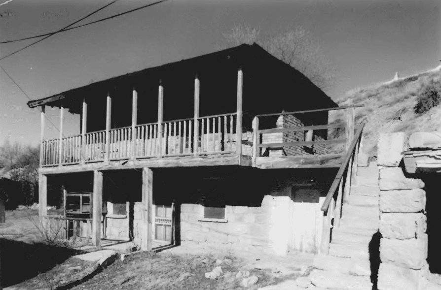
Mahleres & Siampenos Building

28 Thursday Mar 2024

Posted by Jacob Barlow in Uncategorized

≈ Leave a comment

Tags

Carbon County, NRHP, Price, utah

Parker & Weeter Block / Mahleres & Siampenos Building
87 West Main Street in Price, Utah

The Mahleres-Siampenos Building built in 1913 is locally significant as one of the oldest commercial buildings in Price still to retain most of its outstanding architectural features and traditional uses. It exemplifies much of the enduring commercial development that made Price the leading business center of eastern Utah, and remains an outstanding local example of twentieth century commercial architecture which combines elements of the Classical Revival style with the massing and decorative elements of the Prairie Style.

Listed on the National Register of Historic Places (#82004115), the text on this page is from the nomination form from when it was added.

The present Mahleres-Siampenos building was originally known as the Parker and Weeter Block when it was built in 1913. It was constructed on the site of the original Weeter Lumber Company yard, the first enterprise of its kind in Price. John C. Weeter owned both the land and the building, which he constructed in partnership with Frank L. Parker and James W. Loofbourow. Weeter Lumber Co. was also responsible for building many of Price’s other pre-World War I structures; the owners insured that their edifice would be among the finest in that city.

The building has passed through very few owners in its long existence, testifying to its viability as a commercial structure. During the first few years it was managed by Loofbourow, secretary of the J. C. Weeter Lumber Company and later mayor of Price (1924-25). Later, Frank L. Parker obtained sole ownership from his two partners. Parker’s widow, Mary, deeded the building to Harry Mahleres in 1938, who granted one-half interest to Sam Sampenos a year later. (Please note that Siampenos and Sampinos are variations on the same name; the spellings differ on the building and the deed.) Harry Mahleres had actually had an interest in the building before his purchase, investing $59.50 for improvements in 1921. After purchase by Mahleres and Sampinos, the name of the building was changed to that of its present owners, the heirs of the purchasers.

Harry Mahleres and Sam Sampinos were brothers-in-law, since Harry was married to Sam’s sister Ourania. They came from nearby villages in the mountains of central Greece, where sheepherding was a way of life. Upon arrival in America in the early 1900’s both men first worked at odd jobs and later went into the sheep business. Their success at breeding sheep enabled them to buy this building, as well as several other properties which they held in common(including their family home and a ranch out in Nine Mile Canyon where the sheep were sometimes pastured.) No doubt some of the Greek architectural features of this building, especially the ornamental façade, appealed to these Greek men who always retained a love of their native land.

From its construction, the Mahleres-Siampenos Building housed a variety of commercial interests, just as it does today. On the ground floor, the left-hand side has always been a bar. The initial manager was John Causer, who ran the Bank Club 66 bar at that location. Around 1920 the name was changed to Gilners, and the Miners Club formed part of the enterprise. In 1971 the Savoy Club began operation on the premises, where it remains. (This last bar was originally in the grand old Savoy Hotel, across the street to the west, one of Price’s finest landmarks. The hotel was torn down in the late sixties to create a parking lot, but its name is preserved in the business housed in the Mahleres-Siampenos Building.)

The right-hand side of the ground floor has usually been a restaurant. The earliest proprietors were Nick Rinette and Mr. Capitolo, who ran an Italian and French restaurant on the premises for many years. During the 1940’s the Bureau of Land Management office utilized this space, and beginning in the early 1950’s the Hi Spot Restaurant opened in this part of the building. The Hi Spot was first a confectionary, along the lines of the traditional Greek coffee-house, run by immigrant Greeks but catering to people of all nationalities. The first proprietor, Tom Anest, sold out in 1958 to John Sampinos, the nephew of Sam Sampinos and Harry Mahleres. He and his family made the Hi Spot into a restaurant and something of a Price institution. When John retired on May 30, 1980, the community expressed regret at his departure, which was prominently featured in the local newspaper, the Price Sun Advocate. The restaurant currently rests in the capable hands Andy and Reva Douros who maintain the tradition of an eating and meeting place in this building.

The upper floor of the structure was originally a rooming house, or hotel. The first managers are unknown, but the second were Mr. & Mrs. Ernest Sumner, who rented the entire upstairs as well as running a furniture store further east on Price’s Main Street. Around 1920 it became known as the Central Hotel, a name it bore until it closed c. 1960.

The basement of this structure also saw a variety of uses. At first it was utilized for meetings of various clubs: Rotarians, Kiwanas, the American Legion. On several occasions Rinette and Capitolo catered banquets for the clubs on these premises. At other times, dances were held there. During the sixties these functions ceased, and the basement remained unoccupied until 1977, when it housed Infinity Music record shop for a few months. The basement is once again vacant, although it had been remodeled to accommodate this last business.

In the future, the Mahleres-Siampenos Building will undoubtedly continue to house the type of business that it has consistently maintained since construction. The Savoy Club will remain; the Hi Spot is due for some interior remodeling to facilitate the operation of the restaurant. The owners have begun to give some thought to remodeling the upstairs hotel, which could then be reopened for use. There is no doubt that the building will be preserved and will continue to act an an amalgam of Price’s varied, enduring commercial enterprises.

The Mahleres-Siampenos building is a two story brick building, three bays wide and six bays deep with a flat roof. It has elements of the Prairie Style. Classical elements include the paired brackets and dentils at the cornice line. The Prairie Style influence is evident in the horizontality of the building emphasized by the bands of fenestration and accented cornice line. The central projection on the parapet, the geometric quality of the blocky massing of the building, and the geometric ornament are all characteristics common to Prairie Style design in commercial buildings.

The first floor of the façade was originally divided into two commercial spaces each with a recessed entry, which was separated by a recessed central door that offers access to the second floor. The same arrangement still exists except that there is no longer a recessed entrance to the shop on the south half of the building. The panel of windows that spanned the width of the building over the first floor establishments have since been filled in.

The windows on the second story are the double hung sash type. Across the façade they are grouped so that four windows are centered between two pairs of windows. Down the north side of the building there are two windows per bay. The windows are set into a darker brick and the bays are outlined and divided by bands of a light color brick. Within the panel above the windows and separating the bays, defined by the light color brick, are geometric decorative elements reminiscent of Prairie Style design. Above the second story windows is a projecting cornice supported by paired brackets and a line of dentils. The cornice is topped by a parapet which is outlined by a band of light colored brick and ornamented at the corners and at projecting points along the wall with a simple geometric ornament, also reminiscent of Prairie Style design.

The building has received few alterations. No changes are evident above the first floor, and on the first floor only the south half of the façade and the band of windows above the shops appear to have been changed. A hood over the basement steps has been removed. These changes, however, have not affected the original integrity of the building.

← Older posts

Follow Jacob

Follow Jacob

Come wander with me on Youtube.

Blog Stats

  • 2,176,271 hits

Social and Other Links

BarlowLinks.com

Recent Posts

  • Sly Park
  • James Calvin Sly Sr.
  • Farnsworth Grocery
  • Cousin’s Row
  • Charles H. and Lenore Taylor Home

Archives

Loading Comments...