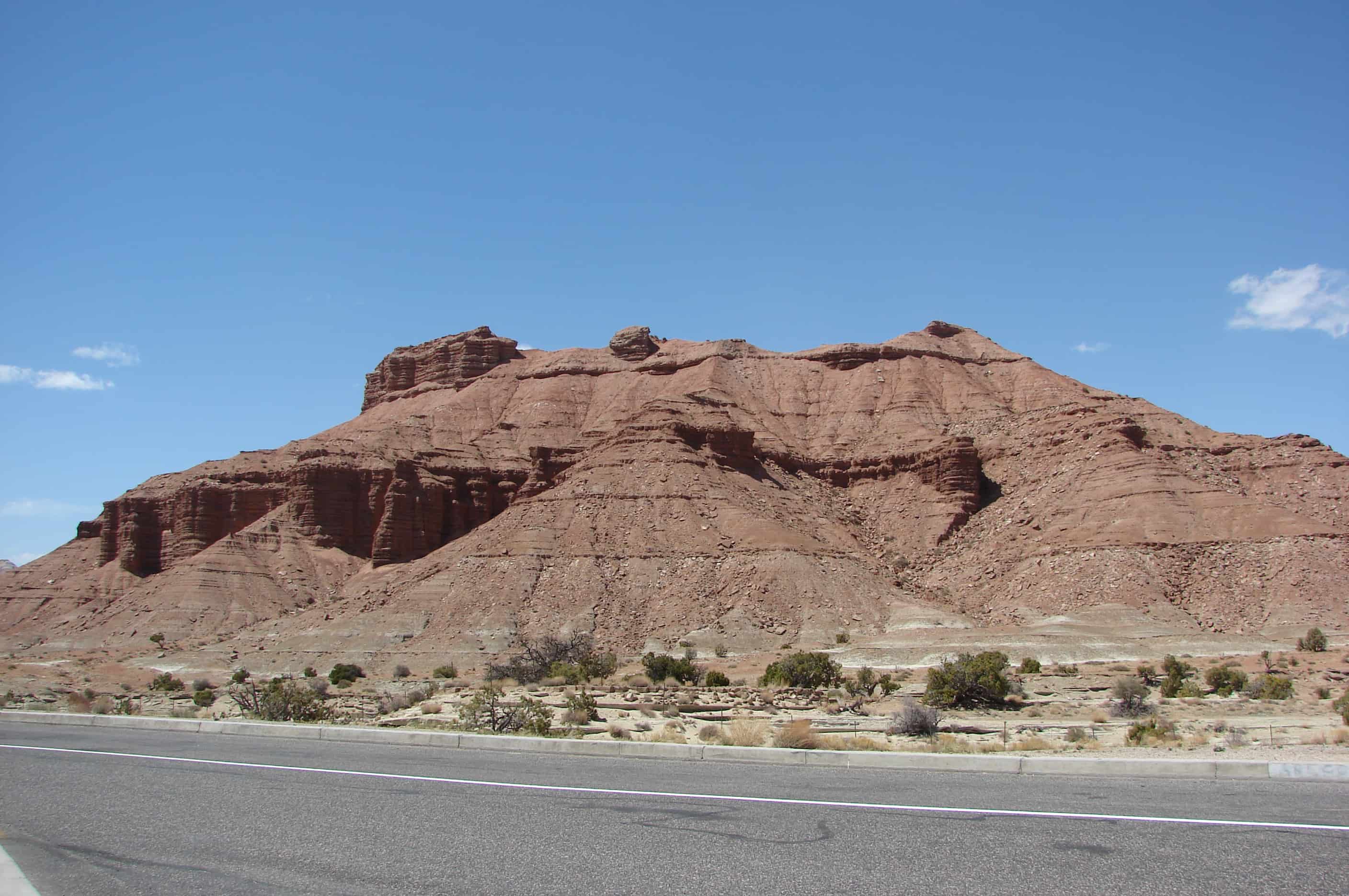
The San Rafael Swell is a kaleidoscope of colors splashed across a rugged landscape of cliffs, canyons, arches and pinnacles. Erosion sculpts the stone, but the environment in which it was deposited determines its color. In general, the brighter colors, red, yellow, and orange, are present in rocks deposited where oxygen was present. Examples of these environments are sand dunes and floodplain material higher then the water table. The duller colors, gray, light green, and purple, are present in rocks where there was no oxygen as they were deposited. These would be formed at the bottom of an inland sea or below a water table. These boggy places also trapped the bodies of dinosaurs ad preserved their bones as fossils. The Cleavland-Lloyd Dinosaur Quarry to the north of here has yielded hundreds of dinosaur fossils. This world famous quarry has produced more dinosaur mounts for display in museums then any other in the world, all thanks to the amazing fosilization of these once boggy areas now in front of you and all around you, take a minute to look at how different this place once was.
As you stand here look around, the magnificent cliffs, canyons, knobs, and spires before you are mostly cut from the 190 million-year-old Navajo Sandstone formation. Imagine the winds that carried sand to this area and deposited it in sand dunes hundreds of feet high. As wind shifted the massive sand dunes, the sands were deposited in a whirl of layers. Buried over eons of geologic time, the sands ceased their movement and turned to stone. Water releases the grains of sand from the grip of stone. Even here in an arid climate, water is the prime agent sculpting the stone into canyons, arches, and pinnacles. You are near the center of the great anticline that is the San Rafael Swell. Here, the layers are nearly flat-lying. It is like a stone dome with the curved top worn away. Soon the layers will begin tilting gently to the west.
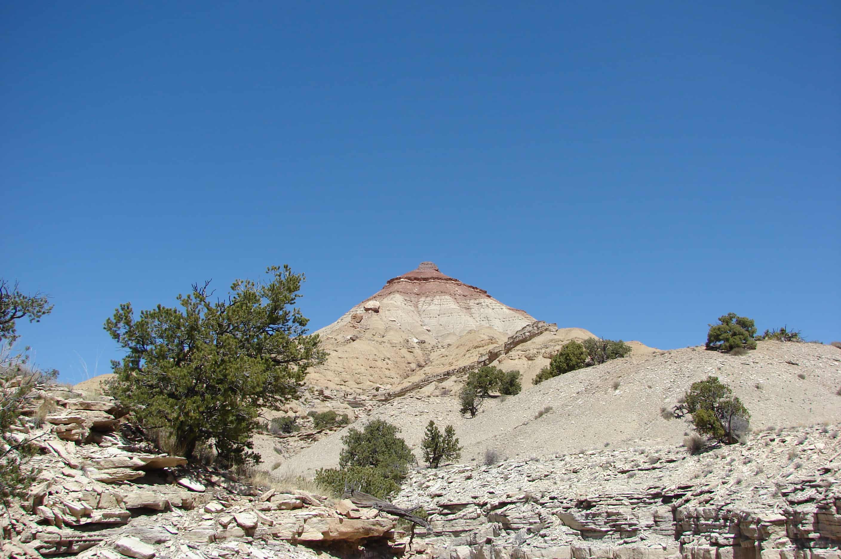
There is a prominent peak in the area called The Wickiup. It stands alone, with layers of color all the way up the cone. You can see it from I-70, and there are two trails that make a loop around it. Combine this trail with Road Hollow and you have a nice loop with The Wickiup in the center.(*)
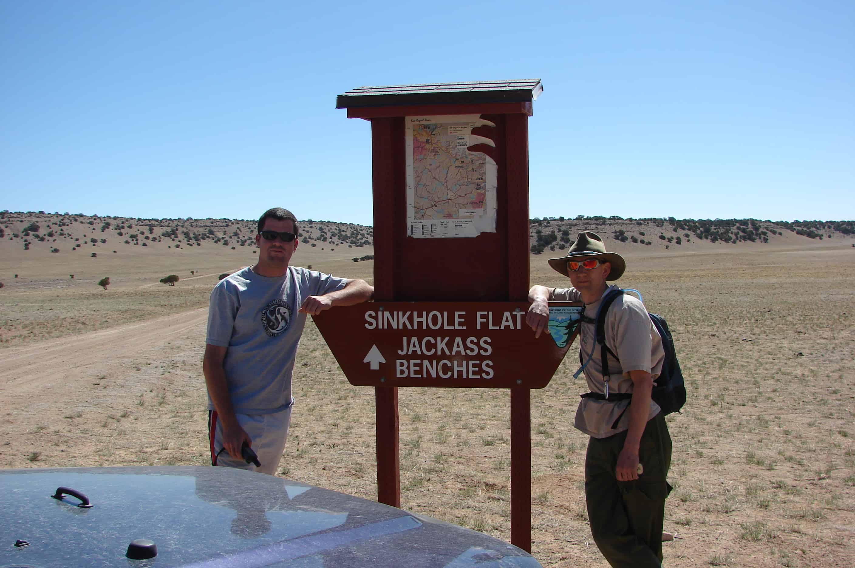
A very dangerous sink hole, about 30 feet in diameter and at least 25 feet deep was discovered on the San Rafael very recently, It was thought to be an old mine shaft which water had gotten into and now has caved in creating a hazardous hole to the surface. A group of off highway vehicle riders found the hole and notified the Bureau of Land Management, who controls most of the land in the San Rafael.
A sinkhole, also known as a sink, shake hole, swallow hole, swallet, doline or cenote, is a natural depression or hole in the surface topography caused by the removal of soil or bedrock, often both, by water. Sinkholes may vary in size from less than a meter to several hundred meters both in diameter and depth, and vary in form from soil-lined bowls to bedrock-edged chasms. They may be formed gradually or suddenly, and are found worldwide.
Mechanisms of formation may include the gradual removal of slightly soluble bedrock (such as limestone) by percolating water, the collapse of a cave roof, or a lowering of the water table. Occasionally a sinkhole may exhibit a visible opening into a cave below. In the case of exceptionally large sinkholes, such as Cedar Sink at Mammoth Cave National Park, USA, a stream or river may be visible across its bottom flowing from one side to the other.
Sinkholes may capture surface drainage for running or standing water, but may also form in currently high and dry locations. The state of Florida in the USA is known for having frequent sinkholes, especially in the central part of the state. The Murge area in southern Italy also has numerous sinkholes. Sinkholes can be formed in retention ponds from large amounts of rain.
Sinkholes are usually but not always linked with karst landscapes. In such regions, there may be hundreds or even thousands of sinkholes in a small area so that the surface as seen from the air looks pock-marked, and there are no surface streams because all drainage occurs sub-surface.
Sinkholes have been used for centuries as disposal sites for various forms of waste. A consequence of this is the pollution of groundwater resources, with serious health implications in such areas.
Sinkholes also form from human activity, such as the rare but still occasional collapse of abandoned mines in places like West Virginia, USA. More commonly, sinkholes occur in urban areas due to water main breaks or sewer collapses when old pipes give way. They can also occur from the overpumping and extraction of groundwater and subsurface fluids.
When sinkholes are very deep or connected to caves, they may offer challenges for experienced cavers or, when water-filled, divers. Some of the most spectacular are the Zacatón cenote in Mexico, the Boesmansgat sinkhole in South Africa, Sarisariñama tepuy in Venezuela, and in the town of Mount Gambier, South Australia.