Tags
Jacobs Chair in San Juan County, Utah

08 Wednesday Dec 2021
Posted in Uncategorized
Tags

Jacobs Chair in San Juan County, Utah


25 Sunday Jun 2017
Posted in Uncategorized
Tags
Geological, Geology, Parks, Provo, Rock Canyon, Trailheads, Trails, utah, utah county
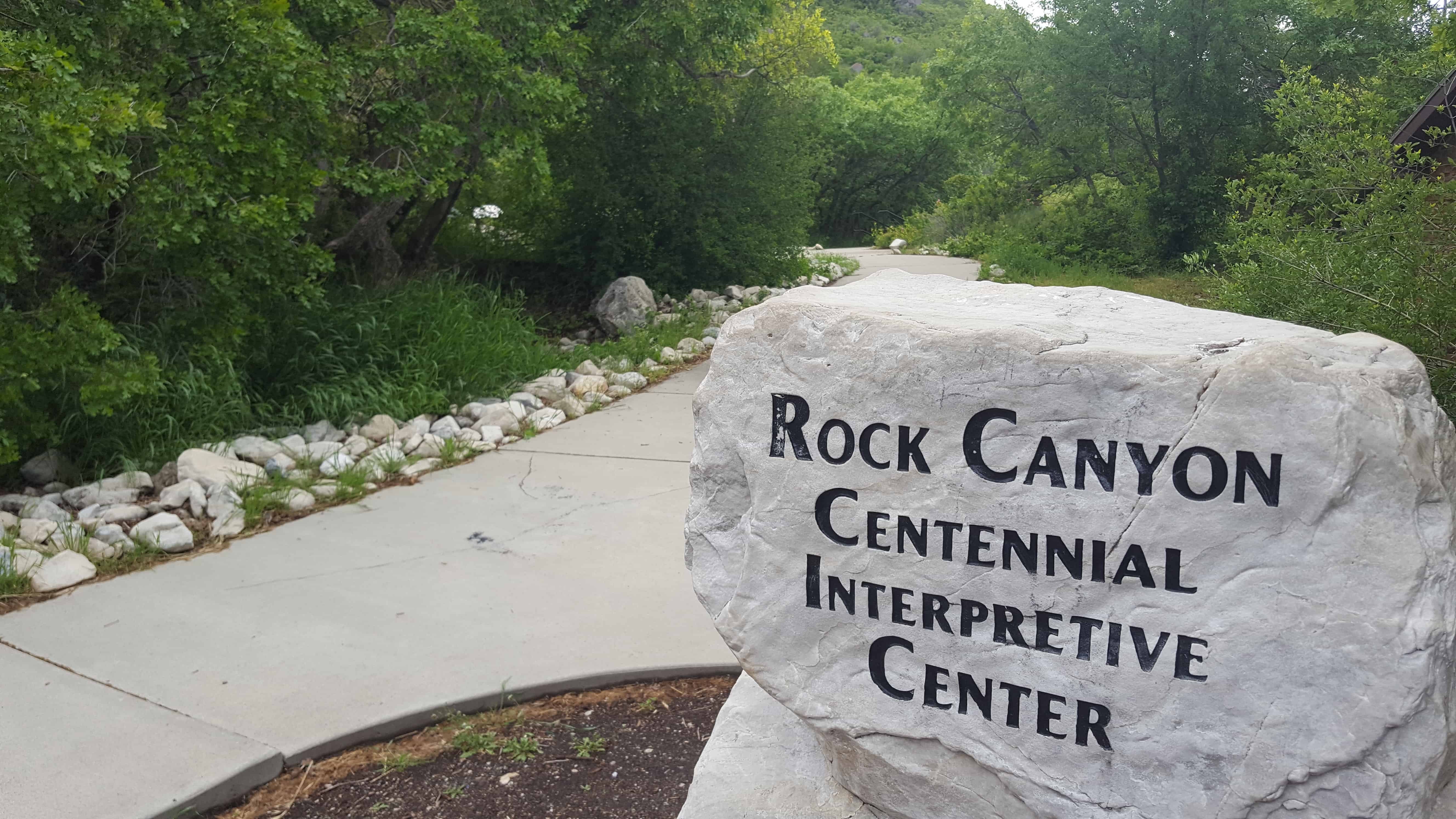
Rock Canyon Centennial Interpretive Center – Rock Canyon Trailhead
This is a popular parking lot for the constant stream of hikers going up Rock Canyon but there are also interesting interpretive signs, an amphitheater, pavilion and bathrooms.


19 Wednesday Apr 2017
Posted in Uncategorized
Tags
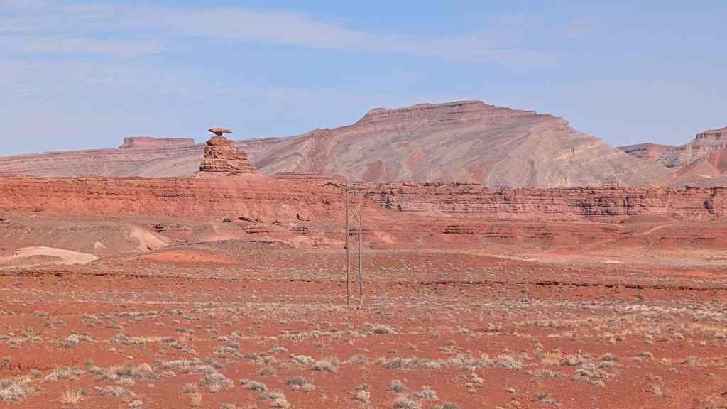
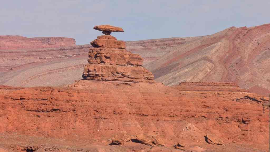
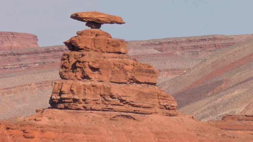
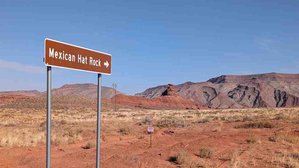
Geologic, Geological, Geology, Halchita, Mexican Hat, Monument Valley, Rock Formations, San Juan County, utah

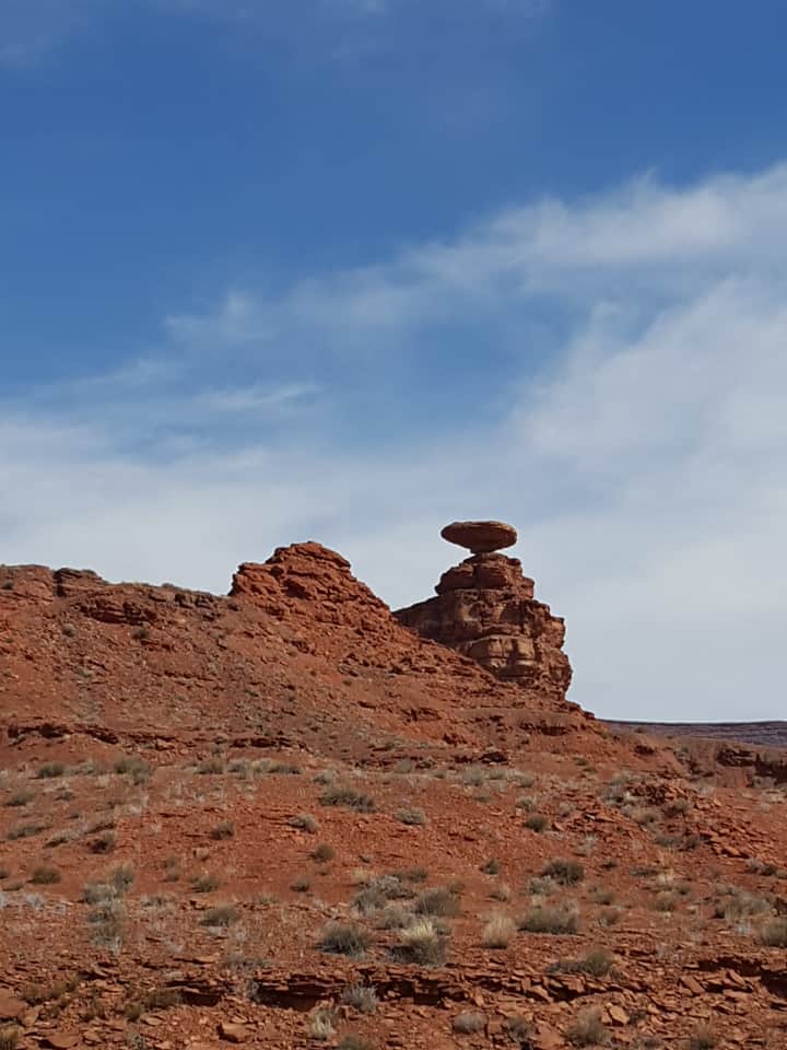
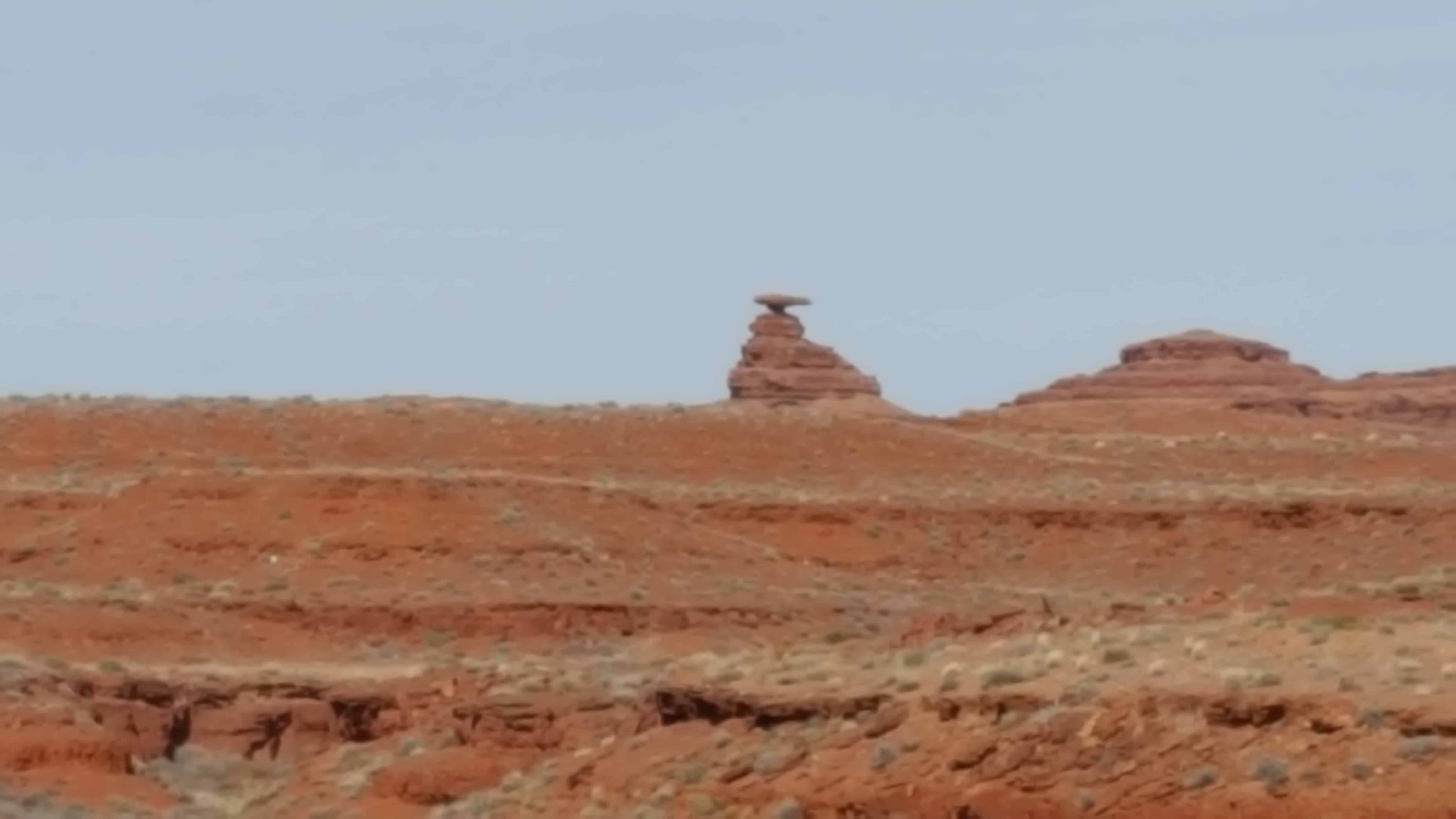
The name “Mexican Hat” comes from a curiously sombrero-shaped, 60-foot wide by 12-foot thick, rock outcropping on the northeast edge of town. The “Hat”‘ has two rock climbing routes ascending it. It has frequently been noted on lists of unusual place names.


08 Sunday Jan 2017
Posted in Uncategorized

Hogback
Steeply dipping strata define the western edge of the San Juan basin. To the west older geologic formations are exposed toward the Defiance uplift whereas basinward they are they are downwarped thousands of feet beneath younger rock units. Vast coal, uranium, oil and gas resources occur in the strata buried within the basin.
Elevation 5,050 feet.


23 Sunday Oct 2016
Posted in Uncategorized
Tags
Bells Canyon, Big Cottonwood Canyon, Geologic, Geological, Geology, Glaciers, Lake Bonneville, Little Cottonwood Canyon, Salt Lake County, Salt Lake County Parks, Sandy

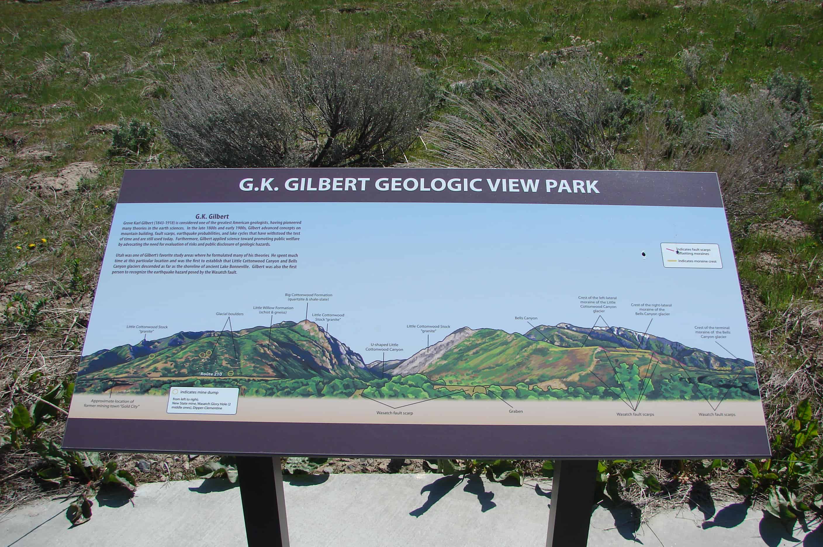
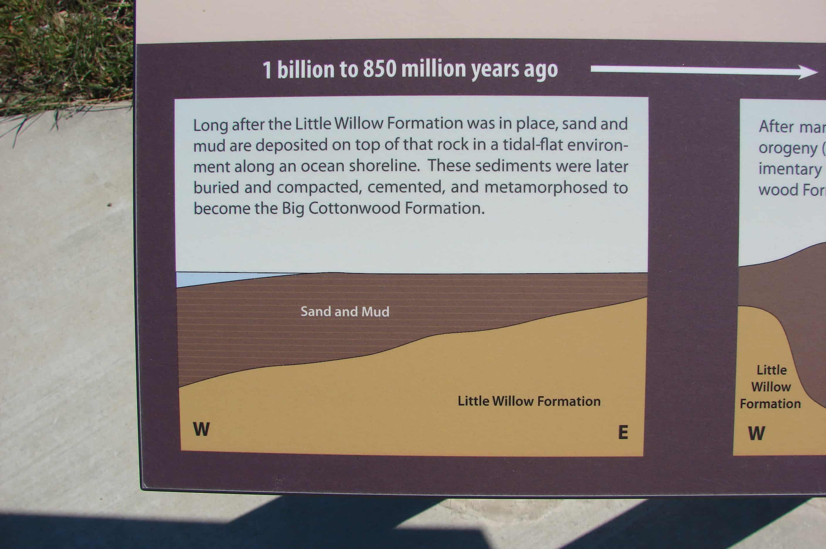
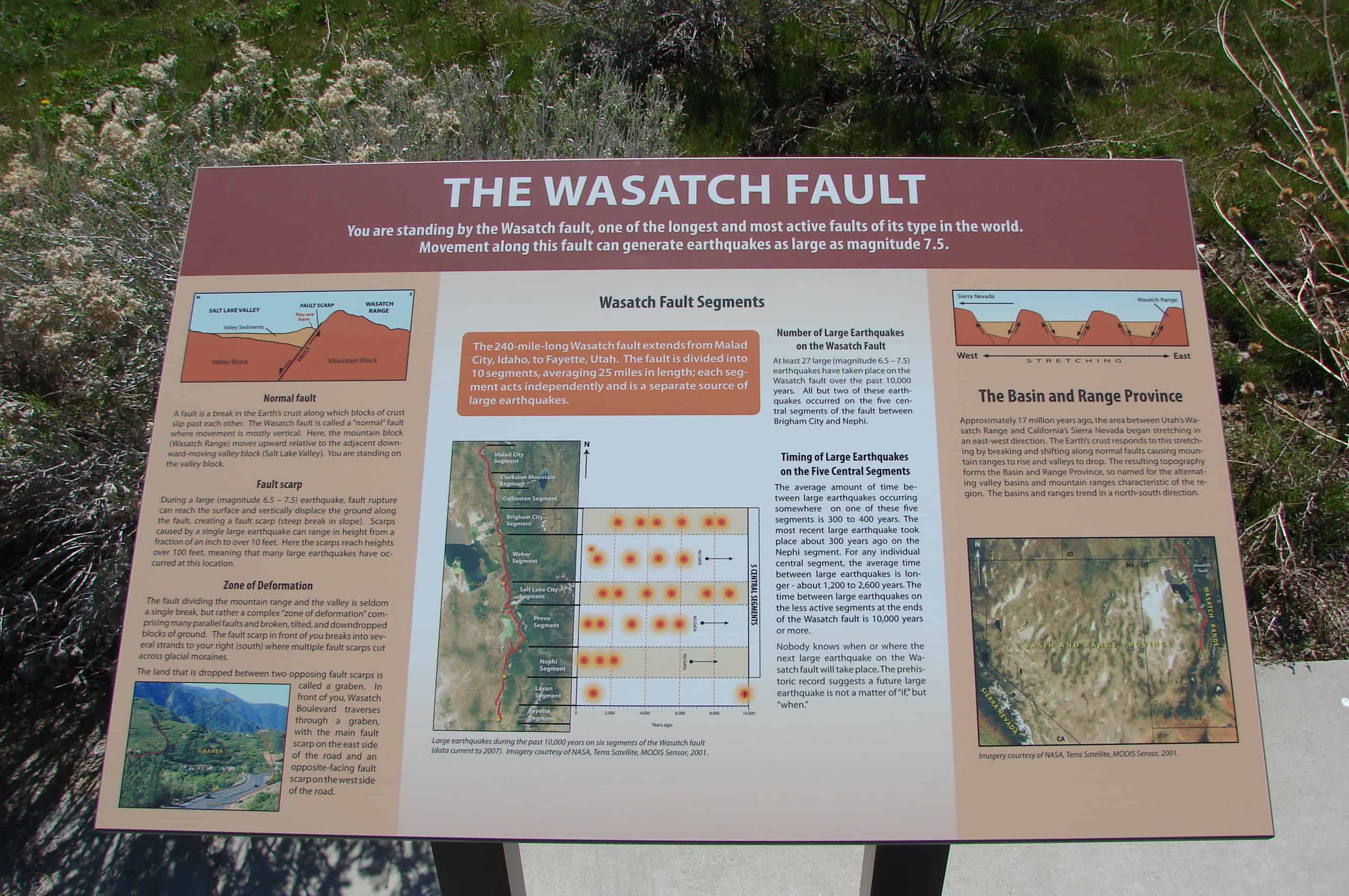
Grove Karl Gilbert (1843-1918) is considered one of the greatest American geologists, having pioneered many theories in the earth sciences. In the late 1800s and early 1900s, Gilbert advanced concepts of mountain building, fault scarps, earthquake probabilities, and lake cycles that have withstood the test of time and are still used today. Furthermore, Gilbert applied science toward promoting public welfare by advocating the need for evaluation of risks and public disclosure of geologic hazards.
Utah was one of Gilbert’s favorite study areas where he formulated many of his theories. He spent much time at this particular location and was the first to establish that Little Cottonwood Canyon and Bells Canyon glaciers descended as far as the shoreline of ancient Lake Bonneville. Gilbert was also the first person to recognize the earthquake hazard posed by the Wasatch fault.
Related Posts:


12 Wednesday Oct 2016
Posted in Uncategorized

As you stand here look around, the magnificent cliffs, canyons, knobs, and spires before you are mostly cut from the 190 million-year-old Navajo Sandstone formation. Imagine the winds that carried sand to this area and deposited it in sand dunes hundreds of feet high. As wind shifted the massive sand dunes, the sands were deposited in a whirl of layers. Buried over eons of geologic time, the sands ceased their movement and turned to stone. Water releases the grains of sand from the grip of stone. Even here in an arid climate, water is the prime agent sculpting the stone into canyons, arches, and pinnacles. You are near the center of the great anticline that is the San Rafael Swell. Here, the layers are nearly flat-lying. It is like a stone dome with the curved top worn away. Soon the layers will begin tilting gently to the west.
(Located at the Ghost Rock Westbound View Area on I-70)


11 Sunday Sep 2016
Posted in Uncategorized
Tags
Alabama, Craters, Elmore County, Geologic, Geological, Geology, Wetumpka

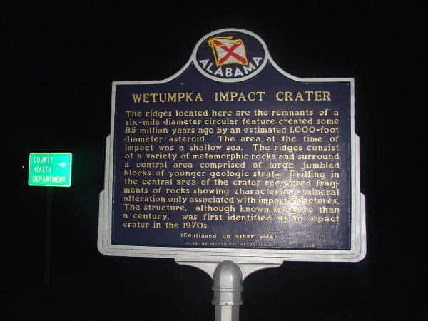
Wetumpka Impact Crater
The ridges located here are the remnants of a six-mile diameter circular feature created some 85 million years ago by an estimated 1,000-foot diameter asteroid. The area at the time of impact was a shallow sea. The ridges consist of a variety of metamorphic rocks and surround a central area comprised of large jumbled blocks of younger geologic strata. Drilling in the central area of the crater recovered fragments of rocks showing characteristic mineral alteration only associated with impact structures. The structure, although known for more than a century, was first identified as an impact crater in the 1970s.
18 Saturday Apr 2015
Posted in Uncategorized
Tags
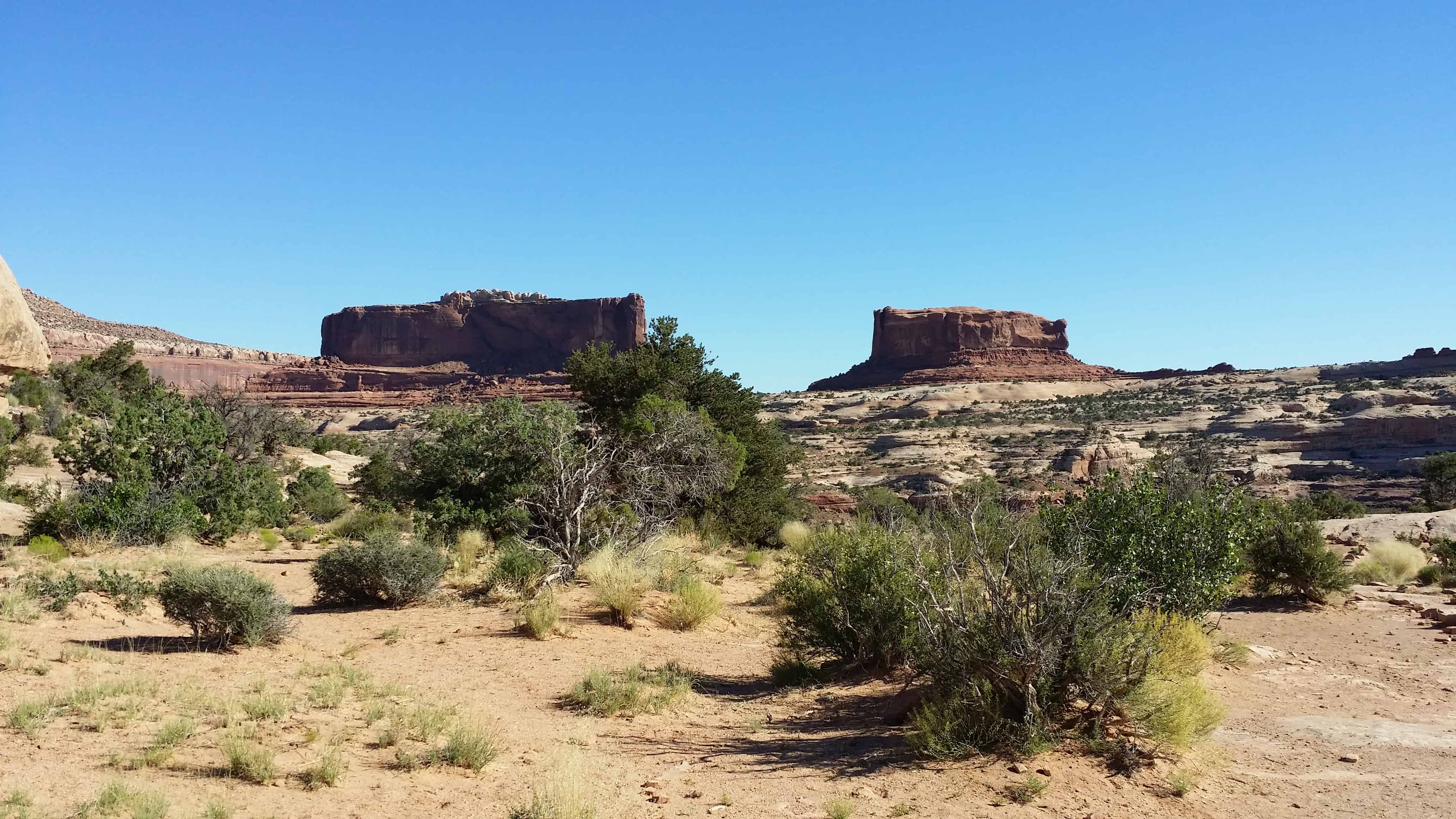
From here you have an excellent view of the Monitor and Merrimac Buttes to the northeast. These prominent land forms tower 600 feet above their Navajo sandstone base. They can be seen from many points as you travel along the highway.
The Monitor and Merrimac Buttes were named after the Civil War ironclad ships of the same names. If you look at a likeness of the old ships, their shapes bear a striking resemblance to these two buttes. The Merrimac (the large rock on your left) was the Confederate ship, called the “Virginia” by the southern forces. The Monitor (on the right) was the Union ship sent to destroy the Merrimac. The resulting sea battle changed maritime warfare forever. Long after both ships lie on the sea bottom, their rock counterparts remain locked in perpetual battle.
The Monitor and Merrimac Buttes are composed of Entrada sandstone. (This is the same rock layer that forms many of the arches in Arches National Park.) This Entrada sandstone is composed of three “members,” or components — Dewey Bridge, Slickrock and Moab Tongue. The different “members” of the Entrada layer erode at varying rates. Specifically, the softer Dewey Bridge member erodes more quickly, causing the Slickrock cliffs to collapse. This process has created the Monitor and Merrimac Buttes, as well as other towering monoliths in the area.
Geological forces have created the stunning landforms that we enjoy today.


