Tags

Located outside the William C. Browning Building at 135 South 1460 East on the University of Utah campus in Salt Lake City, Utah


24 Sunday Sep 2023
Posted in Uncategorized
Tags
Located outside the William C. Browning Building at 135 South 1460 East on the University of Utah campus in Salt Lake City, Utah
11 Saturday Jan 2020
Posted in Uncategorized

Mississippian Marble
The white rock on both sides of the road is a Mississippian limestone which has been recrystallized to marble and then bleached.
Due to the upstream tilt of the beds, the narrowness of the canyon at this point and the strength of the marble below the surface, this spot has been chosen for the site of the proposed Argenta Dam.
Related Posts:
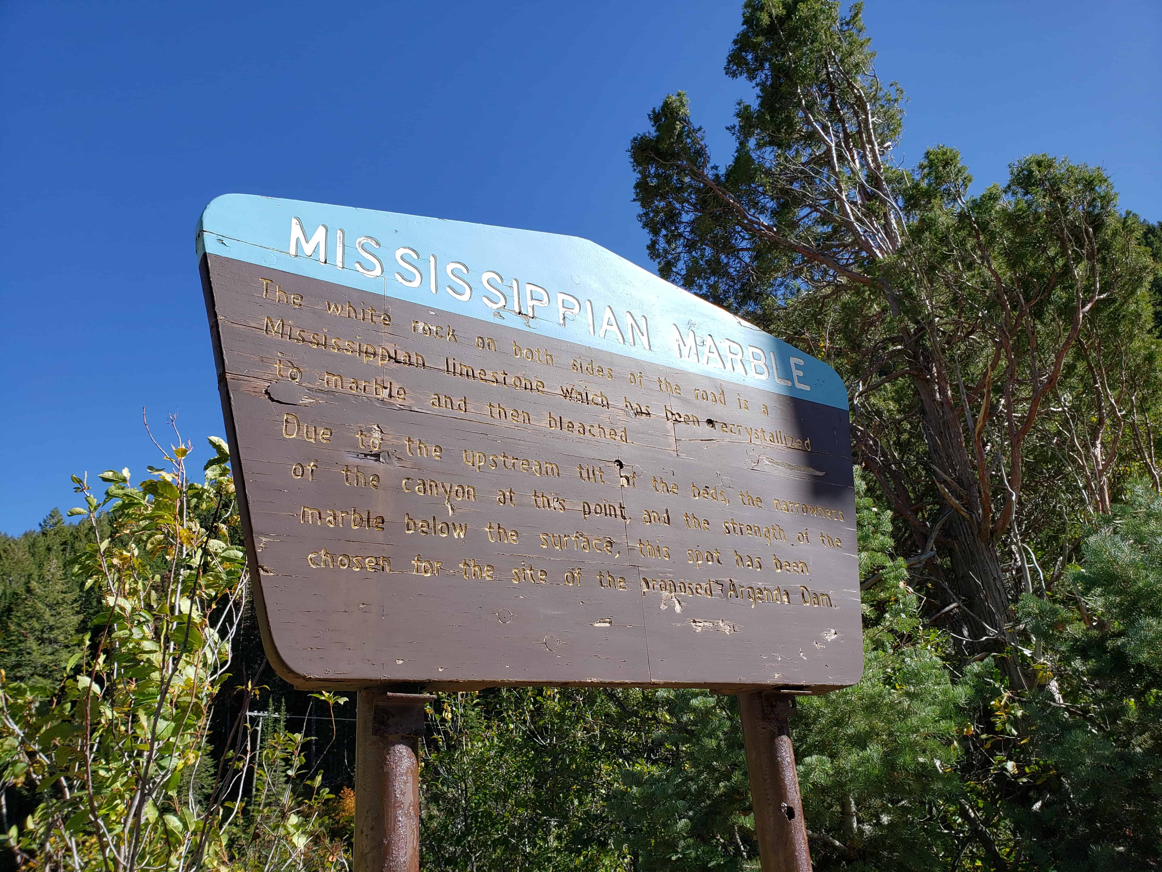


Also located here is a triple historic marker talking about the Blind Miner of the Wasatch, the Big Cottonwood Mining District and Clues – Frozen in Stone.


15 Sunday Dec 2019
Posted in Uncategorized

Meeting of the Glaciers
A small, vigorous glacier coming down Mill D South Fork met the larger sluggish glacier from the main canyon and the two wedged together and stagnated at this point.
The low smooth hill over your left shoulder, is a terminal moraine made up of rock debris deposited by the glaciers.
The L-shaped canyon above is a typical glaciated valley, contrast this with the V-shaped, stream cut canyon below.
Related Posts:


11 Monday Dec 2017
Posted in Uncategorized
Tags
Geology, historic, Parks, Salt Lake City, Salt Lake County, utah, Wells
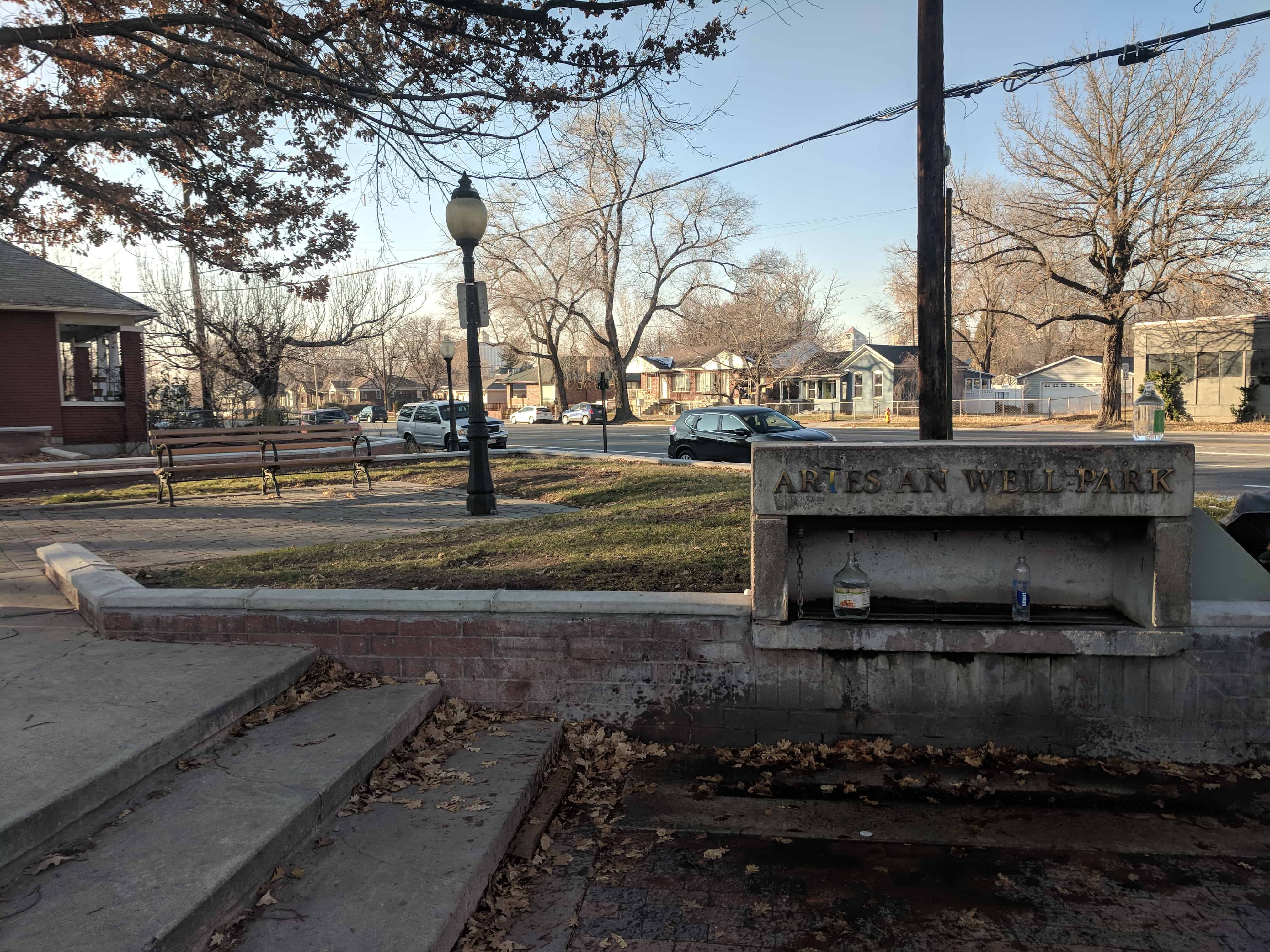
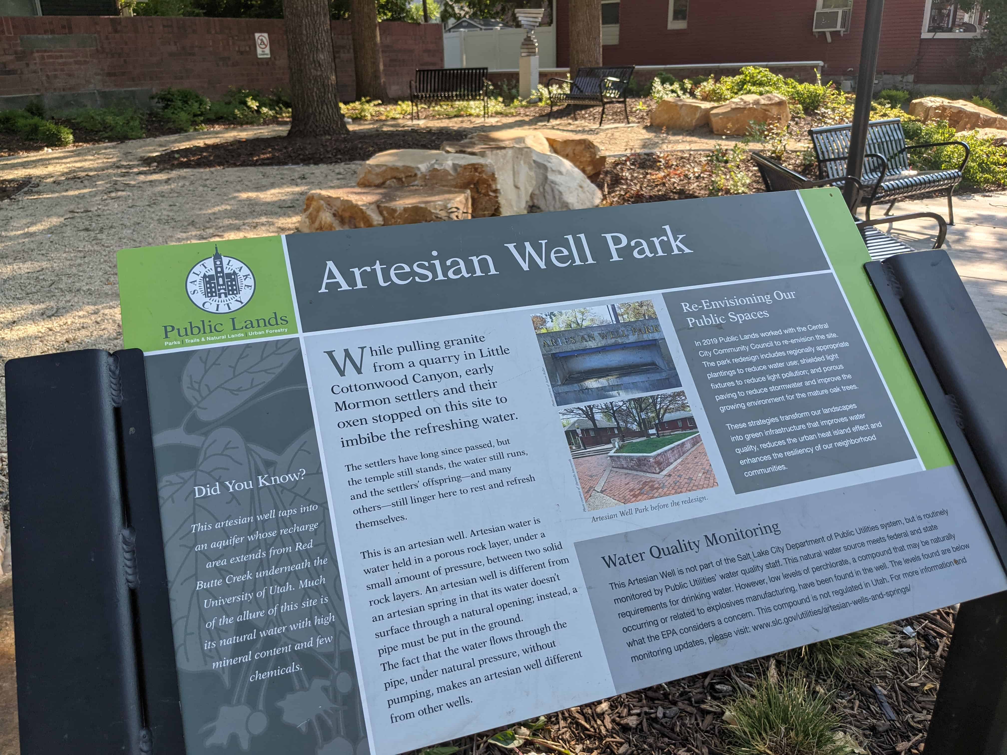
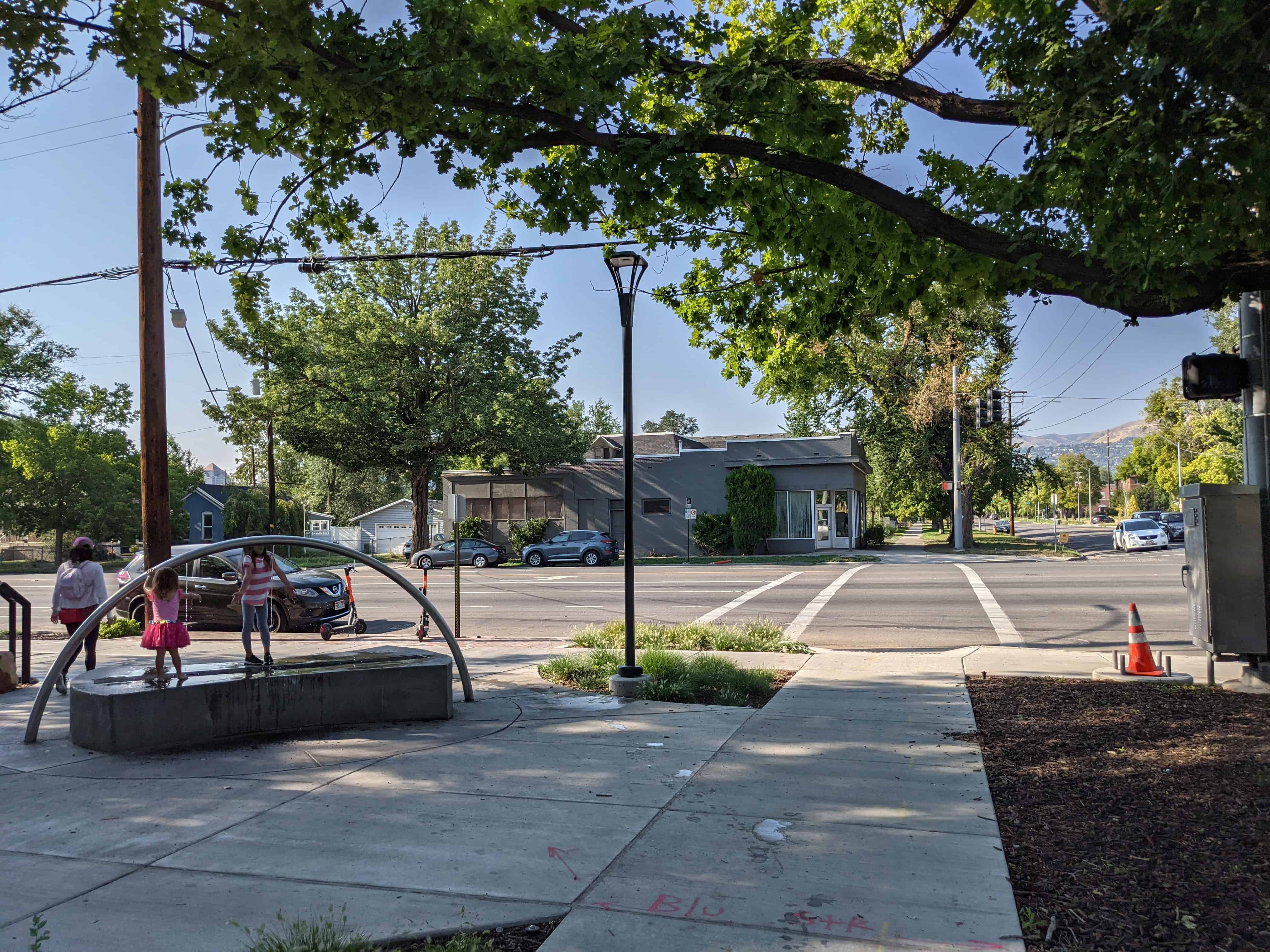
Artesian Well Park in Salt Lake City is a small urban park that contains a natural artesian spring fed by an underground aquifer. It occupies a quarter acre on the southwest corner of the intersection between 800 South and 500 East. People from all over the surrounding area have been coming to get water for free from this spring for over 100 years.
Related posts:
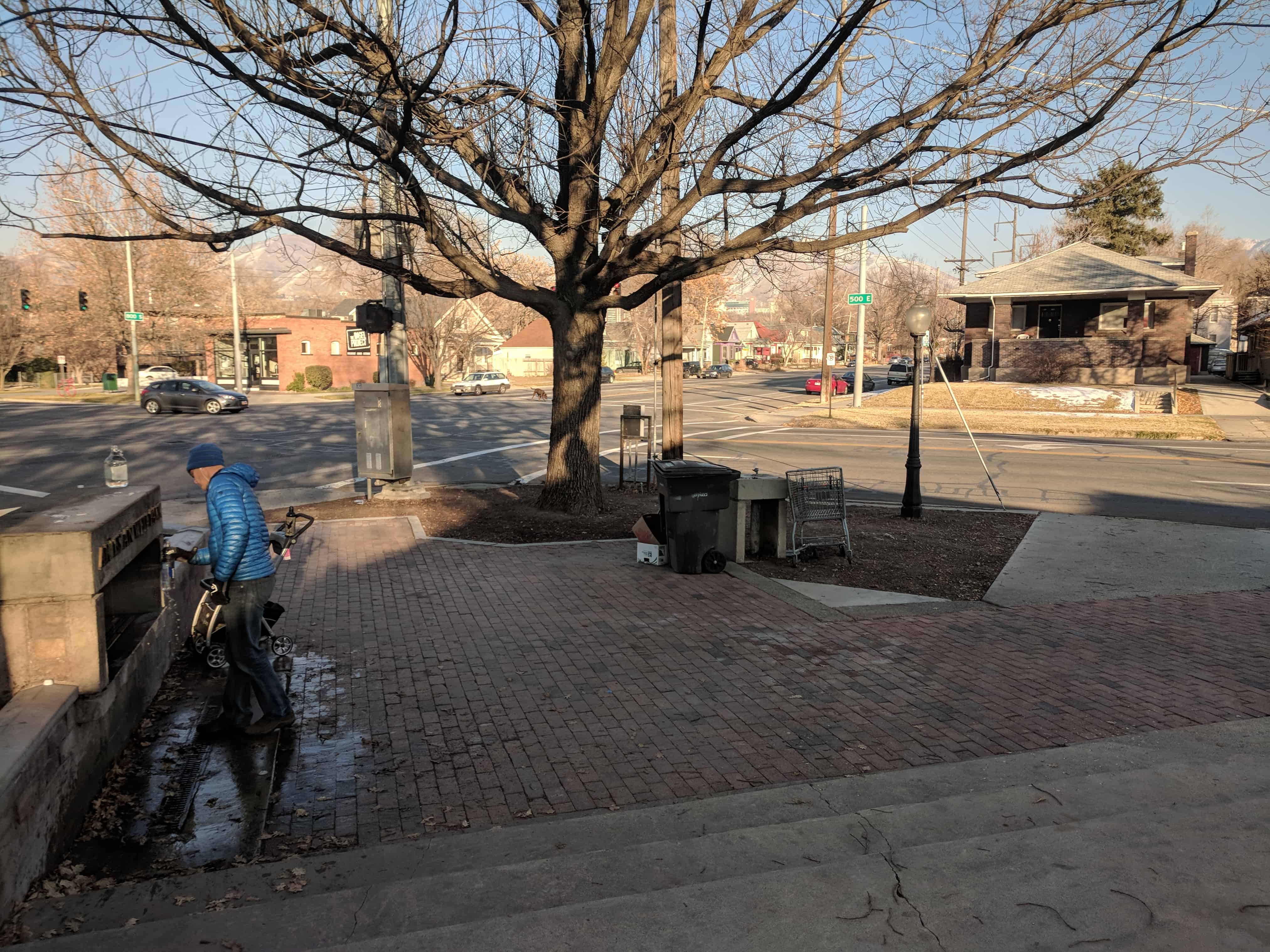


April 2020 – They are renovating the park.


While pulling granite from a quarry in Little Cottonwood Canyon, early Mormon settlers and their oxen stopped on this site to imbibe the refreshing water.
The settlers have long since passed, but the temple still stands, the water still runs, and the settlers’ offspring – and many others – still linger here to rest and refresh themselves.
This is an artesian well. Artesian water is water held in a porous rock layer, under a small amount of pressure, between two solid rock layers. An artesian well is different from an artesian spring in that its water doesn’t surface through a natural opening; instead, a pipe must be put into the ground. The fact that the water flows through the pipe, under natural pressure, without pumping, makes artesian well different from other wells.
This artesian well taps into an aquifer whose recharge area extends from Red Butte Creek underneath the University of Utah. Much of the allure of this site is its natural water with high mineral content and few chemicals.
Photos from a 2021 visit:


20 Thursday Jul 2017
Posted in Uncategorized

The Hassayampa River Riparian Area or Hassayampa River Preserve is a highway rest area just south of Wickenburg, Arizona.


25 Sunday Jun 2017
Posted in Uncategorized
Tags
Geological, Geology, Parks, Provo, Rock Canyon, Trailheads, Trails, utah, utah county
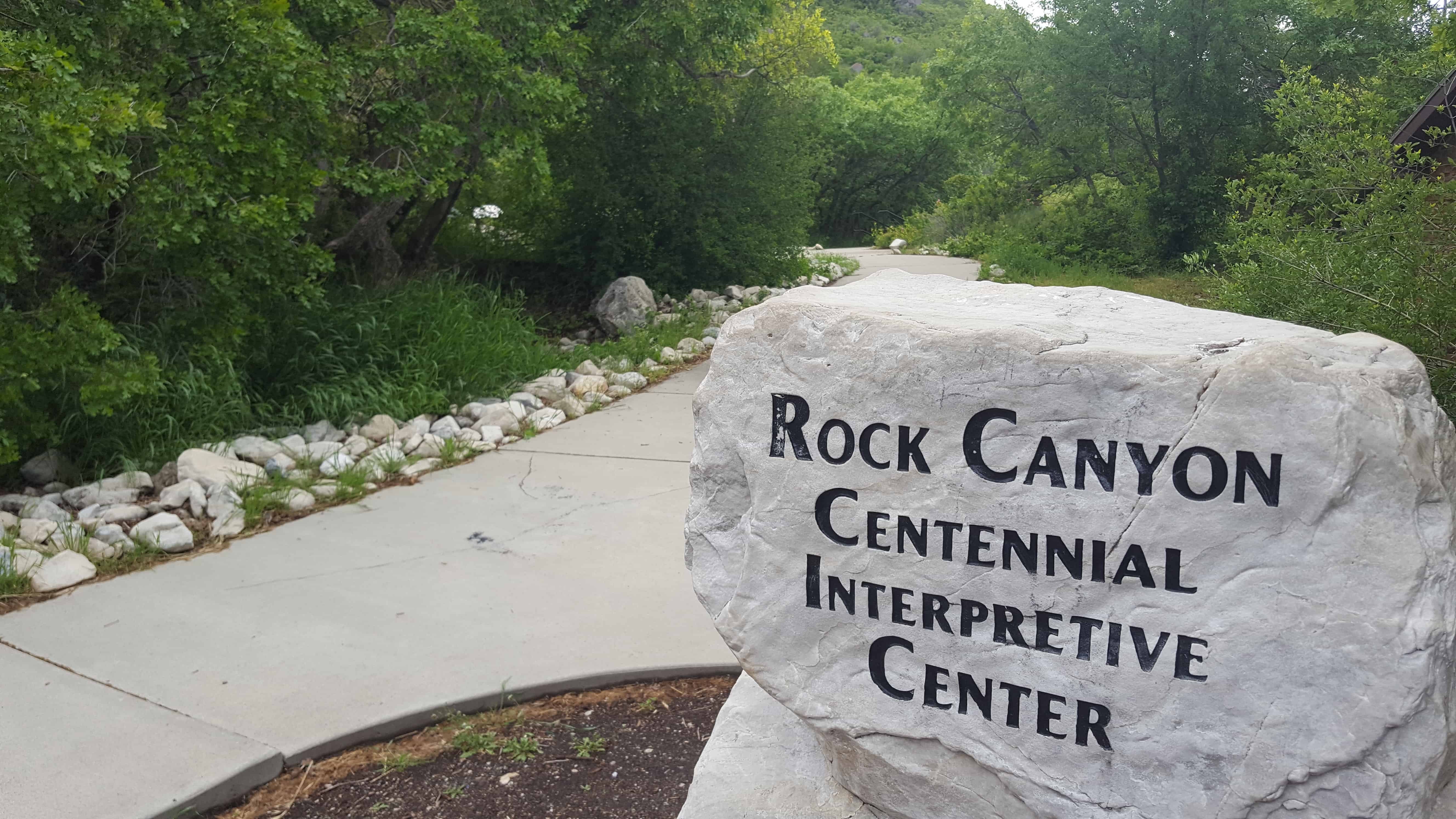
Rock Canyon Centennial Interpretive Center – Rock Canyon Trailhead
This is a popular parking lot for the constant stream of hikers going up Rock Canyon but there are also interesting interpretive signs, an amphitheater, pavilion and bathrooms.


19 Wednesday Apr 2017
Posted in Uncategorized
Tags
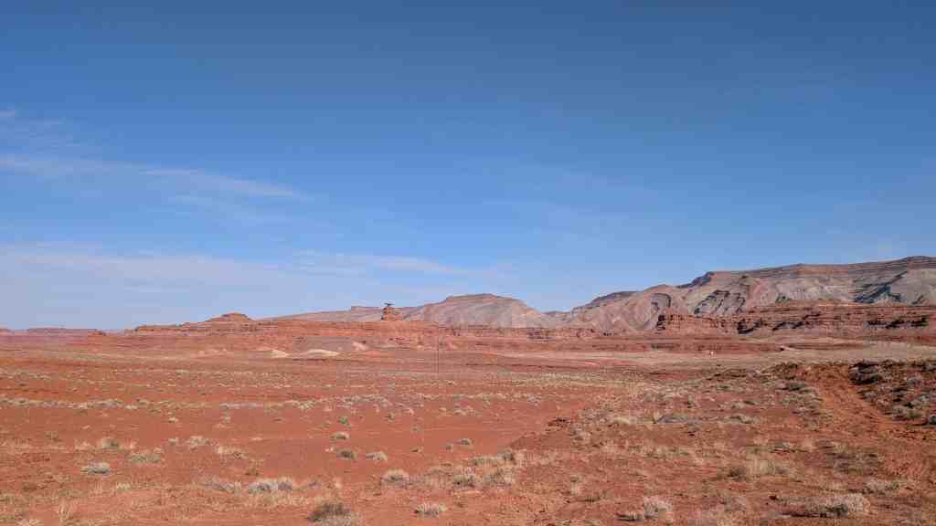
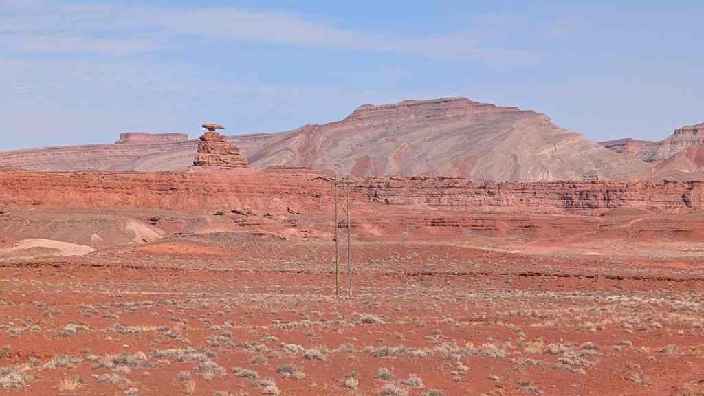
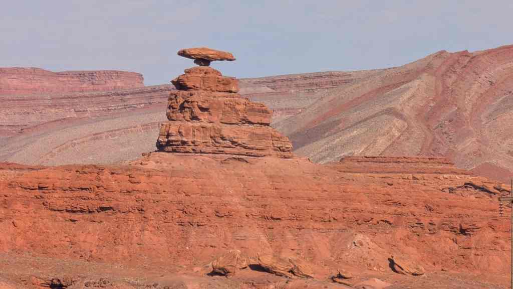
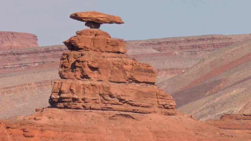
Geologic, Geological, Geology, Halchita, Mexican Hat, Monument Valley, Rock Formations, San Juan County, utah

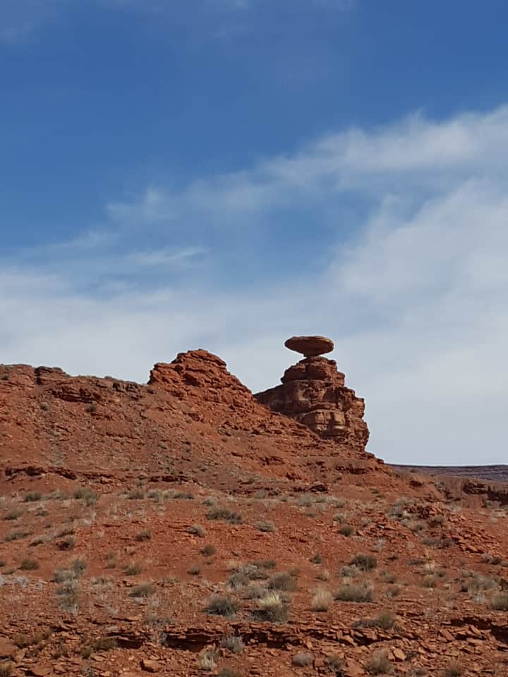
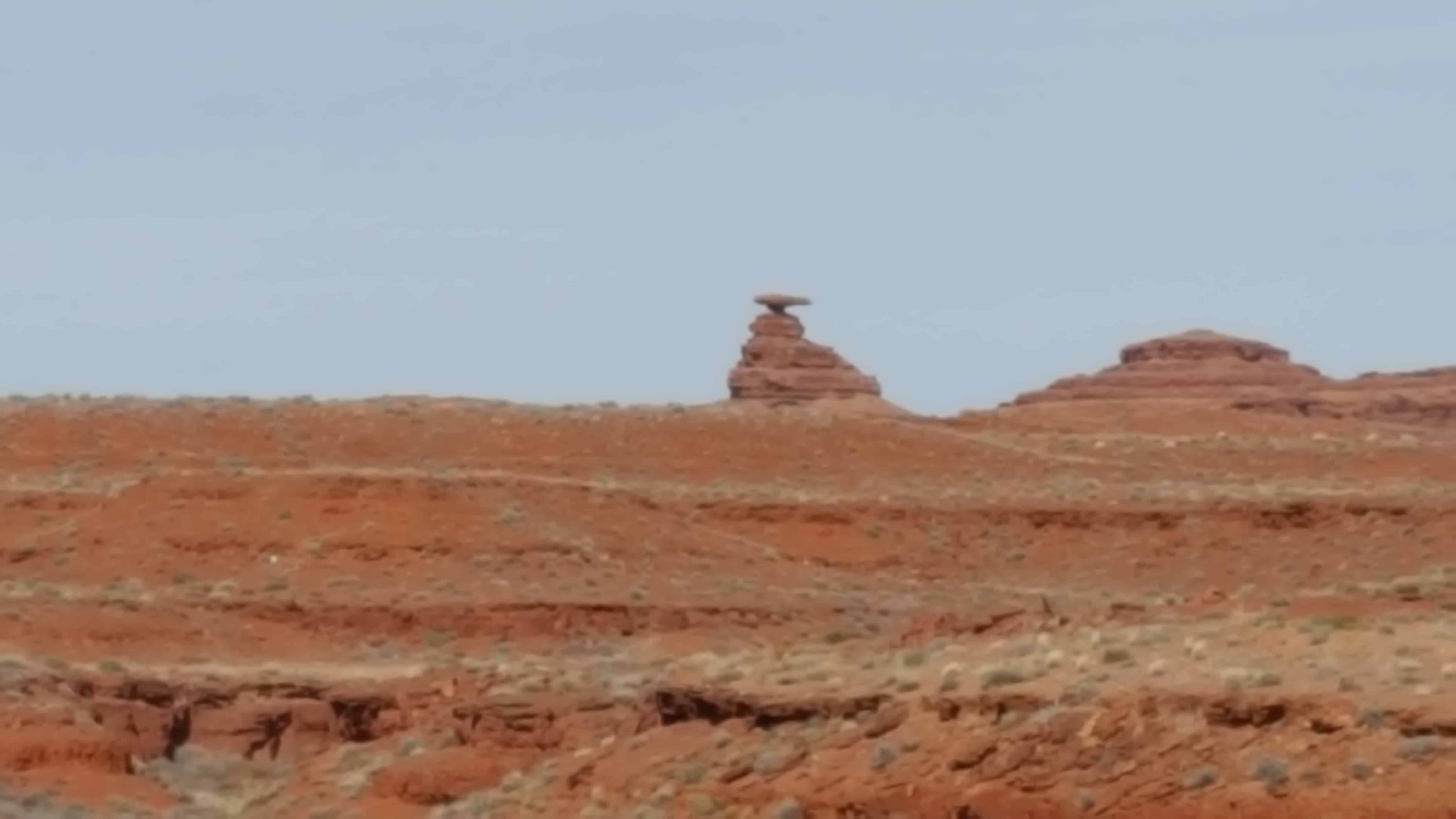
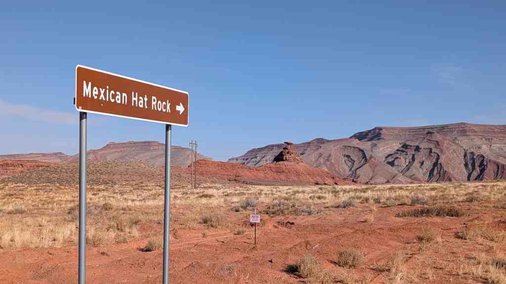
The name “Mexican Hat” comes from a curiously sombrero-shaped, 60-foot wide by 12-foot thick, rock outcropping on the northeast edge of town. The “Hat”‘ has two rock climbing routes ascending it. It has frequently been noted on lists of unusual place names.


08 Sunday Jan 2017
Posted in Uncategorized

Hogback
Steeply dipping strata define the western edge of the San Juan basin. To the west older geologic formations are exposed toward the Defiance uplift whereas basinward they are they are downwarped thousands of feet beneath younger rock units. Vast coal, uranium, oil and gas resources occur in the strata buried within the basin.
Elevation 5,050 feet.


23 Sunday Oct 2016
Posted in Uncategorized
Tags
Bells Canyon, Big Cottonwood Canyon, Geologic, Geological, Geology, Glaciers, Lake Bonneville, Little Cottonwood Canyon, Salt Lake County, Salt Lake County Parks, Sandy

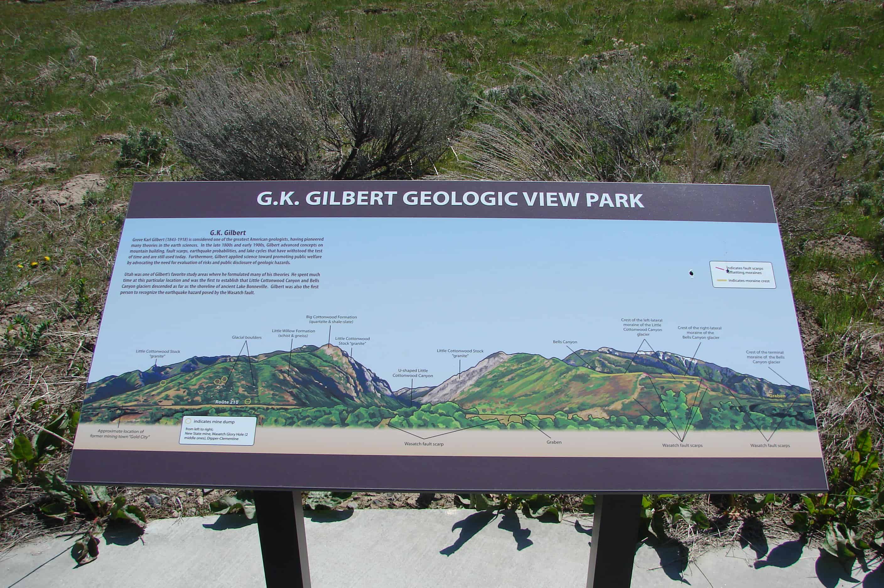
Grove Karl Gilbert (1843-1918) is considered one of the greatest American geologists, having pioneered many theories in the earth sciences. In the late 1800s and early 1900s, Gilbert advanced concepts of mountain building, fault scarps, earthquake probabilities, and lake cycles that have withstood the test of time and are still used today. Furthermore, Gilbert applied science toward promoting public welfare by advocating the need for evaluation of risks and public disclosure of geologic hazards.
Utah was one of Gilbert’s favorite study areas where he formulated many of his theories. He spent much time at this particular location and was the first to establish that Little Cottonwood Canyon and Bells Canyon glaciers descended as far as the shoreline of ancient Lake Bonneville. Gilbert was also the first person to recognize the earthquake hazard posed by the Wasatch fault.
Related Posts:


12 Wednesday Oct 2016
Posted in Uncategorized

As you stand here look around, the magnificent cliffs, canyons, knobs, and spires before you are mostly cut from the 190 million-year-old Navajo Sandstone formation. Imagine the winds that carried sand to this area and deposited it in sand dunes hundreds of feet high. As wind shifted the massive sand dunes, the sands were deposited in a whirl of layers. Buried over eons of geologic time, the sands ceased their movement and turned to stone. Water releases the grains of sand from the grip of stone. Even here in an arid climate, water is the prime agent sculpting the stone into canyons, arches, and pinnacles. You are near the center of the great anticline that is the San Rafael Swell. Here, the layers are nearly flat-lying. It is like a stone dome with the curved top worn away. Soon the layers will begin tilting gently to the west.
(Located at the Ghost Rock Westbound View Area on I-70)


