A natural arch is a natural formation (or landform) where a rock arch forms, with a natural passageway through underneath. Most natural arches form as a narrow ridge, walled by cliffs, become narrower from erosion, with a softer rock stratum under the cliff-forming stratum gradually eroding out until the rock shelters thus formed meet underneath the ridge, thus forming the arch. Natural arches commonly form where cliffs are subject to erosion from the sea, rivers or weathering (sub-aerial processes); the processes “find” weaknesses in rocks and work on them, making them bigger until they break through.
The Following is from Wikipedia.com‘s Natural Arch Page :
Weather-eroded Arches
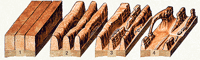
- Deep cracks penetrate into a sandstone layer.
- Erosion wears away exposed rock layers and enlarges the surface cracks, isolating narrow sandstone walls, or fins.
- Alternating frosts and thawing cause crumbling and flaking of the porous sandstone and eventually cut through some of the fins.
- The resulting holes become enlarged to arch proportions by rockfalls and weathering. Arches eventually collapse, leaving only buttresses that in time will erode.
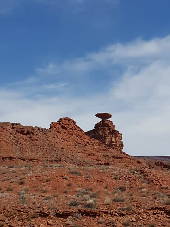
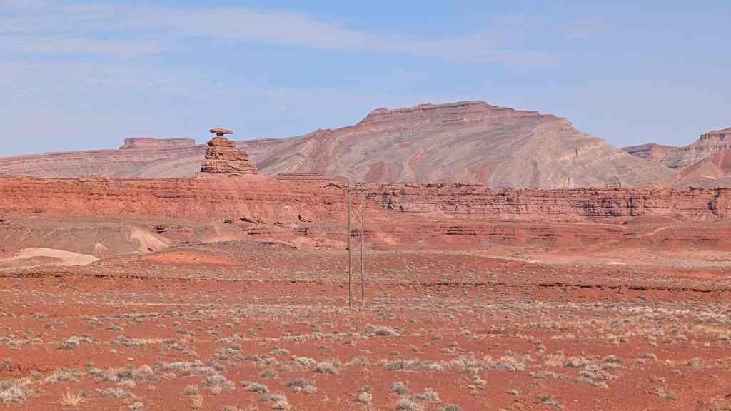
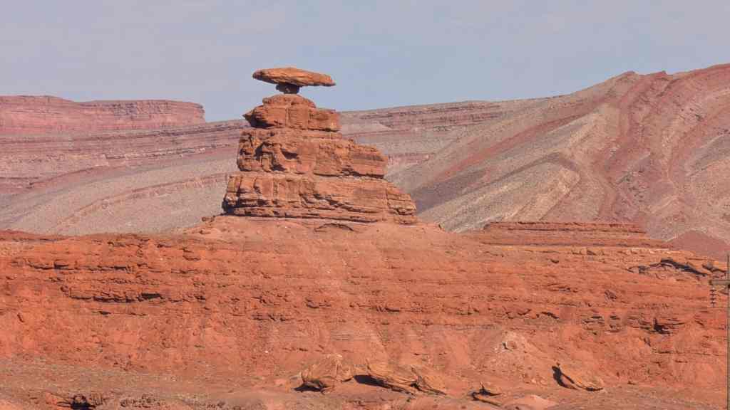
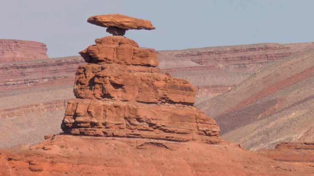
This arch, is located near Panaca, Nevada, A drive and a short walk allows you to climb up quickly and see the awesome work of nature.
This arch is made of local Bentonite.
Bentonite is an absorbent aluminium phyllosilicate generally impure clay consisting mostly of montmorillonite. There are a few types of bentonites and their names depend on the dominant elements, such as K, Na, Ca, and Al. As noted in several places in the geologic literature, there are some nomenclatorial problems with the classification of bentonite clays. Bentonite usually forms from weathering of volcanic ash, most often in the presence of water. However, the term bentonite, as well as a similar clay called tonstein, have been used for clay beds of uncertain origin. For industrial purposes, two main classes of bentonite exist: sodium and calcium bentonite. In stratigraphy and tephrochronology, completely devitrified (weathered volcanic glass) ash-fall beds are commonly referred to as K-bentonites when the dominant clay species is illite. Other common clay species, and sometimes dominant, are montmorillinite and kaolinite. Kaolinite dominated clays are commonly referred to as tonsteins and are typically associated with coal.
Sodium bentonite
Sodium bentonite expands when wet, possibly absorbing several times its dry mass in water. It is often used in drilling mud for oil and gas wells and for geotechnical and environmental investigations.
The property of swelling also makes sodium bentonite useful as a sealant, especially for the sealing of subsurface disposal systems for spent nuclear fuel and for quarantining metal pollutants of groundwater. Similar uses include making slurry walls, waterproofing of below-grade walls and forming other impermeable barriers (e.g. to plug old wells or as a liner in the base of landfills to prevent migration of leachate into the soil).
Sodium bentonite can also be “sandwiched” between synthetic materials to create geo-synthetic liners for the aforementioned purposes. This technique allows for more convenient transport and installation and it greatly reduces the volume of sodium bentonite required.
Calcium bentonite
Calcium bentonite may be converted to sodium bentonite and exhibit sodium bentonite’s properties by a process known as “ion exchange”. Commonly this means adding 5-10% of sodium carbonate to wet bentonite, mixing well, and allowing time for the ion exchange to take place. Pascalite is a commercial name for the calcium bentonite clay.
Uses for both types
Much of bentonite’s usefulness in the drilling and geotechnical engineering industry comes from its unique rheological properties. Relatively small quantities of bentonite suspended in water form a viscous, shear thinning material. Most often, bentonite suspensions are also thixotropic, although rare cases of rheopectic behavior have also been reported. At high enough concentrations (~60 grams of bentonite per litre of suspension), bentonite suspensions begin to take on the characteristics of a gel (a fluid with a minimum yield strength required to make it move). For these reasons it is a common component of drilling mud used to curtail drilling fluid invasion by its propensity for aiding in the formation of mud cake.
Bentonite can be used in cement, adhesives, ceramic bodies, cosmetics and cat litter. Fuller’s earth, an ancient dry cleaning substance, is finely ground bentonite, typically used for purifying transformer oil. Bentonite, in small percentages, is used as an ingredient in commercially designed clay bodies and ceramic glazes. Bentonite clay is also used in pyrotechnics to make end plugs and rocket nozzles, and can also be used as a therapeutic face pack for the treatment of acne/oily skin.
The ionic surface of bentonite has a useful property in making a sticky coating on sand grains. When a small proportion of finely ground bentonite clay is added to hard sand and wetted, the clay binds the sand particles into a moldable aggregate known as green sand used for making molds in sand casting. Some river deltas naturally deposit just such a blend of such clay silt and sand, creating a natural source of excellent molding sand that was critical to ancient metalworking technology. Modern chemical processes to modify the ionic surface of bentonite greatly intensify this stickiness, resulting in remarkably dough-like yet strong casting sand mixes that stand up to molten metal temperatures.
The same effluvial deposition of bentonite clay onto beaches accounts for the variety of plasticity of sand from place to place for building sand castles. Beach sand consisting of only silica and shell grains does not mold well compared to grains coated with bentonite clay. This is why some beaches are so much better for building sand castles than others.
The self-stickiness of bentonite allows high-pressure ramming or pressing of the clay in molds to produce hard, refractory shapes, such as model rocket nozzles. Indeed, to test whether a particular brand of cat litter is bentonite, simply ram a sample with a hammer into a sturdy tube with a close-fitting rod; bentonite will form a very hard, consolidated plug that is not easily crumbled.
Bentonite also has the interesting property of adsorbing relatively large amounts of protein molecules from aqueous solutions. It is therefore uniquely useful in the process of winemaking, where it is used to remove excessive amounts of protein from white wines. Were it not for this use of bentonite, many or most white wines would precipitate undesirable flocculent clouds or hazes upon exposure to warmer temperatures, as these proteins denature. It also has the incidental use of inducing more rapid clarification of both red and white wines.