Edge of the Cedars Pueblo is the largest easily accessible ruin containing stratigraphic structures dating between about 800 and 1150 A.D., in San Juan County, Utah. This site has produced the only reported copper artifact dating from aboriginal times found in the state of Utah. This artifact, a small bell, was probably traded into the area from the HoHokam culture in the Gila-Salt River drainage areas of Arizona, and may have reached there from Mexico.
The site’s numerous Kivas or ceremonial chambers including one in the neighborhood of 40-45 feet in diameter also argue for a role as a regional ceremonial center. No such site has ever been fully and systematically excavated and restored in Utah. It should be preserved because it combines unique scientific value with a ready accessibility to the public, and represents one of few apartment-like houses existing on the high plateau areas, where most of the aboriginal people lived.
Edge of Cedars Indian Ruin is located at Blanding, Utah in San Juan County and is part of the Edge of the Cedars State Park Museum, it was added to the National Historic Register (#71000853) on August 12, 1971.
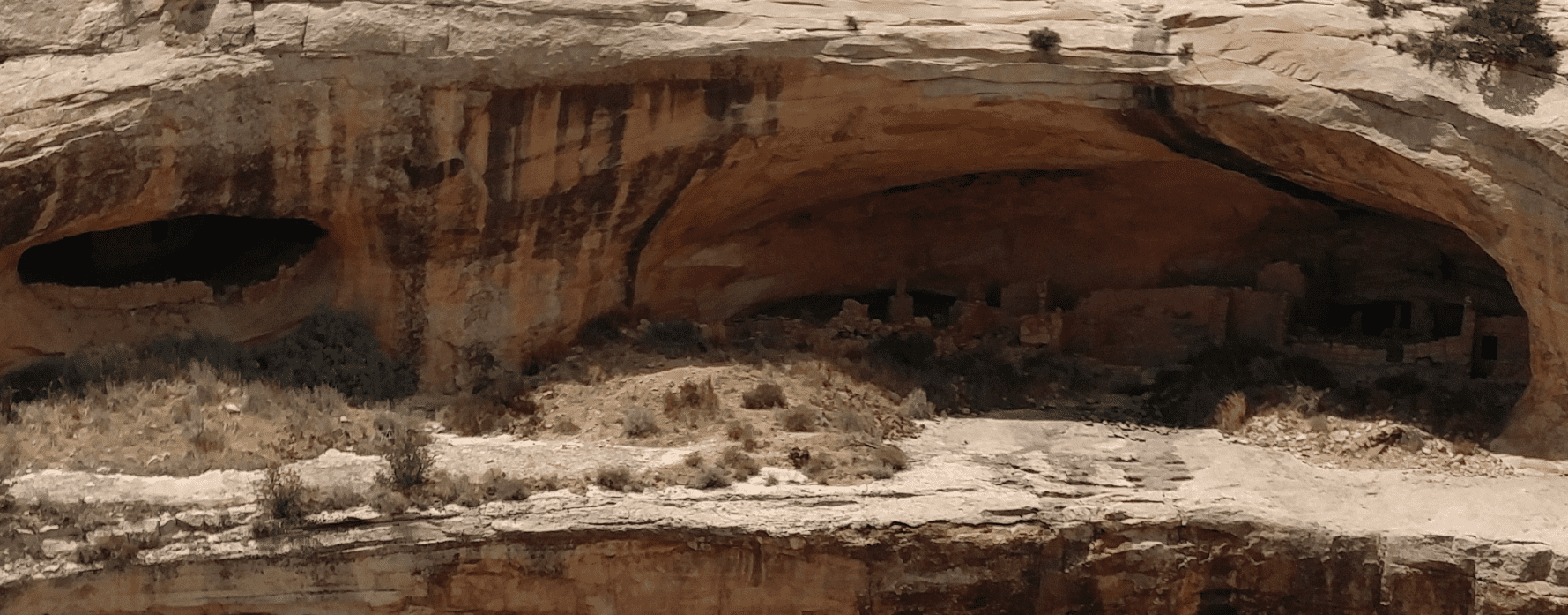
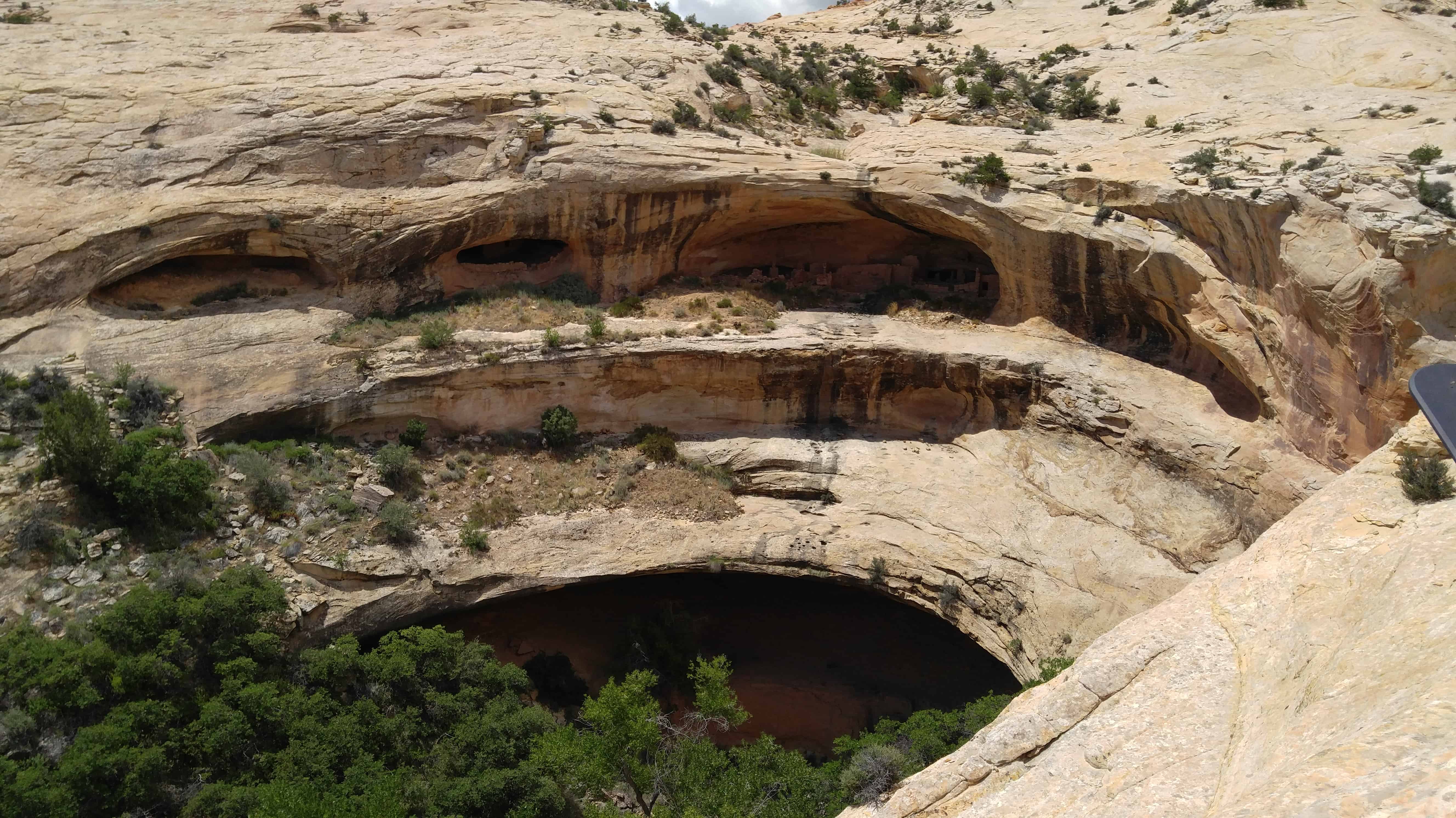
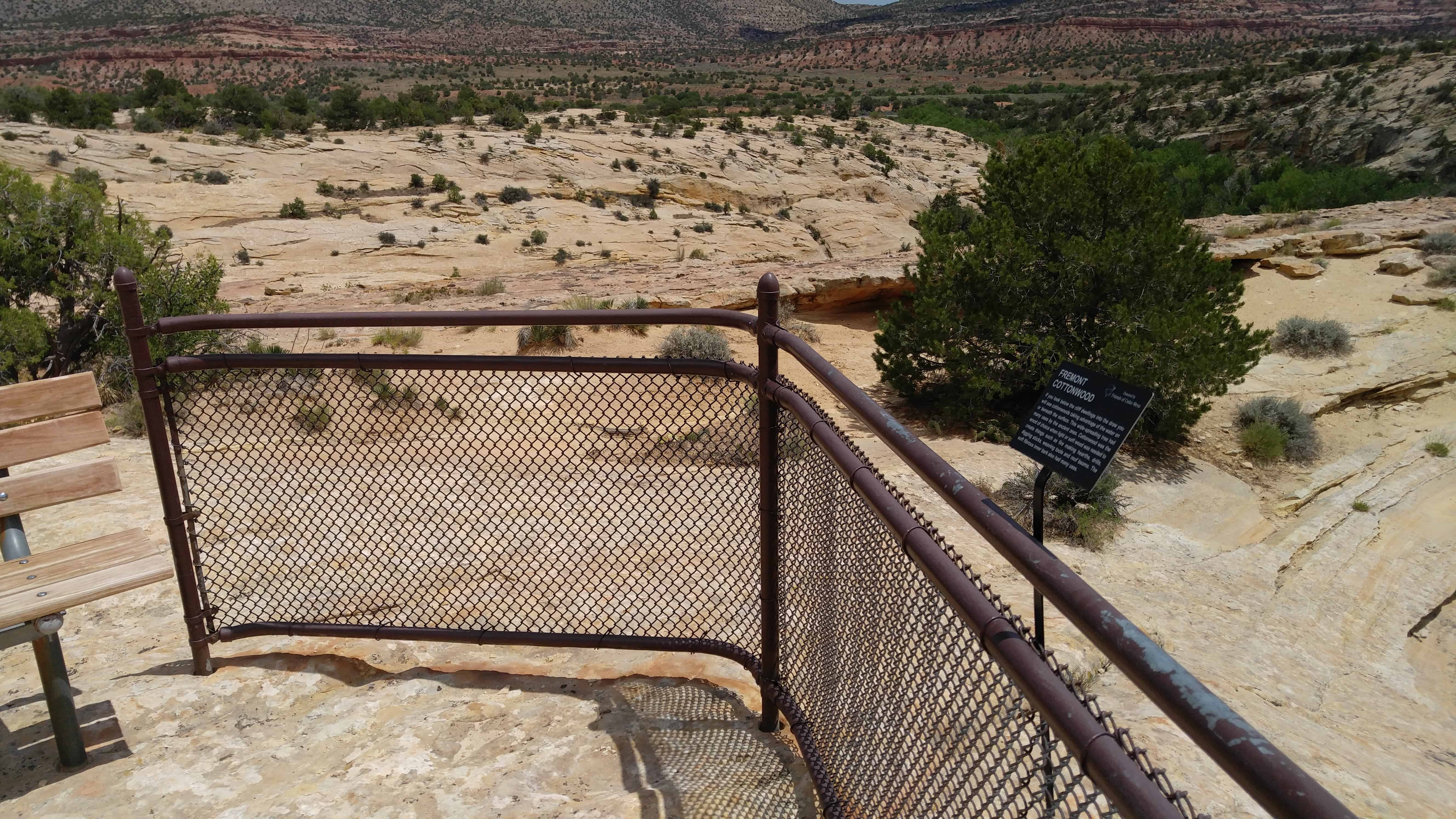
Butler Wash Ruin is a cliff dwelling that was built and occupied by the Ancestral Puebloans, sometimes known as Anasazi, in about 1200 AD. Parts of the site has been stabilized and reconstructed, but most of it remains as it was found in the 1800s. There are habitation, storage and ceremonial structures, including four kivas. This ruin is located in a side canyon of Butler Wash, on the east side of Comb Ridge.
A BLM trail to the site winds its way across slickrock and washes to reach an overlook of the cliff dwelling. Round trip hiking distance is 1 mile and takes approximately a half hour. The difficulty is moderate. An interpretive sign is located at the overlook. Ample parking and a restroom is provided. There is no water at this site, and desert temperatures can be extremely hot and dry. Plan ahead and be prepared. Bring appropriate clothing and lots of water when visiting this site.
The hike from the parking lot to the overlook is an easy one, maybe half a mile to three-quarters of a mile. It was hot and I was out of shape so I whined a bit more than needed. Actually going to the ruins took a bit more effort, working the way south from the overlook down into the canyon and then a little rock climbing and scrambling to get up on the cliff over to the side of the ruins, then straight over.
The Butler Wash Archeological District was added to the National Register of Historic Places (#81000584) on July 11, 1981.
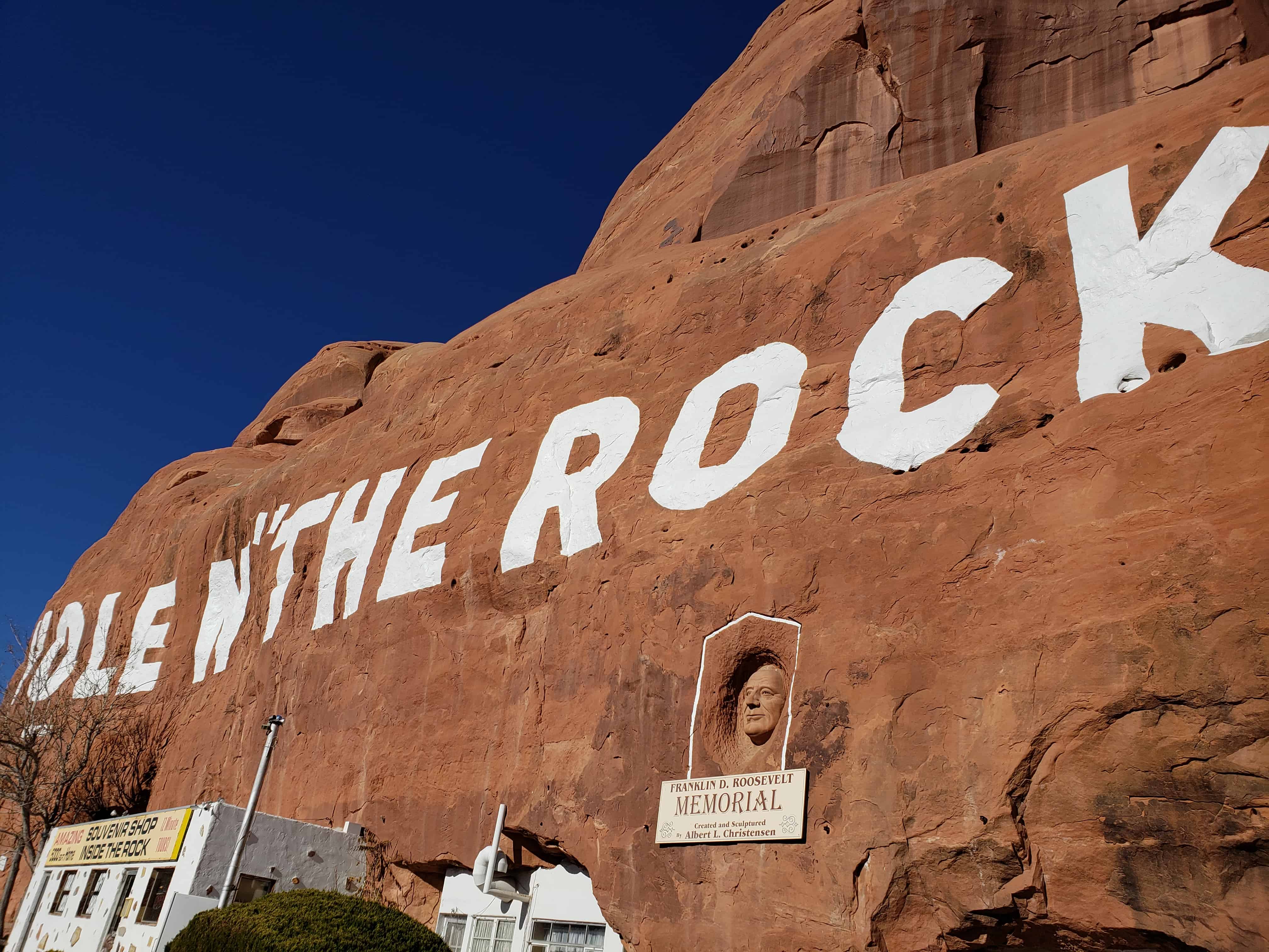
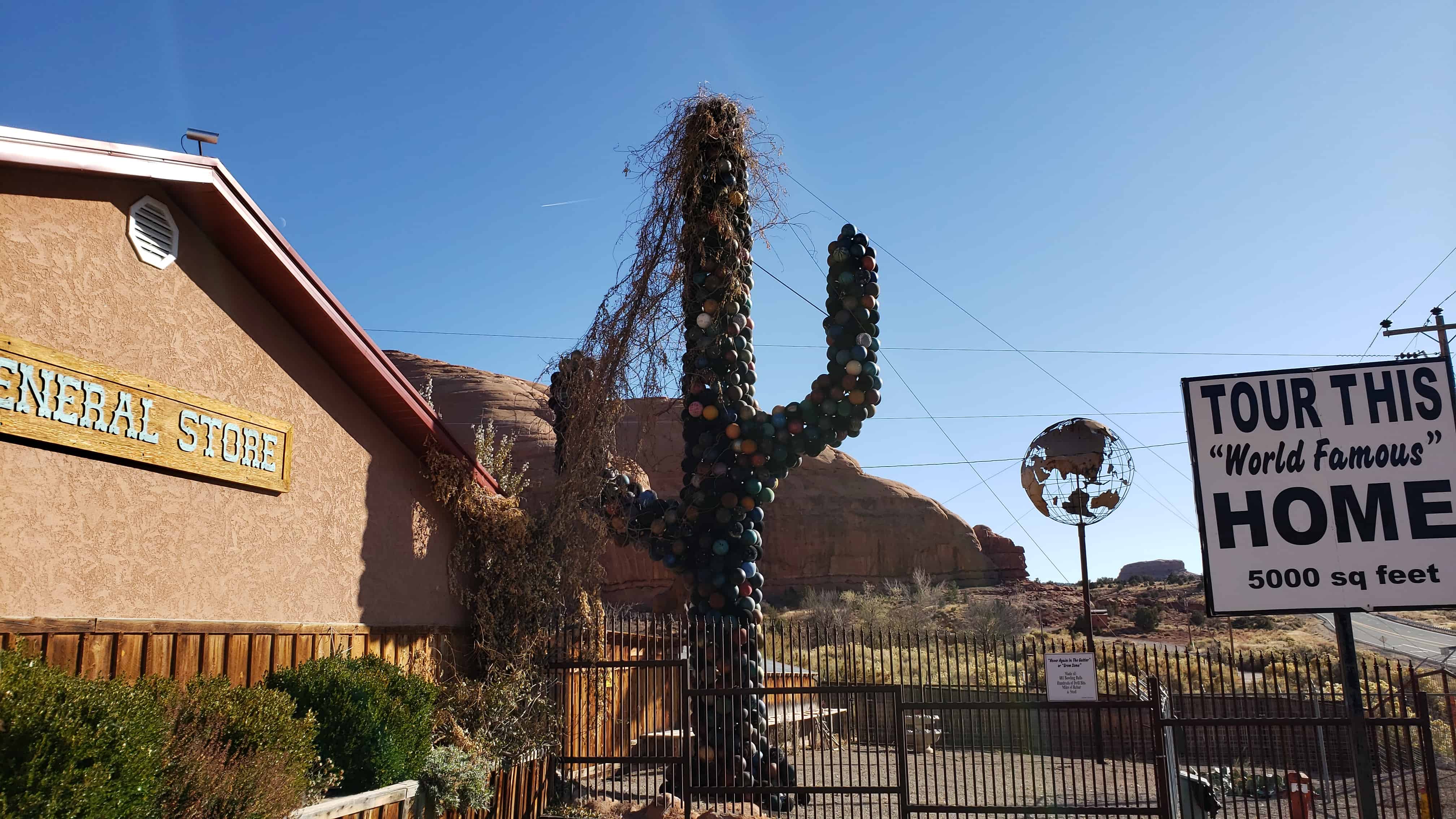
Travelers along U.S. Highway 191 in Southwestern Utah are amazed to discover this historic 5,000 square foot home which began taking shape almost a century ago by the Christensen family. What began as a small alcove for the young Christensen boys to sleep in at night grew into a man-made engineering marvel 20 years in the making. A fireplace with a 65′ chimney,14 rooms arranged around huge pillars and a deep bathtub built into the rock delight visitors who visit this most unusual home in the dessert. Original furnishings, Alberta’s paintings, Gladys’s doll collection and many of the tools used to create this home remind you of the past.
In a 12 year period Albert excavated 50,000 cubic feet of sandstone from the rock. During this time he completed his famous painting Sermon on the Mount and his sculpture of Franklin D. Roosevelt on the face of the rock above his home.
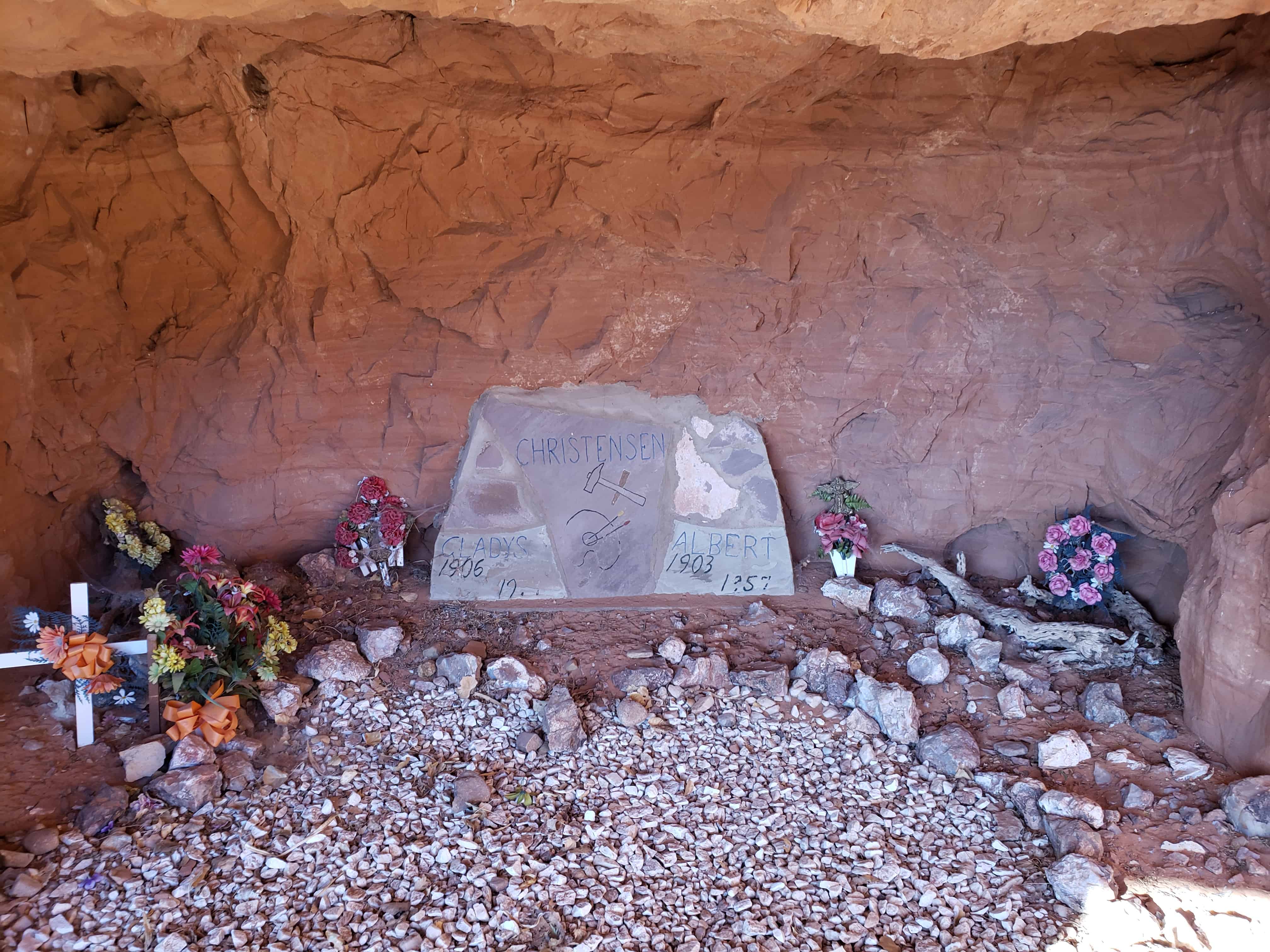
When Albert died in 1957, the home was not complete. Gladys’s in keeping with his wishes & lifelong dreams continued to develop the property, opening a gift shop and giving tours of her home until she passed away in 1974. Gladys is laid to rest next to Albert in a small cove within the rock near the home.(*)
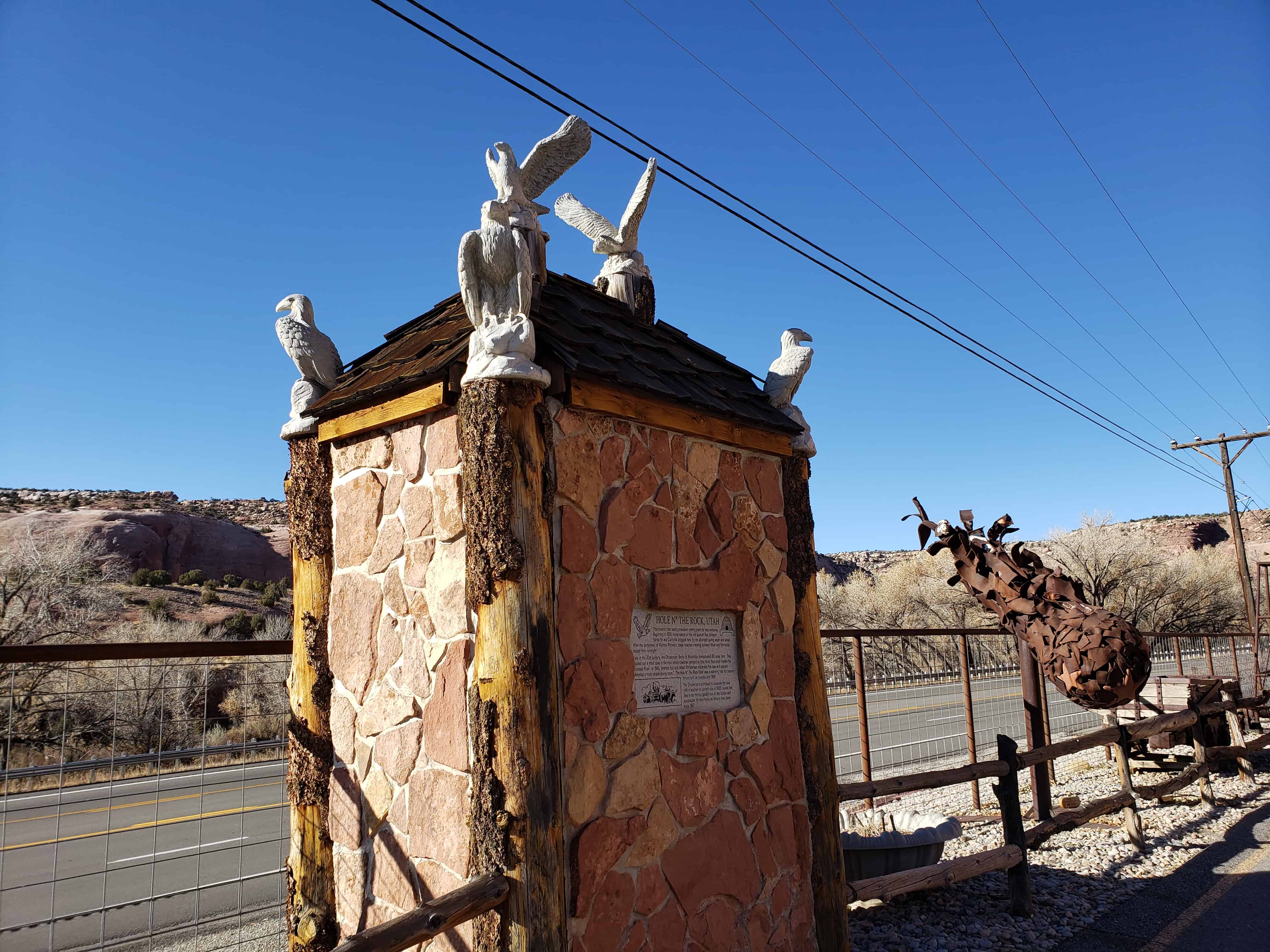
This location has been a travelers’ resting place for two centuries. Beginning in 1829, horse teams on the Old Spanish Trail between Santa Fe and California stopped here for the abundant spring water and shade. After the settlement of Mormon Pioneers, stage coaches traveling between Moab and Monticello stayed here overnight.
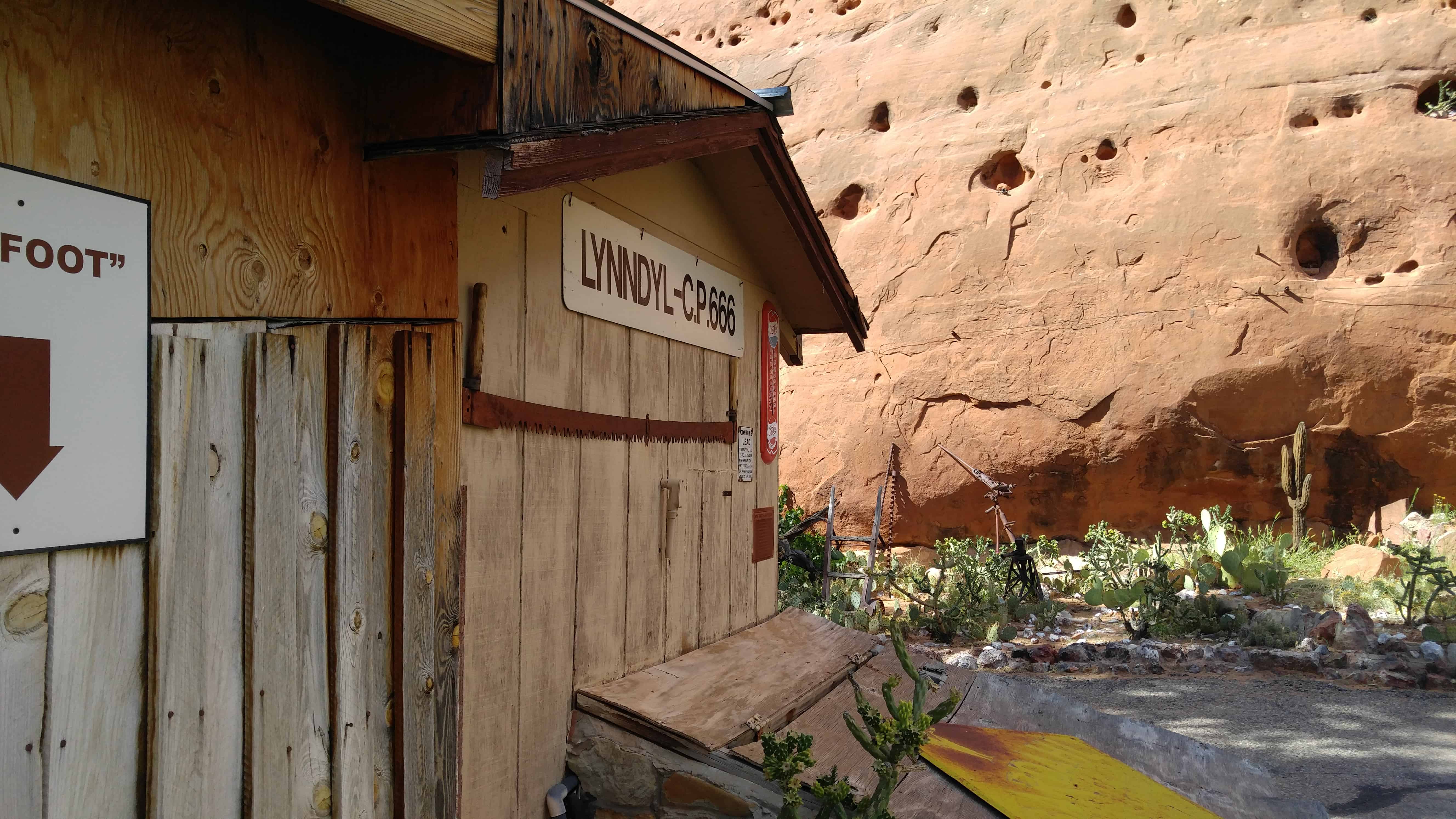
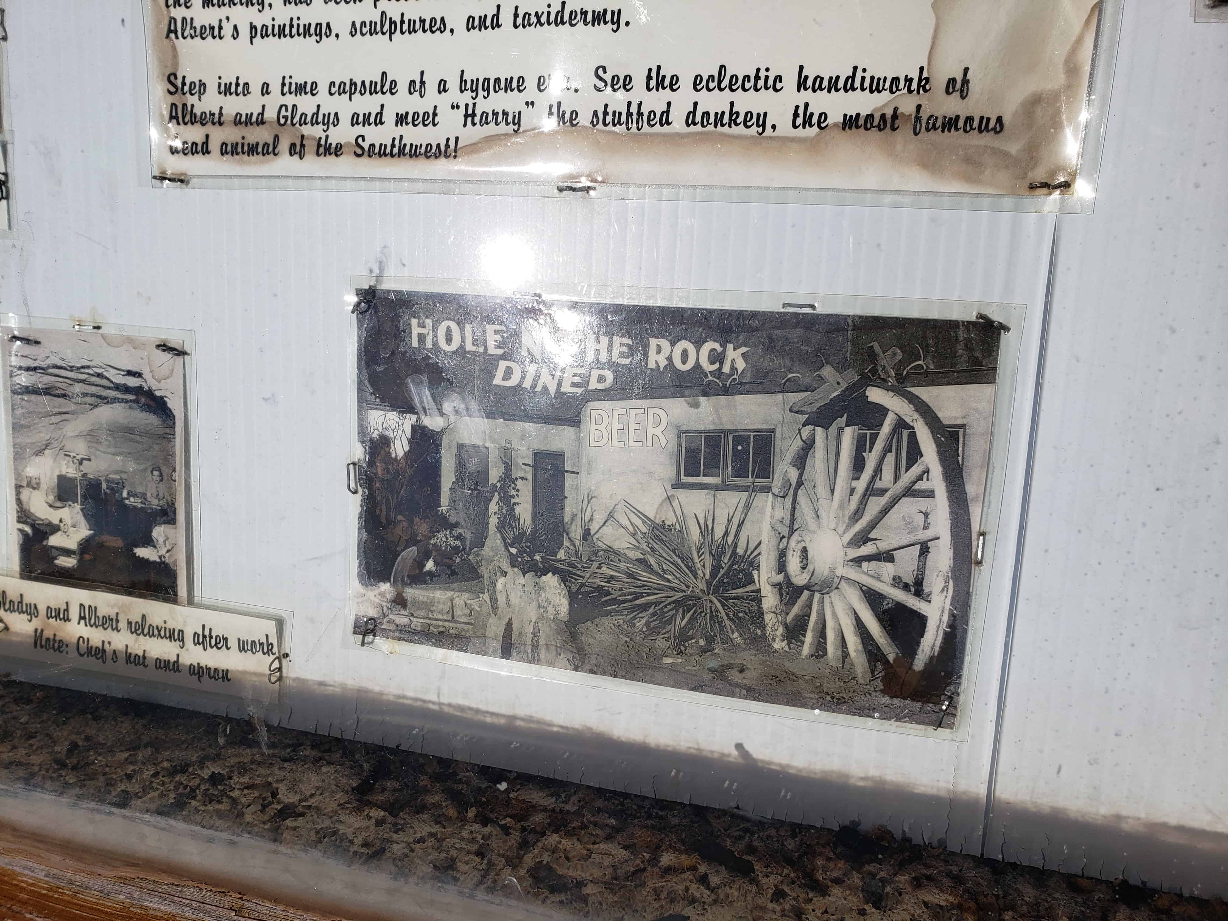
Early in the 20th century, the Christensen family of Monticello homesteaded 80 acres here. They blasted out a small cave in the rock where cowboys camped as they drove their stock toward the Colorado River. In 1945, brothers Leo and Albert Christensen expanded the cave and opened “American’s most unique dining room.” The Hole N” The Rock Diner was a watering hole for uranium miners and car tourists until 1955.
The Christensens continued to excavate the cave until it reached its current size of 5000 square feet. Take a ten-minute guided tour of this unique and spectacular 14-room home as millions have done since 1957.
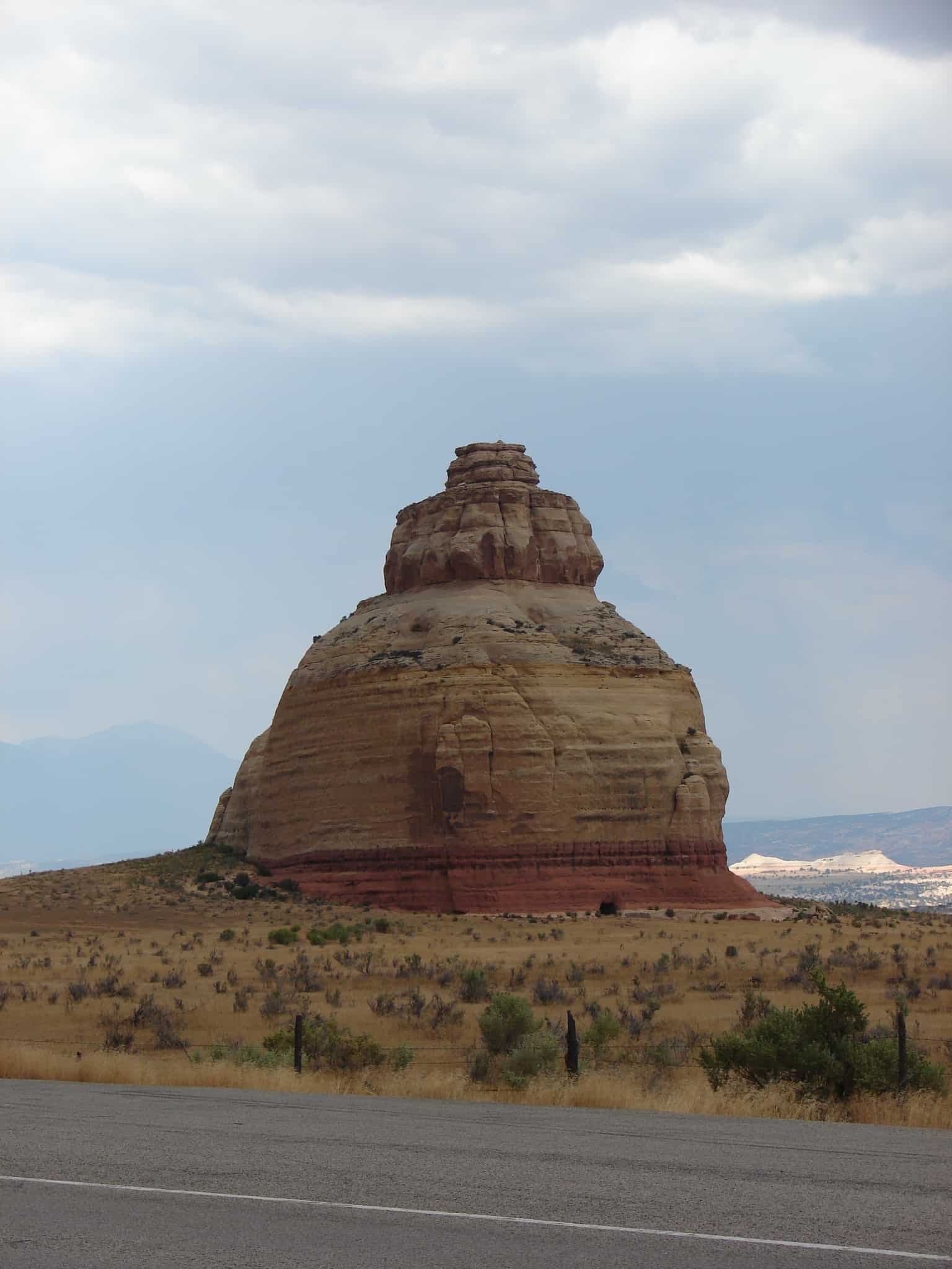
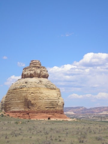
Church Rock is a solitary column of sandstone in southern Utah along the eastern side of U.S. Route 191, near the entrance to the Needles District of Canyonlands National Park.
With majestic Colorado and Green River canyons, Canyonlands, this 200 foot roadside oddity near Monticello is called Church Rock. It seldom attracts more than a casual glance as visitors head toward Newspaper Rock State Historic Monument and the Needles district or drive between Moab and Monticello.
One of the interesting pages of 1930’s myths tells about Church Rock, and how the gumdrop shaped rock earned its name. The story is that Marie Ogden’s Home of the Truth, an Utopian community, was erroneously responsible. Ogden was a spiritualist during the 20’s, giving lectures across the U.S. on spiritualism, until she came to San Juan County, Utah. She allegedly called San Juan County and Church Rock “the spiritual center of the universe.” With a small band of followers, Ogden’s group moved onto a tract of barren land along Utah’s Route 211 in 1933, calling it the “Home of Truth.” Members turned all their worldly goods to Ogden to join her Home of Truth, abiding by a strict code of conduct, were expected to work for the common goals of the settlement. Women tended to the domestic chores and men worked the arid farm acreage. Not far from Church Rock are the remains of Ogden’s ghost town. A few buildings and a small cemetery are all that remain of the Home of the Truth community, found on a ridge called Photograph Gap. After the community broke up, Ogden stayed in Monticello and became the owner and publisher of the community newspaper, The San Juan Record, in the 1940s. She died in the 1975 and is buried in Blanding.
The three-tiered sandstone rock is located not far from the Home of Truth, but is only one of several in the area (Sugarloaf and Turtle Rock among others). Part of the myth is that the group set upon a grand plan to hollow out the entire center of the sandstone monument, by hand, to build a church. In fact, the sandstone formation was owned by a local rancher, Claud Young of Monticello. Young owned about 2000 acres of land, for cattle range, before the highway came through the area known as Dry Valley.
The only evidence of the myth, and the apparent basis for the assumption of turning the rock into a ‘church,’ is the 16 by 24 foot opening chiseled into the rock. In fact, that ‘opening’ was contracted out by the owner, Claud Young. The opening was dynamited and cut out of the stone during the late 1940s to store salt licks and feed for the cattle. The rock is still owned by the Young family, in equal shares by the two daughters and two sons of Claud and Inez Young, their surviving spouses, and/or surviving grandchildren owning their percentage of ‘the rock.'(*)
In 1879 the L.D.S. Church sent missionary families to San Juan Country to make settlement and better relations with the Indians. These pioneers led by Silas S. Smith and Platte D. Lyman came through the Hole-in-the-Rock. The company consisted of 83 wagons, men, women and children. Passage was often cut through solid rock or sandstone. On March 5, 1880 they reached the top of this hill, camped, and worked eight days building a road three miles long to bring the wagons safely to the bottom, a drop of 1,000 feet.
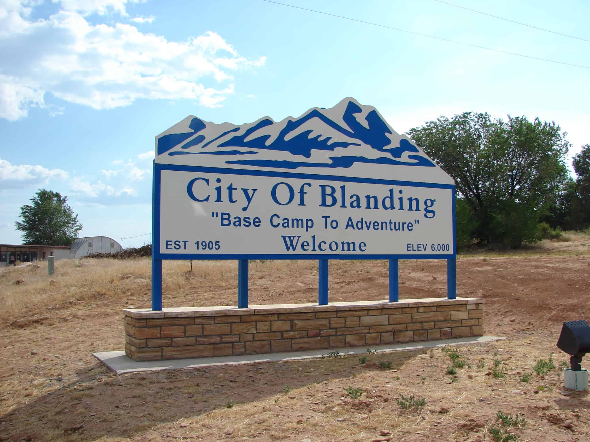
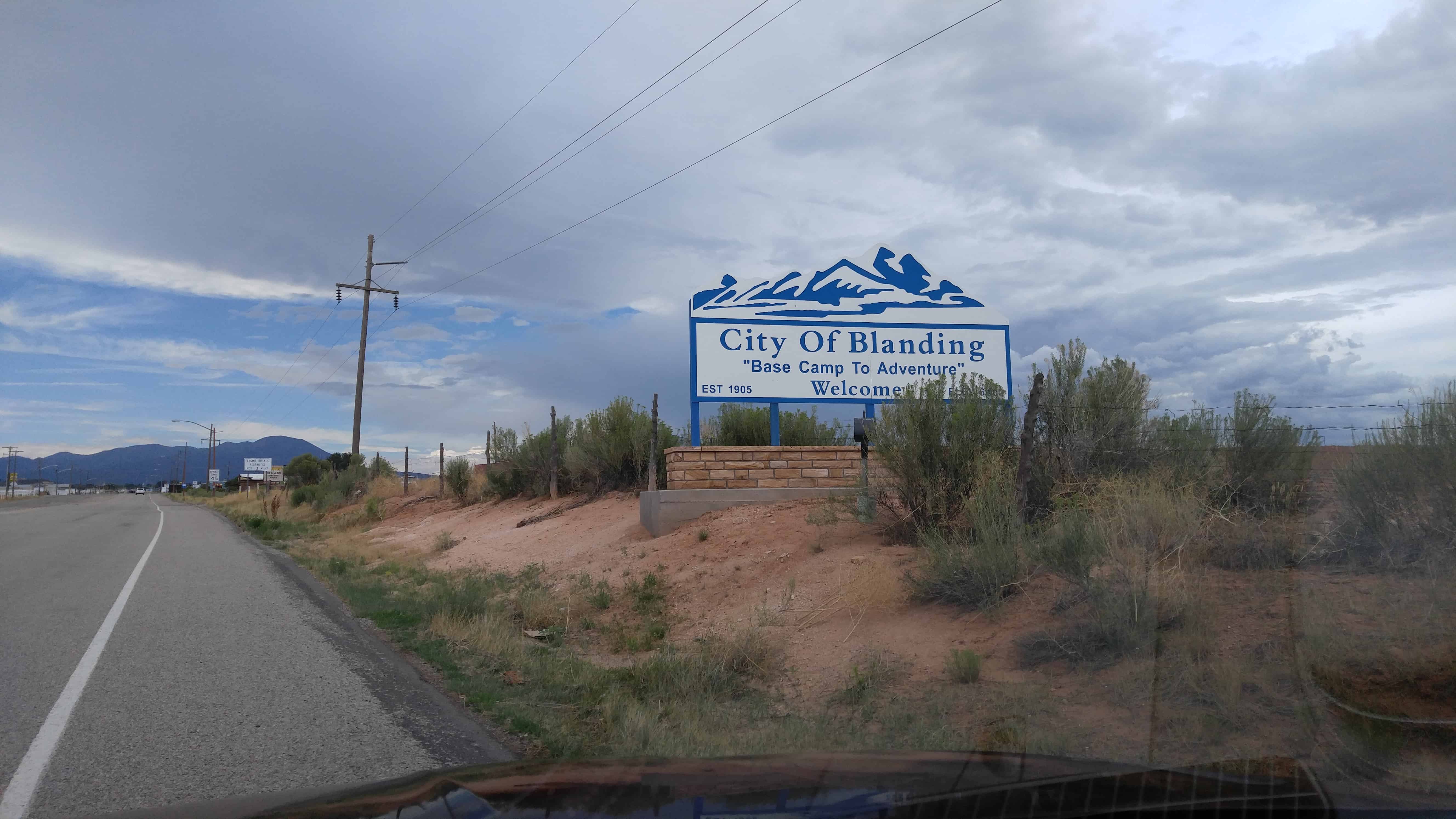
Four distinct cultures, Ute, Navajo, European pioneer, and Spanish have left their history in Blanding, which sits on White Mesa near Blue Mountain. Anasazi occupation occurred here as early as 600 AD. Utes and an occasional Navajo camped in this area because of the water from local springs and seeps. Navajos called the location “Sagebrush,” because of the plant’s prolific growth amidst the pinyon and junipers forest at the base of the mountain.
In 1897, Mormon Walter C. Lyman and his brother Joseph loaded a buckboard with supplies and left Bluff to investigate White Mesa’s potential for a community. Lyman supposedly had a vision that one day this isolated area full of sagebrush would have an LDS temple. Soon, digging began on a canal from Johnson Creek, which was completed in 1905 and still waters abundant crops of hay and grain.
First known as Grayson (after Nellie Grayson Lyman, wife of Joseph), the town changed its name in 1914 when a wealthy easterner, Thomas F. Bicknell, offered a thousand-volume library to any Utah town that would adopt his name. Grayson competed with Thurber (renamed Bicknell) for the prize; the two towns split the books and Grayson was renamed for Bicknell’s wife’s maiden name, Blanding.
Blanding received notoriety for its involvement in the 1923 Posey War, called by some the last Indian uprising in the US. But the “war” was really a final bid for freedom by desperate Utes living on the edge of Blanding.*
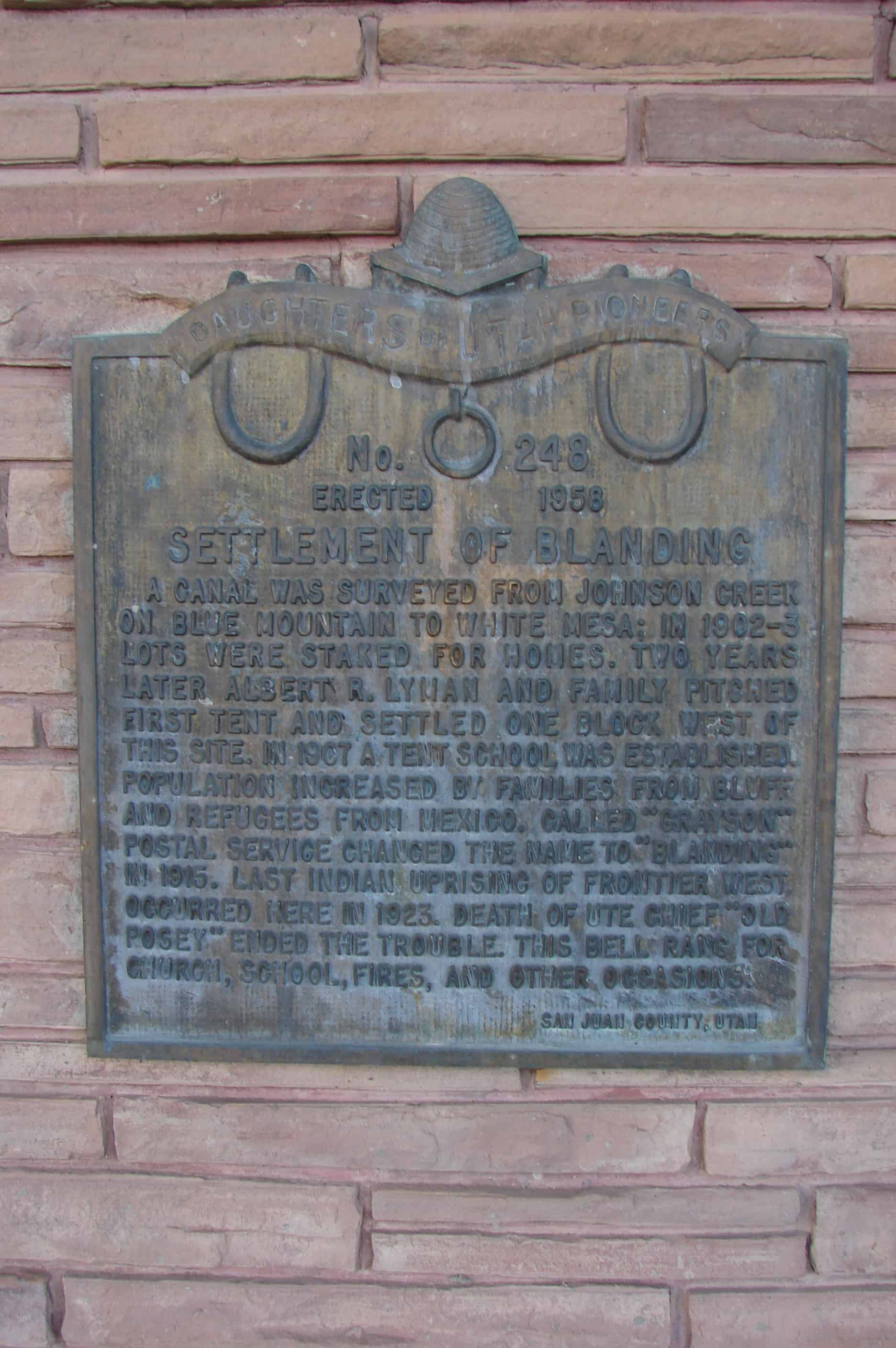
A canal was surveyed from Johnson Creek on Blue Mountain to White Mesa; in 1902-3 lots were staked for homes. Two years later Albert R. Lyman and family pitched first tent and settled one block west of this site. In 1907 a tent school was established. Population increased by families from Bluff and refugees from Mexico. Called “Grayson” Postal Service changed the name to “Blanding” in 1915. Last Indian uprising of frontier west occurred here in 1923. Death of Ute Chief “Old Posey” ended the trouble. This bell rang for church, school, fires, and other occasions.