Tags
Big Water is in Kane County, Utah. Near Glen Canyon/Lake Powell and the Glen Canyon Dam. Prior to 1983 it was called Glen Canyon City.
Related:

06 Sunday Nov 2016
Posted in Uncategorized
Tags

Big Water is in Kane County, Utah. Near Glen Canyon/Lake Powell and the Glen Canyon Dam. Prior to 1983 it was called Glen Canyon City.
Related:
06 Sunday Nov 2016
Posted in Uncategorized
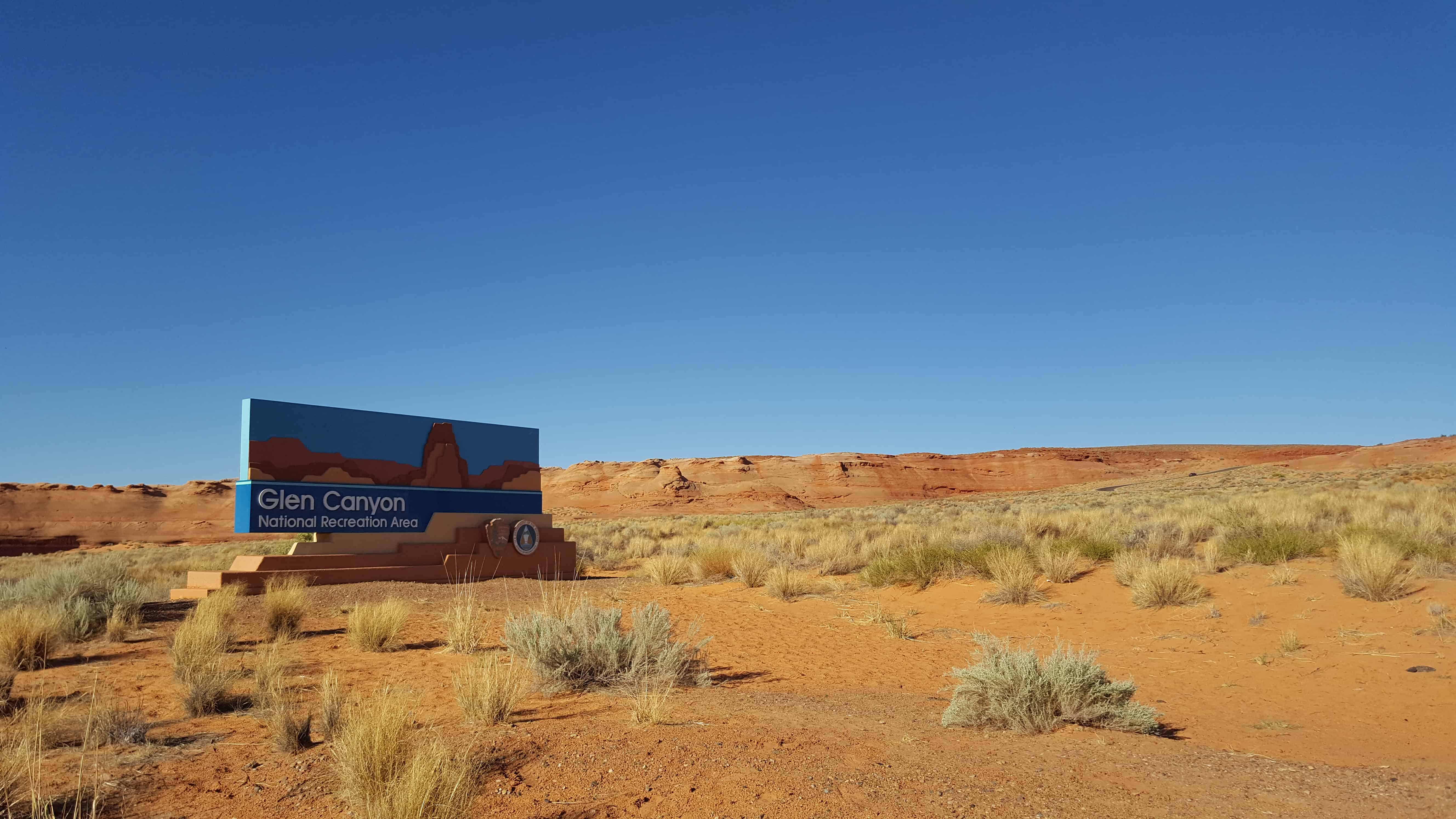
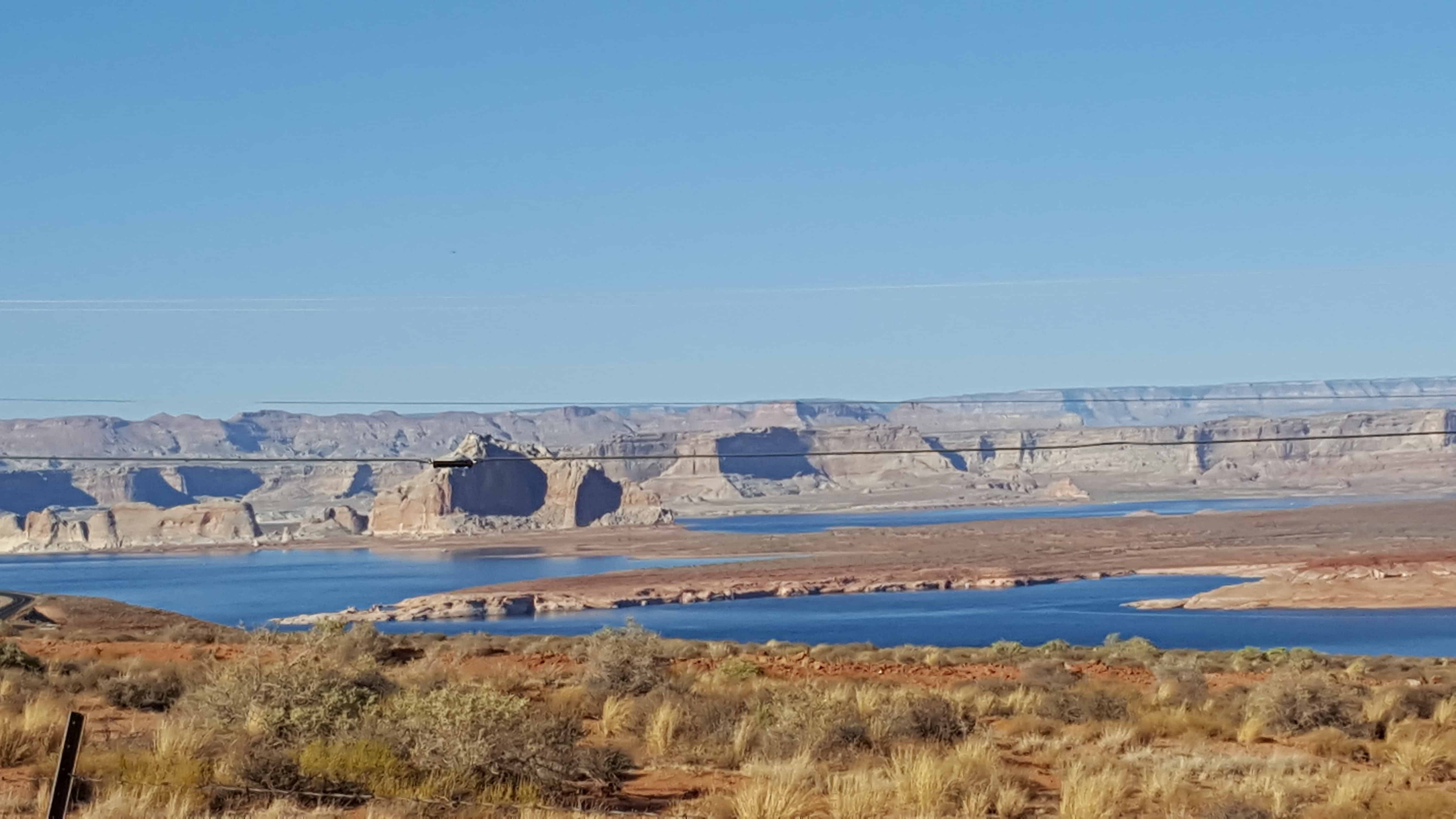
Glen Canyon National Recreation Area is a recreation and conservation unit of the National Park Service that encompasses the area around Lake Powell and lower Cataract Canyon in Utah and Arizona, covering 1,254,429 acres of mostly desert.
The Glen Canyon NRA was established in 1972 “to provide for public use and enjoyment and to preserve the area’s scientific, historic, and scenic features.”
The current Lake Powell lies above Glen Canyon, which was flooded by the Glen Canyon Dam, completed in 1966.


06 Sunday Nov 2016
Posted in Uncategorized
Tags

Unlike other cities in the area, Page was founded in 1957 as a housing community for workers and their families during the construction of nearby Glen Canyon Dam on the Colorado River. Its 17-square-mile site was obtained in a land exchange with the Navajo Nation.
The city was originally called Government Camp, but was later named for John C. Page, Commissioner of the Bureau of Reclamation, 1936-1943.
After the dam was completed in the 1960s, the city grew steadily to today’s population of over 7,000. Because of the new roads and bridge built for use during construction, it has become the gateway to the Glen Canyon National Recreation Area and Lake Powell, attracting more than 3 million visitors per year. Page is also the home of two of the largest electrical generation units in the western United States. Glen Canyon Dam has a 1,288,000-kilowatt capacity when fully online. The other power plant to the southeast is the Navajo Generating Station, a coal-fired steam plant with an output capability of 2,250,000 kilowatts.
30 Friday Sep 2016
Posted in Uncategorized
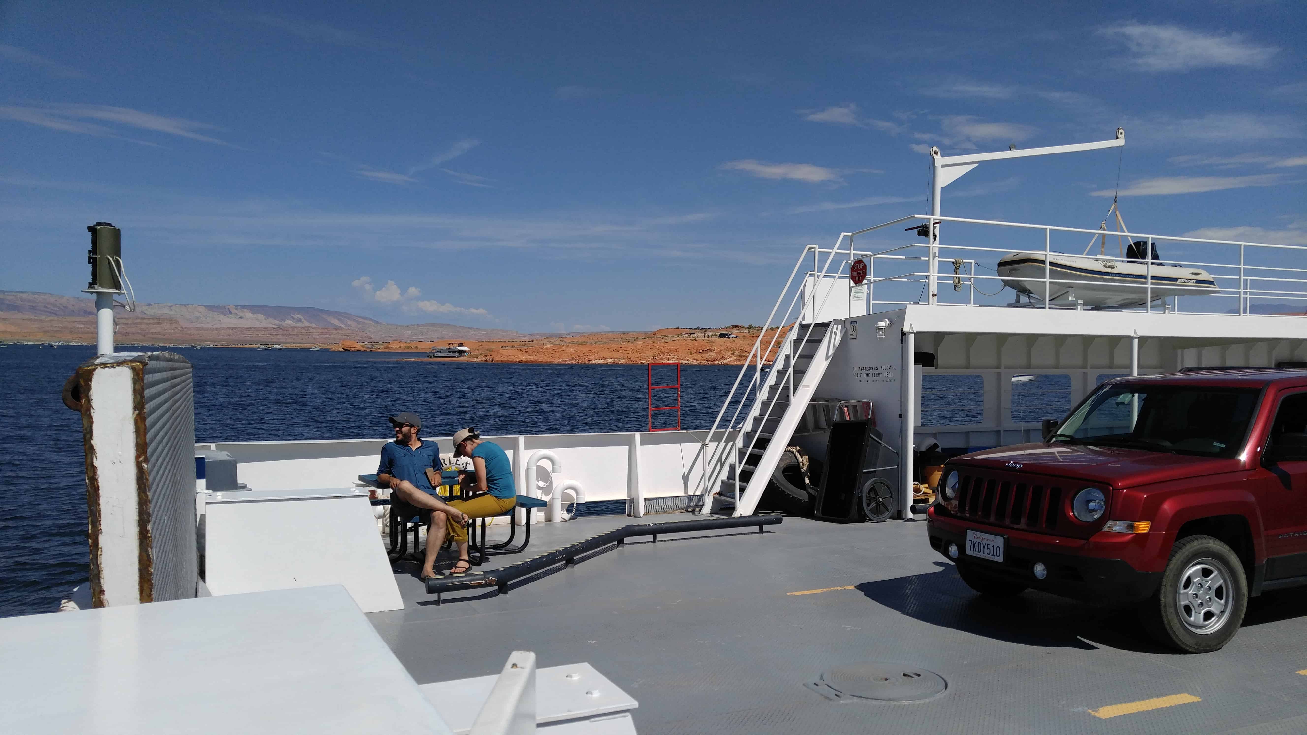
Highway 276 at Hall’s Crossing has a ferry so you can cross Bullfrog Bay of Lake Powell with your vehicle.
Info on schedules and prices can be found here.
In late 1879 the Mormon Hole-in-the-Rock expedition camped near the Dance Hall Rock waiting for the development of a safe crossing for the nearby Colorado river. Hall was an important part of this expedition. He stayed on at the Hole-in-the-Rock crossing hoping to make it an important one for emigrants and freighters traveling both ways across the river. The Hole-in-the-Rock crossing was used for more than a year until the travel began to decline. Hall then developed a better crossing some thirty miles upriver at what is today known as Halls Crossing. He settled at the mouth of Halls Creek in 1882 and ran a ferry crossing the Colorado River. Hall was well known for his projects and for pioneering (he helped pioneer Parowan and Escalante). He also developed the boats used in ferrying across the Colorado River. After the dam was built and Lake Powell filled in the river and side crossing, Bull Frog Marina was developed on the west side of the lake and Halls Crossing on the east side of the Lake at the end of U-263. Today a ferry makes regular crossings at this point. From 1881 to 1883 a small settlement was established at Halls Crossing, but it quickly faded into oblivion.(*)


(The ferry from the hotel)


25 Sunday Sep 2016
Posted in Uncategorized
Tags

Clay Hills Pass – D.U.P. # 305
In 1879 the L.D.S. Church sent missionary families to San Juan Country to make settlement and better relations with the Indians. These pioneers led by Silas S. Smith and Platte D. Lyman came through the Hole-in-the-Rock. The company consisted of 83 wagons, men, women and children. Passage was often cut through solid rock or sandstone. On March 5, 1880 they reached the top of this hill, camped, and worked eight days building a road three miles long to bring the wagons safely to the bottom, a drop of 1,000 feet.


25 Sunday Sep 2016
Posted in Uncategorized
Tags

Ticaboo gets its name from Ticaboo Creek, which was named by Cass Hite in the 1880s, for a Paiute word meaning “friendly.”
The Ticaboo townsite is a master-planned community that was organized in the late 1970s to both provide housing to the then booming uranium mining industry in southeastern Garfield County, and tap into the tourism potential of nearby Lake Powell. The Ticaboo Resort was developed to provide accommodations to guests visiting the remote area as well as to encourage the development of a tourism base outside of Bullfrog in the northern Lake Powell area.
The first inhabitants of Ticaboo were Kayenta Anasazi. In October 1981, the Division of Utah State History conducted an excavation of a small settlement known as the Ticaboo Town Ruins, located directly west of the town of Ticaboo.
Ticaboo Resort is one of many master development lease holders tasked with the development of Ticaboo by the Utah School and Trust Lands Administration (SITLA). Previous master development lease holders have included mining companies who also owned mines in the Henry Mountain Complex, or the Shootaring Mill. Originally established in 1977, Plateau Resources Limited was the master development lease holder and constructed the infrastructure that still exists today for electric, water, and wastewater.


