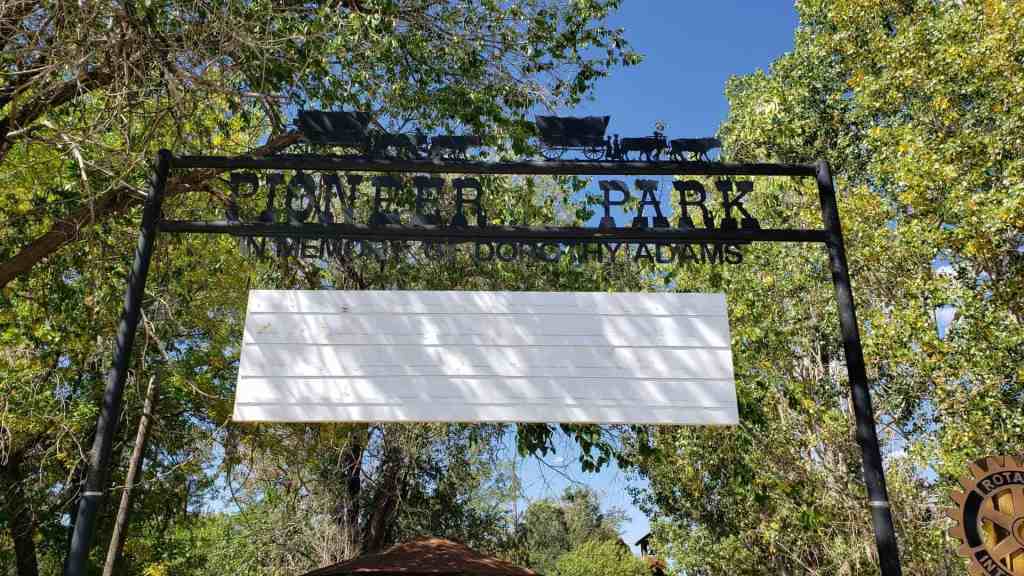
• About JacobBarlow.com
  • Cemeteries in Utah
  • D.U.P. Markers
  • Doors
  • Exploring Utah Email List
  • Geocaching
  • Historic Marker Map
  • Links
  • Movie/TV Show Filming Locations
  • Oldest in Utah
  • Other Travels
  • Photos Then and Now
  • S.U.P. Markers
  • U.P.T.L.A. Markers
  • Utah Cities and Places.
  • Utah Homes for Sale
  • Utah Treasure Hunt

JacobBarlow.com

~ Exploring with Jacob Barlow

JacobBarlow.com

Tag Archives: Monticello

Pioneer Park

21 Thursday Dec 2023

Posted by Jacob Barlow in Uncategorized

≈ Leave a comment

Tags

Historic Markers, Monticello, Parks

Pioneer Park
In Memory of Dorothy Adams

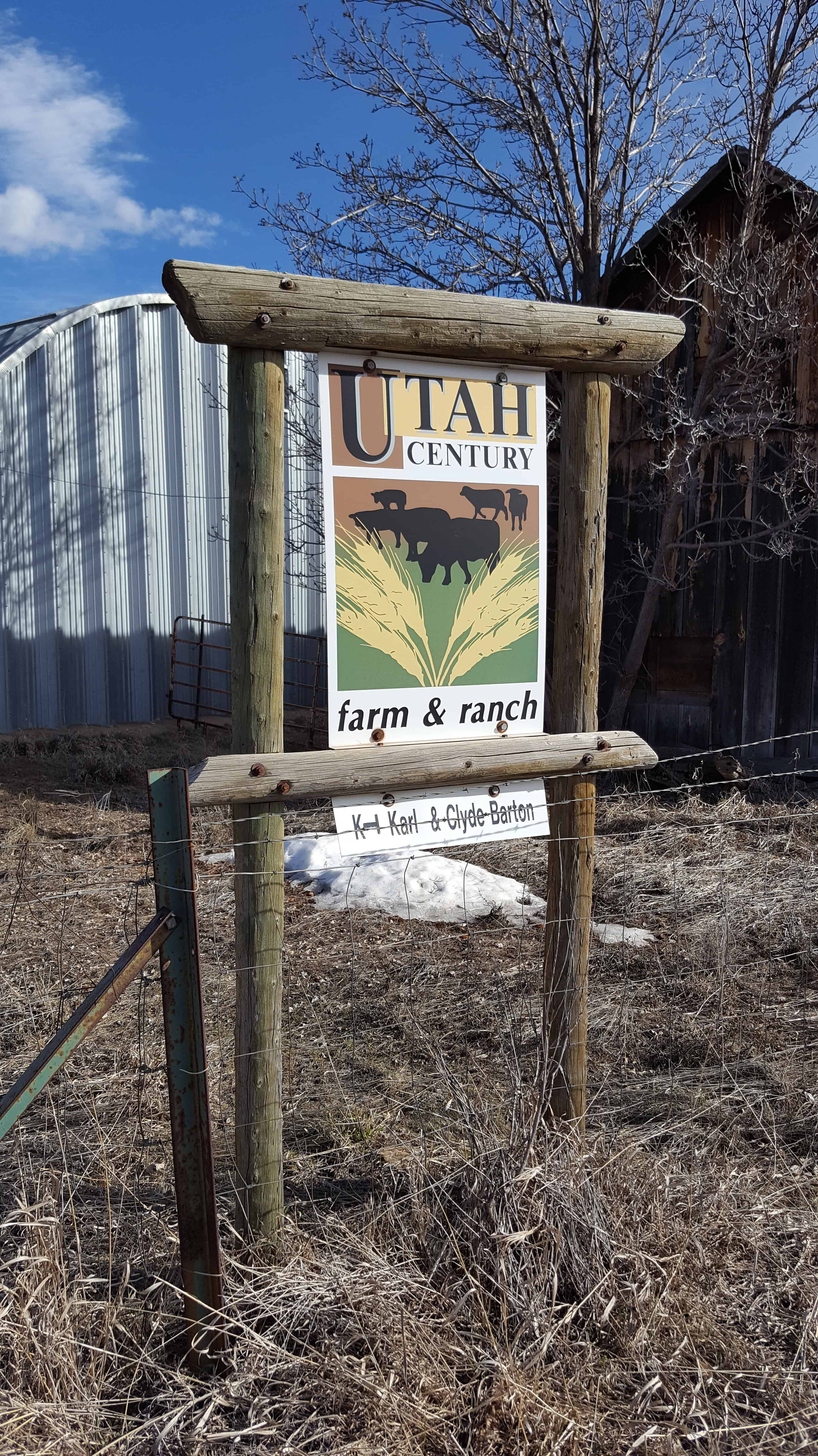
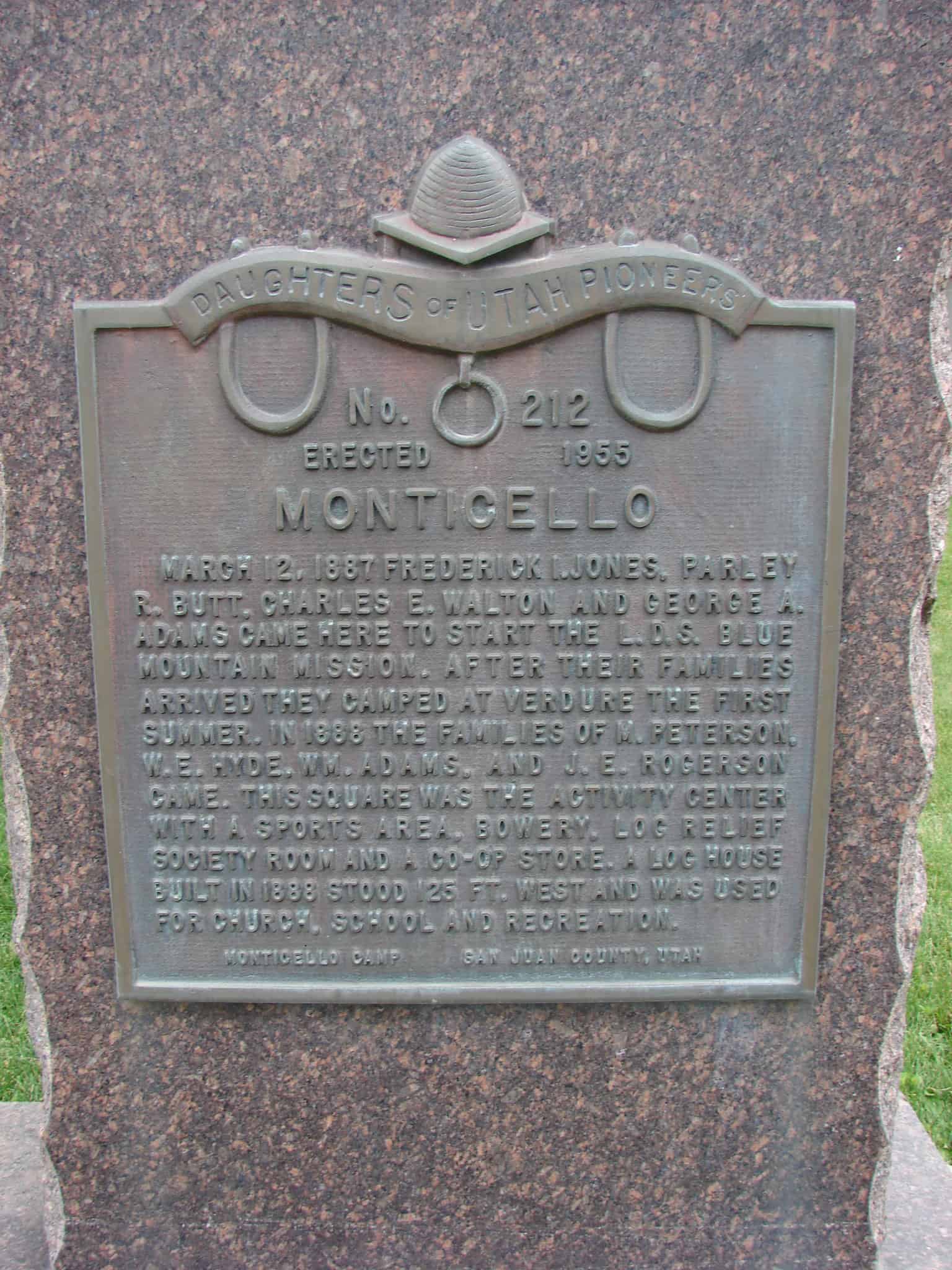
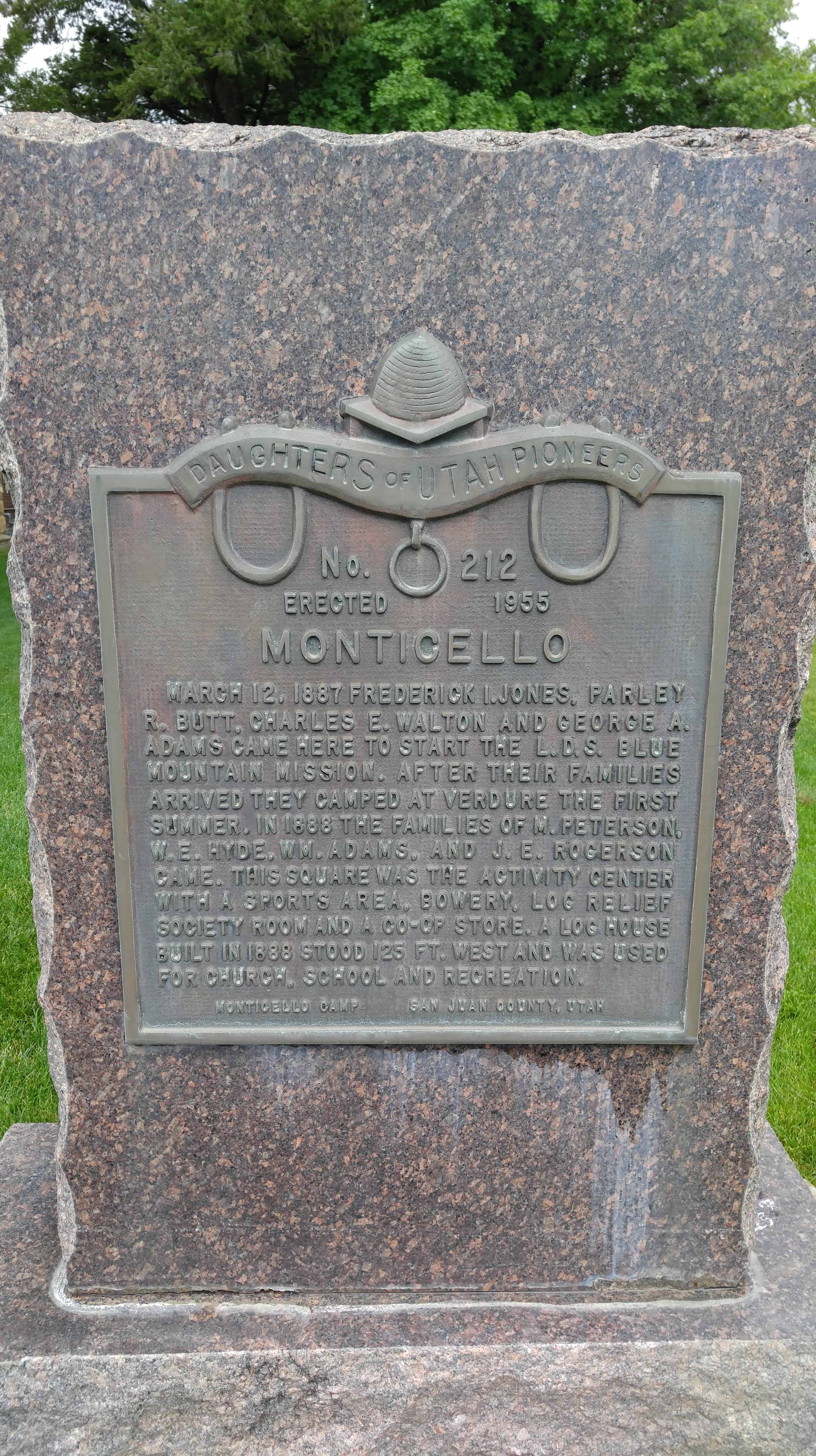
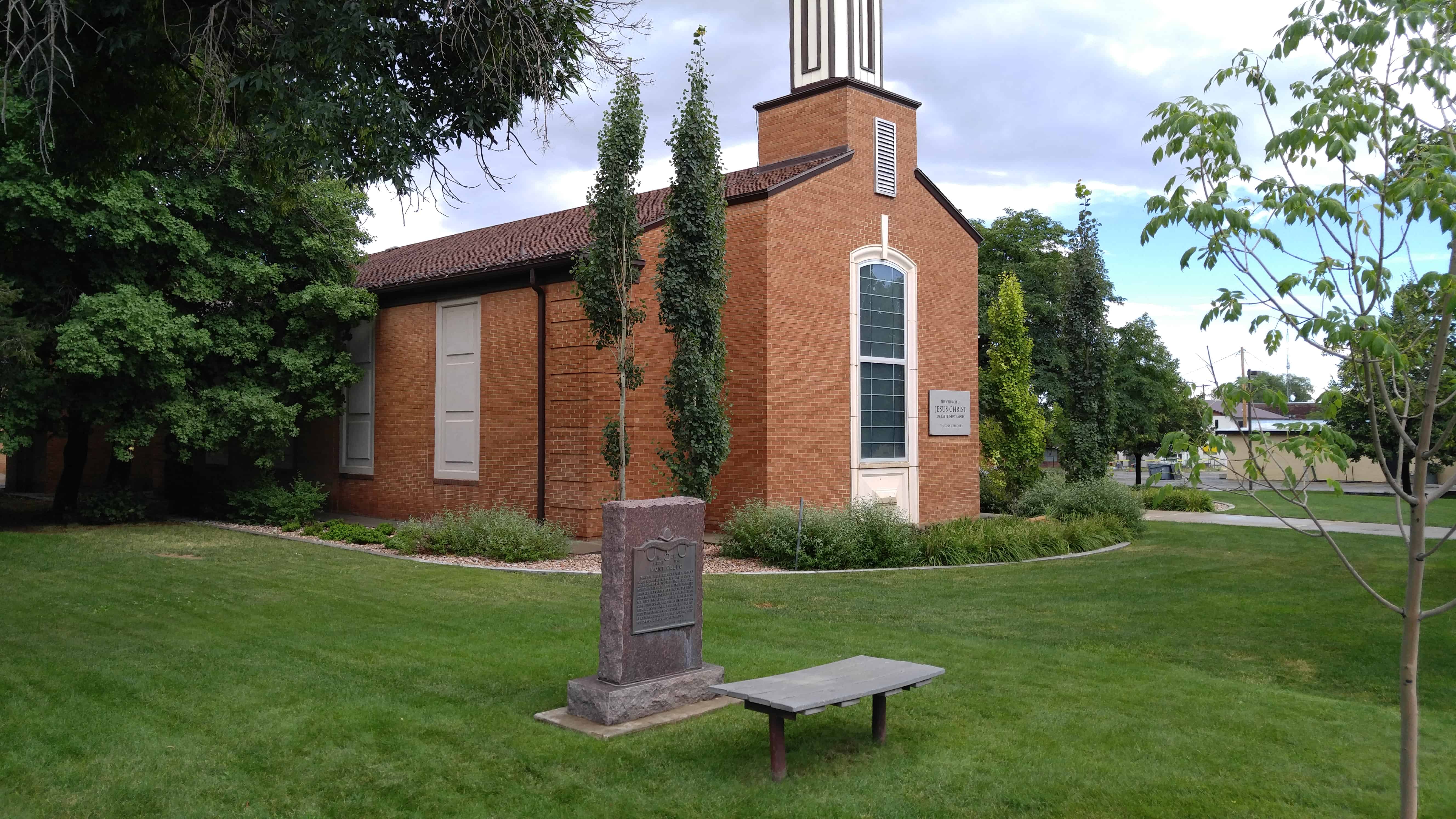
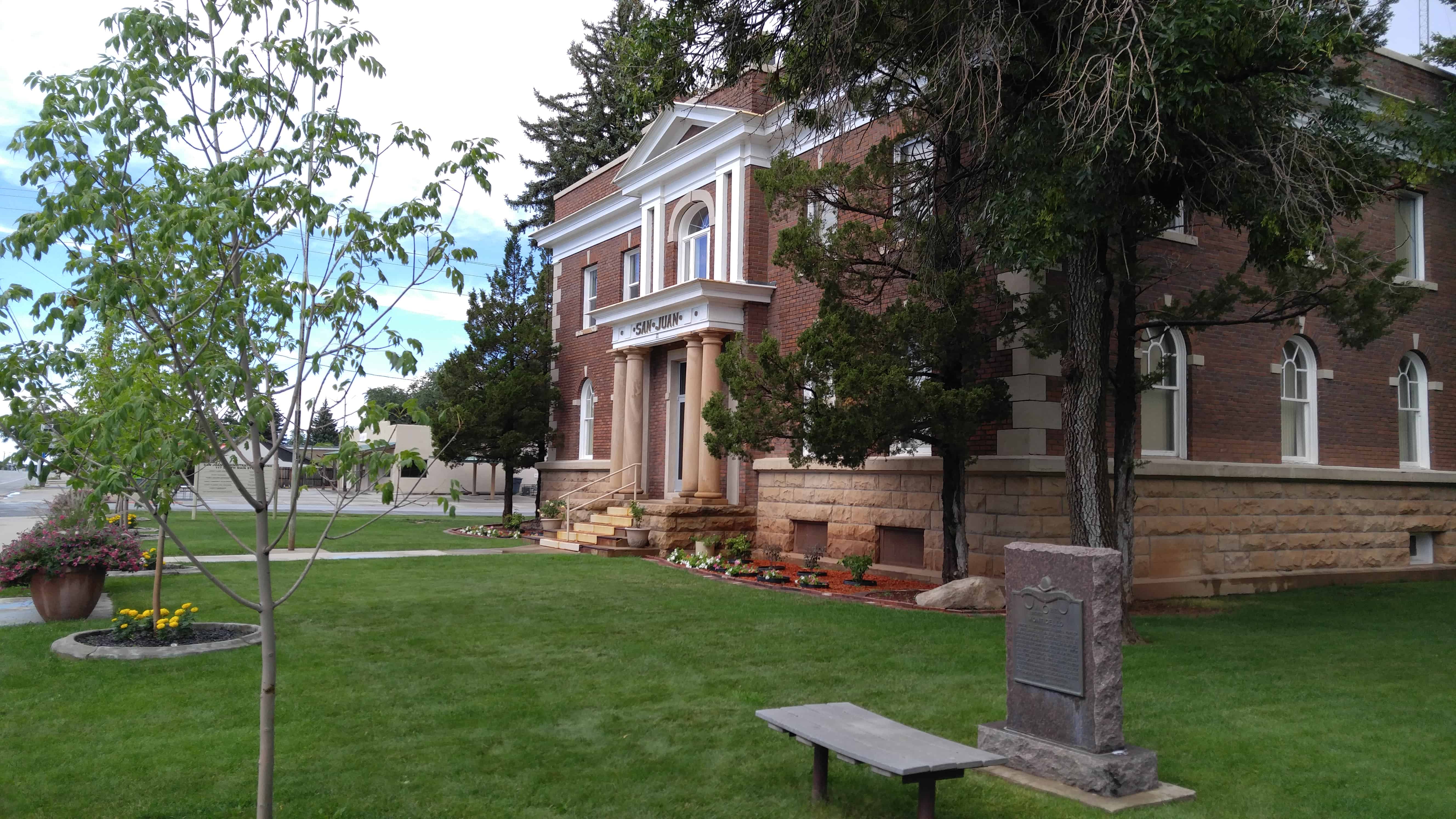
This park, located at 170 South Main Street in Monticello, Utah has many pioneer relics and plaques describing them and the local history.

A Tribute to Dorothy Rasmussen Adams
Born 1910 – Died 1998

Dorothy Rasmussen loved the people, culture, and history of Monticello, Utah. She arrived in her adopted hometown of Monticello in 1915 with her family. Following her graduation from high school, she entered the University of Utah and graduated in 1935 with a degree in education. Her first teaching position was in Sego, Utah. Later she taught second grade in Moab, Utah.

While working in Moab, Dorothy became reacquainted with Donald Adams, a childhood friend. They married in 1937 and moved to Monticello where she continued teaching elementary school. She and Donald had two children, so her teaching time was reduced. She continued to support the war effort through the American Red Cross and raised funds to aid people in Europe.

In 1944 Dorothy became Elementary Supervisor for the San Juan School District. She visited every grade school in the district. She often became stuck driving over dirt roads to reach some of the schools, but quickly learned to dig herself out of the sand. Over the years she taught at Monticello Elementary School and became chairperson of the Library Board for San Juan County and opened the elementary school library to summer readers. Dorothy and Donald were good friends with Harry and Mike Goulding and helped with legal matters for the establishment of Goulding’s Trading Post in Monument Valley.

As Monticello changed with the advent of uranium mining, Dorothy saw opportunities to help improve the quality of the town’s amenities by creating a golf course, swimming pool, offering a Community Concert Series, and getting the Utah Symphony to perform in Monticello. When community libraries became popular, Dorothy was appointed to both the county and state library Boards. Dorothy helped design the Blanding and Monticello libraries and insisted that local materials be used; so the red rock exteriors were from quarries in San Juan County.

Dorothy later spent hours researching the history of the original settlement of Monticello. With the capable modeling skills of Clio Nebeker, they created the Little Town diorama, now located in the Frontier Museum-Welcome Center, accompanied by The Little Green Book, a building-by-building history keyed to the diorama.

Dorothy’s efforts at community enhancement were supported by her family, especially Donald. Eventually she created Pioneer Park on a parcel of her land and worked with Rusty Musselman and other community members to build a replica of the first church in Monticello. Other buildings were added—including a Hispanic cabin and oven built by Pee Wee Barela; a Ute tepee and blacksmith shop donated by Dick Meyer; and an early family cabin donated by the Dean Robinson family. Pioneer Park was then donated to a private foundation and subsequently deeded to Monticello City. Dorothy Rasmussen Adams was committed to the betterment of Monticello. She enjoyed hearing about successes of former students and was heartened by the broadening of town services and attractions. She was a caring and skilled advocate for her town. She died in 1998, and this park is now cared for by Monticello City and the Monticello Rotary Club.

Welcome to Pioneer Park
A Place of History

This park was created as a tribute to the rich and unique heritage of those who settled the Monticello area. As you explore the Park, you will discover some of the early history and ancestry of the community. Early settlers had to contend with Indians, gun-toting cowboys, and severe weather conditions. Pioneer Park is a reminder of the past and of those who have sacrificed and contributed in an effort to increase the bounty of today.

Please be respectful of the surroundings so that all who visit may enjoy the experience. A special thanks to Dorothy Adams for making Pioneer Park a reality.

Old Log Church
Center of the Community

This log church is a replica of the first church in Monticello. The original church, built in 188 for religious worship, also became the core of community activities. It was a school, a refuge for the homeless, a place to dance, a site for public meetings, and a place to mourn the dead.

In addition, this one-room church served as the heart of history-making events. Its first church meeting found the Waltons, Jones, Adams, Butts, Hydes, Rogers and other pioneer families in attendance. Although they met on a dirt floor the first year, they were proud of their church and the community’s progress.

Historical Gathering

As part of the Pioneer Day celebration on July 24, 1891, the church served as a dance hall. Charles Walton played the fiddle and his son, Charles, played the little organ. John Rogers called out the square dance. The merriment suddenly ended as someone rushed in and announced that Tom Roach had stabbed Frank Hyde. A shot was then heard from outside the church building and Bill McCord, a Carlisle cowboy, was found dead. At that point it is reported that Tom Roach held everyone at gun point until Jane Walton stepped forward to reason with him. Another shot was heard and Jane was killed. Tom escaped and was not heard from again.

Log Cabin
An Early Pioneer Home

This original log cabin is representative of the housing of the early pioneers in the area. It was first occupied by three brothers, Warren, John, and Scotty Williamson during the 1880s in Dry Valley., Utah. It is believed that the Williamson brothers built the home and homesteaded the land on which it was located. Their mother, a widow of a Civil War veteran, lived there on a very small pension.

Home Sweet Home

Carl and Kathryn T Williamson were married in 1933 and made this log cabin their first home. Carl worked for the Williamson brothers for the first few years of his marriage, earning $15 per month in cash and $15 per month from calf sales. These earnings were carefully saved to pay baby expenses. Income from their farm products paid daily expenses.

Cowboy Tack Shed
Workstation of the West

The first white settlers of the region were cattlemen. Cattle were first introduced into the San Juan County-Blue Mountain area during the 1870s. Large numbers of the animals were placed on the thousands of acres of lush grasses which grew in the area. Spud Hudson, who came in 1878, dominated the cattle industry until about 1883.

Home on the Range

Monticello endured several typical “old west” conflicts between cowboys and Indians. The cowboy activities of imbibing and shoot ’em ups, were, as expected, a considerable contrast to the Mormon culture of its more settled residents. Many of these cowboys came into San Juan from Texas. They came to this remote canyon country to avoid the law. Some stayed in the county, developing their own cattle companies and other businesses. And became prominent citizens.

The chuck wagon, an invention of Texas cattleman John Goodnight, was declared an ideal device and was widely copied throughout the West. Besides grub, water, pots and pans, medicines, and other supplies, the cowboys’ bedrolls and few personal possessions were carried on the wagon.

Tepee
A Ute Indian Home

Until about the year 1875, nomadic Ute and Piute Indians were the only human inhabitants of this area. The Ute Nation included most of Utah and western Colorado. The Navajo people seldom ventured north of the San Juan River to this area until 1900.

On the Move

Displacement of the Indian began with the advent of cattlemen, many of whom were Texans, followed by the arrival of Mormon settlers. A reservation was established in southern Colorado, and most of the Utes were relocated on the reservation. A few of the Piutes refused and became renegades, stealing cattle and threatening cattlemen and settlers. A number of skirmishes occurred in which both Indians and whites were killed. Most notorious of the renegades were Poke, Posey, and Tse-ne-gat. These people were part of the last Indian uprising in the United States.

On November 13, 1888, the Ute Chiefs signed a treaty selling the Colorado reservation to the Government and accepting the San Juan County reservation. The treaty, although signed by the Indians, was not approved by Congress. The Indians then returned to the reservation.

Sod Roof Cabin
A Spanish-American Home

Hispanics have a very long history in the Southwest, dating back to the early 1600s. The Old Spanish Trail trade from Santa Fe, New Mexico, to California, passed through San Juan County near Monticello. There were no supply stations nor permanent settlements know in the area until the Mormon settlers arrived at Bluff in 1880 and Monticello in 1888.

Establishing a New Abode

Spanish-American sheepherders were recruited by local stockmen, some of whom were Land Grant families from New Mexico. Many of these people established their own homesteads in the area.

The earliest known permanent Spanish settlers were the family of Ramon Gonzalez in 1900. Other Spanish families migrated from New Mexico to the Monticello area in the early 1900s. Among them were the Manzanares, Gallegos, and Jaramillo families. This small, sod-roof cabin is typical of their dwellings.

Recapture Reservoir

15 Wednesday Mar 2017

Posted by Jacob Barlow in Uncategorized

≈ 1 Comment

Tags

Blanding, Lakes, Monticello, Recapture, Reservoirs, San Juan County

2017-03-12 16.35.36

Recapture Reservoir in San Juan County.

Butler Wash Ruin

01 Saturday Oct 2016

Posted by Jacob Barlow in Uncategorized

≈ Leave a comment

Tags

Anasazi, Blanding, Butler Wash, Monticello, Ruins, San Juan County, utah

screenshot-2016-10-01-12-44-24x

Butler Wash Archeological Ruin

Butler Wash Ruin is a cliff dwelling that was built and occupied by the Ancestral Puebloans, sometimes known as Anasazi, in about 1200 AD. Parts of the site has been stabilized and reconstructed, but most of it remains as it was found in the 1800s. There are habitation, storage and ceremonial structures, including four kivas.  This ruin is located in a side canyon of Butler Wash, on the east side of Comb Ridge.

A BLM trail to the site winds its way across slickrock and washes to reach an overlook of the cliff dwelling. Round trip hiking distance is 1 mile and takes approximately a half hour. The difficulty is moderate. An interpretive sign is located at the overlook. Ample parking and a restroom is provided. There is no water at this site, and desert temperatures can be extremely hot and dry. Plan ahead and be prepared. Bring appropriate clothing and lots of water when visiting this site.

The hike from the parking lot to the overlook is an easy one, maybe half a mile to three-quarters of a mile.  It was hot and I was out of shape so I whined a bit more than needed.  Actually going to the ruins took a bit more effort, working the way south from the overlook down into the canyon and then a little rock climbing and scrambling to get up on the cliff over to the side of the ruins, then straight over.

Hole N” The Rock

25 Sunday Sep 2016

Posted by Jacob Barlow in Uncategorized

≈ Leave a comment

Tags

Blanding, Hole N" The Rock, Moab, Monticello, Roadside Attractions, San Juan County, utah

2016-07-31-16-18-32

Travelers along U.S. Highway 191 in Southwestern Utah are amazed to discover this historic 5,000 square foot home which began taking shape almost a century ago by the Christensen family. What began as a small alcove for the young Christensen boys to sleep in at night grew into a man-made engineering marvel 20 years in the making. A fireplace with a 65′ chimney,14 rooms arranged around huge pillars and a deep bathtub built into the rock delight visitors who visit this most unusual home in the dessert. Original furnishings, Alberta’s paintings, Gladys’s doll collection and many of the tools used to create this home remind you of the past.

In a 12 year period Albert excavated 50,000 cubic feet of sandstone from the rock. During this time he completed his famous painting Sermon on the Mount and his sculpture of Franklin D. Roosevelt on the face of the rock above his home.

When Albert died in 1957, the home was not complete. Gladys’s in keeping with his wishes & lifelong dreams continued to develop the property, opening a gift shop and giving tours of her home until she passed away in 1974. Gladys is laid to rest next to Albert in a small cove within the rock near the home.(*)

This location has been a travelers’ resting place for two centuries. Beginning in 1829, horse teams on the Old Spanish Trail between Santa Fe and California stopped here for the abundant spring water and shade. After the settlement of Mormon Pioneers, stage coaches traveling between Moab and Monticello stayed here overnight.

Early in the 20th century, the Christensen family of Monticello homesteaded 80 acres here. They blasted out a small cave in the rock where cowboys camped as they drove their stock toward the Colorado River. In 1945, brothers Leo and Albert Christensen expanded the cave and opened “American’s most unique dining room.” The Hole N” The Rock Diner was a watering hole for uranium miners and car tourists until 1955.

The Christensens continued to excavate the cave until it reached its current size of 5000 square feet. Take a ten-minute guided tour of this unique and spectacular 14-room home as millions have done since 1957.

picture24jul07-044

Monticello Utah Temple

23 Friday Sep 2016

Posted by Jacob Barlow in Uncategorized

≈ 3 Comments

Tags

LDS, Monticello, San Juan County, Temples, utah

  • 13912575_10153977975629234_8464549311372050967_n

Once the smallest temple of the Church, the temple was expanded an additional 4,000 square feet.

The Monticello Utah Temple is the 53rd operating temple of The Church of Jesus Christ of Latter-day Saints (LDS Church). In October 1997, LDS Church president Gordon B. Hinckley announced the building of smaller Latter-day Saint temples throughout the world. The first of these smaller temples was to be built in Monticello, Utah. Less than one year after the announcement, the Monticello Utah Temple was dedicated on July 26, 1998.

The Monticello Utah Temple serves nearly 13,000 church members in Blanding, Moab, and Monticello, Utah areas and members from Durango, Colorado and Grand Junction, Colorado.  Located at the base of the Abajo Mountains, the temple’s exterior is finished in a marble called Noah’s Crème. Thirteen thousand tiles used on the temple were evaluated carefully to make sure they blended with each other for a uniform effect. The Monticello Utah Temple has a total floor area of 11,225 square feet, two ordinance rooms, and two sealing rooms.

Verdure, Utah

13 Friday Jun 2014

Posted by Jacob Barlow in Uncategorized

≈ 2 Comments

Tags

Monticello, San Juan County, utah, Verdure

picture24jul07-078

The historic marker alongside the highway reads:

The oldest Mormon settlement in the Blue Mountain Region was first known as South Montezuma. Later the name was changed to Verdure after the lush green growth along the stream bed. Verdure was settled by men of the Blue Mountain Mission March 11, 1887, under the direction of Pres. Francis A. Hammond of the San Juan Stake. He called George A. Adams, Frederick I. Jones, Parley R. Butt and Charles E. Walton to establish a new settlement at North Montezuma, later named Monticello. They first set up camp at Verdure to prepare for a permanent settlement at Monticello, six miles to the north.

When company members moved on to Monticello in 1888 the Adams and Butt families remained at Verdure. By 1894 they were joined by the Alvin Decker, Willard Butt, Lingo Christensen, R.P. Hott and Francis Nielson families. Nielson operated a store and a school out of his log home, the first church met in the Decker home, and in 1893 a post office was installed in the Adams home.

Verdure was a peaceful frontier village where cattle, farming and cheese-making were the main occupations. Gradually the settlers moved to Monticello.

2017-03-12 16.46.24-1

2017-03-12 16.47.25

Monticello

30 Friday May 2014

Posted by Jacob Barlow in Uncategorized

≈ 1 Comment

Tags

DUP, historic, Monticello, San Juan County, utah

picture24jul07-073

March 12, 1887 Frederick I. Jones, Farley R. Butt, Charles E. Walton and George A. Adams came here to start the L.D.S. Blue Mountain Mission. After their families arrived they camped at Verdure the first summer. In 1866 the families of M. Peterson, W.E. Hyde, Wm. Adams, and J.E. Rogerson came. This square was the activity center with a sports area, bowery, log relief society room and a co-op store. A log house built in 1888 stood 125 ft. west and was used for church, school and recreation.

picture24jul07-072

This is Daughters of Utah Pioneers historic marker #212 located at 165 South Main Street in Monticello, Utah

  • D.U.P. Historic Markers

Monticello, Utah

31 Friday Jan 2014

Posted by Jacob Barlow in Uncategorized

≈ 4 Comments

Tags

Monticello, San Juan County, utah

picture24jul07-066

The city of Monticello rests at the foot of Blue Mountain on the Great Sage Plain of southeastern Utah. Local springs east and west of its present location offered water to passersby, who gave them such names as Piute Springs, Soldier’s Spring, and Vega (Spanish for “fertile plain”) Creek.

Monticello Posts:

  • Church Rock
  • Hyland Hotel
  • LDS Temple
  • Monticello DUP Marker
  • Pioneer Park
  • Verdure
  •  
  • Monticello posts sorted by address

In March 1886 Francis A. Hammond, LDS stake president of San Juan County, sent an exploration party from Bluff to determine likely sites for towns close to the mountain and its water. The south and north forks of Montezuma Canyon provided real possibilities, yet the general region was already utilized by Edmund and Harold Carlisles’ Kansas and New Mexico Cattle and Land Company, located a few miles north of Monticello, and the L.C. outfit, headquartered on the South Fork of Montezuma Creek. Undaunted, Hammond called Frederic I. Jones and four other men to start planting crops, laying out a townsite, and surveying an irrigation ditch. By the first part of July 1887 the men had their tasks well under way and had joined in a conflict with the cowboys of the Carlisle outfit that would continue for approximately the next eight years. Warning shots, heated disputes, and legal wrangling were all part of this tension as each group tried to control access to the area’s water. Homesites established at Verdure, on the South Fork of Montezuma Creek, were not free of conflict either, with cowboys as well as Ute Indians adding to the stress.

The Mormons claimed all of the water in the South Fork as well as three-fourths of it from the North Fork, and they learned from lawyers that the Carlisles had very little legal title to any of it. Since more water was available on the South Fork, the men there raised an initial crop of wheat, oats, and potatoes, and they experimented with both irrigation and dry-farming agriculture. In the spring of 1888 the settlers returned and undertook the construction of a town that was known as both North Montezuma and Hammond until it took the name Monticello in honor of Thomas Jefferson’s estate.

To bolster this new colony, Hammond called twenty additional men from Moab, Bluff, and Mancos, Colorado. Together they fenced 320 acres, established crude homes from wagon boxes and tents, and started the arduous task of hauling wood from the mountains. Private homes and a meetinghouse arose from the sagebrush flats, while the irrigation ditch, built by the newly incorporated Blue Mountain Irrigation Company, snaked its way across the flats to water the crops.

A rudimentary livestock and agricultural economy blossomed. Most of what was not home grown or locally made came from the stores of either Moab (via the railroad running through Thompson) or from the towns of Cortez, Mancos, and Durango, Colorado. Wagon freighting to distant markets provided an extra income for locals, but created a shortage of manpower for the women and children remaining at home. In 1903 the Utah State Agricultural College in Logan established an experimental station in Verdure, and for thirteen years the station tested various types of dry-farming techniques and products suitable to the climate.

This information, along with the passage in 1909 of the Enlarged Homestead Act that provided 320 acres of non-irrigatable land for a small price, encouraged an explosion of new farms carved out of the sagebrush lands north and east of Monticello. The establishment of small communities comprised of homesteaders–Boulder (1910), Lockerby (1912), Ucola (1913), Summit Point (1915), Cedar Point (1916), Horsehead (1916), Ginger Hill (1917), Urado (1918), and Torb (1919)–supported the economic growth of the larger town like the spokes of a wheel linked to a hub. Even after the economic boom of World War I and during the Great Depression of the 1930s, farming remained a major local occupation.

The prosperity of the town ebbed and flowed. Monticello became the county seat in 1895 and in 1910 was incorporated as a city. A brick schoolhouse erected in 1897 replaced the log cabin school built nine years before. The Blue Mountain Irrigation Company accepted bids for a combined water and power system that came to fruition in 1917, supplying the 250-member community with twenty-four hour service. The town welcomed its first phone lines in 1906, tying communications in to Colorado circuits; two years later, Monticello connected with Moab. In 1915 Oscar McConkie established the San Juan Record, the county newspaper, in Monticello where it remains to this day.

World War II brought further changes. The Vanadium Corporation of America (VCA) selected Monticello as a site for a wartime vanadium processing mill. It employed 200 workers until it closed in 1946, only to reopen in 1949 as a converted vanadium and uranium plant. During the 1950s, the mill processed large amounts of ore taken from the canyons of southeastern Utah; however, in 1960, the Atomic Energy Commission closed the plant permanently. The government conducted a tailings cleanup project in the 1990s to remove any hazardous waste from the site.

Today, Monticello still serves as the county seat, is home to the school-district offices, has an eighty-prisoner correctional facility and the district court, and it has a growing tourist industry derived from Canyonlands National Park and traffic coming from southwestern Colorado. According to the 1990 census, it has a population of 1,806, which includes a small Hispanic community, and is the second largest city in San Juan County.

(Robert S. McPherson
Utah History Encyclopedia*)

picture20sep08-119

Follow Jacob

Follow Jacob

Blog Stats

  • 2,033,346 hits

Social and Other Links

BarlowLinks.com

Recent Posts

  • Dixie Sorghum (Molasses) Mill
  • This is the Place State Park
  • Eyes Westward
  • Wellsville Relief Society Meetinghouse
  • Angels Are Near Us

Archives


Loading Comments...