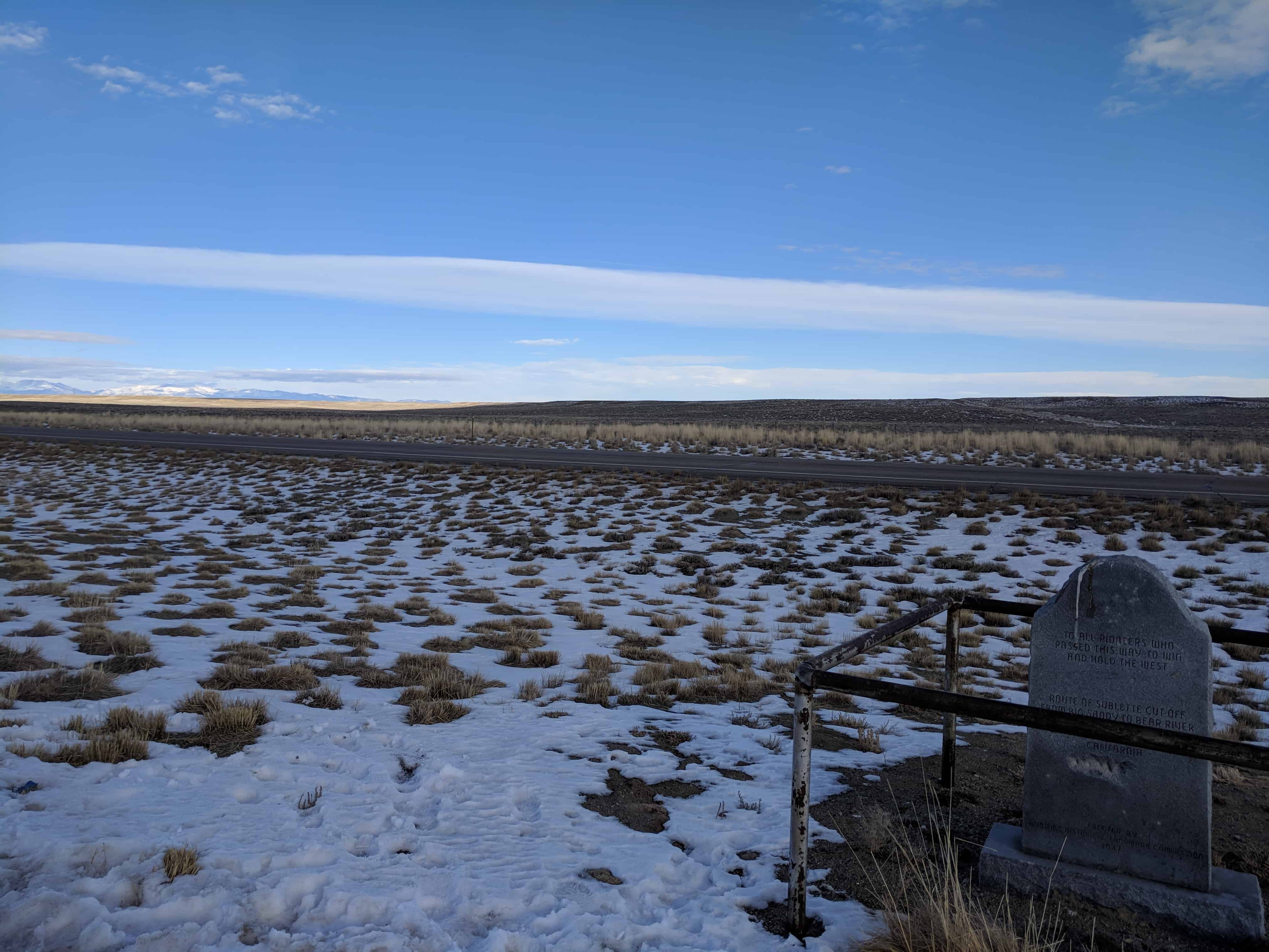
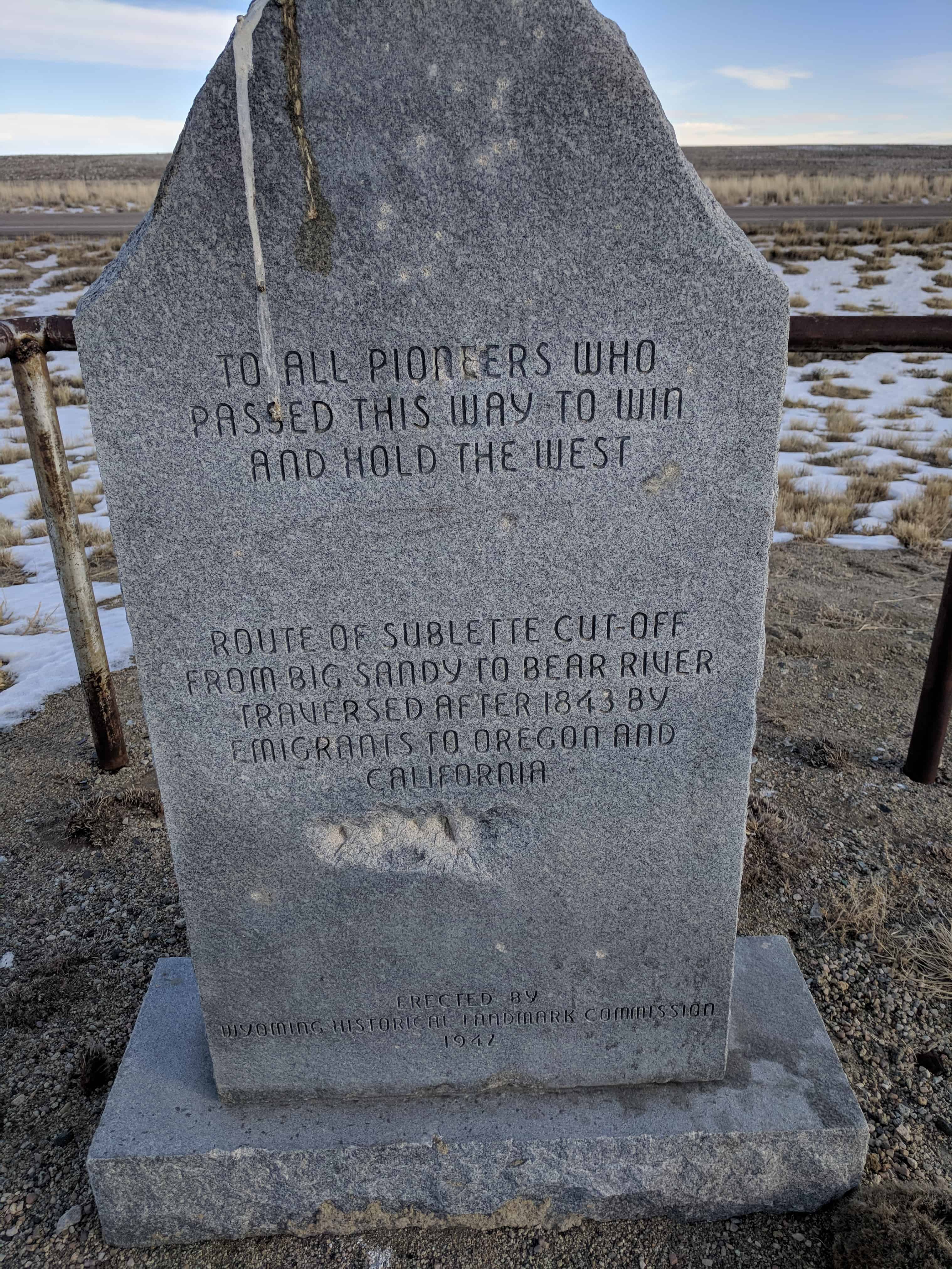
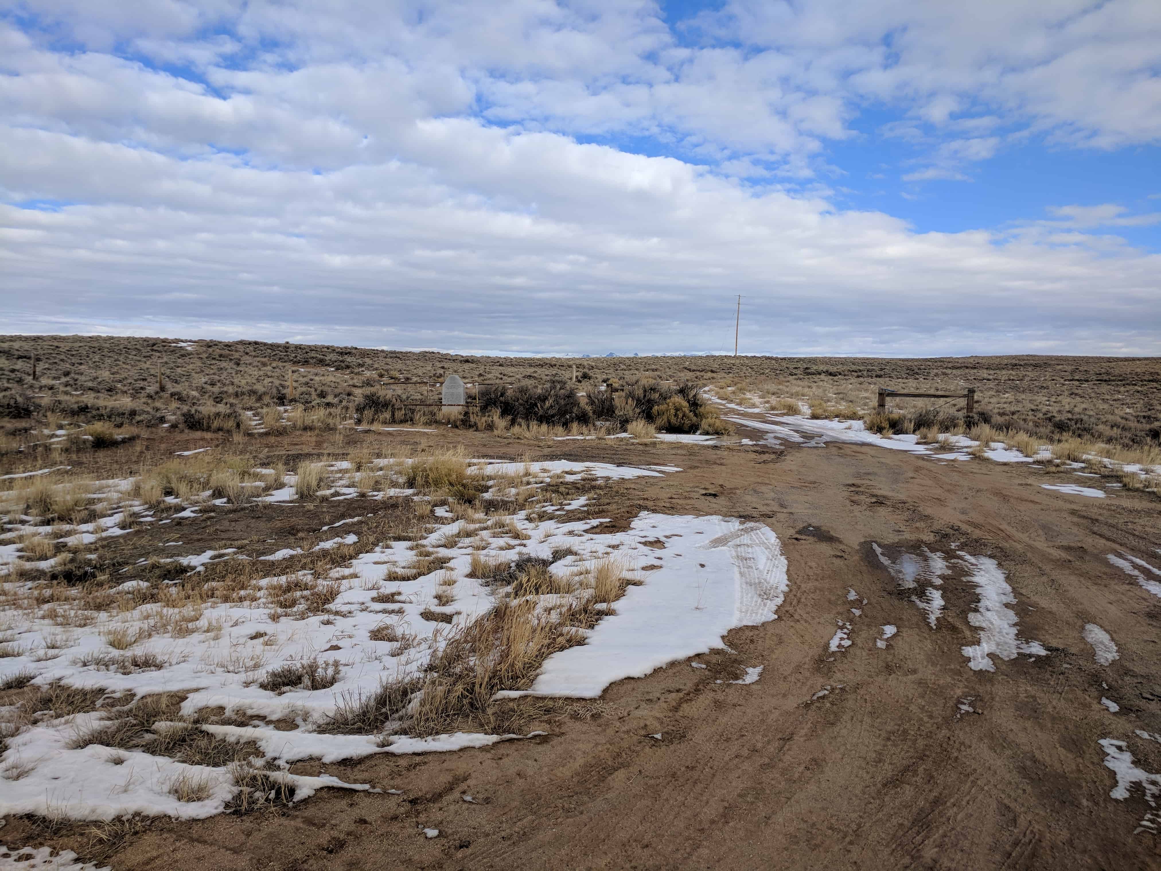
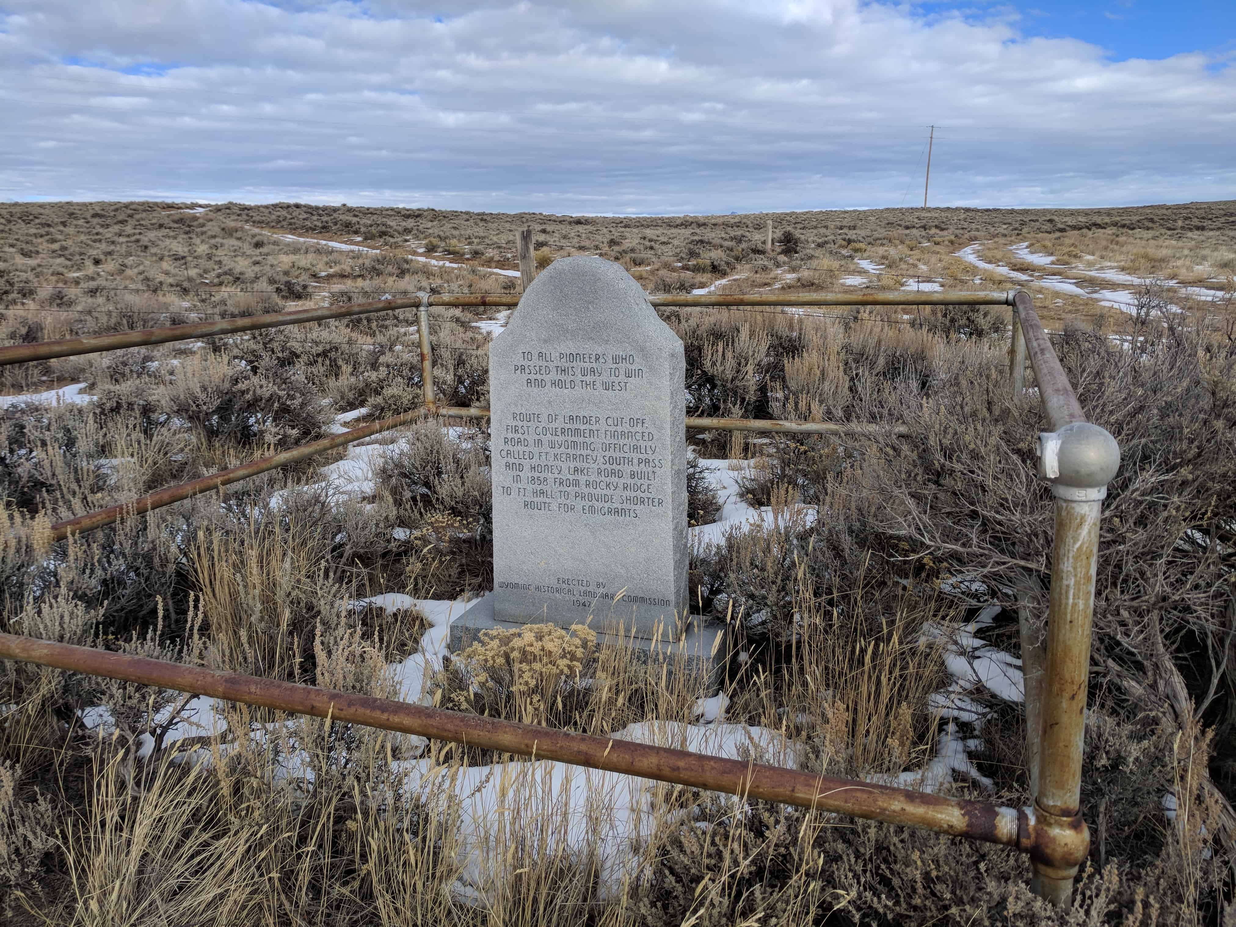
To all pioneer who passed this way to win and hold the west.
Route of Sublette cut-off from Big Sandy to Bear River. Traversed after 1843 by emigrants to Oregon and California.

10 Saturday Mar 2018
Posted in Uncategorized
To all pioneer who passed this way to win and hold the west.
Route of Sublette cut-off from Big Sandy to Bear River. Traversed after 1843 by emigrants to Oregon and California.
08 Thursday Feb 2018
Posted in Uncategorized
Tags
22 Sunday Jan 2017
Posted in Uncategorized
Tags

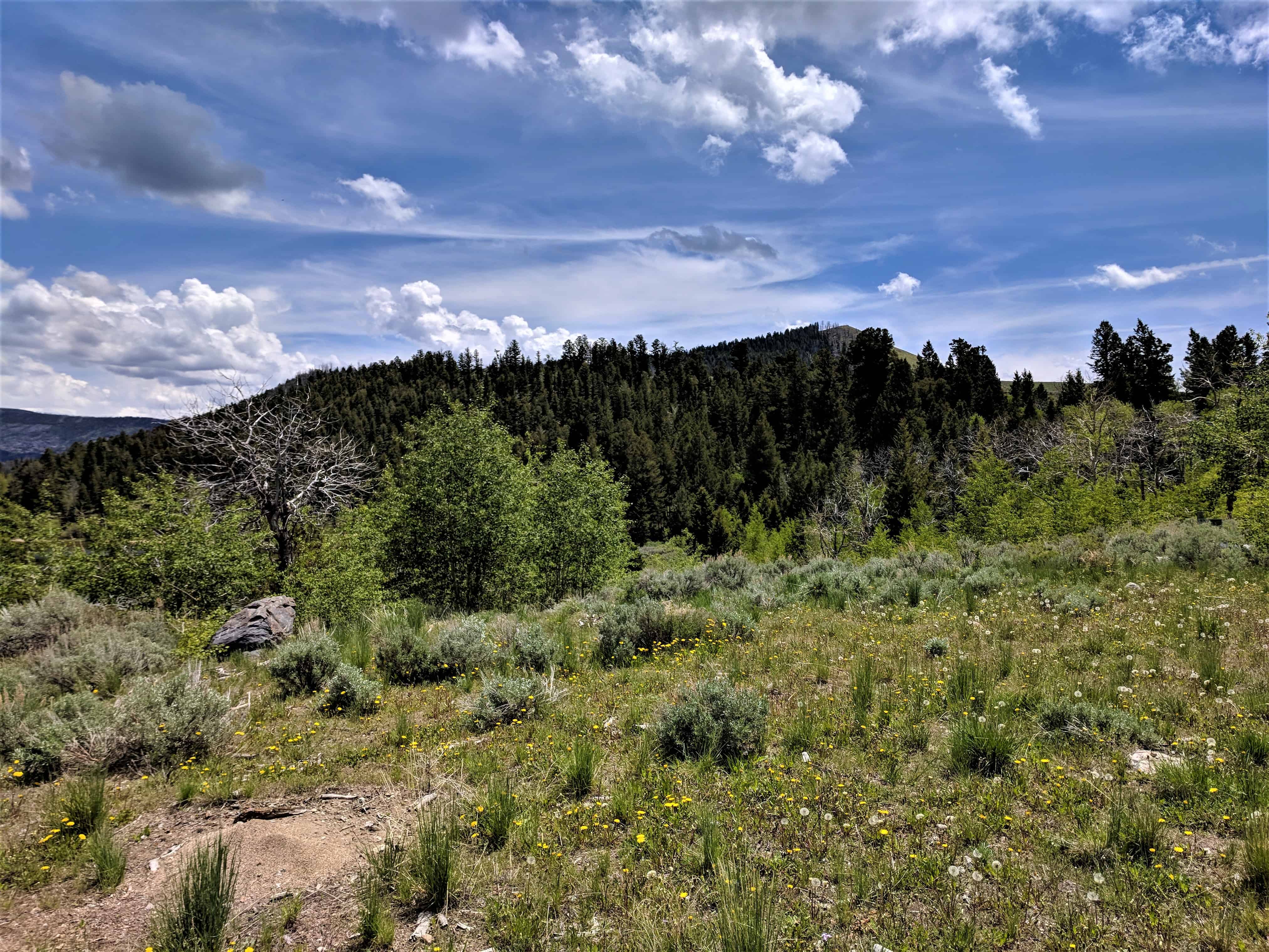
What happens when glaciers move across land? Glaciers gather up rocks as they move down the mountain. The rocks act as sharp, rough, cutting tools that are held tightly in the glacier ice. These “rock tools” rip out more rocks and soil and they are added to the moving glacier. Glaciers of the Great Ice Age deeply eroded the land wherever they traveled. Glaciers today continue to form sharp peaks and jagged ridges. They are a powerful force.
Scientists used to wonder about piles of unsorted rocks and soils that appeared far from where they belonged. They also found humongous single rocks. Long ago people thought floods had moved the soil and rocks. A Swiss scientist, Louis Agassiz, determined that they were moved by glaciers. Glaciers cut valleys into the land and leave sharp mountain peaks. They also leave smooth, rolling hills. You can tell if glaciers have been there if you see deep scratches on rocks, large boulders standing alone, and round ponds left behind where the soil was dug away.
See also:

26 Saturday Nov 2016
Posted in Uncategorized
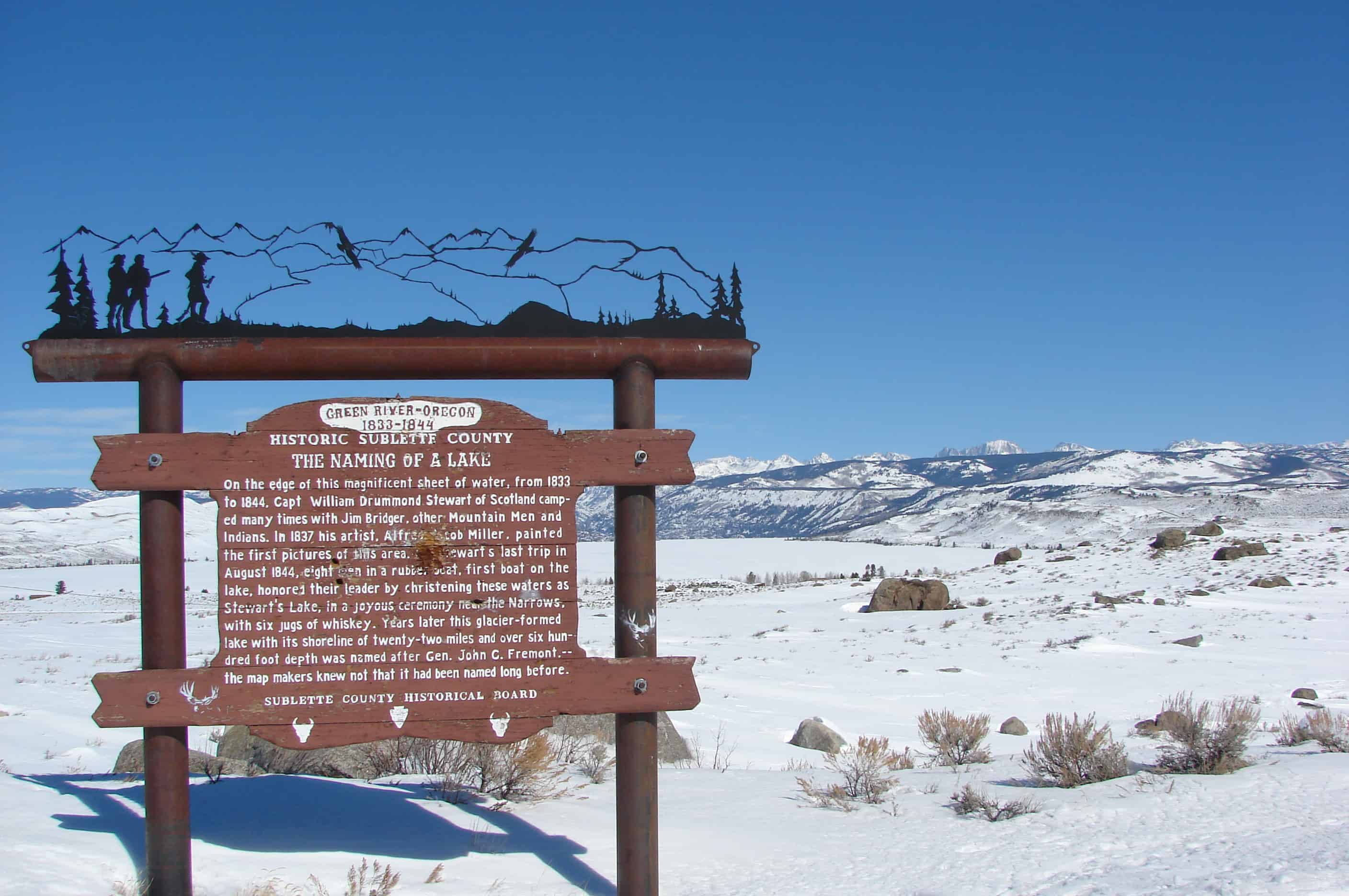
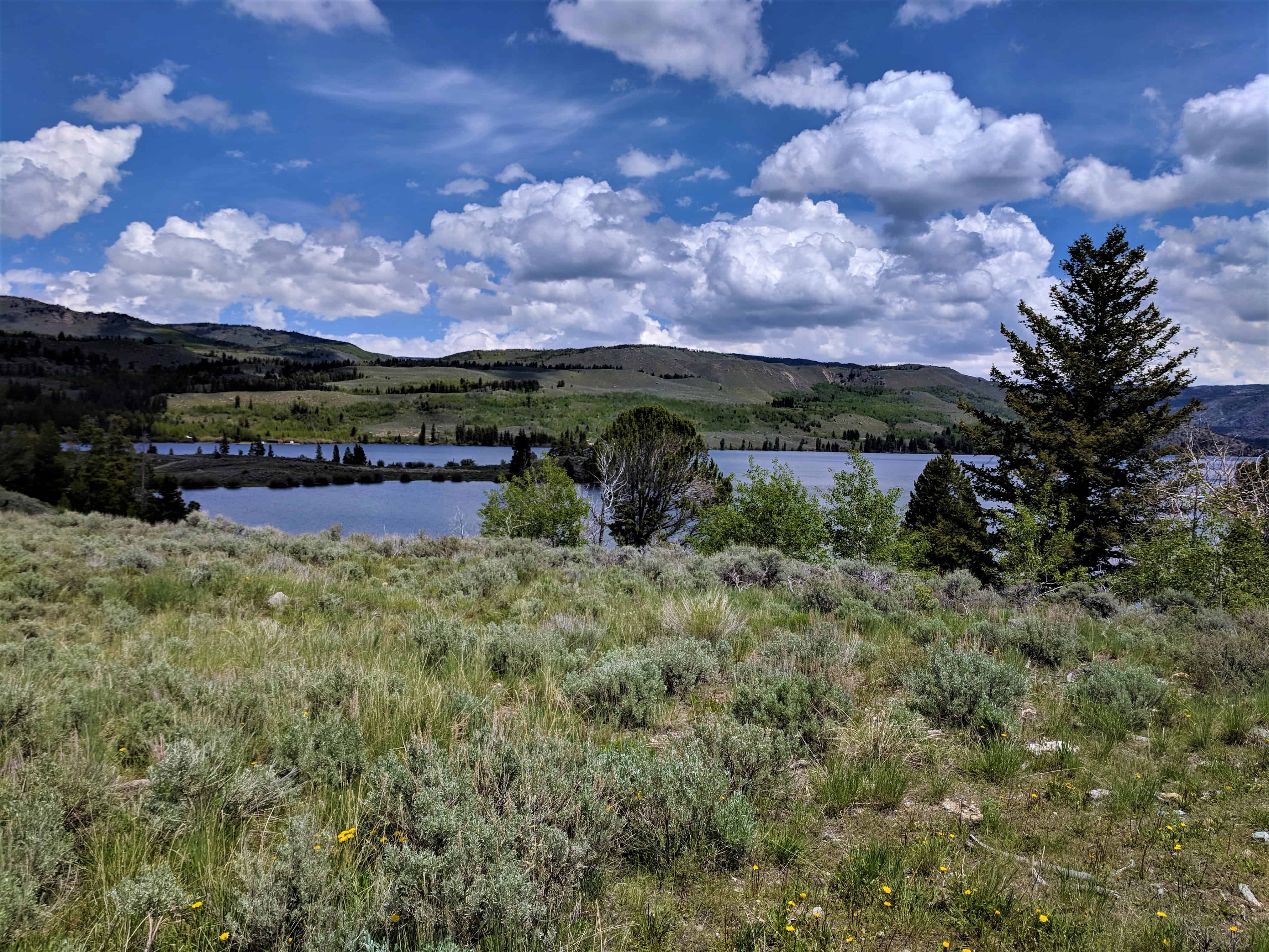
On the edge of this magnificent sheet of water, from 1833 to 1844, Captain William Drummond Stewart of Scotland, camped many times with Jim Bridger and other Mountain Men and the Indians. In 1837 his artist, Alfred Jacob Miller, painted the first pictures of this area. On Stewart’s last trip in 1844, eight men in a rubber boat, first boat on the lake, honored their leader by christening these waters as Stewart’s Lake in a joyous ceremony near the narrows with a jug of whiskey. Years later this glacier-formed lake with its shoreline of twenty-two miles and over six hundred foot depth was named for John C. Fremont, – the map makers knew not it had been named long before.


The marker pictured above has been replaced and the new one says:
Sir William Drummond Stewart of Scotland can be called Wyoming’s first tourist. Stewart attended every summer rendezvous from 1833 to 1838, during the heyday of the mountain man fur trade. Four of those gatherings took place nearby, at the confluence of Horse Creek and the Green River.
This magnificent glacier-carved lake must have been one of Stewart’s favorite spots. Artist Alfred Jacob Miller accompanied Stewart in 1837 and painted the first pictures of the area, including the mountain lakes that inspired both men.
Although the last rendezvous was held in 1840, Stewart and mountain man William Sublette returned one more time in 1843. They camped here for 10 days in August, visited old Shoshone Indian and trapper friends, and raced horses on a flat to the west near the New Fork River. Stewart and a small party floated to the head of the lake in an India-rubber boat brought especially for that purpose. At that time this lake was called both Stewart’s Lake and Loch Drummond.
The year before, in 1842, explorer John C. Fremont had made his first trip west, and guided by Kit Carson, climbed what he thought was the highest summit in the Wind River Mountains. This peak, which towers over the lake, was later named Fremont’s Peak. Long after, not knowing that the lake had already been named in honor of Stewart, Fremont supporters named it Fremont Lake even though John C. Fremont had never actually been there.
At 9 miles long, 1 mile wide and 600 feet deep, Fremont Lake is the second largest natural lake in Wyoming.
29 Saturday Aug 2015
Posted in Uncategorized
Tags


29 Monday Sep 2014
Posted in Uncategorized
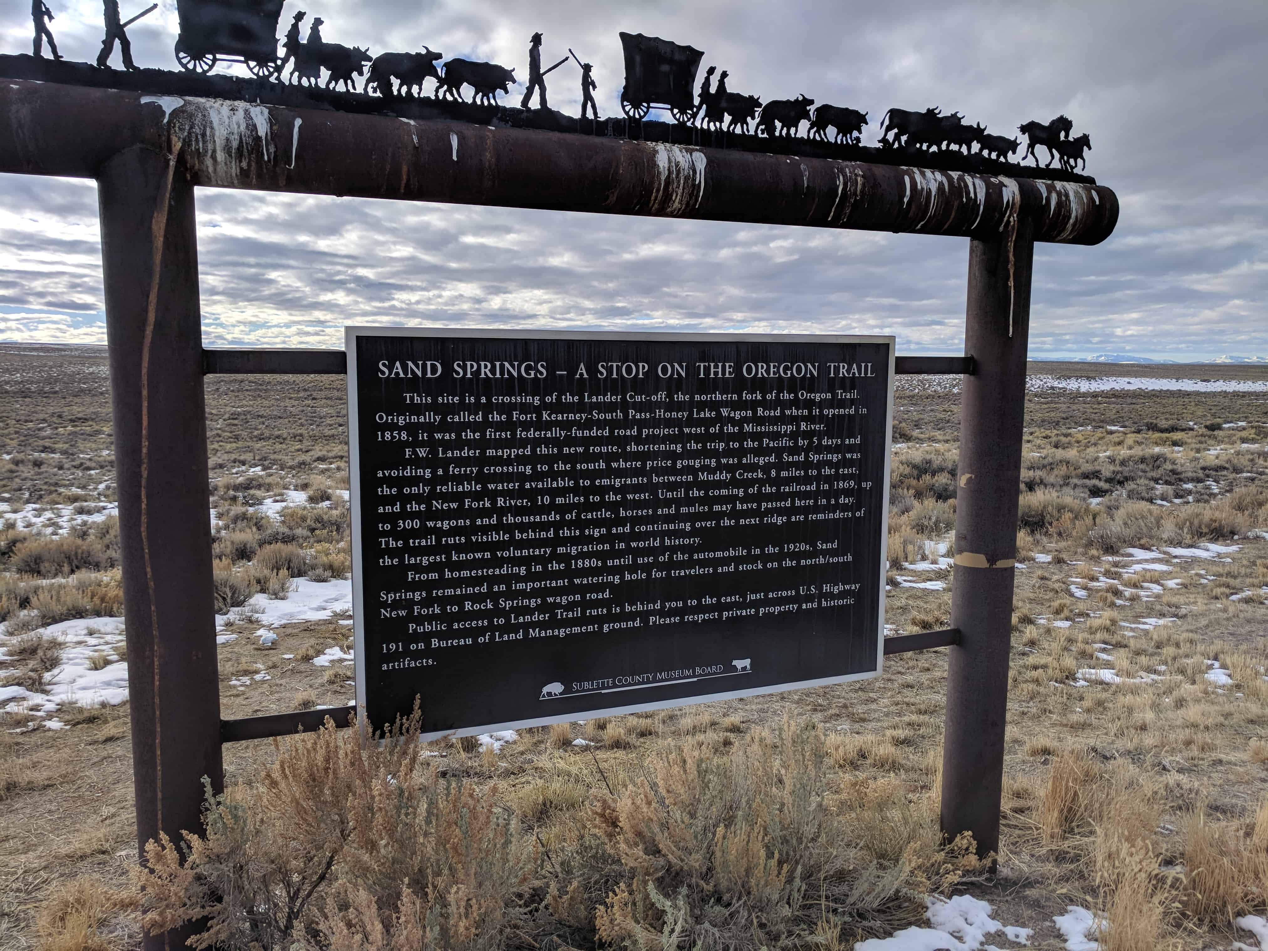
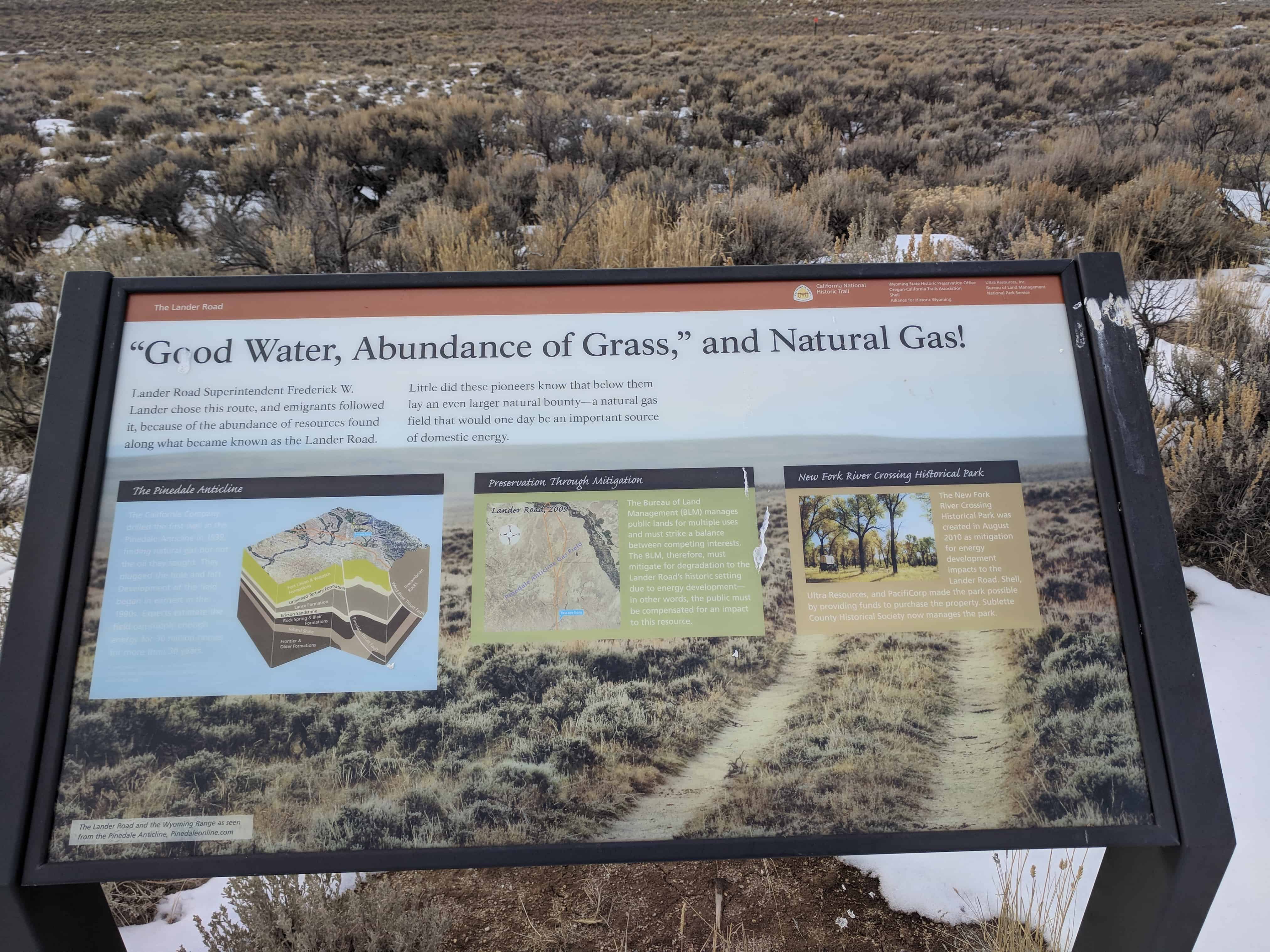
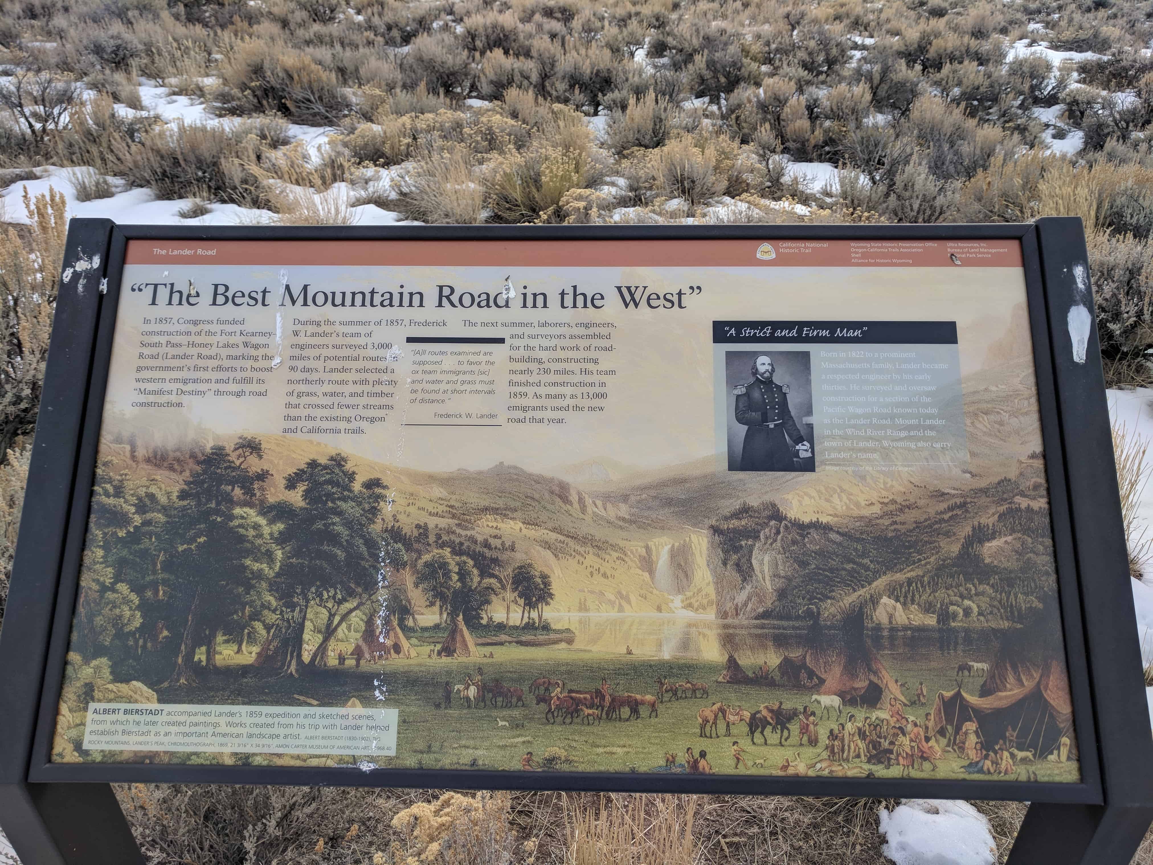
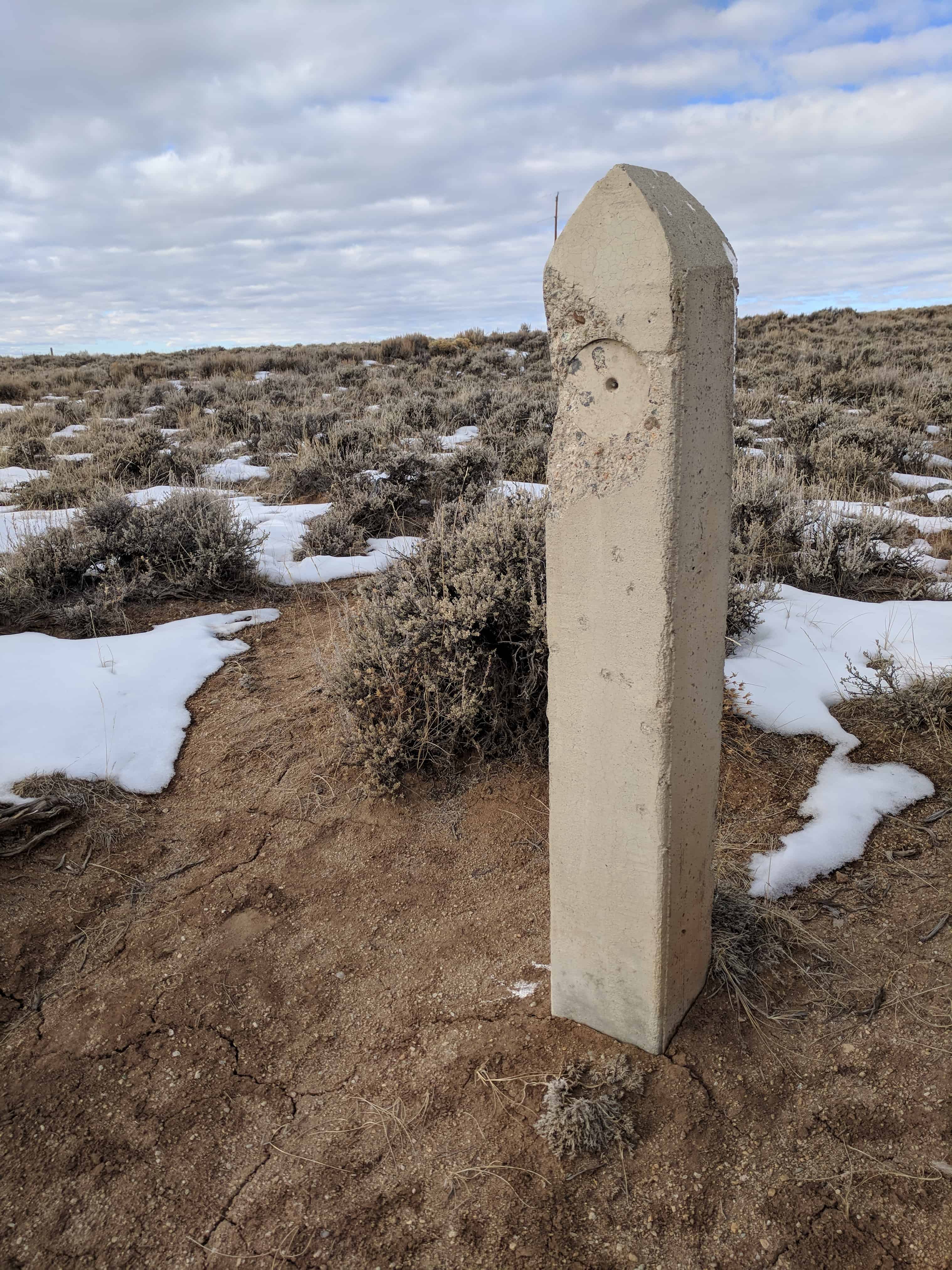
This Site is a crossing of the Lander Cut-off – the northern fork of the Oregon Trail, following a route of the fur traders. It was suggested as an emigrant road by Mountain Man John Hockaday in order to avoid alkali plains of the desert, shorten the trip to the Pacific by five days and provide more water, grass and wood. In 1857 it was improved as a wagon road by the Government under the supervision of F.W. Lander and termed the Fort Kearney-South Pass-Honey Lake Road. As many as three hundred wagons and thousands of cattle, horses and mules passed here each day. An expanding nation moved with hope and high courage. The trail, cut deep into the dirt of the plains and the mountains, remains as a reminder of a great epoch.”


27 Friday Jun 2014
Posted in Uncategorized
Tags
 A marker west of highway 189 between Daniel and Big Piney, near the Big Piney Cut-off reads:
“Thousands of people, cattle and horses passed this way to the Northwest when the Sublette Cut-off of the Oregon Trail was opened in 1857. None settled in this county. At the close of the Indian Wars in 1877, cattle herds from Oregon came this way to meet the railroad and to stock Wyoming ranges. The first Sublette County herds were started with other western cattle. In 1878-79, Ed Swan’s, Otto Leifer’s (Circle), D. B. Budd’s, Hugh McKay’s (67) and A. W. Smith’s (Muleshoe) outfits settled on nearby Piney Creek. Their cattle were not longhorns. The county’s first barbed wire was unrolled in 1881 on the Circle outfit.”
The marker was erected in June 1960 at the expense of the Sublette County Historical Society. The text was written by Jim Harrower.


27 Friday Jun 2014
Posted in Uncategorized
Tags

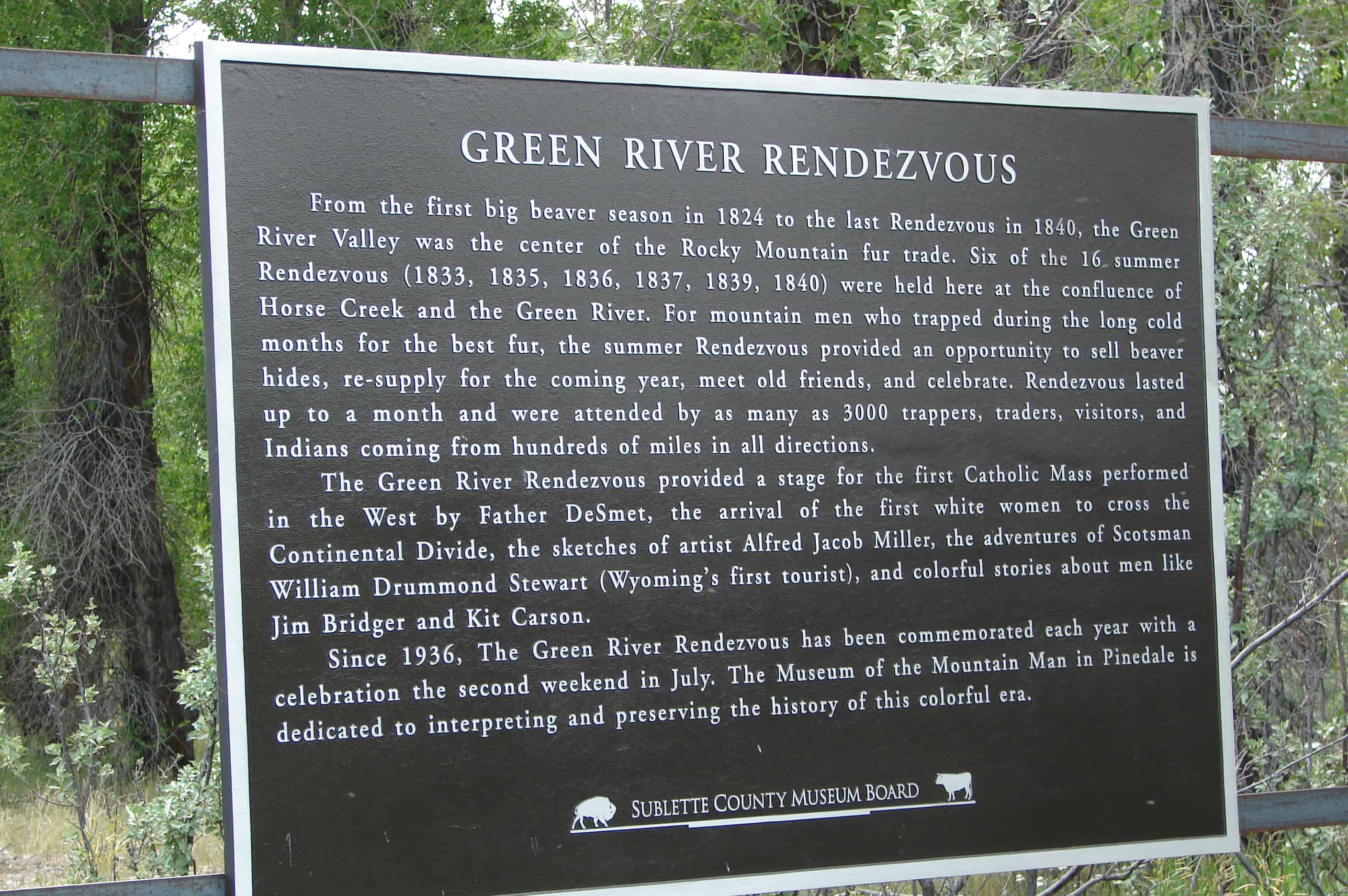
The Rendezvous had a broad meaning with the early trappers; not only was it a place to which they carried their furs and exchanged them for all sorts of commodities, such as clothing, saddles, bridles, tabacco, whiskey, bright dyes for coloring the trappings of their horses – but it was a place to meet traders who might wish to engage their services for the coming year. It was indeed a place noted for business, pleasure, mirth, gambling and brawls, and the motley collection was not without interest even to the early missionaries. Along about 1835, religious teachers became a regular feature at the Rendezvous. Rev. Samuel Parker made a number of religious talks to white men and Indians at the Green River in 1835. Father De Smet made a number of his winning and pleasant talks in 1840 at this same place. The Green River Rendezvous are commemorated the second Sunday in July each year at the Museum of The Mountain Man in Pinedale. A large interpretive historical site marker was erected by the Sublette County Historical Society in July 1955 on the Rendezvous grounds near Daniel. It was designed by Jim Harrower and Myra Cooley prepared the lettering. Mrs. Jean Roth cut the stencils and arranged the lettering. The legend on the sign reads: “A market place of the fur trade, from the Mississippi to the Pacific, from Canada to Mexico, where trappers, traders and Indians came to barter for the first great resource of the West. Six Rendezvous were held here, gathering not only furs but information of geographical importance to weld the final link in exploration of the new world. It is a tribute to the brave men, both red and white, who blazed the trails for culture and progress, and to the lowly beaver who gave it impetus”


20 Friday Jun 2014
Posted in Uncategorized
Tags
A marker located west of the Pine Creek Bridge in Pinedale, on the North side of the highway reads:
“On Oct. 16, 1812, the Astorians Robert Stuart, Ramsay Crooks, Robert McClellan, Joseph Miller, Benjamin Jones, Francis LeClair and Andy Vallee, traveling from Astoria to St. Louis, all their horses having been stolen by Indians, passed this way on foot and forded Pine Creek near here, the first white men known to have seen it.
From Stuart’s Journal: ‘We forded another stream whose banks were adorned with many pines – near which we found an Indian encampment – deserted about a month ago, with immense numbers of buffalo bones strewed everywhere – in the center of camp a great lodge of pines and willows – at the west end three persons lay interred with feet to east and at head of each a large buffalo skull painted black – from lodge were suspended numerous ornaments and moccasins.’
Six days later, on Oct. 22, 1812, they made the memorable discovery of the South Pass.”
The marker was erected in August of 1962 at the expense of the Sublette County Historical Board. The script is by Jim Harrower.


20 Friday Jun 2014
Posted in Uncategorized
Tags

Pinedale Posts:
In 1904, John F. Patterson proposed establishing a town in the Green River Valley along Pine Creek in western Wyoming, in what then was still part of Fremont County. Patterson offered to build and stock a general store if local ranchers Charles A. Petersen and Robert O. Graham each donated five acres for the town site. The three men agreed, and hired a surveyor. Pinedale, Wyo., named after the post office on Petersen’s ranch, became a town on paper owned by the trio.
The boundary line set by the ranchers became Pine Street. Patterson earned recognition as the founder of Pinedale. On Sept. 26, 1904, the first town plat was drawn on a piece of yellow cloth showing blocks, lots and streets. That date was designated as Founder’s Day.

The tiny town served the area’s small, yet thriving, industries. This included supplying provisions for tie hacks living in mountain camps. Tie hacks, who cut trees and shaped railroad ties from them, came from around the world for this work. As Union Pacific Railroad expanded its tracks through Wyoming in the early years of the 20th century, it needed ties to support the new rails.

Even before the town of Pinedale was founded, guests, often known as “dudes,” paid guides to assist them during their visits to the nearby Wind River Mountains. During the late 1800s, tourists came to enjoy horse pack trips, fishing and hunting in the beautiful nearby mountains.


Great herds of Hereford and Black Angus cattle roamed on area ranches in the Green River Valley, some of which were established before the town itself. Ranchers and cowboys, along with their families, were among the early settlers of the region.(…more here)