Wyoming Historic Markers
31 Sunday May 2026
Posted in Uncategorized

31 Sunday May 2026
Posted in Uncategorized
14 Friday Feb 2025
Posted in Uncategorized
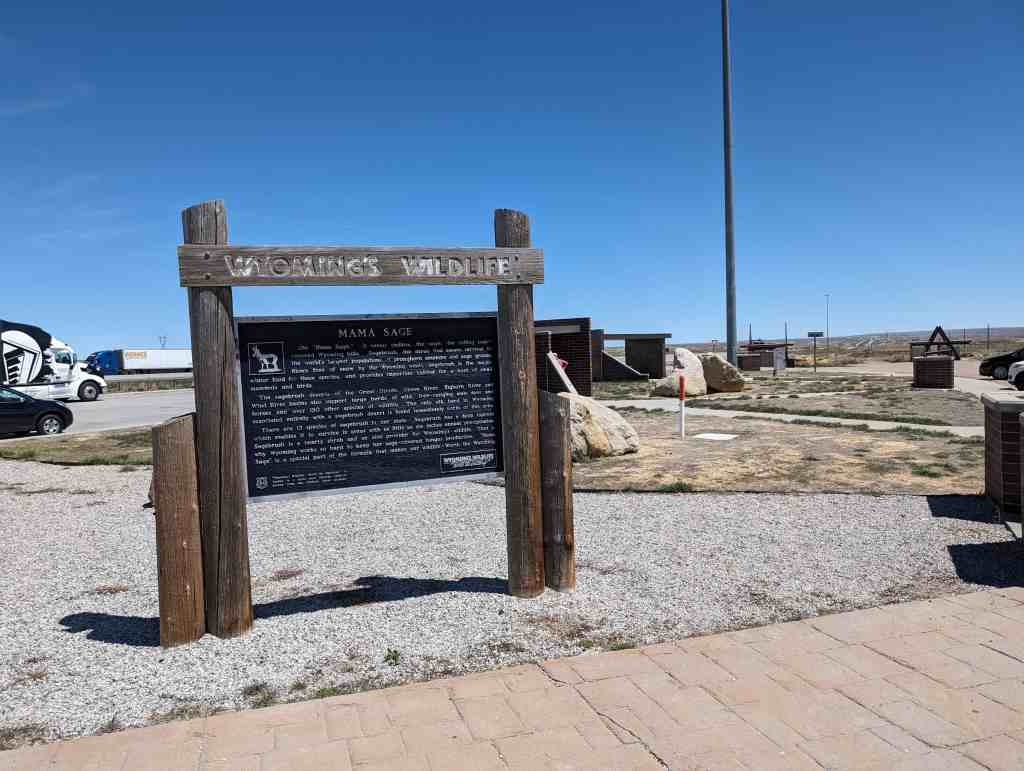
Mama Sage
Oh! “Mama Sage.” It seems endless, the sage; the rolling sage” covered Wyoming hills. Sagebrush, the shrub that means survival to the world’s largest populations of pronghorn antelope and sage grouse. Blown free of snow by the Wyoming winds, sagebrush is the major winter food for these species, and provides important habitat for a host of small mammals and birds.
The sagebrush deserts of the Great Divide, Green River, Bighorn River and Wind River basins also support large herds of wild, free-ranging mule deer and horses and over 150 other species of wildlife. The only elk herd in in Wyoming associated entirely with a sagebrush desert is found immediately north of this area.
There are 13 species of sagebrush in our state. Sagebrush has a deep taproot which enables it to survive in areas with as little as six inches annual precipitation. Sagebrush is a hearty shrub and an able provider for Wyoming’s wildlife. That is “Mama why Wyoming works so hard to keep her sage-covered ranges productive. Sage” is a special part of the formula that makes our wildlife Worth the Watching.
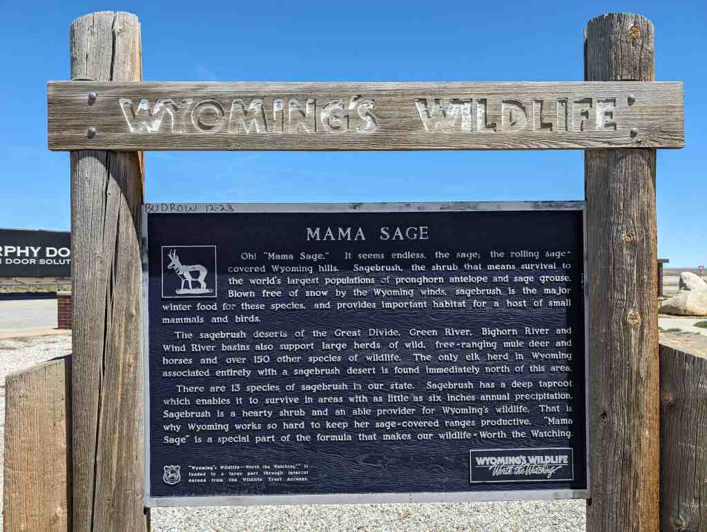
Located at the Bitter Creek Rest Stop on Interstate 80, Eastbound, east of Rock Springs, Wyoming.
25 Wednesday Dec 2024
Posted in Uncategorized
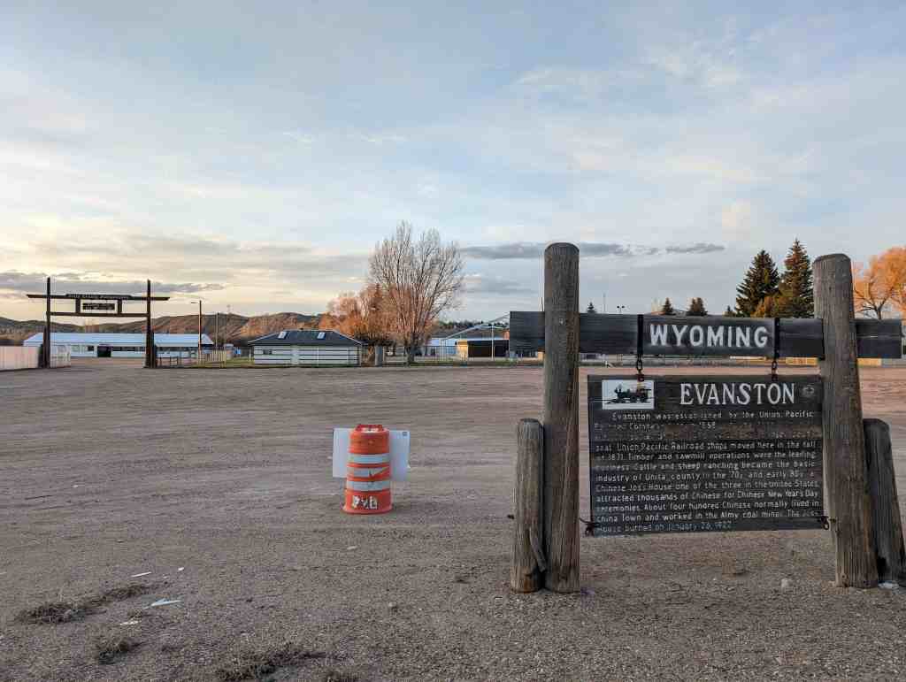
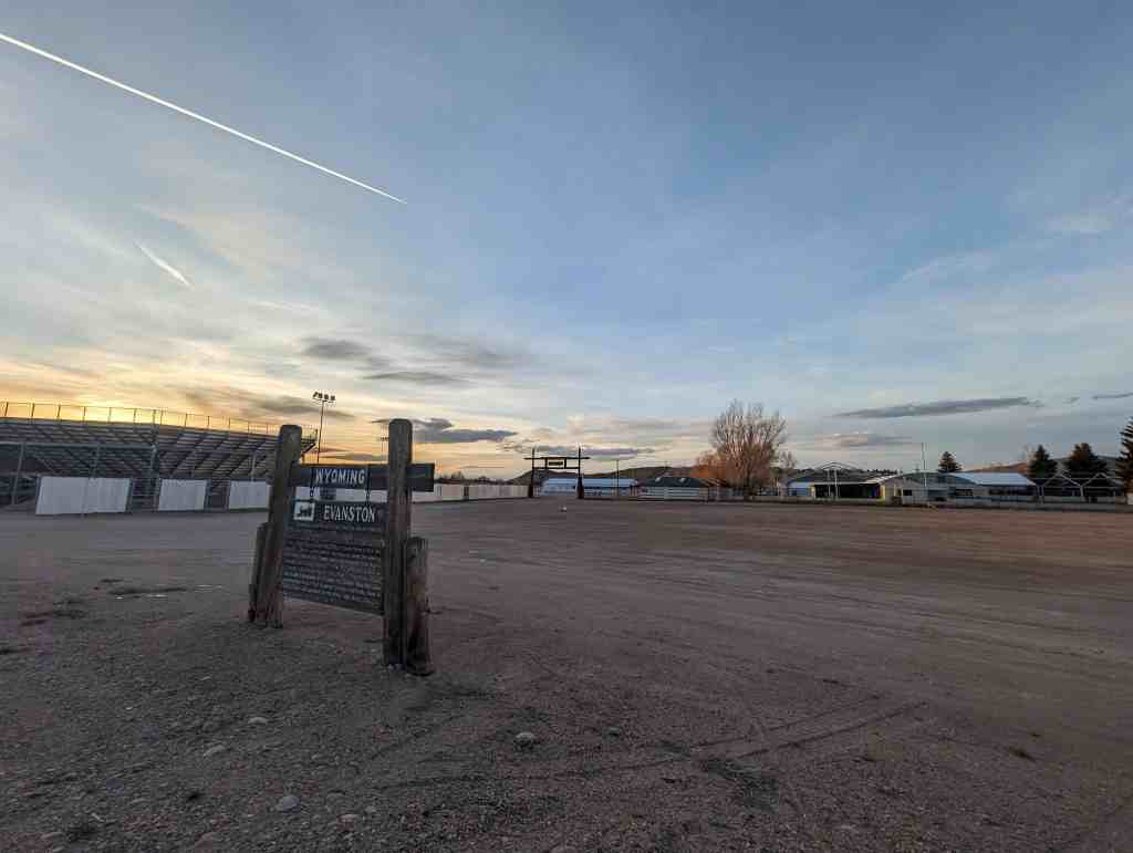
Evanston was established by the Union Pacific Railroad Company late in 1868. In the first county election, September 6, 1870, Evanston was chosen county seat. Union Pacific Railroad shops moved here in the fall of 1871. Timber and sawmill operations were the leading business. Cattle and sheep ranching became the basic industry of Unita county. In the ’70s and early ’80s, a Chinese Joss House, one of the three in the United States, attracted thousands of Chinese for Chinese New Year’s Day ceremonies. About four hundred Chinese normally lived in China Town and worked in the Almy coal mines. The Joss House burned on January 26, 1922.
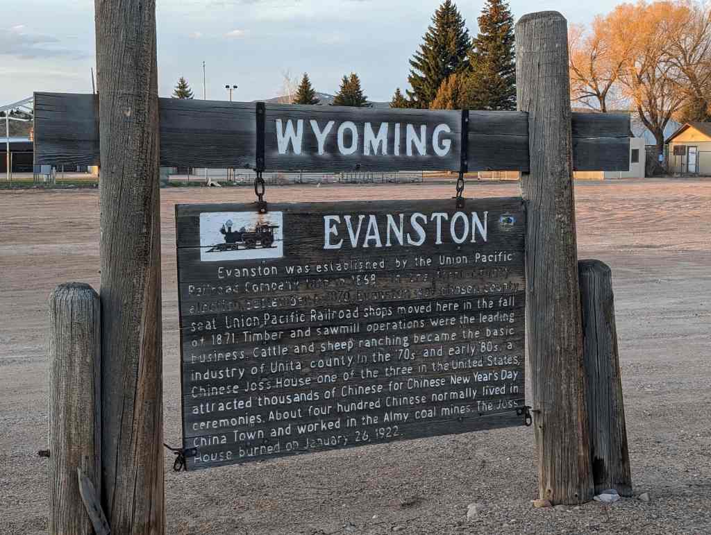
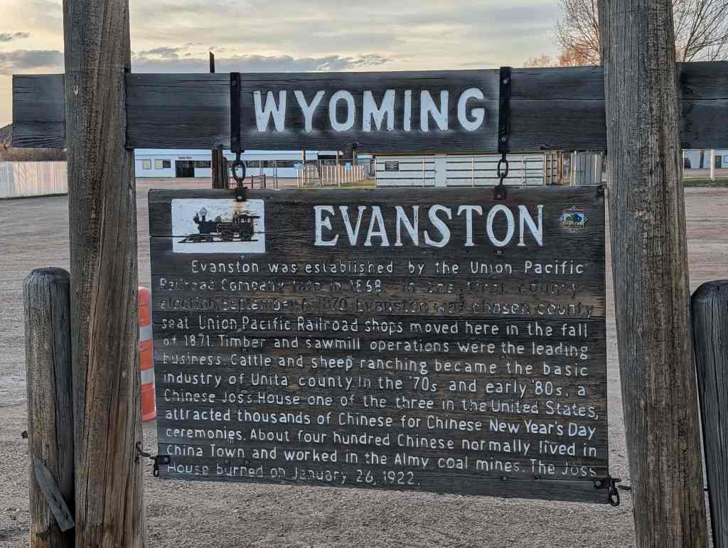
Located at Evanston, Wyoming.
13 Wednesday Jul 2022
Posted in Uncategorized

1825 Rocky Mountain Rendezvous
“When all had come in, he (Ashley) opened his goods, and there was a general jubilee…. We constituted quite a little town, numbering at least eight hundred souls, …half were women and children. There were some…who had not seen any groceries, such as coffee, sugar, etc, for several months. The whiskey went off as freely as water, even at the exorbitant price he sold it for. All kinds of sports were indulged in with a heartiness that would astonish more civilized societies.”
Taken from, The Life and Adventures of James P. Beckwourth, as told to Thomas D. Bonner, this passage describes a raucus social event; the rendezvous. Here, mountain men swapped stories, tested their skills, and shared news of friends. The annual event was actually begun as a time saving measure whereby trappers could replenish supplies and trade furs, without traveling to St. Louis each summer. North of this point on Henrys Fork of the Green River, between Birch and Burnt Fork Creeks, the first Rocky Mountain Rendezvous was held during June and July, 1825. Held under the direction of William Ashley the gathering was planned for the Green River, but was moved up Henrys Fork because that site provided better forage for animals. One-hundred twenty trappers gathered to barter their furs at Burnt Fork. Among those assembled were some of the industry’s most colorful characters: General Ashley, Jedediah Smith, Bill Sublette, Davey Jackson, Tom Fitzpatrick, Etienne Provost, James Beckwourth and a still green Jim Bridger. On July 2, 1825, Ashley and his men headed for St. Louis with a load of furs worth $50,000.
Held annually throughout the region until 1840, when the demand for beaver pelts decreased, the rendezvous is remembered as one of the western frontiers most colorful traditions. Modern day mountain men still reenact these 19th century “fur fairs”.

30 Friday Mar 2018
Posted in Uncategorized

The Mormon Wall
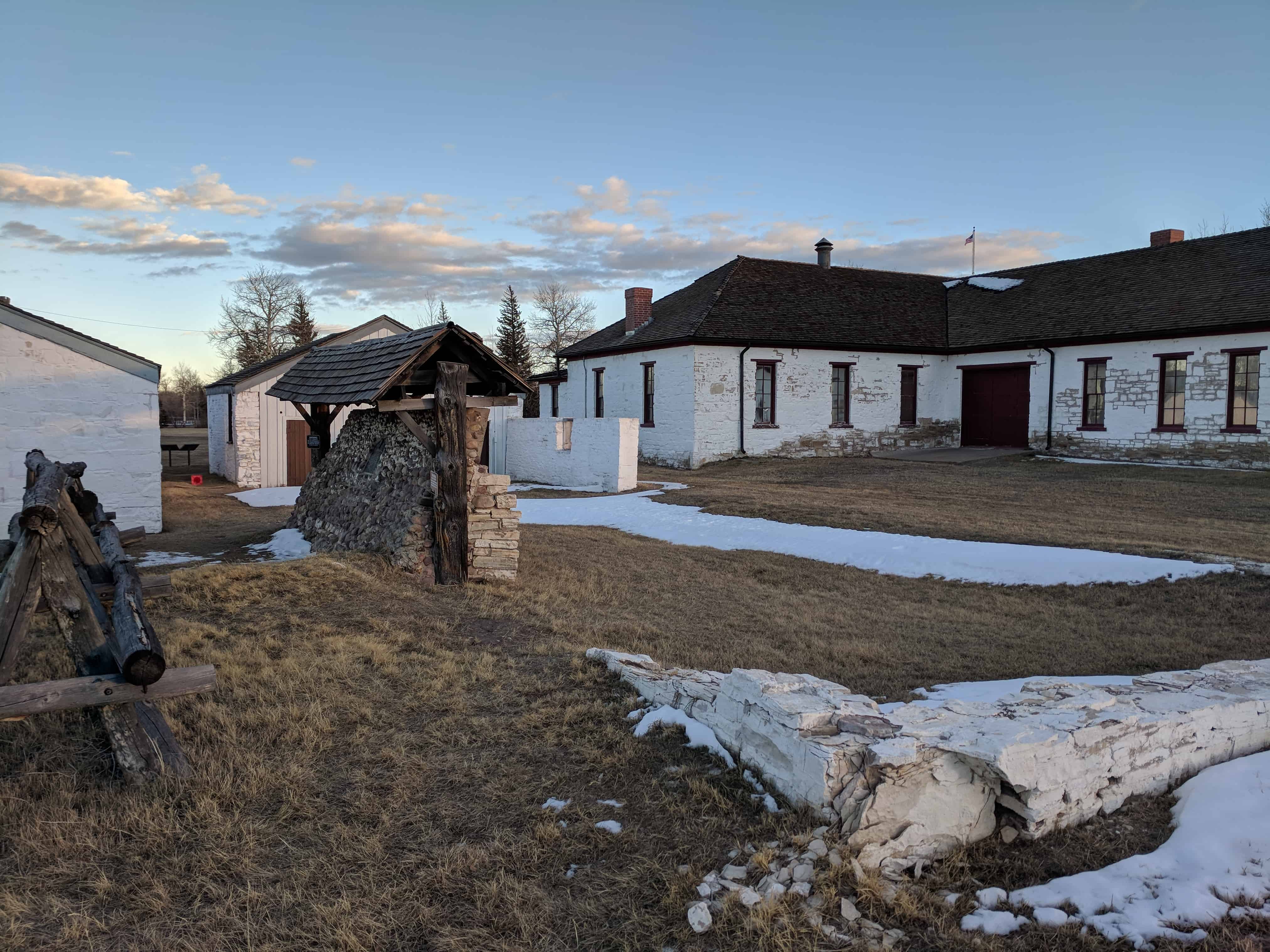
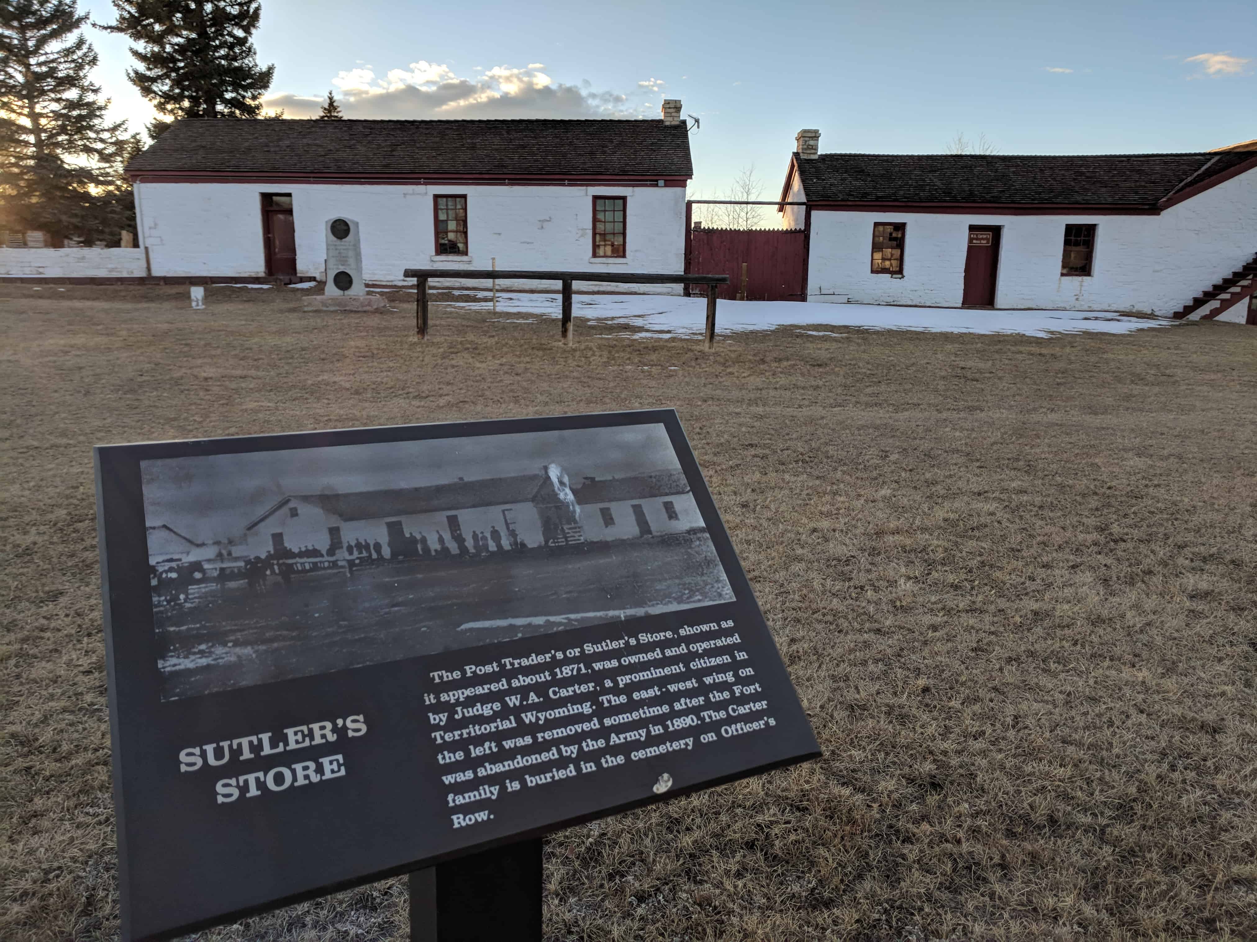
On August 3, 1855, the Church of Jesus Christ of Latter-day Saints, concluded arrangements for the purchase of Fort Bridger from Louis Vasquez, partner of James Bridger, for $8,000. Final payment was made October 18, 1858. A cobblestone wall was erected in the fall of 1855, replacing Bridger’s Stockade. A few additional log houses were built within the fort. The place was evacuated and burned on the approach of Johnston’s Army September 27, 1857. A portion of the wall is here preserved. In 1855, Fort Supply was established by Brigham Young six miles south where crops were raised for the emigrants.
This is UPTLA Marker #25, located at Fort Bridger, for the rest of the series visit this page.


30 Friday Mar 2018
Posted in Uncategorized
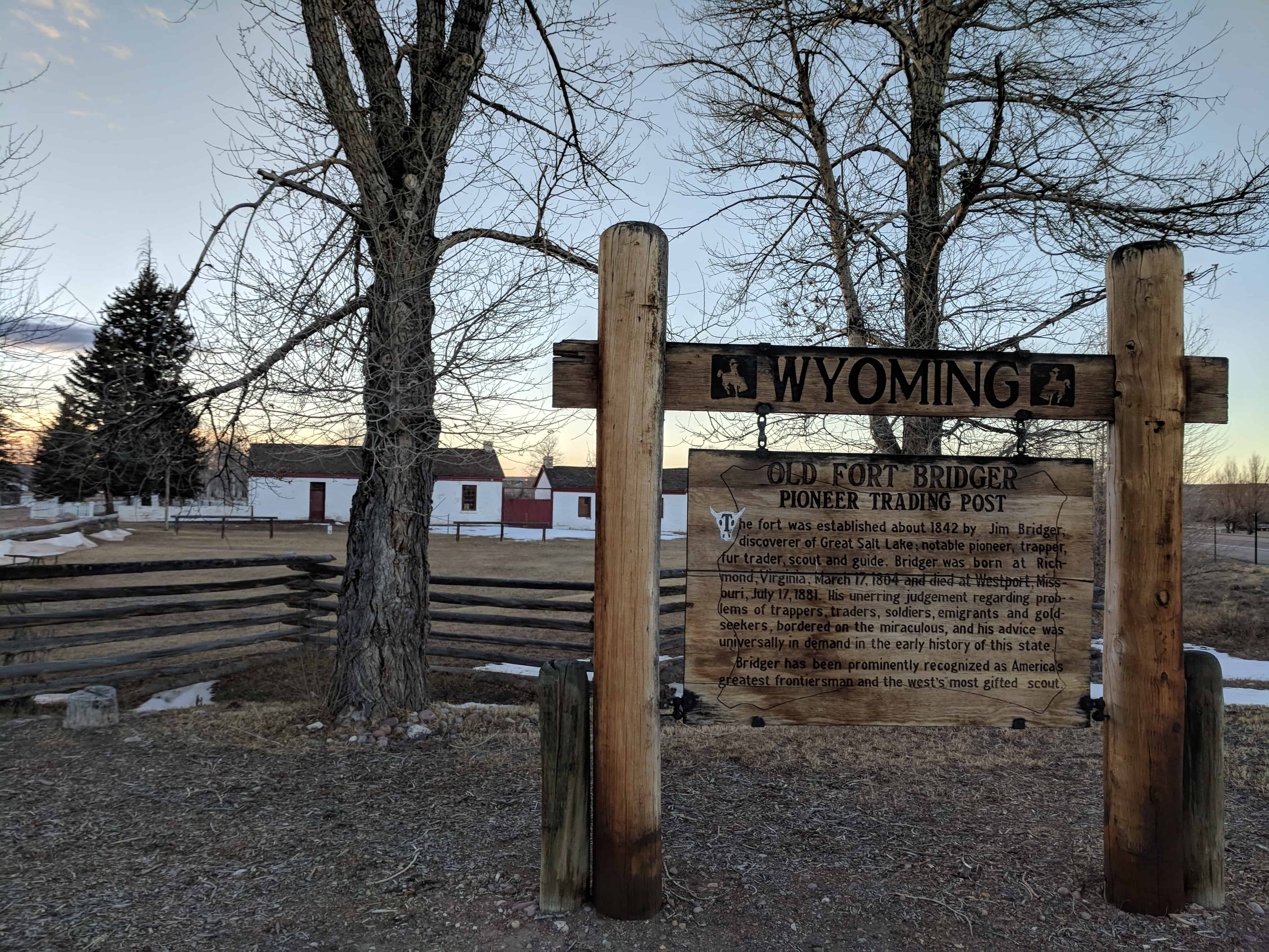
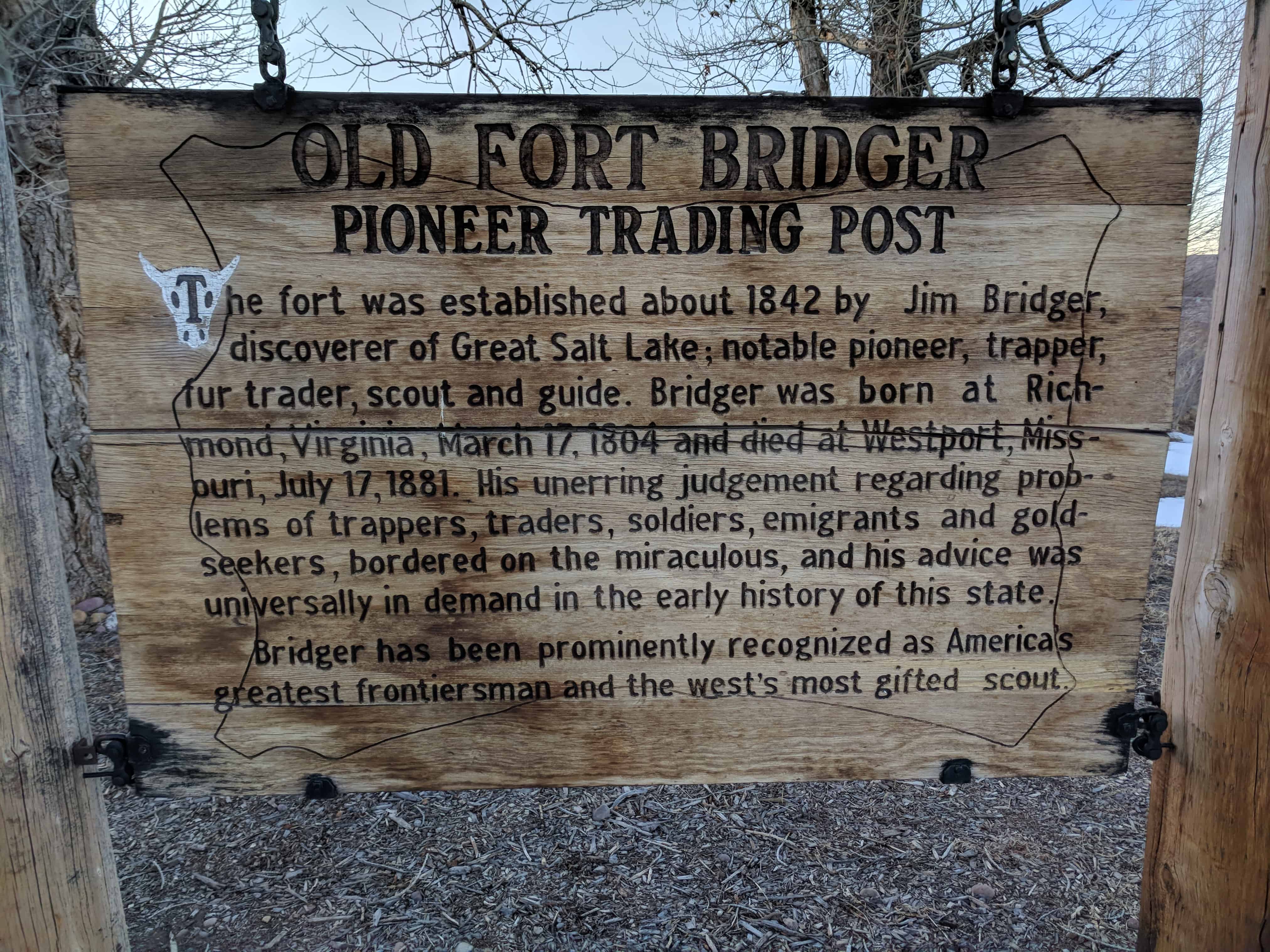
Old Fort Bridger Pioneer Trading Post
The fort was established about 1842 by Jim Bridger discoverer of Great Salt Lake; notable pioneer, trapper, fur trader, scout and guide. Bridger was born at Richmond, Virginia, March 17, 1804 and died at Westport, Missouri, July 17, 1881. His unerring judgement regarding problems of trappers, traders, soldiers, emigrants and gold-seekers, bordered on the miraculous, and his advice was universally in demand in the early history of this state.
Bridger has been prominently recognized as America’s greatest frontiersman and the west’s most gifted scouts.
30 Friday Mar 2018
Posted in Uncategorized

The First School House in Wyoming
In 1860 Judge Wm. A. Carter erected this school house for the education of his four daughters, two sons and other children of the fort. Competent instructors from the east were employed and the students of this school were permitted to enter Eastern colleges without further preparation. Thus the way was paved for future education in Wyoming.
This is D.U.P. Marker #52, located at Fort Bridger, see others in the series here.


30 Friday Mar 2018
Posted in Uncategorized
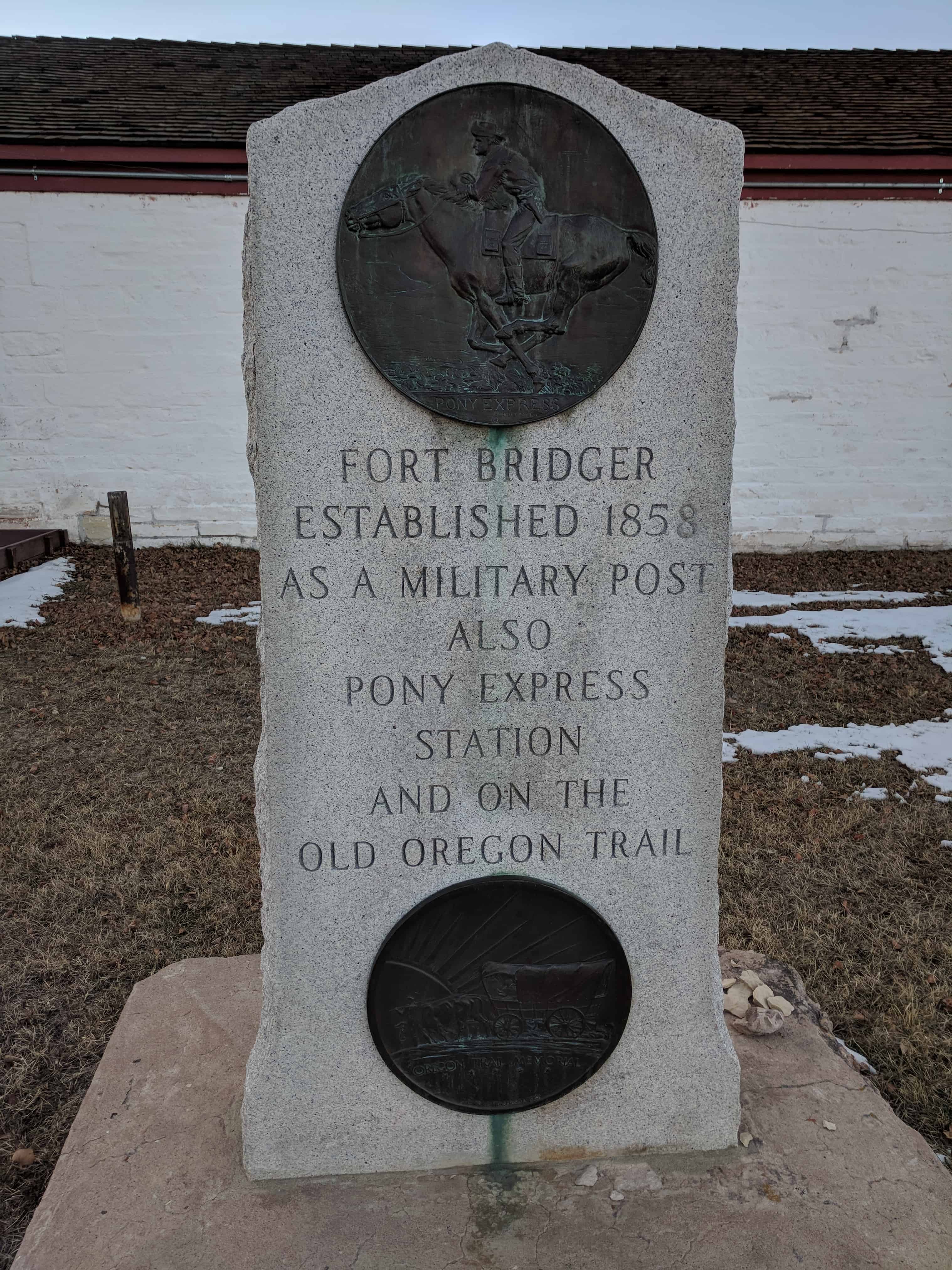
Fort Bridger Pony Express Station
Related Posts:

22 Thursday Mar 2018
Posted in Uncategorized
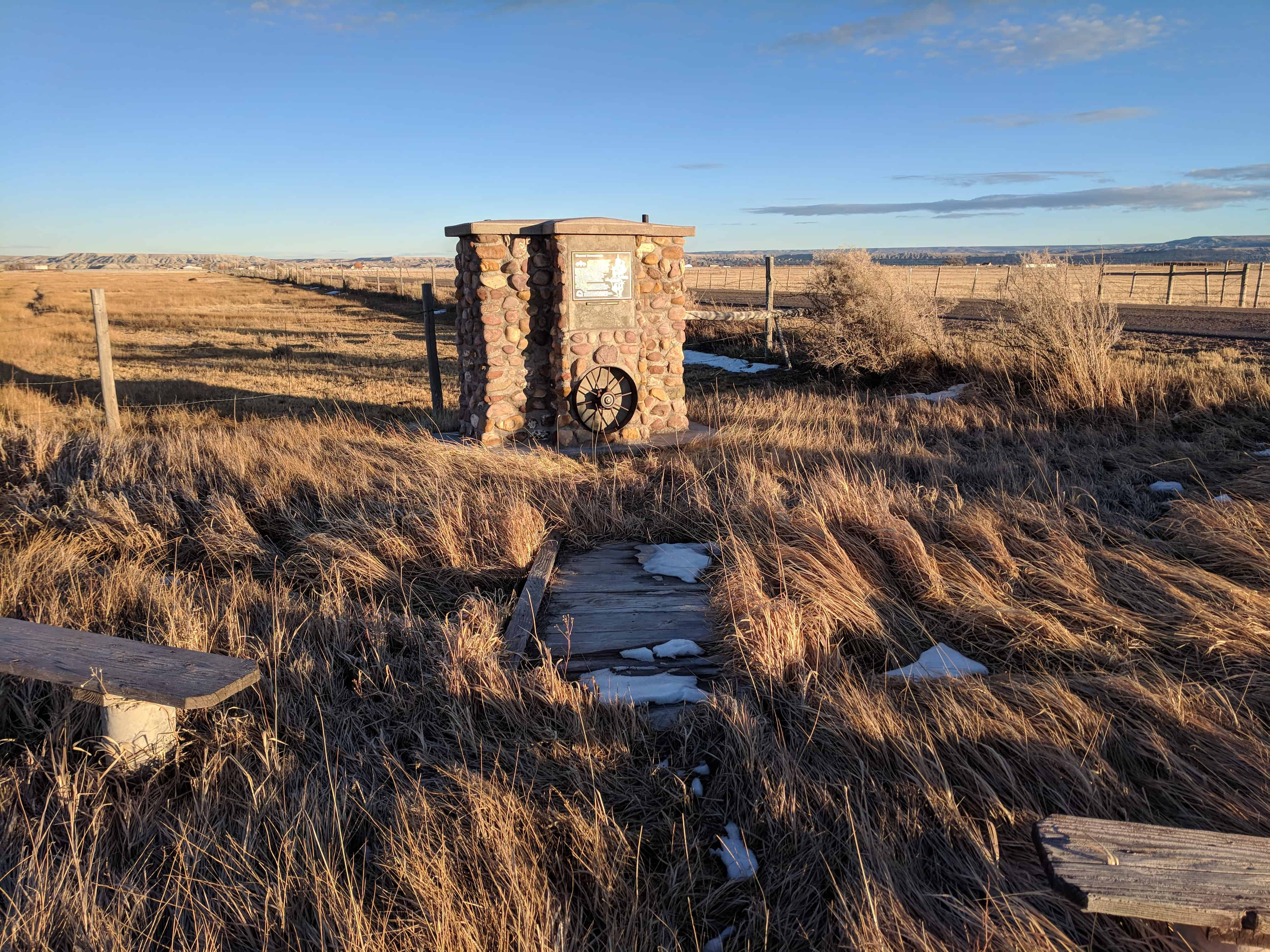
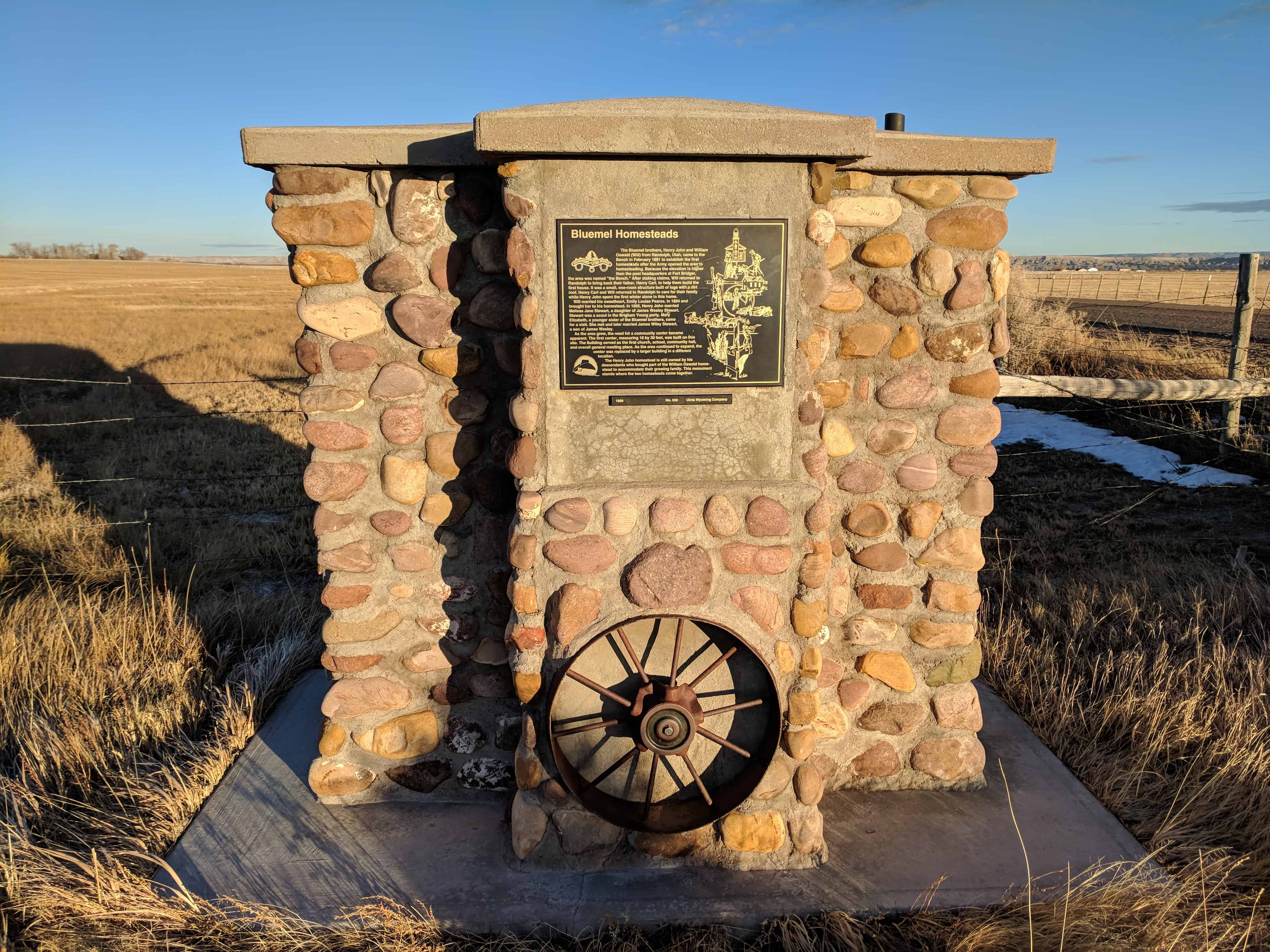
Bluemel Homesteads
The Bluemel brothers, Henry John and William Oswald (Will) from Randolph, Utah, came to the Bench in February 1891 to establish the first homesteads after the Army opened the area yo homesteading. Because the elevation is higher than the post headquarters at Fort Bridger, the area was named “The Bench.” After staking claims, Will returned to Randolph to bring back their father, Henry Carl, to help them build the first house. It was a small, one-room structure built of logs with a dirt roof. Henry Carl and Will returned to Randolph to care for their family while Henry John spent the first winter alone in this home.
Will married his sweetheart, Emily Louise Pearce, in 1894 and brought her to his homestead. In 1895, Henry John married Melissa Jane Stewart, a daughter of James Wesley Stewart. Stewart was a scout in the Brigham Young party. Mary Elizabeth, a young sister of the Bluemel brothers, came for a visit. She met and later married James Wiley Stewart, a son of James Wesley.
As the area grew, the need for a community center became apparent. The first center, measuring 18 by 30 feet, was build on this site. The building served as the first church, school, community hall, and overall general meeting place. As the area continued to expand, the center was replaced by a larger building in a different location.
The Henry John homestead is still owned by his descendants who bought part of the William Oswald homestead to accommodate their growing family. This monument stands where the two homesteads come together.
See other D.U.P. Historic Markers here.


22 Thursday Mar 2018
Posted in Uncategorized

Erected by the members of the Woodruff Stake in honor of the Mormon Pioneers who passed this point on Wednesday July 7, 1847 and in subsequent years.
This monument is at the Lyman Rest Area just off Interstate 80.
