• About JacobBarlow.com
  • Cemeteries in Utah
  • D.U.P. Markers
  • Doors
  • Exploring Utah Email List
  • External and Referral Links
  • Geocaching
  • Historic Marker Map
  • Movie/TV Show Filming Locations
  • Oldest in Utah
  • Other Travels
  • S.U.P. Markers
  • U.P.T.L.A. Markers
  • Utah Cities and Places.
  • Utah Homes for Sale
  • Utah Treasure Hunt

JacobBarlow.com

~ Exploring with Jacob Barlow

JacobBarlow.com

Tag Archives: Fort Bridger

Fort Bridger

30 Friday Mar 2018

Posted by Jacob Barlow in Uncategorized

≈ 2 Comments

Tags

Fort Bridger, Historic Buildings, Historic Markers, NRHP, Pony Express, Uintah County, Wyoming

2018-01-05 16.36.13

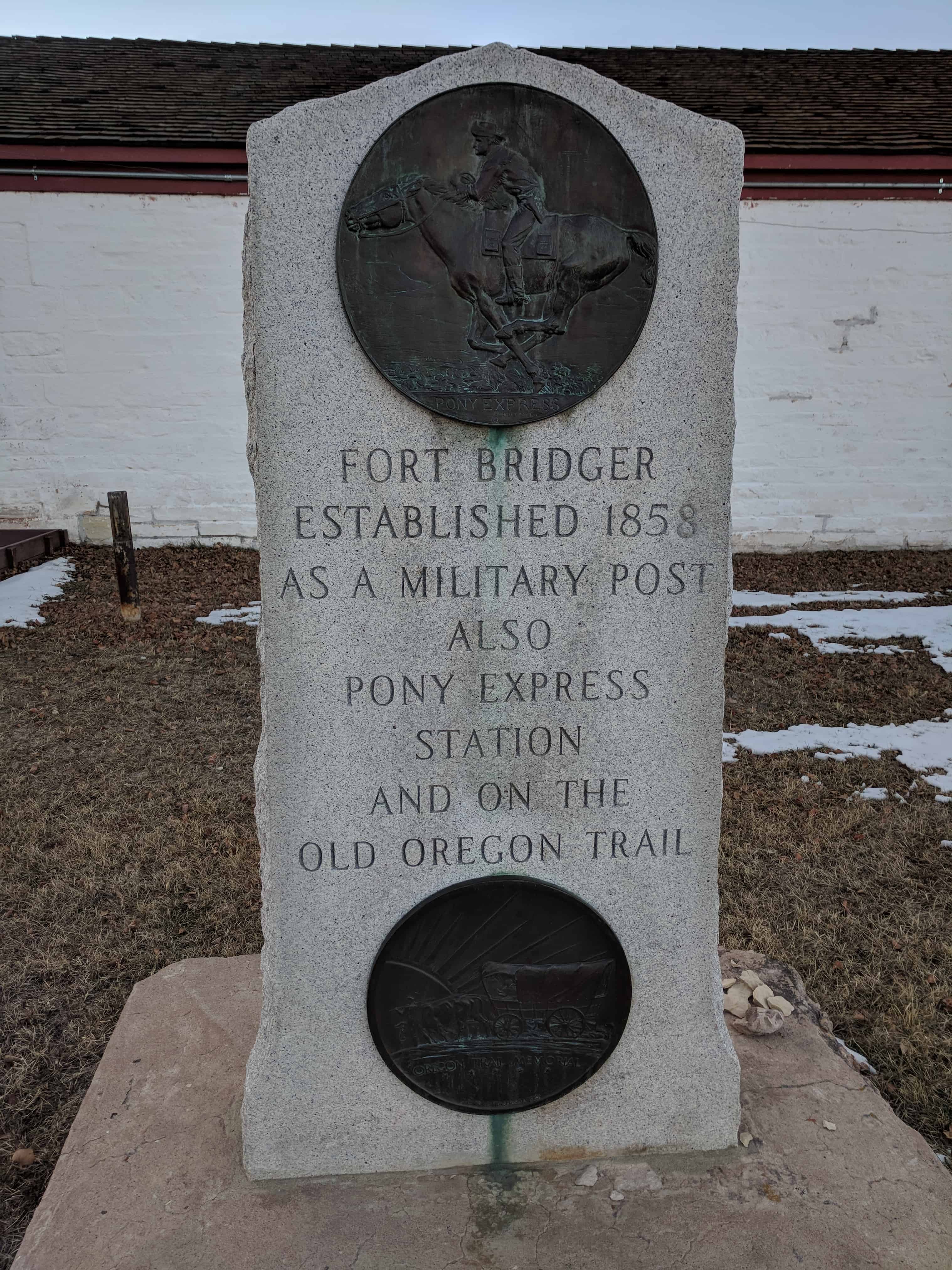
Fort Bridger, Wyoming was established in 1843 by Jim Bridger and Louis Vasquez. It served as a trading post for those who were traveling westward along the Oregon Trail, as well as LDS Pioneers, the Pony Express, the Lincoln Highway, and the transcontinental railroad. The fort was also commonly used to trade with the local Native Americans.

The fort was not very glamorous, it was even a disappointment to most travelers. It was simply two log cabins about 40 feet in length connected by a fence to hold horses. Most visitors complained about insufficient supplies and it being over priced. They did, however, have a blacksmith’s that many travelers took advantage of.

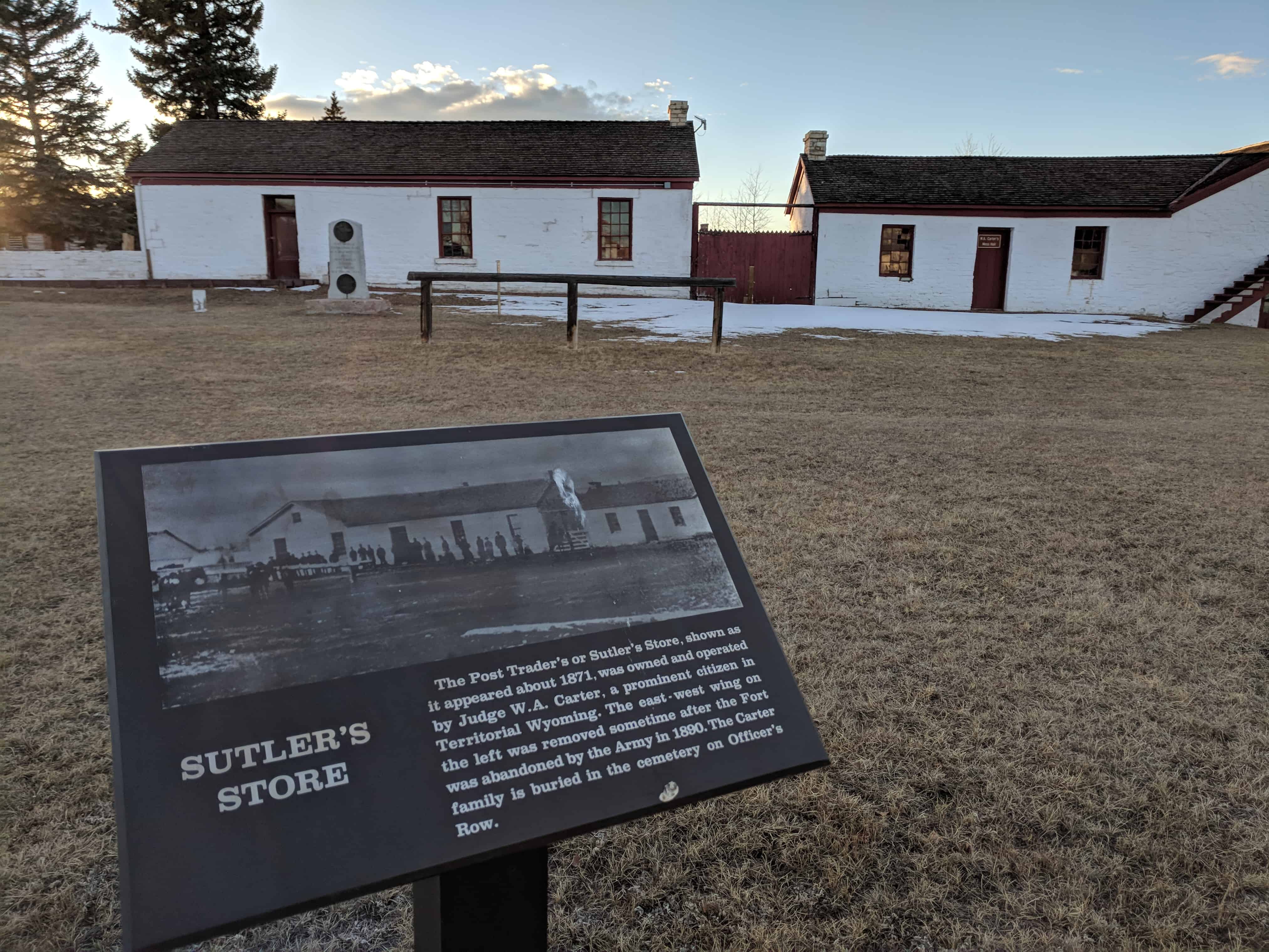
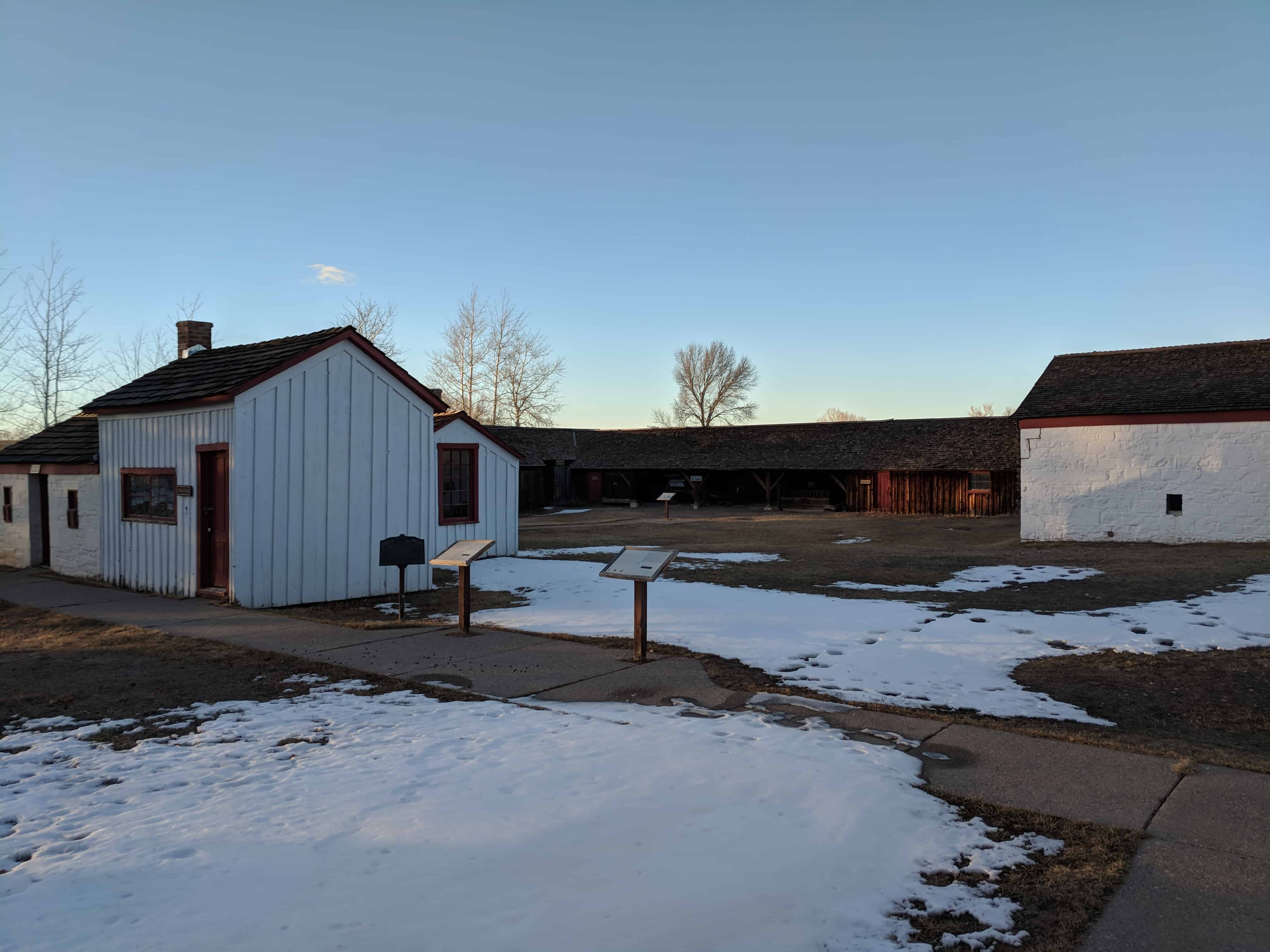
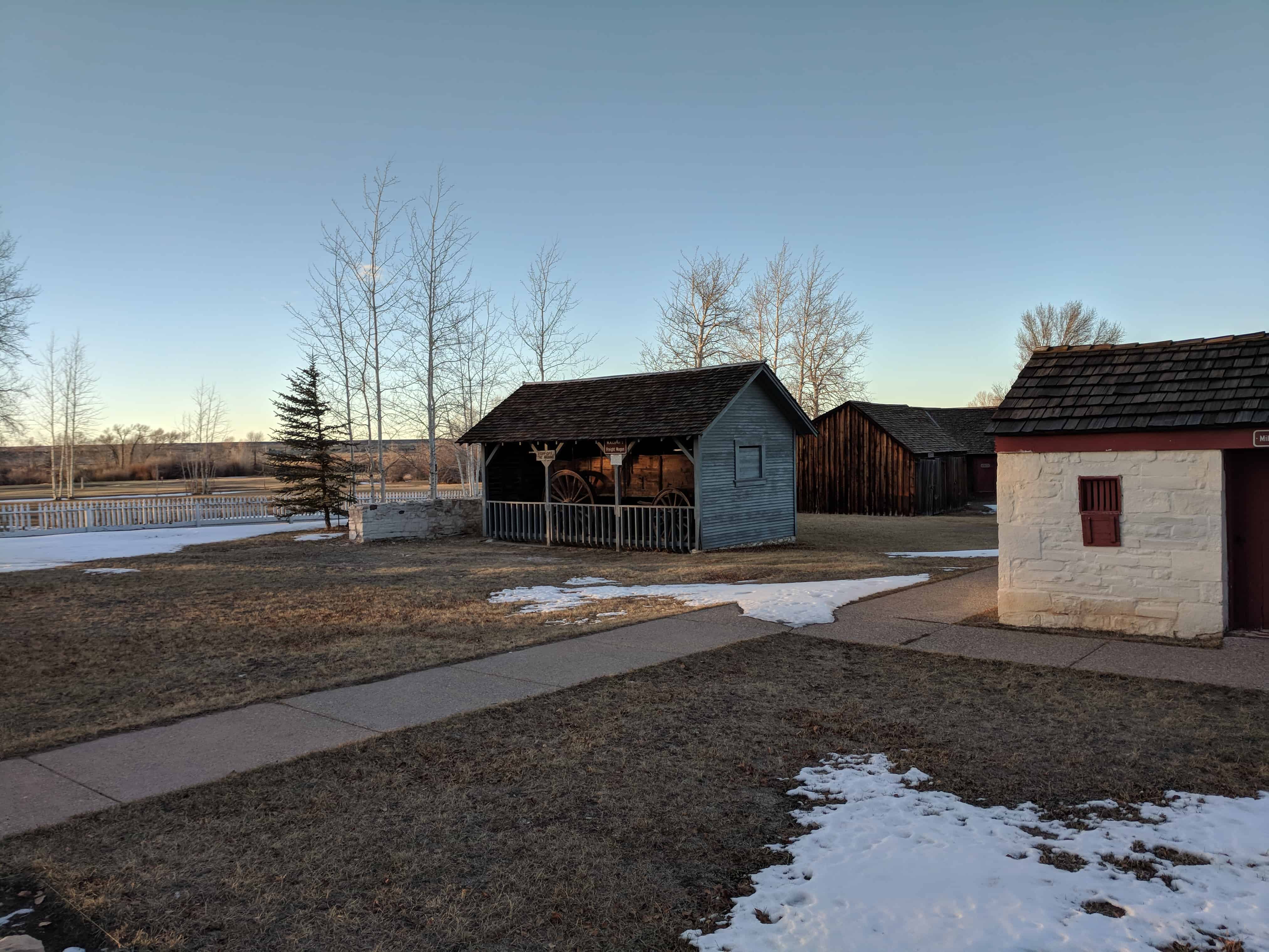
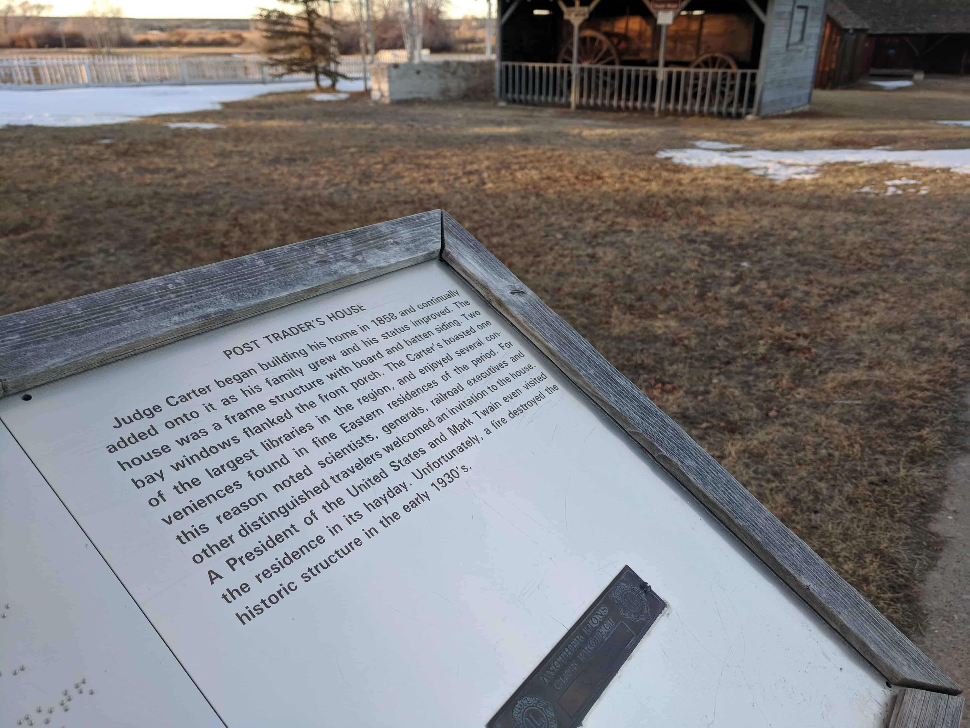
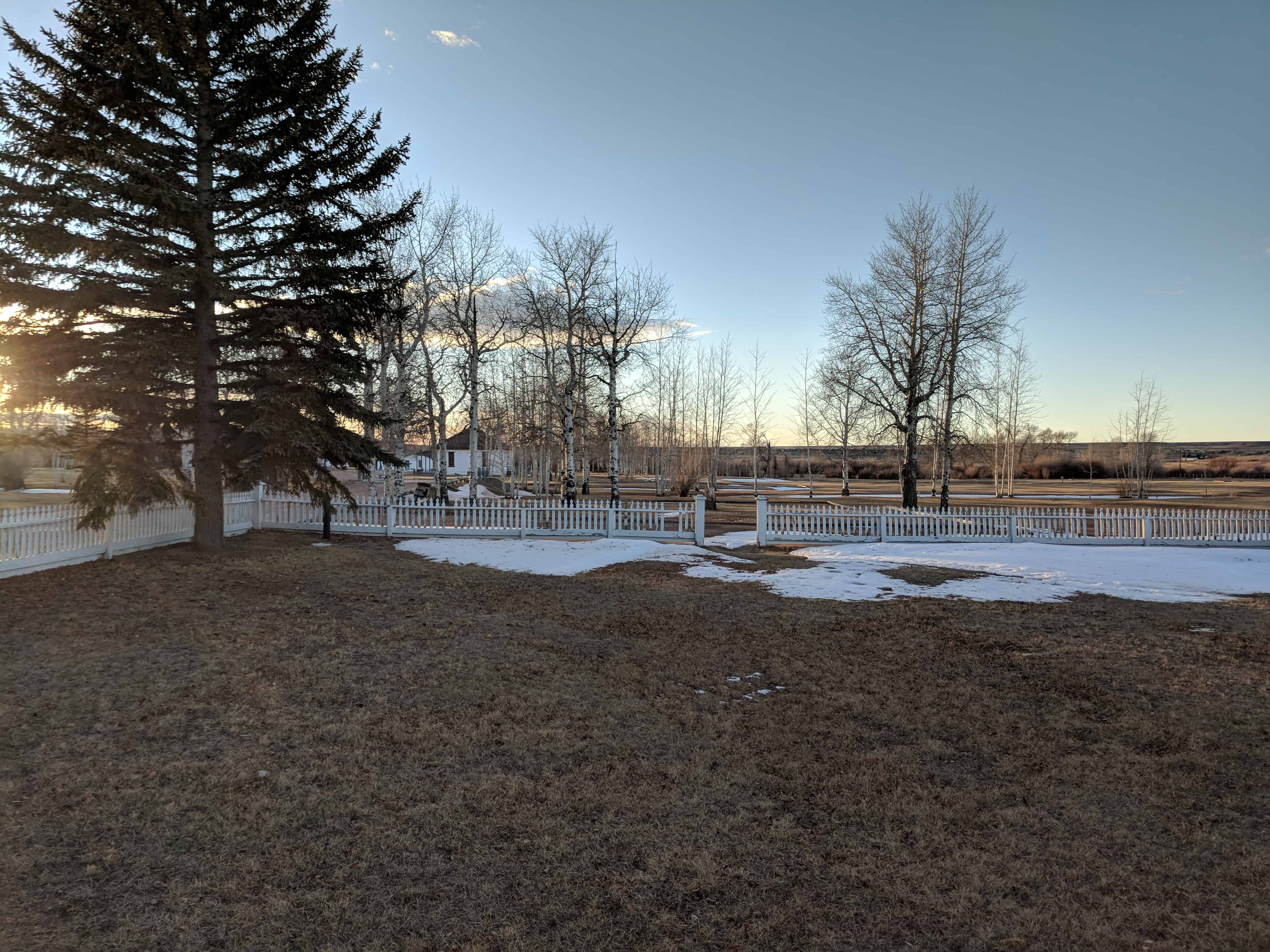
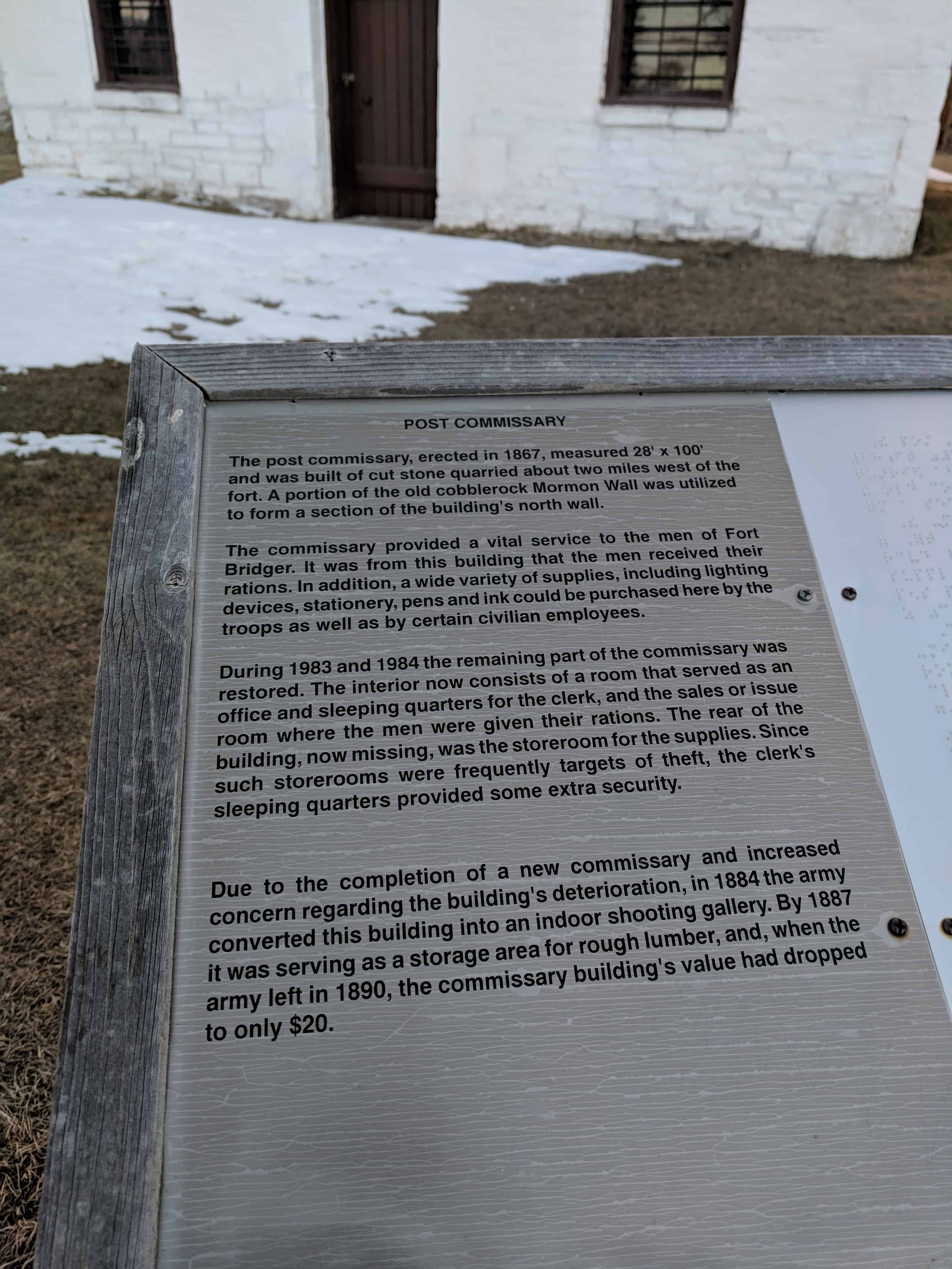
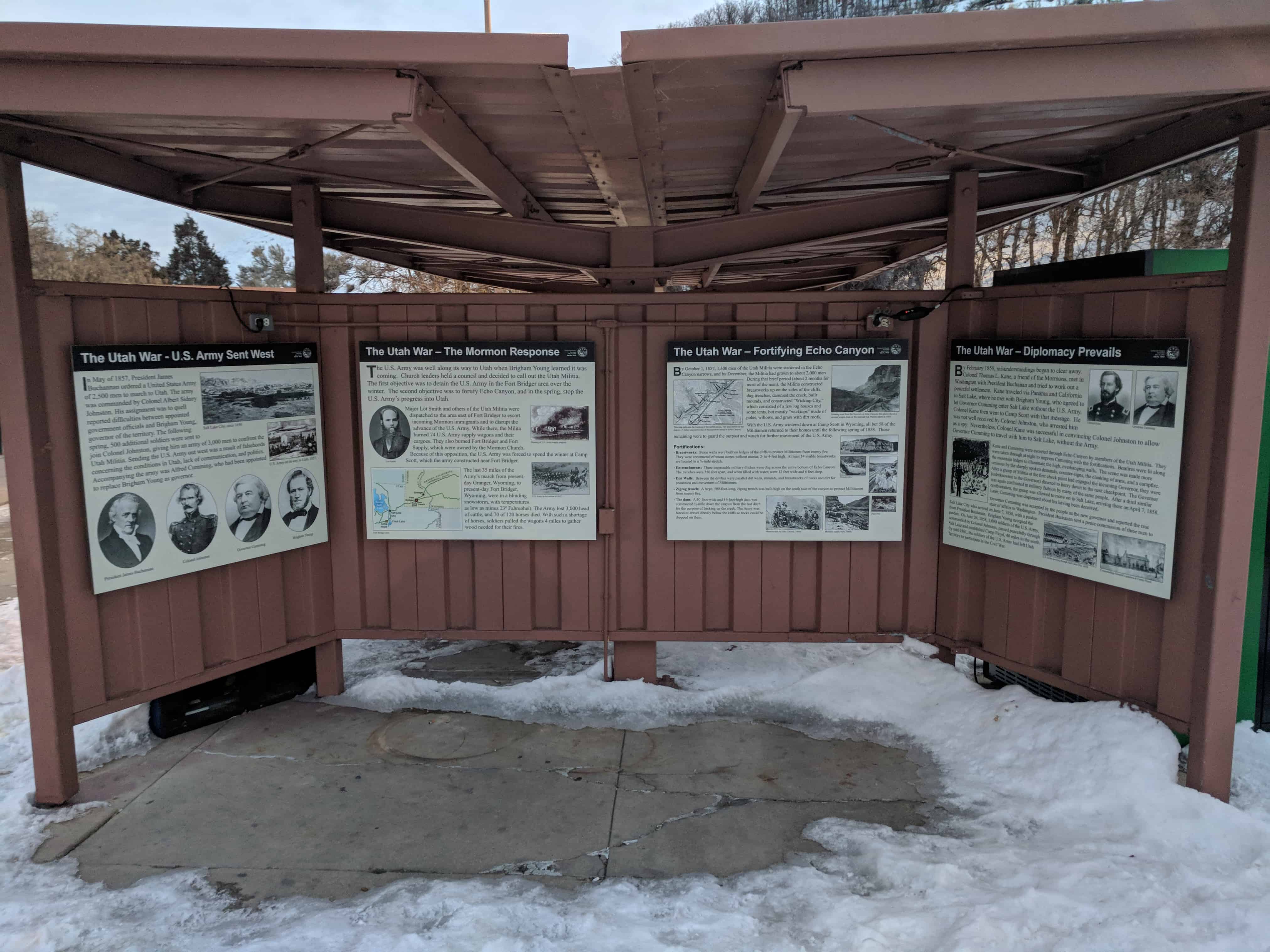
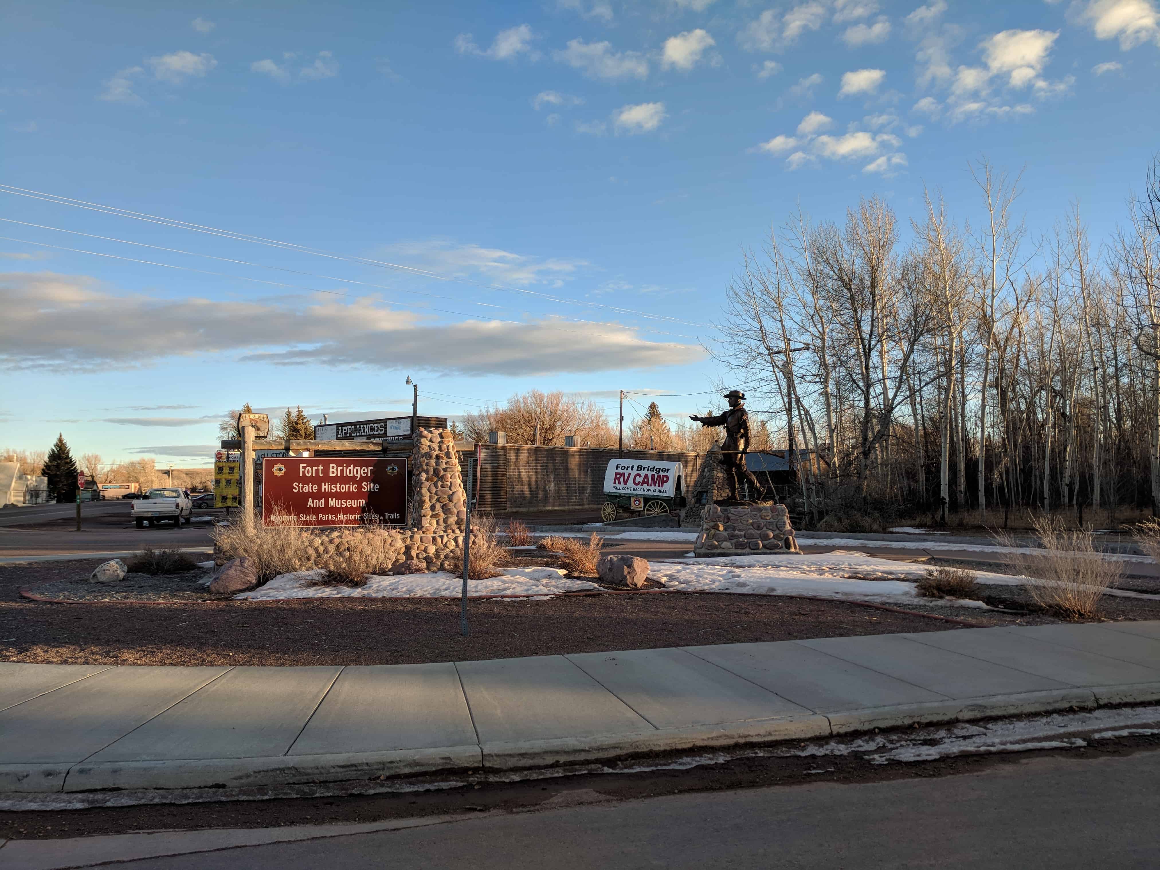
By 1858, Fort Bridger became a military outpost. Today, Fort Bridger is a historic site. Jim Bridger’s trading post is reconstructed, along with other historic buildings from the military. There is also a museum with gift shops available for visitors.

Related Posts:

  • First School House in Wyoming
  • Fort Bridger Obelisk
  • Fort Bridger Pony Express Station
  • Jim Bridger
  • Lincoln Highway – Black and Orange Cabins
  • The Mormon Wall
  • Old Fort Bridger Pioneer Trading Post
2018-01-05 16.37.08
2018-01-05 16.37.19
2018-01-05 16.37.30
2018-01-05 16.37.46
2018-01-05 16.37.54
2018-01-05 16.38.06
2018-01-05 16.38.10
2018-01-05 16.38.13
2018-01-05 16.38.17
2018-01-05 16.38.21
2018-01-05 16.38.28
2018-01-05 16.38.42
2018-01-05 16.38.37
2018-01-05 16.38.55
2018-01-05 16.39.05
2018-01-05 16.39.07
2018-01-05 16.39.14
2018-01-05 16.39.16
2018-01-05 16.40.07
2018-01-05 16.43.26
2018-01-05 16.43.31
2018-01-05 16.43.33
2018-01-05 16.43.36

The First School House in Wyoming

30 Friday Mar 2018

Posted by Jacob Barlow in Uncategorized

≈ Leave a comment

Tags

DUP, Fort Bridger, Historic Markers, Wyoming, Wyoming Historic Markers

2018-01-05 16.38.55

The First School House in Wyoming

In 1860 Judge Wm. A. Carter erected this school house for the education of his four daughters, two sons and other children of the fort. Competent instructors from the east were employed and the students of this school were permitted to enter Eastern colleges without further preparation. Thus the way was paved for future education in Wyoming.

This is D.U.P. Marker #52, located at Fort Bridger, see others in the series here.

2018-01-05 16.38.46

2018-01-05 16.38.50


Fort Bridger Pony Express Station

30 Friday Mar 2018

Posted by Jacob Barlow in Uncategorized

≈ Leave a comment

Tags

Fort Bridger, Pony Express, Uinta County, Wyoming, Wyoming Historic Markers

2018-01-05 16.37.14

Fort Bridger Pony Express Station

Related Posts:

  • First School House in Wyoming
  • Fort Bridger Obelisk
  • Fort Bridger Pony Express Station
  • Jim Bridger
  • Lincoln Highway – Black and Orange Cabins
  • The Mormon Wall
  • Old Fort Bridger Pioneer Trading Post
  • Pony Express Stations

2018-01-05 16.37.19

2018-01-05 16.37.30

Fort Bridger, Wyoming

30 Friday Mar 2018

Posted by Jacob Barlow in Uncategorized

≈ Leave a comment

Tags

Fort Bridger, Uintah County, Wyoming

2018-01-05 16.36.13


Fort Bridger is a census-designated place (CDP) in Uinta County, Wyoming. The population was 345 at the 2010 census. The town takes its name from the eponymous Fort Bridger established in 1842.

The Utah War – The Mormon Response

29 Monday Jan 2018

Posted by Jacob Barlow in Uncategorized

≈ Leave a comment

Tags

Echo Canyon, Fort Bridger, Fort Supply, Forts, Historic Markers, summit county, SUP, The Utah War, utah, Utah Militia, War

2018-01-05 07.37.33

The Utah War – The Mormon Response

The U.S. Army was well along its way to Utah when Brigham Young learned it was coming. Church leaders held a council and decided to call out the Utah Militia. The first objective was to detain the U.S. Army in the Fort Bridger area over the winter. The second objective was to fortify Echo Canyon, and in the spring, stop the U.S. Army’s progress into Utah.

Major Lot Smith and others of the Utah Militia were dispatched to the area east of Fort Bridger to escort incoming Mormon immigrants and to disrupt the advance of the U.S. Army. While there, the Militia burned 74 U.S. Army supply wagons and their cargoes. They also burned Fort Bridger and Fort Supply, which were owned by the Mormon Church. Because of this opposition, the U.S. Army was forced to spend the winter at Camp Scott, which the army constructed near Fort Bridger.

The last 35 miles of the Army’s march from present- day Granger, Wyoming, to present-day Fort Bridger, Wyoming, were in a blinding snowstorm, with temperatures as low as minus 23° Fahrenheit. The Army lost 3,000 head of cattle, and 70 of 120 horses died. With such a shortage of horses, soldiers pulled the wagons 4 miles to gather wood needed for their fires.

This is part of a cluster of S.U.P. Historic Markers, #185-A, 185-B, 185-C, 185-D located at the eastbound rest stop in I-80 in Echo Canyon.   For other S.U.P. Historic Markers see this page.

2018-01-05 07.37.45

2018-01-05 07.39.48

Fort Bridger Obelisk

23 Friday Sep 2016

Posted by Jacob Barlow in Uncategorized

≈ 2 Comments

Tags

Fort Bridger, historic, Uinta County, Wyoming

69d3fa23-be40-460c-9c8c-7302cbd8aeec

An Obelisk Monument at Fort Bridger, Wyoming with a historic plaque that reads:

Fort Bridger – Established as a Trading Post in 1843, U.S. Military Post on the Overland Trail – June 10, 1858 to October 6, 1890.

This monument erected by a few interested residents of the Community in the year 1914.

2018-01-05 16.47.13

2018-01-05 16.47.00
2018-01-05 16.46.57
2018-01-05 16.46.52

e2d266fe-7cce-408d-ac43-392315f353c5
ee4ffd48-670c-4064-9a82-9a05398a18f4

Follow Jacob

Follow Jacob

Social and Other Links

BarlowLinks.com

Blog Stats

  • 595,718 hits

Recent Posts

  • Fort Thornburgh
  • How Far Would You Carry a Brick for Seven Cents
  • 737 N 970 W
  • Grantsville Branch Chapel
  • Grantsville First Ward Chapel

Archives


Loading Comments...