
Dedicated to those who lost their lives in the mines of Sweetwater County


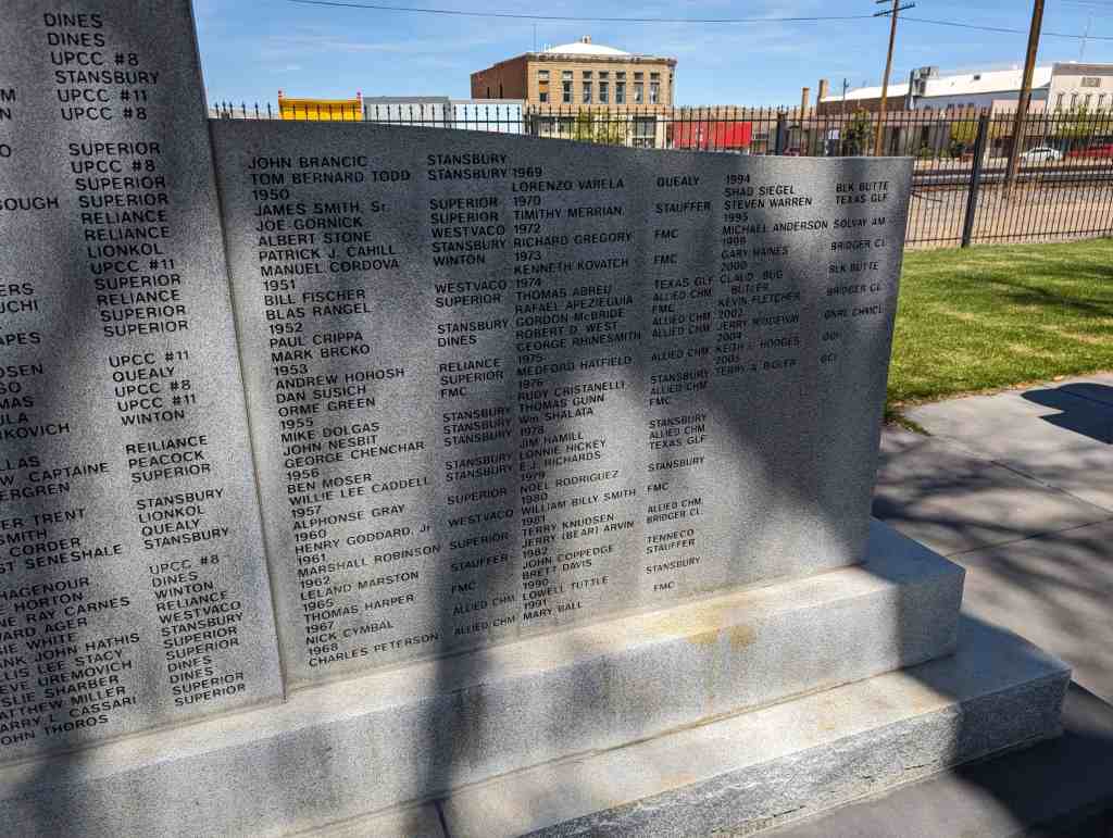
Located in Railroad Park in Rock Springs, Wyoming.

29 Sunday Dec 2024
Posted in Uncategorized
Dedicated to those who lost their lives in the mines of Sweetwater County
Located in Railroad Park in Rock Springs, Wyoming.
28 Saturday Sep 2024
Posted in Uncategorized

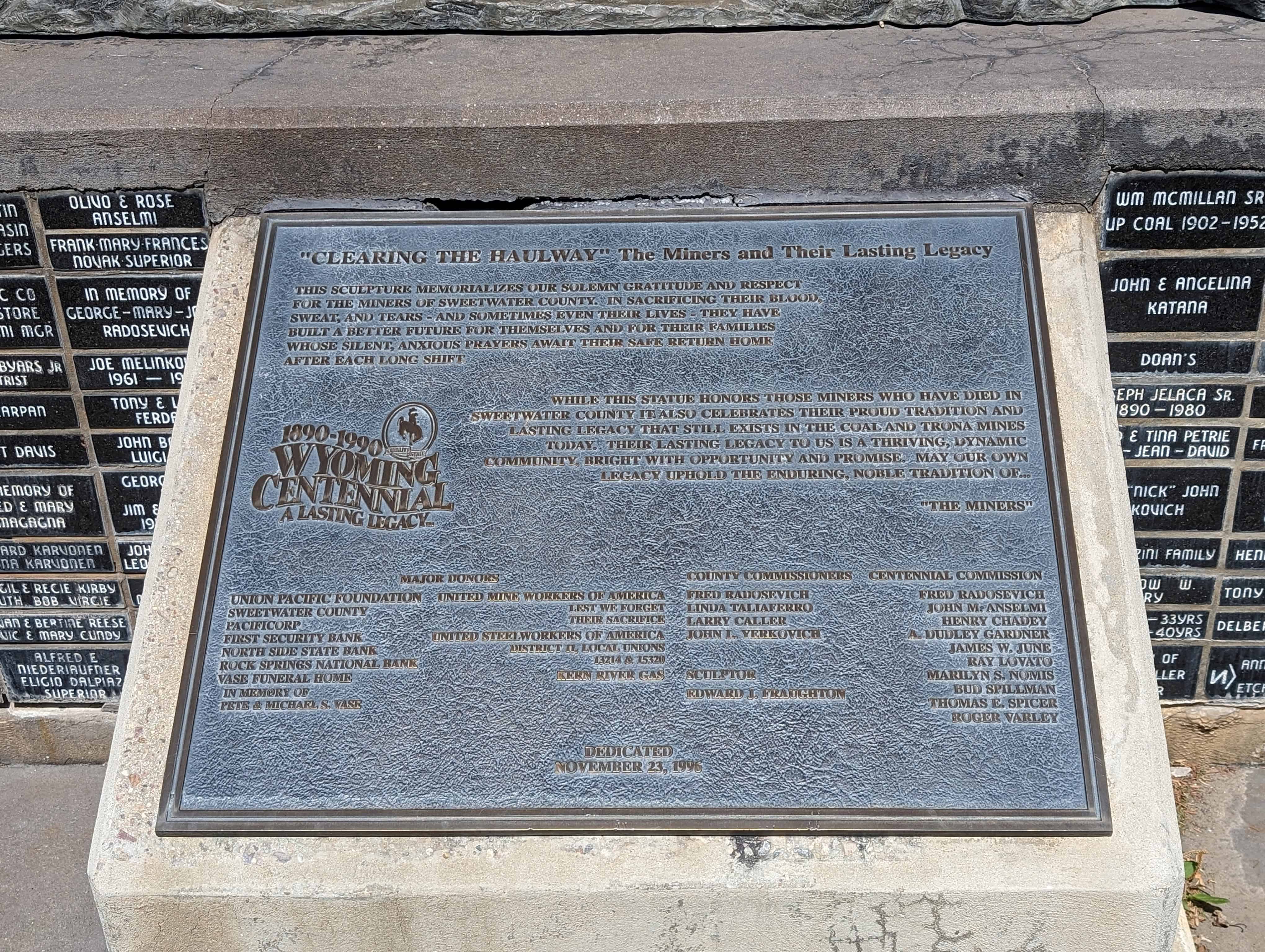
“Clearing the Haulway” The Miners and Their Lasting Legacy
This sculpture memorializes our solemn gratitude and respect for the miners of Sweetwater County. In sacrificing their blood, sweat, and tears – and sometimes even their lives – they have built a better future for themselves and for their families whose silent, anxious prayers await their safe return home after each long shift.
While this statue honors those miners who have died in Sweetwater County it also celebrates their proud tradition and lasting legacy that still exists in the coal and trona mines today. Their lasting legacy to us is a thriving, dynamic community, bright with opportunity and promise. May our own legacy uphold the enduring, noble tradition of… “The Miners.”
Located in Railroad Park in Rock Springs, Wyoming.

20 Tuesday Aug 2024
Posted in Uncategorized
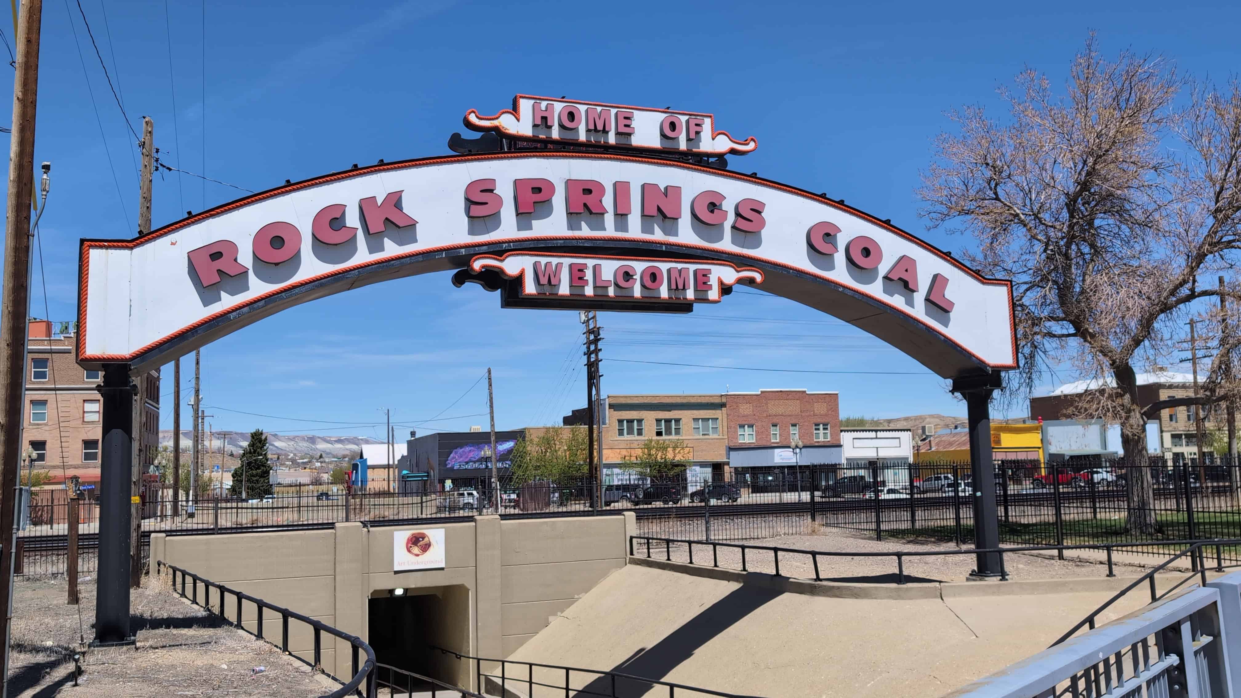
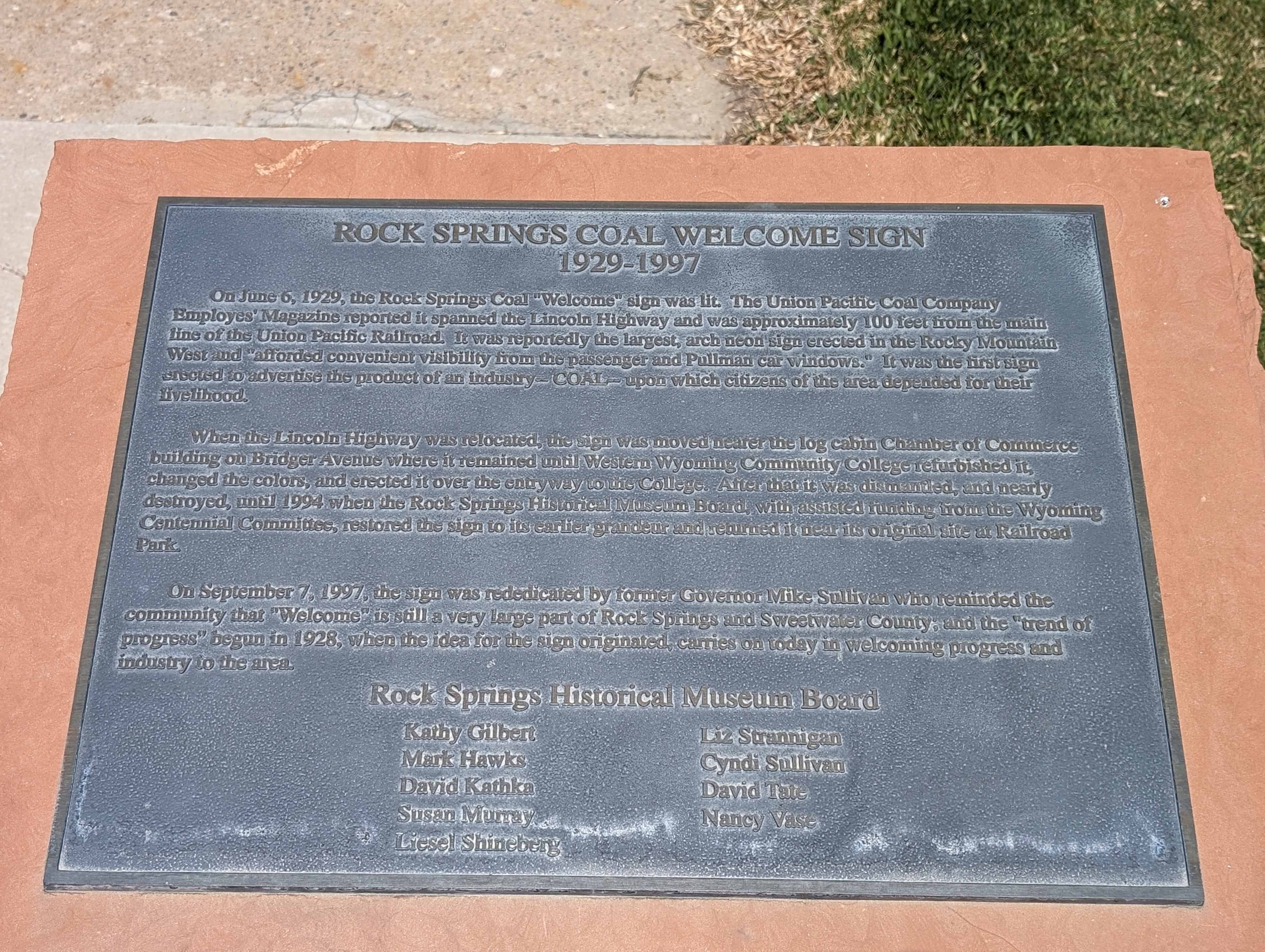
Rock Springs Coal Welcome Sign
1929-1997
On June 6, 1929, the Rock Springs Coal “Welcome” sign was lit. The Union Pacific Coal Company Employees’ Magazine reported it spanned the Lincoln Highway and was approximately 100 feet from the main line of the Union Pacific Railroad. It was reportedly the largest, arch neon sign erected in the Rocky Mountain West and “afforded convenient visibility from the passenger and Pullman car windows.” It was the first sign erected to advertise the product of an industry – COAL – upon which citizens of the area depended for their livelihood.
When the Lincoln Highway was relocated, the sign was moved nearer the log cabin Chamber of Commerce building on Bridger Avenue where it remained until Western Wyoming Community College refurbished it, changed the colors, and erected it over the entryway to the College. After that it was dismantled, and nearly destroyed, until 1994 when the Rock Springs Historical Museum Board, with assisted funding from the Wyoming Centennial Committee, restored the sign to its earlier grandeur and returned it near its original site at Railroad Park.
On September 7, 1997, the sign was rededicated by former Governor Mike Sullivan who reminded the community that “Welcome” is still a very large part of Rock Springs and Sweetwater County; and the “trend of progress” begun in 1928, when the idea for the sign originated, carries on today in welcoming progress and industry to the area.

The sign is located at Main Street and C Street in Rock Springs, Wyoming.
21 Wednesday Mar 2018
Posted in Uncategorized

Continuing the Journey West
Just a few miles from where you’re standing, the emigrants would come to the first of several trail “splits” that would take them to a crossing on the Green River where they would camp for the evening.
Even with South Pass behind them, Oregon or California-bound travelers still faced more than half their journey and the roughest traveling portion of the trail. Emigrants headed to Utah were slightly better off as they were less than a month away from journey’s end.
As you continue your journey, think about the courage of the people who passed through this country and settled half our nation.


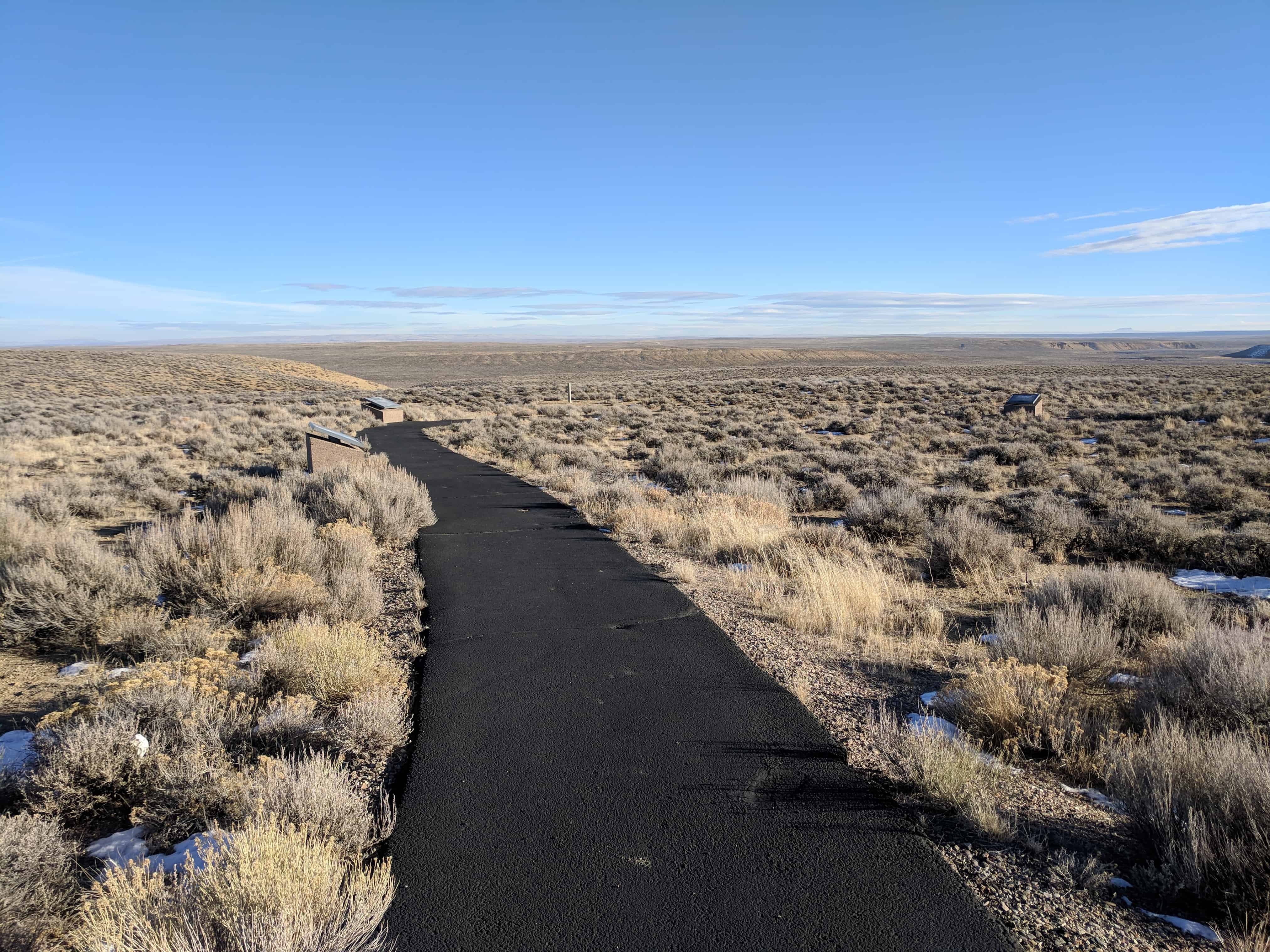
This historic marker is located on a walking path loop on Highway 28 just west of Farson, stopping here you can see all these markers:
21 Wednesday Mar 2018
Posted in Uncategorized
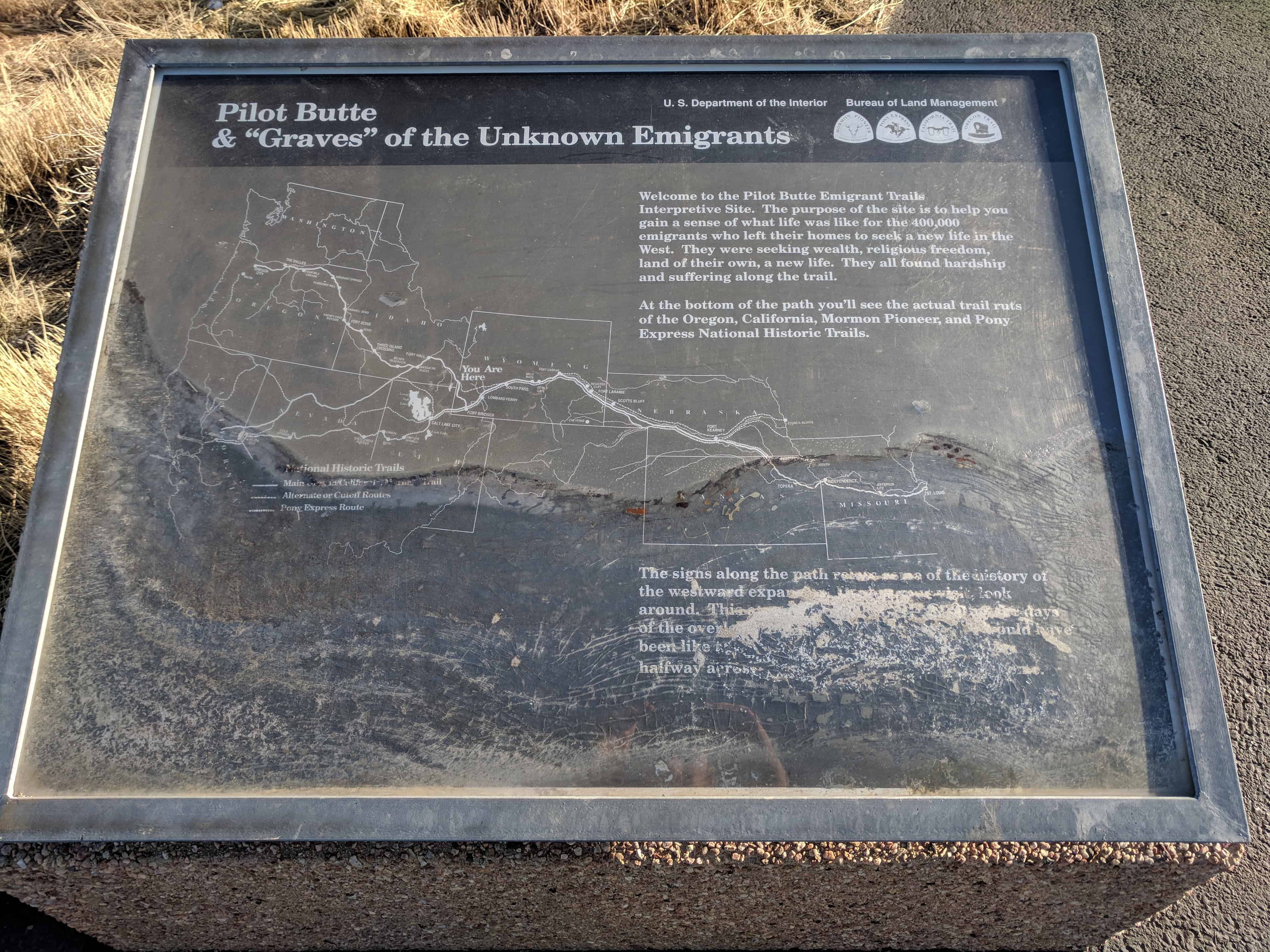
Pilot Butte & “Graves” of the Unknown Emigrants
Welcome to the Pilot Butte Emigrant Trails Interpretive Site. The purpose of the site is to help you gain a sense of what life was like for the 400,000 emigrants who left their homes to seek a new life in the West. They were seeking wealth, religious freedom, land of their own, a new life. They all found hardship and suffering along the trail.
At the bottom of the path you’ll see the actual trail ruts of the Oregon, California, Mormon Pioneer, and Pony Express National Historic Trails.
The signs along the path relate some of the history of the westward expansion. During your visit, look around. This area is largely unchanged from the days of overland emigrants. Imagine what it would have been like to walk, ride a horse, or drive a wagon halfway across America and a long way from home.
This historic marker is located on a walking path loop on Highway 28 just west of Farson, stopping here you can see all these markers:
21 Wednesday Mar 2018
Posted in Uncategorized

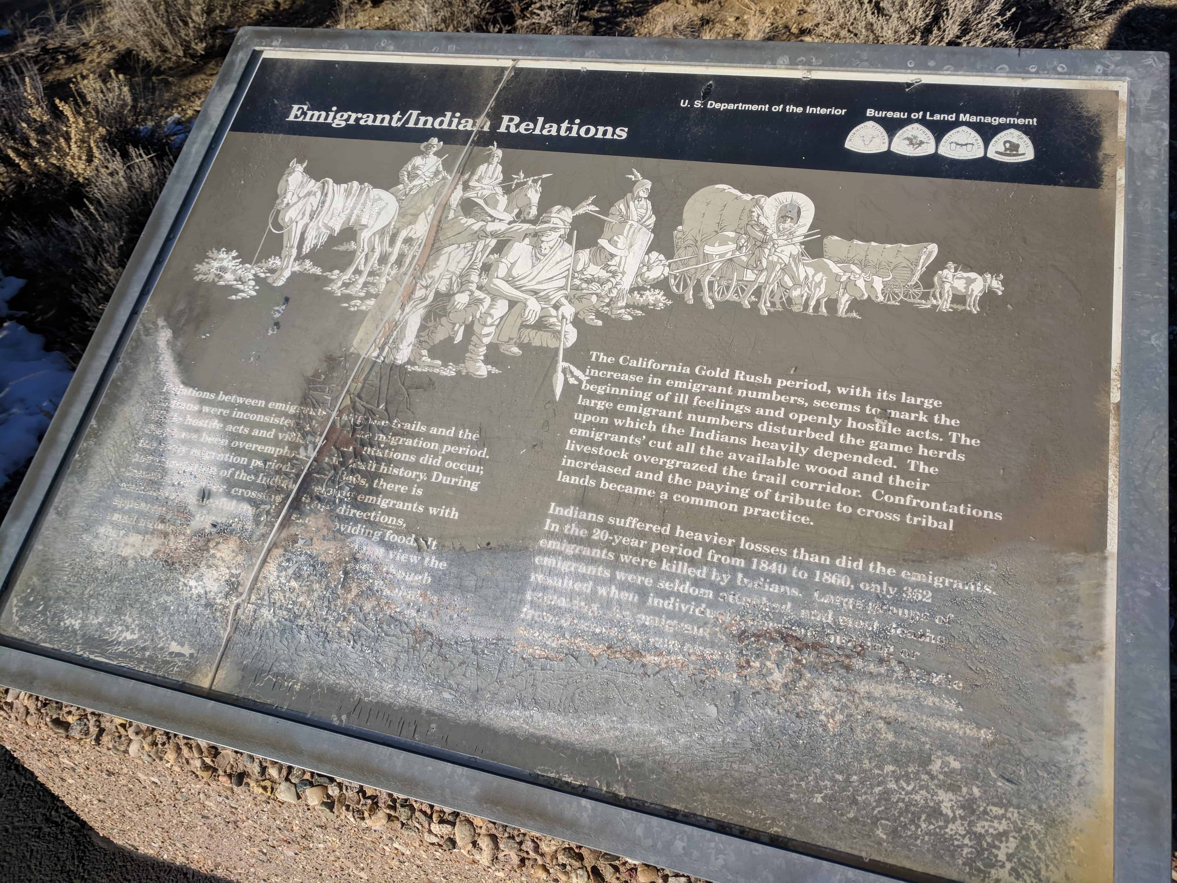
Emigrant/Indian Relations
Relations between emigrants using the trails and the Indians were inconsistent during the migration period. While hostile acts and violent confrontation did occur, they have been overemphasized in trail history. During the early migration period of the 1840s, there is documentation of the Indians helping emigrants with treacherous river crossings, giving directions, conducting peaceful trading, and providing food. It appeared that the native populations did not view the small numbers of emigrants as a threat, even though they were trespassing on tribal lands. Chief Washakie and his Shoshones were well-known for their kindness and…
The California Gold Rush period, with its large increase in emigrant numbers, seems to mark the beginning of ill feelings and openly hostile acts. The large emigrant numbers disturbed the game herds upon which the Indians heavily depended. The emigrants’ cut all the available wood and their livestock overgrazed the trail corridor. Confrontations increased and the paying of a tribute to cross tribal lands became a common practice.
Indians suffered heavier losses than did the emigrants. In the 20-year period from 1840 to 1860, only 362 emigrants were killed by Indians. Large groups of emigrants were seldom attacked, and most deaths resulted when individuals were out hunting or exploring. An emigrant was much more likely to die from disease, be run over by a wagon, trampled in a stampede, accidentally shot, or drowned while crossing a river.
This historic marker is located on a walking path loop on Highway 28 just west of Farson, stopping here you can see all these markers:
21 Wednesday Mar 2018
Posted in Uncategorized
First Transcontinental Telegraph
In 1859, the California legislature offered $6,000 a year for the first overland telegraph. This was followed by an act of the United States Congress on June 16, 1860, pledging $40,000 a year for ten years for carrying government messages. With these inducements, the first work was begun in 1860, but by the end of that year the line ran only to Fort Kearny, Nebraska, from the east and to Fort Churchill, Nevada, from the west.
There was some question of which route should be followed over the Rocky Mountains. The Western Union and Missouri Telegraph Company informed Colorado residents that if they would subscribe $20,000 worth of stock in the enterprise, the company would run the line through Denver, otherwise, the emigrant and mail route over South Pass would be followed. The support in Colorado did not come, and the telegraph was pushed across Wyoming in the summer and fall of 1861. The lack of trees along much of the western route posed a considerable construction problem, but in the fall of 1861, the transcontinental telegraph carried the first message from New York to San Francisco. The remains of the telegraph poles have long since disappeared, but it passed along the emigrant trail in front of this sign.

This historic marker is located on a walking path loop on Highway 28 just west of Farson, stopping here you can see all these markers:
21 Wednesday Mar 2018
Posted in Uncategorized
Pilot Butte
On the horizon about 25 miles to the south is Pilot Butte. An important landmark, Pilot Butte served as a guide post separating South Pass trails from the more southerly Overland Trail that crossed southern Wyoming. Oddly enough, Pilot Butte was more important to travelers headed east than it was for west-bound emigrants.
The name Pilot Butte appears on fur trade maps at least as early as 1837. Captain Howard Stansbury mentioned Pilot Butte on September 12, 1850, as his column of topographic engineers travelled east from Fort Bridger guided by Jim Bridger.
Stansbury’s journal reads, “… we came in sight of a high butte, situated on the eastern side of the Green River, some forty miles distant: a landmark well known to the traders, and called by them Pilot Butte.”
The butte grew in importance as a landmark as traffic eastward increased in the 1850s and especially in 1862 when Ben Holladay moved his stagecoach and freighting operations from the Oregon Trail south to the Overland route.
Interestingly, the butte sits atop White Mountain and is just north of the original location of the Rock Springs airport. Thus, Pilot Butte was used as a landmark by early-day pilots – flying the first airmail routes across the nation.
Stand in the trail ruts immediately in front of this sign, look at Pilot Butte, and feel the passage of history.

This historic marker is located on a walking path loop on Highway 28 just west of Farson, stopping here you can see all these markers:
21 Wednesday Mar 2018
Posted in Uncategorized
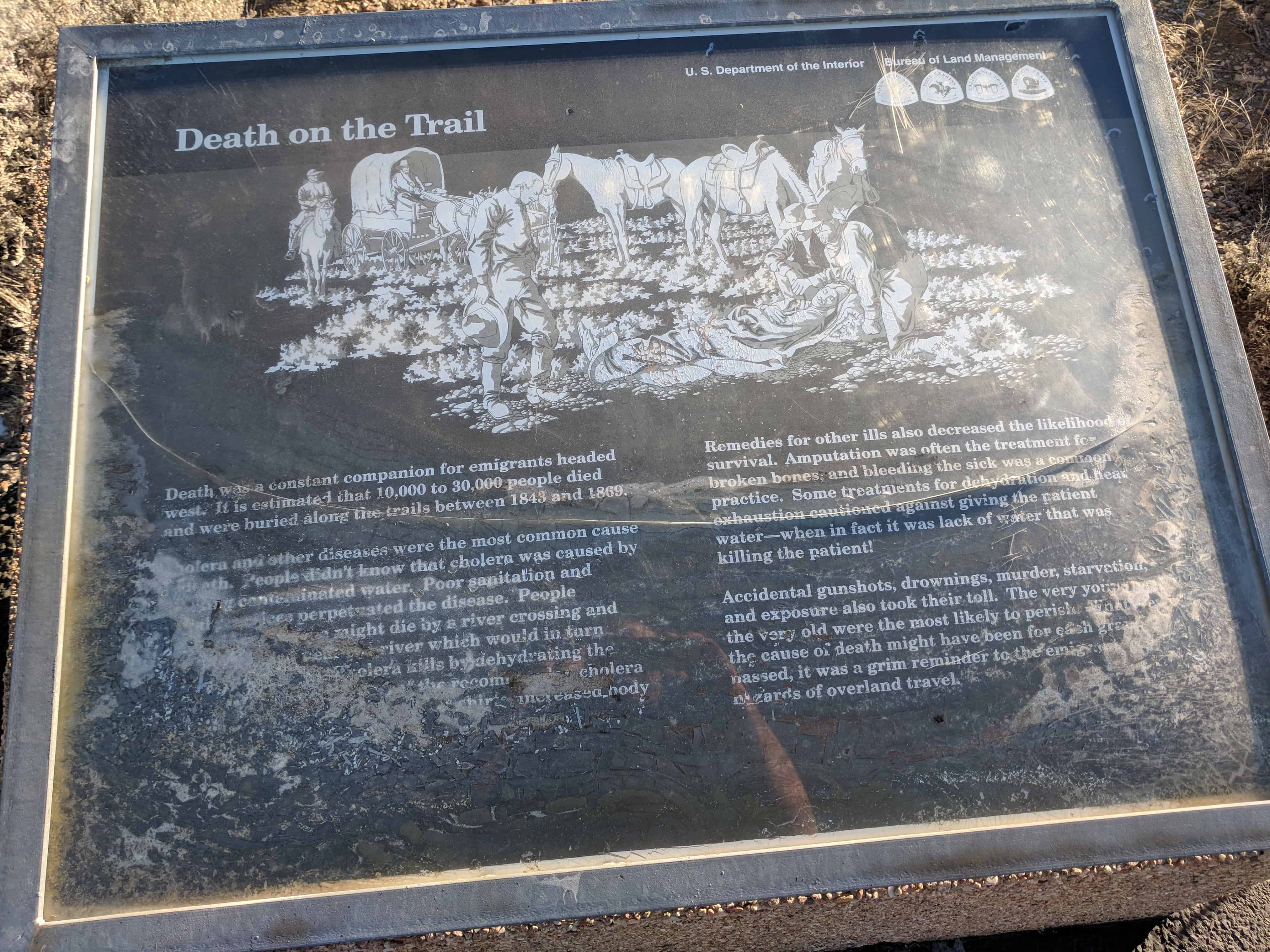
Death on the Trail
Death was a constant companion for emigrants headed west. It is estimated that 10,000 to 30,000 people died and were buried along the trails between 1843 and 1869.
Cholera and other diseases were the most common cause of death. People didn’t know that cholera was caused by drinking contaminated water. Poor sanitation and burial practices perpetuated the disease. People infected long before might die by a river crossing and would be buried near the river which would in turn infect more people. Cholera kills by dehydrating the body. Unfortunately, many of the recommended cholera remedies such as wearing flannel shirts, increased body temperature and dehydration.
Remedies for other ills also decreased the likelihood of survival. Amputation was often the treatment for broken bones, and bleeding the sick was a common practice. Some treatments for dehydration and heat exhaustion cautioned against giving the patient water—when in fact it was lack of water that was killing the patient!
Accidental gunshots, drownings, murder, starvation, and exposure also took their toll. The very young and the very old were the most likely to perish. Whatever the cause of death might have been for each grave passed, it was a grim reminder to the emigrant of the hazards of overland travel.
This historic marker is located on a walking path loop on Highway 28 just west of Farson, stopping here you can see all these markers:
21 Wednesday Mar 2018
Posted in Uncategorized
“Graves” of the Unknown Emigrants
Graves were an all-to-frequent reminder of the dangers of overland travel. Most emigrant journals record death, burial, or passing graves during the day’s travel. Most burials along the trail were hasty affairs.
The official Company Journal of the Edmund Ellsworth Company of Handcart Pioneers, dated September 17, 1856, stated,
“James Birch, age 28 died this morning of diarrhea. Buried on the top of sand ridge east side of Sandy. The camp rolled at eight and traveled eleven miles. Rested … by the side of Green River.”
In the two weeks prior to Birch’s death, five other company members were buried along the trail. Birch’s gravesite has not been found.
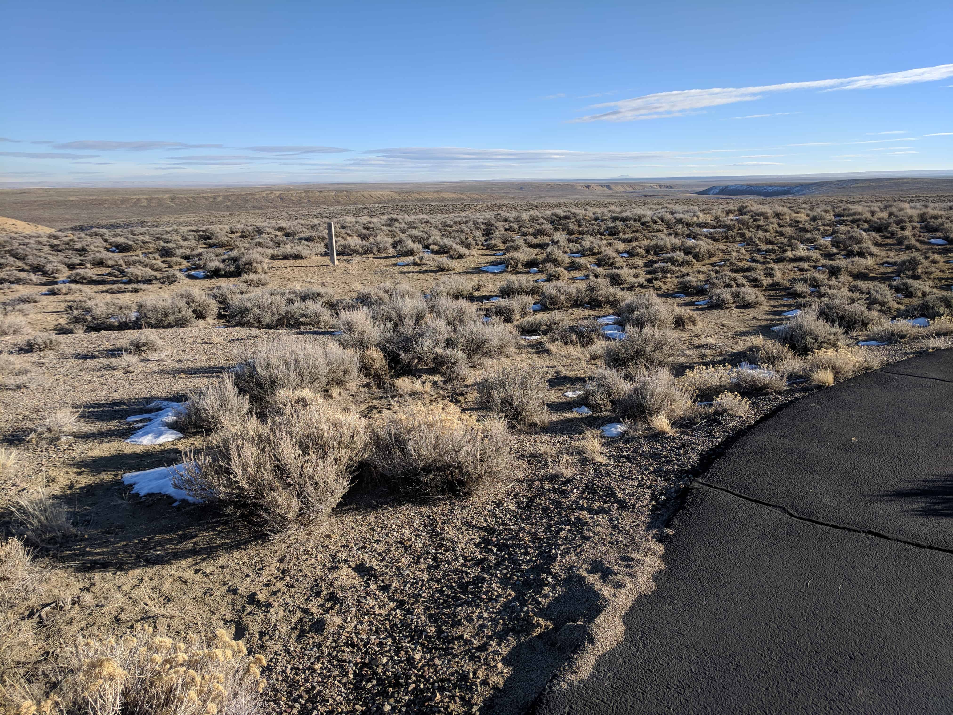
No one is buried in the graves in front of this sign. They are here as symbols of all the emigrants who died and were buried alongside the trail, lost forever.
As you look at these simple mounds of rock and dirt, imagine what it would be like to lose a spouse, child, or friend on the trail. You would dig a shallow grave, say your goodbyes, and continue your journey West, saddened and bereft.

This historic marker is located on a walking path loop on Highway 28 just west of Farson, stopping here you can see all these markers: