Tags

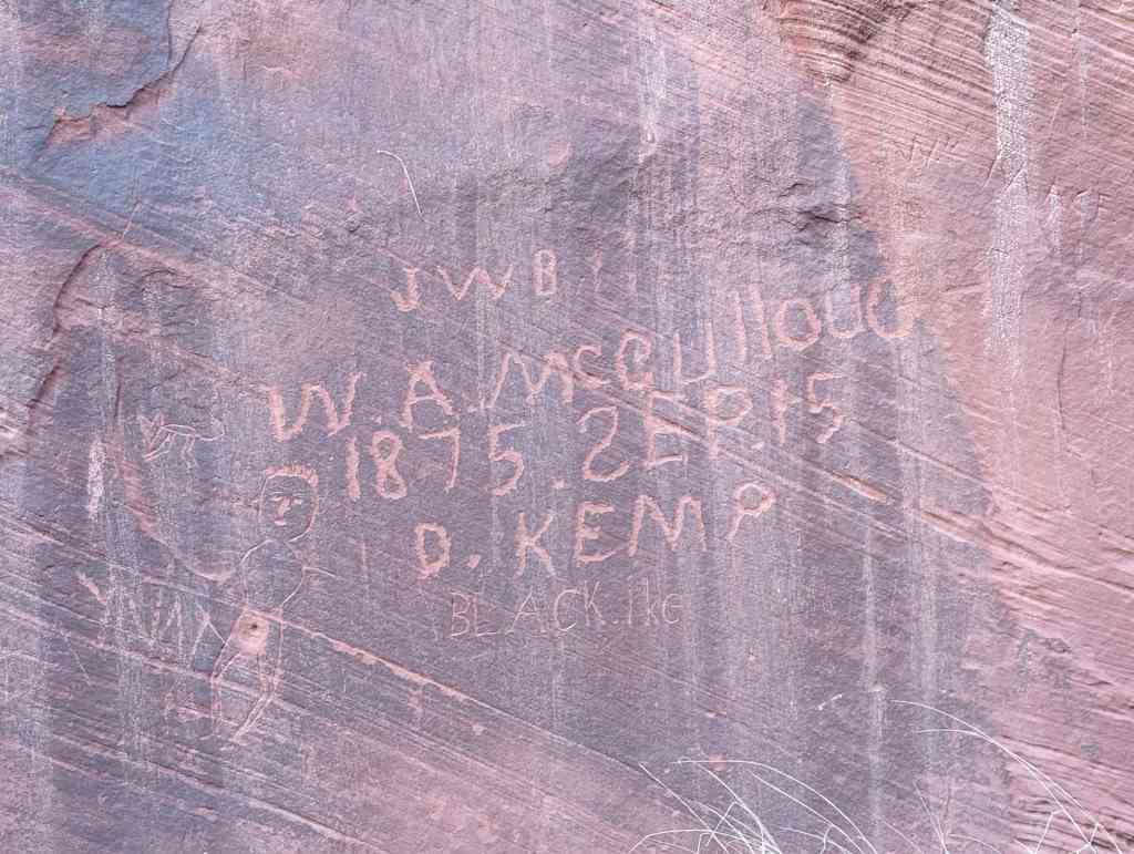
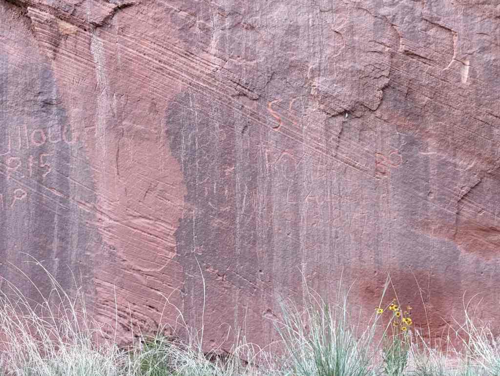
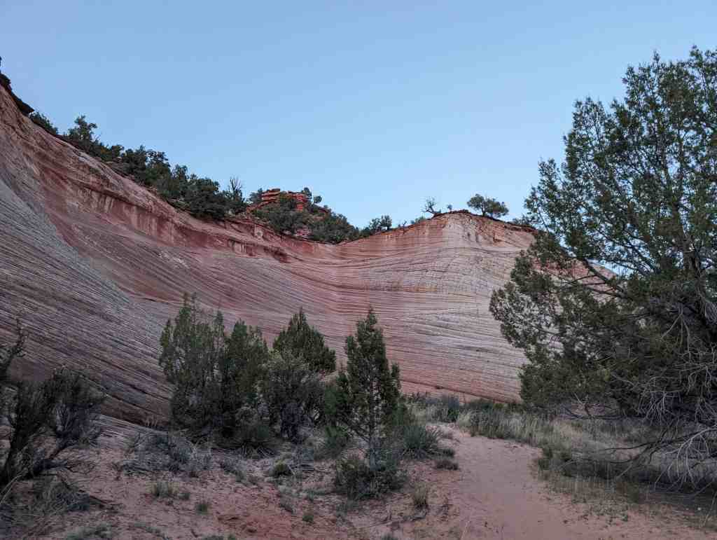
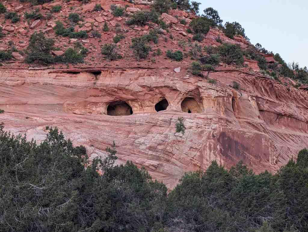
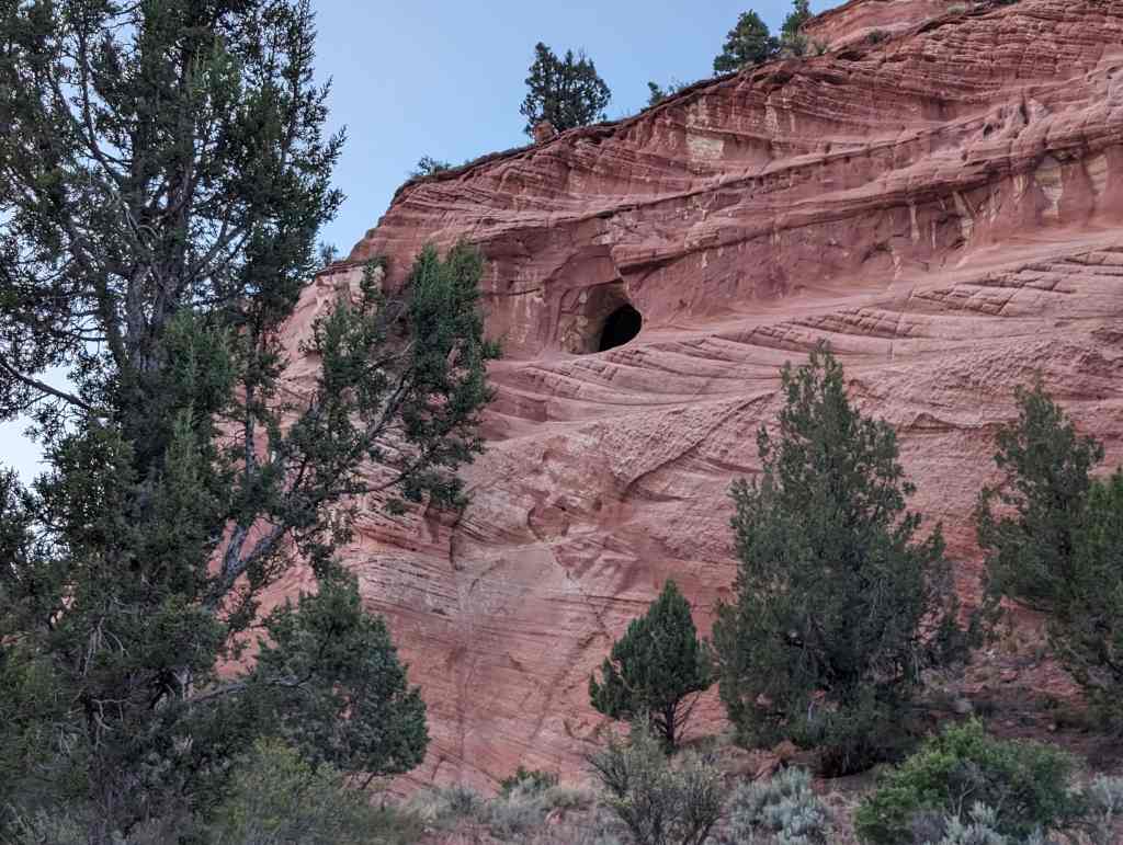
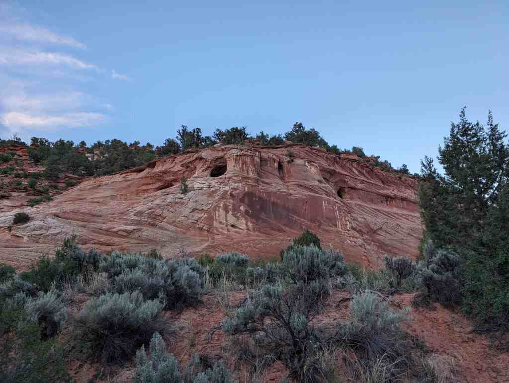
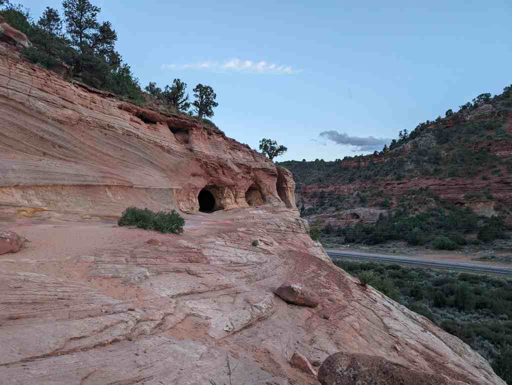
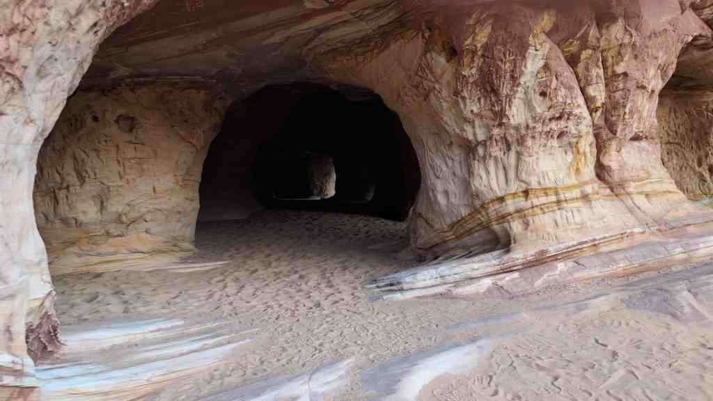
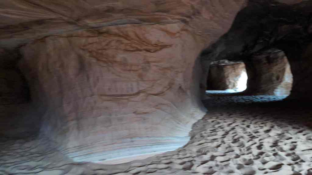
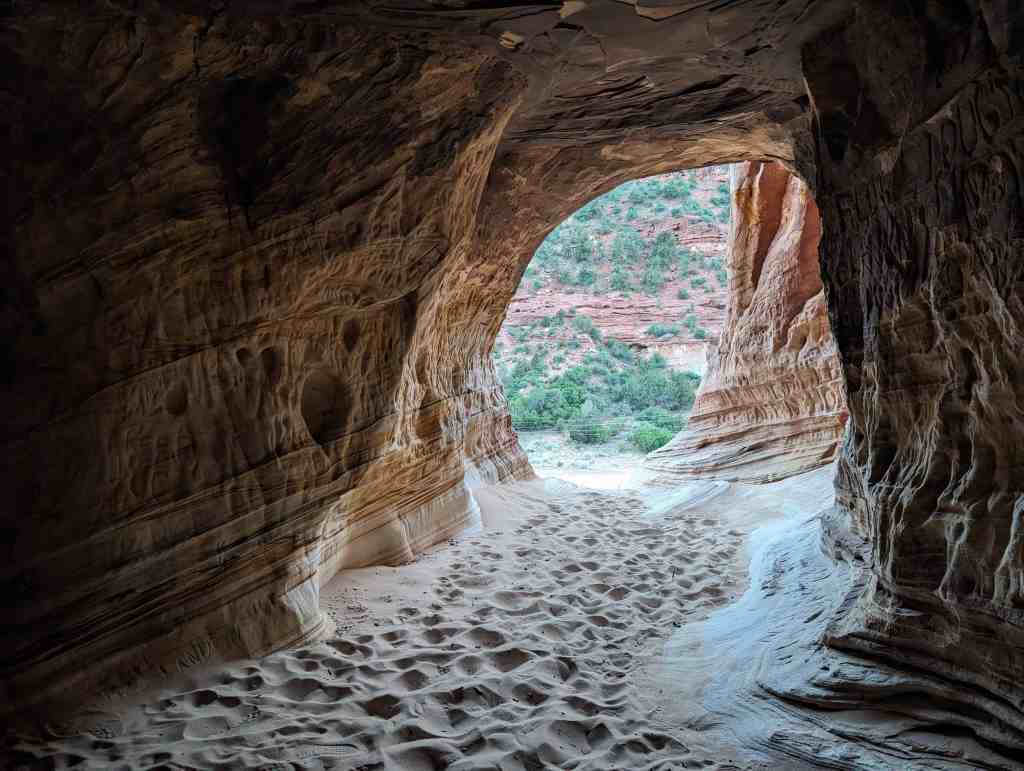
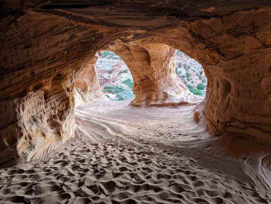
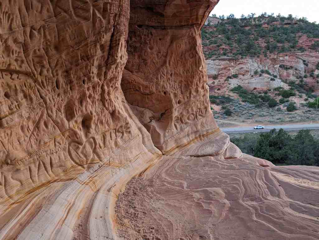
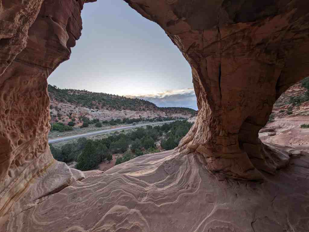
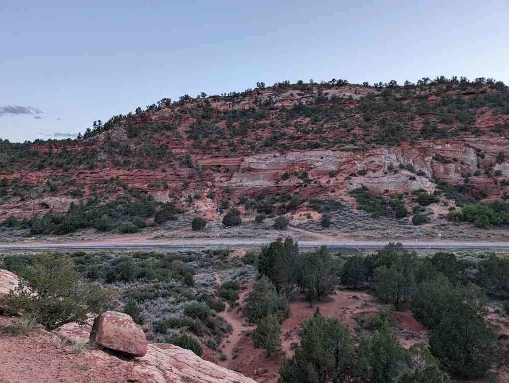
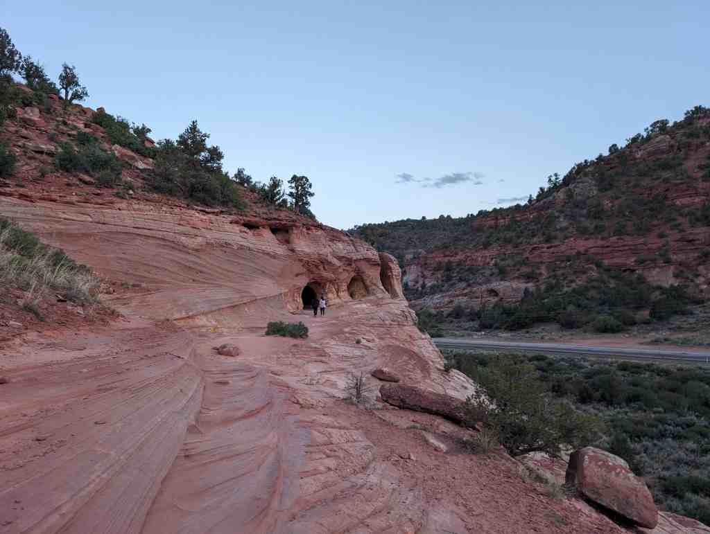
The Sand Caves, also often called the Kanab Sand Caves or the Moqui Sand Caves are located just off Highway 89 North of Kanab, Utah.


Related:
Parking:


03 Monday Feb 2025
Posted in Uncategorized
Tags
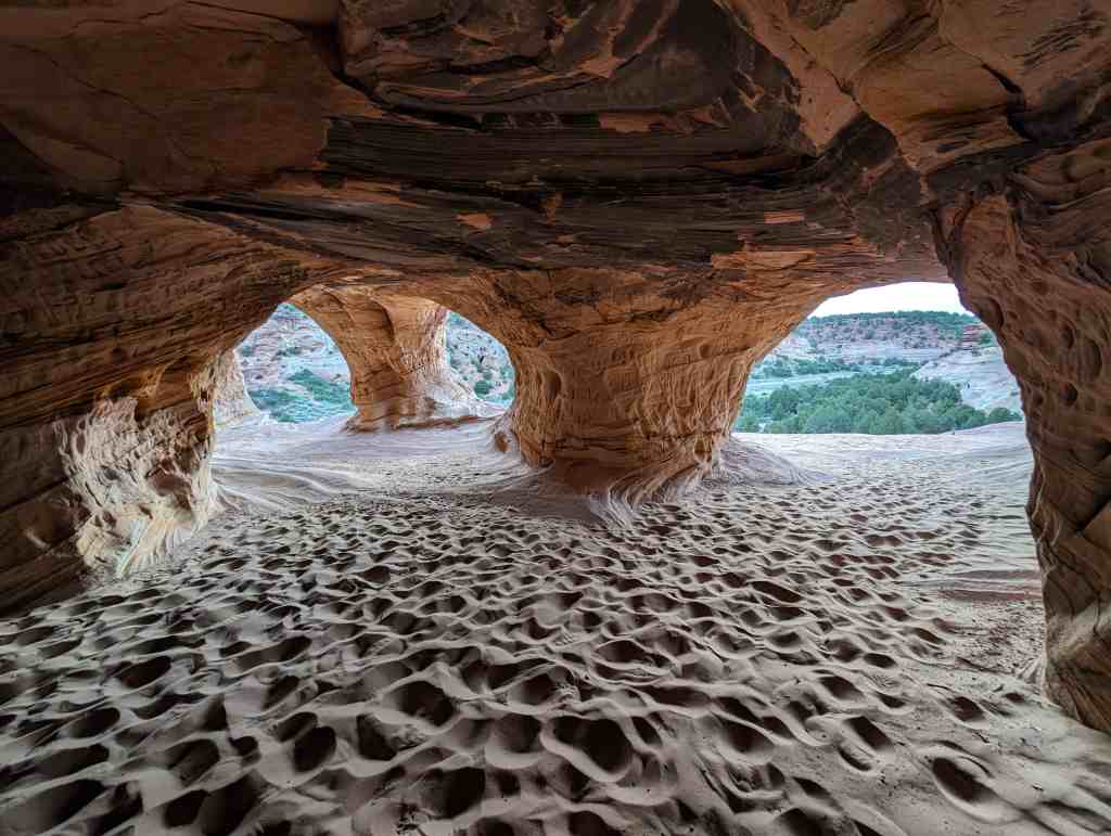
The Sand Caves, also often called the Kanab Sand Caves or the Moqui Sand Caves are located just off Highway 89 North of Kanab, Utah.
Related:
Parking:
03 Monday Feb 2025
Posted in Uncategorized
Tags
22 Friday Mar 2024
Posted in Uncategorized
Tags
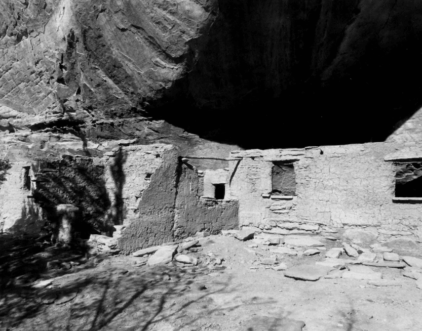
Cottonwood Canyon Cliff Dwelling (42Ka1504) was first recorded by Neil M. Judd in 1919 (see Judd 1926}. Judd did not excavate any of the site, although he did note some deterioration due to weather and cattle but the impact was- apparently small. Judd labelled this cliff dwelling “Cave 6,” one of more than twenty which he noted in Cottonwood, Indian and Farm Canyons. In October 1973, Michael Bunker of the Bureau of Land Management-Kanab recorded the site for the Kanab District Archeological site inventory, There have been no subsequent archeological activities at this site. However, during July 1966 Utah State University contracted with the BLM to stabilize portions of the site. Presently additional stabilization is being considered.
The BLM survey analyzed the cliff dwellings as being affiliated with the Virgin branch of the Anasazi culture area. The site is a Pueblo II-type and has been dated to A.D. 1100-1200. It is unknown at this time whether earlier components exist at the site, but excavations at another cliff dwelling in Cottonwood Canyon (42Ka1170; Judd 1926) did indicate Basketmaker occupation.
Ten to twelve structures were identified as probable living and storage structures by the BLM survey. (Judd had recorded nearly twenty structures.) This makes Cottonwood Canyon Cliff Dwelling the largest site in the drainage, and one of the largest in the Kanab vicinity. Cultural material observed by the BLM include: gray and corrugated ceramics; ashes, fire-cracked rocks and smoke-stained ceilings indicating hearths; and structure walls standing to a height of five feet. Other sites in Cottonwood Canyon have yielded cedar bark, corn stalks, a mountain goat-hair bag, stone slabs, sandals, digging sticks, basketry fragments, rabbit skin, corn kernals, beans and black-on-white ceramics. (Judd 1926)
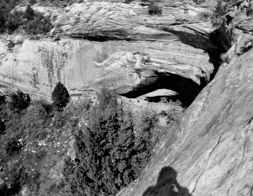
The cliff dwelling, is located under a semicircular overhang, 53 m long and 12 m deep, in the low enclosed sandstone cliff at the head of an unnamed eastern tributary of Cottonwood Canyon. The midden area which spills down the slope in front of the rock shelter is 530 m square. A spring flowed at the north end of the overhang at one point. Vegetation outside, the shelter currently consists of oak, cedar and pinion pine.
Intrusions at the site consist of pot holes adjacent to several structures. However, it is the opinion of the BLM survey that the majority of the site is undisturbed.
Although smaller cliff dwellings and other sites exist in the Cottonwood Canyons, the large size of 42Ka1504 makes it unique and significant in its own right. A “district” nomination of the entire Cottonwood drainage does not seem warranted at this time as no systematic survey of the area has been made. That should not detract from the integrity and importance of this site, alone. Unfortunately, although the Cottonwood Canyon Cliff Dwelling did not function in isolation and should not be considered so, insufficient data exists to nominate the canyon as a whole.
The following are elements of the site’s significance:
Integrity – Where twenty or more rock shelters were noted by Judd in 1919, only 9 are officially recorded today. Some of these are not duplicates. Cottonwood Canyon Cliff Dwelling (42Ka1504) is one of the few listed in “good” condition. A comparison of photo- graphs from 1919 and 1978 indicates that little deterioration has occurred. The site’s condition, its proximity to Kanab and its accessibility would provide an excellent opportunity for public education. However, these same factors make it a prime candidate for looting.
Site – Most all other archeological structures in the Kanab vicinity are small storage units or rock art panels. This site combines both dwelling and storage units. According to present knowledge, there are. only two other sites similar to this one in the area. One is in a tributary to Johnson Canyon, which is approximately ten miles east of Kanab. The other is located on private ground a few miles farther up Cottonwood Canyon. This site, 42Kall40, completely excavated in 1919, contained only a few structures. Clearly, 42Ka1504 is unusually large. Even Judd (1926:114), a man well-acquainted with many Southwestern archeological sites, called it the “largest Cliff-dweller settlement visited by the writer during his archeological observations north of the Rio Colorado.”
Research Potential – Research questions would revolve around this problem of size. Because of its unique size, we would expect that Cottonwood Canyon Cliff Dwelling should exhibit unique intrasite spatial patterning indicative of a special political and social development. Additionally, there is the question of the specific culture history of the site itself. Should earlier component exist at this cliff dwelling as existed at other Cottonwood Canyon sites, then information concerning culture change could be recovered.
Cottonwood Canyon Cliff Dwelling would be a focal point in regional studies as it must have been a focal point in prehistoric regional activity. Its large size indicates that the site may have been an economic or political center for the Cottonwood canyons. What was the settlement pattern within the drainage? What was the relationship between this unusual site and other, more typical sites in the canyons? Answers to these questions could answer questions on settlement and organizational patterns in the Virgin Anasazi subarea as a whole.
15 Friday Mar 2024
Posted in Uncategorized
Tags
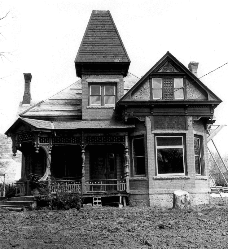
Bowman-Chamberlain House / McAllister Home
The significance of this home lies both in its architecture and its occupants. The architectural significance has already been noted in section 7 B. The site passed through a number of hands before it was purchased by Henry E. Bowman .April 30, 1892, It was he who had the present dwelling constructed. Bowman arrived in Kanab in 1885 where he taught school. In 1887 Henry E, Bowman bought an–adobe house faced with brick at 2nd North and Main in Kanab, It was in this home that Bowman began his mercantile business in the 19 x 21 ft. living room. In 1892 H, E, Bowman and four other residents formed a corporation called the Bowman Company, At this time they built a brick building on the corner of Center and Main, It wasn’t until 1894 that Bowman sold the adobe home mentioned above, at which time his new home was probably completed. It is not known who designed the home or if an architect was used, Bowman operated the mercantile business until 1896 when he sold both his home and the business to Thomas Chamberlain in order to raise the funds to go on a mission for the Mormon Church to Switzerland, He was president of the Swiss Mission from 1898 to 1900, Upon his return, he went to Mexico, returning to Kanab in 1916 and acquiring the Bowman Company once again. Bowman was responsible for the construction of the road connecting Kanab and Orderville to the north which required hauling clay and gravel by team to cover the sand which stretched between Kanab and Orderville, This highway was later to become part of Highway 89,
Located at 14 East 100 South in Kanab, Utah and added to the National Historic Register (#75001811) on July 8, 1975.
On November 28, 1896, Thomas Chamberlain acquired the Bowman house for $5,000. Chamberlain was among the first settlers of Orderville arriving in Long Valley in 1871, He was among the first to join in the United Order, a Mormon cooperative effort which was particularly successful in Orderville, He was designated bishop of the Qrderville Ward in 1877 and was one of the original High Councilors in the Kanab Stake, He was on the Board of Directors of the United Order serving for nine years as its president, Chamberlain had six wives and fifty-five children. He served six months (1888-9) in the Utah penitentiary for polygamy, His first wife, Elinor Hoyt Chamberlain, resided in the home until 1935, when it was acquired by her daughter, Lillian C, McAllister, Her husband, June McAllister, continued to live in the home from 1956 until his death, at which time it was sold by his estate to the city of Kanab, Kanab citizens are now engaged in a restoration project which has received funds from the State Bicentennial Commission, Plans for the building include museum space as well as a meeting place for the local historical society and other groups.
03 Sunday Mar 2024
Posted in Uncategorized
Tags
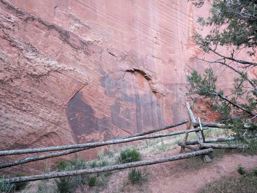
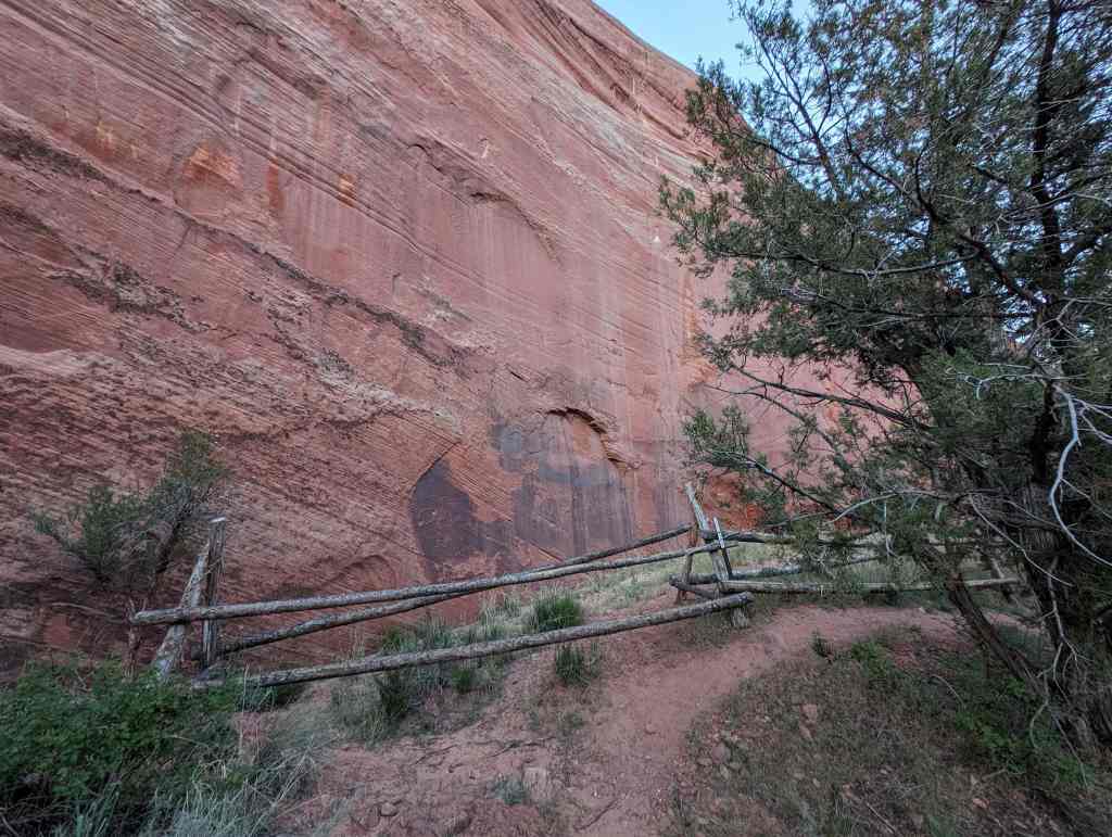
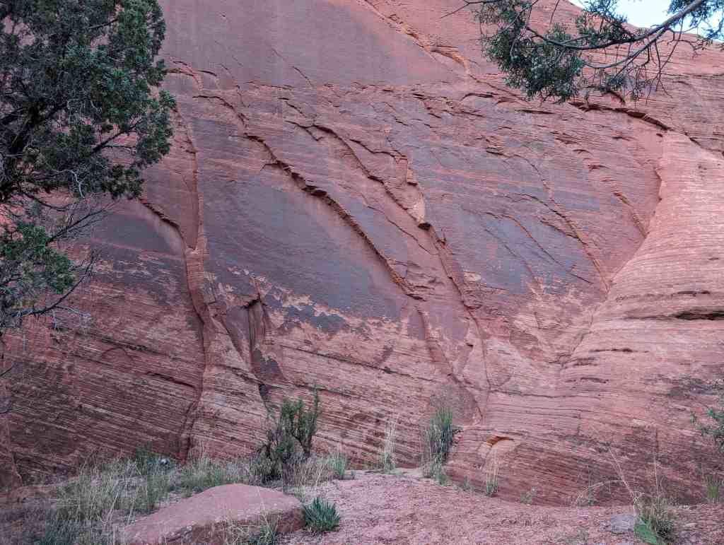
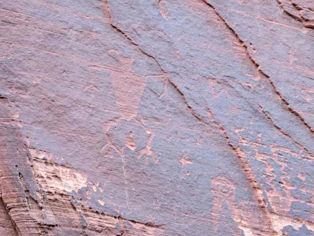
Davis Gulch Pictograph Panel
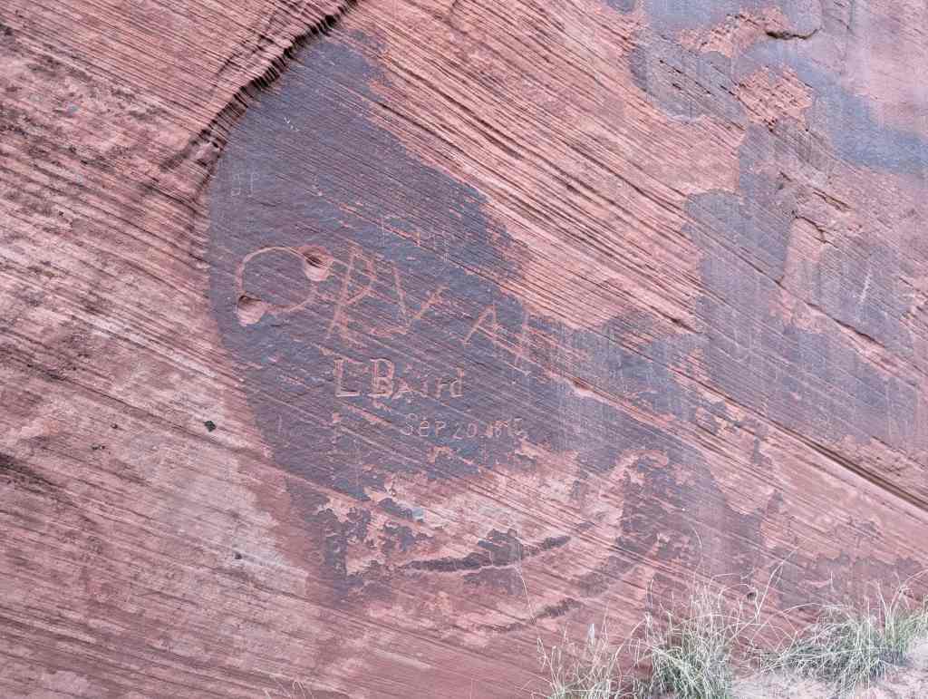
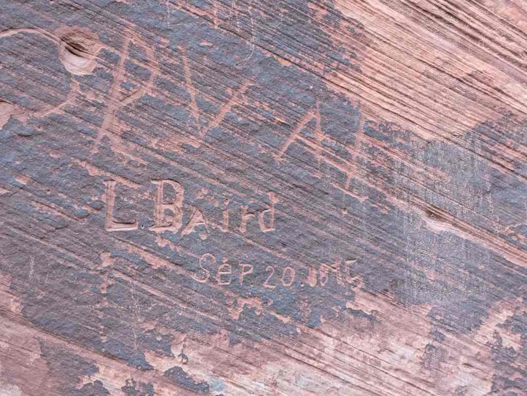
This 60 linear foot panel consists of about 35 painted one to two foot high designs, including a dozen anthropomorphs, placed about four to seven feet above the sandy floor of a protective sandstone cliff alcove. Protected by the deep overhang of the sandstone alcove, alteration and patination of the bedrock back wall is minor. Some flaking and spalling of the pictographs dull white and gray-white pigment has occurred. The preservation of the panel is excellent and due largely to isolation, lack of moisture and, perhaps, continuous shading from most direct sunlight. What damage has occurred is probably attributable mainly to abrasive sand-laden winds that must blow in the alcove at various times of the
year. Modern graffiti has begun to appear among the designs as access to the public has become easier.
Funded studies in the preservation or pictographs are under way and this site is expected to receive treatment to protect it from wet environments. Completed preservation treatment is expected to cost $20,000.
Pictographs are rare in the Glen Canyon region and in a 1963 review of rock art literature in western North America fewer than 20 panels of comparable size could be found. On the basis of number alone, the Davis Gulch pictographs have considerable cultural value.
The dating of the Davis Gulch pictographs by weathering, style and ceramics make it most likely that the panel was produced between 1050-1250 A.D.
The pictograph panel has been designated Style 4, associated with the Pueblo II-III occupation, Anasazi ethnic group.
Added to the National Historic Register (#75000166) on June 5, 1975.
19 Tuesday Dec 2023
Posted in Uncategorized
Tags
East Entrance Checking Station
The East Entrance Checking Station was constructed in 1935 at a cost of $1,000. It was built by enrollees from CCC Camp NP-2, stationed at Zion, of rock quarried at the Zion Stone Quarry. It has served as the entrance station singe the Park Service first developed the East Entrance, four years after the completion of the Zion-Mt. Carmel Highway.
Located in Kane County, Utah and in Zion National Park and added to the National Historic Register (#86003711) on February 14, 1987.
19 Tuesday Dec 2023
Posted in Uncategorized
Tags
East Entrance Residence
This residence was built by the Park Service in 1934 to serve as a ranger’s residence at the East Entrance. The four-room dwelling cost $6,874 to construct. The residence was a Public Works Project, designed by the Western Division Branch of Plans and Desig.
Located in Kane County, Utah and in Zion National Park and added to the National Historic Register (#86003712) on February 14, 1987.
19 Tuesday Dec 2023
Posted in Uncategorized
Tags
East Entrance Sign
The East Entrance sign was built by enrollees of Camp NP-2, stationed at Zion, in 1935. A year earlier, the East Checking Station had been constructed. These two structures marked the east entrance to Zion National Park, which had been accessible from the east since the completion of the Zion-Mt. Carmel Highway in 1930.
Located in Kane County, Utah and in Zion National Park and added to the National Historic Register (#86003710) on July 7, 1987.
03 Friday Nov 2023
Posted in Uncategorized
Tags
14 West State Street in Orderville, Utah
03 Friday Nov 2023
Posted in Uncategorized