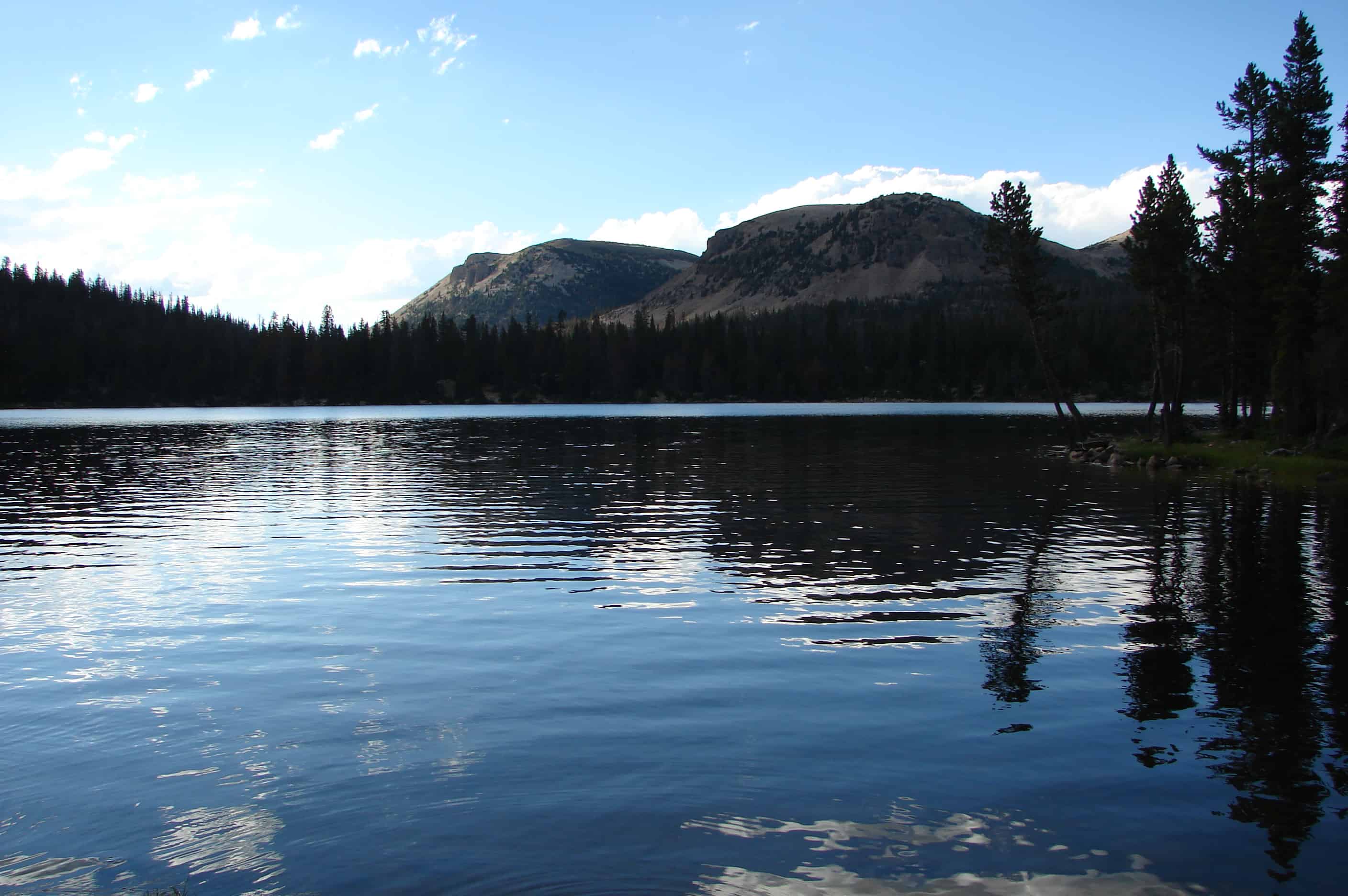
Mirror Lake is a lake in the high Uinta Mountains in Utah. It is a popular fishing and recreation spot. The lake contains three species of trout: rainbow, brook, and tiger. The lake has a Forest Service campground, picnic facilities, and a boat ramp for non-motorized watercraft. Access to the lake is by the Mirror Lake Highway, which is only open during the summer (other than by snowmobile).
The Mirror Lake Scenic Byway winds its way through the Uinta Mountains and connects travelers to a land rich with natural treasures. Along its 42 mile journey through the Wasatch-Cache National Forest, the Byway passes through the nation’s longest east-west mountain range (the Uintas); through watersheds, which form the headwaters of four major rivers (the Provo, Bear, Weber and Duchesne); past glacially carved lakes and valleys and beneath 13,000 foot peaks.
The land you see before you is rich with plant and animal life. Except for desert species, most of Utah’s plant and animal species are found along the Byway. To travel the Mirror Lake Scenic Byway is to filly experience Utah’s rich geological and natural history.
From Timber to Tourism:
In 1862, the transcontinental railroad, which ran just to the north of this area, was completed at Promontory Point, Utah. Trees from the north slope of the Uintas played a crucial role in this monumental effort that opened up the west. Railroad ties were hand hewn from pine and spruce trees by woodsmen known as tie hacks. The tie hacks worked year round to build and maintain the railroad through the late 1800’s.
During this same time period a conservation movement was growing across the United States. This movement resulted in the designation of national forest reserves. The Uintah Forest Reserve, which included the first eleven reserves created in 1897. Managed by the newly formed Forest Service, the Uintah Forest Reserve was a multi-use area. Today, this area of the forest is part of the Wasatch Cache National Forest and still continues to serve many uses including grazing, timber, mining and recreation.
As Utah’s population grew, the primary use of the forest changed from timber to recreation. Automobiles began carrying visitors up the new road from Kamas to Mirror Lake in 1925. The road reached Evanston by 1942. Today this road, the Mirror Lake Scenic Byway, brings thousands of visitors each year to the High Uintas to fish, camp and hike – the same woods that once echoed with the sounds of a growing nation.
Kletting Peak (elevation 12,000 feet) was named for Richard K.A. Kletting (1858-1943), eminent architect, who designed Utah’s capitol and other prominent buildings. Kletting also devoted his life to pioneering in conservation. In 1897 he sponsored the designation of these High Uinta Mountains as the first Forest Reserve in Utah, for their resource in timber, range, wildlife, watershed and recreation.
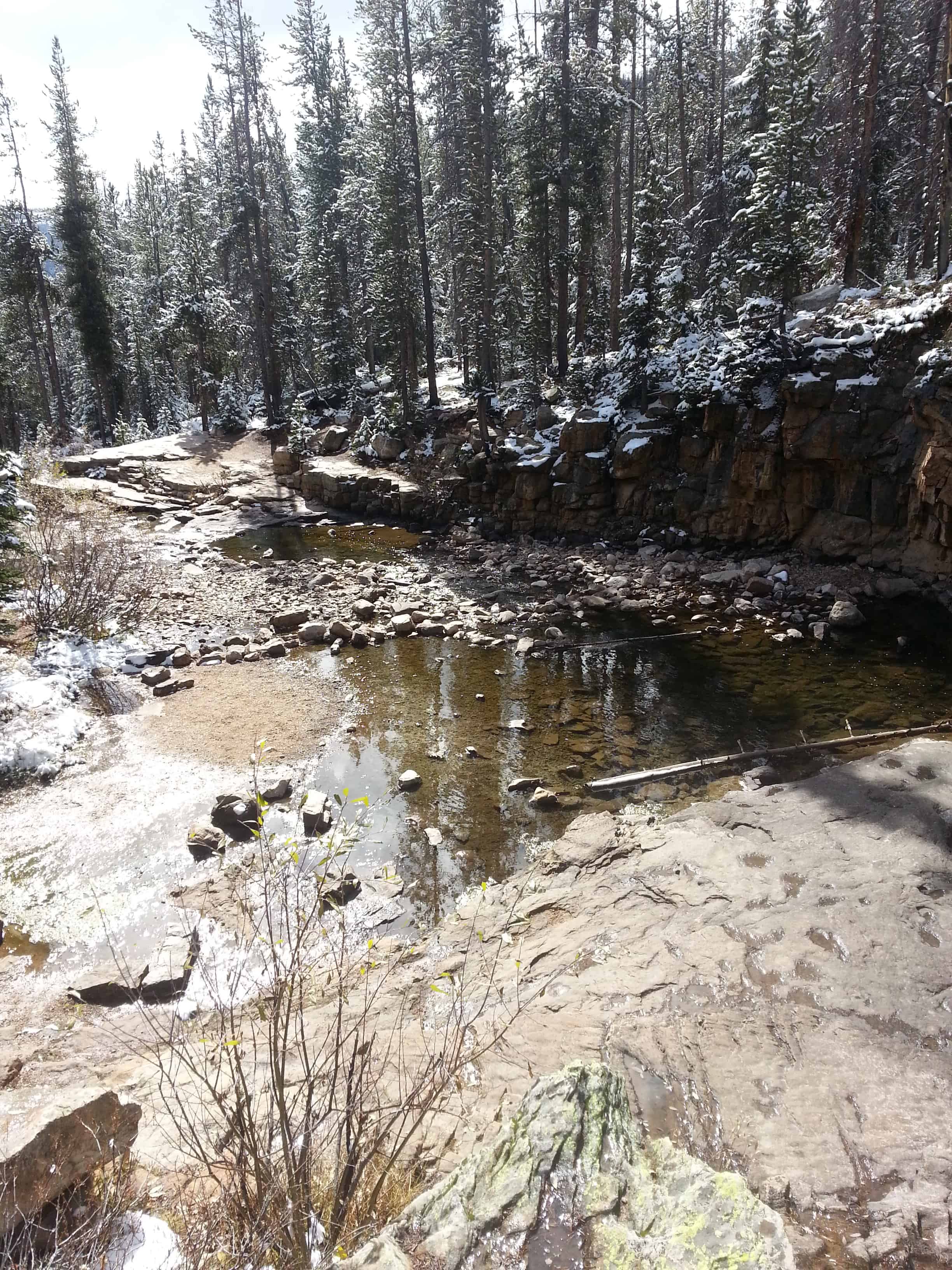
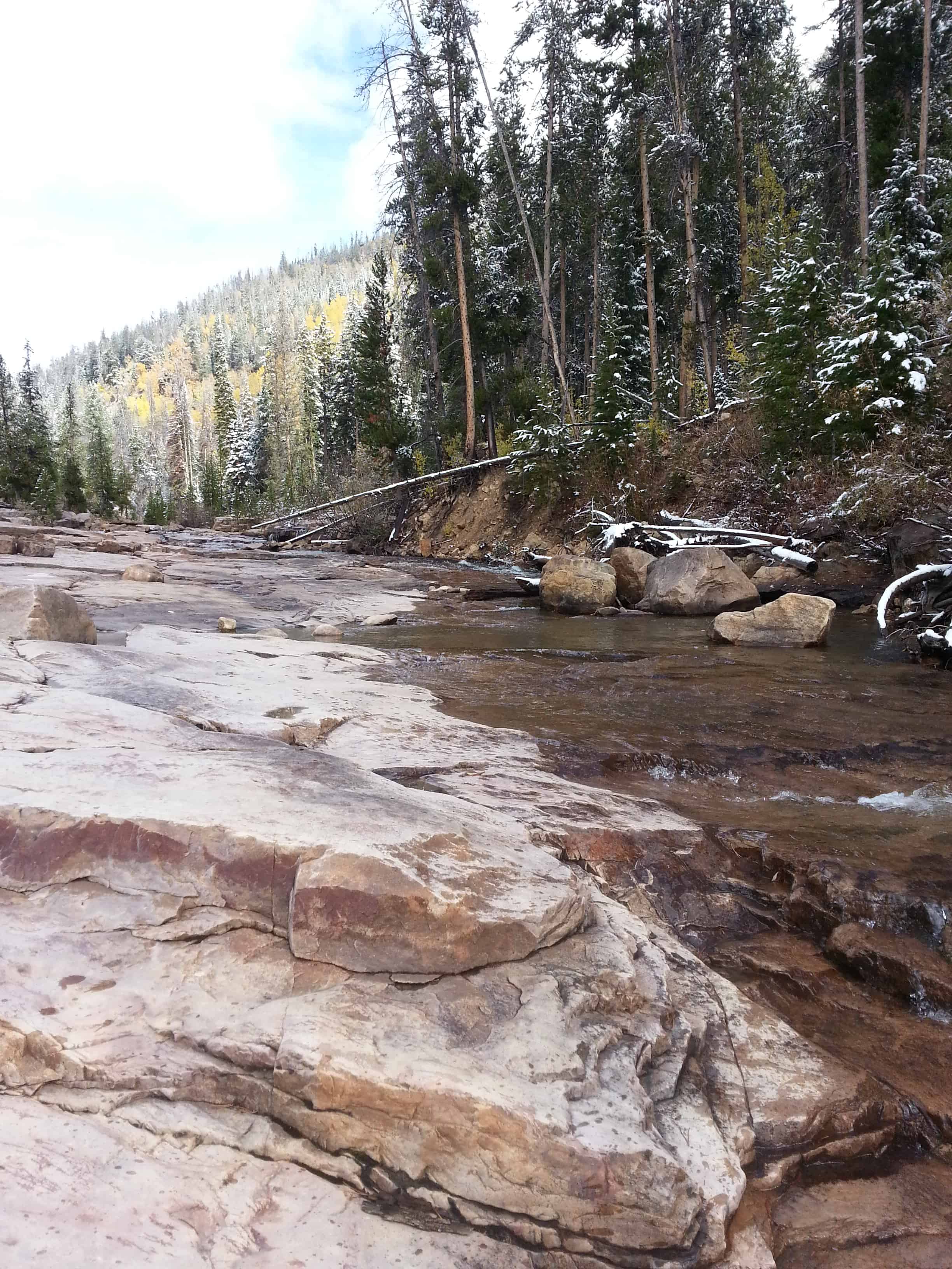
Slate Gorge Overlook
Immediately, upon looking out over the canyon at the Slate Gorge Overlook, you will see the colorful Precambrian strata, namely the Uinta Mountain group. Its reddish, gray, and black shale and sandstone stands out. Notice that there is no slate in sight. Misnamed, probably for the dark gray slate appearance of the rock, the shale actually breaks differently than slate would. Shale breaks along bedding planes whereas slate breaks parallel to them. White Tintic quartzite glacial boulders are also present in the landscape (Chronic, 1990).
What is it?
The Duchesne Tunnel is a six-mile long 10-foot diameter concrete-lined horseshoe-shaped rock tunnel that runs from the Duchesne Diversion through the Uinta Mountains to the Provo River.
Why was it built?
The Provo River Project and the Association have water rights in the Duchesne River and Little Deer Creek, and the Duchesne Tunnel was built to convey that water from the Duchesne River to the Provo River. Much of the water eventually is stored in Deer Creek Reservoir where it is made available to the Association’s shareholders.
When was it built?
Construction on the Duchesne Tunnel began in 1948, but was halted in 1951 at the outbreak of the Korean War. It resumed in 1953 and was completed in 1954. One team of workers started construction at the proposed inlet of the tunnel, and at the same time another team started at the proposed outlet, planning to meet in the middle. It has been reported that with only transits and slide rules, engineers were so accurate in their surveying that when the two ends met they were only inches off. The tunnel is so straight that one can peer inside and see the other end, six miles away!
How big is it?
The Duchesne Tunnel is six miles long and 10 feet in diameter. It has a capacity of 630 cfs. The highest flows in the Tunnel are during the spring runoff.
What is the Association’s responsibility?
It is the Association’s responsibility to keep the Tunnel clear and running freely in order to divert water to the Provo River, and to maintain the associated machinery and structures.(*)
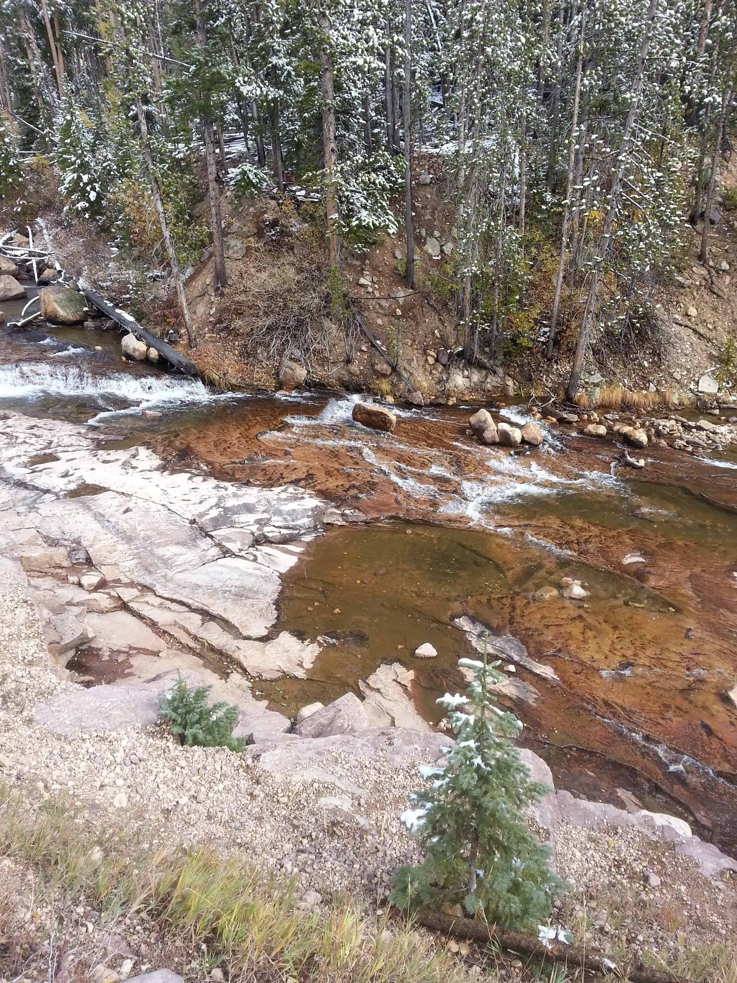
Provo River Falls is a beautiful location to stop while traveling the Mirror Lake Highway (access from Kamas, Utah or Evanston, Wyoming.)
Cooling off at the high elevations in the summer, wading with kids at the lower areas, taking pictures and enjoying wildlife, these are some of the things you can enjoy there.
The river was originally named the Timpanogotzis (or Tumpanowach) after the American Indian tribe living on its bank. Early settlers changed the name to Provo, after trapper Etienne Provost, for whom the city of Provo, Utah is also named. The old name for the river was instead given to the mountain to the north, which later became known as Mount Timpanogos.