Related Posts:
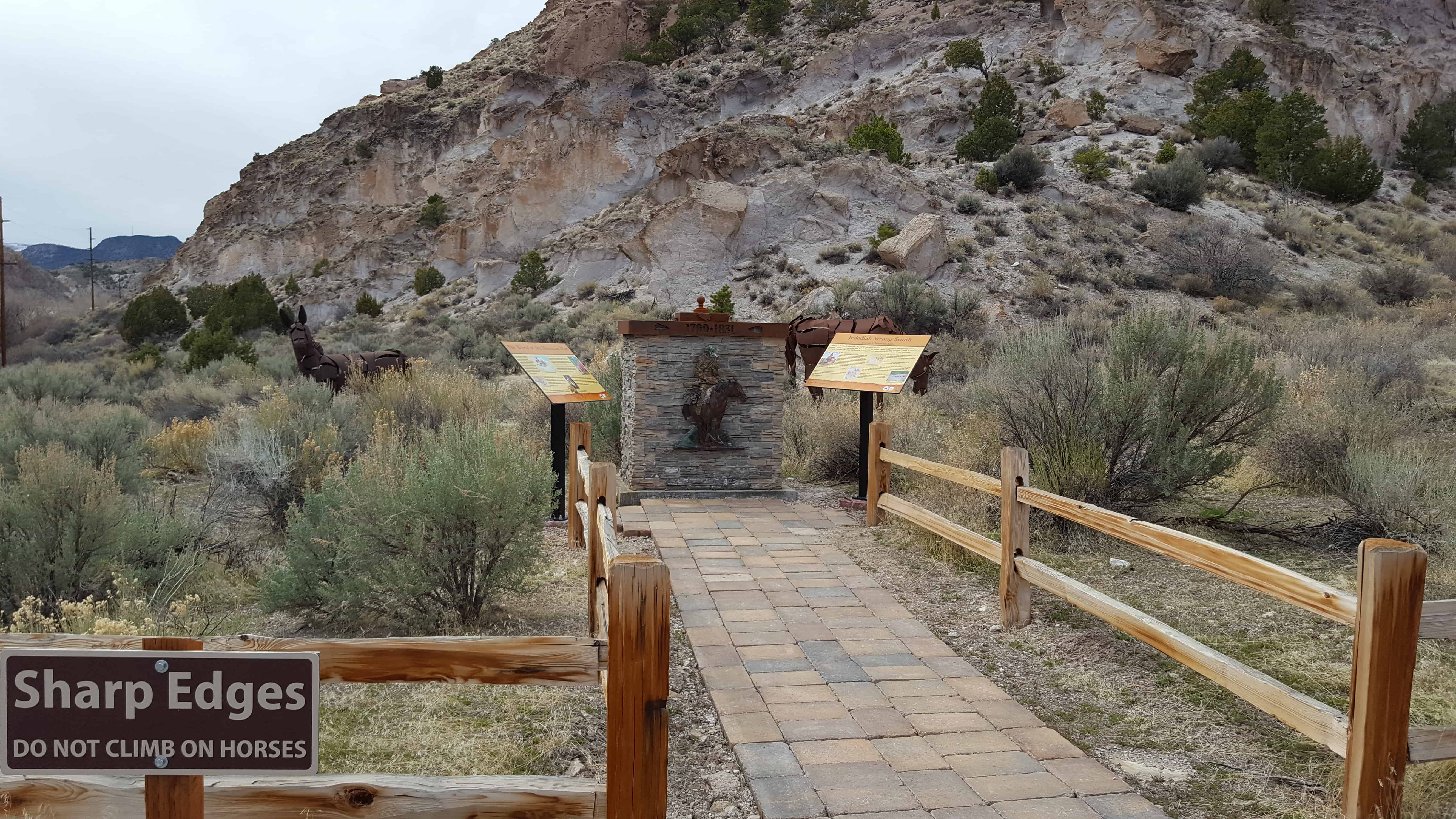
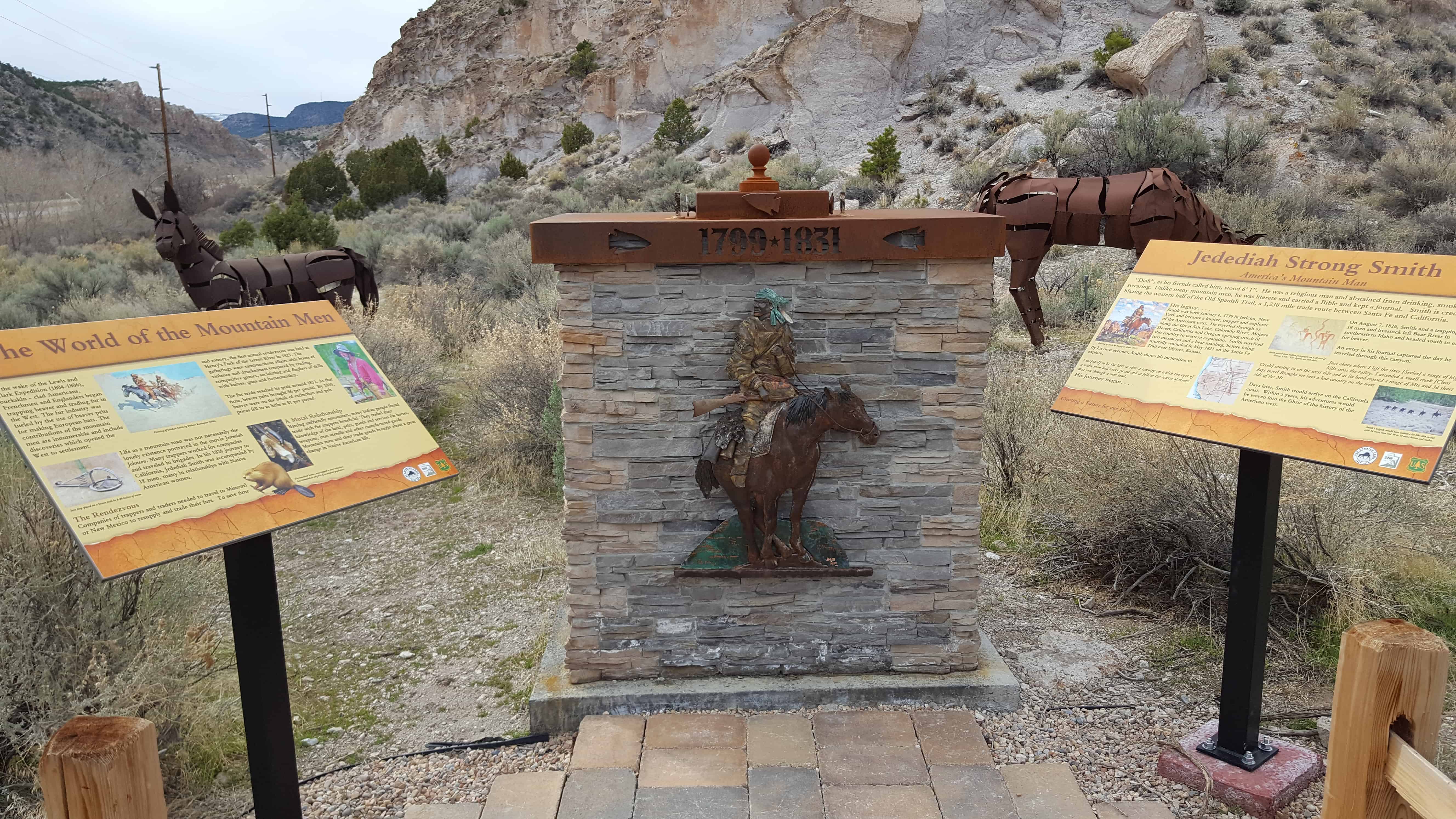
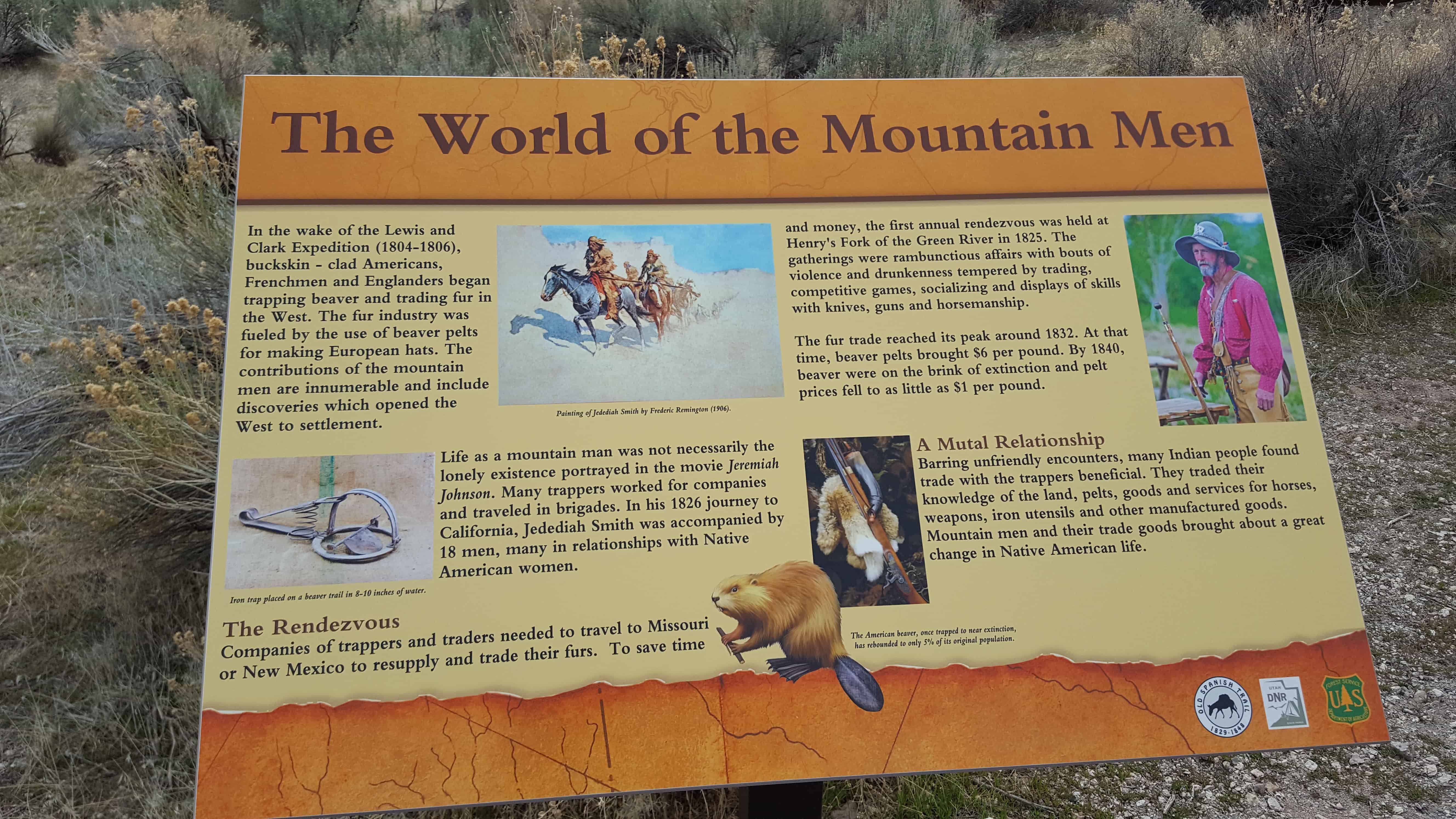
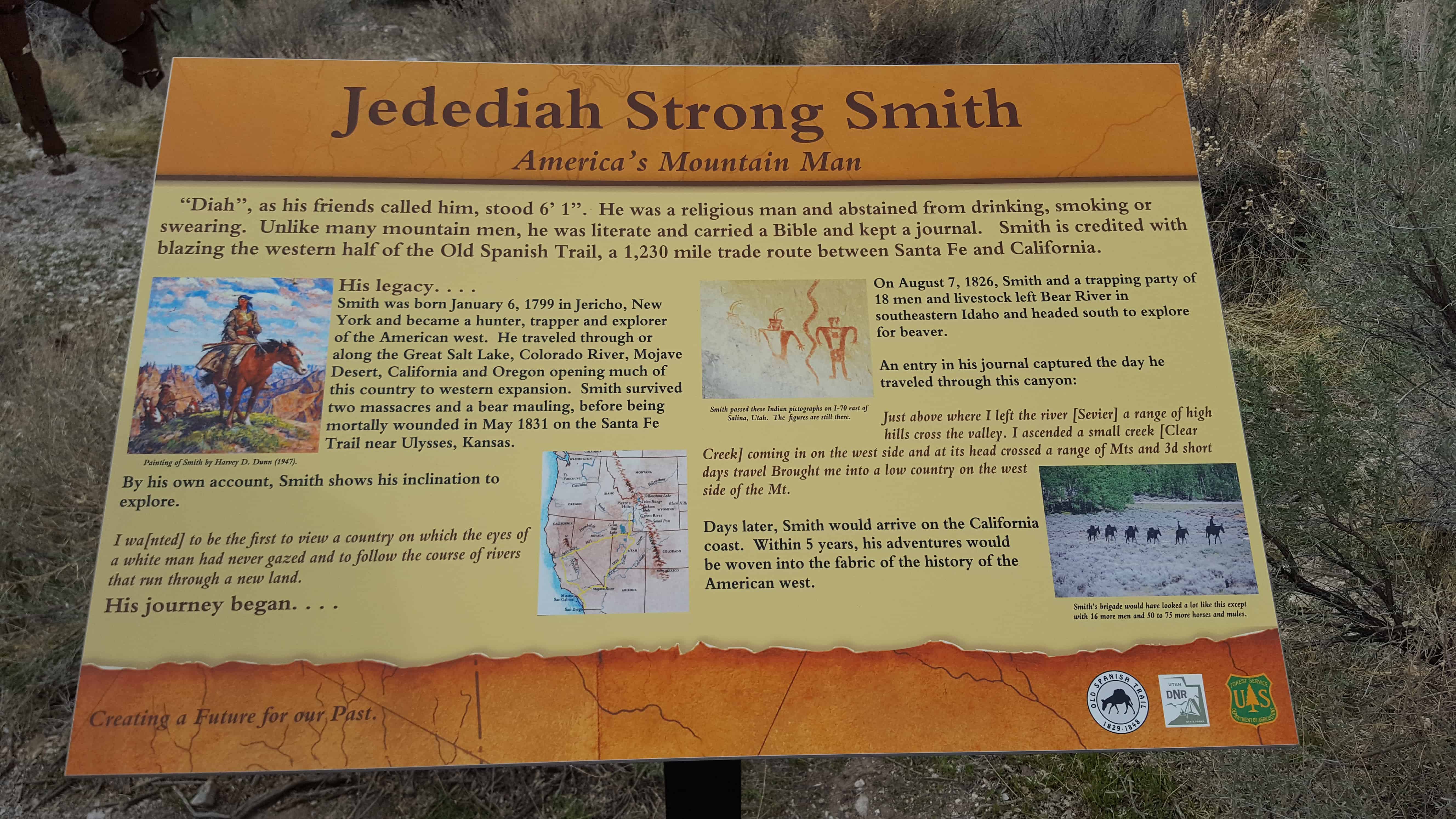
- America’s Mountain Man
- Barstow
- Harry Wade Exit Route
- John Christopher Armstrong
- Lower Bear Valley
- Moab
- Mystic Hot Springs
- Nevada Marker #31
- Nevada Marker #33
- Nevada Marker #34
- Nevada Marker #115
- Old Spanish Trail – Mormon Road Historic District
- The Old Spanish Trail (Fremont Canyon)
- The Old Spanish Trail 1829-1848 (Beaver Dam)
- The Old Spanish Trail – Armijo’s Route
- The Old Spanish Trail – Beaver Dam Wash
- The Old Spanish Trail – Fish Lake Cut-Off
- The Fish Lake Cut-off on the Old Spanish Trail
- The Old Spanish Trail 1829-1848: The Journey of Death
- The Old Spanish Trail – Mountain Springs Pass
- The Old Spanish Trail (at the Richfield Visitor Center)
- Between Parowan and Paragonah
- Paragonah
- Pipe Spring
- Richfield
- Snowfield Monument “Franciscan Fathers”
- Southern Utah Expedition of 1849 – Winter Trail in Fremont Canyon
- The Spanish Trail (Kane Springs)
- Trader and Explorer Trails
- Virgin Valley


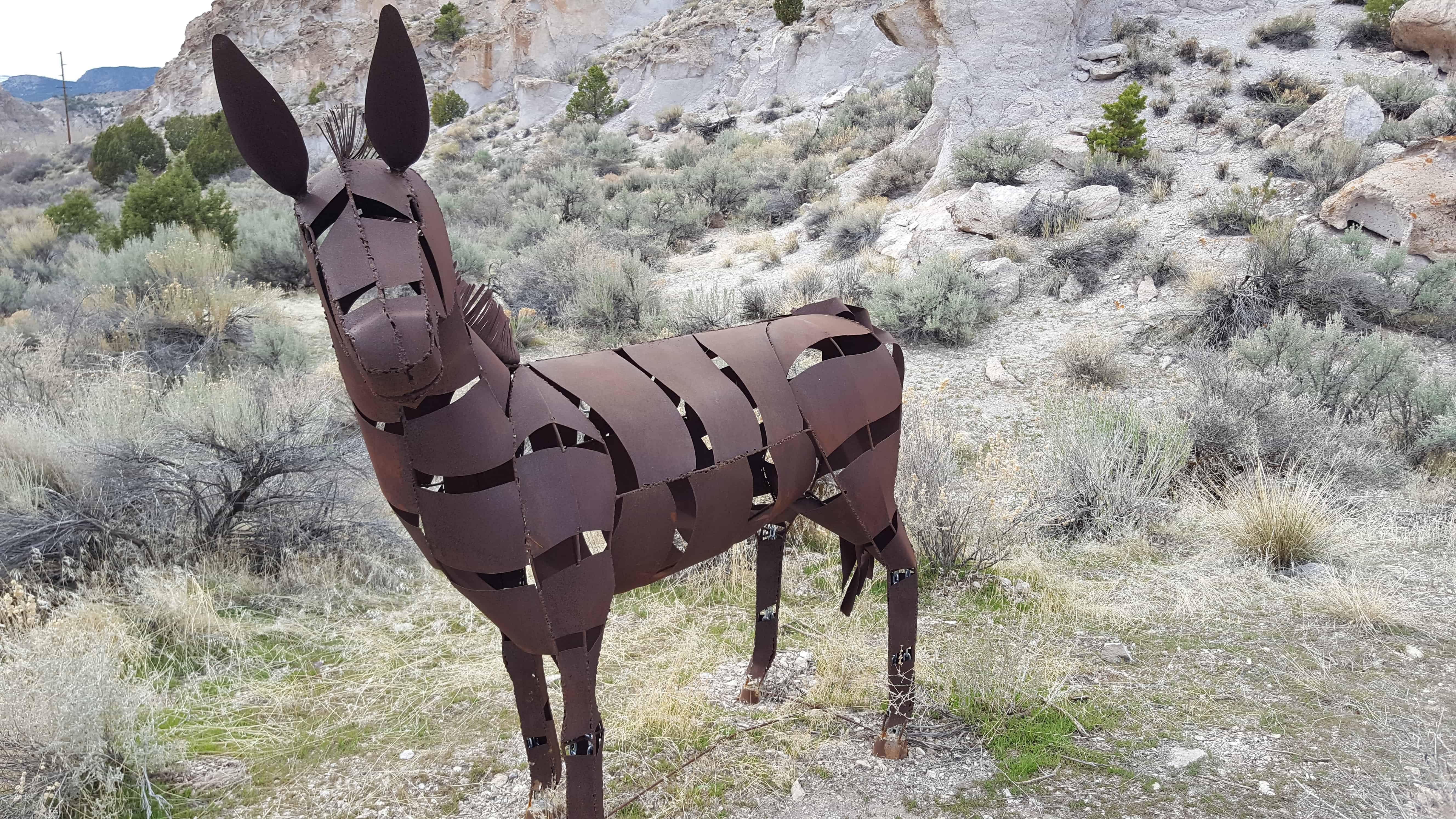
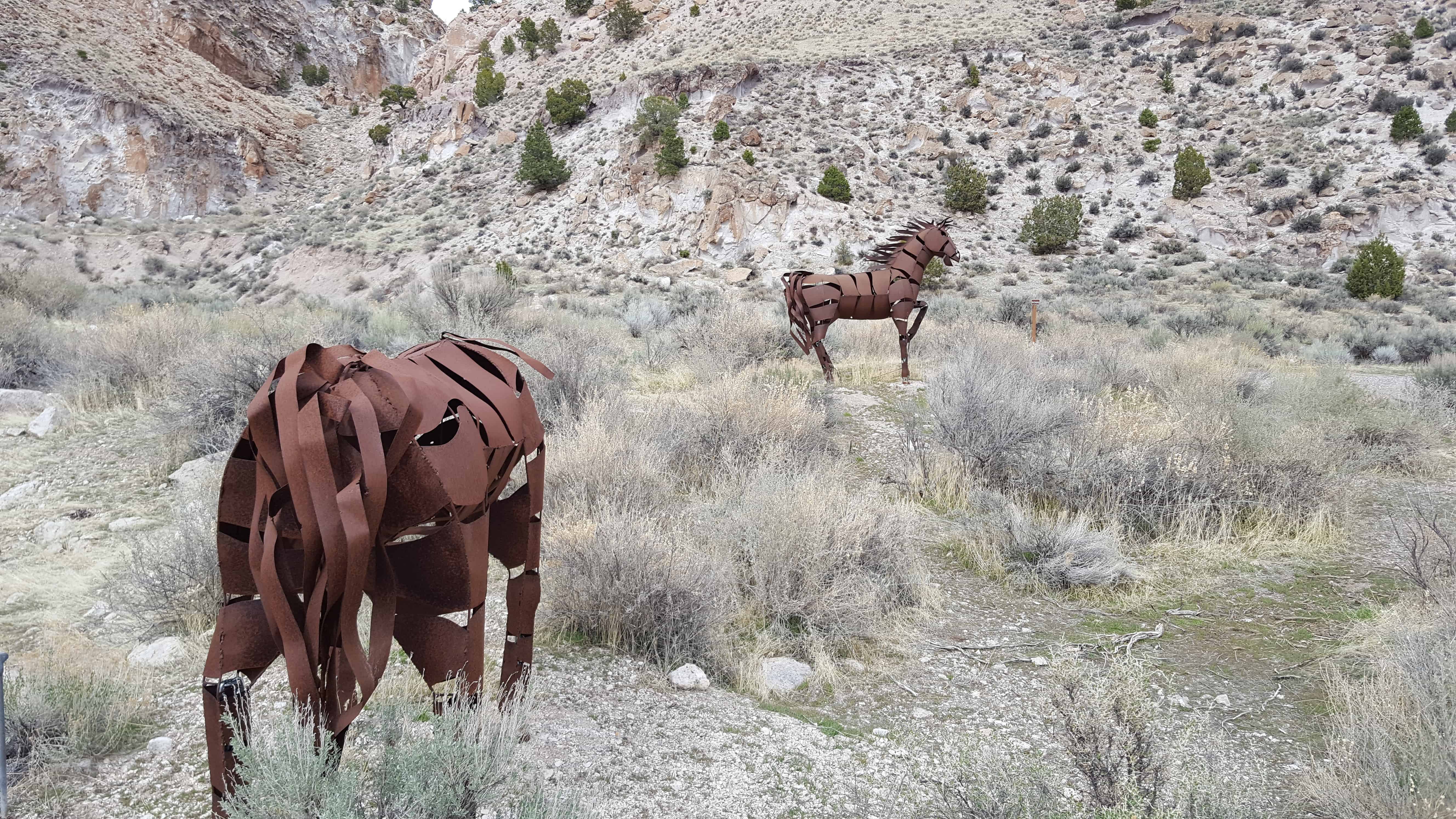
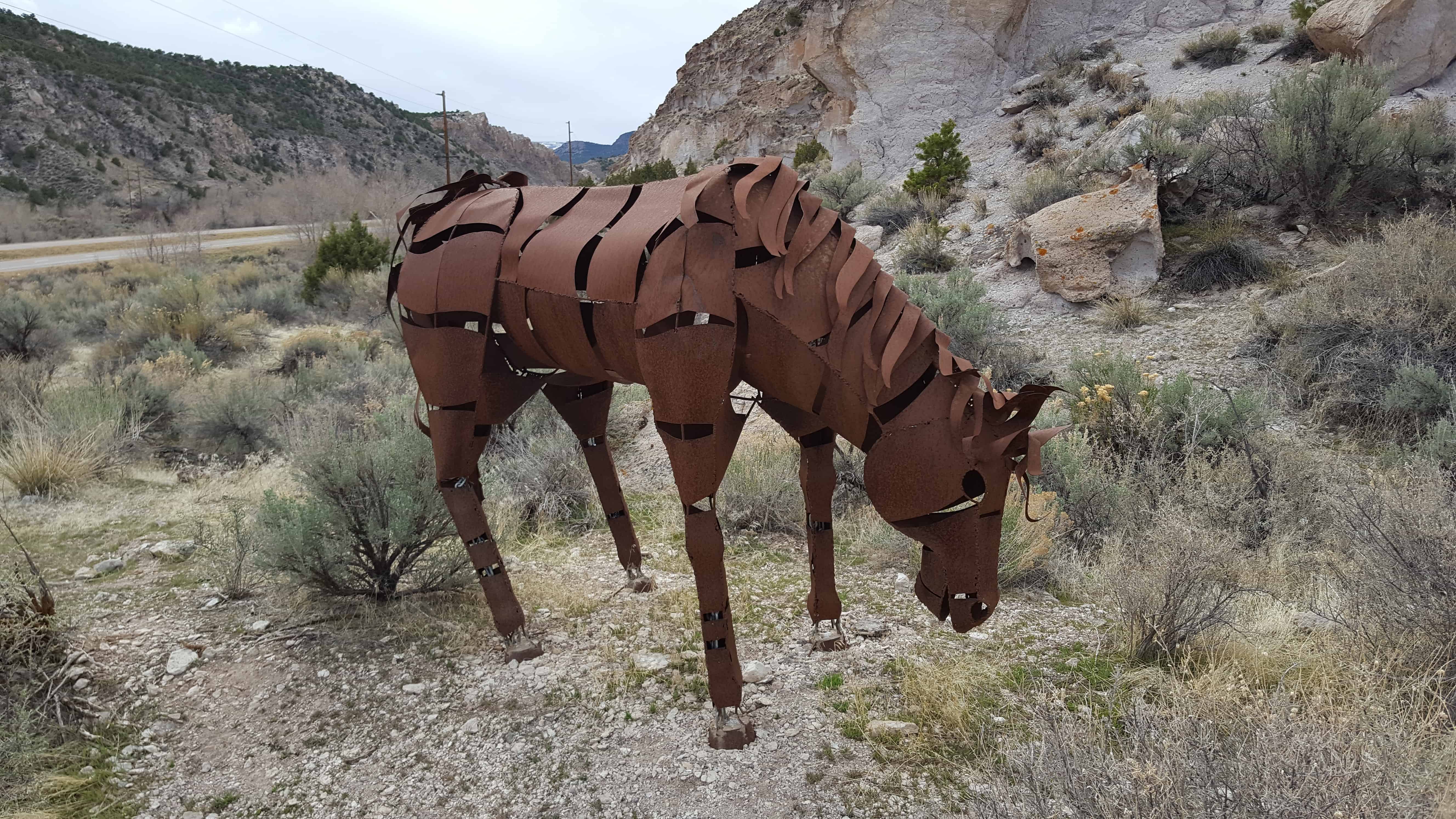
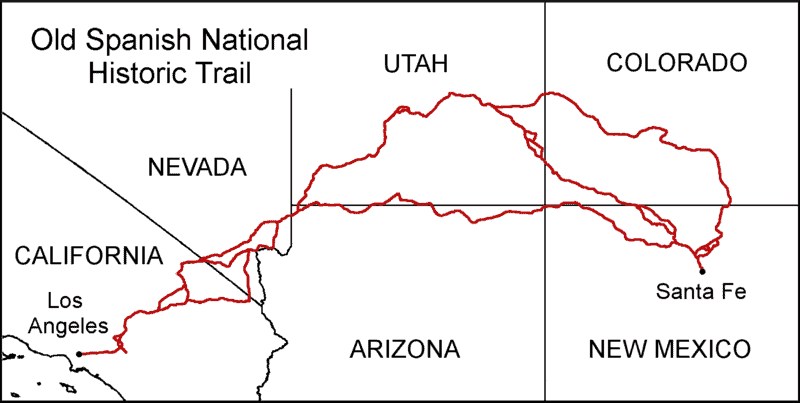
(From Wikipedia) The Old Spanish Trail is an historical trade route that connected the northern New Mexico settlements of (or near) Santa Fe, New Mexico with those of Los Angeles, California and southern California. Approximately 700 mi long, the trail ran through areas of high mountains, arid deserts, and deep canyons. It is considered one of the most arduous of all trade routes ever established in the United States. Explored, in part, by Spanish explorers as early as the late 16th century, the trail saw extensive use by pack trains from about 1830 until the mid-1850s.
The name of the trail comes from the publication of John C. Frémont’s Report of his 1844 journey for the U.S. Topographical Corps., guided by Kit Carson, from California to New Mexico. The name acknowledges the fact that parts of the trail had been known to the Spanish since the 16th century. Frémont’s report named a trail that had already been in use for about 15 years. The trail is important to New Mexico history because it established an arduous but usable trade route with California.
Armijo Route
The Armijo Route of the Old Spanish Trail was established by an expedition led by Antonio Armijo in 1829-1830. Leaving on November 7, 1829 Armijo’s expedition traveled a route northwest and west of Santa Fe from Abiquiu, following the Chama River and the Puerco River, and crossed to the San Juan River basin. From the San Juan they entered the Four Corners area, passed north of the Carrizo Mountains to Church Rock, east of present-day Kayenta. The trail then ran to Marsh Pass and north through Tsegi Canyon into canyon country and to the Colorado River (then called the Rio Grande), where the travelers forded at the Crossing of the Fathers above present day Glen Canyon Dam.
Continuing west to Pipe Spring and on to Virgin River above present day St. George, Utah, the expedition then followed the Virgin to the mouth of the Santa Clara River, which they followed up to the vicinity of the Shivwits Reservation. They then crossed southward over the Beaver Dam Mountains, at Utah Hill Summit to the Virgin River again, which they followed for three days down to the Colorado River, before turning west parallel to the river, over difficult terrain in the Black Mountains, to avoid the deep narrow gorge of Boulder Canyon, to the riverside oases of Callville Wash and Las Vegas Wash. Armijo waited there for his scouts to return, especially Rivera who had visited the Mohave villages down river before. Rivera returned, having recognized the Mohave Trail that led westward to Southern California. Perhaps because of the belligerence of the Mohave to parties of mountain men in recent years, or merely to save time, Armijo attempted a short cut route southwest to the mouth of the Mojave River.
From Las Vegas Wash on the Colorado River, Armijo’s expedition passed southwestward to Dry Lake in Eldorado Valley and the spring at Goodsprings Valley, then through Wilson Pass, across Mesquite Valley and California Valley, through Emigrant Pass to Resting Springs, then along the Amargosa River from near Tecopa to Salt Spring. From Salt Spring they crossed a two-day-long waterless stretch up Salt Creek to Laguna del Milagro (“Lake of the Miracle”), (probably Silver Lake), then to Ojito del Malpais (“little spring of the badlands”) on Soda Lake, then another waterless day beyond Soda Lake, where they reached the only intermittently dependable Mojave River and the Mohave Trail leading up river.
By now short of food, Armijo sent some of his scouts ahead to get more food in the settlement at San Bernardino de Sena Estancia. They followed the river for six days (110 miles to its head from the mouth), having to kill a mule or horse each day to eat. Probably at Summit Valley at the top of the river, east of Cajon Pass they met vaqueros of the San Bernardino de Sena Estancia with food. Armijo did not cross over the mountains by the Mohave Trail route over Monument Peak, but followed a route he called “Cañon de San Bernardino” from the upper Mojave River west through Cajon Pass and down Crowder Canyon and Cajon Canyon to the mouth of Cajon Pass, where the trail reached the coastal plain of San Bernardino Valley, a route no doubt known to the vaqueros of San Bernardino Estancia.
Once through the pass, they turned west along the foot of the San Gabriel Mountains for two days to San Jose Creek, then following it to cross the San Gabriel River at the Rancho La Puente, reaching Mission San Gabriel Arcángel on January 30, 1830. Armijo returned by the same route between March 1 and April 25, 1830. He submitted a brief journal of his journey (itemizing the days with names of places where camps were made but with no distances) to the government of New Mexico, and it was published by the Mexican government in June 1830.
Main Route
The Main Route (also referred to as the Central Route or the Northern Route) of the Old Spanish Trail avoided territory of the Navajo, (who had returned to a state of hostilities after Armijo’s trip), and the more difficult canyon country traversed by the Armijo Route around the Colorado River. First traveled in 1830 by a party led by William Wolfskill and George Yount, this route ran northwest from Santa Fe through southwestern Colorado, past the San Juan Mountains, Mancos, and Dove Creek, entering Utah near present-day Monticello. The trail then proceeded north through difficult terrain (see Kane Springs) to Spanish Valley near today’s Moab, Utah, where a ferry crossed the deep and wide Colorado River and then turned northwest to a ferry crossing on the similarly sized and dangerous Green River near present-day Green River, Utah. The route then passed through (or around) the San Rafael Swell, the northernmost reach of the Trail. Entering the Great Basin in Utah via Salina Creek Canyon, the trail turned southwest following the Sevier, Santa Clara, Virgin Rivers to the north bank of the Colorado River. There they could follow the Colorado River to Las Vegas Wash, then south through the Eldorado Valley and Piute Valley to join the Mojave Trail, west of the Mohave villages (below modern Laughlin) and followed the route between the springs along the Mojave Trail to Soda Lake and the Mojave River. Later caravans could alternatively follow the Armijo Route diverting southwestward from the Colorado at Las Vegas Wash, to Resting Springs and to the Mojave River where it joined the Wolfskill/Yount Route, following that river upward to and over the San Bernardino Mountains through Cajon Pass, Crowder Canyon and lower Cajon Canyon and across the coastal valleys to Mission San Gabriel and Los Angeles.
North Route
The North Branch of the Old Spanish Trail was established by traders and trappers using Indian and Spanish colonial routes. It ran from Sante Fe north to Taos and on north into the San Luis Valley of Colorado. Caravans then headed west to today’s Saguache, crossing over the Continental Divide at Cochetopa Pass, and then through present day Gunnison and Montrose to the Uncompahgre Valley. The trail then followed the Gunnison River to today’s Grand Junction, where the Colorado River was forded, and then on west to join the Main Route just east of the Green River. The North Branch later became an interest of explorers seeking viable routes for a transcontinental railroad along the 38th parallel. In 1853 alone, three separate expeditions explored the North Branch over Cochetopa Pass. These groups were led, in order, by Lieutenant Edward Fitzgerald Beale, Captain John Williams Gunnison, and John C. Frémont.