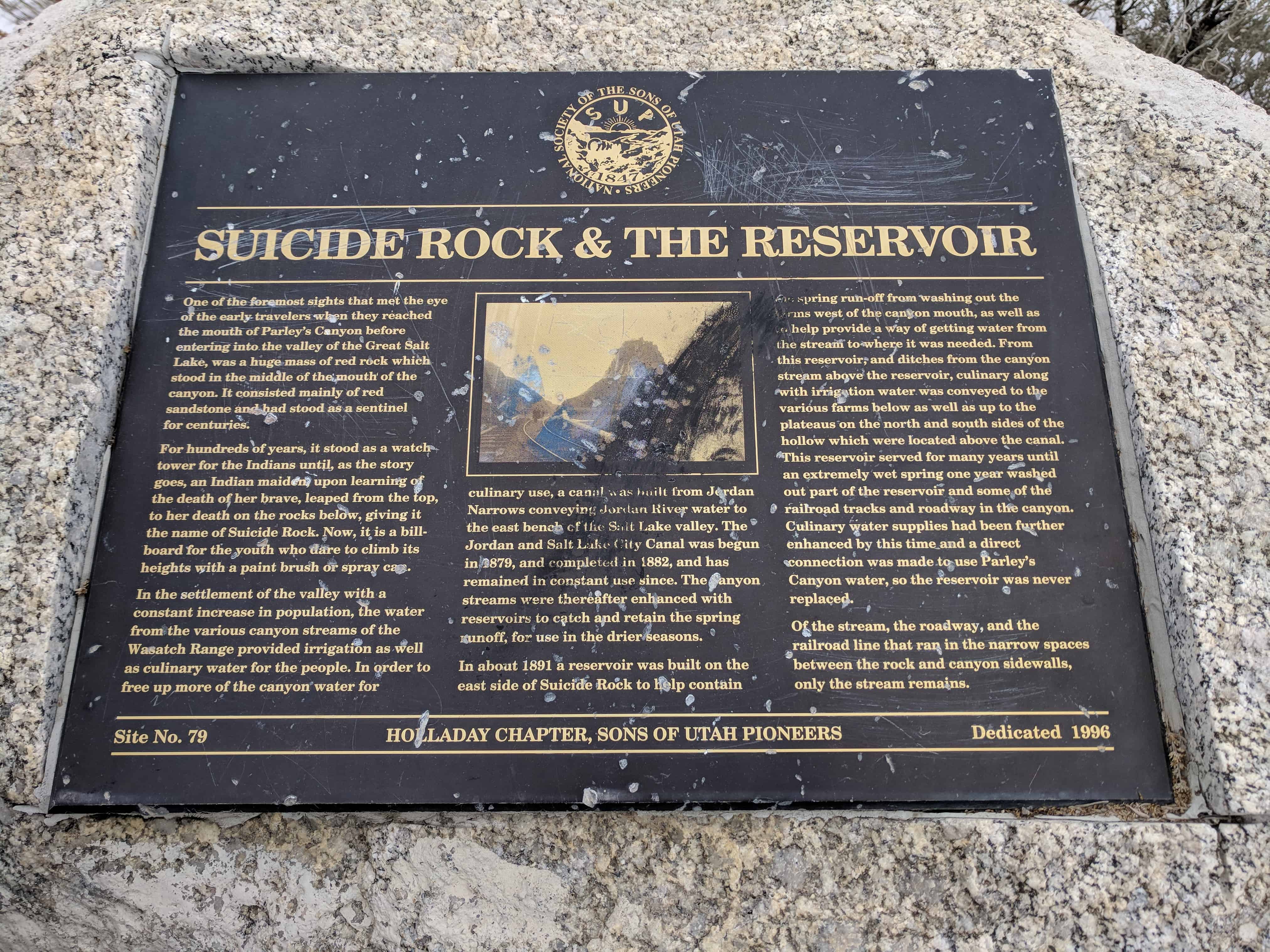
Suicide Rock & the Reservoir
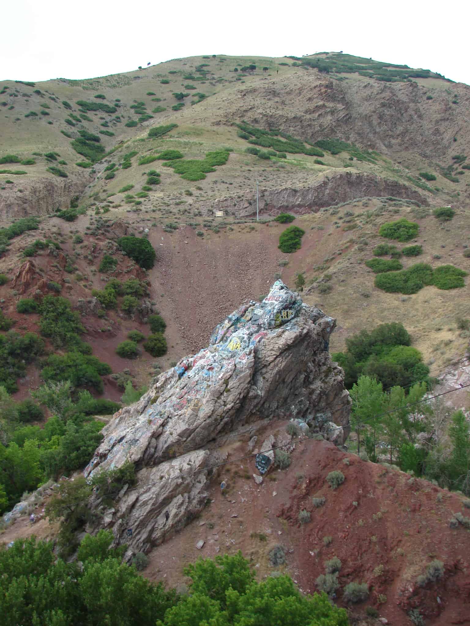
One of the foremost sights that met the eye of the early travelers when they reached the mouth of Parley’s Canyon before entering into the valley of the Great Salt Lake, was a huge mass of red rock which stood in the middle of the mouth of the canyon. It consisted mainly of red sandstone and had stood as a sentinel for centuries.
For hundreds of years, it stood as a watch tower for the Indians until, as the story goes, an Indian maiden upon learning of the death of her brave, leaped from the top, to her death on the rocks below, giving it the name of Suicide Rock. Now, it is a billboard for the youth who dare to climb its heights with paint brush or spray can.
In the settlement of the valley with a constant increase in population, the water from the various canyon streams of the Wasatch Range provided irrigation as well as culinary water for the people. In order to free up more of the canyon water culinary use, a canal was built from Jordan Narrows conveying Jordan River water to the east bench of the Salt Lake valley. The Jordan and Salt Lake City Canal was begun in 1879, and completed in 1882, and has remained in constant use since. The canyon streams were thereafter enhanced with reservoirs to catch and retain the spring runoff, for use in the drier seasons.
In about 1891 a reservoir was built on the east side of Suicide Rock to help contain the spring run-off from washing out the farms west of the canyon mouth, as well as to help provide a way of getting water from the stream to where it was needed. From this reservoir, and ditches from the canyon stream above the reservoir, culinary along with irrigation water was conveyed to the various farms below as well as up to the plateaus on the north and south sides of the hollow which were located above the canal. This reservoir served for many years until an extremely wet spring one year washed out part of the reservoir and some of the railroad tracks and roadway in the canyon. Culinary water supplies had been further enhanced by this time and a direct connection was made to use Parley’s Canyon water, so the reservoir was never replaced.
Of the stream, the roadway, and the railroad line that ran in the narrow spaces between the rock and canyon sidewalks, only the stream remains.
This is S.U.P. Marker # 79, to see the others in the series visit this page.