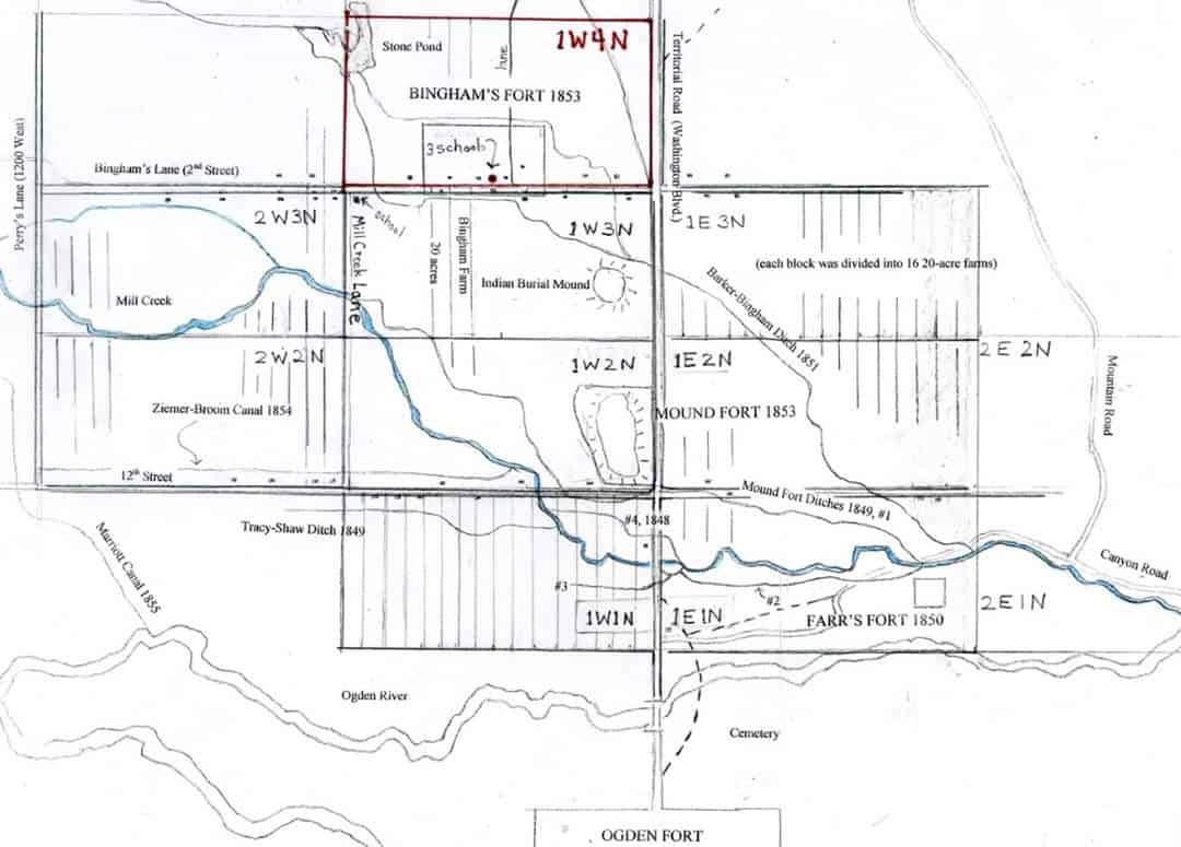
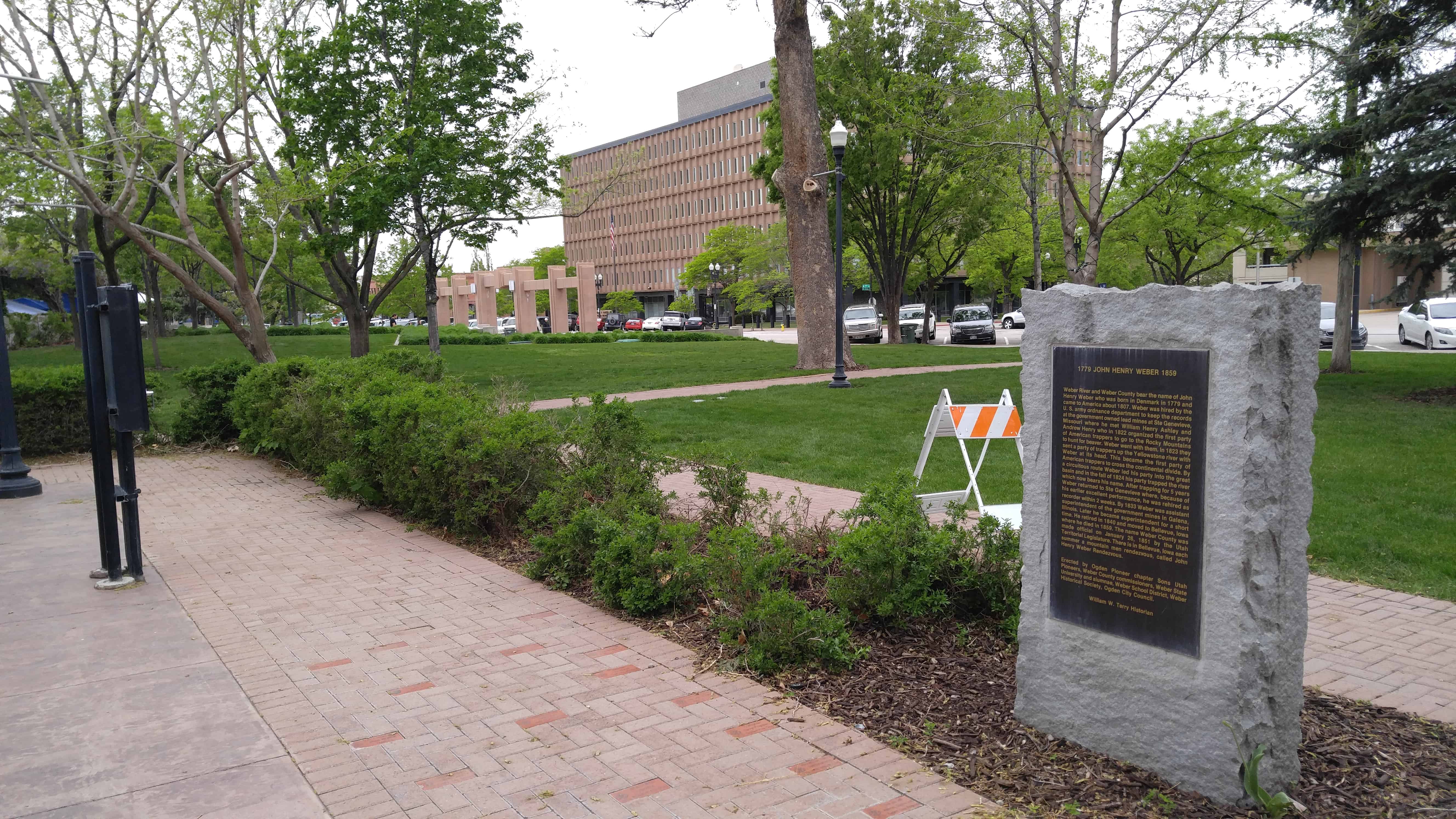
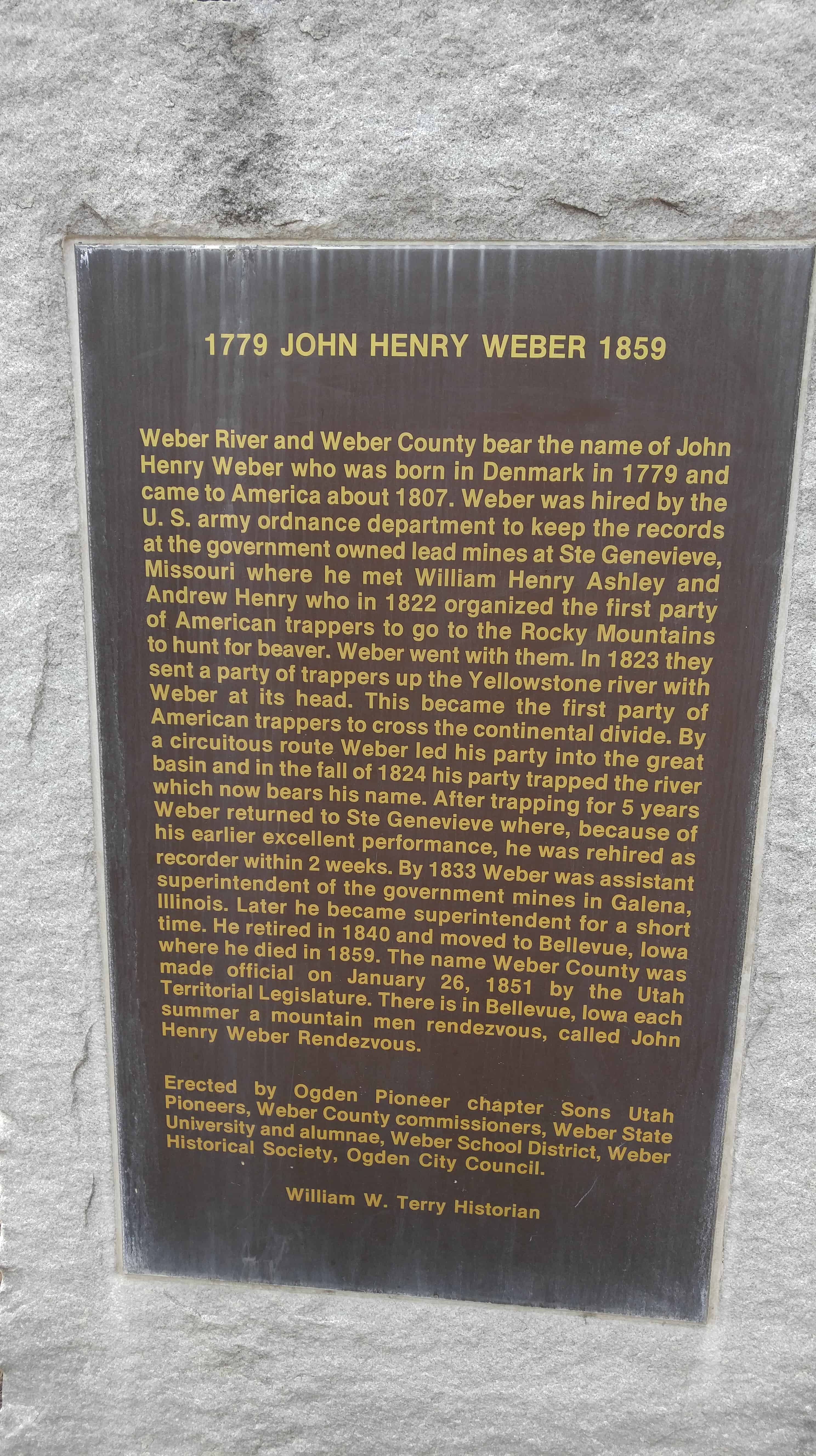
Weber River and Weber County bear the name of John Henry Weber who was born in Denmark in 1779 and came to America about 1807. Weber was hired by the U.S. army ordnance (sic) department to keep the records at the government owned lead mines at Ste Genevieve, Missouri where he met William Henry Ashley and Andrew Henry who in 1822 organized the first party of American trappers to go to the Rocky Mountains to hunt for beaver. Weber went with them. In 1823 they sent a party of trappers up the Yellowstone river with Weber at its head. This became the first party of American trappers to cross the continental divide. By a circuitous route Weber led his party into the great basin and in the fall of 1824 his party trapped the river which now bears his name. After trapping for 5 years Weber returned to Ste Genevieve where, because of his earlier excellent performance, he was rehired as recorder within 2 weeks. By 1833 Weber was assistant superintendent of the government mines in Galena, Illinois. Later he became superintendent for a short time. He retired in 1840 and moved to Bellevue, Iowa where he died in 1859. The name Weber County was made official on January 26, 1851 by the Utah Territorial Legislature. There is in Bellevue, Iowa each summer a mountain men rendezvous, called John Henry Weber Rendezvous.
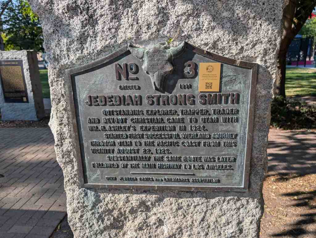
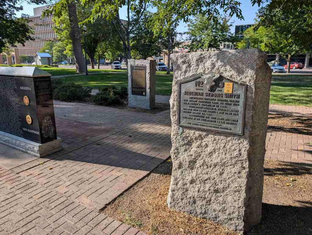
Outstanding explorer, trapper, trader and devout Christian. Came to Utah with Wm. H Ashley’s expedition in 1824.
Started first successful overland journey through Utah to the Pacific Coast from this vicinity August 22, 1826. Substantially the same route was later followed by the main Highway to Los Angeles.
Torrey is a small agricultural community on U-24 between Bicknell and Capitol Reef National Park, It was named in honor of Colonel Torrey, who fought in the Spanish American War. Torrey has had several earlier names such as Poverty Flat, Youngstown, Central, Popular, and Bortita.(*)
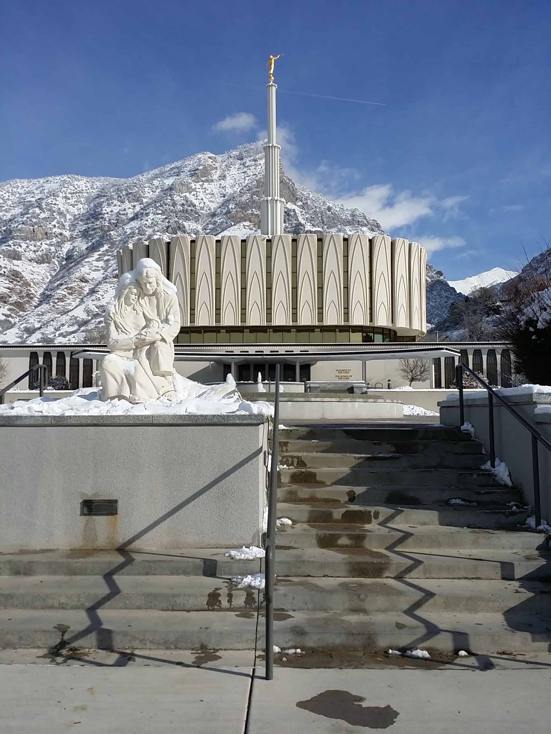
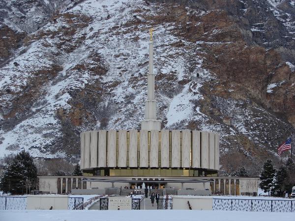
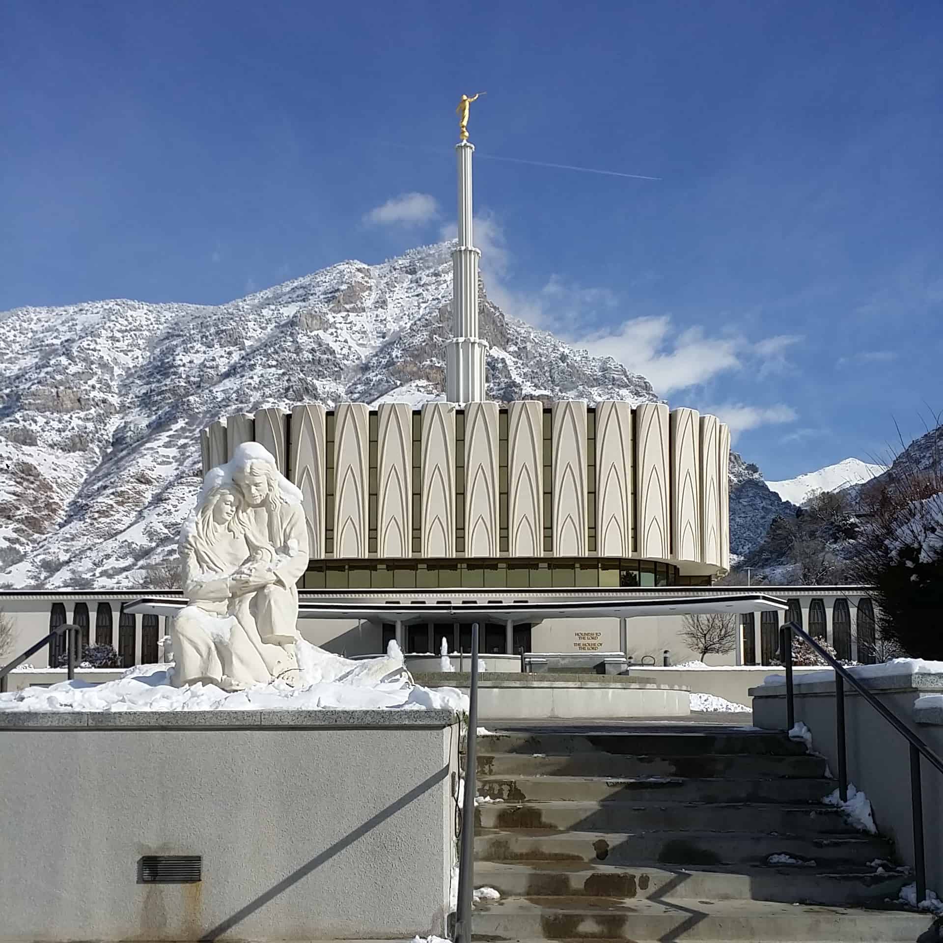
The Provo Utah Temple (formerly the Provo Temple) is the 17th constructed and 15th operating temple of The Church of Jesus Christ of Latter-day Saints (LDS Church). Located in the city of Provo, Utah, it was built with a modern single-spire design, similar to the original design of the original Ogden Utah Temple.
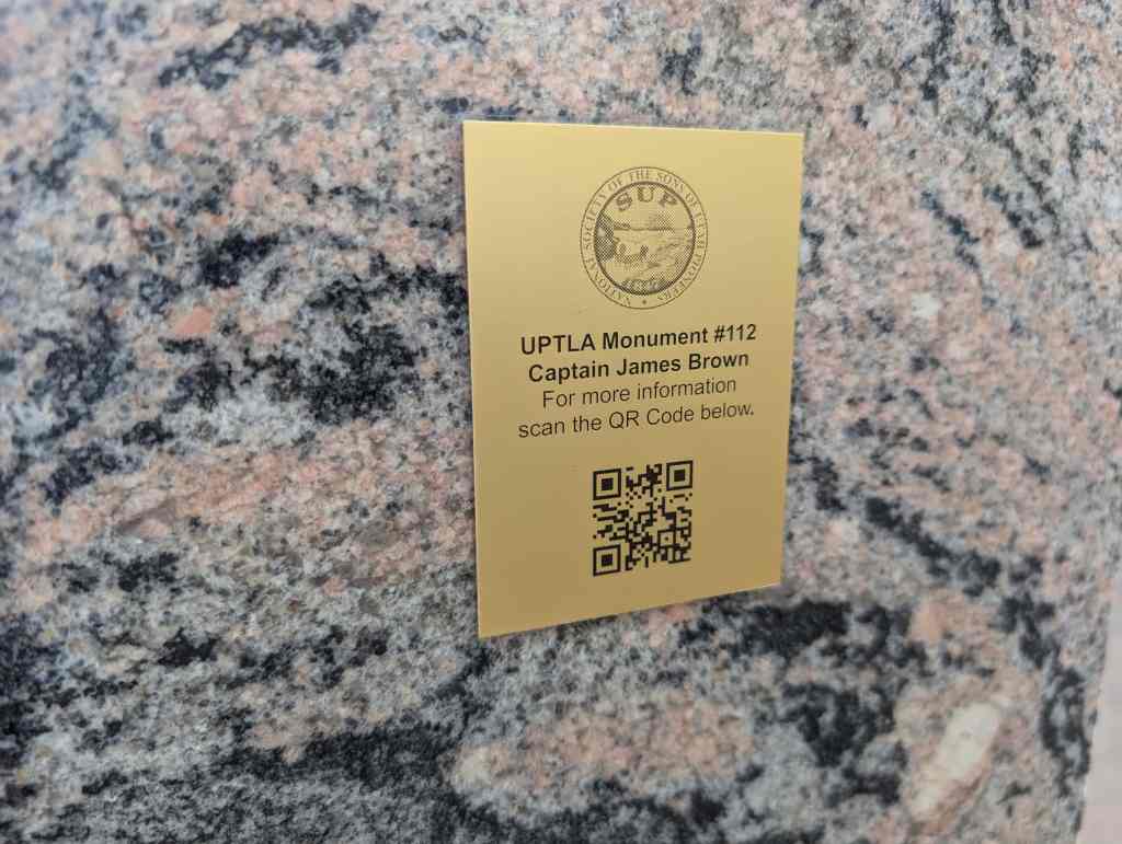
#112 – Captain James Brown Captain James Brown, pioneer, soldier and one of the founders of Ogden, enlisted in the Mormon Battalion of the U.S. Army in the Mexican War, July 18, 1846, at Council Bluffs, Iowa, and was made Captain of Company C. Longest march of Infantry ever recorded, at Santa Fe, Captain Brown was placed in charge of the sick detachment and ordered to Pueblo where they spent the winter of 1846-47 with a group of converts to the Church of Jesus Christ of Latter-Day Saints enroute from Mississippi to the Salt Lake Valley.
In the spring he marched his men by way of Fort Laramie and the South Pas arriving in the Valley July 23, 1847, closely following Brigham Young and the Mormon Pioneers.
Early in August he left by way of Fort Hall for California to collect the Army pay due members of the Battalion. Returning late in 1847, he stopped at the Fort of Miles Goodyear, a trapper, located near the junction of the Ogden and Weber Rivers. From Goodyear he purchased for $3,000 all of the land now comprising Weber County together with some livestock and the Fort.
the land was conveyed to Captain Brown in a Mexican Land Grant, this entire area being at that time a part of Mexico. In January 1848, he settled here with his family and began the colonization of Brownsville, late Ogden. He was born September 30, 1801, and died September 30, 1863.
This monument erected by descendants of Captain James Brown, Citizens of Weber County and the Utah Pioneer Trails and Landmarks Association.
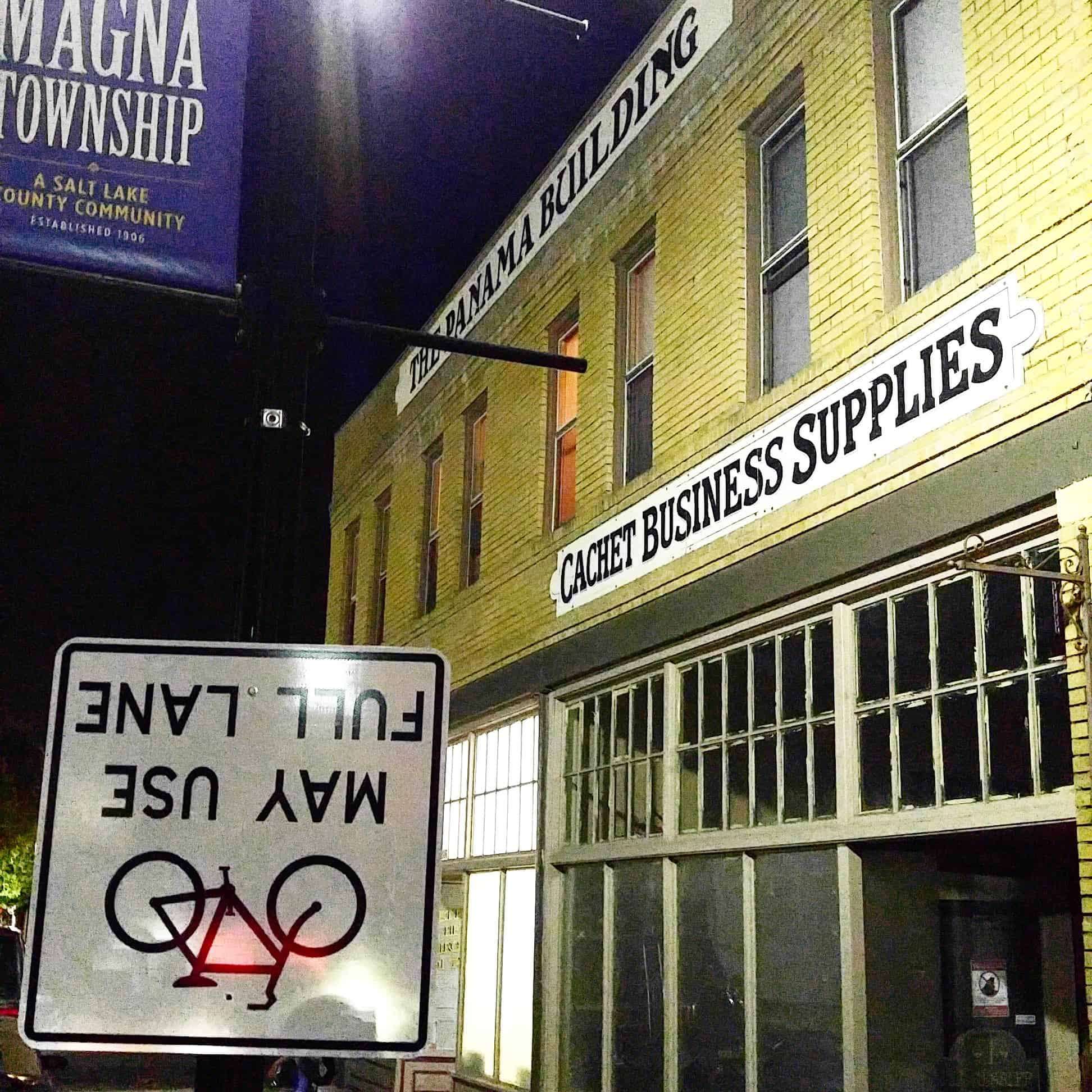
Settlement of the area began in 1851 shortly after the Mormon pioneers reached the Salt Lake Valley. Early Farmers settled in 1868 at the base of the northern Oquirrh Mountains and called their community Pleasant Green. By 1900, there were about 20 families in the area.
One of the first Pleasant Green pioneers was Abraham Coon, who established a livestock ranch and settlement called “Coonville” in a canyon mouth at about 5400 South. The canyon is now known as Coon Canyon, and Coon Creek flowing out of it, is one of the major Oquirrh Mountain drainages. Coon Creek flows north and west through Magna to the Great Salt Lake.
In 1897,the first LDS Ward, Pleasant Green Ward, was constructed. Prior to the construction of the ward house church was held in the homes of the settlers. The Pleasant Green Cemetery located in the Oquirrh foothills, about 3500 South, where many community pioneers are buried, was established in 1883.
In 1890, in response to a law requiring all children to receive a free education, a public school was built at about 4100 South 8450 West This one-room structure, and an existing brick and adobe building at 8600 West 2700 South were known as the District 47 Schools, containing all grades, and served the whole northwestern Salt Lake Valley.
In the early 1900’s, copper mining activity in the Oquirrhs began transforming the Pleasant Green area from an agricultural hamlet to an industrial community. D.C. Jackling established the Utah Copper Company, which later became Kennecott Copper Corp.
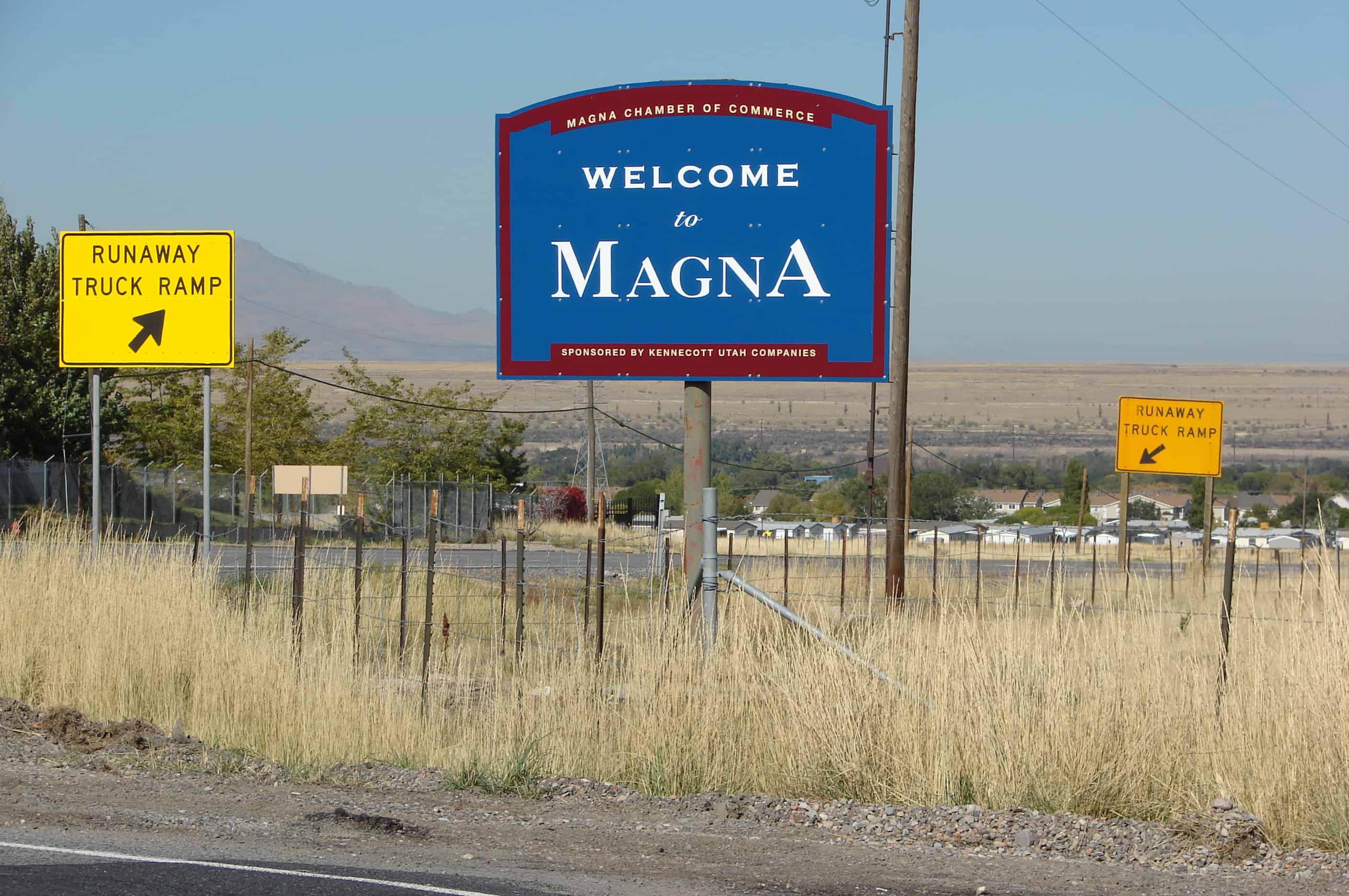
In 1906, the company began constructing its Magna Mill. He chose the name “Magna” from the Latin word meaning “great” or “superior.”
Boston Consolidated Copper constructed a second mill in the area in 1909. Two years later the companies merged and the mill was renamed as the Arthur Mill. Construction workers lived in a temporary settlement known as “Ragtown,” that was located north of the present Webster School at the base of the hill on which the mills are still located. Several substantial homes were built in the tent city and later moved to the present community. As the mills began operating, some local farmers traded in their ploughs for a steady company paycheck, and began moving in to work at the mills.
In 1906, postal officials complained that “Pleasant Green” was too similar to “Pleasant Grove,” another Utah town. So the community adopted the name “Magna” from the mill.
By 1909, the Hawthorne School (no longer standing) had been built in the eastern Magna area. In 1908, the present Webster School was built at the west end of what is now called Main Street. In 1924, the first building of the present Cyprus High School was completed. Over the years, various new buildings and additions have been constructed to comprise the present school campus.
At the time, automobile commuting to work was not practical, few mining workers had cars and cross valley roads were in marginal condition. Workers lived in the town and walked to the mills. Downtown Magna was scaled to the pedestrian. The area included churches, saloons, fraternal halls, and stores that met residents social, entertainment, and shopping needs. Several small neighborhoods, such as Japtown, Snaketown, and Little Italy developed around main street, all adding to Magna’s colorful history.
Many early residents were immigrants primarily from Eastern Europe. Magna developed a reputation for embodying the American dream – being a town where immigrants’ children gained an education and often moved into professional, business and civic leadership roles in and outside the community.
Between 1915 and 1960, the town’s fortunes fluctuated with the copper industry. During the depression, the mills shut down for a period and workers were laid off. But about 1940, there was resurgence as pending war boosted copper demand and that growth continued through the 1960’s.
By the 1960s, the community was experiencing the first signs of a suburban transition. The Hercules Powder Co., once a small dynamite manufacturing firm, had begun producing rocket motors at its Baccus Works south of the Magna community. The increased jobs were one factor encouraging subdivision development in the Magna, Kearns and West Valley areas.
In 1961, the voters in the Magna Improvement District (now the Magna Water and Sewer District) approved a bond that financed a sewage treatment plant, water storage tanks, pumps and well development. The improvements created sufficient capacity to serve more than double the population at the time and ehlped open the way for development.
Not only did Magna’s population begin shifting southward during the 1960s, but also automobile commuting, both to work and shopping, became common. As business activity moved to other areas, Main Street slowly began to deteriorate. Presently, some of the commercial space there is vacant and in general, ready for businesses that wish to cater to the pedestrian.
During the 1970s, as part of a general west valley suburbanization trend, the community experienced more dramatic growth. Inexpensive land south and east of the historic town center began being developed into moderate priced single-family homes. The new neighborhoods trended to attract middle-income working class couples with younger families. While the community had grown from approximately 8,900 in 1960 to 10,000 in 1970, between 1970 and 2000, population has increased to over 23,000. This increase is about double the countywide growth rate.
For many decades, Magna has maintained its status as one of Utah’s most populous unincorporated communities. With this population come 5 Elementary schools, 2 Jr. High Schools and 1 High School. We have 3 grocery stores and numerous other eating and shopping areas outside of the downtown area.
We have brought about changes in our area that have made us a Township in Salt Lake County. This change alone took over 10 years. Our growth and development continue to be a big part of what makes up Magna. Magna is an area to be watched in the present and future of Utah, as we grow and bring about great things for all.(*)