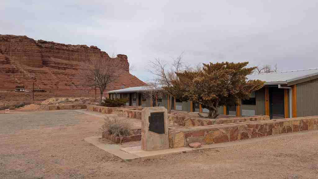
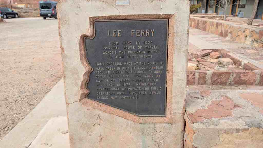
Lee Ferry From 1872 to 1929 Principal route of travel across the Colorado River to Utah Settlements
First Crossing made at the mouth of Paria Creek in 1864 by Jacob Hamblin. Regular ferry established by John Doyle Lee in 1872. Purchased by Latter-day Saints Church after his death in 1877. Maintained continuously by private and public operators until 1929 when Navajo Bridge was completed.
Originally built in 1899 as the Arizona and Utah Railway, this short-line reached almost twenty five miles from the siding at McConnico on the Sante Fe to the White Hills. In 1904, a storm washed out much of the route. In 1905, the Sante Fe acquired the right-of-way and created the Western Arizona Railway over the same route. This railroad served the mines in the Chloride area, as well as mines in nearby Eldorado Canyon in Nevada. In 1910 the Western Arizona was completed to Chloride proper, and served the community until 1931. Though it was considered for expansion to bring supplies to the Hoover Dam project, the distance was too far and the railway was abandoned. In cooperation with the Chloride Historical Society, and the people of Chloride, Arizona.
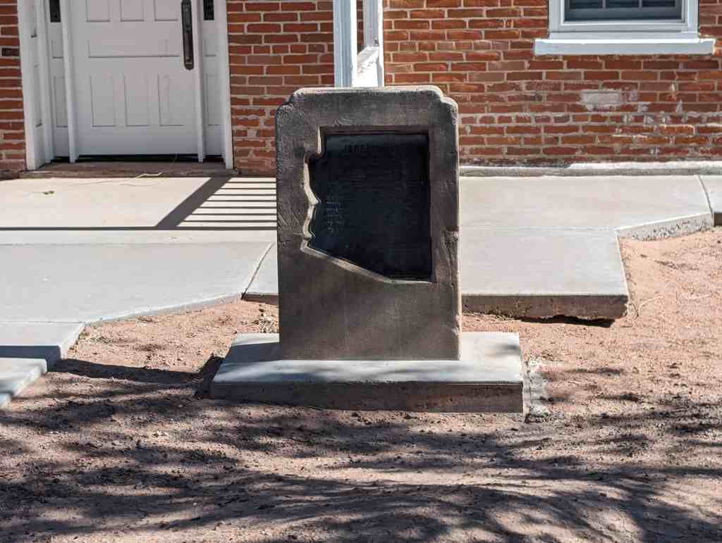
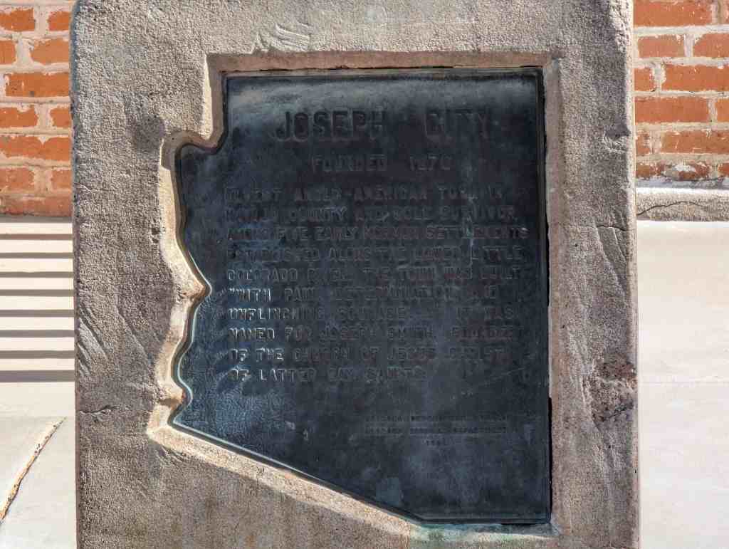
Oldest Anglo-American town in Navajo County and sole survivor among five early Mormon settlements.
Established along the lower Little Colorado River. The town was built “with pain, determination, and unflinching courage…” It was named for Joseph Smith, founder of The Church of Jesus Christ of Latter-day Saints.
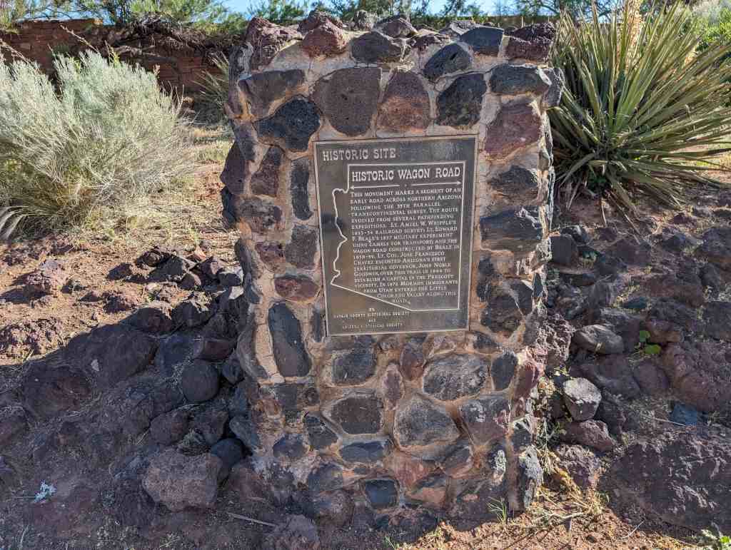
This monument marks a segment of an early road across northern Arizona following the 35th parallel-transcontinental survey. The route evolved from several pathfinding expeditions: Lt. Amiel W. Whipple’s 1853-54 railroad survey; Lt. Edward F. Beale’s 1857 military experiment using camels for transport; and the wagon road constructed by Beale in 1858-59. Lt. Col. Jose Francisco Chavez escorted Arizona’s first territorial governor, John Noble Goodwin, over this trail in 1864 to establish a capital in the Prescott vicinity. In 1876 Mormon immigrants from Utah entered the Little Colorado Valley along this road.
Located at 205 East 2nd Street in Winslow, Arizona
This monument marks a segment of an early road across northern Arizona following the 35th parallel-transcontinental survey. The route evolved from several pathfinding expeditions: Lt. Amiel W. Whipple’s 1853-54 railroad survey; Lt. Edward F. Beale’s 1857 military experiment using camels for transport; and the wagon road constructed by Beale in 1858-59. Lt. Col. Jose Francisco Chavez escorted Arizona’s first territorial governor, John Noble Goodwin, over this trail in 1864 to establish a capital in the Prescott vicinity. In 1876 Mormon immigrants from Utah entered the Little Colorado Valley along this road.
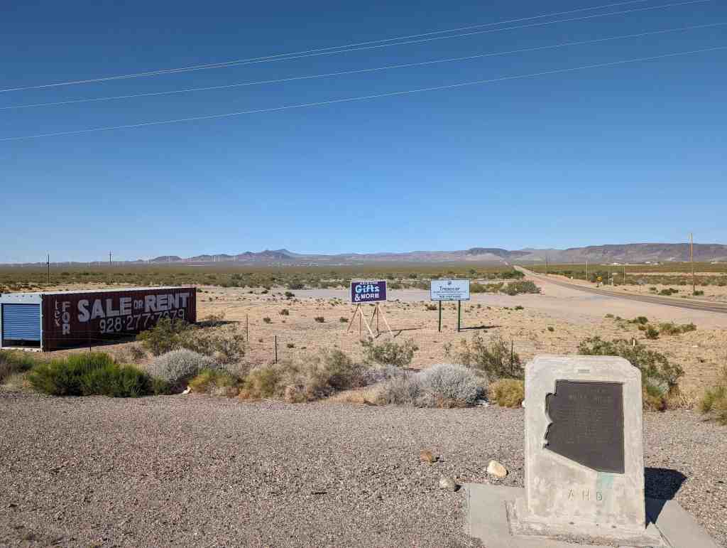
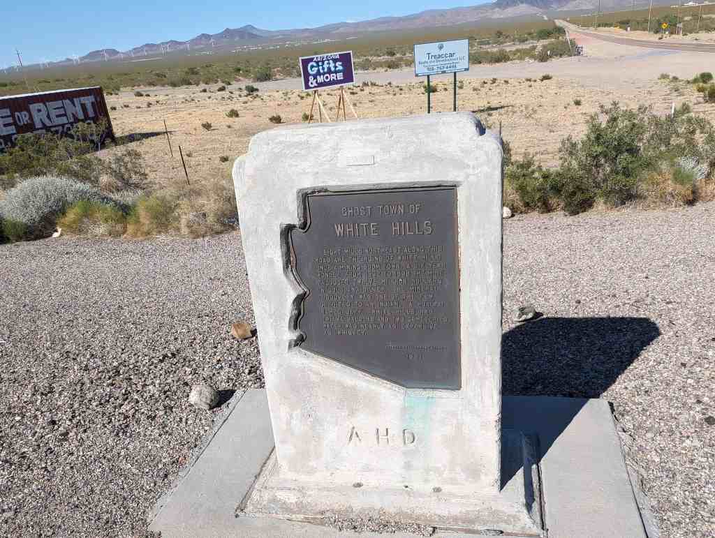
Eight miles northeast along this road are the ruins of White Hills, once a mining boom town. A six-year wonder, from 1892 to 1898 the mine produced twelve million dollars in gold and silver. The mineral discovery was one of the few credited to an indian… a hualpai named Jeff. White Hills had twelve saloons and two cemeteries. Water was nearly as expensive as whiskey.
Formerly known as Indian Secret Mining District or Silverado, the White Hills mining camp started in the 1890’s. The mines were rich producers of silver, especially horn silver, also called chloride silver. This large community was devastated by a flash flood on the morning of August 5, 1899 from which the town never recovered. After the closure of the mines, the remaining buildings slowly disappeared. Now nothing is left of the once prosperous mining camp. The ghost town of White Hills continues to be marked on travel maps.
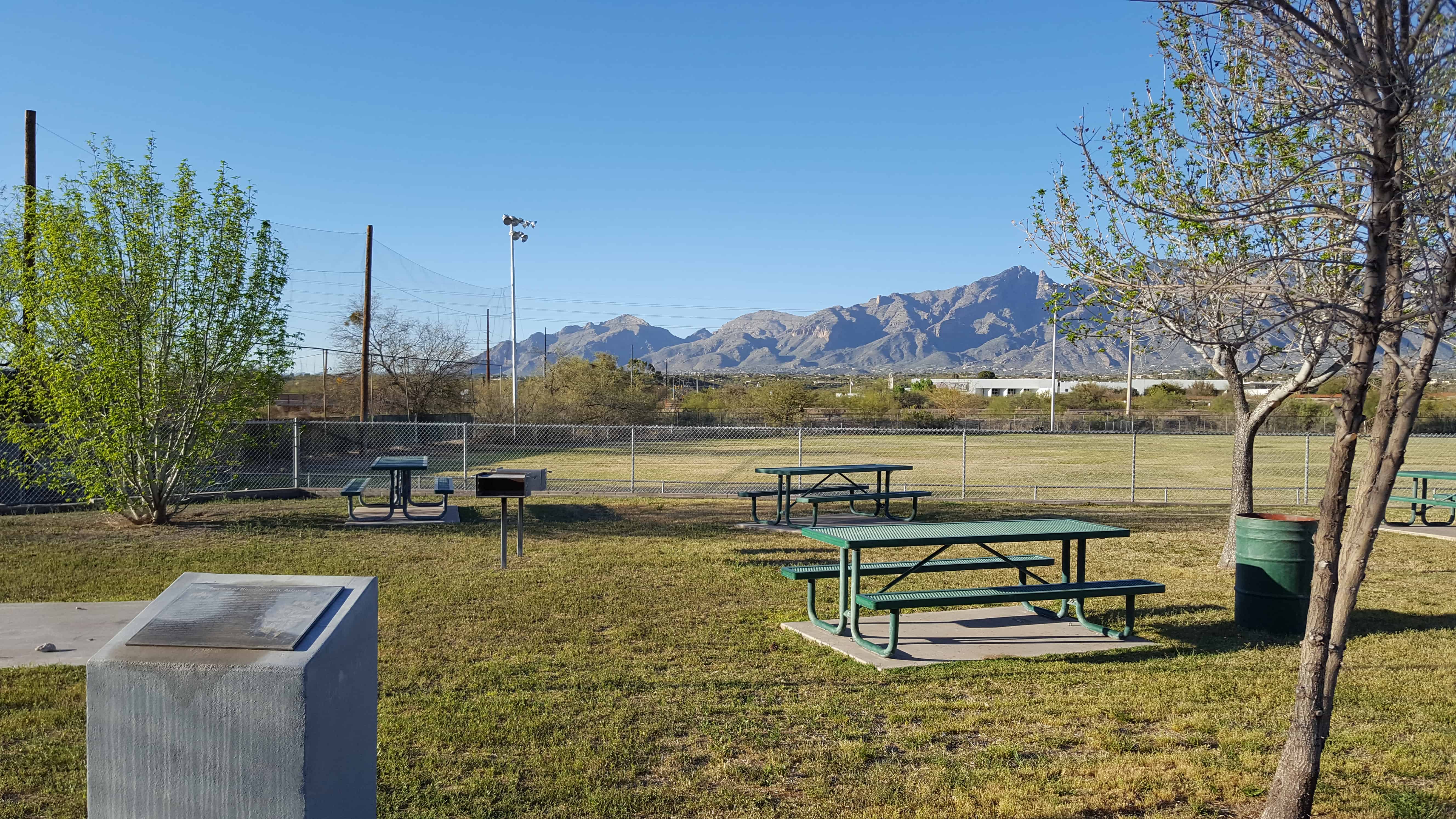
The first members of The Church of Jesus Christ of Latter-day Saints to enter what is now Arizona were remnants of the Mormon Battalion. They arrived in the Valley of the Tucson Basin December 17, 1847, prepared for battle. However, the Mexican Garrison refused to surrender and departed with most of the population. The Stars and Stripes were raised over the ancient Indian village. This march accomplished the task of pioneering a route through southern Arizona and inspired many, like Pvt. Erastas Bingham, to return with his wife and sons. They homesteaded, cleared land of mesquite, creosote, cats claw, rattlers, Gila monsters, lizards and tarantulas. Teams, plows, picks, and shovels were used to build reservoirs and irrigation systems. They called their community Binghampton, The children walked or rode on horseback or in buggies to school at Nephi Bingham’s home. School was later held in a one-room building south of the Rillito River at Fort Lowell & Maple Boulevard. In 1905 Alexander Davidson donated land for the Davidson School. Charles Bayless furnished materials, and members of The Church of Jesus Christ of Latter-day Saints donated labor. The school was used for cultural and church events. Settler families, Bingham, Farr, Young, Webb, Williams, and Hurst, were soon followed by Mormon Colonists fleeing Mexico. Colonists Langford, Bluth, Done, Ray, Johnson, Hardy, Nelson, Stock, Evans, Terrel, Jesperson, James, Price, Cordon, Butler, Huish, Naegle, Heder, Chlarson, and others added to the bustling Mormon farm village. The Binghampton Branch of The Church of Jesus Christ of Latter-day Saints was organized May 22, 1910. Binghampton was gradually absorbed by Tucson’s growth. All that remains is the pioneer cemetery, a few adobe homes, and the chapel built in 1927, still used by ward members from the Tucson Arizona Stake.
This is DUP Marker #548, for other DUP Markers click here.
Here the first Government Indian School was established for Pimas and Maricopas in 1871, with Rev. Charles H. Cook as teacher. It was the location of Pima villages, friendly resting place for travelers during the Mexican War and the Gold Rush. It was also the birth place of Ira Hayes, a Pima, one of the U.S. Marines in the famed Flag-Raising at Iwo Jima.
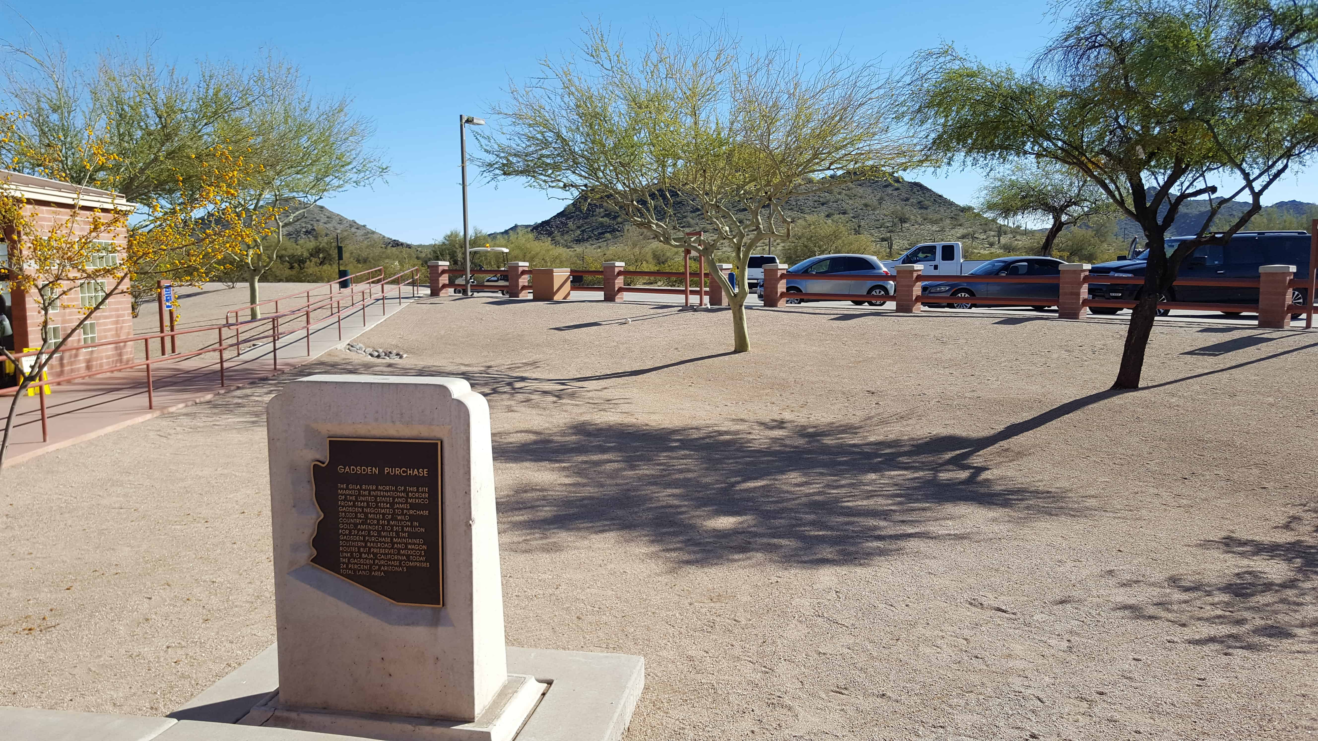
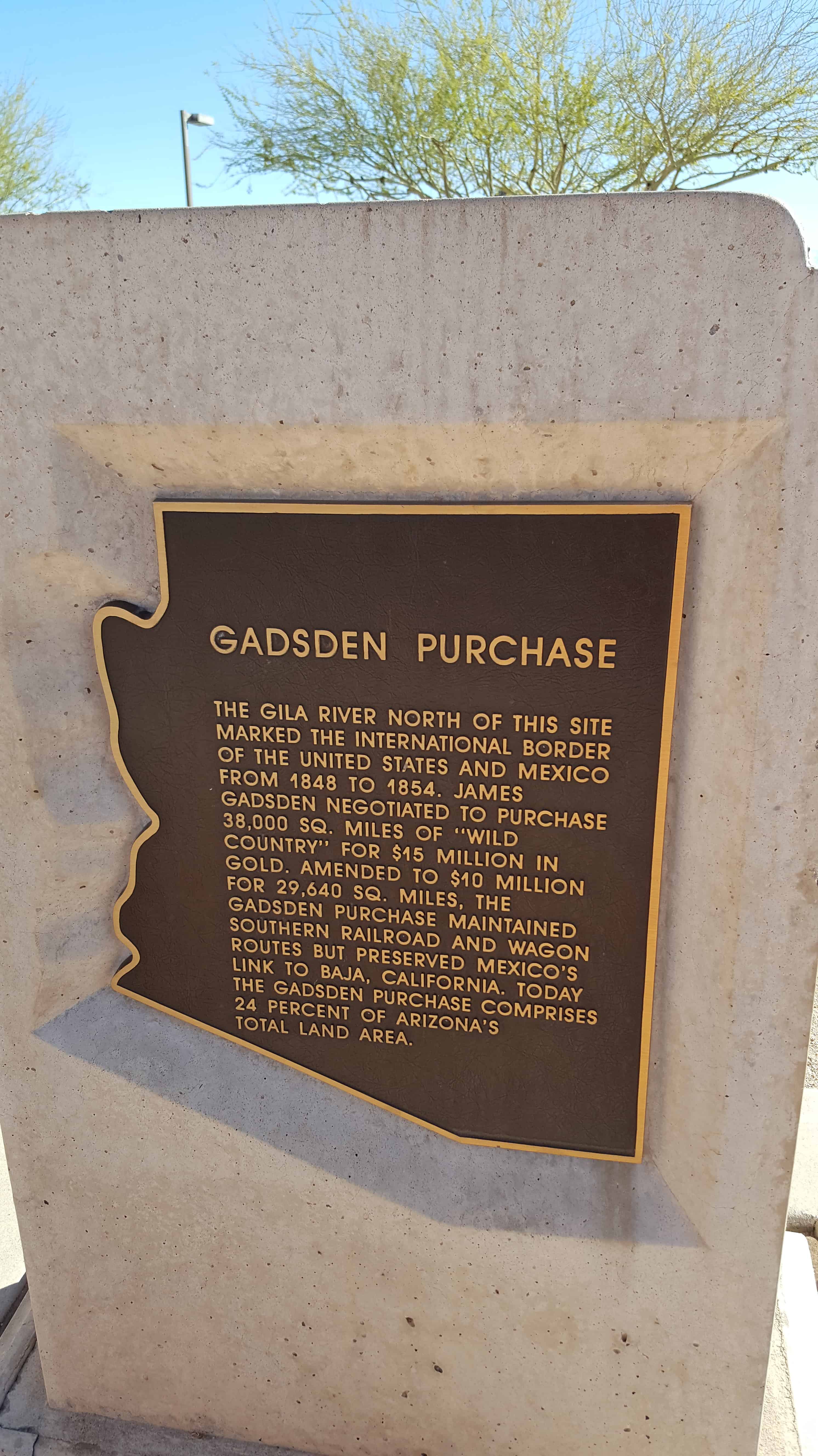
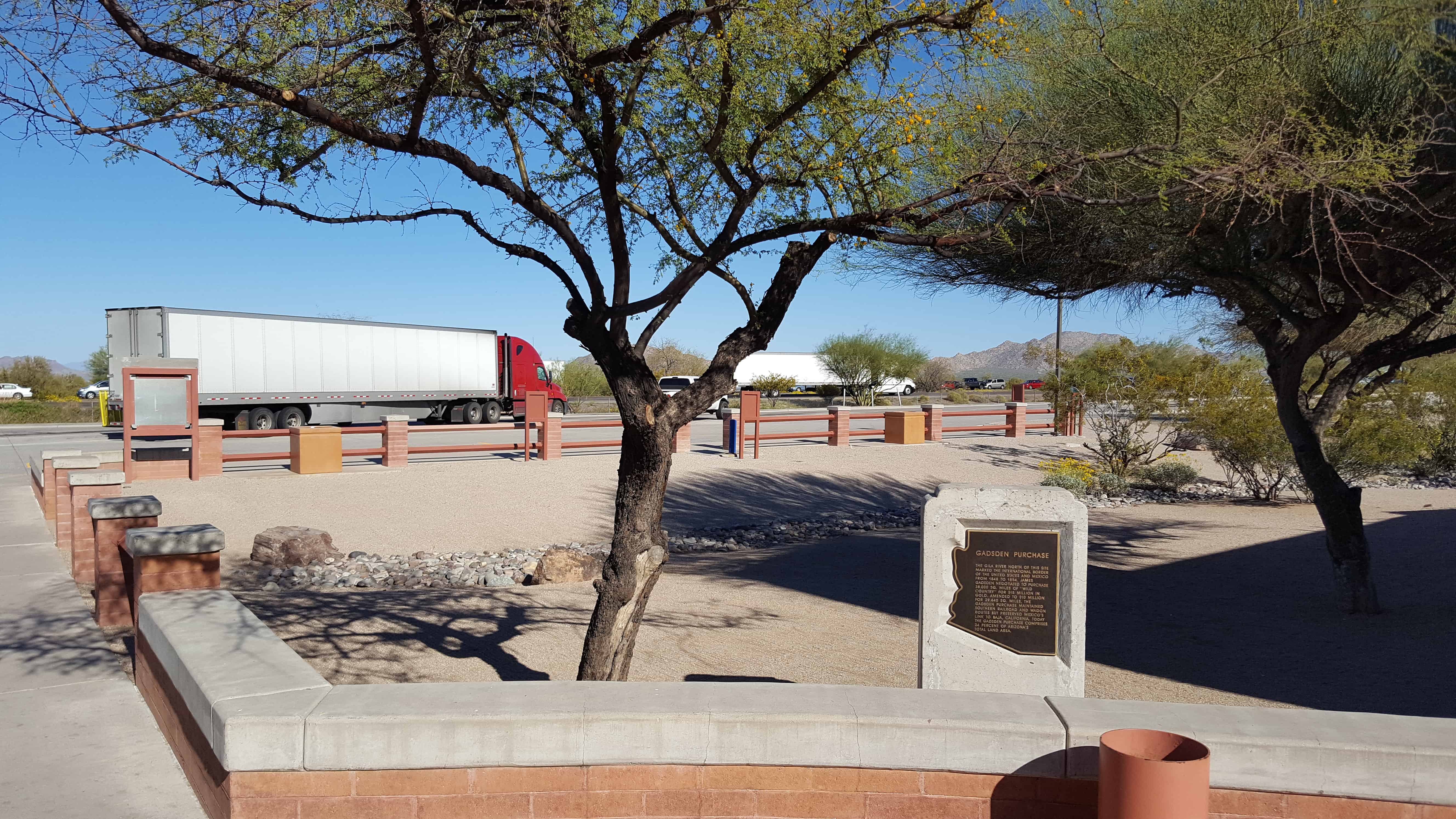
The Gila River north of this site marked the international border of the United States and Mexico from 1848 to 1854. James Gadsden negotiated to purchase 38,000 SQ. Miles of ‘wild country’ for $15 million in gold. Amended to $10 million for 29,640 SQ. miles, the Gadsden Purchase maintained southern railroad and wagon routes but preserved Mexico’s link to Baja, California. Today the Gadsden Purchase comprises 24 percent of Arizona’s total land area.