Tags
Beaver Dam, Arizona is in Mohave County on Interstate 15 just east of Mesquite, Nevada.
Related Posts:
- Beaver Dam Sinkhole
- Beaver Dam Wash (the lowest point in Utah)
- Beaver Dam Wash and Welcome Creek area
- The Old Spanish Trail (historic marker)

28 Monday Sep 2020
Posted in Uncategorized
Tags

Beaver Dam, Arizona is in Mohave County on Interstate 15 just east of Mesquite, Nevada.
Related Posts:
20 Thursday Jul 2017
Posted in Uncategorized

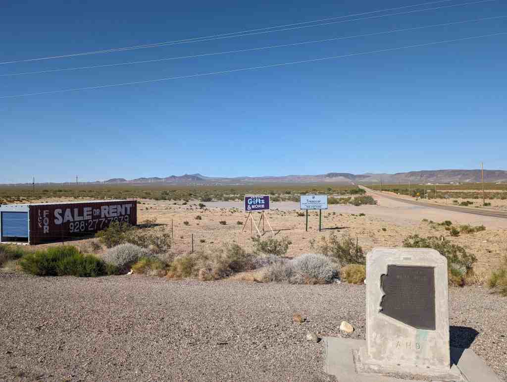
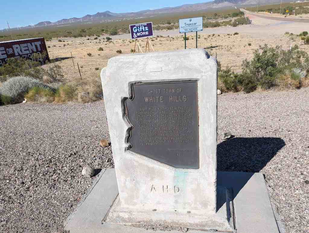
Ghost Town of White Hills
Eight miles northeast along this road are the ruins of White Hills, once a mining boom town. A six-year wonder, from 1892 to 1898 the mine produced twelve million dollars in gold and silver. The mineral discovery was one of the few credited to an indian… a hualpai named Jeff. White Hills had twelve saloons and two cemeteries. Water was nearly as expensive as whiskey.


Formerly known as Indian Secret Mining District or Silverado, the White Hills mining camp started in the 1890’s. The mines were rich producers of silver, especially horn silver, also called chloride silver. This large community was devastated by a flash flood on the morning of August 5, 1899 from which the town never recovered. After the closure of the mines, the remaining buildings slowly disappeared. Now nothing is left of the once prosperous mining camp. The ghost town of White Hills continues to be marked on travel maps.
Related:


22 Wednesday Mar 2017
Posted in Uncategorized
Tags
Arizona, Forts, historic, Historic Markers, LDS, Mohave County, National Monuments, Pipe Spring, Springs

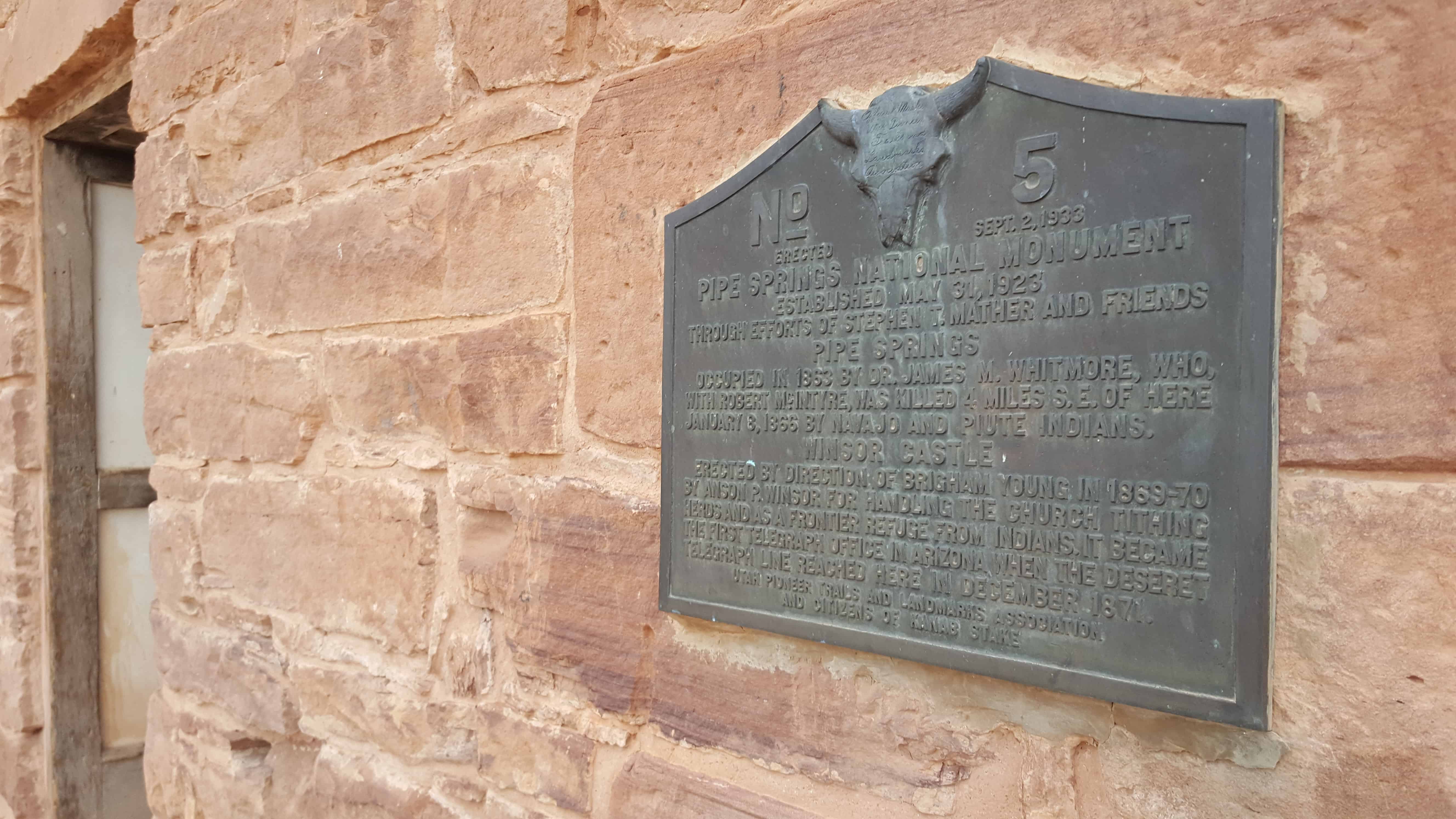
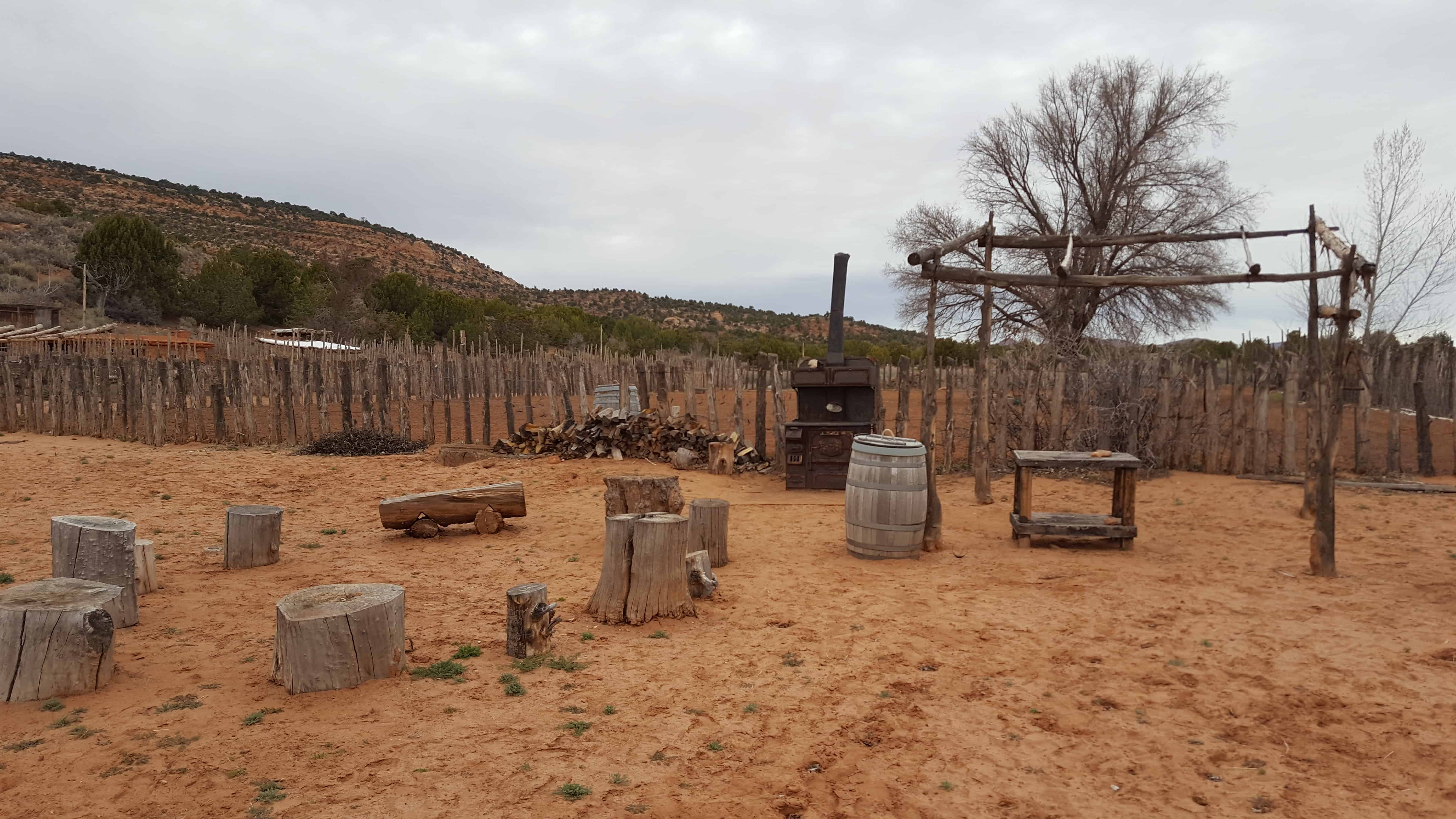
UPTLA (SUP) Marker #5 at Pipe Spring National Monument.
PIPE SPRINGS NATIONAL MONUMENT, Established May 31, 1923, through efforts of Stephen T. Mather and friends. PIPE SPRINGS, occupied in 1863, by Dr. James M Whitmore, who, with Robert McIntire was killed 4 miles S.E. of Pipe Springs January 8, 1866, by Navajo and Piute Indians.
WINDSOR CASTLE Erected by direction of Brigham Young in 1869 – 70 by Anson Windsor for handling the Church tithing herds and as a frontier refuge from Indians. It became the first telegraph office in Arizona when the Deseret Telegraph Line reached here in December 1871.
See other historic markers in the series on this page for UPTLA/SUP Markers.
08 Sunday Jan 2017
Posted in Uncategorized
Tags
Arizona, Arizona Historic Markers, Forts, historic, Historic Buildings, Historic Markers, Mohave County, National Monuments, National Parks, Pipe Spring National Monument, Springs

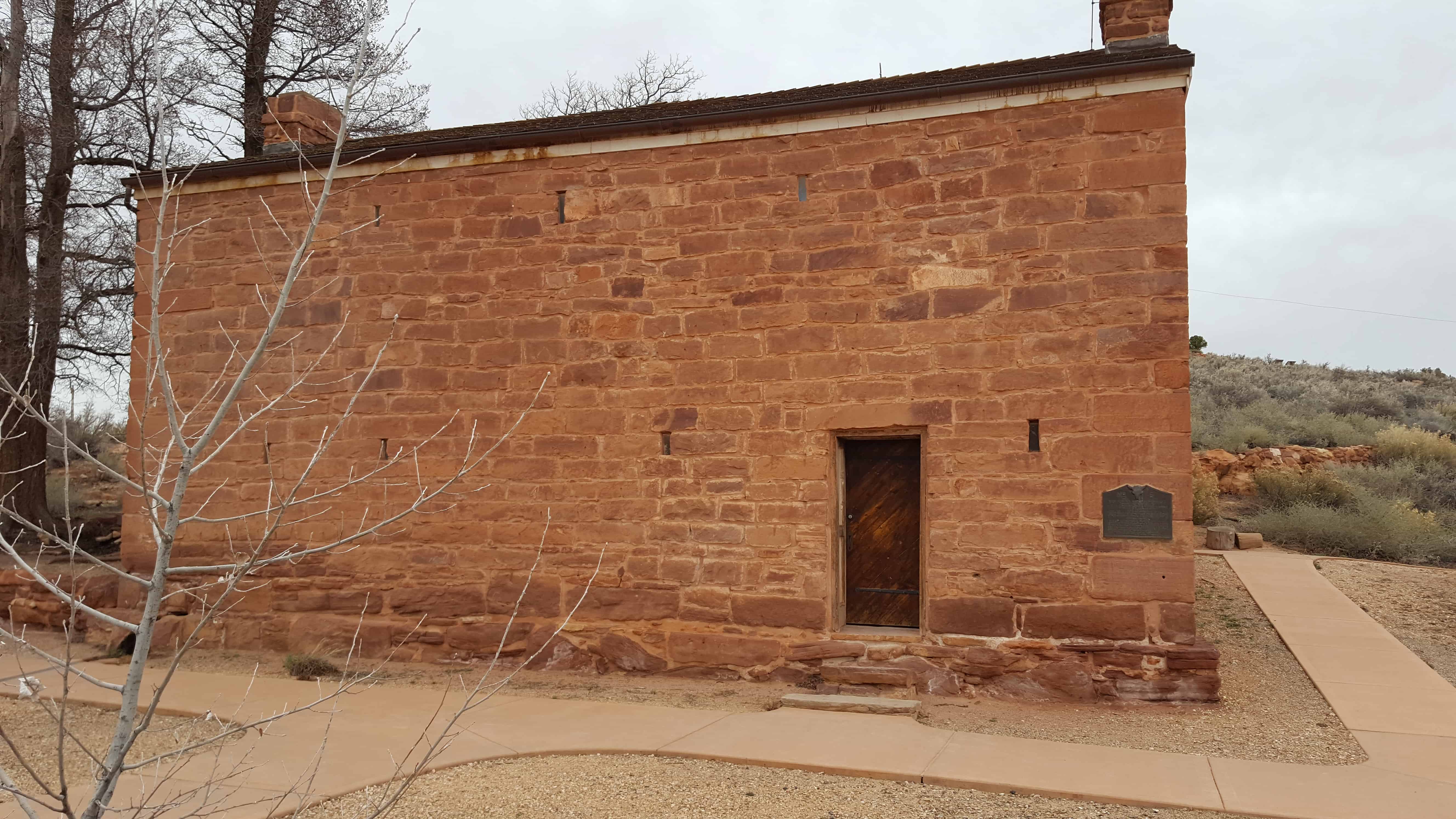
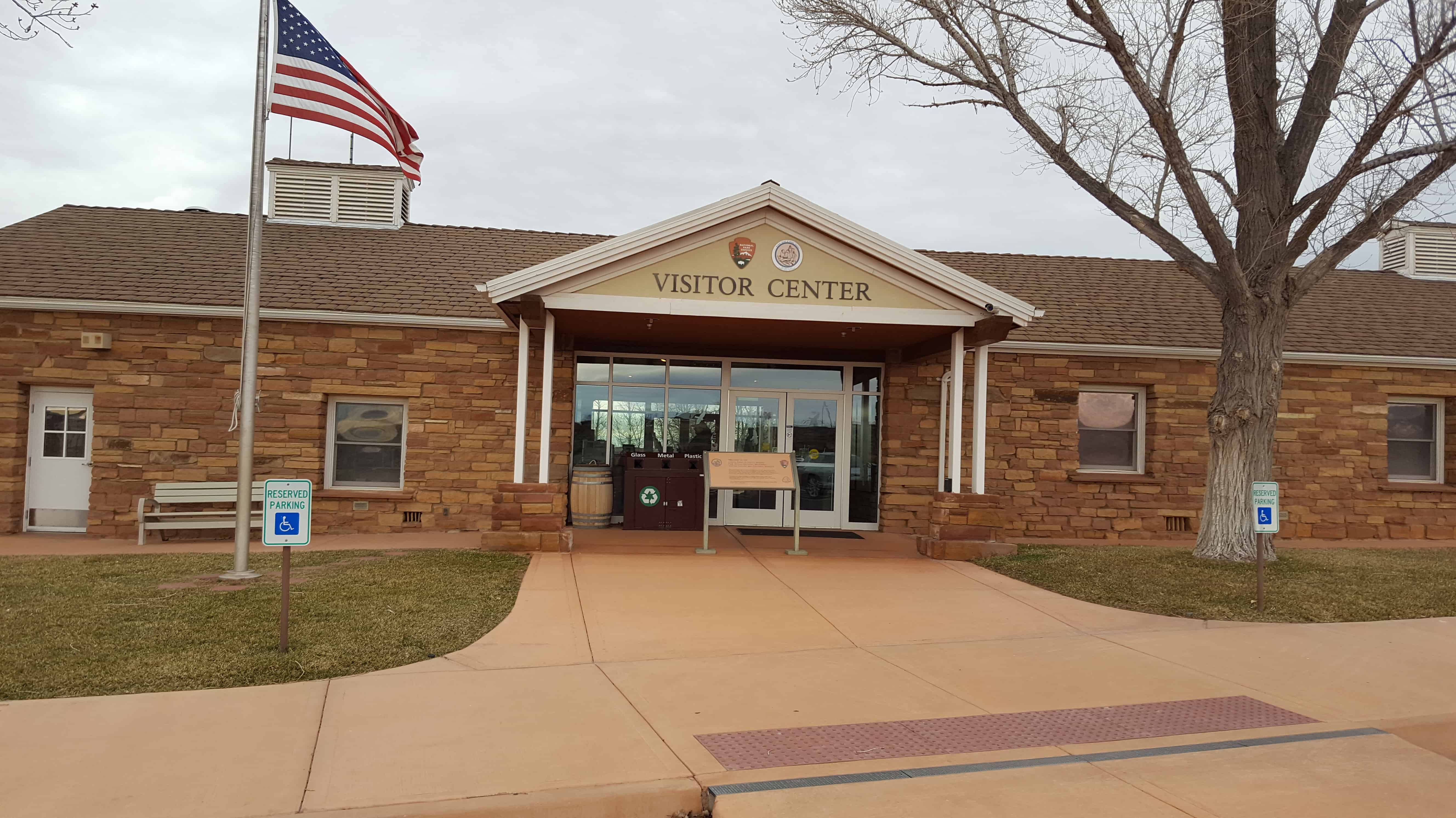
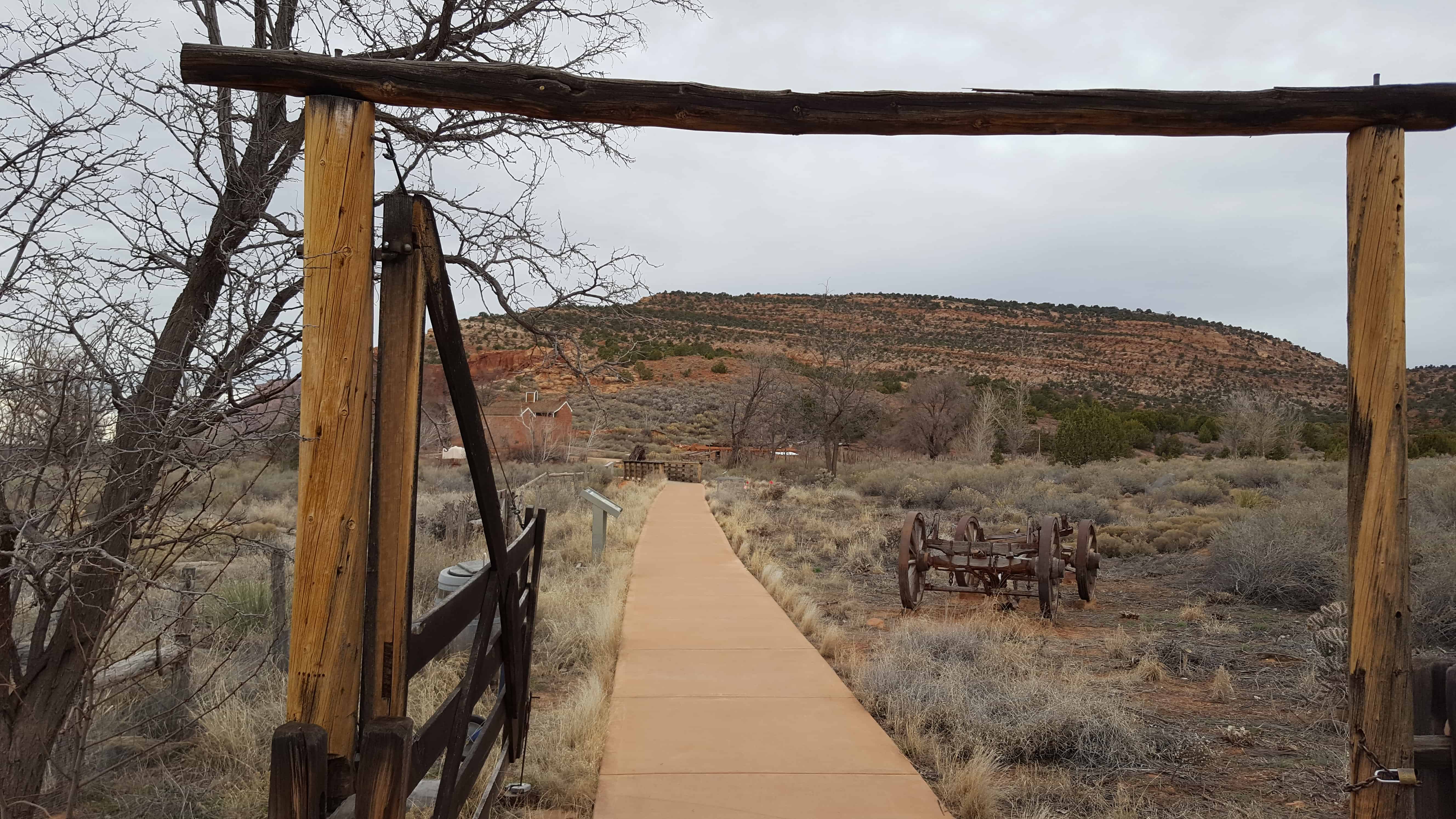
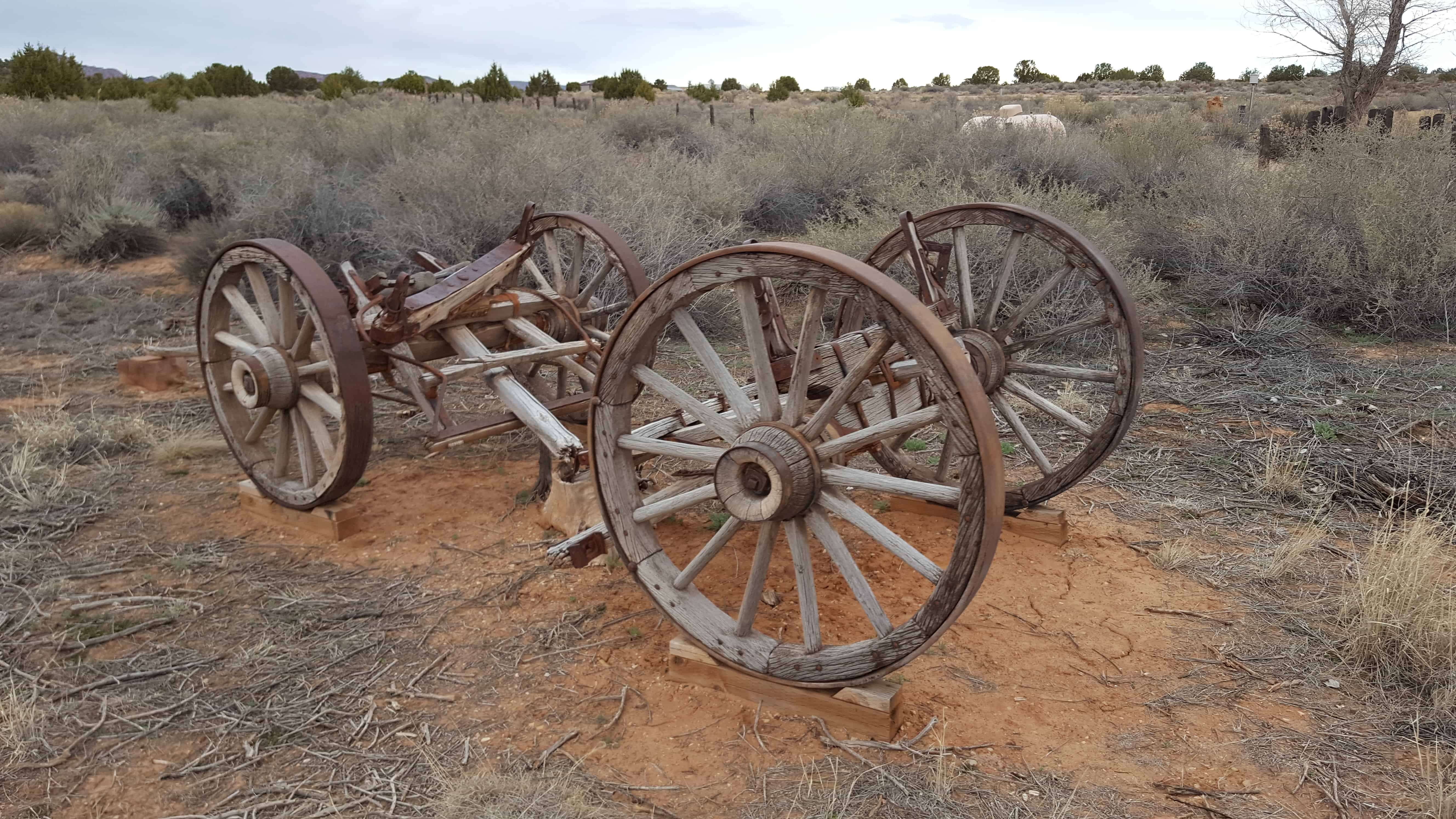
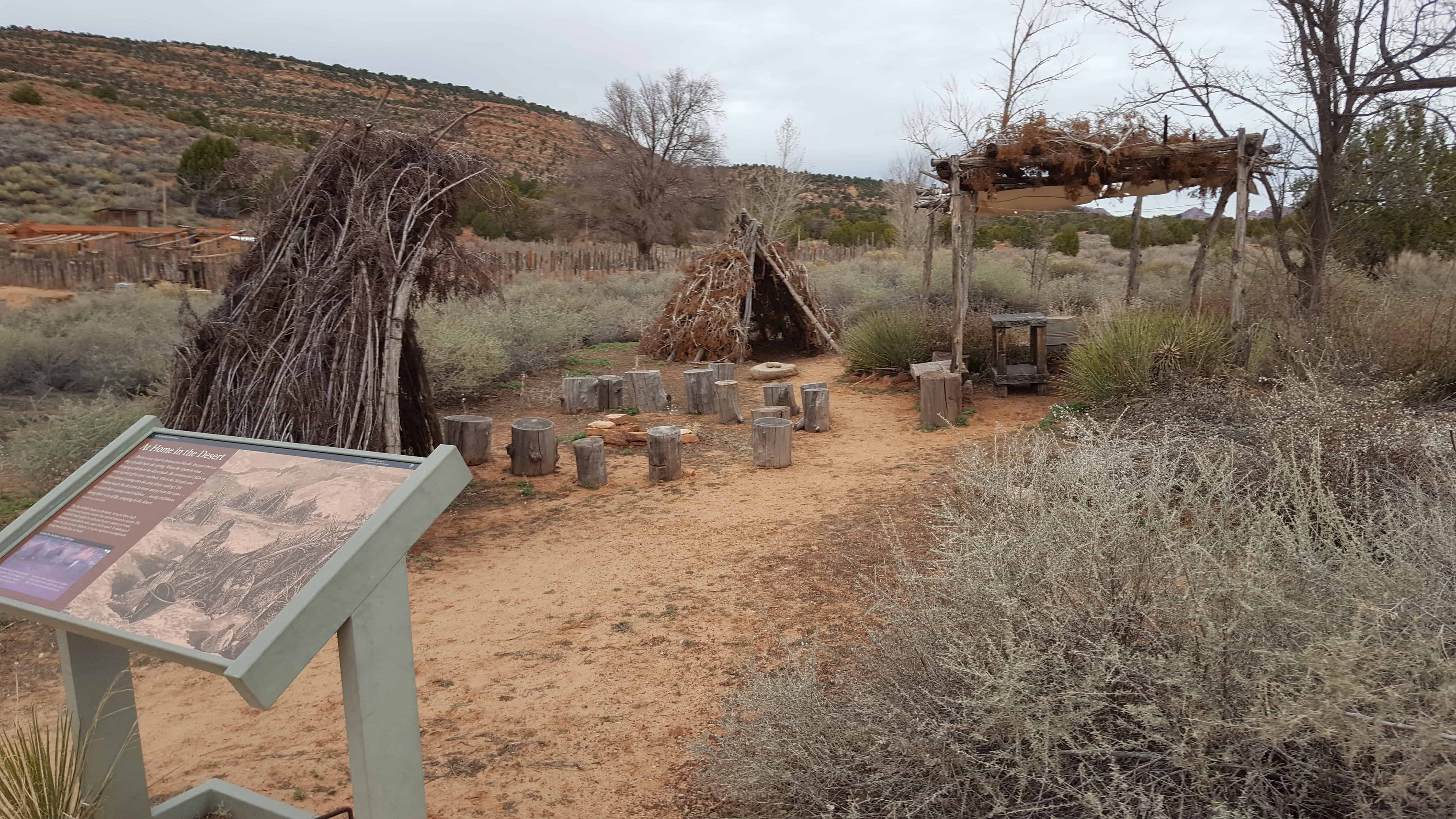
Pipe Spring National Monument Posts:
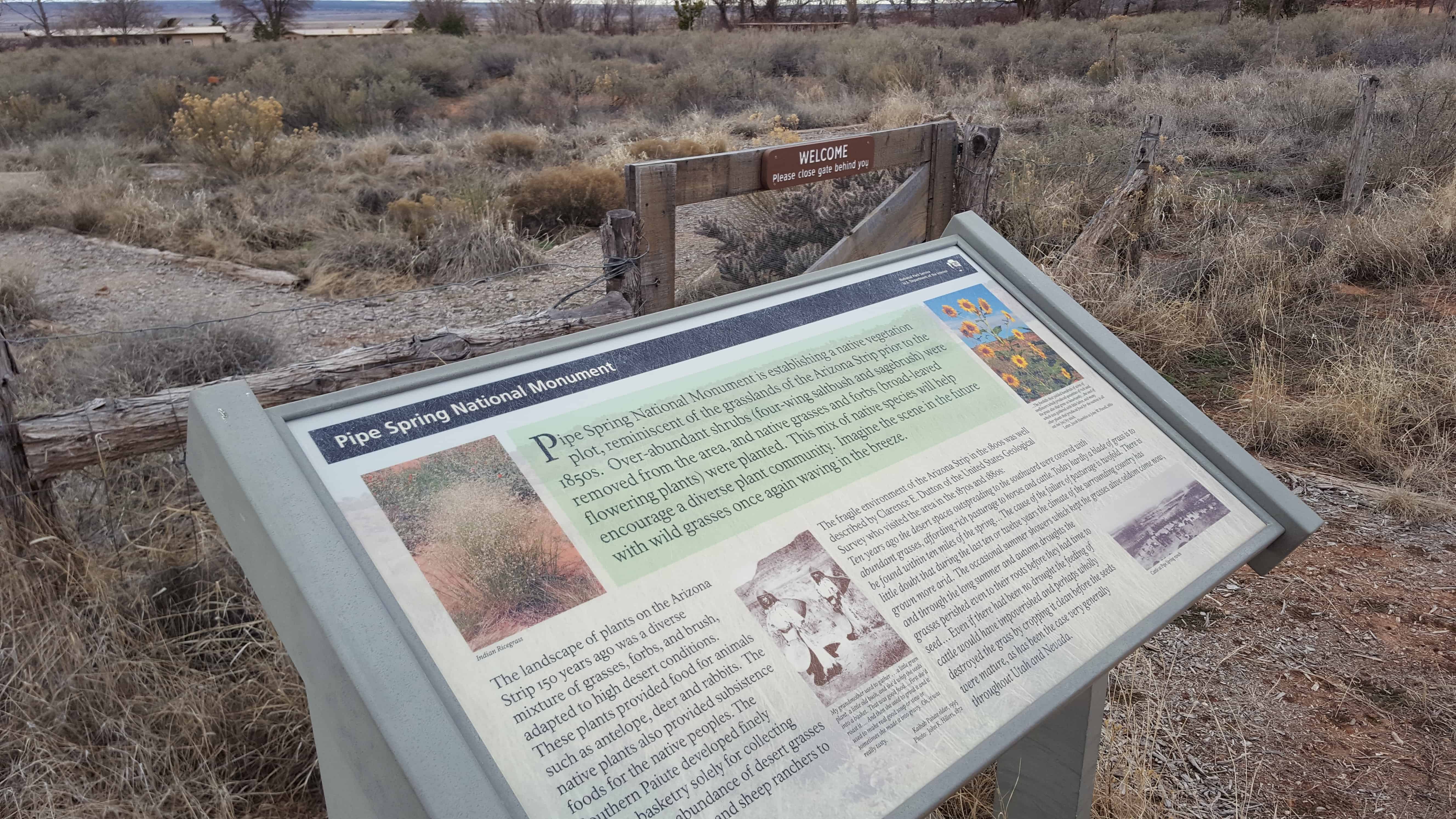
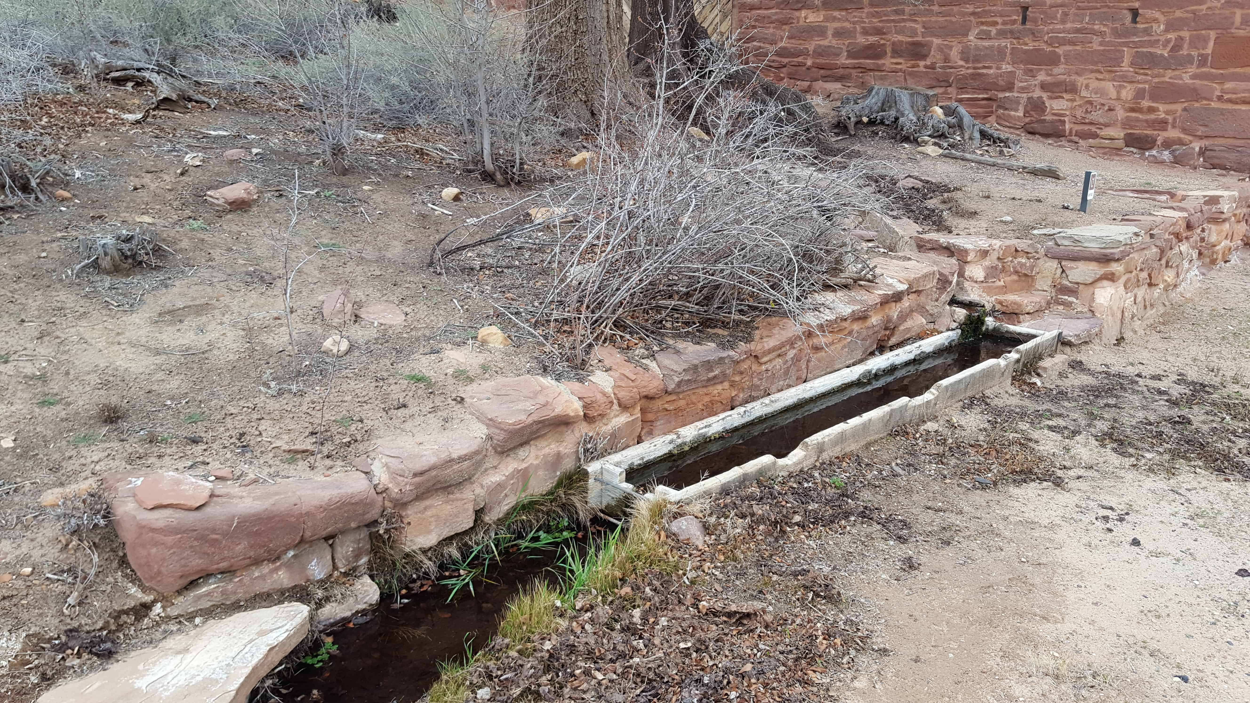
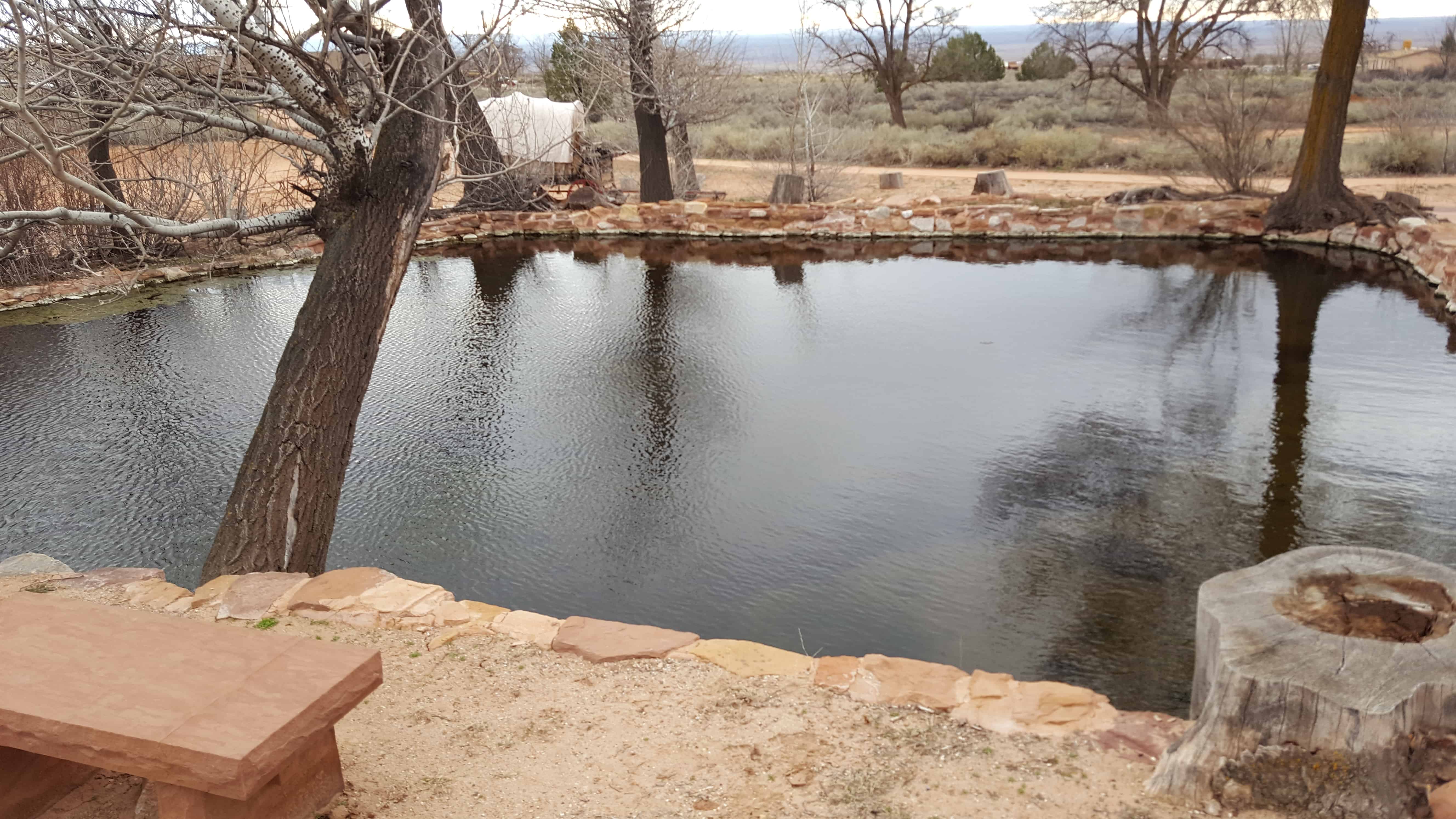
The water of Pipe Spring has made it possible for plants, animals, and people to live in this dry desert region. Ancestral Puebloans and Kaibab Paiute Indians gathered grass seeds, hunted animals, and raised crops near the springs for at least 1,000 years.
Antonio Armijo discovered the springs when he passed through the area in 1829, when he established by the Armijo Route of the Old Spanish Trail.
Pipe Spring was named by the 1858 Latter-day Saint missionary expedition to the Hopi mesas led by Jacob Hamblin. In the 1860s Mormon pioneers from St. George, Utah, led by James M. Whitmore brought cattle to the area, and a large cattle ranching operation was established. In 1866 the Apache, Navajo and Paiute tribes of the region joined the Utes for the Black Hawk War, and, after they raided Pipe Spring, a protective fort was constructed by 1872 over the main spring. The following year the fort and ranch was purchased by Brigham Young for The Church of Jesus Christ of Latter-day Saints (LDS Church). The LDS Bishop of nearby Grafton, Utah, Anson Perry Winsor, was hired to operate the ranch and maintain the fort, soon called Winsor Castle. This isolated outpost served as a way station for people traveling across the Arizona Strip, that part of Arizona separated from the rest of the state by the Grand Canyon. It also served as a refuge for polygamist wives during the 1880s and 1890s. The LDS Church lost ownership of the property through penalties involved in the federal Edmunds-Tucker Act of 1887.
Although their way of life was greatly impacted by Mormon settlement, the Paiute Indians continued to live in the area and by 1907 the Kaibab Paiute Indian Reservation was established, surrounding the privately owned Pipe Spring ranch. In 1923, the Pipe Spring ranch was purchased and set aside as a national monument to be a memorial to western pioneer life.


02 Monday Jan 2017
Posted in Uncategorized
Tags
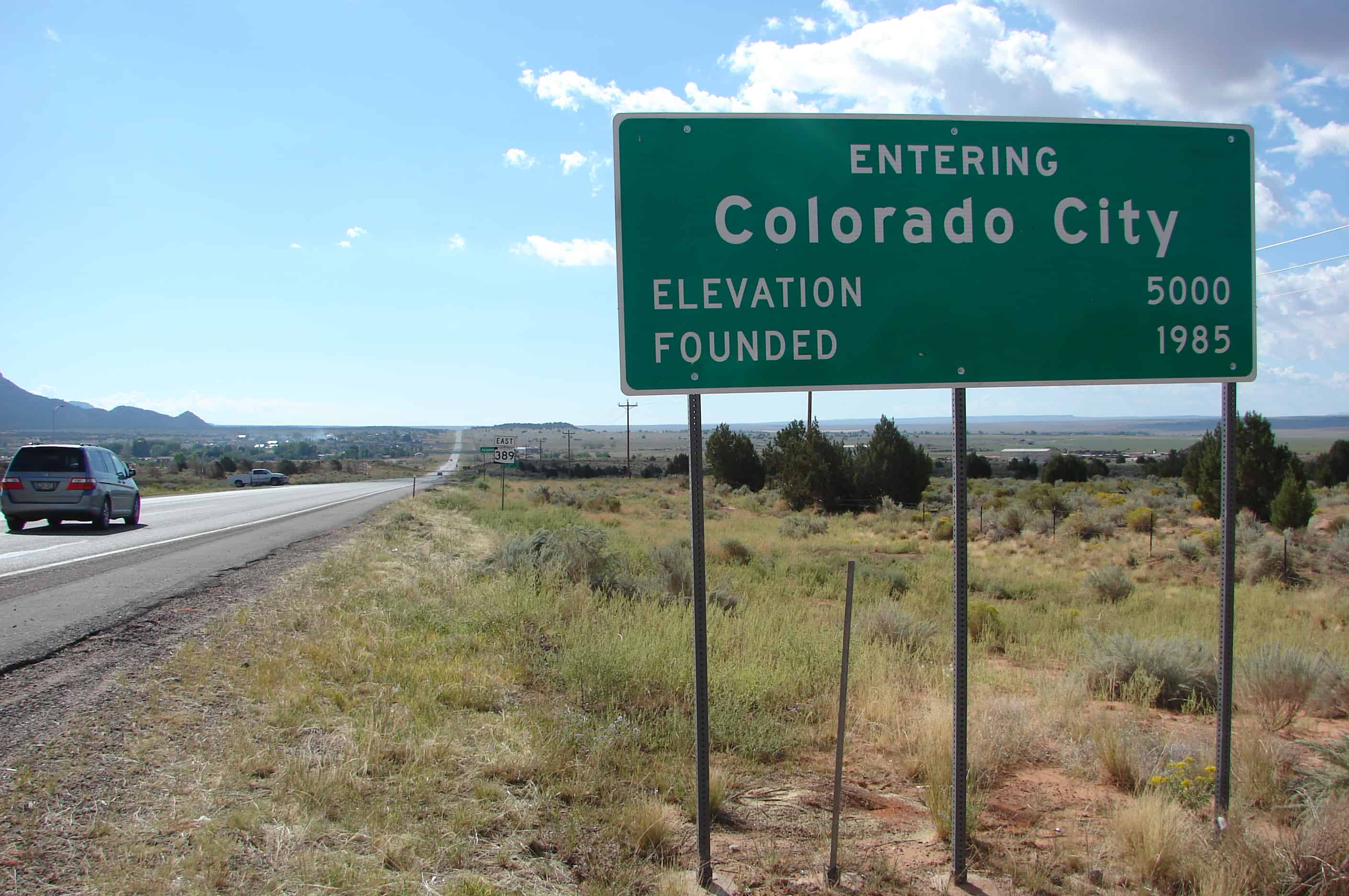
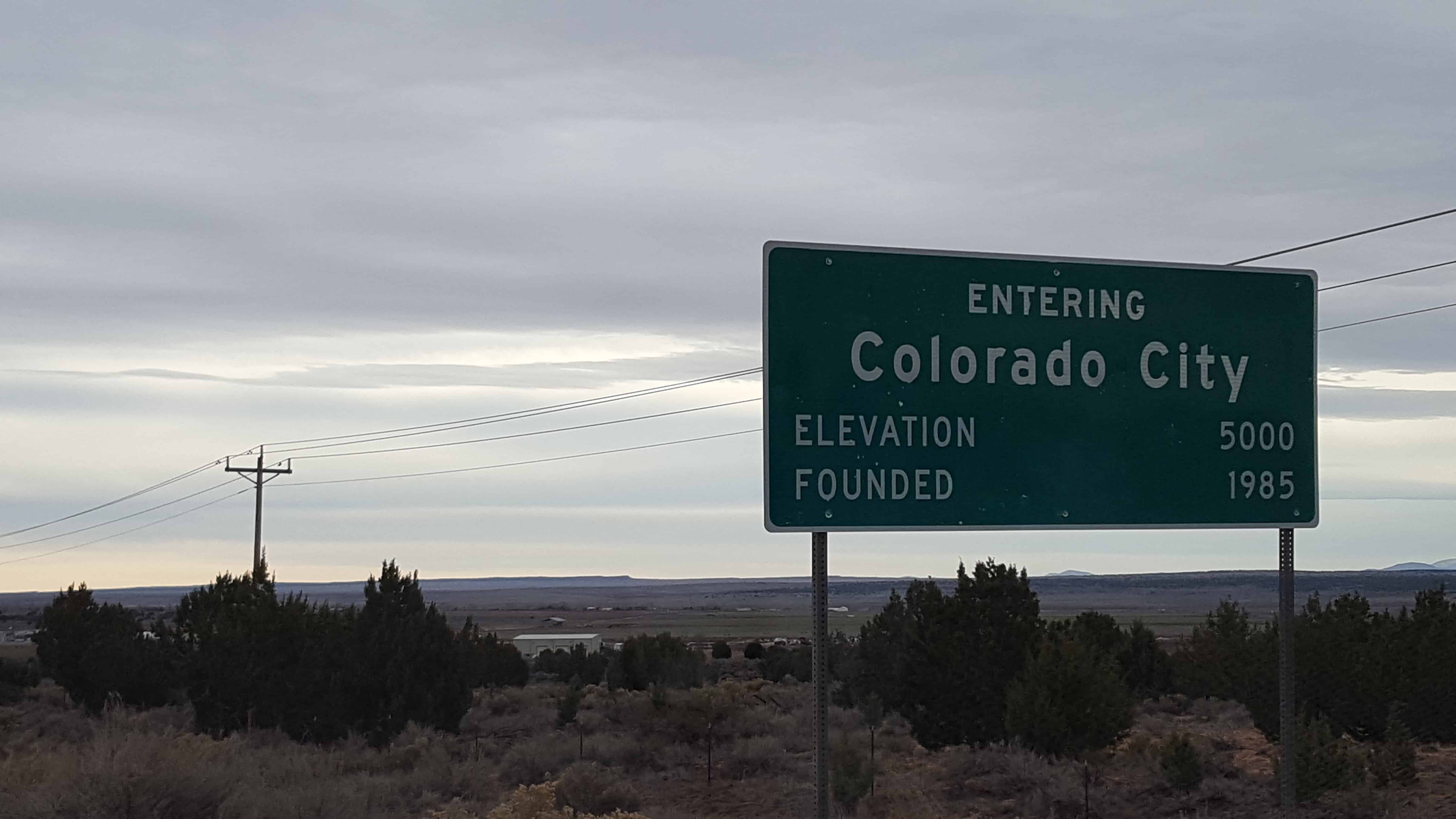
Colorado City, formerly known as Short Creek (or the Short Creek Community), was founded in 1913 by members of the Council of Friends, a breakaway group from the Salt Lake City-based The Church of Jesus Christ of Latter-day Saints (LDS Church). The Council of Friends membership desired a remote location where they could practice plural marriage, which had been publicly abandoned by the LDS Church in 1890. On July 26, 1953, Arizona Governor John Howard Pyle sent troops into the settlement to stop polygamy in what became known as the Short Creek raid. The two-year legal battle that followed became a public relations disaster that damaged Pyle’s political career and set a hands-off tone toward the town in Arizona for the next 50 years.
27 Sunday Nov 2016
Posted in Uncategorized
27 Sunday Nov 2016
Posted in Uncategorized

First exploration probably by early Spanish explorers, Espejo in 1852 and Farfan in 1589. Explored later by Lt. Amiel W. Whipple in 1854. Important agriculture, mining, milling, and smelting area in our early days. The McCrackin Mine discovered by Jackson McCrackin and H. A. “Chloride Jack” Owen in 1874, lies 18 miles south. The Signal Mine was 12 miles south. Stamp mills were at Greenwood, 8 miles southwest and at Virginia City, 9 miles southwest. Cofer Hot Springs 3 miles east.


19 Saturday Nov 2016
Posted in Uncategorized
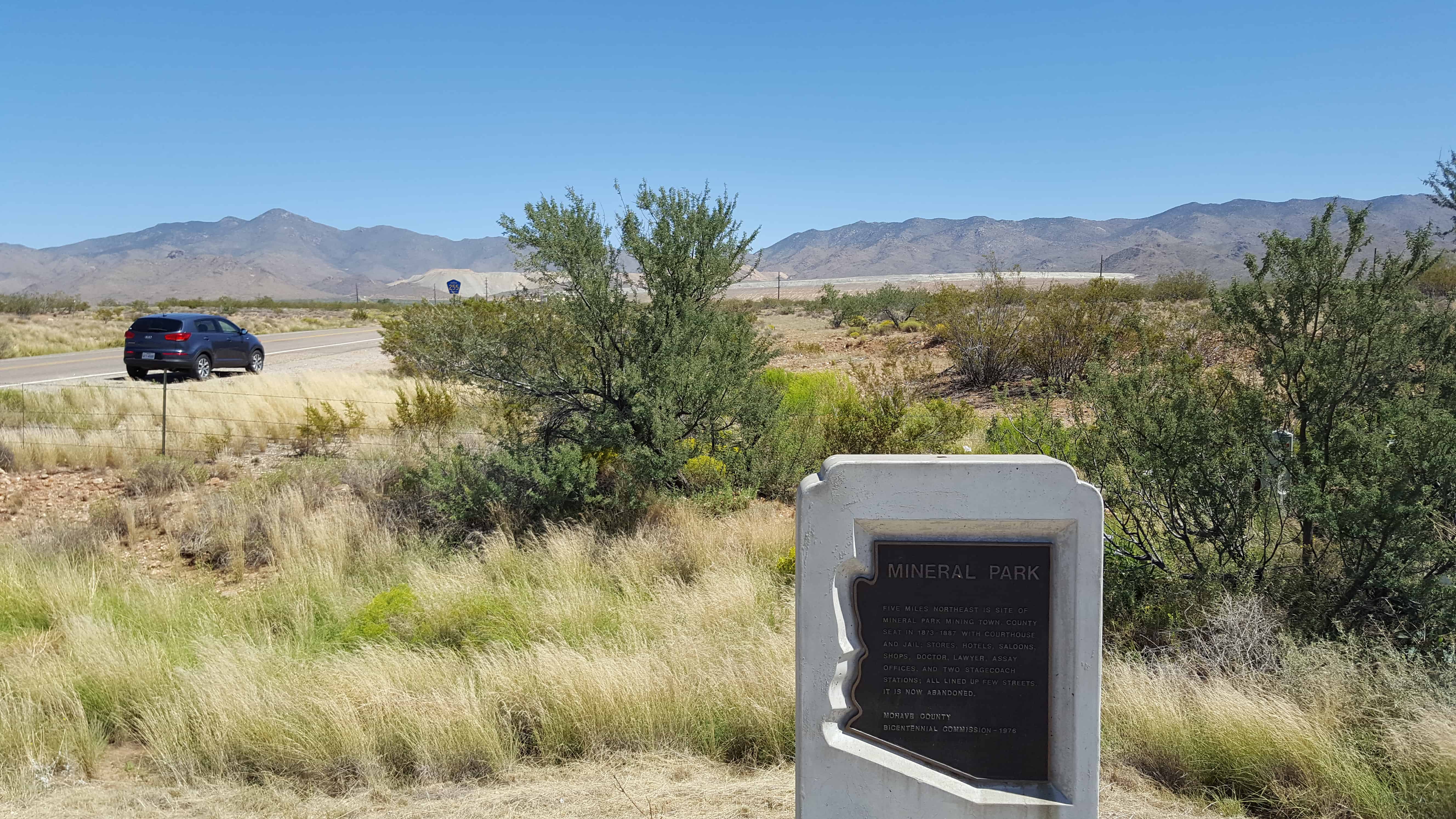
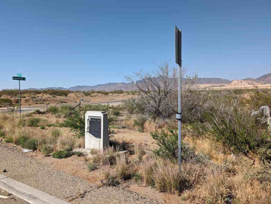
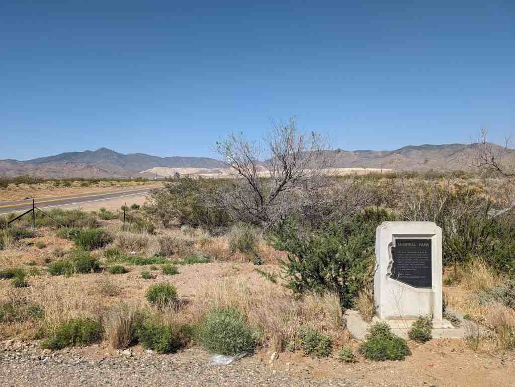
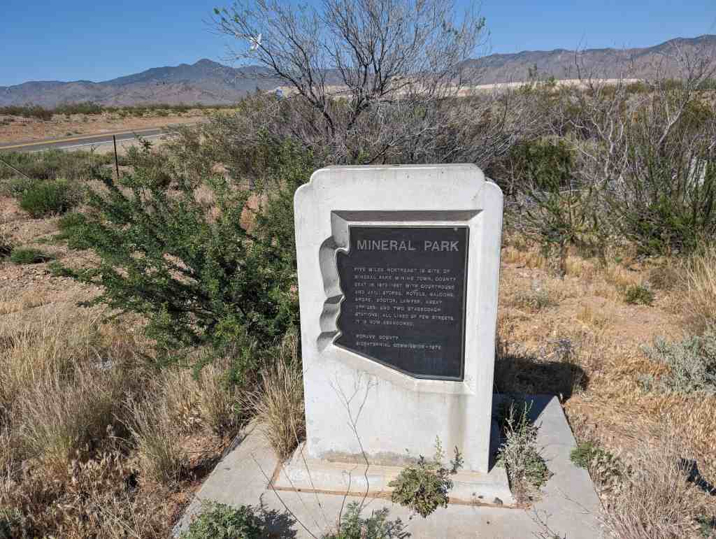
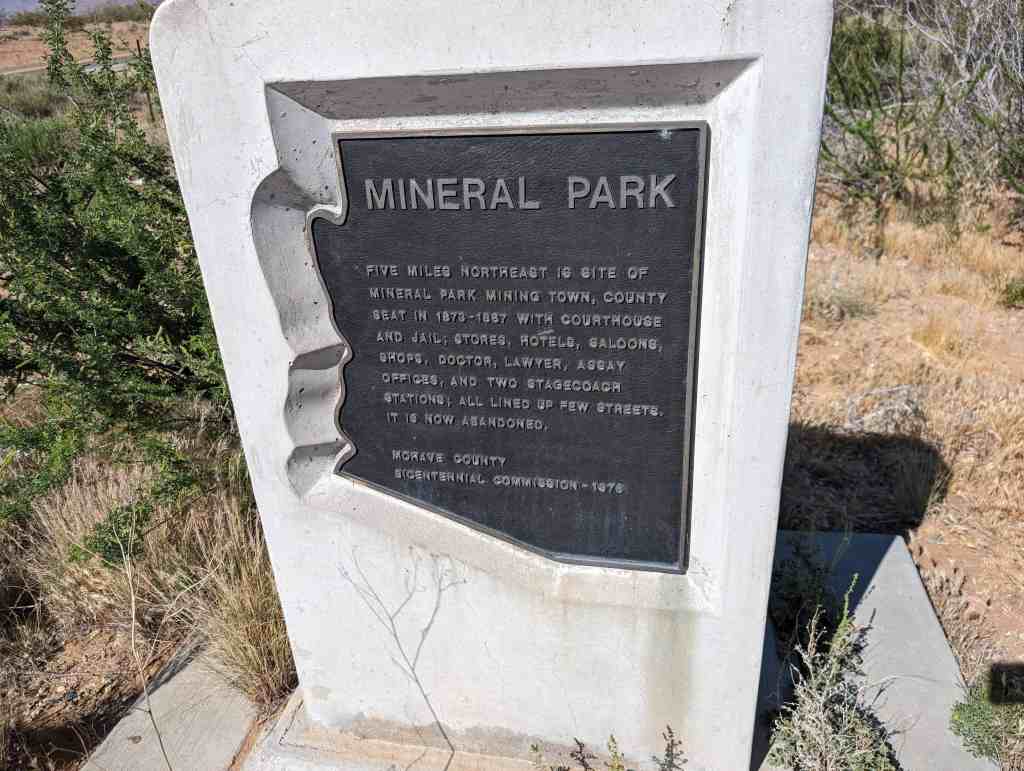
Mining in the area began in 1871 and a camp was established soon after. The mines produced primarily silver, gold, copper, lead and zinc. The post office was opened December 23, 1872. It grew to be the largest town in the county and became the county seat in 1873. It had the county courthouse and jail, stores, hotels, saloons, shops, doctors, lawyers, assay offices and two stagecoach stations. The town published a newspaper, the Mohave County Miner.
In 1887 it lost the county seat to the railroad town of Kingman in an election. Some of the population and the newspaper moved and mining began to slacken with the price of silver. The post office closed in April 30, 1893. It reopened in September 1894, but closed for the last time in 1912. Mining revived in the area since the 1960s, but the town never did.


19 Saturday Nov 2016
Posted in Uncategorized
Tags

Nothing is an uninhabited ghost town in eastern Mohave County.
he locals told travelers it “got named by a bunch of drunks.” Nothing has frequently been noted on lists of unusual place names.
The town sign reads:
Town of Nothing Arizona. Founded 1977. Elevation 3269ft.
The staunch citizens of Nothing are full of Hope, Faith, and Believe in the work ethic. Thru-the-years-these dedicated people had faith in Nothing, hoped for Nothing, worked at Nothing, for Nothing.
At its height, Nothing had a population of 4. The settlement contained a gas station and small convenience store.


12 Saturday Nov 2016
Posted in Uncategorized
Tags

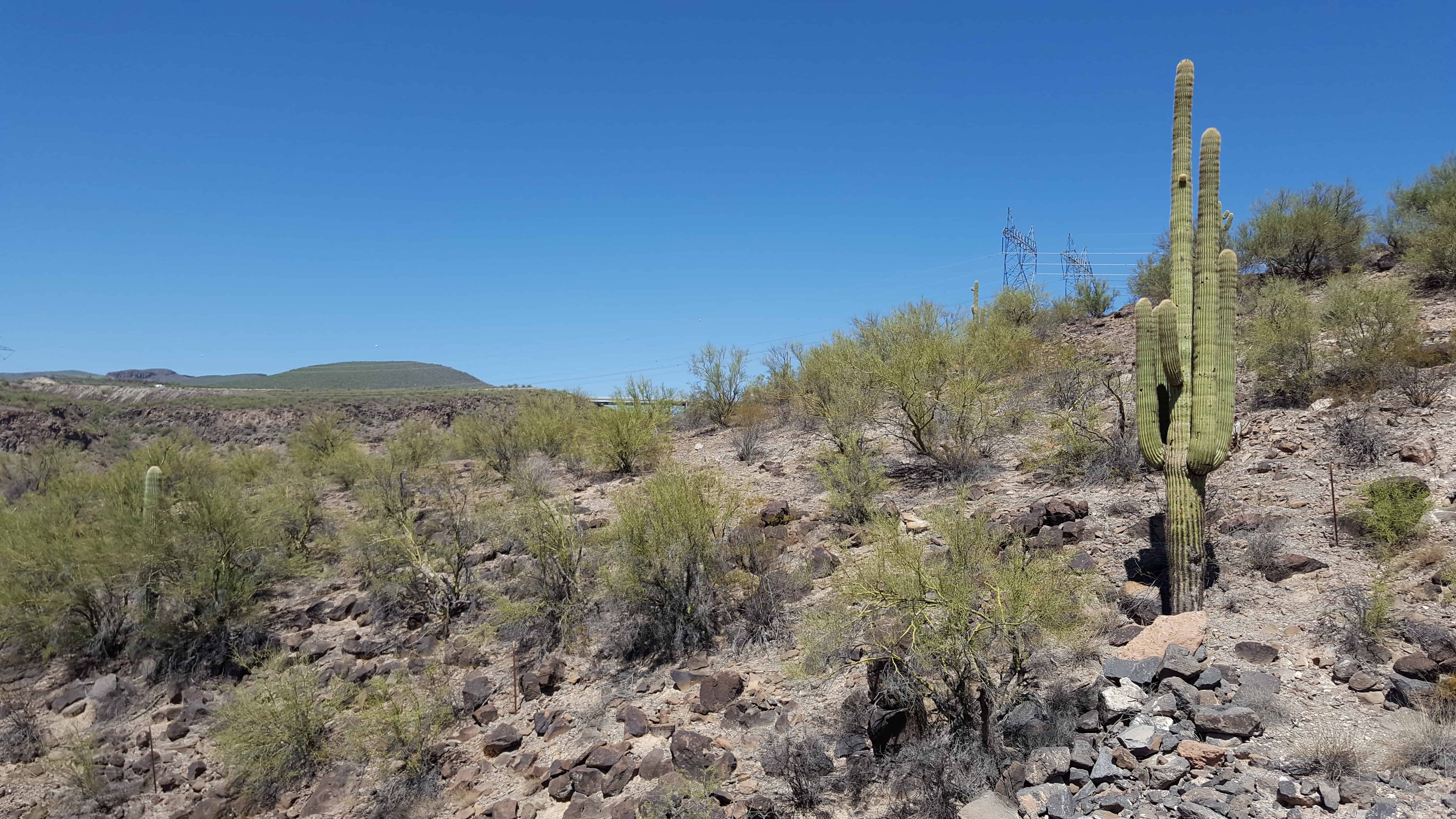
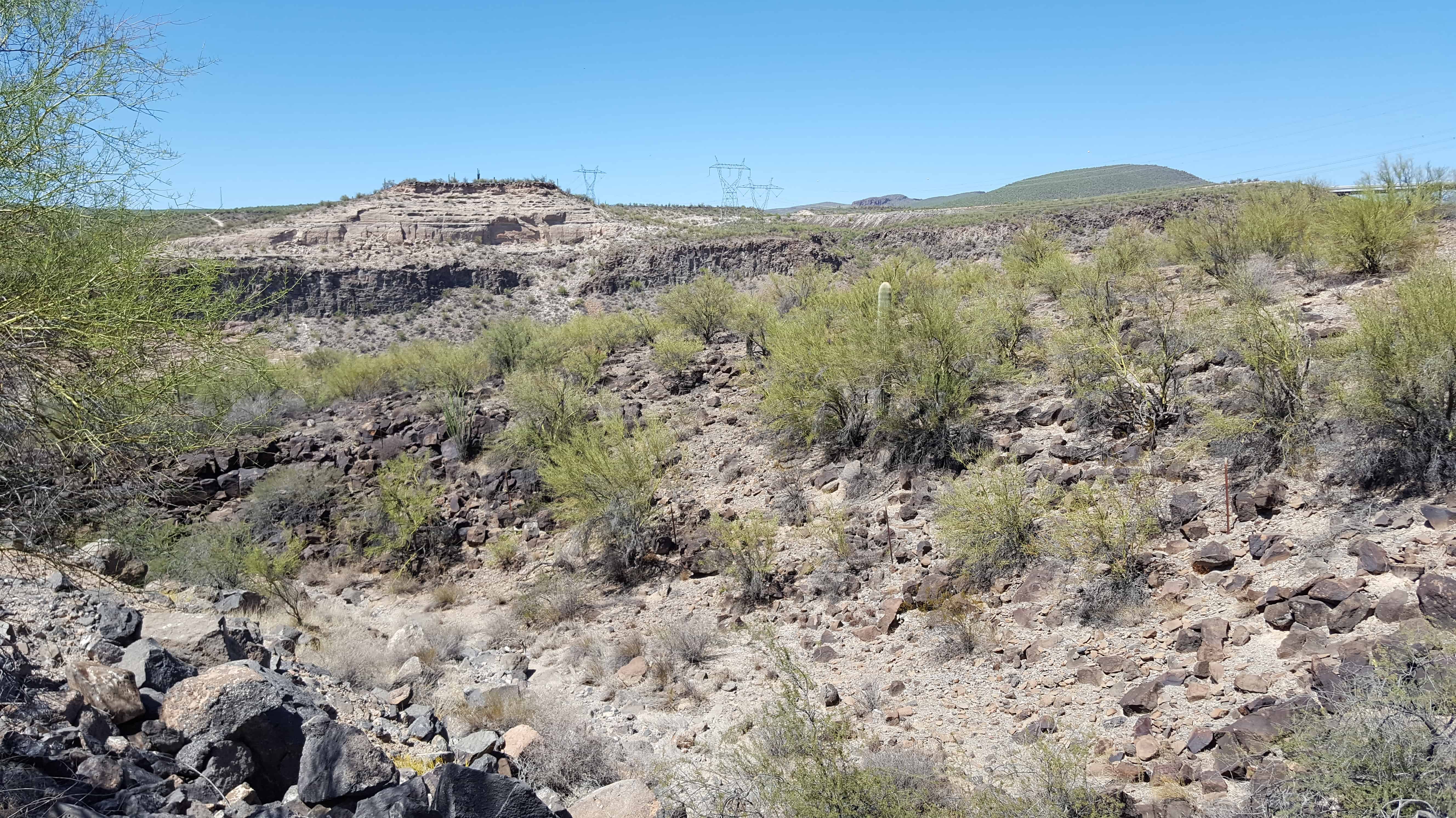
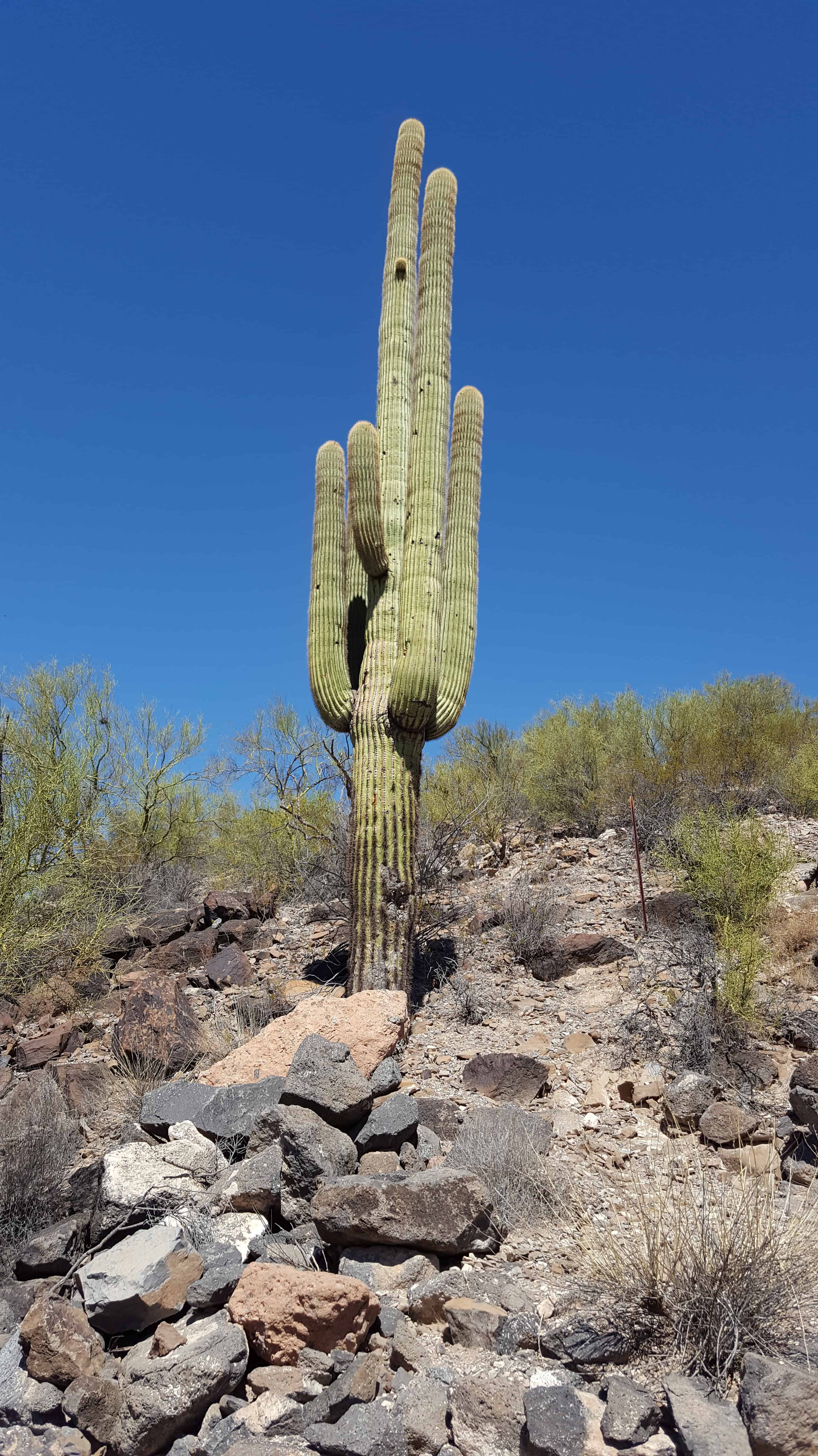
The Burro Creek Recreation Site is situated along Burro Creek within a very scenic Sonoran desert Canyon at an elevation of 1,960 feet. This peaceful area has long been a favorite stop of travelers on nearby Highway 93. Visitors here are invariably fascinated with the contrast between the deep blue pools and tree-lined banks of Burro Creek, and the saguaro-studded hills and cliffs of its desert setting.