Tags
Kay’s Burnt Oak Ranch
06 Thursday Jul 2023
Posted in Uncategorized

06 Thursday Jul 2023
Posted in Uncategorized
Tags
26 Friday Aug 2022
Posted in Uncategorized
31 Friday Dec 2021
Posted in Uncategorized
Tags

Mona Bicentennial Memorial Park
In memory of our Mona School and the dedicated teachers, board members, custodians, students and citizens, who made it great; we have built this monument from the sandstone and brick recovered there from. The bell hereon, signaled the beginning of school from its erection in 1907 until its termination in 1971.
This bicentennial park now situated on these grounds commemorates our devotion to and appreciation of our pioneer heritage.
(Monument erected in 1976 in Mona, Utah)


21 Wednesday May 2014
Posted in Uncategorized
Tags
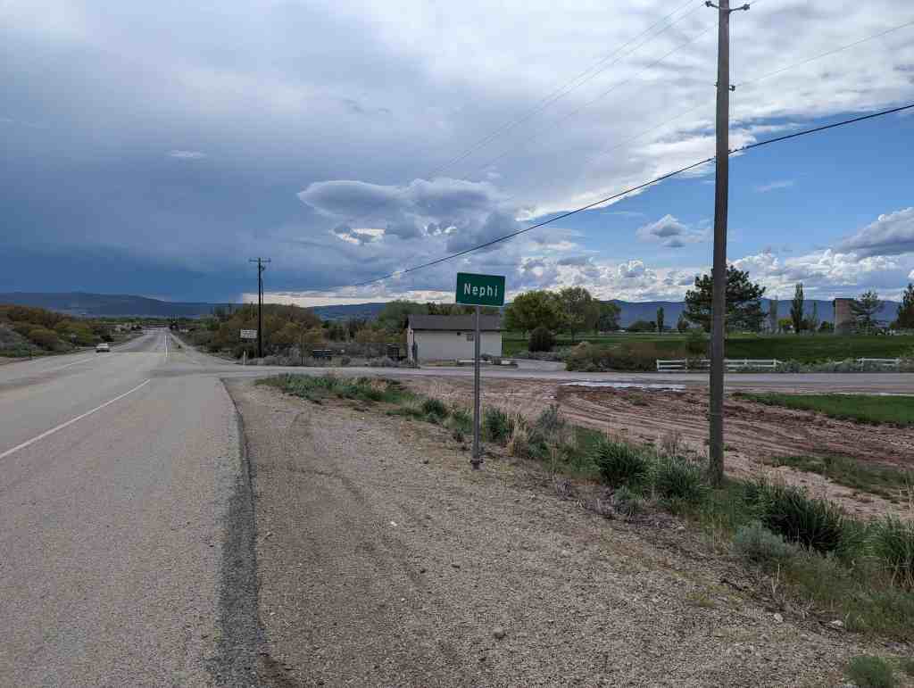
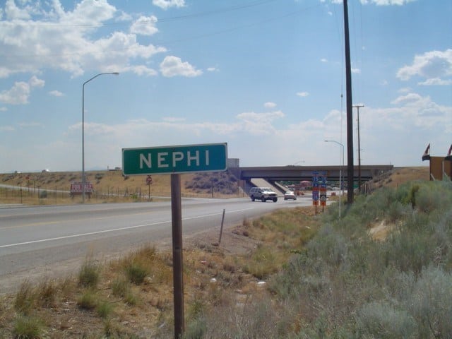
Juab County, Mona, Nephi, utah

Nephi Related Posts:
Some history borrowed from http://historytogo.utah.gov/places/nephi.html
Nephi is located at the mouth of Salt Creek Canyon; the north peak of Mount Nebo is to the northeast and the Red Cliffs are to the southeast. The city covers an area of approximately four square miles.

As with most settlements in Utah, Nephi’s founders were Mormons, and the name of the town came from the Book of Mormon. In the summer of 1851 Joseph L. Haywood and Jesse W. Fox, the territorial surveyor, were instructed by church leaders to lay out the town of Salt Creek, so named for the local salty stream. Haywood served as civic and spiritual leader in the area for three years. The settlers immediately began to clear ground and build homes. They also started schools for their children. Nephi boasted the third high school (and the first rural one) in the state in 1894. In 1879 a Presbyterian school was opened and later a Methodist school.(*)
Nephi was known for some years as Salt Creek. However, early church records refer to it as the Nephi Branch and some government records also called it Nephi. Until 22 May 1882 mail to the town was addressed to the Salt Creek post office. Nephi was incorporated in 1889, and on 16 January 1882 an act by the governor and the legislature of the territory was approved, making Nephi the county seat of Juab County.
Agriculture was the first industry. Farming and livestock have always been important in the Nephi area. The settlers traced the source of the salt in the creek to a cave in the canyon east of town and they then began to mine it. This soon became a flourishing local industry, with salt traded to people as far away as St. George in exchange for food and clothing. In 1893 the Nebo Salt Manufacturing Company was organized. However, it eventually became unprofitable to compete with the larger companies on the shores of the Great Salt Lake, and 1925 marked the end of the local industry.
Milling was another local industry with Zimra H. Baxter, George W. Bradley, and Abraham Boswell building a grist mill. Later more mills were built and modernized, and Nephi’s Gem and Snowflake flour became known throughout most of Utah. In 1917 R.C. and Robert Winn built a mill which was later purchased by the Hermanson family. In June 1991 it was destroyed by fire with a loss of more than $20,000 worth of inventory; however, the California partners who now own it are planning to rebuild.
When gypsum was found at the mouth of Salt Creek Canyon, plaster was made by grinding it between two rocks and cooking the powder. Later a grinding machine was obtained and a waterwheel installed which was powered by water diverted from Salt Creek. In 1889 the Nephi Plaster and Manufacturing Company was incorporated and the first mill was constructed. It survived two fires in the early 1900s and flourished to become the major employer in Nephi.
On 3 May 1879 the railroad came to Nephi, and in 1880 the Sanpete Valley Railroad was built from Wales to Nephi for the purpose of hauling coal from the mines. This helped make Nephi a business center and greatly improved the local economy.
The business district on Main Street grew rapidly, and during the late nineteenth century there were restaurants, mercantile stores, hotels, clothing stores, a tailor, a furniture store, two millinery stores, two barber shops, and several other establishments. At this time, because of the number of businesses, Nephi was frequently referred to as “Little Chicago.”
Early in 1900 the main railroad line was moved west to Lynndyl and Delta. This resulted in some changes, but the people generally adjusted and other industries appeared to supplement the economy. In 1930 Nephi Poultry, Inc., which was affiliated with the Utah Poultry Association, was formed and employed a number of locals. The Nephi Processing Plant was organized in July 1945 to process turkey meat. In 1947 the Juab Valley Feed Company was organized; in 1958 it was purchased by Utah Poultry.
In June 1948 Termoid Western was dedicated and opened for inspection. The company manufactured rubber conveyor and transmission belting; molded types of industrial hose for oil fields, automotive fan belts, mechanical rubber products, and tank lining. By 1956-57 gross sales reached over six million dollars and it employed about 300 people. During the past thirty years the company has had multiple changes. It has closed and reopened, has changed owners several times, and is now operating as N.R.P.-Jones. It currently employs about 145 people.
Unfortunately, with the general ease and availability of transportation to larger urban areas, Nephi’s Main Street business district has somewhat declined, as is the case with many rural areas in Utah. Nevertheless, Nephi’s population reached its largest numbers in 1980, 3,285 residents, and continued to grow throughout the decade to 3,515 in 1990. Students attend the Nephi Elementary School and the Juab Middle and High School which share a building completed in 1980. The city hosts the annual Ute Stampede Rodeo, first held in 1936. The population is predominantly LDS with members attending seven wards in two stakes.


28 Thursday Nov 2013
Posted in Uncategorized
Tags

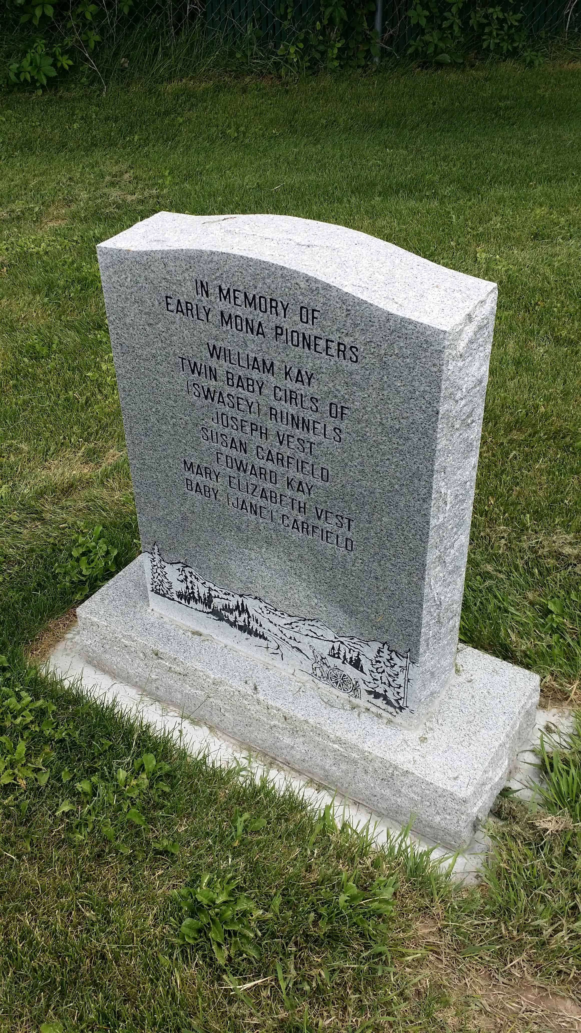
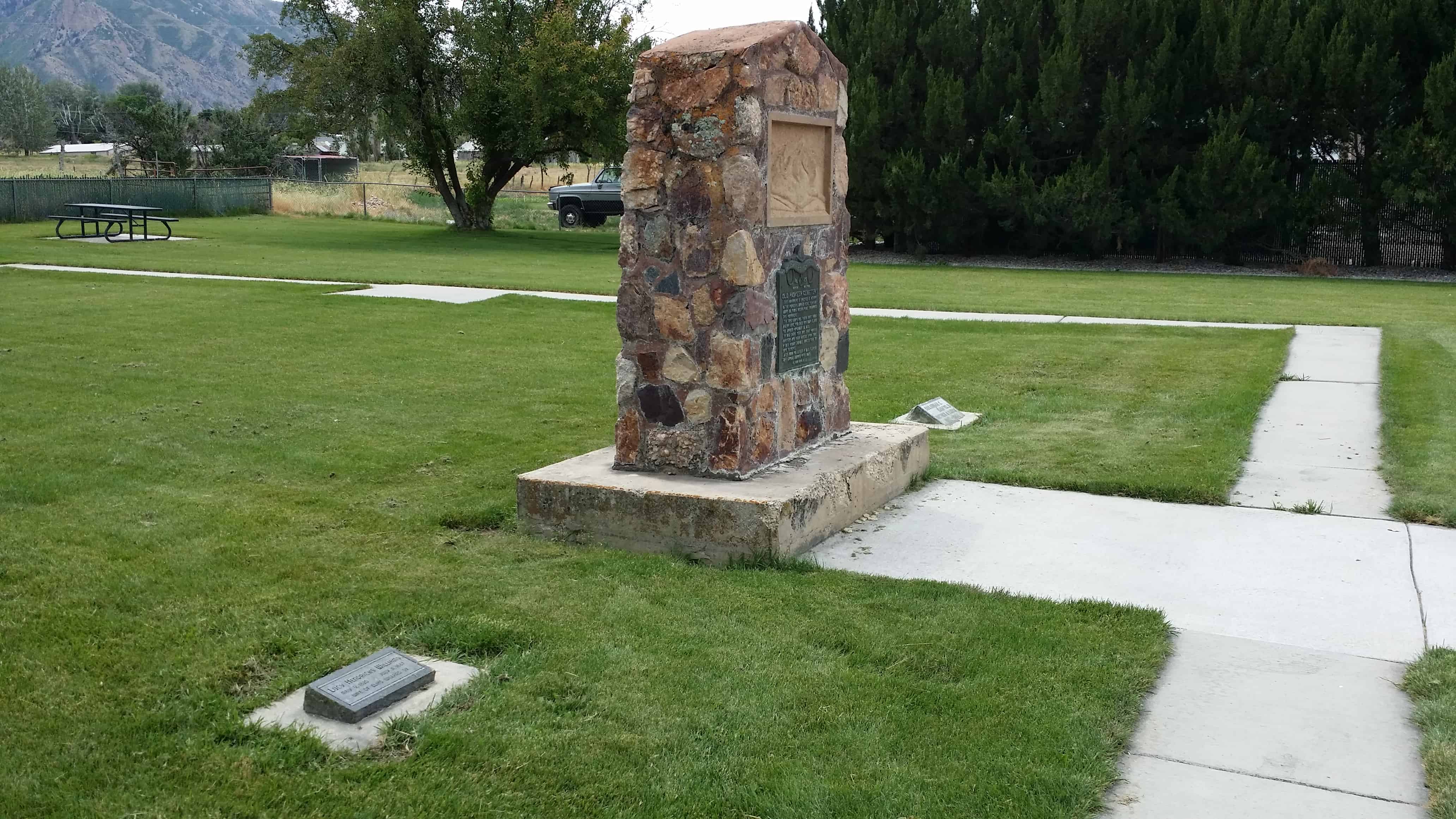
This monument is erected in memory of the pioneers buried here, there are about 20 whose resting place surrounds this monument. The first grave was that of Nancy Maria Biglow Love, who died November 27, and was buried November 28, 1852. In 1852 there were only three pioneer ranchers and their families living here. In 1853 Indian trouble forced them to move to Nephi. After Mona was settled in 1859, it served for a burial ground until 1869.


This is Daughters of Utah Pioneers historic marker #29 located at Mt. Nebo Pioneer Park in Mona, Utah
See others here:


12 Tuesday Nov 2013
Posted in Uncategorized
Tags

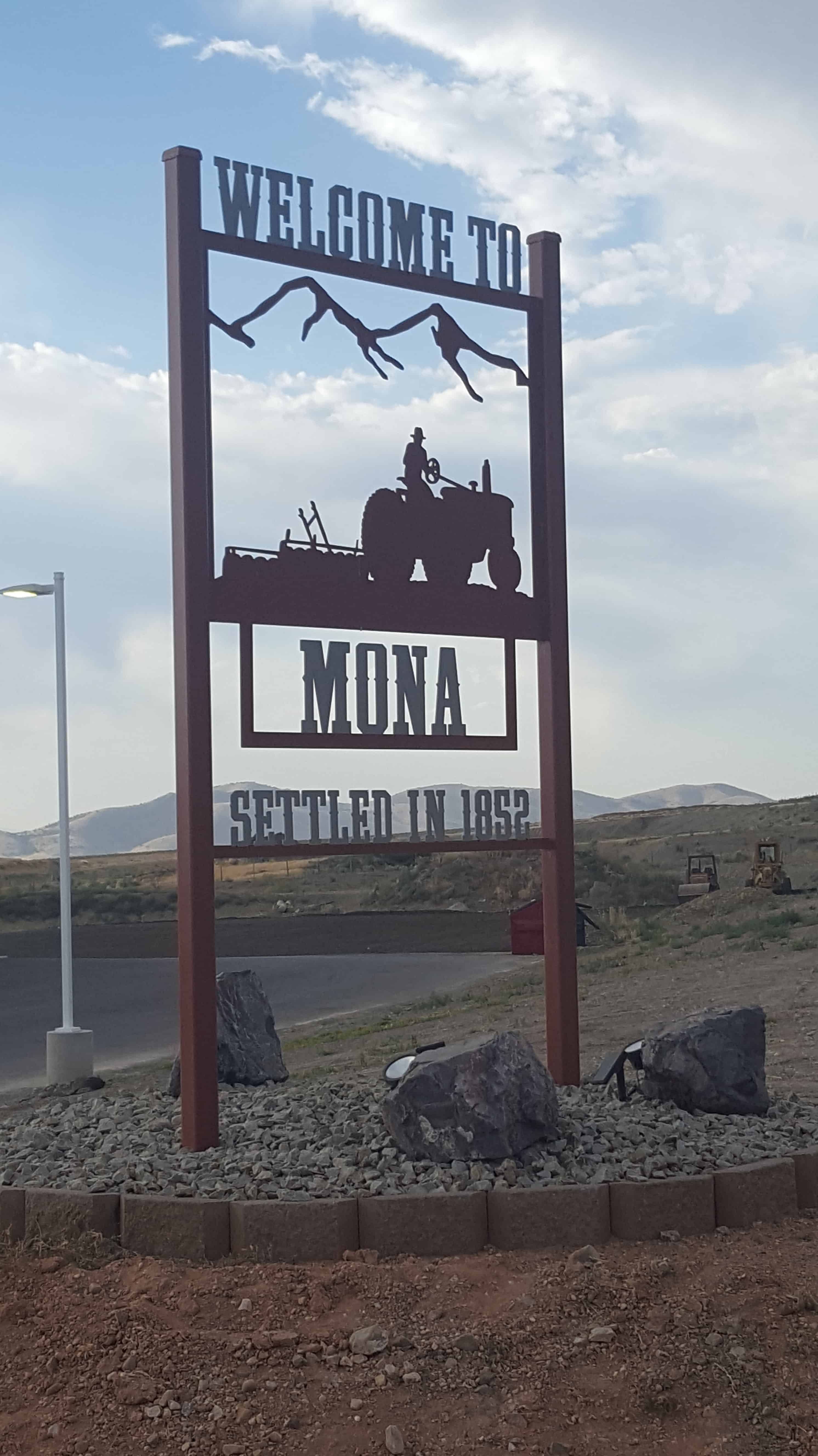
Originally named Clover Creek, then Willow Creek, then Starr and finally Mona – this small town is in Juab County between Santaquin and Nephi.
Mona is popular for the lavender farms, they bring many visitors in. They also are popular for Burraston Ponds, people come from hours away to swing on rope swings into the water or just fish.
Mona Posts:


12 Tuesday Nov 2013
Posted in Uncategorized

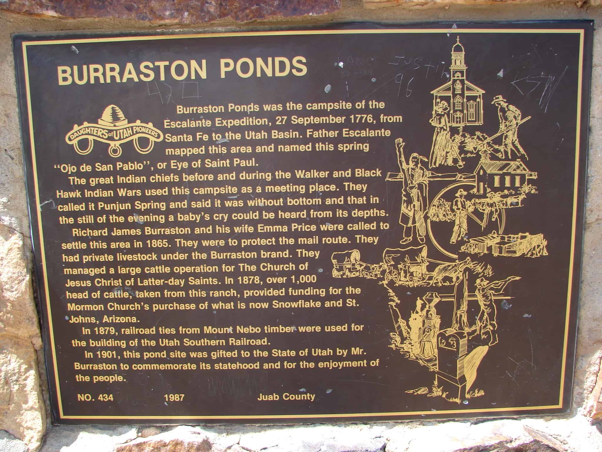
Located near Mona, Utah in Juab County.
Burraston Ponds is popular for fishing and the rope swing, people come from all over to take part in both.
Burraston Ponds was the campsite of the Escalante Expedition, 27 September 1776, from Santa Fe to the Utah Basin. Father Escalante mapped this area and named this spring “Ojo de San Pablo” or Eye of Saint Paul. The great Indian chiefs before and during the Walker and Black Hawk Indian Wars used this campsite as a meeting place. They called it Punjun Spring and said it was without bottom and that in the still of the evening a baby’s cry could be heard from its depths. Richard James Burraston and his wife Emma Price were called to settle this area in 1865. They were to protect the mail route. They had private livestock under the Burraston brand. They managed a large cattle operation for the Church of Jesus Christ of Latter-day Saints. In 1878, over 1,000 head of cattle, taken from this ranch, provided funding for the Mormon Church’s purchase of what is now Snowflake and St. Johns, Arizona. In 1879, railroad ties from Mount Nebo timber were used for the building of the Utah Southern Railroad. In 1901, this pond site was gifted to the State of Utah by Mr. Burraston to commemorate its statehood and for the enjoyment of the people.

Visit my list of places in Utah or list of DUP markers.

