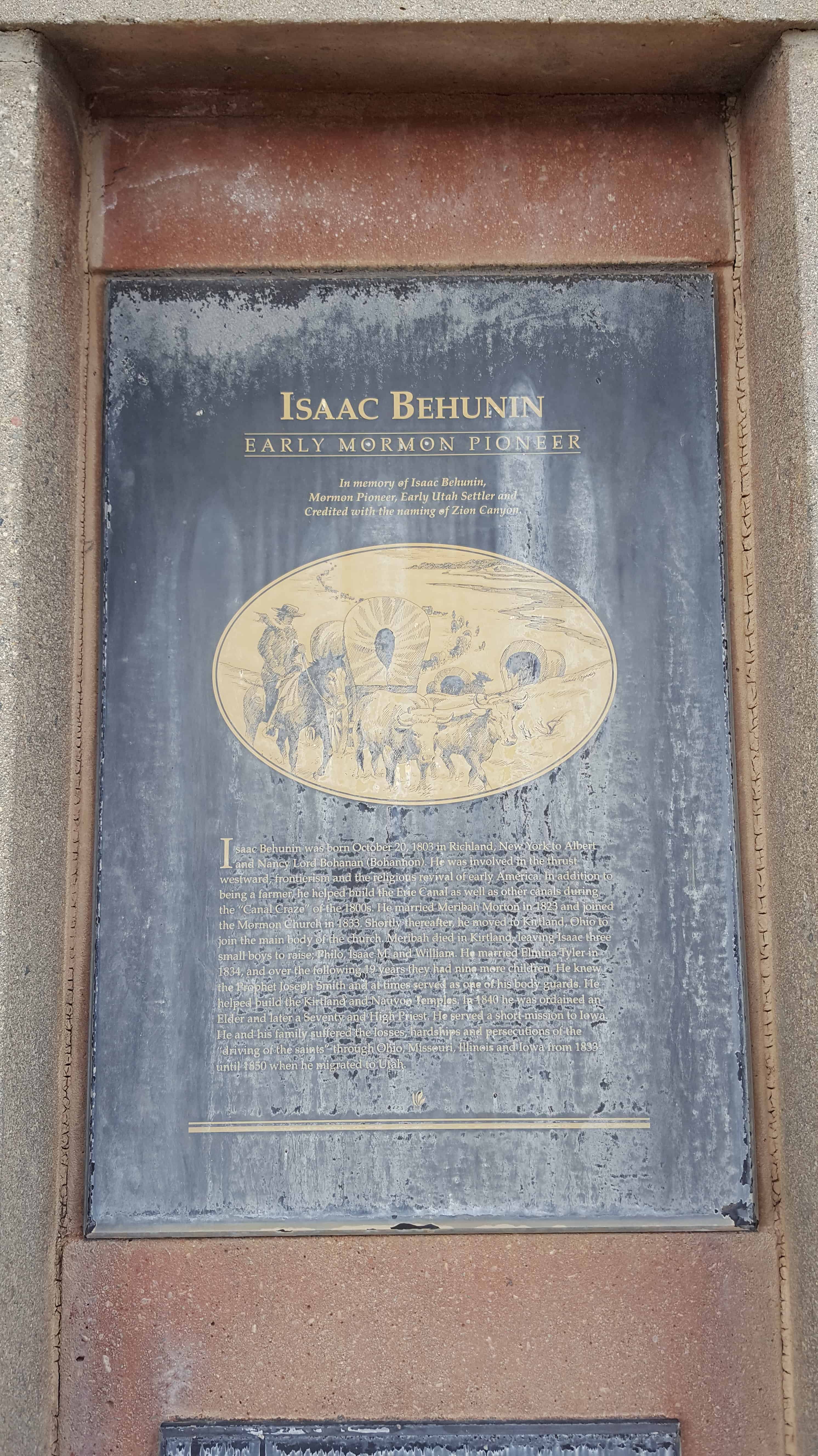
• About JacobBarlow.com
  • Cemeteries in Utah
  • D.U.P. Markers
  • Doors
  • Exploring Utah Email List
  • Geocaching
  • Historic Marker Map
  • Links
  • Movie/TV Show Filming Locations
  • Oldest in Utah
  • Other Travels
  • Photos Then and Now
  • S.U.P. Markers
  • U.P.T.L.A. Markers
  • Utah Cities and Places.
  • Utah Homes for Sale
  • Utah Treasure Hunt

JacobBarlow.com

~ Exploring with Jacob Barlow

JacobBarlow.com

Tag Archives: Mt. Carmel

Isaac Behunin Monument

02 Sunday Apr 2017

Posted by Jacob Barlow in Uncategorized

≈ 7 Comments

Tags

historic, Historic Markers, Kane County, Mt. Carmel, utah

2017-03-05 11.37.17

Isaac Behunin
_______________

Early Mormon Pioneer
_______________
In memory of Isaac Behunin,
Mormon Pioneer, Early Utah Settler and
Credited with the naming of Zion Canyon.
Isaac Behunin was born October 20, 1803 in Richland, New York to Albert and Nancy Lord Bohanan (Bohannon). He was involved in the thrust westward, frontierism and the religious revival of early America. In addition to being a farmer, he helped build the Erie Canal as well as other canals during the “Canal Craze” of the 1800s. He married Meribah Morton in 1823 and joined the Mormon Church in 1833. Shortly thereafter, he moved to Kirtland, Ohio to join the main body of the church. Meribah died in Kirtland, leaving Isaac three small boys to raise; Philo, Isaac M. and William. He married Elmina Tyler in 1834, and over the following 19 years they had nine more children. He knew the Prophet Joseph Smith and at times served as one of his body guards. He helped build the Kirtland and Nauvoo Temples. In 1840 he was ordained an Elder and later a Seventy and High Priest. He served a short mission to Iowa. He and his family suffered the losses, hardships and persecutions of the “driving of the saints” through Ohio, Missouri, Illinois and Iowa from 1833 until 1850 when he migrated to Utah.

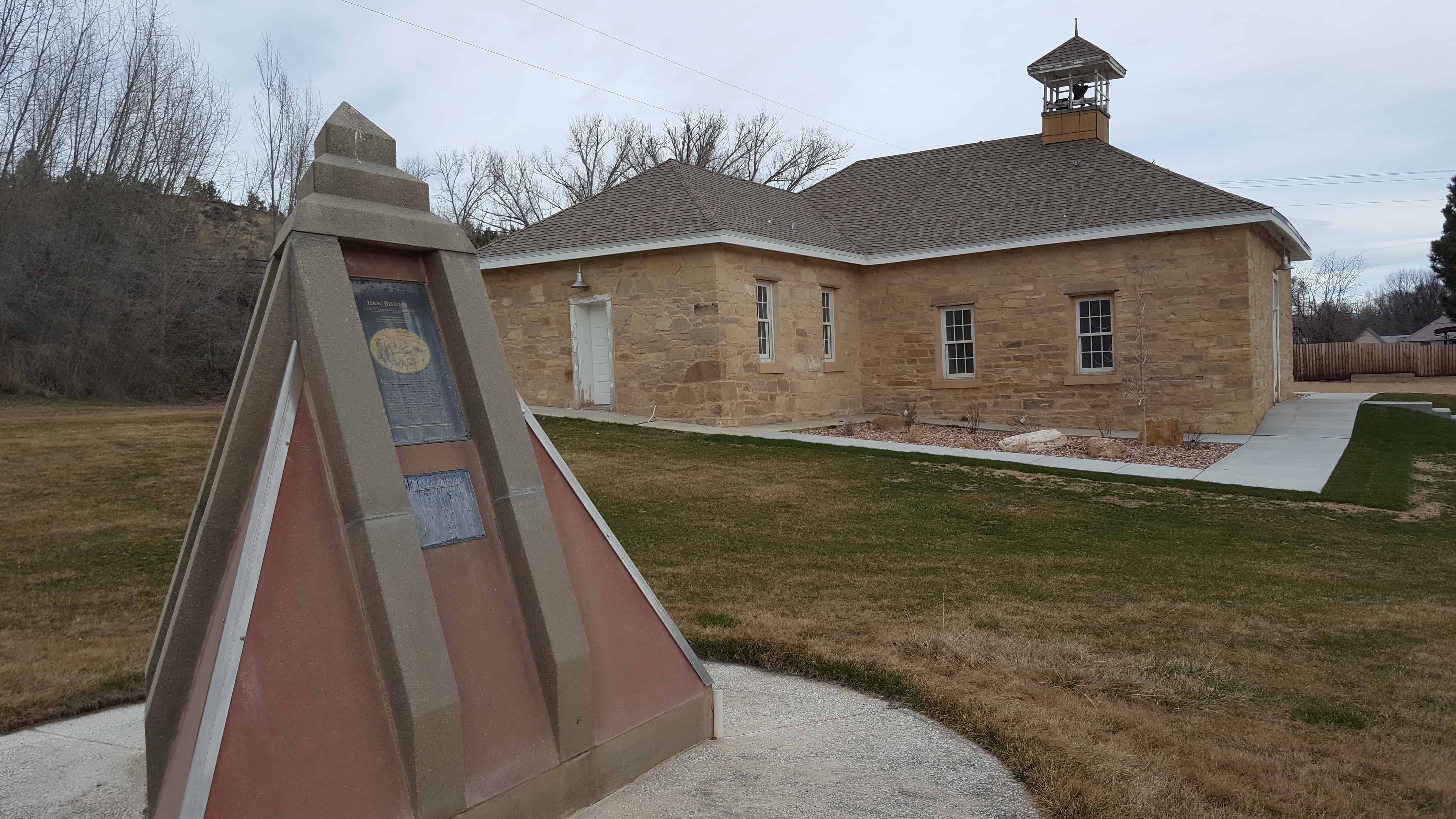
This monument is located in Mount Carmel and the Mt. Carmel School and Church.

Related posts:

  • Behunin-Beck House
  • Ephraim Settlement
  • Isaac Behunin Dugout Site
  • Northrop

Kane County, Utah

06 Wednesday Nov 2013

Posted by Jacob Barlow in Uncategorized

≈ 1 Comment

Tags

Alton, Big Water, Duck Creek, Glendale, Kanab, Kane County, Mt. Carmel, Orderville, utah

picture20sep08-012
  • Belly of the Dragon
  • Cascade Falls
  • Cottonwood Canyon Cliff Dwelling
  • Davis Gulch Pictograph Panel
  • Hole-In-The-Rock
  • Hole-in-the-Rock Trail
  • Moqui Cave
  • Peek a Boo Trailhead
  • Sand Caves and Rock Art
  • Shingle Creek Rest Area
  • United Order Woolen Factory
  • Zion National Park
    • East Entrance Checking Station
    • East Entrance Residence
    • East Entrance Sign

Kane County, named for Col. Thomas L. Kane, a friend of the Mormon settlers. Its county seat and largest city is Kanab.

ARP09 001
dce2b9ad-458e-4492-9b70-9332f2c57718
2016-09-06-17-54-20
3352_75008344233_8216633_n
199571_4311549233_4916_n
10400911_27964539233_6552_n
10400911_27964544233_6980_n

Kane County, Utah

A list of the cities in Kane County from the County’s website.

Kanab
Known as “Utah’s Little Hollywood” for its western movie history, Kanab is Kane County’s largest area of population, as well as the county seat.
Population*: 4,312
Elevation: 4,925 ft.
Founded: 1870

Alton
Nestled in northern Kane County’s high elevations, the tiny town of Alton occupies a scenic peaceful valley, not far from Bryce Canyon.
Population*: 119
Elevation: 7,041 ft.
Incorporated: 1984

Big Water
Minutes from the shores of Lake Powell, Big Water is surrounded by some of the most spectacular scenery in the world.
Population*: 475
Elevation: 4,100 ft.
Incorporated: 1984

Duck Creek
Located on Kane County’s Cedar Mountain, Duck Creek offers year-round activities for the whole family.
Population*:60
Elevation: 8,474 ft.

Glendale
Glendale is located on scenic Highway 89, at the northern end of Long Valley. An entrance to the Grand Staircase-Escalante National Monument is right in the center of town.
Population*: 381
Elevation: 5,800 ft.
Incorporated: 1935

Mt. Carmel
Mt. Carmel, at the junction of highways 9 and 89, is the gateway to Zion National Park’s east entrance.
Population*:116
Elevation: 5,192 ft.
Established: 1865

Orderville
Orderville, initially established under the direct order of Brigham Young, has a rich history which is treasued by modern residents.
Population*: 577
Elevation: 5,250 ft.
Established: 1870

Follow Jacob

Follow Jacob

Blog Stats

  • 2,008,538 hits

Social and Other Links

BarlowLinks.com

Recent Posts

  • Fort Douglas Commanders House
  • Herbert B. Maw Home
  • Marriner S. Eccles Home
  • William and Grace Ebaugh Home
  • Emma Thatcher Jeppeson Home

Archives


Loading Comments...