Deseret Telegraph and Post Office
Communication in early Utah was a difficult and time-consuming task, With the completion of the Transcontinental Telegraph line in Salt Lake City, October 23, 1861, the Mormons had instantaneous contact with the outside world. They desired next to put the miracle to use in Utah.
Almost immediately plans were made to build a telegraph line from Logan in the north to St. George in the south. However, the shortages of material occasioned by the Civil War forced postponement of the line. Later it was built with “war surplus” purchased from the federal government.
During the winter of 1865- 1S66 plans for its construction were revived Cash tithing was accumulated to purchase wire and insulators for the 500 miles of line. A telegraphers 1 school, taught by John C. Clawes, was opened in Salt Lake City to train operators. Each area serviced by the line was asked to send an operator to the school. In many instances young men and women were “called” to this assignment. Their salaries, later, came from donations collected for that purpose.
The Deseret Telegraph and Post Office is located at 91 West Main Street in Rockville, Utah and was added to the National Historic Register (#72001263) on February 23, 1972. The text on this page is from the historic register’s nomination form.
To finance construction, the Deseret Telegraph Company was organized March 21, 1867 with a stock issue of $100,000. In addition, each valley was expected to provide labor organized and directed by the L.D.S. Church Priesthood. Poles were cut, hauled and set, so that by the time Horace D. Height’s ox teams arrived in October 1866 with supplies, the lines were ready for them. By January 10, 1867, the St. George office was open. When completed, the system was appraised at about $500,000.
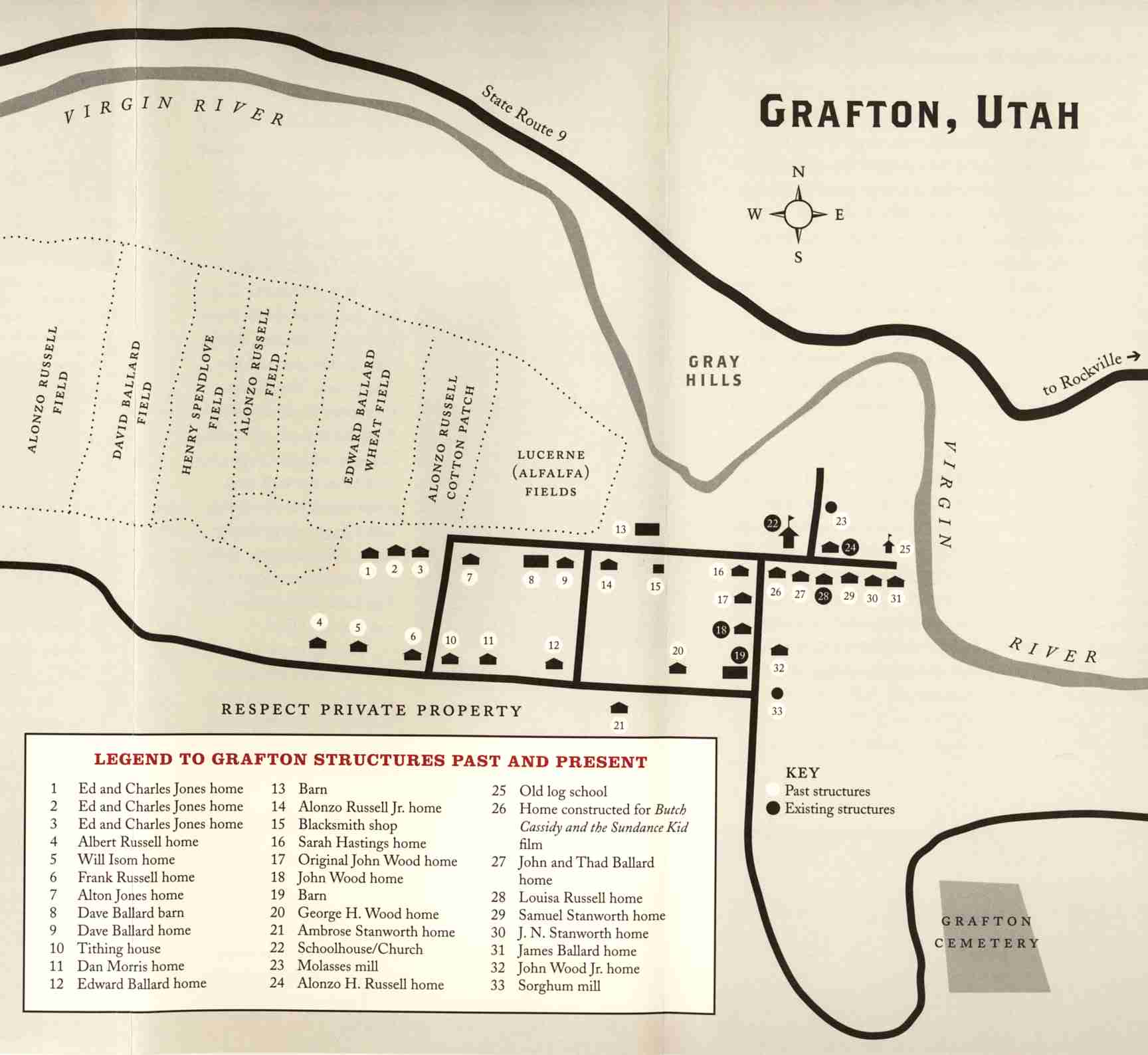
Soon after this branch telegraph lines were opened. One of these led from Toquerville in southern Utah, southeast to Rockville and then south and east to Windsor Castle (Pipe Springs) by December 1871. This was Arizona’s first telegraph office. The line continued north to Kanab and on to Long Valley. The ^Rockville Station became an important link in the telegraph extension to the east Pipe Springs and Kanab where the Navajo Indian raiders were first intercepted when raiding the Mormon communities.
Although one reference suggests that Erastus Snow, in St. George, received a “telegram” from Rockville as early as November 22, 1868, it is believed that the “express” actually came from Toquerville, on the main southern line, that someone rode from Rockville to Toquerville to send the telegram.
The Deseret News (December 20, 1871) records that the telegraph office was first opened in mid-December, 1871, in “Brother Charles N. Smith’s Parlor. Messrs. Scipio Kenner and Gerana Bebee. Operators. The citizens of course are much pleased.” Smith’s home seems to have been a sawed-log structure.
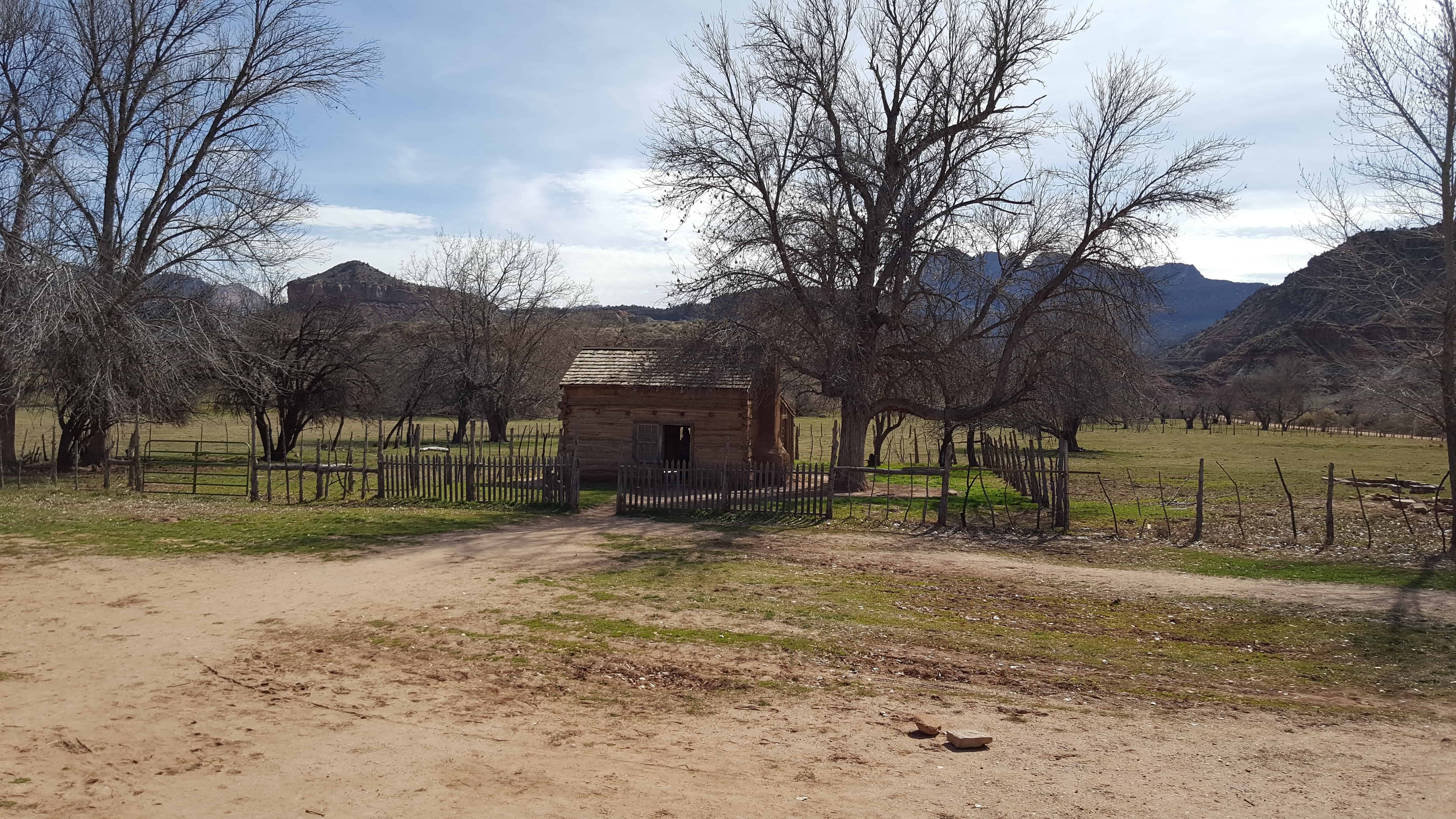
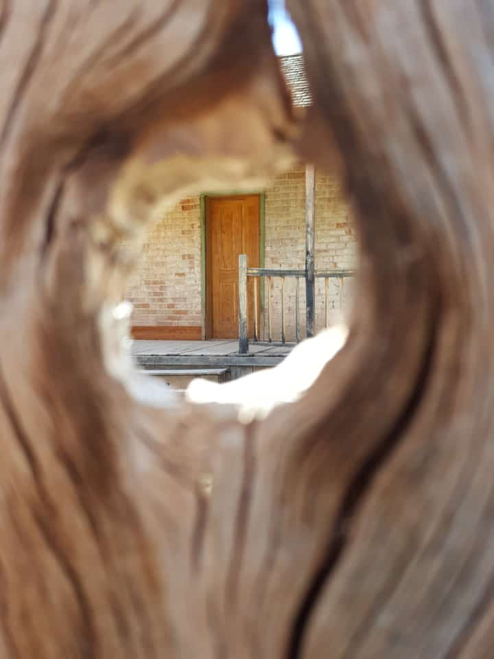
A few years later a telegraph office was built and attached to the west end of the old rock house that Edward Huber (or Hubert) had built in 1864. Both structures are included in the site designation. The little building was used as a Telegraph and Post Office for several decades. In 1903 the Deseret Telegraph Company had discontinued its services in southern Utah.
Most of the company had been sold to Western Union earlier. At its height, the church owned Deseret Telegraph Company, served all of Utah, and interlocked with Mormon settlements in Arizona, Nevada, and Idaho, Its more than 1,000 miles of lines were built primarily to serve as a communications medium for the Mormon people. Only where it served “gentiles” did it “turn a profit.” This little office and rock house at Rockville recall this distinctive part of western and Mormon history.


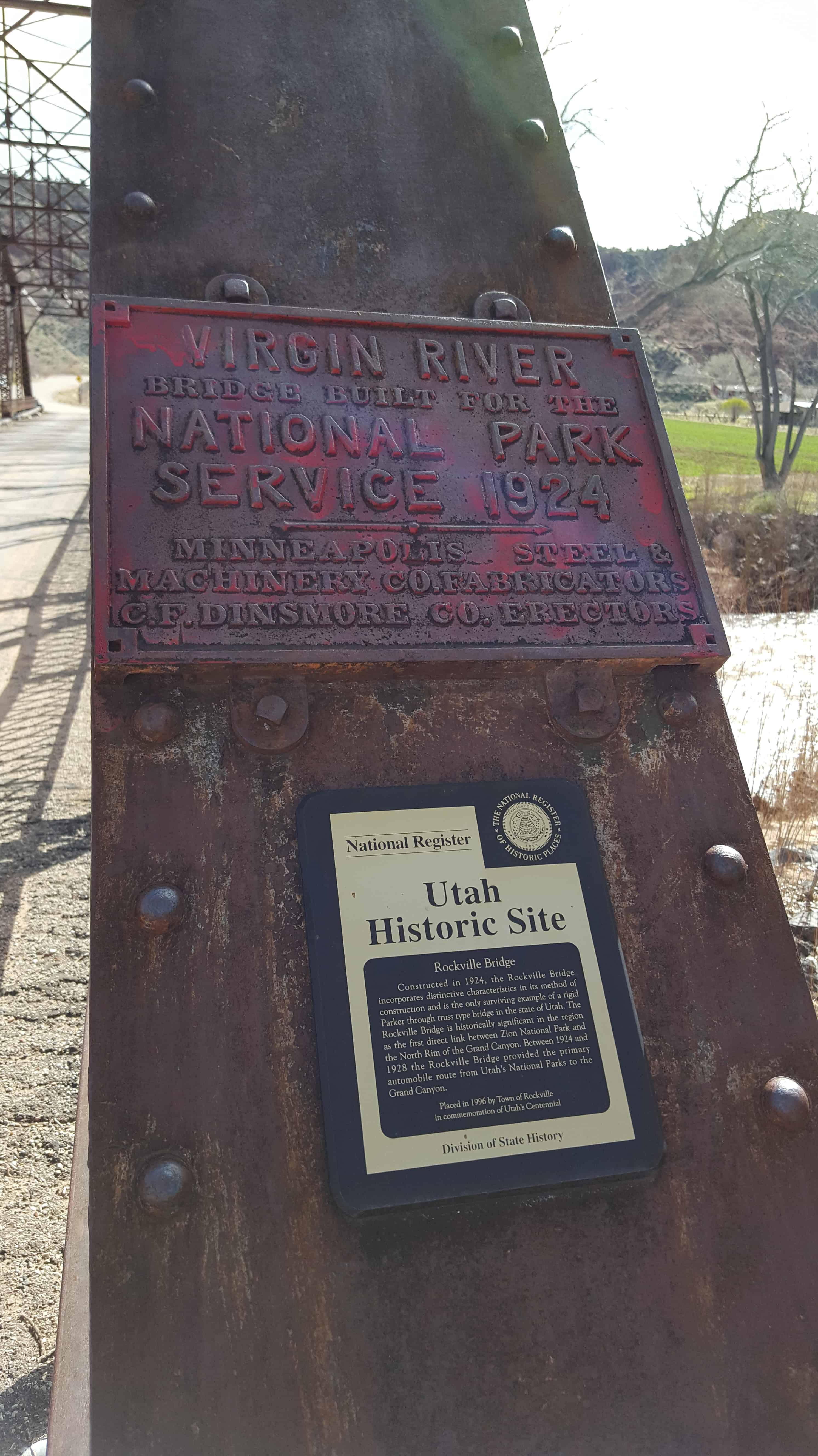
 The Rockville Bridge spans the east fork of the Virgin River in