• About JacobBarlow.com
  • Cemeteries in Utah
  • D.U.P. Markers
  • Doors
  • Exploring Utah Email List
  • Geocaching
  • Historic Marker Map
  • Links
  • Movie/TV Show Filming Locations
  • Oldest in Utah
  • Other Travels
  • Photos Then and Now
  • S.U.P. Markers
  • U.P.T.L.A. Markers
  • Utah Cities and Places.
  • Utah Homes for Sale
  • Utah Treasure Hunt

JacobBarlow.com

~ Exploring with Jacob Barlow

JacobBarlow.com

Tag Archives: Franklin County

Pass of the Standing Rock

14 Sunday May 2023

Posted by Jacob Barlow in Uncategorized

≈ Leave a comment

Tags

DUP, Franklin County, Historic Markers, Idaho

The Pass of the Standing Rock was held sacred by the ancient ones of the Shoshone and other Native American Tribes long before John C. Fremont’s exploratory party came to Weston Canyon on August 29, 1843. Fremont’s surveyors spent the entire day exploring, measuring, and illustrating this location that Fremont later named, The Pass of the Standing Rock. Illustrations of Standing Rock were published in Fremont’s The Exploring Expedition to the Rocky Mountains, depicting the Great Basin of the West.

The giant sentinel rock fell from the cliffs above, landing perpendicular near the middle of the valley. The elevation at the base of Standing Rock is 5,381 feet. The rock stands nearly 100 feet tall, is 75 feet wide, and weights several thousand tons. Nearby, naked blue limestone crags spire skyward into pinnacles that dominate ridges the entire length of Weston County.

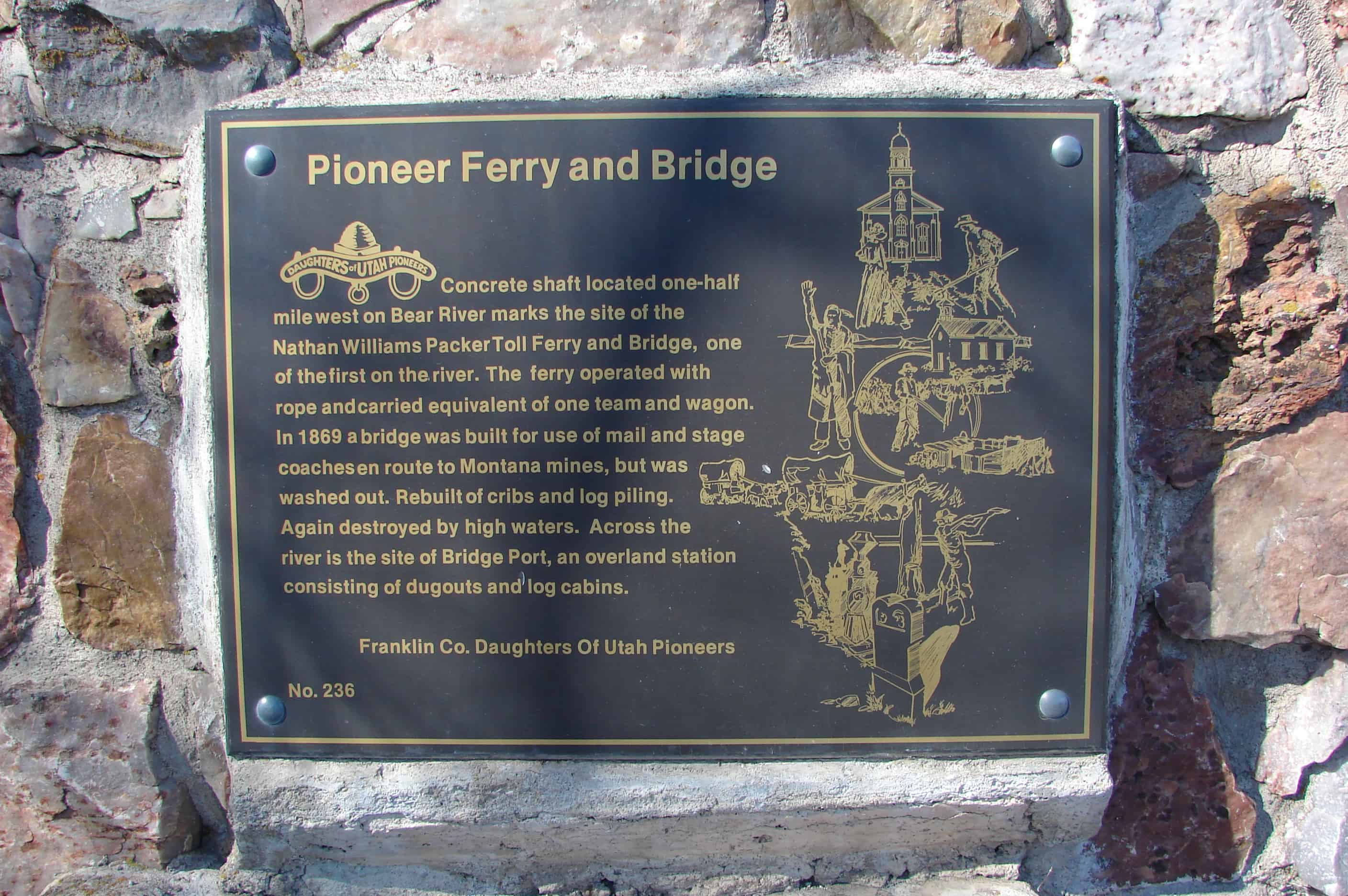
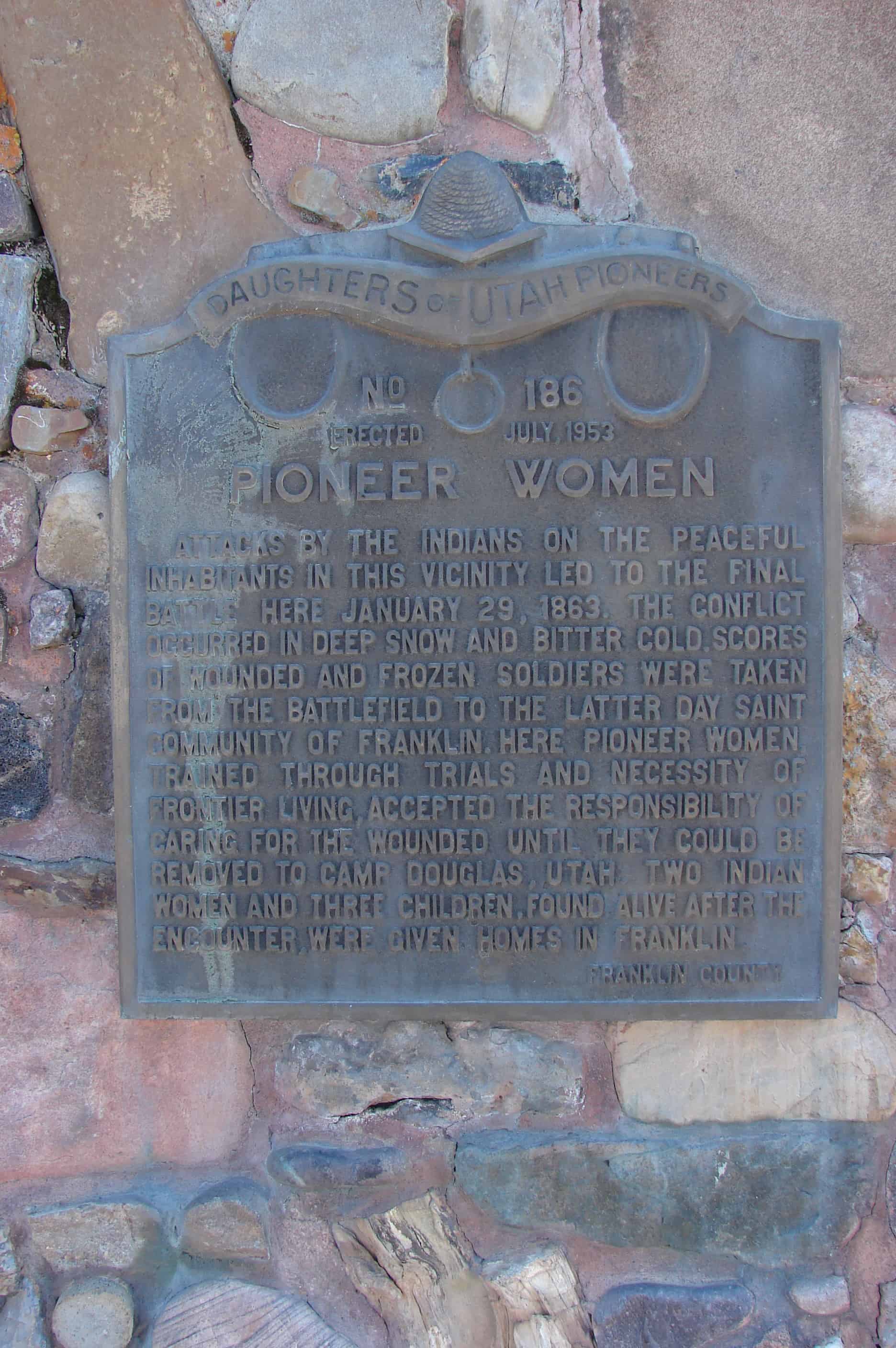
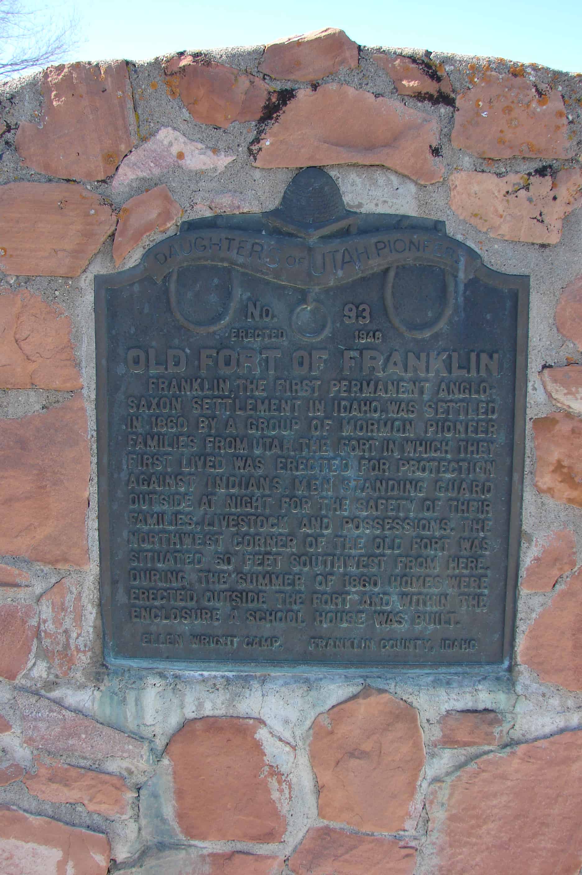
Weston pioneer settlers arrived from Richmond, Utah, on April 15, 186?, temporarily housing their families in wagon boxes, tents and dugouts. Others dwelt in two large canyon caves. They cut logs for cabins and cedar posts for fencing. Settlers harnessed the canyon steams and springs to construct the original Pioneer Dam, located just below Castle Rock. The buffalo, elk, deer and antelope were almost extinct because of trappers who had exploited the furs of the valley. Fish and small game provided sustenance until crops could be raised. The pioneers delighted in naming the rock formations throughout the pass: Castle Rock, Vision Rock, Johnny Jump Off, Peek a Boo, Three Bars of Soap, Balancing Rock, Spirit Rock, Eagle Rock, East Gate and West Gate.

Weston is the second oldest permanent white settlement in Idaho. Bishop Peter Maughan directed construction of the first meetinghouse in 1869. Brigham Young, church president, traveled from Malad, Idaho, to Weston by coach on June 8 and 9; he delighted in the archeology of the canyon. Young’s church sermon encouraged the agricultural efforts of Weston, especially the farming of wheat.

The harsh winter snows and spring runoff often closed the pass. In 1960, the road was paved, allowing year-round access to one of the archaeological jewels of Idaho. This pass has been a place of rest, reflection, reverence, and renewal. It represents outstanding rock, flora, and forest. It is a treasured landmark in the history of the early pioneers.

The above text is from the historic marker placed by the Daughters of Utah Pioneers, see others on this page. The marker number listed on the plaque is #553 but this marker in Deseret, Utah also had that number and the DUP has called this “Pass of the Standing Rock” marker #552 in their published book.

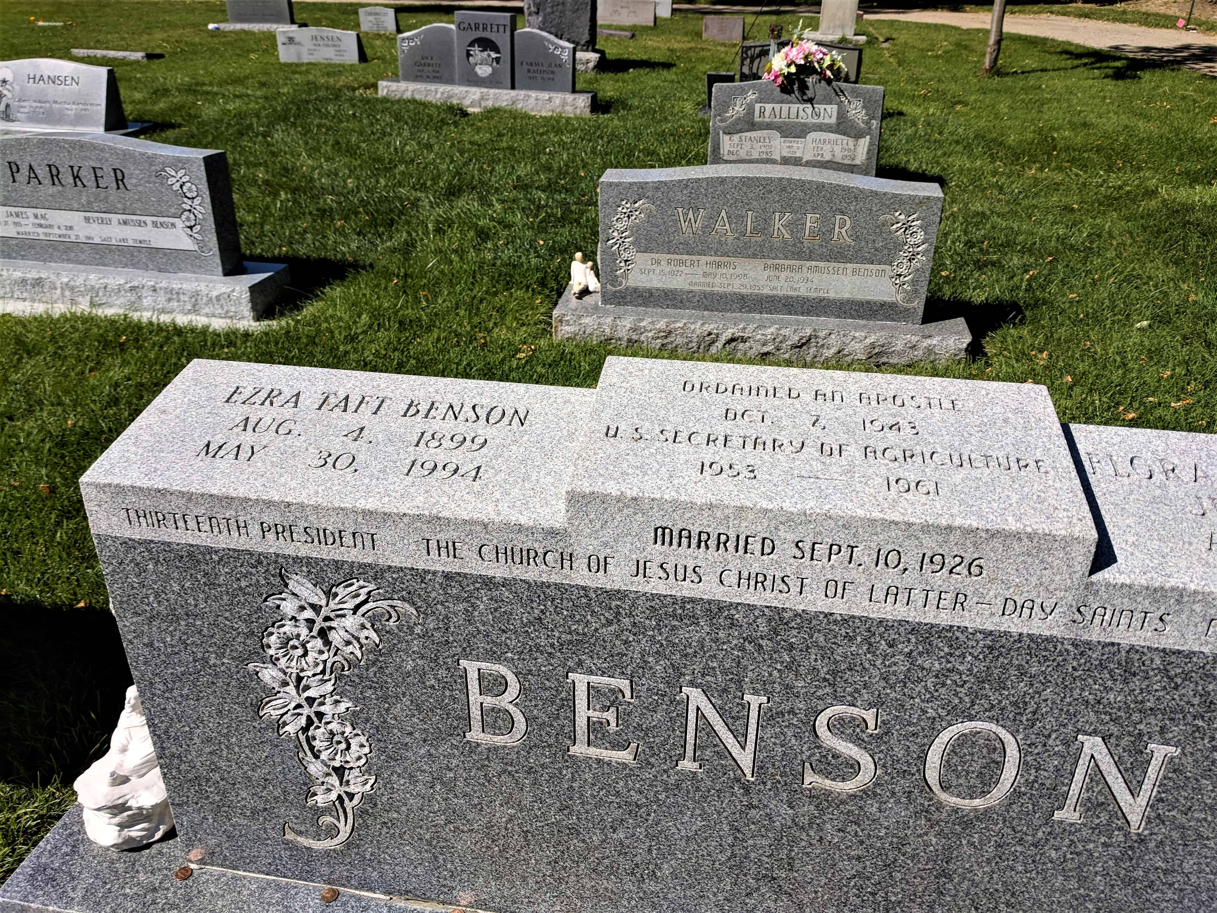
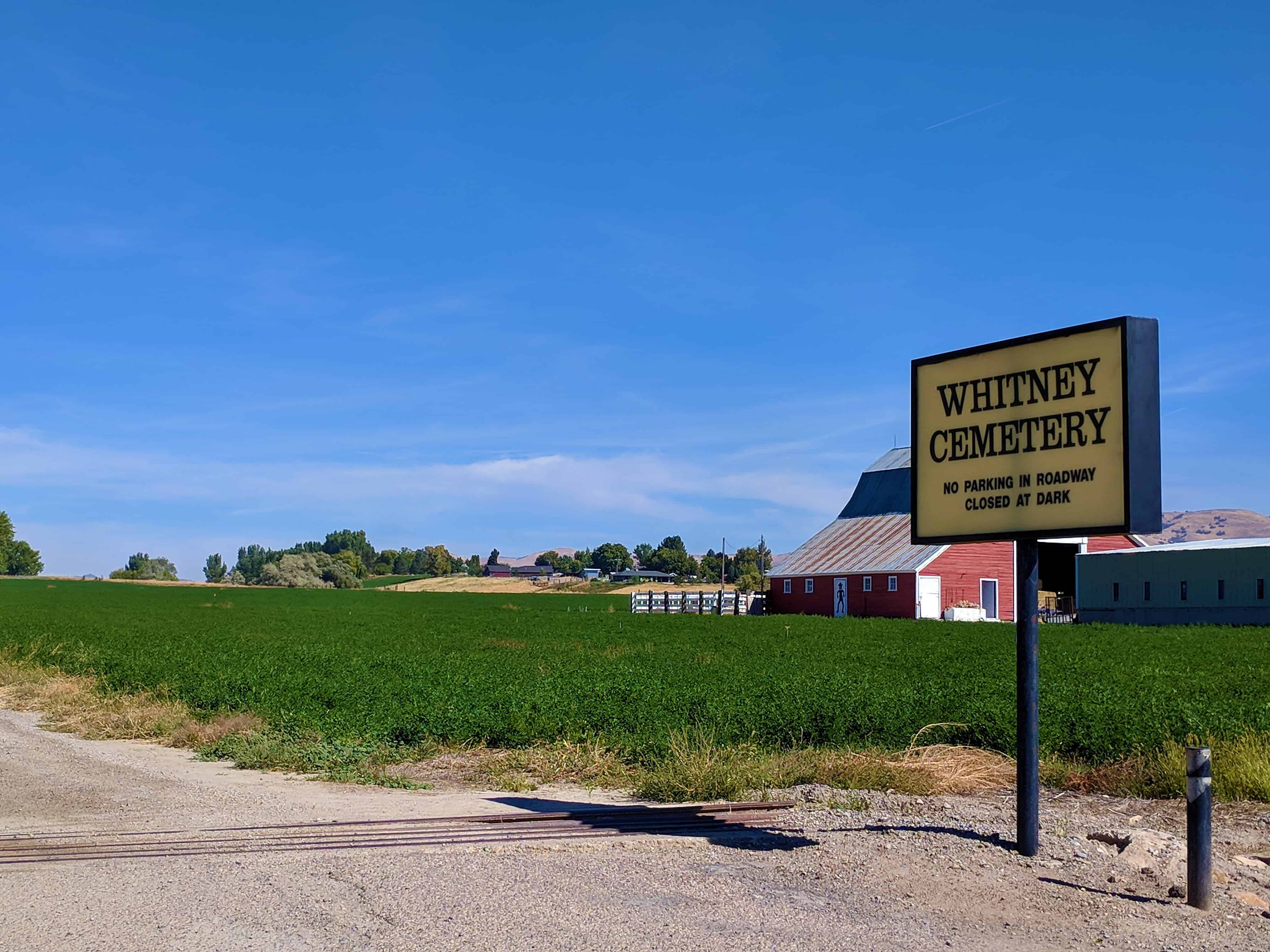
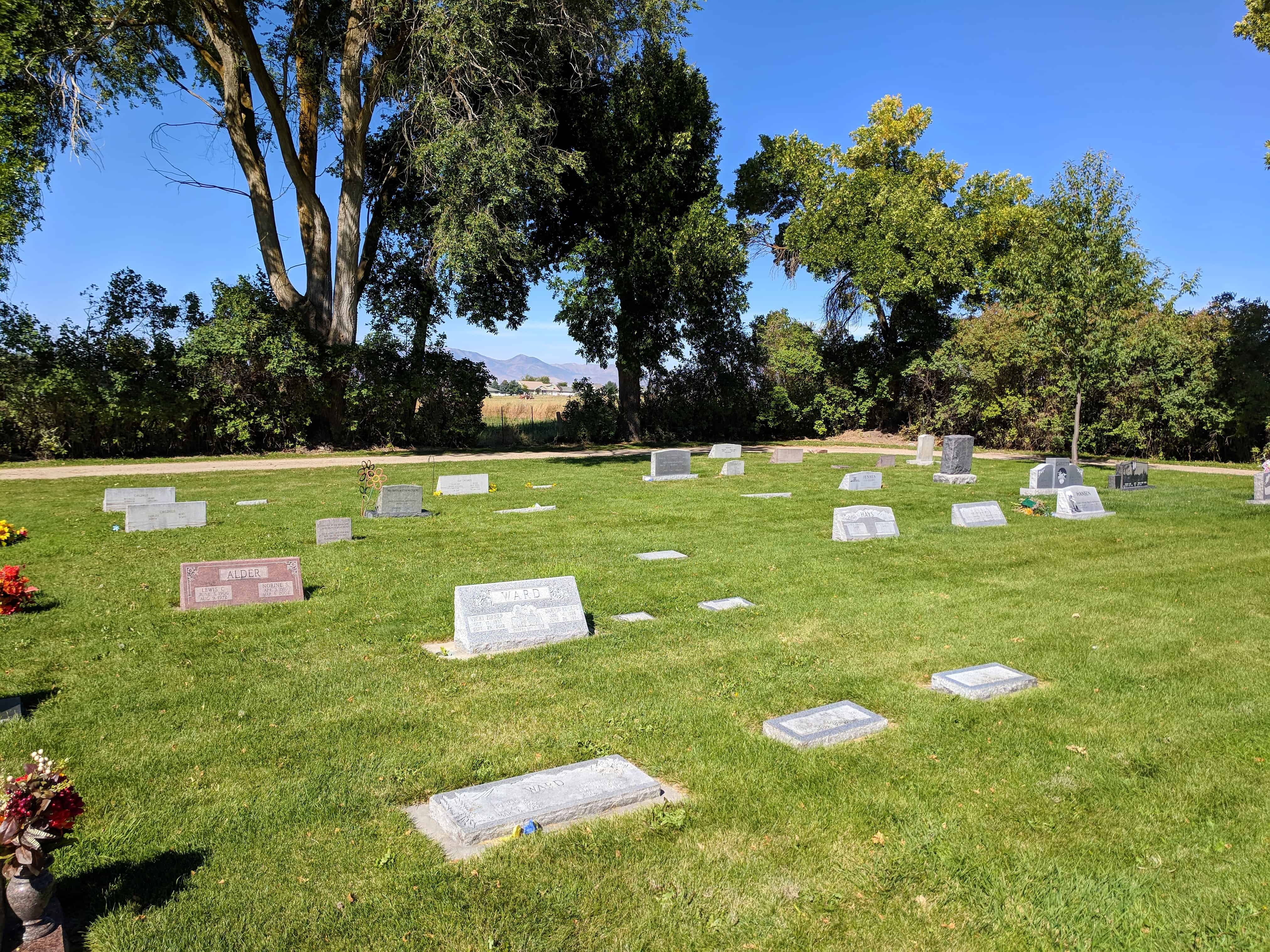
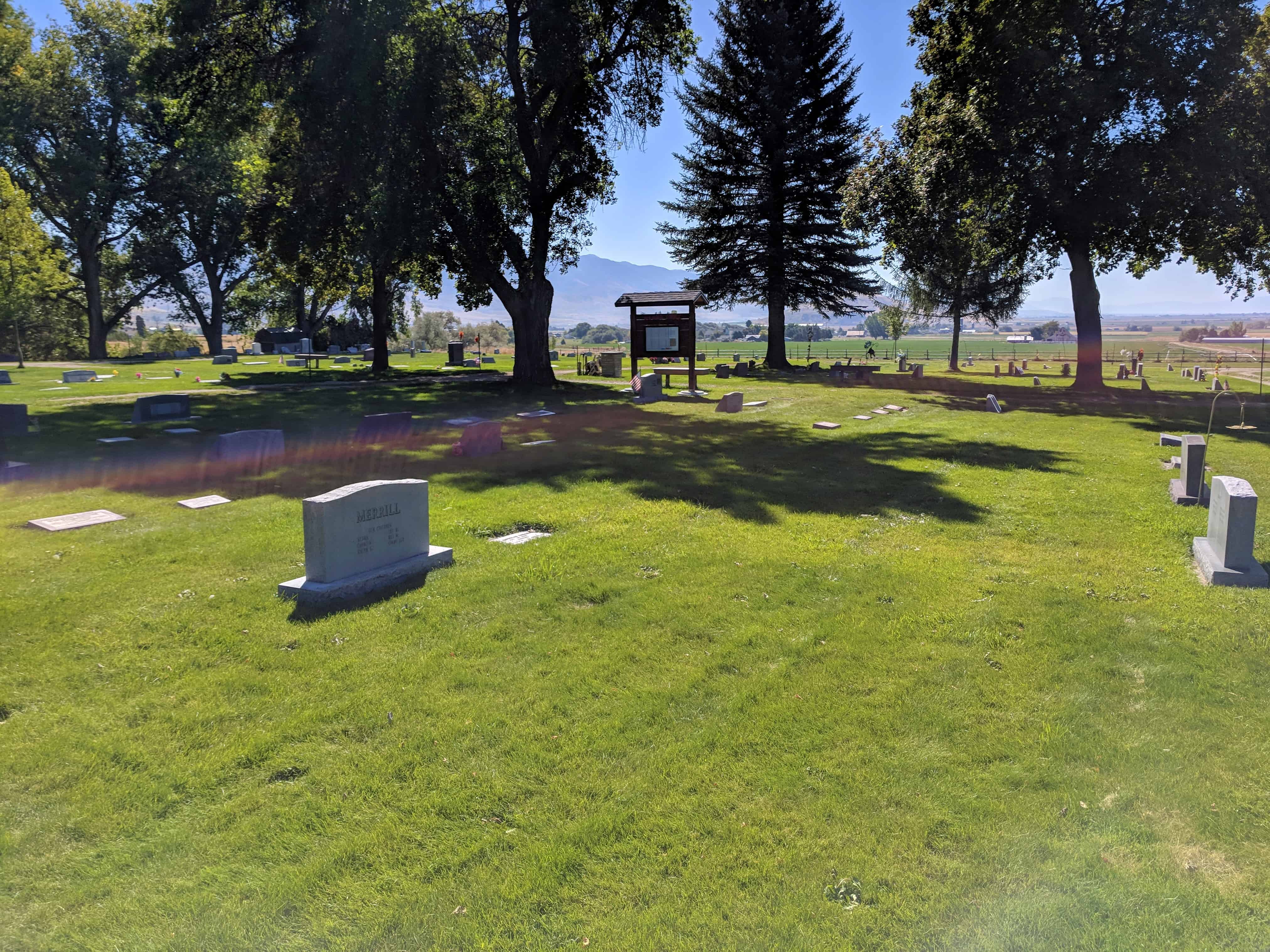
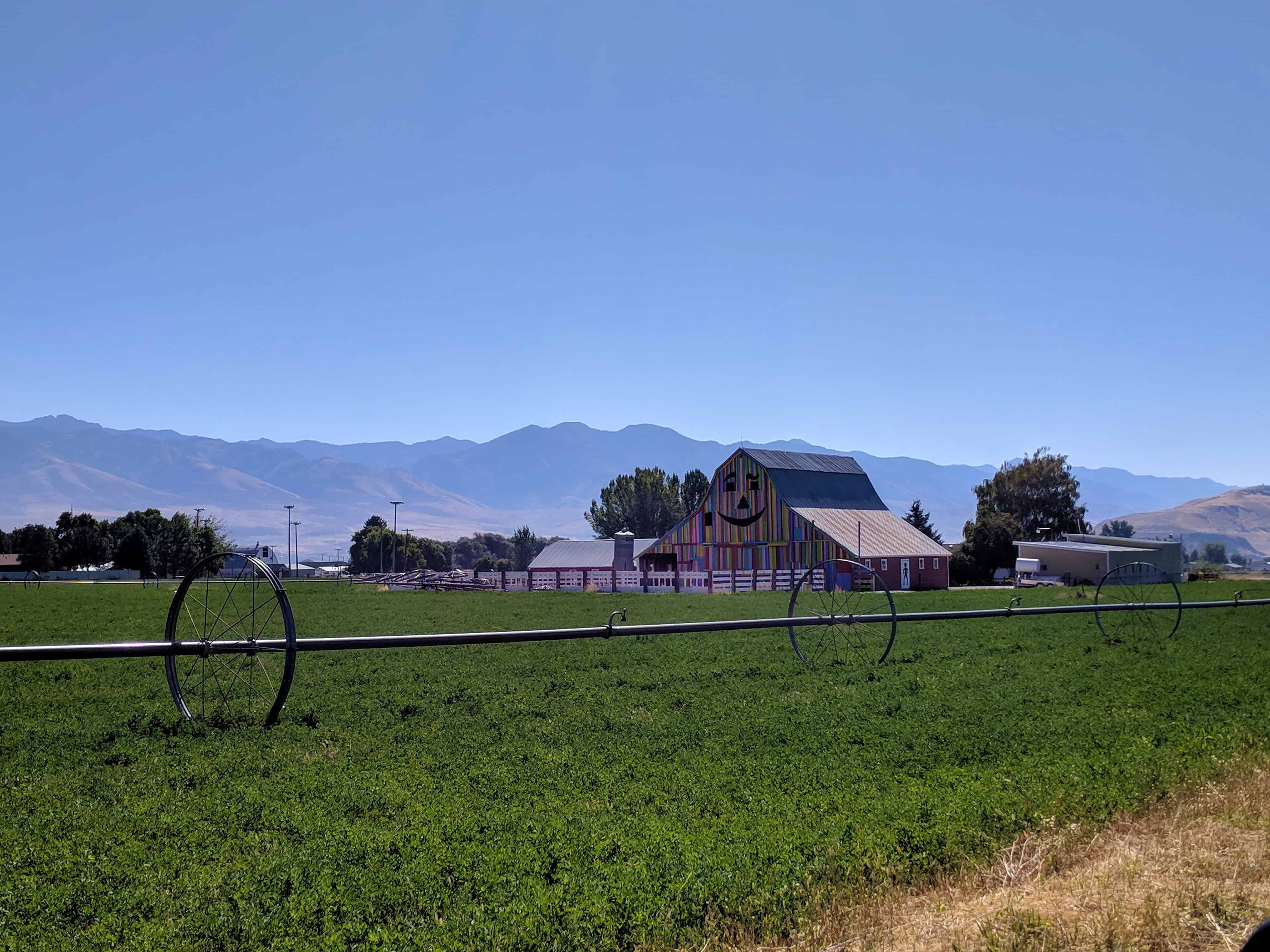
The photos below were submitted by Marshall Hurst:

Ezra Taft Benson Gravesite

24 Monday Sep 2018

Posted by Jacob Barlow in Uncategorized

≈ Leave a comment

Tags

Cemeteries, Franklin County, Idaho, LDS Church, Whitney

2018-09-22 11.44.38

Ezra Taft Benson Gravesite.

Located in the Whitney Cemetery in Whitney, Idaho

For a list of the presidents of the church and links to their gravesites click here.

2018-09-22 11.45.02

2018-09-22 11.44.50

2018-09-22 11.44.45

Whitney Cemetery

24 Monday Sep 2018

Posted by Jacob Barlow in Uncategorized

≈ 1 Comment

Tags

Cemeteries, Franklin County, Idaho, Whitney

2018-09-22 11.39.42

Whitney Cemetery in Whitney, Idaho

Related posts:

  • Ezra Taft Benson Gravesite

2018-09-22 11.42.51

2018-09-22 11.42.54

2018-09-22 11.43.01

2018-09-22 11.44.38

2018-09-22 11.44.50

2018-09-22 11.48.26

Whitney, Idaho

24 Monday Sep 2018

Posted by Jacob Barlow in Uncategorized

≈ 2 Comments

Tags

Franklin County, Idaho, Whitney

2018-09-22 11.37.52

Whitney, Idaho is a small unincorporated community in the Cache Valley of Franklin County.

Related posts:

  • Ezra Taft Benson Gravesite in the Whitney Cemetery

2018-09-22 11.48.26

2018-09-22 11.48.18

2018-09-22 11.37.52

The Battle of Bear River

04 Sunday Dec 2016

Posted by Jacob Barlow in Uncategorized

≈ 4 Comments

Tags

DUP, Franklin County, Historic Markers, Idaho, Preston, SUP

picture09march08-043

This monument is a rock structure, with plaques on each side, and a miniature Teepee on the top. One plaque is by the Pioneer Trails and Landmarks Association and others. Another plaque is by the National Park Service, and another by the Daughters of the Utah Pioneers. The fourth plaque is missing.
The Battle of Bear River, as it was called, and later designated as the Bear River Massacre, was fought in this vicinity January 29, 1863. Col. P. E. Connors, led 300 California Volunteers from Camp Douglas, Utah, against Bannock and Shoshone Indians, who had been blamed for hostile attacks on emigrants and settlers. Although exact numbers differ, more than 400 Indians were trapped and destroyed in battle as they occupied a winter camp that offered ideal protection in Battle Creek Canyon. They suffered a military disaster unmatched in western history, when Connor’s Force struck at daybreak. 250 to 300 Indians were killed, including 90 women and children, and lodges were burned. Very few Indians survived, not only the battle but also the cold.

Also at this site:

  • Bear River Massacre
  • Pioneer Women
picture09march08-049

Historic markers located here:

  • Bear River Massacre – D.U.P. Marker #590
  • Bear River Massacre – Idaho Marker #216
  • Pioneer Women – D.U.P. Marker #186
  • The Battle of Bear River – U.P.T.L.A. Marker #16
  • Utah & Northern Railway – Idaho Marker #257

Pioneer Ferry and Bridge

03 Tuesday Jun 2014

Posted by Jacob Barlow in Uncategorized

≈ Leave a comment

Tags

DUP, Franklin County, historic, Idaho, Preston

  • picture09march08-051

Concrete shaft located one-half mile west on Bear River marks the site of the Nathan Williams Packer toll Ferry and Bridge, one of the first on the river. The Ferry operated with rope and carried equivalent of one team and wagon. In 1869 a bridge was built for use of mail and stage coaches en route to Montana mines, but was washed out. Rebuilt of cribs and log pilling. Again destroyed by high waters. Across the river is the site of Bridge Port, an overland station consisting of dugouts and log cabins.

  • picture09march08-050

Check out all of the historic markers placed by the Daughters of Utah Pioneers at JacobBarlow. com/dup

Pioneer Women

29 Thursday May 2014

Posted by Jacob Barlow in Uncategorized

≈ 1 Comment

Tags

DUP, Franklin County, historic, Historic Markers, Idaho, National Historic Landmarks, Preston

picture09march08-043

Attacks by the Indians on the peaceful inhabitants in this vicinity led to the final battle here January 29th, 1863. The conflict occurred in deep snow and bitter cold, scores of wounded and frozen soldiers were taken from the battlefield to the Latter-Day Saint community of Franklin. Here pioneer women trained through trails and necessity of frontier living accepted the responsibility of caring for the wounded until they could be removed to Camp Douglas, Utah. Two Indian women and three children, found alive after the encounter were given homes in Franklin.

Also at this site:

  • Bear River Massacre
  • The Battle of Bear River

picture09march08-049

Historic markers located here:

  • Bear River Massacre – D.U.P. Marker #590
  • Bear River Massacre – Idaho Marker #216
  • Pioneer Women – D.U.P. Marker #186
  • The Battle of Bear River – U.P.T.L.A. Marker #16
  • Utah & Northern Railway – Idaho Marker #257

Old Fort of Franklin

04 Monday Nov 2013

Posted by Jacob Barlow in Uncategorized

≈ 1 Comment

Tags

DUP, Franklin County, historic, Idaho

picture09march08-054

Franklin, the first permanent Anglo-Saxon settlement in Idaho was settled in 1860 by a group of Mormon pioneer families from Utah. The Fort in which they first lived was erected for protection against Indians, Men standing guard outside at night for the safety of their families, livestock, and possessions, the Northwest corner of the old fort was situated 50 feet southwest from here. During the summer of 1860 homes were erected outside the fort and within the enclosure a school house was built.

picture09march08-053

Other markers placed by the Daughters of Utah Pioneers are listed at JacobBarlow.com/dup

Follow Jacob

Follow Jacob

Blog Stats

  • 2,033,259 hits

Social and Other Links

BarlowLinks.com

Recent Posts

  • Dixie Sorghum (Molasses) Mill
  • This is the Place State Park
  • Eyes Westward
  • Wellsville Relief Society Meetinghouse
  • Angels Are Near Us

Archives


Loading Comments...