Tags
James and Mary Forbes House
Built in 1863 of fieldstone in the hall-parlor style with a crosswing addition added by son, Will Forbes in 1913.
2776 North Valley View Drive in Layton, Utah

28 Saturday Dec 2024
Posted in Uncategorized
Tags
James and Mary Forbes House
Built in 1863 of fieldstone in the hall-parlor style with a crosswing addition added by son, Will Forbes in 1913.
2776 North Valley View Drive in Layton, Utah
24 Sunday Mar 2024
Posted in Uncategorized
Tags

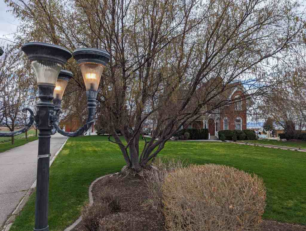
Joseph Adams House
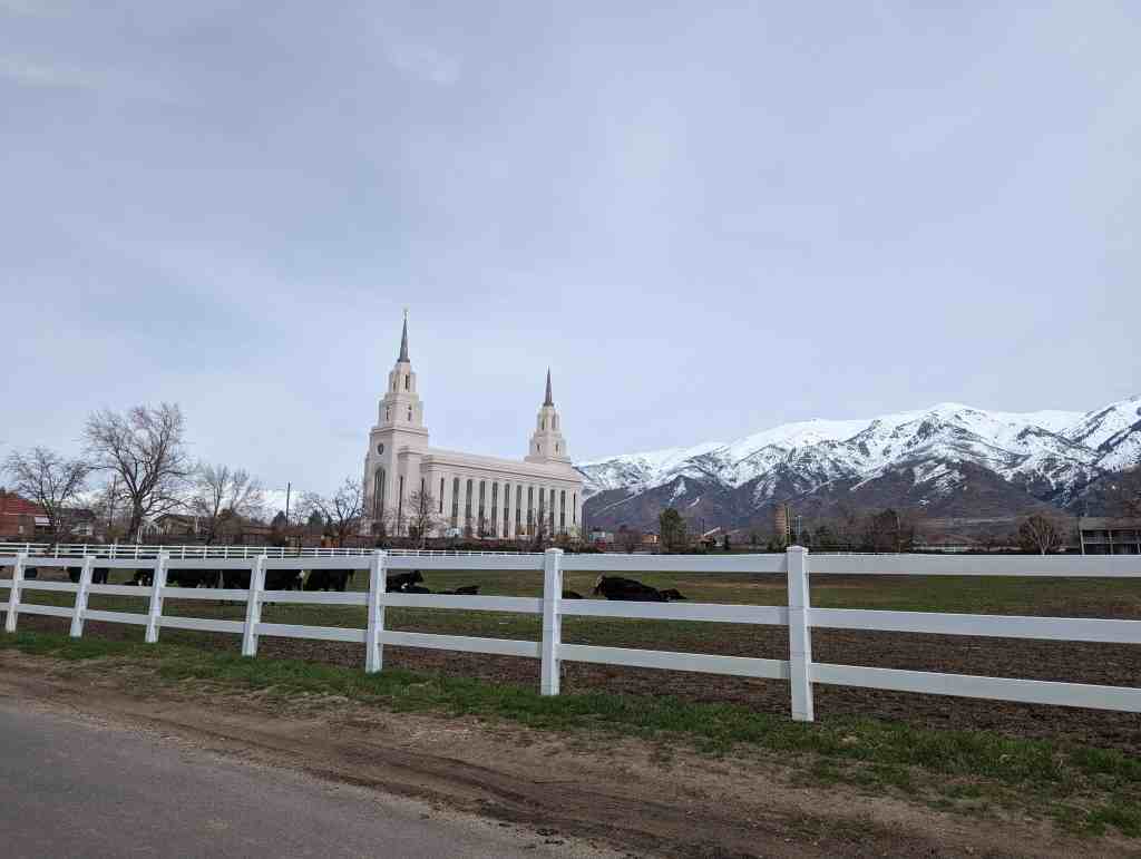
The Joseph Adams House is significant as one of the best remaining examples of the turn-of-the-century farm house in Utah’s Davis County. Located between the two large metropolitan areas of Salt Lake City and Ogden, Davis County became the garden spot of the Wasatch front as a considerable number of prosperous family farms were operated in the county; however, in the last few decades much of the farmland has been appropriated for housing subdivisions, schools, shopping centers, highways, and other urban structures. The Joseph Adams House and out buildings, located in a grove of trees and surrounded by pasture land, provides a glimpse of the by-gone rural-agricultural era of Davis County.
Located at 400 North Adamswood Road in Layton, Utah and added to the National Historic Register (#78002655) on February 17, 1978 (text on this page is mostly from that nomination form).
Related:

Joseph Samuel Adams was born at Quincy, Adams County, Illinois, September 19, 1841. Earlier his parents Elias and Malinda Railey Adams had joined the Church of Jesus Christ of Latter-day Saints and moved to Illinois to be with the main body of Mormons. Following the exodus from Illinois the Adams family moved to Mount Pisgah in May 1846 and remained there until 1850. In the spring of 1850 Elias Adams was released from his assignment at the Mount Pisgah way station and allowed to complete the journey to the Great Salt Lake Valley.
After their arrival in Salt Lake City, September 7, 1850, the Adams family immediately traveled north to the Kaysville settlement where Elias Adams claimed a parcel of land .approximately one by two miles.
Joseph Adams remained with his family in Kaysville until 1873 when he was called to serve as a colonizing missionary to northern Arizona. The mission proved a failure, and the group returned to Utah. However Joseph Adams left his mark in Arizona at House Rock Springs where his assessment of the mission, carved in stone, can still be read, “Joseph Adams from Kaysville to Arizona and busted June 4, A.D. 1873.”

Joseph returned to Kaysville and in February 1876 married Isabella “Belle” Smith. He purchased 80 acres of land from his father for 450 bushels of grain. In the spring of 1876 a large log house was constructed and several out buildings including the granary, cellar and wash house. The farm proved profitable and in 1889 Adams began construction of the present brick house. Brick for the house was made by Joseph Adams who had learned brick making from his father.
Joseph Adams died October 13, 1901. His wife “Belle” remained in the house until her death in 1944. Prior to that time his son Charles moved into the house and the property passed to him. Charles Adams died in 1966, and his wife, Minnie N. Adams, is the current owner. She has deeded the house and property to her son, Charles P. Adams, who has shown a strong commitment to the preservation of the house and property.

Of the original eighty-acre farm only six acres are included as the National Register property. The six acres include the following buildings: the house, constructed in 1889-1890; the wash house, constructed in 1876; the milk house, constructed c. 1900; the granary, buggy shed, and milking shed, constructed in 1876; and a garage, constructed c. 1920. Also on the property but not included in the nomination is a thresher shed constructed in 1959.
The Adams house is a good example of a basic “T” form, 2-story brick house (with a one-story shed addition), which uses Queen Anne style decorative elements without the variation in plan or massing characteristic of more elaborate Queen Anne buildings. The fine decorative detail, although limited to the front façade, makes for great visual interest. The first floor double two-over-two windows in the gable end framed by a brick arch, with a tracery pattern in the wood infill below the arch. The second floor windows above and the dormer window are set in raised brick corbelling. Both second story windows, one in the gable end and the dormer over the porch, are framed by raised corbelled brick.
The porch projects past the front of the house and is supported by six turned posts with bell and spindle fret work just below the porch roof line. The roof of the porch is broken by a projecting gable over the steps with a turned finial on the gable peak.
The wash house is approximately 10 feet by 14 feet. The log structure was constructed in 1876 for bathing and washing clothes.
The granary, located to the rear, southeast of the house, was constructed in 1876 and is built of wood on a stone foundation which comprises a cellar and is reached by an entry on the west side of the granary. The granary is reached by doors on the north.
Attached to the granary on the east is a buggy shed with three stalls which open to the north. Attached to the buggy shed to the east is the milking shed. It opens to the south. The milk house, a 4 foot by 6 foot wooden shed used to cool the milk is located approximately forty feet west of the granary.
The garage is located east of the house, approximately 120 feet and north of the granary approximately 60 feet. It is a wood frame structure.
The house and out buildings are surrounded by approximately four and a half acres of pasture land.


24 Wednesday May 2023
Posted in Uncategorized
Tags
19 Friday May 2023
Posted in Uncategorized
Tags
Davis County, Historic Homes, Layton, NRHP, Porch Spandrels, utah

George W. Layton House
The George W. Layton house, built in about 1897, is significant as one of a very limited number of houses designed by the Kaysville architect William Allen, that is virtually unaltered. William Allen was the only architect in Davis County at the time that the Layton house was designed, and continued to be the leading architect in the county until the 1920s. The Layton house also documents the use of pattern book house types in the late nineteenth century, and it is the same pattern that Allen used in the John Henry Layton house in West Layton, and possibly in the Joseph Adams house in East Layton. Of the three houses the George W. Layton house received the most ornate program of ornament, and thereby records one extreme of the stylistic possibilities of pattern book design. The complexity of the brick and wood ornamentation, and its unaltered and well preserved condition make the George W. Layton house one of the most distinctive Victorian pattern book houses in Utah. In addition, Layton, who is credited with the resident’s actual construction, served in a number of capacities within the community.
Located at 2767 West Gentile Street in Layton, Utah and added to the National Historic Register (#82004123) on February 11, 1982.

The George W. Layton Farm House, in West Layton, was built c. 1897. According to Vera Louise Layton Merrill, a daughter of Layton, the house incorporated an earlier three-room structure. The house was designed by William Alien, a prominent Davis County architect, and the actual construction of the residence is credited to Layton himself. The George W. Layton house is a two story red brick house with a stone foundation that was designed by the Kaysville architect, William Alien. It is a pattern book design with an impressive program of East lake and Queen Anne ornamentation. The pattern Alien chose for this house is almost exactly the same as the one he used for the John Henry Layton house which is several miles east on West Gentile Street. The John H. Layton house has longer proportions, but in general massing it is the mirror image of the George W. Layton house.
In 1851, Joseph (Cap) Hill “I” homesteaded at the mouth of Kay’s Creek. In 1862, James Sevens built a house on the south side of Kay’s Creek. Seven years later, Christopher Layton and some of his sons and sons-in-law cleared six sections of land to be dry farmed. This dry farm and the adjacent areas became known as West Layton. The early settlers of the area were sons and daughters of people who had settled in Kaysville and other areas of Davis County.
George Willard Layton was born November 11, 1863, in Kaysville, Utah. He was a son of Christopher and Rose Ann Hudson Layton. George W. spent his early years in Kaysville. It was there that he met and married Jeanette Maria Hill on December 18, 1884. Layton purchased 82 acres of land located in West Layton in 1891 from William and Aaron Call. At that time, there was a three room structure located on the site, and in about 1897 Layton had Allen design the present structure, with Layton himself involved in its construction.
Layton’s activities were not limited to farming. He has been characterized as being involved in “everything from baseball diamonds to banking.” He raised cattle and livestock and also grain to provide feed. He was president of the First National Bank of Layton and was a major stockholder in the Layton Sugar Company and the Ellison Cattle Ranch. He is also credited with building eleven other houses, in addition to his own. The Laytons were members of the LDS Church and were active in church activities. The couple had eight children, two of whom died in early infancy.
In the early 1900s the Laytons moved from the farmhouse to a house located nearer to the town of Layton. The farmhouse was used as the residence of the hired farmhand. This enabled George W. to take care of his responsibilities at the farm and in town. The children loved the new location because it was located nearer to the train station which provided transportation to Lagoon, a popular resort.
Mrs. Layton died in 1933. George lived eleven years after her death, passing away on January 10, 1944.
The house was deeded to Glen Seymour Layton and other members of the family in 1931. In 1961, the property was acquired to Sheron Layton Ahlstrom and Patricia Layton Evans, who presently (1980) own the property. The house is being used as rental property.


19 Friday May 2023
Posted in Uncategorized
Tags
John Henry Layton House
The John H. Layton farmstead, dating from the 1880s, is significant as one of few well preserved examples of a homestead in Utah, a pattern of settlement that developed after 1869 which diverged from the typical plan of a Mormon community. The house, erected in the late 1890s, summer kitchen, well house, granary, and barn have received few alterations, and as a unit are representative of a way of life, the family farm, that is becoming obsolete. This cluster of buildings is also significant as the physical remains of one of Layton’s prominent farmers, John Henry Layton, son of Christopher Layton, the pioneer after whom Layton was named. The house itself is particularly significant because it was designed by William Allen, the only architect in Davis County at the time of its design, and the leading architect in the county until the 1920s. It is one of a very limited number of houses designed by William Allen that has not been dramatically altered. It is of pattern book design, one that may have been used by Allen in the Joseph Adams House in East Layton, and repeated in the George W. Layton house in West Layton. Because the house has received few major alterations it stands as a well preserved example not only of a type that was preferred by Allen, but also one that was considered suitable for a prominent farmer. With some variation in the treatment of ornamentation this type suited a wide range of tastes. The condition of the interior of the house is particularly noteworthy. It is one of few older houses in Utah in which the original woodwork is completely intact. It is a superb example of the technique of wood graining, a procedure by which an inferior wood, pine, for example, was painted to resemble a more high quality wood.
Located at 683 West Gentile Street in Layton, Utah and added to the National Historic Register (#82004123) on February 11, 1982.

The John H. Layton farmstead was first occupied after 1883 when John Henry Layton purchased the land from his father, Christopher Layton. The family originally occupied a two room adobe house that stood in the location of the present summer kitchen. The two story brick house that is presently the focus of the farmstead was built in the late 1890s. The Abstract of Title does not indicate the exact date of construction, but the house was occupied as early as January of 1898. At that time Frankie Josephine Layton Dickson, the twelfth child of John Henry and Hannah Maria Layton, the original owners, is reported to have been born in the house. The house was designed by William Allen, the only architect working in Davis County at the time.
John Henry and Hannah Layton are reported to have been among the first settlers in West Layton, arriving in 1880. John Henry, son of Christopher Layton and his fifth wife, Isabella Golightly, was born in Grantsville in 1855. He was the eighth of thirty-one sons born to Christopher Layton from ten marriages. Christopher Layton was the pioneer after whom Layton was named, and one who made significant contributions to the establishment and growth of several Mormon communities. John Henry and Hannah were married on January 30, 1879 in Salt Lake City. Hannah was the daughter of Edward Phillips, one of the first settlers in Kaysville. John Henry made a living by farming; growing club barley, hay, and sugar beets, and by raising livestock; cattle, sheep and hogs. He and his wife were members of the West Layton Ward of the LDS Church. Although John Henry was not an active church member, Hannah did much to encourage musical activities in the ward and served as ward organist. She also served as the first counselor to the Young Ladies Mutual Improvement Association of the West Layton Ward, and was a member of the Davis Stake Primary Association for twenty-five years. John Henry and Hannah had thirteen children, ten of which were raised to maturity on the Layton farm.
John Henry’s activities in the business world included participation as one of the organizers of the First National Bank of Layton, serving as the director of the Ellison Ranching Company, and owning stock in the Layton Sugar Company, the Farmer’s Union Store, the Davis and Weber Counties Canal Company, and the Kays Creek Irrigation Company.
The Layton farm can be considered as a late example of a homestead, a pattern of settlement that developed after the Homestead Act was passed in 1869. Homesteading was the first significant development away from the Mormon plan which consolidated homes as a nucleus in a town, and designated fields on the perimeter of the town for farming. John H. Layton’s farm, however, was not the typical homestead in that John Henry did not acquire the typical parcel of 160 acres, but rather purchased his land from his father. He was a homesteader in that he chose to live and farm large areas of land that were remote from the principal area of settlement.
The Layton farmstead was not only a local center of farm activities, but it was also a guest house for those Layton relatives who traveled from Arizona to Utah to be married in the temple in Salt Lake City.
John Henry died in 1920, and Hannah Layton continued to live on the farmstead until her death in 1939. The estate passed from Hannah to her children who divided it among themselves. The house and land immediately surrounding it passed to Lottie Jane Layton and Luella Layton Humphries. They lived in the house until their deaths. Luella left her half interest in the house to her son, Richard Humphries, and Lottie left her portion to other members of the family. Richard Humphries eventually bought Lottie’s half of the property and lived in the house until 1973. At that time lie sold the property to the Lakewood Investment firm. A real estate contract indicates that the house and several acres of land were then sold to Spencer Lynn Nunley for $38,000. Nunley was a house painter from Salt Lake City who bought the house to redecorate and resell. Sharon and E. Keith Slatore bought the property from tile Nunley’s in 1974, and are the current owners. Mr. Slatore is a civil engineer.
William Allen, the architect who designed the Layton House, was originally from London, England. He settled in Kaysville at the age of thirteen and worked as a brick mason. After having completed a correspondence] in architecture he became the leading architect in Davis County. The Kaysville Tabernacle, the Kaysville Presbyterian Church, the Kaysville City Hall, the Kaysville Elementary School, the Barnes Block in Kaysville, and the Davis County Courthouse in Farming ton were among his major works. He also designed a significant number of large brick residences throughout the county.


07 Wednesday Dec 2022
Posted in Uncategorized
Tags

Veterans Park Layton Utah
Veterans Park is located between 155 West and 175 West Gentile Street on the east side of the Union Pacific Railroad tracks. The park is an irregular shaped plot, planted with grass and trees. The park is maintained by the Layton City Parks Department, but the area is owned by the Oregon Short Line/Union Pacific Corporation.
The Oregon Short Line/Union Pacific railroad ran along Main Street in Layton. The Layton depot and railroad tracks were moved from downtown to a new right of way west of Main Street in 1911-1912. A new, larger freight and passenger depot was built on the east side of the tracks about 350 feet south of Gentile Street. The railroad property also included the piece of property where the park is located.

From the time it was built until the mid-1940s the Layton depot was an important gathering place, particularly during World War I and throughout the 1920s. At that time freight and passenger trains made regular stops in Layton. Crowds would gather there to meet or bid farewell to passengers, pick up or receive freight, or visit the station just to see the trains pass by. In addition to the station there was an area planted in the grass and surrounded by a combination wire fence. The fence was necessary then because herds of cattle and sheep were frequently driven up and down Gentile Street. The fence also kept stray horses and cattle from grazing on the lawn. The stationmaster was probably responsible for the care of the fence and lawn. Since the railroad station was the focal point for the town, the grass areas next to Gentile Street was regarded as a public park. In 1921 four trees were planted in this park as a memorial to four young men from Layton who died during or very shortly after World War I.
Due to railway expansion in 2008 one of those memorial trees was removed and replaced with a new tree in this location.


P F C David Day
Serial No. 4269347
David Day, son of James W and Elizabeth Day, was born May 1, 1897, in Layton, Utah
He was inducted into service in Company M, 8th Infantry, under Captain Graves, August 9, 198. He trained for three months in Camp Fremont and the Camp Mills. While on his way to overseas assignment he was involved in a troop train accident in Geneva, Illinois. He was slightly injured and spent the night of the accident exposed to the rain. He was stricken with flu and died of pneumonia at Camp Mills, New York on November 3, 1918.
Full military honors were given in the burial on Kaysville cemetery, at Kaysville, Utah.
He was the first World War Hero to be buried in Davis County.

P F C Hubert Henry Layton
Serial No. 2780989
Hubert Henry Layton, son of Orson and Ruth E. Layton, was born March 22, 1891, in Layton Utah.
He was married to Dora Jane Dunyon and they had one daughter, Jane Ruth Layton.
Hubert Henry Layton was a graduate from University of Utah and practiced law as an attorney.
He was inducted into service in Battery B of the 348th Field Artillery, April 27, 1918. Three months were spent in training a Camp Lewis and he sailed overseas July 27, 1918.
He was stationed a Clearmont Ferand, France, where he died of typhoid fever, October 19, 1918. He was buried in the American cemetery but was later returned home for final burial in the Wasatch Lawn cemetery at Salt Lake City, Utah.
(more info here)

P F C David Lane Jones
Serial No. 5206305
David Lane Jones, son of Thomas R. and Carrie Mabel Jones, was born February 15, 1899, in Fairfield, Utah but he was raised in Layton, Utah.
He volunteered for service October 3, 1918. He was assigned to Company D. Student Army Training Camp, University of Utah for a few weeks. He was sent home on account of influenza epidemic but was recalled to Fort Douglas, November 18, 1918. He died at Fort Douglas, Utah of influenza, December 1, 1918.
He is buried in the Kaysville cemetery, at Kaysville, Utah.

P F C William Clyde Layton
Serial No. 2259409
William Clyde Layton, son of Charles A. and Victoria J Walker Layton, was born July 11, 1895, in Davis County, Utah.
He was inducted into service September 19, 1917 and was assigned to Machine Gun Company 362nd Infantry, 91st Division. He trained a Camp Lewis, Washington, and Camp Merrit, New Jersey.
In March, 1918 he was granted furlough. He came home and was married to Meldon Kirkham, who returned with him to Washington state. He sailed overseas July 5, 1918.
On the night of July 23rd near Bonnieres-sur-Seine, France a small village about forty miles north of Paris, a troop train on which his company was riding was struck by a heavy freight train. William C. Layton was among those who lost their lives in the wreck. He was killed instantly.
July 15, 1921, the body was returned to America and buried in the Kaysville cemetery, at Kaysville, Utah.
175 West Gentile Street in Layton, Utah


In Honor Of All Who Served
This site was once part of a railroad station where servicemen and servicewomen said “good-bye” to friends and families before departing to serve in the U. S. Armed Forces. This monument, designed by Layton High School student Jyana Messenger, was dedicated November 11, 2000, to honor those Layton citizens who have served their country in the U. S. Army, Navy, Air Force, Marines and Coast Guard and to keep alive their memory for future generations. The circle of connected hands represents the give service branches and the give armed conflicts of the 20th century. It symbolizes stability and strength between fellow servicemen and servicewomen and also serves as their link to future generations.
Four trees were planted in the park in 1921 in memory of four young men who died during World War I. The site was donated to Layton City by the Union Pacific Railroad and named “Veterans Park” on November 11, 1991.
The park has become a deeply meaningful memorial for the people of Layton, Utah.
Those Who Lost Their Lives
WORLD WAR I
WORLD WAR II
KOREAN WAR
VIETNAM WAR
IRAQI WAR


02 Wednesday Nov 2022
Posted in Uncategorized
Tags

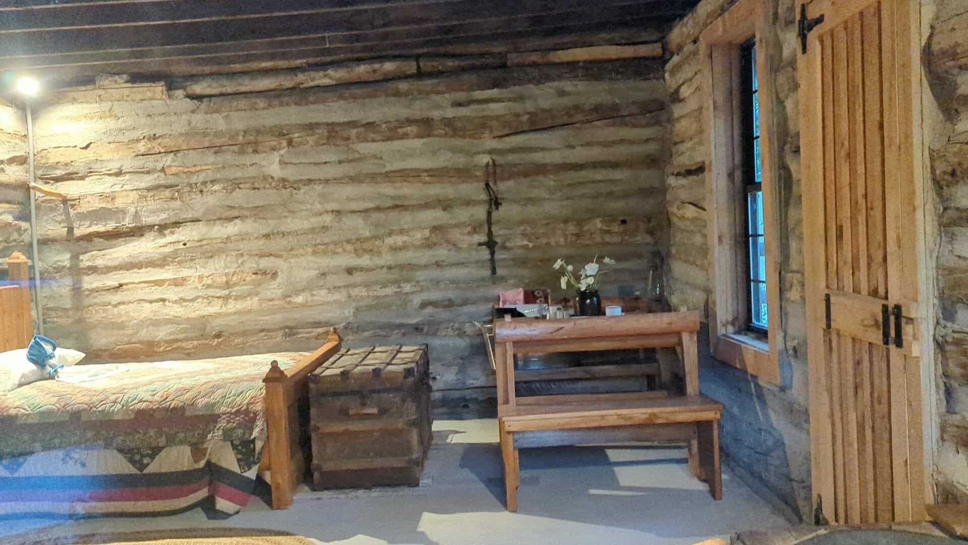
Joseph “Cap” Hill Cabin
After sitting 161 years on its original building site, the Joseph “Cap” Hill cabin was moved to Layton Commons Park in 2017. This cabin is one of the oldest pioneer buildings in Davis County. It was built by Joseph Hill Sr. and his family between 1851 and 1854 and has been in the possession of the Hill family for over five generations.
Joseph “Cap” and Edith Ann Hill
Born in Gloucestershire, England, Joseph and his wife Edith Ann Marsden Hill, joined The Church of Jesus Christ of Latter-day Saints and immigrated to America in the 1840s with their three children – John C., Joseph Jr. and Alice Ann. They lived in Nauvoo, Illinois for a time and then moved to Utah Territory in September 1850. After arriving in Salt Lake City, the Hill’s move to the Kay’s Ward (later Kaysville) settlement to establish a permanent home. During this exodus across the plains, Joseph served as a captain of 10 wagons, under the direction of Mathew Caldwell, a captain of 50. For the rest of his life, Joseph would be remembered as “Cap” or “Captain” by his many friends and neighbors.
Joseph Sr. and his family worked hard to build a new homestead in what is now West Layton, on the west side of Angel Street. Once the cabin was built, the family established a farm where they raised hay, grain crops and cattle. In the late 1850s, Joseph Sr., hoping to seek his fortune in the gold fields, moved his family briefly to Sacramento, California; however, they returned to Utah in 1862. While passing through Carson City, Nevada, Edith Ann was critically injured in a wagon accident and died on July 4, 1862. After burying his wife, Joseph Sr. returned to Kay’s Ward and took up residence once again in the cabin he had built. He lived there until his death on august 21, 1889; and he was buried in the Kaysville City Cemetery. Following his death, the cabin was used for a variety of purposes until it fell into disrepair.
Eventually, the cabin passed into the possession of Joseph Sr.’s 2nd great-granddaughter, Odessa Webster Hill Harris and her husband Robert Jay Harris. The couple restored the cabin to its current condition in 1990. In 2000, the Harris’ built a beautiful home on the Hill property next to the cabin and cared and looked after the property until their passing in 2017. After their deaths, the cabin was moved to its current location where it serves as a reminder to Layton citizens as well as to all visitors who see it of those who came before us.
Related:


Located at Layton Commons Park at 437 N Wasatch Drive in Layton, Utah
The Joseph Hill Family Cabin, built sometime between 1851 and 1858, is a one-story single-pen log cabin, located at 2133 W. 1000 South in Layton, Davis County, Utah. After a period of vacancy and deterioration, the cabin was rehabilitated around 1990 when it was raised and placed on a concrete pad. The rehabilitation included replacement logs from a derelict barn on site, re-chinking, replacement windows and interior casings, gable trim, an interior brick chimney, drop ceiling, and a new roof with wood shingles. Despite these modifications in some materials and workmanship, the Hill Family Cabin retains its historic integrity in terms of location, design, feeling and association of a pioneer-era log cabin. Although the immediate setting of the cabin has been compromised by the landscaped yard, the wider setting is still rural as much of the original farmstead remains agricultural. A new home built on the 1.53-acre property in 2000 is non-contributing. There is also an associated historic outhouse near the log cabin, but the outhouse has been modified and moved, and is therefore considered non-contributing. The Joseph Hill Family Cabin is one of four extant log cabins in the Layton area and the only example that still retains its domestic appearance. The cabin is a contributing resource in its Layton neighborhood.
The Joseph Hill Family Cabin sits on roughly rectangular property of 1.53-acres, a combination of two descriptions into one legal parcel. The cabin is located at the southeast corner of the property in the backyard of the non-contributing house, built in 2000, facing north to 1000 South. The new house was built where a one-story red brick Victorian-era cottage was located before it was destroyed by fire in the 1970s. The property is mostly lawn with pasture on the three adjoining sides. There is one mature elm tree located north of the cabin. This tree is the only remnant of the copse that surrounded the cabin prior to the rehabilitation. There are newer trees with decorative boulder plantings scattered in the backyard. A non-contributing gazebo structure is in one of the plantings. Just south of the cabin in one of the plantings is a wood outhouse. Although historic and associated with the cabin, the outhouse was recently moved and does not retain sufficient integrity to be contributing. There is also new gazebo west of the cabin.
The West Layton neighborhood at the intersection of 2200 West and 1000 South retains a rural feeling despite recent construction activity in the area. There are newer homes on either side of the cabin property, but there is pasture between. A new barn sits southwest of the log cabin on a separate legal parcel. There are onion fields to the north of 1000 South. To the south is undeveloped open pasture, further south and west are marshes at the edge of the Great Salt Lake. The path of the abandoned Bluff Road is visible in aerial photographs in the vicinity of the Joseph Hill Family Cabin.
The Joseph Hill Family Cabin in Layton, Utah, is locally significant under Criterion A, in three distinct areas:
Exploration/Settlement, Commerce, Transportation, and Ethnic Heritage. The log cabin built by the Hill family is a rare extant example from the early settlement of the area formerly known as West Layton. The exact date of construction is unknown. In local histories, the construction of the cabin has been attributed to either Joseph Hill Sr. upon his arrival in 1851 or his son, Joseph Hill Jr., prior to his marriage in 1858. Both families are considered important early settlers of the Big Field area of West Layton. The Hill cabin was never moved from the family farmstead along the Bluff Road contributing to the cabin’s significance in the areas of Commerce and Transportation. Bluff Road was the preferred route for California-bound gold seekers leaving Salt Lake City to travel around the north end of the Great Salt Lake. The Hill family raised cattle on the flats below the bluff and sold beef and other commodities to the travelers. The family also represents the small minority of Mormon settlers who were lured to California by the promise of gold and silver. Joseph Hill Sr.’s extended family left Layton in 1860 and returned in 1862 after an unsuccessful and tragic journey, which resulted in the death of his wife, Ann Edith Marston Hill. After their return, Joseph Hill Jr. built a red brick house for his wife, Ellen Sheen Hill, and family. During that time Joseph Sr. may have lived in the cabin behind the brick house. The Hill Cabin is the only extant log cabin in Utah that is linked to the Bluff Road and it is the only known cabin in Layton to have continued a residential use into the twentieth century.
The Hill Cabin is also the only documented building in Davis County to be associated with the Japanese soaking tub practice (known as ofuro), which gives the building significance in the area of Ethnic Heritage. The continued maintenance of the log cabin as a residence likely contributed to its easy conversion to a bathhouse/dressing room in the 1940s and 1950s for one of the many Japanese families that rented farms in West Layton. Beginning in the 1920s and continuing into the 1950s, several Japanese families moved to Davis County to become farmers. Because the immigrants were discouraged from owning land, the immigrants share-cropped or rented the farms of older residents. Despite modifications that occurred during a circa 1990 rehabilitation, the building retains many of the characteristics that it had during an exceptional long period of significance that represents a century of productive use. The Joseph Hill Family Cabin is a contributing resource in its West Layton neighborhood.
The history of Layton begins with the history of Kaysville, Utah. In the winter of 1847-1848, just a few months after the arrival of members of the Church of Jesus Christ of Latter-day Saints (LDS or Mormon Church) to the Salt Lake Valley, Hector C. Haight kept a herd of cattle in the area, and in April 1850, William Kay and Edward Phillips raised wheat near what became known as Kay’s Creek. They were later joined by several families. By 1853, the population of Kaysville, which included present-day Layton, was 417. Among the settlers who came in 1850 was the family of Joseph and Ann Hill. Joseph Hill Sr. was born in 1806 in Sandhurst, Gloucester, England. His wife, Ann Edith Marston, was born in 1808 in Norton, Gloucester, England.34 They were married in 1828 and had three children, John Calvert (born 1835), Joseph Jr. (1837) and Alice Ann Marston (1839). The family immigrated to the United States before 1850. Joseph Hill Sr. was designated a captain over a team of immigrants while crossing the plains and was known as Captain or “Cap” Hill for the rest of his life. The family was living in a log cabin on “the salt flats near or on the dividing line between Kaysville and Layton” by time of the 1850 census enumeration. This area was known as the “Big Field.” A hand-drawn map of the early settlement places the Joseph Hill Sr. home north of Kay’s Creek in the northwest quarter of Section 31, Township 4 North, Range 1 West.
Unlike many of his contemporaries, Joseph Hill Sr. did not file for a homestead patent for his land. The first recorded claim to the land was when his son, Joseph Hill Jr., obtained a deed for 159 acres in the west half of Section 31 from the Union Pacific Railroad Company in July 1880. While the exact location of the first home of Joseph Sr. and Ann Hill is unknown, historic records agree that by the time of his marriage, Joseph Hill Jr. lived in a log cabin at the present-day intersection of 1000 South and 2200 West, although neither street existed prior to the 1880s. Joseph Hill Jr. married Ellen Sheen on December 28, 1858. Ellen Sheen Hill was born in 1837 in Berrow, England. She came to Utah in a handcart company in 1856 and settled in west Kaysville with her family. Joseph Jr. and Ellen Hill had two sons and five daughters. They lived in the log cabin until they were able to build a red brick house that faced north to a lane along the north line of Section 31 (today’s 1000 South). The 1870 and 1880 census enumerations show that after Ann Hill’s death in 1862, Joseph Sr. lived next to Joseph Jr. and Ellen. The juxtaposition combined with the Victorian-style windows added to the cabin suggest that Joseph Sr. may have lived in the log cabin on the property until his death in 1889.
By the 1880s, residents of the Layton area wanted to separate from Kaysville, which had been in incorporated in 1868. They questioned Kaysville’s authority to tax their property without providing municipal services. The Layton Ward of the LDS Church, named for early settler Christopher Layton, was established in 1889. The West Layton Ward of the LDS Church was organized in 1895, one year after a court case was decided in favor of the residents. Layton became an independent unincorporated area in 1902 and an incorporated town in 1920. By the time of incorporation, roads along the section lines (e.g. 2200 West) were created to connect to Gentile Street, the main east-west road to the Layton’s growing commercial district and the railroads.
Only a tiny fraction of the thousands of log cabins built by Mormon pioneers exist today. Of the twenty-seven log cabins built before the coming of the railroad that appear in the Utah SHPO’s database of historic resources, seventeen have been moved to museums or city parks for display. For example, the circa 1865 Levi Roberts cabin originally built on Kay’s Creek was moved to This is the Place State Park on the east bench of Salt Lake City in 1977. The Layton area is current represented by only four extant log cabins: the Hill cabin, the Higgs cabin on Fort Lane in East Layton, the Webster cabin on Angel Street (moved 500 feet), and the Kay cabin (moved to Syracuse). More importantly the Hill Cabin is the only surviving cabin that sits on its original farmstead and was associated with the emigrant trail along Bluff Road.
29 Thursday Sep 2022
Posted in Uncategorized
Tags

Layton Commons Park
437 N Wasatch Drive in Layton, Utah
Related:


12 Saturday Mar 2022
Posted in Uncategorized

The First National Bank of Layton, built in phases between 1905 and 1945, is a one-part commercial block in the Victorian Eclectic style. The bank building is significant under Criteria A arid C for its association with the development of Layton, and for its association with Davis County’s most prominent and prolific architect at the turn of the century, William Allen. In 1905, the First National Bank was the third bank to be established in Davis County and during 2005 celebrated its centennial as the oldest continually operating business in Layton. For a century, the bank has been an integral part of the Layton City and Davis County economies. The bank building includes a 1915-1916 expansion, which provided office space for the Layton Sugar Company, the area’s largest employer at the time. During the 1940s, the bank building expanded again mainly due to the rise in population associated with the development of Hill Air Force Base (Hill Field). Between 1905 and 1916, the bank building was designed, constructed and expanded by Davis County’s most respected architect, William Allen. William Allen began his career as a brick mason and ended it as a contractor and self-taught architect. He was among the first architects licensed by the State of Utah, and the only licensed architect in Davis County for many years. Of Allen’s over one-hundred documented works, six are listed on the National Register of Historic Places and another is pending. The First National Bank of Layton is a contributing historic resource in Layton, Utah.
Located at 50 West Gentile Street in Layton, Utah and added to the National Historic Register (#06000232) April 5, 2006.

Layton, Davis County’s largest city, was originally an outgrowth of Kaysville, a Mormon pioneer town first settled in 1854. By 1886, a separate precinct and post office were located in a small business center north of Kaysville. The community was named Layton, for Christopher Layton, a prominent early settler of the area. In 1902, the community of Layton legally severed the ties with Kaysville and became an unincorporated area. With a population of 500, Layton was incorporated as a third-class town in 1920. In 1950, after a decade-long boom period which accompanied the development Hill Air Force Base, the population reached 3,456 and Layton was declared a third-class city.
Layton’s historic business district is clustered near the intersection of Gentile Street and Main Street, which for many years paralleled the track of the original Utah Central Railroad (the tracks were removed in 1953). The Layton business district was also serviced by the Oregon Short Line (later Union Pacific, 1912-present) on the west side of town and the Bamberger Electric Railway (1906-1952, later obliterated by Interstate 15) east of the commercial district. At the beginning of the twentieth century, Layton’s business district included two general stores, a meat market, saloon, coal dealer, blacksmith shop, barber shop, hotel, and the Layton Milling and Elevator Company, which in 1903 shipped more flour than any other Utah mill. Through the first half of the twentieth century, the economy was predominantly agricultural. The most important cash crops were alfalfa, grain, onions, and potatoes. A cannery was built to process tomatoes and peas, and a factory was established in 1915 to process sugar beets. The business district was the support and shipping center for products of Layton fanners.
The First National Bank of Layton was established in 1905. At the time it was only the third bank in Davis County, and one of only two national banks that were established that year. The Layton Bank was established during a period of banking expansion that followed the depression years of the mid-1890s. The bank required a $20,000 minimum of capital in order to comply with Utah’s 1888 Banking Act. The original thirty-nine stockholders raised $25,000 (250 shares of $100). Most of the stockholders lived in Layton with a few living in the nearby communities of Ogden, Kaysville, Plain City and Syracuse. Among the stockholders were several prominent members of the Ellison family, whose descendants own the original bank building. The first officers of the bank were James Pingree, President; E. P. (Ephraim Peter) Ellison, Vice-President; Rufus Adams, Vice President; James E. Ellison, Cashier; and Laurence E. Ellison, Assistant Cashier.
The bank officials selected Kaysville architect, William Allen, to draw up plans for the new bank building. William Allen had designed E. P. Ellison’s Farmers Union store in 1892. The bank was built on land across the street from the store at the corner of Main and Gentile Streets. The land was originally patented to Thomas Sandall in 1875, but was not purchased by the bank until 1911. The one-story brick building first opened its doors for business on May 15, 1905. On October 20 and 21, 1906, an east wind blew through northern Davis County causing hundreds of thousands of dollars in property damage. Among the casualties of the disaster was the Layton Bank Building, which was “completely destroyed roof and walls.” An examination of the building concluded that the “violent wind blew in the bank’s east window, creating intense internal air pressure, which caused the front brick wall to explode onto Gentile Street.”
The bank moved its operations temporarily to the Farmers Union Store, while William Allen redesigned the bank. Though the disaster had occurred just eighteen months after the bank’s opening, the board of directors was determined to persevere. The Davis County Clipper reported on the first annual meeting after the windstorm stating “No quarterly dividend was declared, probably, it had been paid to the east wind that blew the bank building down. It is thought that it will probably take another quarterly dividend to pay for the damage done by the wind.” Another article in the Davis County Clipper described the construction enhancements of the new building: “The Layton bank which is being rebuilt is as strong physically as the Bank of England is financially. Iron anchors, several feet long, were placed in the walls and other irons were put between the courses of brick in such a way as to hold the building together.”
The bank moved from the store back into the new building in the spring of 1907. In October of that year, two burglars broke into the bank vault, but were unable to open the safe where the money was kept. A second attempt in May 1910 was also unsuccessful. By that time, the Layton Bank had a time-locked safe. Frustrated in their attempt, the two thieves locked cashier, Laurence Ellison and night-watchman, Hyrum Evans, in the vault. Ellison and Evans managed to escape and the would-be robbers were apprehended. Laurence Ellison, who had been promoted to Cashier after his brother James left, was the bank’s lone employee, until he was joined by Vird Cook in 1913. Vird Cook, who was nineteen at the time, spent the next forty-six years working in the bank. By 1914, the assets of the bank had grown to $187, 907. During its first decade, the Layton Bank’s stockholders and customers included most of the business owners and farmers of Layton.
Agriculture had been the economic base of Layton since the pioneer era, but by the 1890s many farmers were
beginning to specialize. In particular, the sugar beet was an important cash crop in northern Davis County, with many thousands of tons of sugar beets shipped to sugar plants in Lehi, Utah, and later Ogden, Utah. In 1913, Kaysville-Layton area farmers and businessmen organized the Layton Sugar Company in 1913. The company was incorporated in 1915, with E. P. Ellison as one of the founders. By the fall of 1915, the Dyer Construction Company had completed a $500,000 sugar plant on a forty-eight-acre site near the Denver & Rio Grande tracks in west Layton. The first year the plant processed 25,000 tons of beets from farms in Kaysville and Layton. In the next two years, the output doubled. The factory employed approximately 300 men working round-the-clock shifts. James E. Ellison served as manager and president of the company.
On August 25, 1915, the minutes of the First National Bank of Layton record that a committee was organized to “investigate the feasibility of remodeling the bank building and making an addition thereto to be rented to the Layton Sugar Company.” In September, the bank board approved plans for the addition and a charge of $60 per month rent to be paid by the Layton Sugar Company. William Allen was again chosen as architect for the addition and remodeling. The Davis County Clipper reported that expanded bank would have several objectives: “to furnish a larger home for the bank, provide offices for the sugar company as well as for professional men, etc.” 10 The newspaper continued to monitor the progress of the building. According to one report the contractors, Hyde and Sheffield, “have employed all the bricklayers in Davis County that they could get and some few from the outside” for the bank building and another project. As the construction neared completion in January 1916, the Clipper published the following glowing report: “The brickwork on the First National Bank addition is completed and the new metal cornice is in place. The metal cornice was placed on the old building so as to make it harmonize perfectly with the new. The cement trimming about the door and windows gives it a massive and attractive appearance. The mason work has also been done with skill. The
building is certainly a credit to Architect Allen.”
The Layton Bank weathered difficult times through the 1920s, including a successful robbery in 1920 in which the robbers made off with several thousand dollars in war bonds. In 1924, the bank installed the security alarm box still extant on the south elevation. Utah experienced several years of depression even before the stock market crash of 1929. However, the First National Bank of Layton thrived, most likely because it had several large depositors, including the sugar company and the Davis and Weber Counties Canal Companies, in addition to its community customers. The bank hired several bookkeepers, including its first women employees, Beth Green and Norma Underwood. In 1922, the Kaysville Weekly Reflex printed this description of the bank’s operations: “The bank does a business extending over the state of Utah and into Nevada and Canada, where Layton people have large interests” 13 In the 1930s, the old system of banks issuing currency was abandoned, and today the few surviving First National Bank of Layton notes are held by collectors. The 1939 remodeling of the bank’s interior utilized the popular Art Deco style of the period. That same year, the decision to build an air depot near Ogden would greatly impact the economy of Layton.
The bulk of the Hill Field base was within Davis County with Layton as the closest established community to the base’s main gate. The base was operational by November 1940, and even before the United States’ entrance into World War II, the economy of Layton was booming. Although the bank benefited from proximity of the base; with so many employed in war-related services, the bank had difficulty finding employees. The Layton Bank even changed its hours to accommodate paydays for Hill Field employees. In 1941, Laurence E. Ellison was elected president of the Utah Bankers’ Association. The bank began planning to expand its facilities and build a new vault in 1944, but wartime shortages of materials postponed the project. Though the exterior of the expansion was almost complete in October 1945, the interior work was not completed until 1946. The addition and remodeling included a new bank vault, new safe deposit boxes, a paneled boardroom, kitchenette and restrooms. The addition also doubled the size of the sugar company offices. When the Layton Sugar Company went out of business in 1959, and the bank operations took over the entire building.
In the post World War II years, the First National Bank of Layton became an even more integral part of the economic community. The bank was one of the first in Davis County to offer loans guaranteed under the G.I. Bill. Many important businesses were started with loans from the Layton Bank. One example was Rufus C. Willey of Syracuse, who was a bank customer and founder of the R.C. Willey Company, today Utah’s largest furniture and appliance retailer. Through the 1950s, 1960s and 1970s, the bank continued to upgrade and modernize. A night depository box was first installed in 1954. The glass vestibule was installed in the 1970s. In 1981, the bank moved across the street to the restored Farmers Union Building, where it currently conducts business. During the move, the marble teller stations and the vault were also moved. The L.E. Ellison Family Company purchased the building in 1985. In the 1980s and 1990s, the building was used for a variety of businesses including a print shop, coffee house, computer store, bridal & photography, beauty salon, and most recently, a jewelry store. The building has been vacant since 2003.

The First National Bank of Layton, built in four phases between 1905 and 1945, is a one-part commercial block, located at 50 West Gentile Street in Layton, Utah. The building is brick masonry with stone and concrete foundations. The current roof is flat and built-up. The original bank building, a one-part Victorian-style commercial block with an angled entrance, was constructed in 1905. In October 1906, the building was partially destroyed by a windstorm. Between 1906 and 1907, the bank building was rebuilt using the surviving stone foundation and two brick walls. Most of the Victorian elements of the 1905 building were replicated during the 1906-1907 reconstruction, but the parapet was built higher and other modifications were made. In 1915, the bank building was expanded to the east and a new entrance was built flush with the south elevation and featured stylized classical elements. In 1945, the building was expanded to the east and in the rear, creating a wedge-shaped east elevation that followed the line of Layton’s Main Street. The interior of the bank has been remodeled several times, with the extant finishes dating from 1939 to the 1980s. The bank building has been vacant since 2003.
The original 1905 building measured approximately forty-three by twenty-two feet. The longest elevation faced south onto Gentile Street with the shorter end on Main Street. The main entrance was angled and faced southeast toward the intersection. 1 The foundation was rock-faced sandstone. The face brick was laid in a stretcher bond. There was a corbelled brick base with a sandstone stringcourse, which also served as the sill. Historic photographs show the south elevation divided into two bays by brick pilasters. Each bay featured a large plate-glass window with several courses of segmental-arched rowlock brick. A decorative stringcourse highlighted the arched windows. A similar bay was on the east elevation. The angled entrance featured stone steps, double wood-sash doors, with transoms and a segmental-arched hood. Above the fenestration were three corbelled brick courses and a brick parapet with a metal cornice. A decorative block with the date “1905” was above the entrance. The west elevation had a small window near the south end (now filled-in), but otherwise the west and north elevations were blank. On October 20-21,1906, a windstorm blew in the east window creating a vacuum, which caused the roof to collapse and the south elevation to explode. Between late 1906 and 1907, the bank building was rebuilt using the original foundation and surviving north and west walls. The
rebuilt structure was similar in design to the original, but featured a much higher and stronger parapet. The new parapet was completely brick and featured a dog-tooth course above the original corbelling. The brick masonry
was reinforced with iron bars and anchors. The sloped roof was reinforced as well.
Between 1915 and 1916, an L-shaped addition was constructed effectively expanding the building twenty feet to the north and twenty-five feet to the east. The addition created a south facing entrance and an extra bay to the east. The addition was designed by the same architect-builder as the original building, and the brickwork is nearly identical. The main difference between the old and new bays is the use of concrete for the foundation and sills, rather than stone, and vents in the dogtooth course. The new steps are also concrete. The new entrance features a slightly projecting surround of cast concrete. The flanking pilasters were banded, as were a dividing mullion and pilasters (with capitals) in the slightly recessed double doors (the mullion was removed in the 1970s). Above the arched opening is a cast concrete panel with the words “First National Bank.” These elements give the building’s entrance a stylized classical appearance. The brick parapet was also enlarged in 1915-1916, and with accent block appeared as a classical balustrade. The date “1905” is in a block above the main entrance.
The building was expanded again in 1945-1946. During this phase the east elevation was demolished and the façade was expanded by another bay, which replicated the 1915-1916 addition. A similar, but smaller bay faces east. The remainder of the east elevation addition angles to the northwest along the line of Main Street. The angled wall is constructed of brick on a concrete foundation and features a geometric design of corbelled brickwork. The parapet is plain and has been used as a signboard. There is a simple metal coping along the parapet. The brickwork for the north elevation addition is similar. There are windows (now filled with glass block, date unknown) in the north and west corners of the building, but no other openings. The different building phases are best discerned on the west elevation where the joints between additions are visible. There is a double-door service entrance in the center of the west elevation (probably 1980s). Other modifications to the exterior include the installation of an interior alarm box (circa 1924, south elevation), exterior paint (white in the 1960s and currently tan with darker tan and gold accents), and the removal of the double entrance doors to provide a single glass door into a vestibule (circa 1970s).
The interior of the building has been remodeled several times. The original 1906-1907 interior featured a marble lobby with a pressed-tin ceiling. The vault was built out in the northwest corner. During the 1915-1916 expansion the lobby was not altered but additional vault and office space was added to the rear. The addition included office space for the local sugar company to the east, which had its own vault. In 1939, a major interior remodeling included the removal of the original ceiling and a change to the teller cages. The 1939 interior remodeling had some elements of the Art Deco-style. 2 Further remodeling accompanied the 1945-1946 addition. The banking space was expanded to include the 1915-1916 spaces and the vault was moved to the rear. Decorative plaster work was added to the ceiling and walls of the main banking space (extant). The rear addition included an upper-story accessed by a central closed stair. The rear addition has three rooms (currently finishes from the 1980s) and parts of the 1915-1916 building exterior are visible on the south walls. On the main floor, a wood-paneled board room was installed (extant although slightly damaged). In the northwest corner a kitchenette and restrooms were installed (extant). The glass vestibule was installed in the 1970s and a night depository box was added. There is a wall-mounted safe near the vestibule (date unknown, possibly 1980s). The marble teller counter and the vault doors were relocated to the Farmers’ Union Building (listed on the National Register in November 1978) across the street when the bank moved its operations there in 1981. In the bank area, many of 1939-1946 features and finishes have survived. To the east, where the offices were located, most of the current interior finishes date from the 1980s after the bank moved out.
The First National Bank of Layton sits on a wedge-shaped parcel of 0.1779 acres. It is located at the angled corner of Main Street and Gentile Street. There is a sidewalk and planters on Gentile Street, but only a sidewalk on Main Street. A narrow pedestrian alley is located between the bank and the historic building to the west.
There is a small asphalt parking area in the rear (against the north elevation). The bank is one of several historic buildings located in downtown Layton, but most, with the exception of the Farmers Union Building and one general store, have been altered. The First National Bank is in good condition and contributes to the historic resources of Layton, Utah.

07 Monday Mar 2022
Posted in Uncategorized
Tags