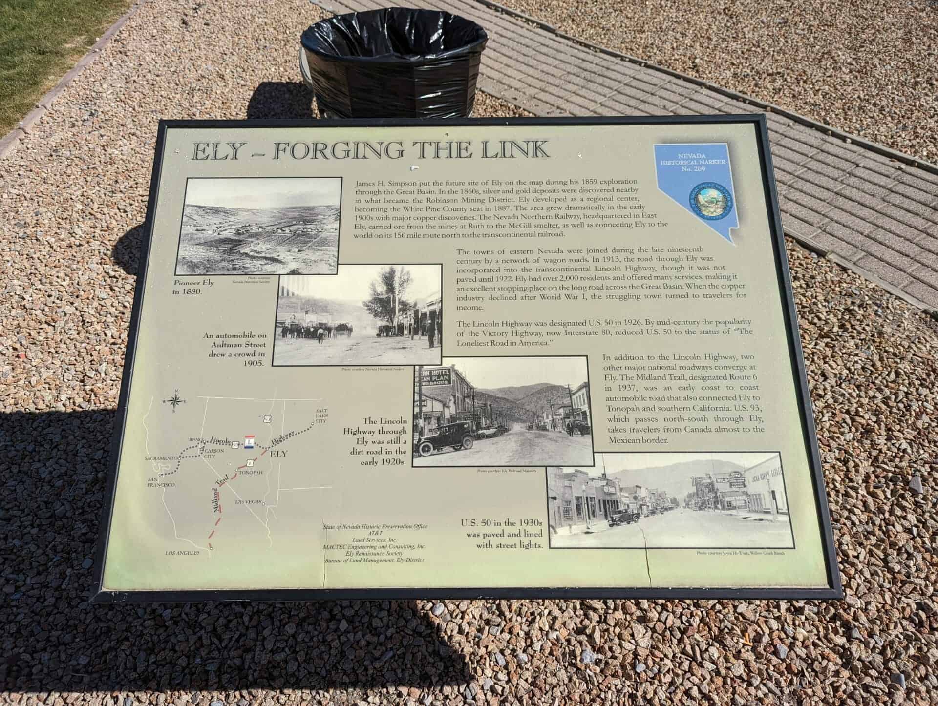
Ely – Forging the Link
James H. Simpson put the future site of Ely on the map during his 1859 exploration through the Great Basin. In the 1860s, silver and gold deposits were discovered nearby in what became the Robinson Mining District. Ely developed as a regional center, becoming the White Pine County seat in 1887. The area grew dramatically in the early 1890s with major copper discoveries. The Nevada Northern Railway, headquartered in East Ely, carried ore from the mines in Ruth to the McGill smelter, as well as connecting Ely to the world on its 150 mile route north to the transcontinental railroad.
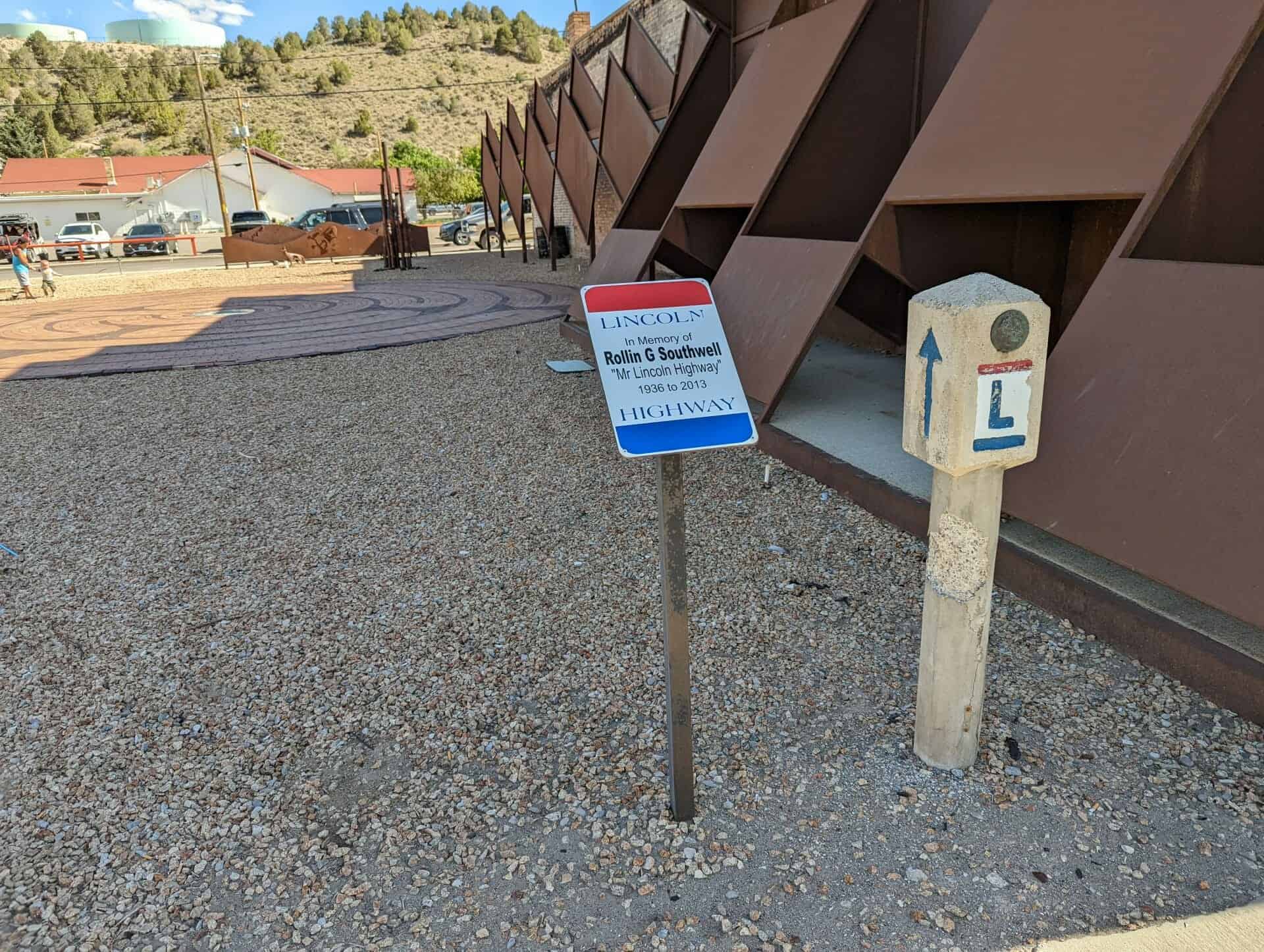
The towns of eastern Nevada were joined during the late nineteenth century by a network of wagon roads. In 1913, the road through Ely was incorporated into the transcontinental Lincoln Highway, though it was not paved until 1922. Ely had over 2,000 residents and offered many services, making it an excellent stopping place on the long road across the Great Basin. When the copper industry declined after World War I, the struggling town turned to travelers for income.
The Lincoln Highway was designated U.S. 50 in 1926. By mid-century the popularity of the Victory Highway, now Interstate 80, reduced U.S. 50 to the status of “The Loneliest Road in America.”
In addition to the Lincoln Highway, two other major national roadways converge at Ely. The Midland trail, designated Route 6 in 1937, was an early coast to coast automobile road that also connected Ely to Tonopah and southern California. U.S 93, which passes north-south through Ely takes travelers from Canada almost to the Mexican border.
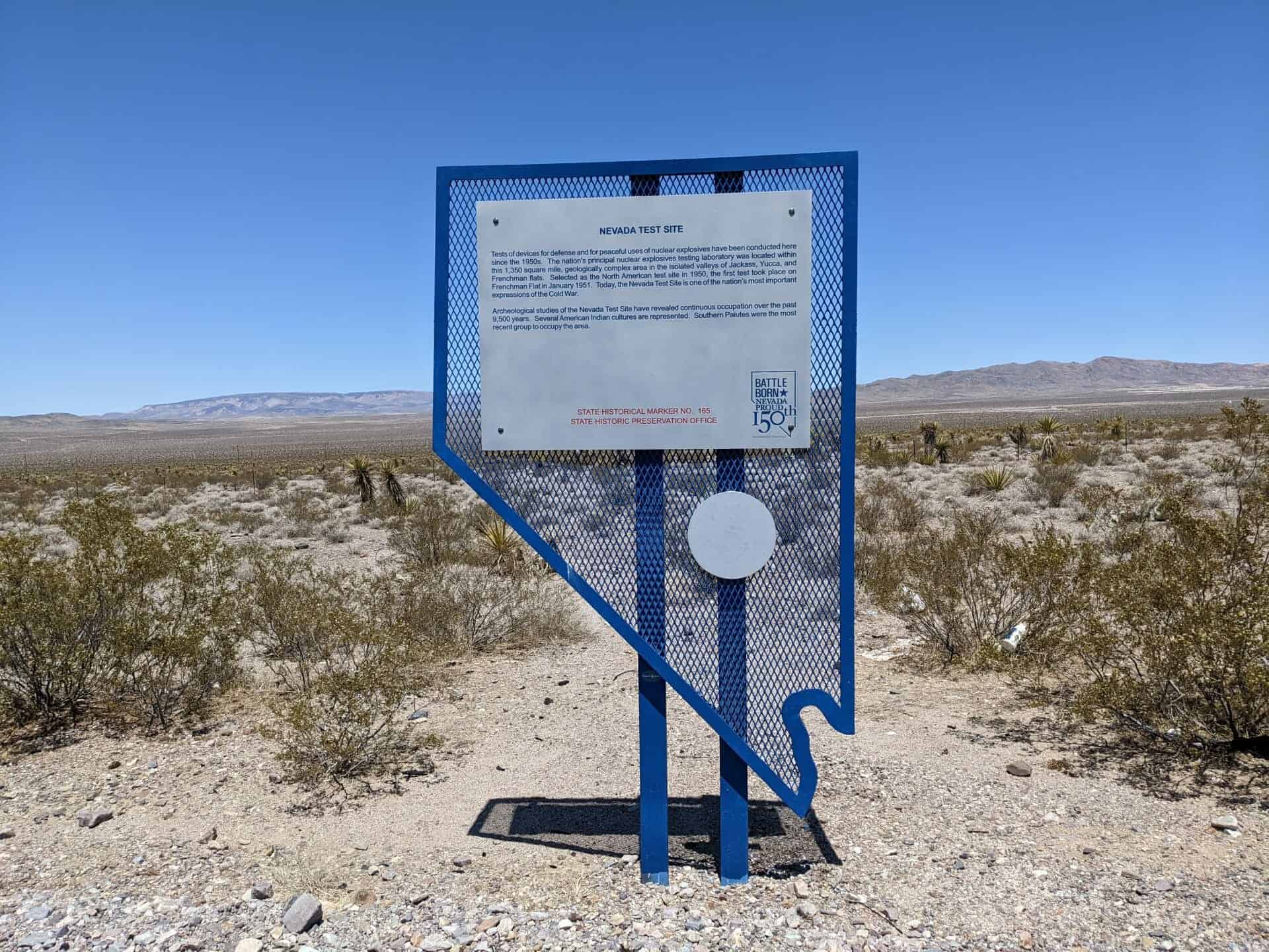
This is Nevada State Historical Marker #269, located at 681 East Aultman Street in Ely, Nevada.
See others on this page:
Related: