Tags
The church at the corner of Main and Center in New Harmony, Utah.
Related Posts:

21 Thursday May 2020
Posted in Uncategorized
Tags

The church at the corner of Main and Center in New Harmony, Utah.
Related Posts:


29 Wednesday Apr 2020
Posted in Uncategorized
Tags

A company town for the Stormont Mill was called Babylon in an attempt to set themselves apart from the overwhelming majority of LDS Church members in the area.


28 Tuesday Apr 2020
Posted in Uncategorized

Related Posts:
History from wchsutah.org
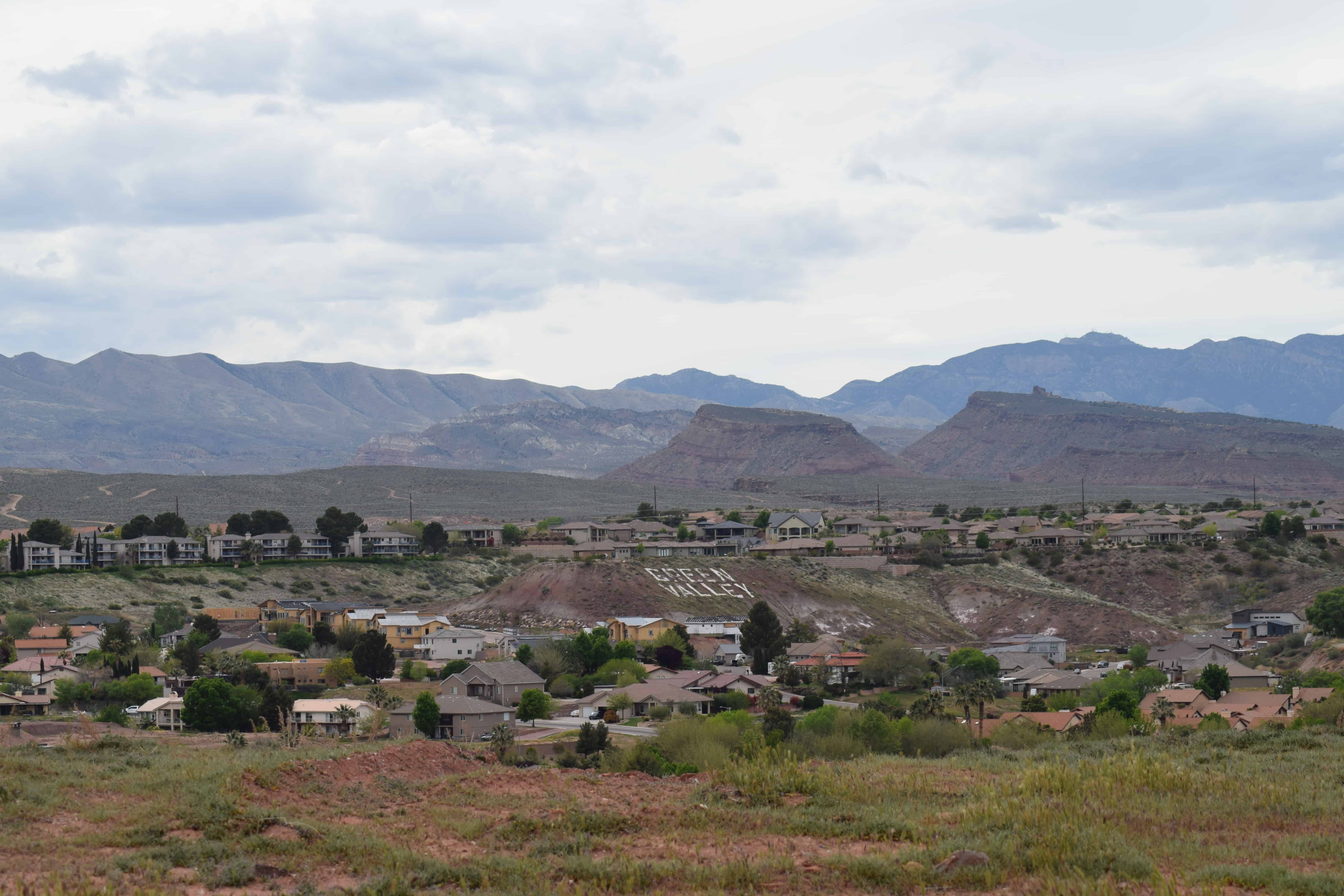
Green Valley is an area in the west side of St. George, Utah.
Green Valley was created out of Bill & Ron Snow’s six hundred acre ranch. The land was acquired and annexed into the City of St. George in 1976. Alan Coombs was the developer and driving force behind this new venture.
An 80-lot subdivision called the “Estates at Green Valley” was the first development in the Green Valley area. The sales of these lots provided the funds to develop “The Park at Green Valley”.
The Park opened in 1978 and had many firsts for St. George. It was a turning point for home building in the area. In addition to high quality homes, The Park came with an owners association, clubhouse, swimming pool, weight room, racquetball courts, and tennis courts.
In 1981, The Sports Village was opened with affordable vacation homes. 280 of these homes were purchased in the next two years.
The most ambitious development in Green Valley was started in 1985. Las Palmas was to have 1,000 deluxe condominiums, a 1,000 sq. ft. Sports & Fitness Center, 50 tennis courts (including grass and clay courts), an Olympic size pool, a golf teaching center, and spa. The project was interrupted when the government put some severe restrictions on condominium financing. But eventually the restrictions were lifted and sales in Las Palmas improved. It took six years, but eventually 300 units were sold.
During the downtime in the Las Palmas project (1989), a development called “The Cottages” was built using some of the land originally intended for Las Palmas. 95 single family townhomes with a nostalgic cottage design were built and sold.
Also starting in 1989, unsold condominiums in Las Palmas were rented out to weekend and over night guests. A property management and hotel operation was set up and began promoting Green Valley as an upscale alternative to the downtown motels. The completed swimming pools and tennis courts helped to make Green Valley a popular place to stay and was beneficial to sales by adding a resort atmosphere and providing rental income to condominium owners.
The developer’s wife, Carole Coombs, had owned a popular day spa in Salt Lake, Bel Viso. She set up a spa for owners and renters. Green Valley’s reputation began to grow as a spa retreat. In the spring of 1998, the spa was outgrowing the existing facilities. The Green Valley Spa was built with 35 separate hotel suites, a new restaurant, weight room, aerobic rooms, treatment center, and indoor tennis courts. Two years later, the success of the spa required the construction of 11 additional grand suites.


26 Sunday Apr 2020
Posted in Uncategorized
Tags
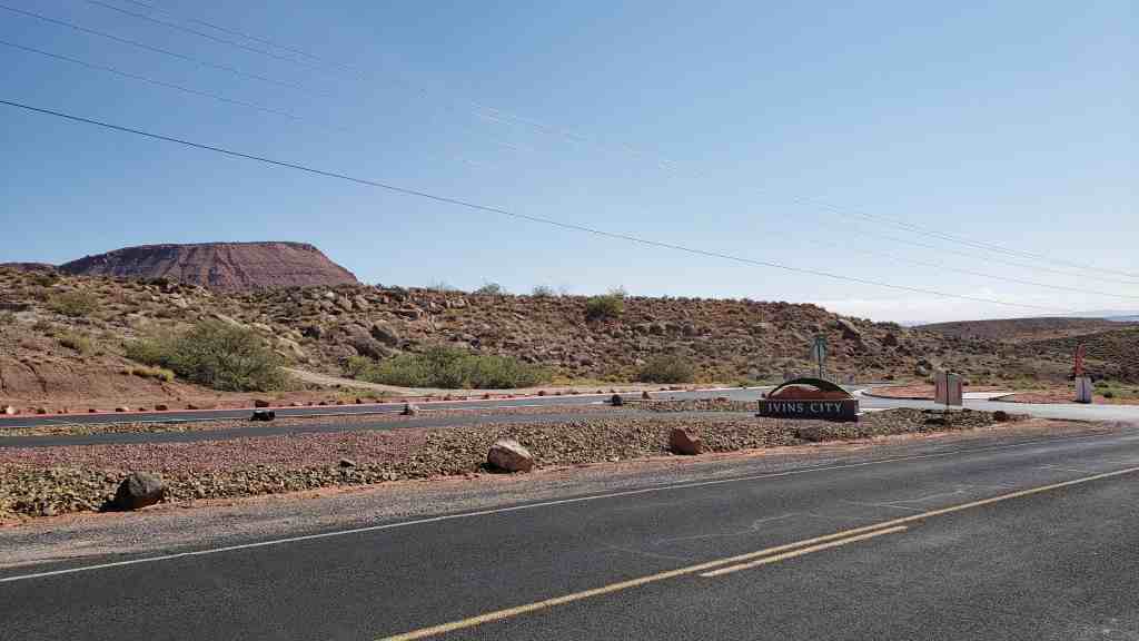
Ivins was settled in 1922 by Swiss immigrants, at the time it was Santa Clara Bench. The town was named after Anthony W. Ivins, a leader in the LDS Church.

18 Saturday Apr 2020
Posted in Uncategorized
Tags
03 Friday Apr 2020
Posted in Uncategorized
Tags
(From wchsutah.org) Gunlock is an unincorporated town in Washington County.
William Hayne Hamblin (nicknamed Will, Bill, and Gunlock; a brother of Jacob Hamblin) settled there and built a cabin in 1857. He was soon joined by his two brothers-in-law, Dudley and Jeremiah Leavitt and also Isaac Riddle.
On a visit, George A. Smith named the place Gunlock in honor of its first settler.
On Christmas day in 1861, it started to rain almost constantly for the next 30 days. Santa Clara Creek flooded and the budding community was forced to move north to the “Black Ridge” where the current town is located (the early settlement was located where the Gunlock fields are, south of the current town).
Gunlock was on the “Old California Road” or “Santa Fe Trail” so the town got frequent visitors and was able to carry on trade as people passed through.
Unlike many Utah towns, Gunlock was not laid out in blocks. Instead, it consisted of houses on each side of the main street. In 1880, the original “cow trail” through town was straightened and cottonwood trees were planted for a mile on each side of the street.
Mail service to Gunlock began in July of 1883. Prior to that time, they received mail only occasionally from St. George or Hebron. Solenda Huntsman, wife of Joseph S. Huntsman became the first postmistress with Hyrum E. Jones as the first mail carrier. Later postmasters included Elizabeth Vaughan Hunt, James S. P. Bowler, Josepth L. Bowler, and Olive Holt.
In 1913, the people of Gunlock and their neighbors in the surrounding areas felt a need for a telephone system. They formed a company, later know as the “People’s Progressive Telephone and Telegraph Company”. It put up telephone lines that served the areas from Moapa to Enterprise, including Moapa, Bunkerville, Mesquite, Santa Clara, Gunlock, Enterprise, New Castle, Pine Valley, Central, and Veyo. They eventually included some lines into St. George. The telephone system was eventually taken over by Mountain Bell. Telephone booths were provided on the streets. By 1960, everyone in town had a telephone but they were on 8-party lines through the 1960s and 1970s.
28 Saturday Mar 2020
Posted in Uncategorized
Bull Valley, aka Cove Creek Camp, aka General Steam is located northwest of Veyo.
There are still some remaining signs of the structures from before.
N 37.42305 W 113.80333
18 Wednesday Mar 2020
Posted in Uncategorized
Tags
From wchsutah.org:
The Crawford Canal was built by Mormon settlers in Zion whose community of farms in the Oak Creek Canyon was sometimes referred to as Crawfordville. Water was originally diverted from the west bank of the Virgin River (approximately one mile north of the present-day Virgin River Bridge) by moans of a pioneer-built wooden headgate. In 1931, the Oak Creek Canyon farms were purchased the National Park Service which took possession of the water delivery system. In 1933, CCC personnel of Camp N.P.2 widened the Crawford Canal to eighteen inches for a distance of 5,178 feet. A concrete cyclopean-type diversion dam was installed at the head of the canal on December 23, 1941 by the Park Maintenance Dept.
Although the canal is no longer functional, its course is clearly visible. The canal and its system of laterals provided water for livestock and irrigated fields of alfalfa and sorghum.
Related Posts:
18 Wednesday Mar 2020
Posted in Uncategorized
Tags
Crawfordville was a small collection of farms in Oak Creek Canyon near what is now the museum on the western edge of Zion National Park. It was the home of the Crawford family and others in the late 1800 and early 1900s.(*)
13 Friday Mar 2020
Posted in Uncategorized

Homeward Bound
On July 29, 1776, Fathers Francisco Atansio Dominguez and Silvestre Velez de Escalante led an exploration party of ten horsemen from Santa Fe, New Mexico to establish an overland route to Monterey, California while spreading the Catholic faith to the native peoples they hoped to meet along the way.
On October 14, the expedition camped at San Hugelino in present day Toquerville. The previous day, the two Indian guides, suspicious and afraid of the Spaniards, led them into the hills west of Ash Creek Canyon and disappeared, leaving the padres to find their way out the best they could. The Spaniards found their way back to Rio del Pilar 9Kanarra Creek) with great difficulty and camped there at San Daniel.
Two days later, as the party traveled south near present day Hurricane they came upon three small corn fields, watered by irrigation ditches Since they had nothing left but two slabs of chocolate, this meant provision could be secured on the return trip to Santa Fe. The community orientation of these Indians also meant that the chances for success in teaching Christianity to them were good.
Although the expedition never reached California, they covered some 2,000 miles of challenging terrain, adding greatly to the knowledge of the geography and the native inhabitants of the Spanish domain now called the American Southwest.
This marker is located just outside the Hurricane Pioneer Museum in Hurricane, Utah
