• About JacobBarlow.com
  • Cemeteries in Utah
  • D.U.P. Markers
  • Doors
  • Exploring Utah Email List
  • External and Referral Links
  • Geocaching
  • Historic Marker Map
  • Movie/TV Show Filming Locations
  • Oldest in Utah
  • Other Travels
  • S.U.P. Markers
  • U.P.T.L.A. Markers
  • Utah Cities and Places.
  • Utah Homes for Sale
  • Utah Treasure Hunt

JacobBarlow.com

~ Exploring with Jacob Barlow

JacobBarlow.com

Tag Archives: Escalante y Dominguez

Silvestre Vélez de Escalante

14 Tuesday Mar 2023

Posted by Jacob Barlow in Uncategorized

≈ Leave a comment

Tags

Escalante y Dominguez, Silvestre Velez de Escalante

Father Silvestre Velez de Escalante was a Spanish explorer who passed through Utah among other places so I have documented a lot of his explorations. This page is to link to all of this from one place.

Related:

  • Domínguez and Escalante

Posts on this site related to him should be tagged with these tags:

  • Escalante y Dominguez
  • Silvestre Velez de Escalante

…or they should be listed here, sorted by the date of when he was in a location:

  • July 29, 1776 – Santa Fe, New Mexico – Expedition Begins
  • Sept 11, 1776 – Soldier Summit, Utah – Soldier Summit
  • September 1776 – Spanish Fork Canyon – Castilla Hot Springs
  • Sept 23, 1776 – Spanish Fork Canyon –Dominguez Hill Cross / Escalante Cross
  • Sept 23, 1776 – Spanish Fork Canyon – Dominguez y Escalante Expedition
  • Sept 23, 1776 – Spanish Fork, Utah – The Lush Valley of the Timpanogotzis
  • Sept 23, 1776 – Utah Valley – Southern Utah Valley
  • Sept 23, 1776 – Utah Valley – Valley of Our Lady of Mercy of Timpanogos
  • Sept 24-25, 1776 – Provo, Utah – Escalante Trail
  • Sept 27, 1776 – Mona, Utah – Burraston Ponds
  • Oct 2, 1776 – Delta, Utah – Escalante Trail
  • Oct 11, 1776 – Cedar City, Utah – Casting Lots
  • Oct 13, 1776 – Snowfield, Utah – Franciscan Fathers
  • Oct 14, 1776 – Hurricane, Utah – Homeward Bound
  • Oct 21, 1776 – Fredonia, Arizona – Prickly Pears and Pinon Nuts
  • January 2, 1777 – The Fathers arrived back at the Santa Fe Mission
  • Escalante
  • Father Escalante
  • Paragonah Town Square
  • Provo’s Name Has an Interesting History

Prickly Pears and Pinon Nuts

19 Monday Dec 2022

Posted by Jacob Barlow in Uncategorized

≈ Leave a comment

Tags

Arizona, Escalante y Dominguez, Fredonia, Historic Markers

Prickly Pears and Pinon Nuts

A worn and hungry band of Spanish explorers made camp at Johnson Wash, six miles to the east, on October 21, 1776. Fathers Dominguez and Escalante called it Santa Barbara. They found no water for horses or the men who were subsisting on meager supplies of pinon nuts and prickly-pear cakes obtained in trade from the local Paiutes.

The Spaniards had already spent nights without water and only minimal nourishment. Lorenzo de Olivares was nearly mad with thirst after eating too many of the salty cactus cakes. He disappeared that evening stumbling up the wash. Having worried about their companion all night, the padres found him the next morning at some small pools near the base of the red Shinarump Cliffs to the north.

The territory known as the Arizona Strip confronted the expedition with some of its most brutal difficulties. Wandering first southeasterly then north, without the aid of native guides, they struggled through a harsh and rutted land searching for the Ute crossing of the Colorado River.

Dominguez and Escalante returned to Santa Fe in January, 1777 after exploring much of what is now the Four Corners region but having failed in their effort to open a land route to Spanish settlements at Monterey.

Homeward Bound

13 Friday Mar 2020

Posted by Jacob Barlow in Uncategorized

≈ Leave a comment

Tags

Escalante y Dominguez, Historic Markers, Hurricane, Spanish Explorers, utah, Washington County

Homeward Bound

On July 29, 1776, Fathers Francisco Atansio Dominguez and Silvestre Velez de Escalante led an exploration party of ten horsemen from Santa Fe, New Mexico to establish an overland route to Monterey, California while spreading the Catholic faith to the native peoples they hoped to meet along the way.

On October 14, the expedition camped at San Hugelino in present day Toquerville. The previous day, the two Indian guides, suspicious and afraid of the Spaniards, led them into the hills west of Ash Creek Canyon and disappeared, leaving the padres to find their way out the best they could. The Spaniards found their way back to Rio del Pilar 9Kanarra Creek) with great difficulty and camped there at San Daniel.

Two days later, as the party traveled south near present day Hurricane they came upon three small corn fields, watered by irrigation ditches Since they had nothing left but two slabs of chocolate, this meant provision could be secured on the return trip to Santa Fe. The community orientation of these Indians also meant that the chances for success in teaching Christianity to them were good.

Although the expedition never reached California, they covered some 2,000 miles of challenging terrain, adding greatly to the knowledge of the geography and the native inhabitants of the Spanish domain now called the American Southwest.

This marker is located just outside the Hurricane Pioneer Museum in Hurricane, Utah

Domínguez and Escalante

19 Thursday Dec 2019

Posted by Jacob Barlow in Uncategorized

≈ Leave a comment

Tags

Escalante y Dominguez, Spanish Explorers

Spanish explorers Silvestre Vélez de Escalante and Atanasio Domínguez were looking for a good ruote from Santa Fe, New Mexico to Monterey, California and I often come across historic markers and sites related to their travel.

I created this page so I can continually add links to the sites I find related to Escalante y Domínguez.

  • Burraston Ponds (camped here Sep 27, 1776)
  • Castilla Hot Springs (they discovered the springs in 1776)
  • Dominguez Hill Cross (above Spanish Fork)
  • Dominguez y Escalante Expedition (Spanish Fork)
  • Escalante (city named for Father Escalante)
  • Escalante Cross above Spanish Fork
  • Escalante Trail (Delta)
  • Escalante Trail (Provo)
  • Father Escalante (Duchesne)
  • Homeward Bound (Hurricane)
  • The Lush Valley of the Timpanogotzis (Spanish Fork)
  • Paragonah Town Square (the expedition passed this area)
  • Provo’s Name Has an Interesting History (named the lake and river)
  • Silvestre Vélez de Escalante
  • Snowfield Monument “Franciscan Fathers”
  • Soldier Summit Historic Marker
  • Southern Utah Valley
  • Spanish Fathers Visit Utah Valley in 1776 (Provo)
  • Spanish Fork City Park and Library (camped near here, Sep 23, 1776)

The Lush Valley of the Timpanogotzis

13 Wednesday Dec 2017

Posted by Jacob Barlow in Uncategorized

≈ 1 Comment

Tags

Escalante y Dominguez, Historic Markers, spanish fork, utah, utah county

2016-10-03-17-51-24

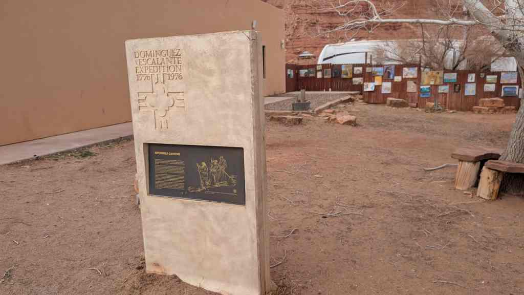
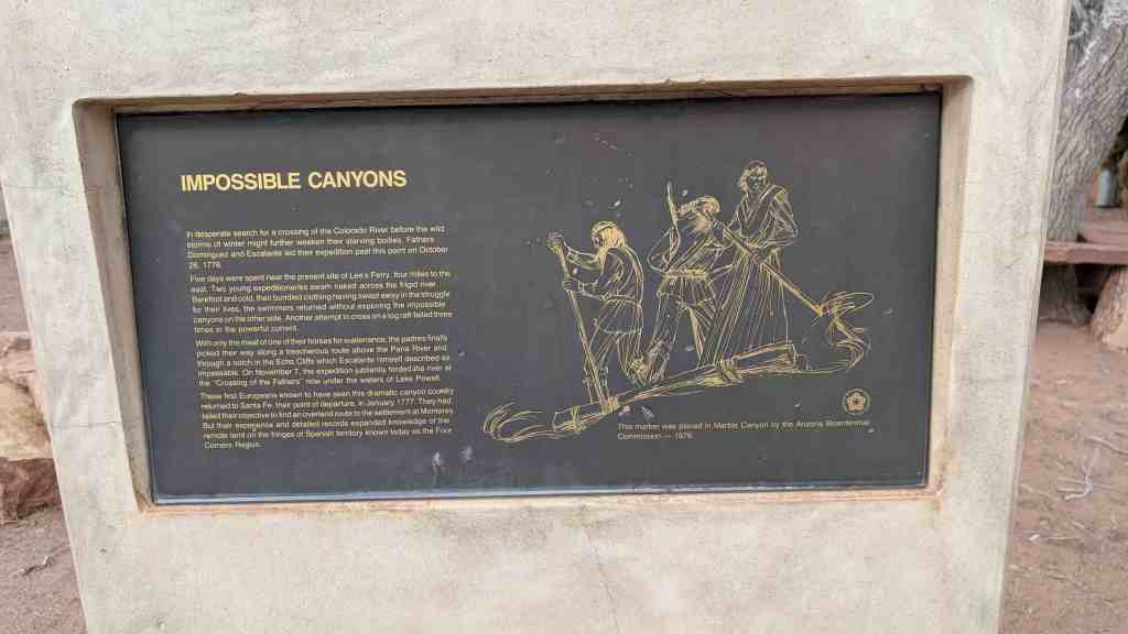
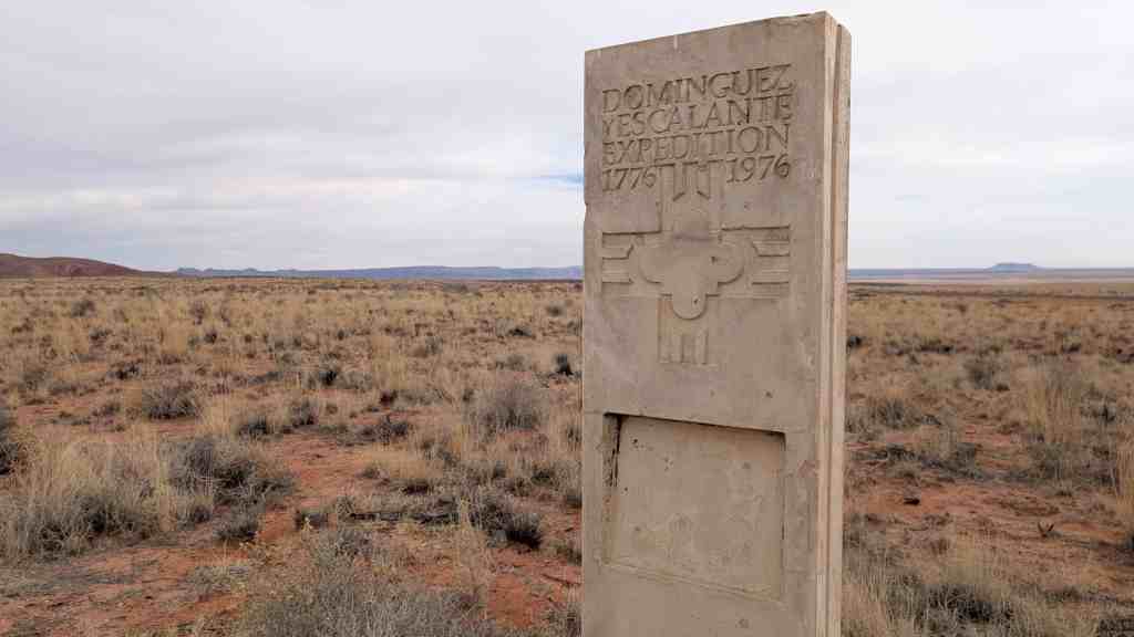
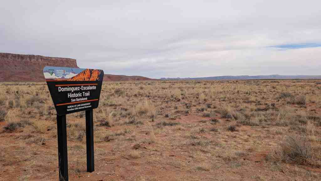
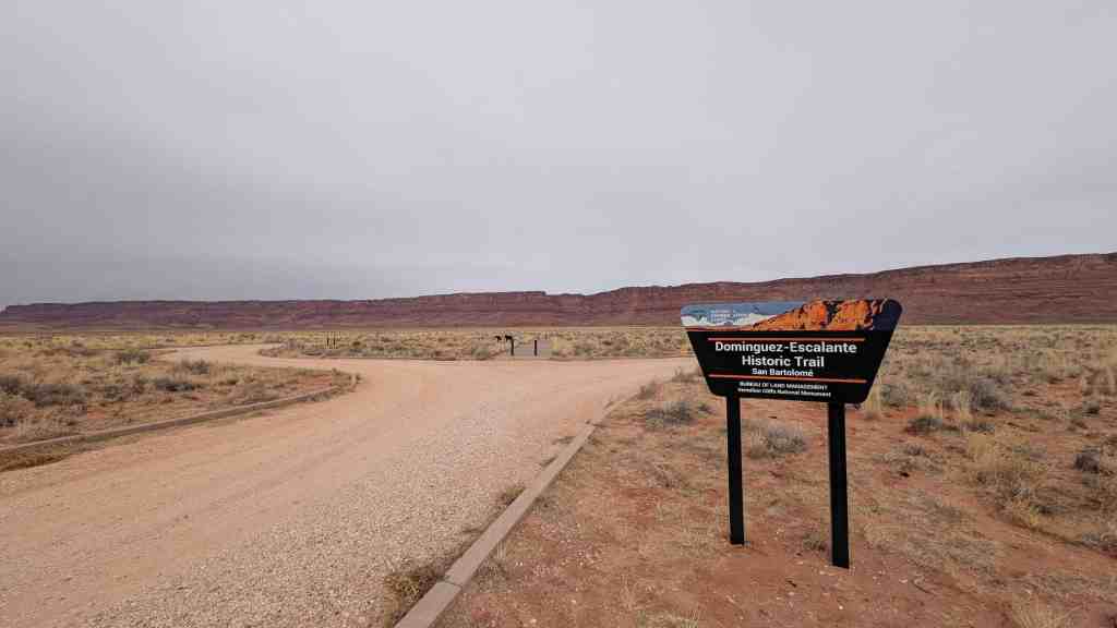
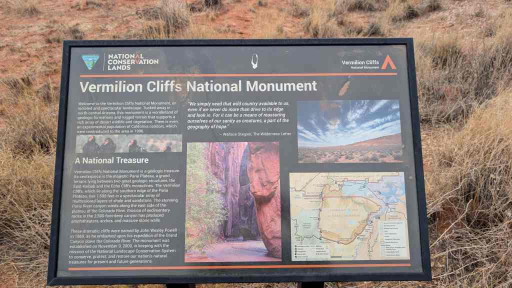
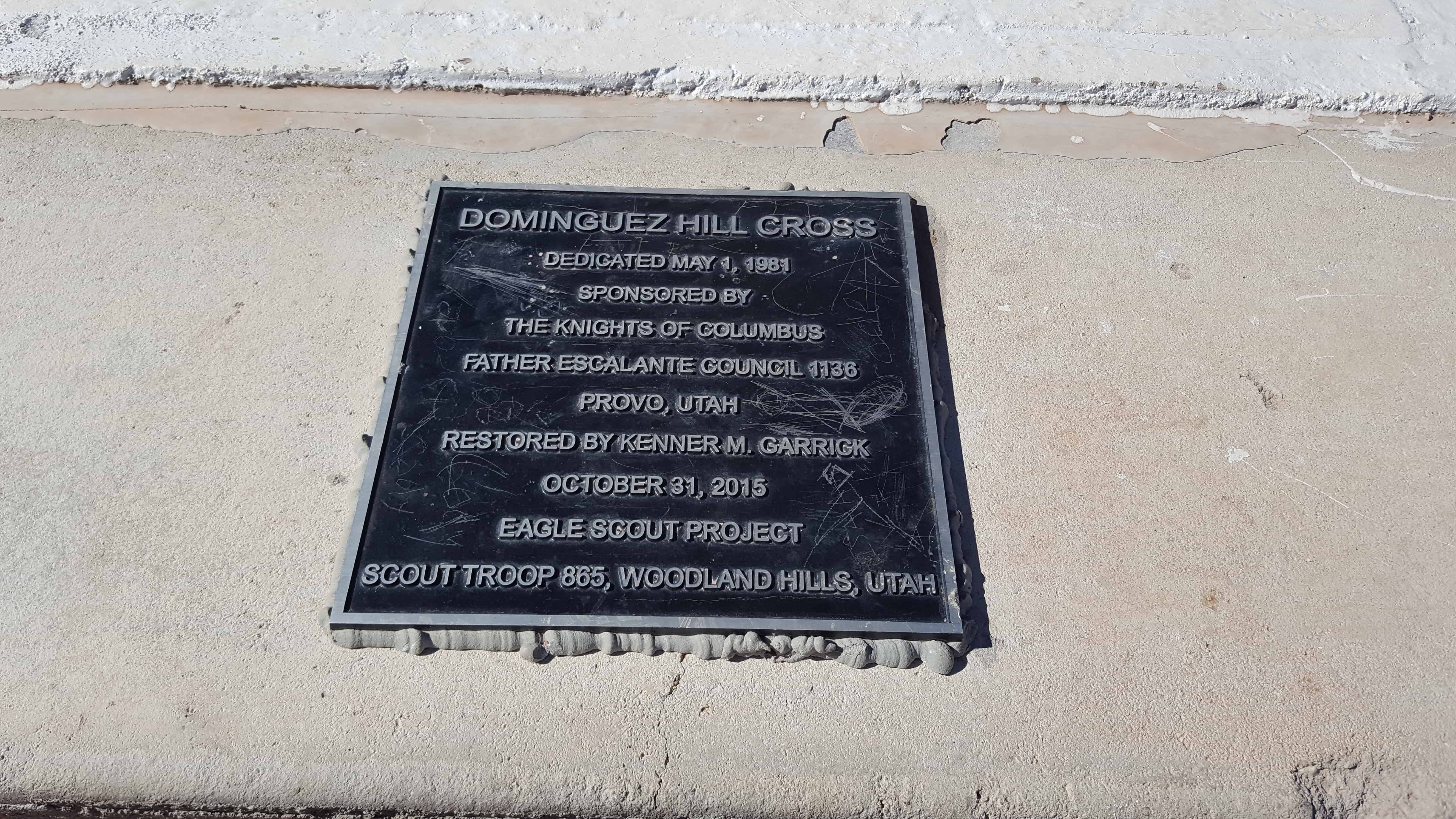
On July 29, 1776, Fathers Francisco Atanazio Dominguez and Silvestre Valez de Escalante led an exploration party of 10 horsemen from Sante Fe, New Mexico to establish an overland route to Monterey, California, while spreading the Catholic faith to the native peoples they hoped to meet along the way.

On September 23, the party emerged from Spanish Fork Canyon into Utah Valley. Escalante recorded in his diary, “We went for half a league northwest, crossed over to the other side of the river, went up a brief slope, and caught sight of the lake and spreading valley of Nuestro Senora de la Merced of the Timpanogotzis. We also saw that they were sending up smoke signals on every side, thus spreading the news of our coming.” When camp had been established near Spanish Fork, the Padres proceeded to the Indian village on the Provo River. The natives readily accepted the teachings of the Franciscan Fathers and urged them to return with other friars to live among them.

Escalante’s diary gives us a graphic description of Utah Valley and is our best account of life in the 18th century in Utah. “In mid sierra lies L’Valle de Neustra Senora de la Merced of the Timpanogotzis surrounded by the sierra’s heights from which four medium-sized rivers that water it emerge. All over it there are good and very abundant pasturages and the climate here is a good one. It has plenty of firewood and timber in the adjacent sierra – many sheltered spots, waters and pasturages, for raising cattle and sheep and horses.

This one (lake) of the Timpanogotzis abounds in several species of good fish – of geese, beavers, and other amphibious creatures. Round about it reside the Indians mentioned who live on the lake’s abundant fish. Besides this, they gather the seeds of wild plants in the bottoms and make gruel from them, which they supplement with the game of jackrabbits, coneys and fowl, of which there is a great abundance here. They also have bison handy not too far away, but fear of the Commanches prevents them from hunting them.

“Their dwellings are some sheds or little wattle-huts of osier, out of which they have interestingly-crafted baskets and other utensils for ordinary use. They are very poor as regards to dress. The most becoming one they wear is a deer skin jacket and long leggings of the same. For cold seasons they wear blankets made of jackrabbit and coney rabbit furs. They possess good features and most of them are fully bearded. All the sections of the sierra are inhabited by a great number of peoples of the same nation, language and easy-going character.”

It is interesting to speculate on what might have happened, had the Spaniards been able to return to Utah Valley. Provo may have had an architectural flavor similar to that of Santa Fe and would probably have been the cultural center of Utah. The Mormons may not have settled in Salt Lake Valley at all, since they were seeking a land promised by God for themselves alone.

This monument is located in Spanish Fork City Park next to the Spanish Fork Library.

2016-10-03-17-51-12

2016-10-03-17-51-03
2016-10-03-17-50-58
2016-10-03-17-50-51

ingress_20131217_215730_4
2016-10-03-17-52-00
2016-10-03-17-51-52
2016-10-03-17-51-41

Dominguez Hill Cross

01 Tuesday Aug 2017

Posted by Jacob Barlow in Uncategorized

≈ Leave a comment

Tags

Escalante y Dominguez, Mapleton, spanish fork, spanish fork canyon, utah, utah county

2017-06-25 17.06.57

I grew up hiking up to this cross often, it overlooks Spanish Fork and Utah County better than most hikes this short could.   We always called it Escalante Cross.   Recently (Oct. 2015) an Eagle Scout Project added a plaque calling it Dominguez Hill Cross – I didn’t find anything to back that up but I guess if you add the plaque you can pick the name.

A couple other posts on this site about the cross are:

  • Dominguez y Escalante Expedition
  • Escalante Cross above Spanish Fork

2017-06-25 17.07.00

2017-06-25 17.06.51

2017-06-25 17.06.26

2017-06-25 17.06.23

2017-06-25 17.06.21

2017-06-25 17.06.19

2017-06-25 17.06.17

2017-06-25 17.06.15

2017-06-25 17.06.12

2017-06-25 17.06.10

Escalante Cross above Spanish Fork

12 Friday Dec 2014

Posted by Jacob Barlow in Uncategorized

≈ 2 Comments

Tags

Escalante, Escalante y Dominguez, spanish fork, utah, utah county

I hiked up to the Escalante Cross again today, for more information check out this link.

I always enjoy that hike and just wanted to share the pictures this time.

2014-12-12 14.56.48

2014-12-12 15.07.33

2014-12-12 15.07.35

2014-12-12 15.07.38

2014-12-12 15.08.05

2014-12-12 15.08.26

2014-12-12 15.14.09

2014-12-12 15.20.06

2014-12-12 15.20.10

2014-12-12 15.20.13

2014-12-12 15.33.41

I found the following online:
Recent accounts have reported sightings of a ”shadowy wolf-like figure” near the foothills of Mt. Loafer. Sightings have been reported in the same general area as the Escalante Cross. The 37 foot cross towers over the small town of Spanish Fork on Dominguez hill. The cross is said to be a landmark planted in honor of the Dominguez and Esclante expedition. However, this is not the original cross planted by Silvestre Vlez de Escalante and Francisco Atanasio Domnguez in 1776. It is said that a similar cross, like the one we see today, was originally planted by the two Franciscan Friars. Journal entries found, written by these Christian explorers, tell us the cross was planted to warn off an ”evil entity” which was said to have haunted the travelers in their sleep. Tormented by howling, and sightings of this ”creature”, the explorers left abruptly, without explanation. The cross we see today was planted in 1981, in place of the original. Little do most Spanish Fork residents know, the terrifying history behind the so-called ”Escalante Cross.”

40.071782-111.594876

Escalante Trail

30 Friday May 2014

Posted by Jacob Barlow in Uncategorized

≈ 1 Comment

Tags

Delta, DUP, Escalante y Dominguez, historic, Historic Markers, Millard County, utah

No. 218
Erected 1955
Escalante Trail

Father Escalante camped here October 2, 1776. His exploring party of ten men headed by Father Francisco Dominguez and map-maker Pacheco preached to the Indians and charted a northern route between Santa Fe, New Mexico and Monterey, California. They named this valley “Valley Salado” (Valle of Salt). They traveled west near Clear Lake then east to a hillock, (Pahvant Butte). Here they found marshes and much pasturage, but salt water.

Related Posts:

  • Delta, Utah
  • Domínguez and Escalante
  • D.U.P. Historic Markers

This historic marker is #218 of the Daughters of Utah Pioneers historic markers and is located at the city park in Delta, Utah

picture24jul07-215

picture24jul07-217

Escalante, Utah

31 Thursday Oct 2013

Posted by Jacob Barlow in Uncategorized

≈ 5 Comments

Tags

Escalante, Escalante y Dominguez, Garfield County, Silvestre Velez de Escalante, utah

picture24jul07-128

Escalante Posts:

  • Escalante Cemetery
  • Escalante DUP Marker
  • Escalante Historic District
  • Escalante Post Office
  • First Public Building
  • Head of the Rocks Overlook
  • L.D.S. Tithing Office
  • Old Boulder Mail Trail

Previously known as Potato and also Spud Valley, Escalante is in Garfield County, Utah. It is named after Silvestre Velez de Escalante, a missionary and the first European explorer in the general area although he never came to this valley.

The first white people here were a group of Mormon cavalry during the Black Hawk Indian War of the mid-1860s.

ingress_20140120_142510_4
picture24jul07-136


Follow Jacob

Follow Jacob

Social and Other Links

BarlowLinks.com

Blog Stats

  • 795,966 hits

Recent Posts

  • Rigby
  • Bybee – Centerville
  • Pooles Island – Menan
  • 10011 Centennial Pkwy
  • The Great Feeder

Archives


Loading Comments...