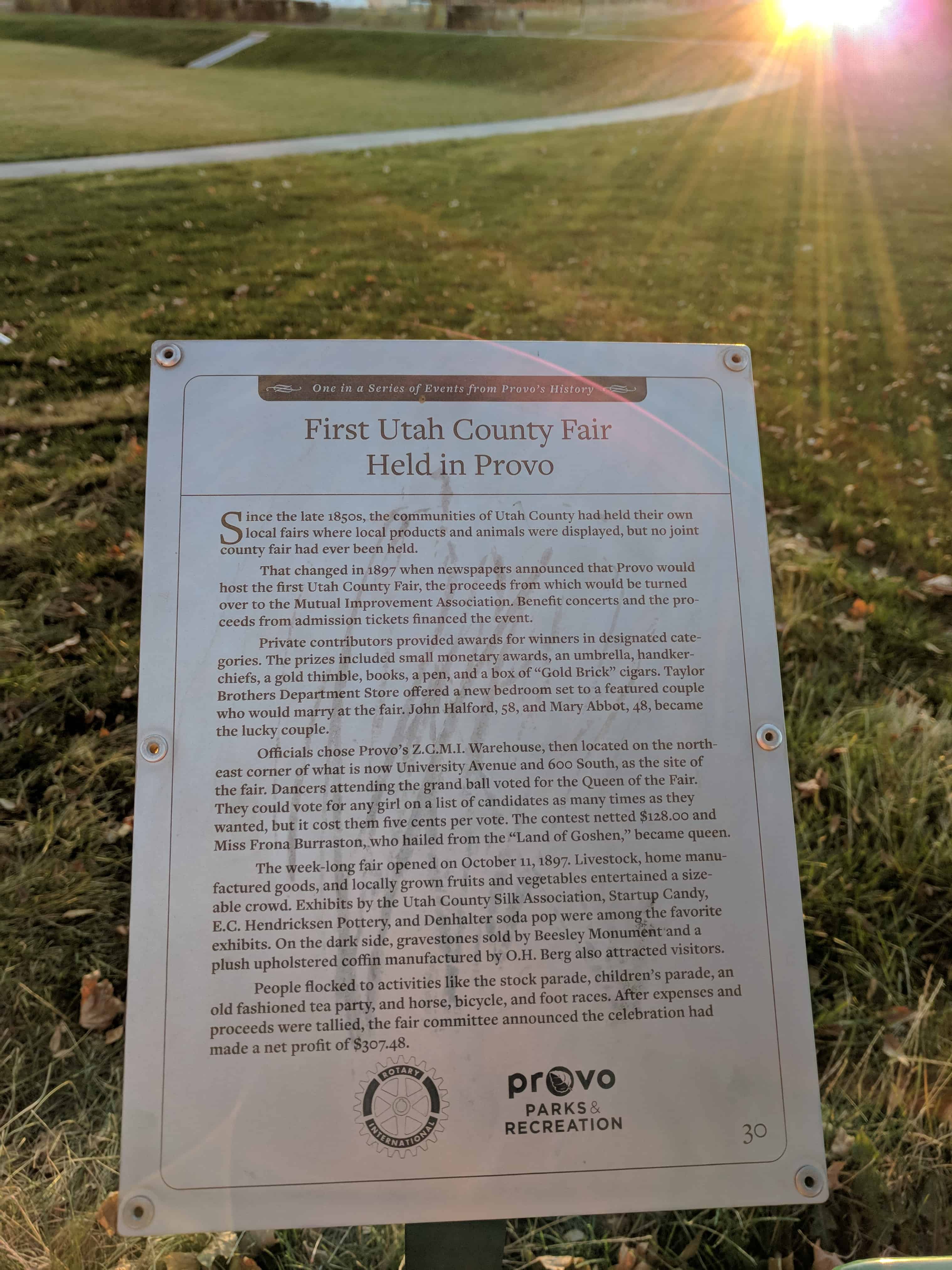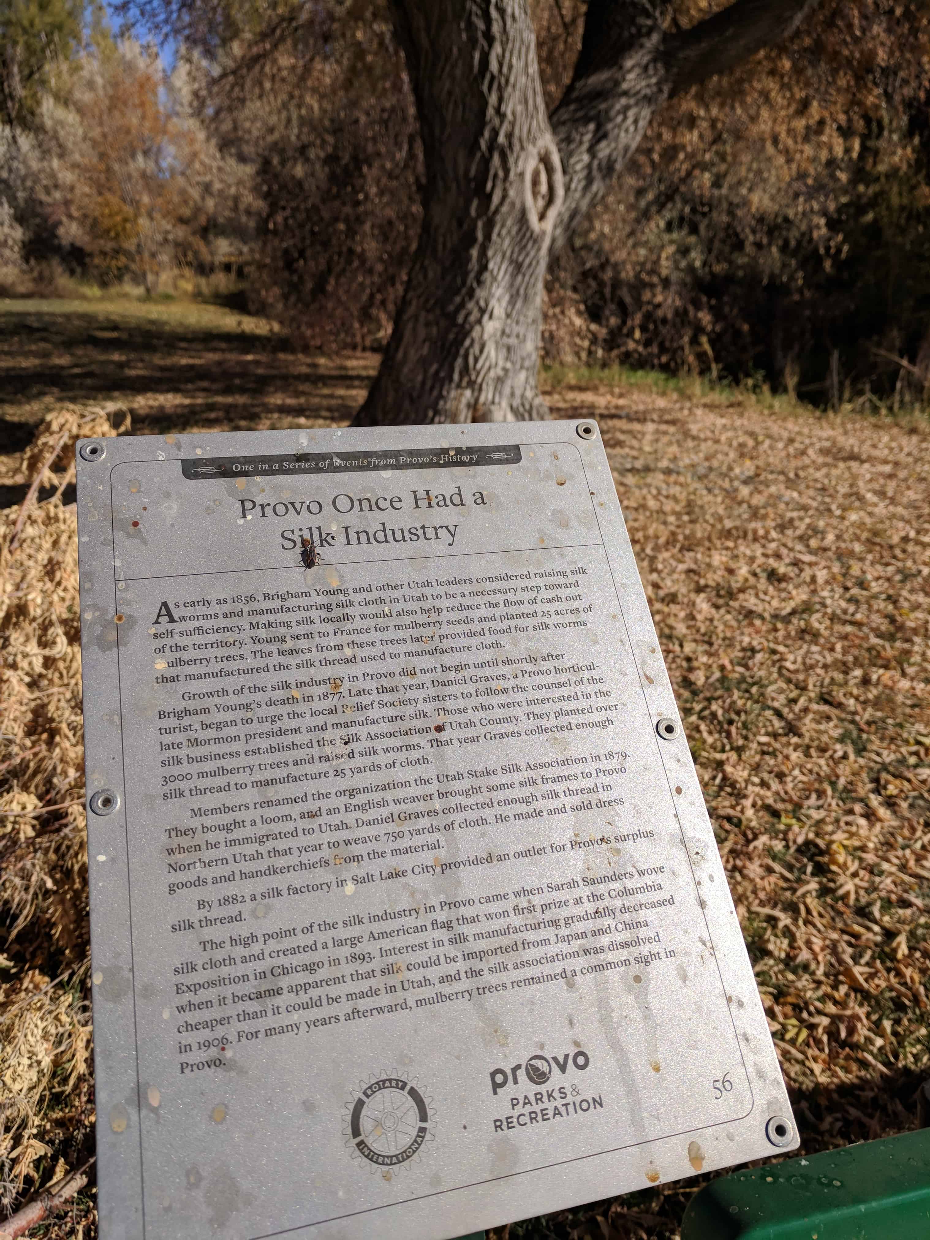
First Utah County Fair Held in Provo.
Since the late 1850s, the communities of Utah County had held their own local fairs where local products and animals were displayed, but no joint county fair had ever been held.
That changed in 1897 when newspapers announced that Provo would host the first Utah County Fair, the proceeds from which would be turned over to the Mutual Improvement Association. Benefit concerts and the proceeds from admission tickets financed the event.
Private contributors provided awards for winners in designated categories. The prizes included monetary awards, an umbrella, handkerchiefs, a gold thimble, books, a pen, and a box of “Gold Brick” cigars. Taylor Brothers Department Store offered a new bedroom set to a featured couple who would marry at the fair. John Halford, 58, and Mary Abbot, 48, became the lucky couple.
Officials chose Provo’s Z.C.M.I. Warehouse, then located on the northeast corner of what is now University Avenue and 600 South, as the site of the fair. Dancers attending the grand ball voted for the Queen of the Fair. They could vote for any girl on a list of candidates as many times as they wanted, but it cost them five cents per vote. The contest netted $128.00 and Miss Frona Burraston, who hailed from the “Land of Goshen,” became queen.
The week-long fair opened on October 11, 1897. Livestock, home manufactured goods, and locally grown fruits and vegetables entertained a sizable crowd. Exhibits by the Utah County Silk Association, Startup Candy, E.C. Hendricksen Pottery, and Denhalter soda pop were among the favorite exhibits. On the dark side, gravestones sold by Beesley Monument and a plush upholstered coffin manufactured by O.H. Berg and attracted visitors.
People flocked to activities like the stock parade, children’s parade, an old fashioned tea party, and horse, bicycle, and foot races. After expenses and proceeds were tallied, the fair committee announced the celebration had made a net profit of $307.48.
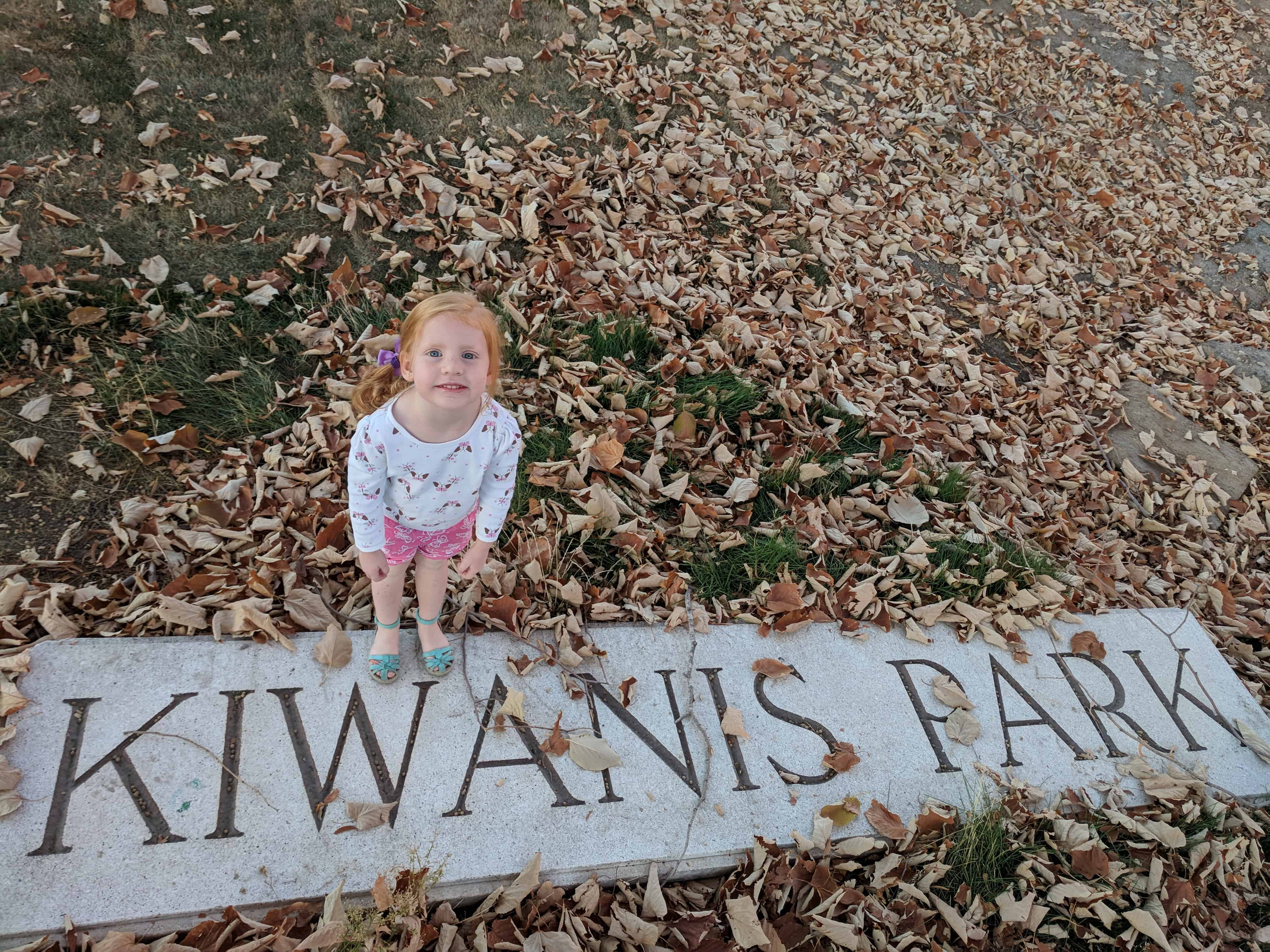
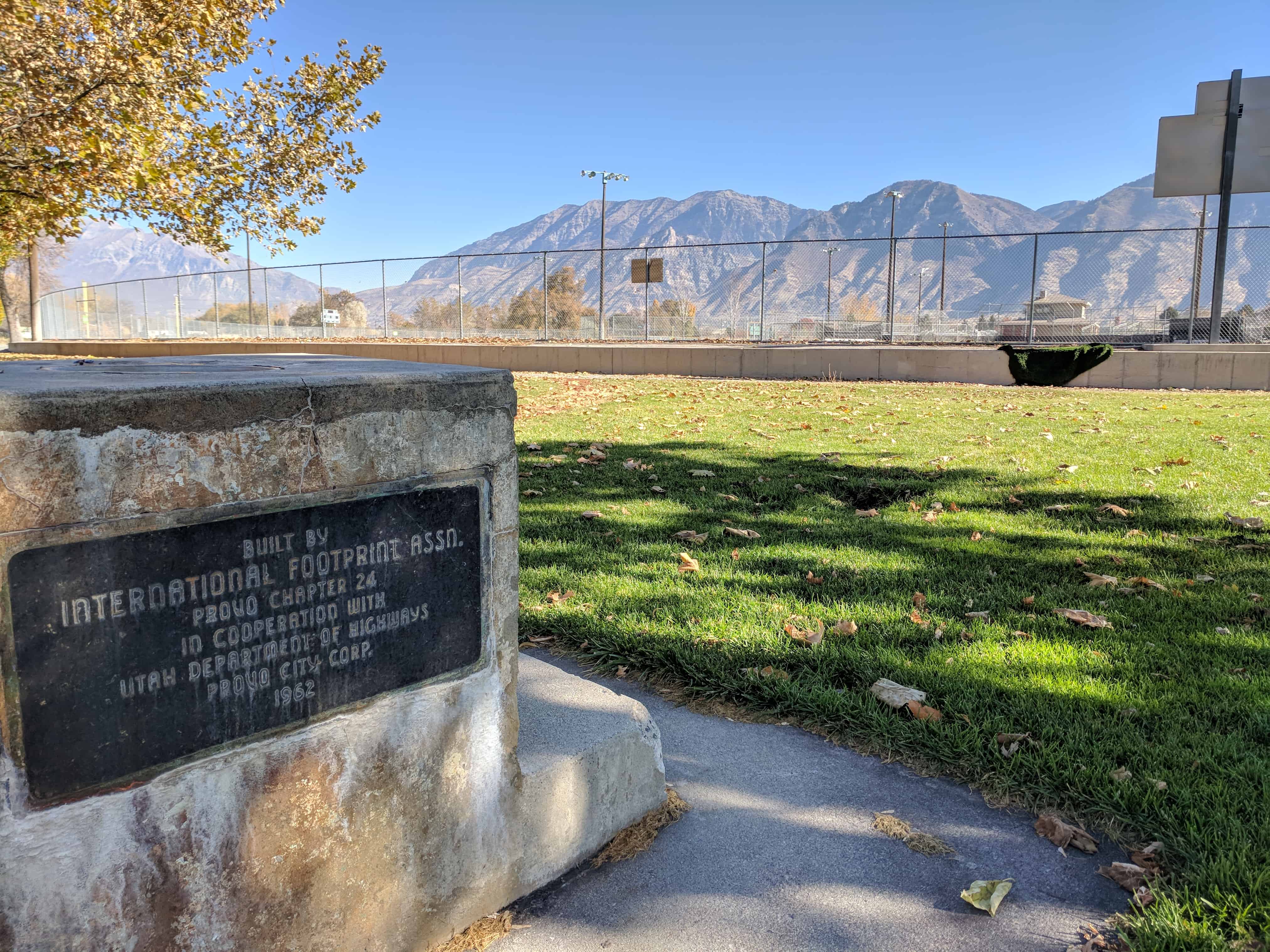
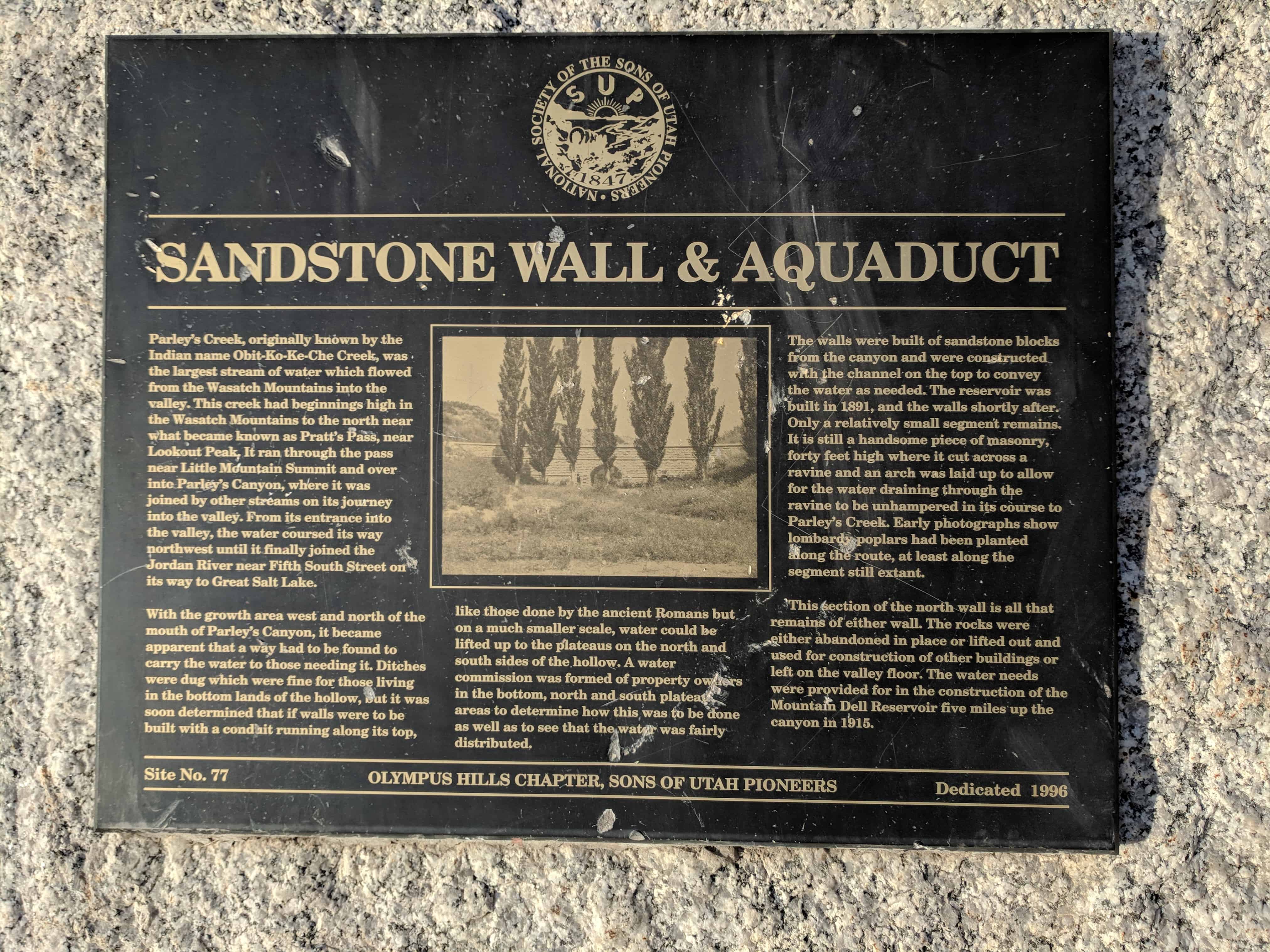
This plaque is #30 in this series and is located in Kiwanis Park in Provo.