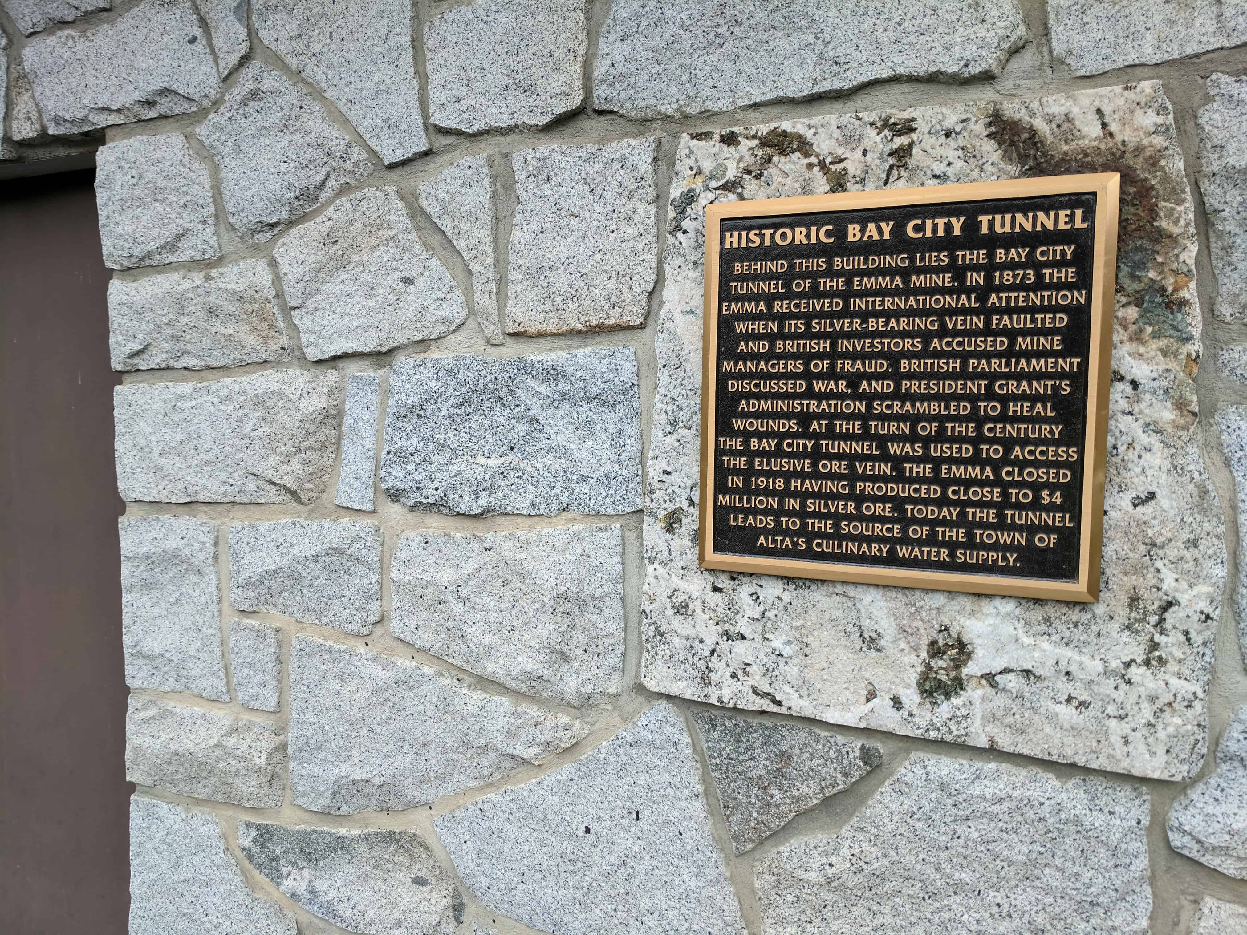
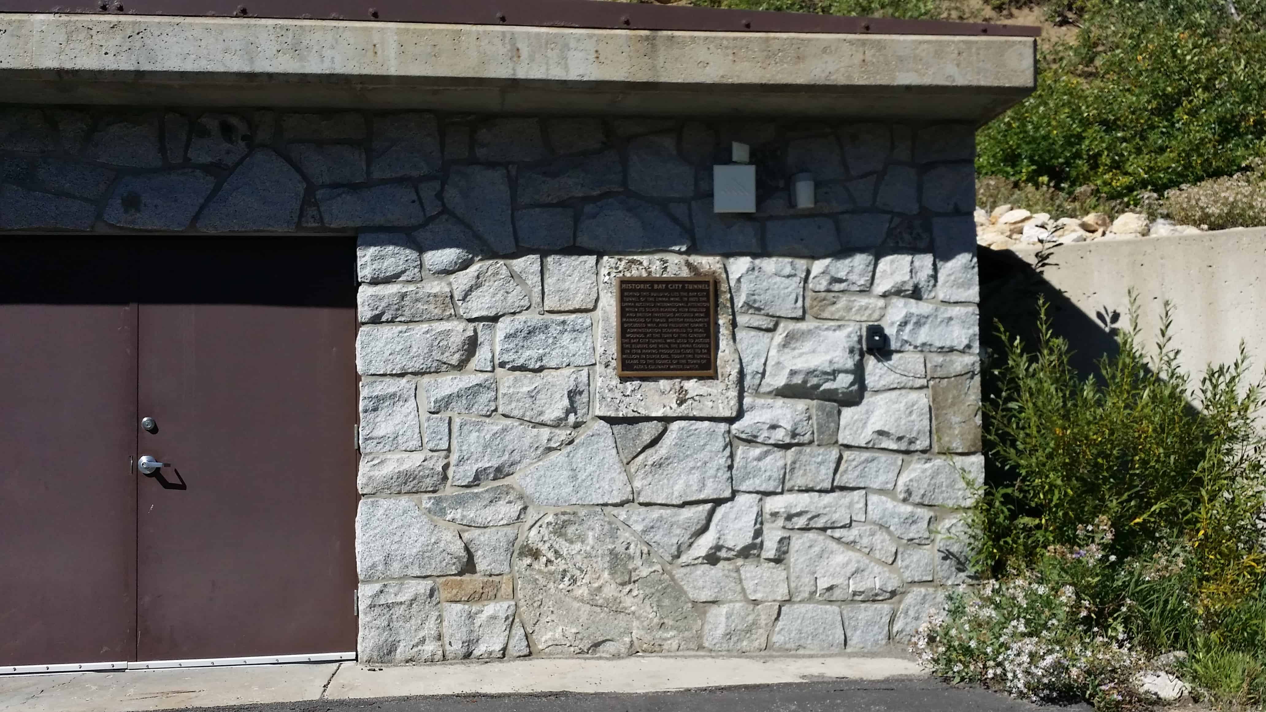
Historic Bay City Tunnel
Behind this building lies the Bay City Tunnel of the Emma Mine. In 1873 the Emma received international attention when its silver-bearing vein faulted and British investors accused mine managers of fraud. British parliament discussed war, and President Grant’s administration scrambled to heal wounds. At the turn of the century the Bay City Tunnel was used to access the elusive ore vein. The Emma closed in 1918 having produced close to $4 million in silver ore. Today the tunnel leads to the source of the town of Alta’s culinary water supply.
Related posts: