Tags

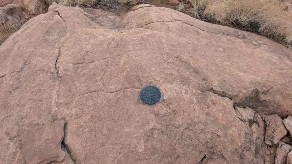
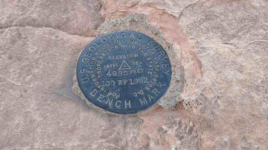
I like to stop and document the Benchmarks I see when exploring, this one, 100 WF was along the Hole-in-the-Rock Trail at N 37.44087 W 111.18807


28 Saturday Feb 2026
Posted in Uncategorized
Tags
I like to stop and document the Benchmarks I see when exploring, this one, 100 WF was along the Hole-in-the-Rock Trail at N 37.44087 W 111.18807
31 Saturday Jan 2026
Posted in Uncategorized
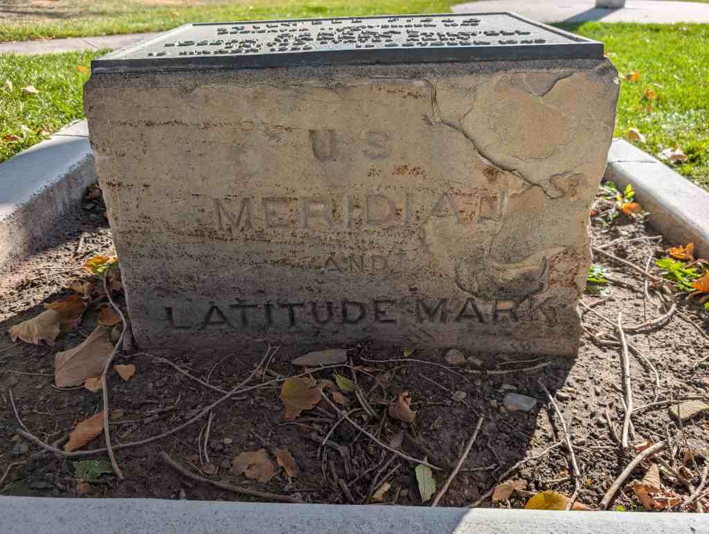
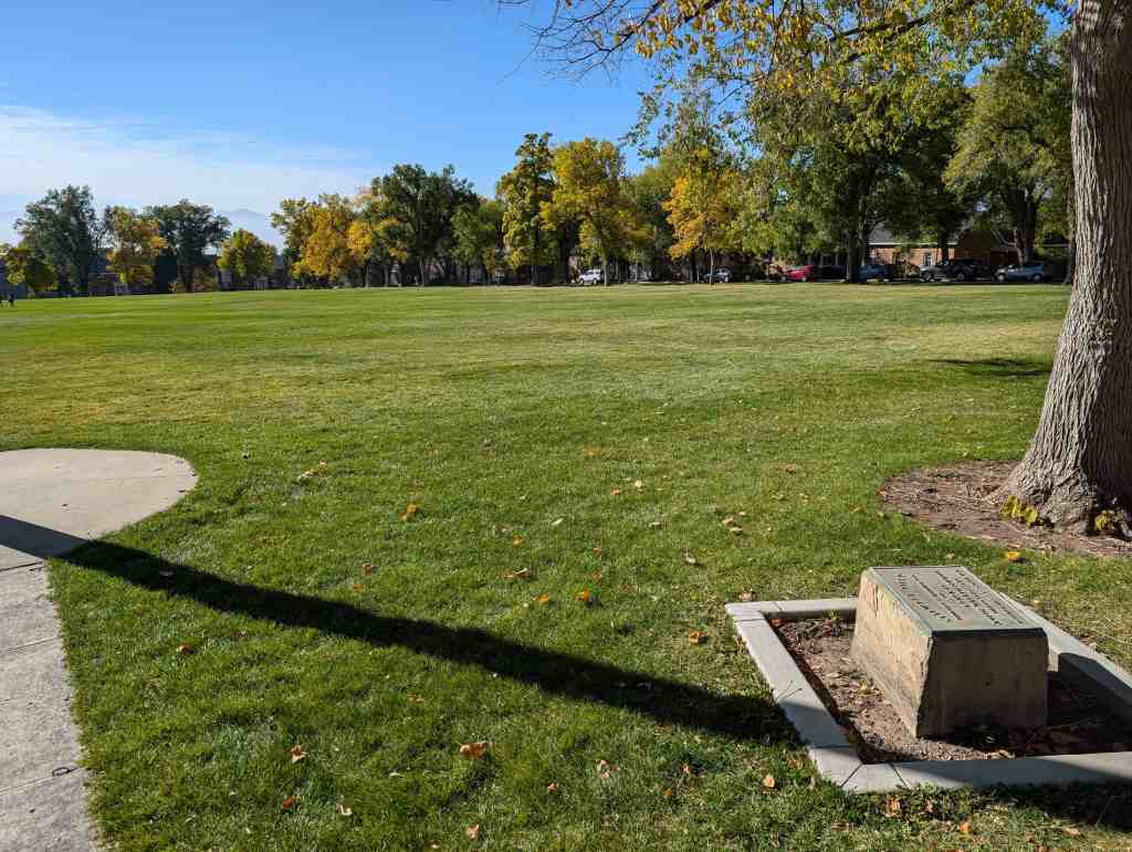
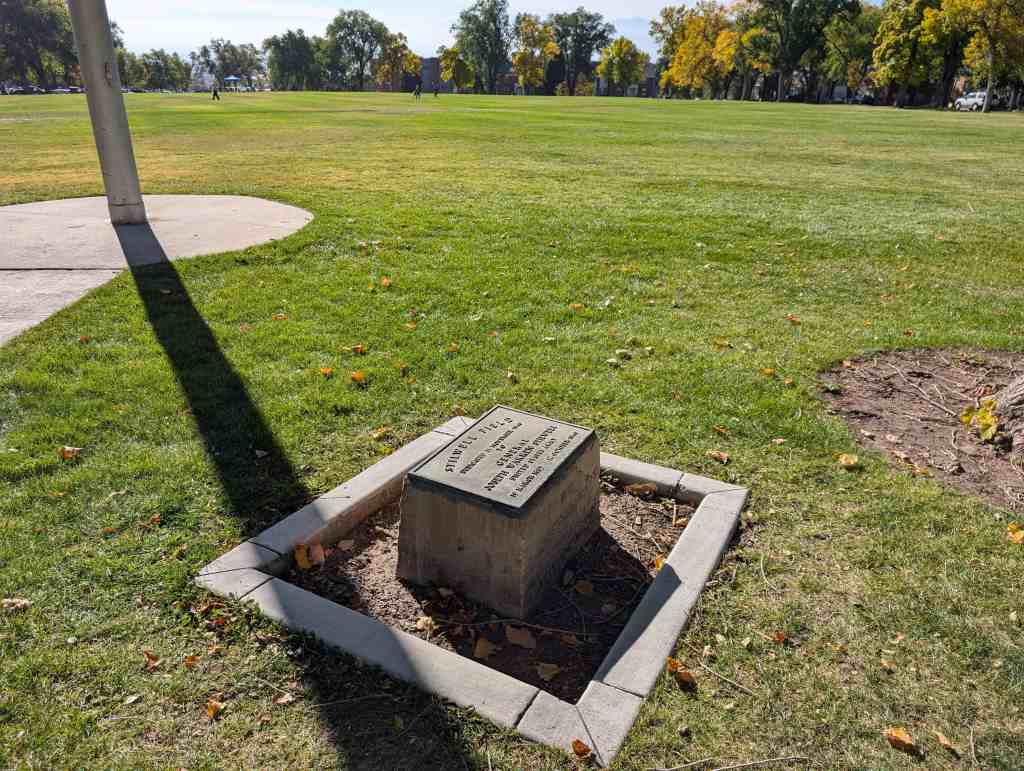
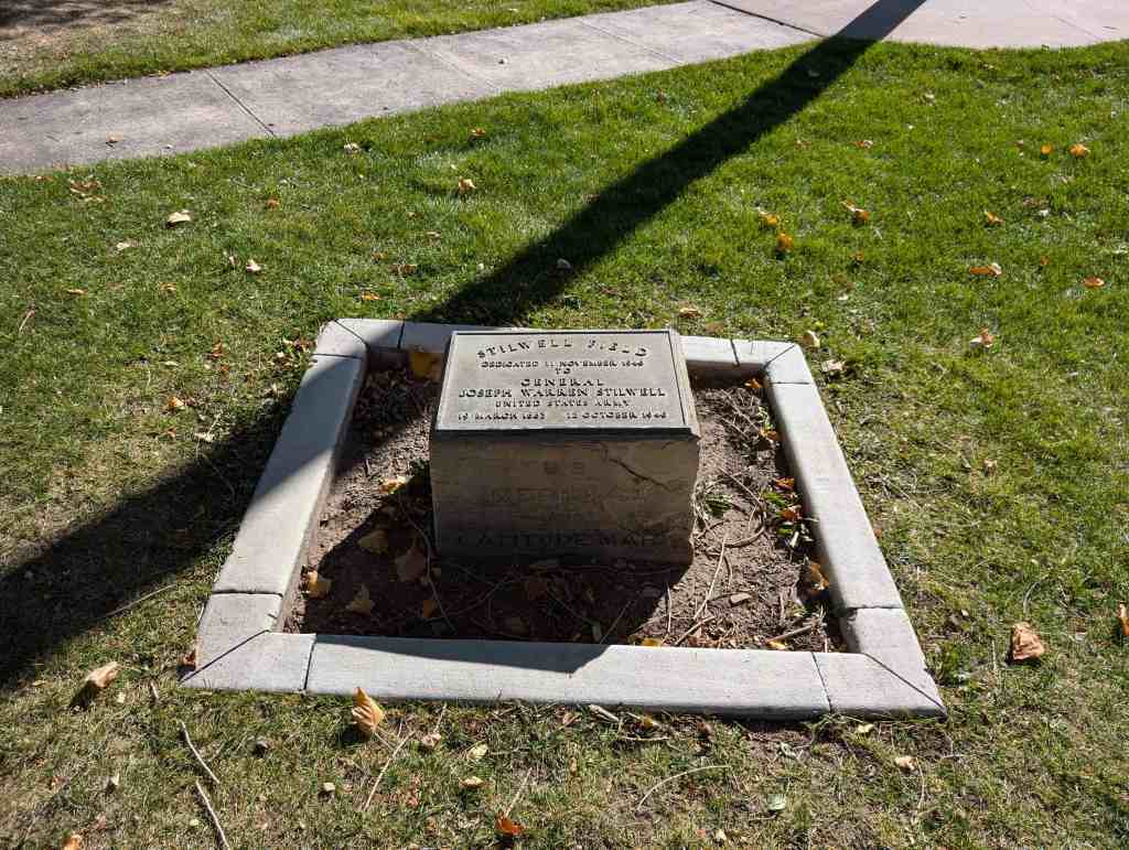
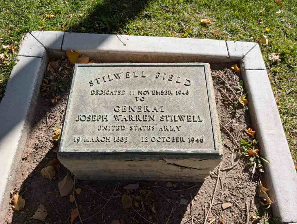
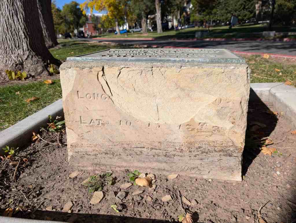
U.S. Meridian and Latitude Mark at Stilwell Field on Fort Douglas in Salt Lake City, Utah.
Stilwell Field
Dedicated 11 November 1946
to
General Joseph Warren Stilwell
United States Army
19 March 1883 12 October 1946
12 Tuesday Mar 2024
Posted in Uncategorized
Tags
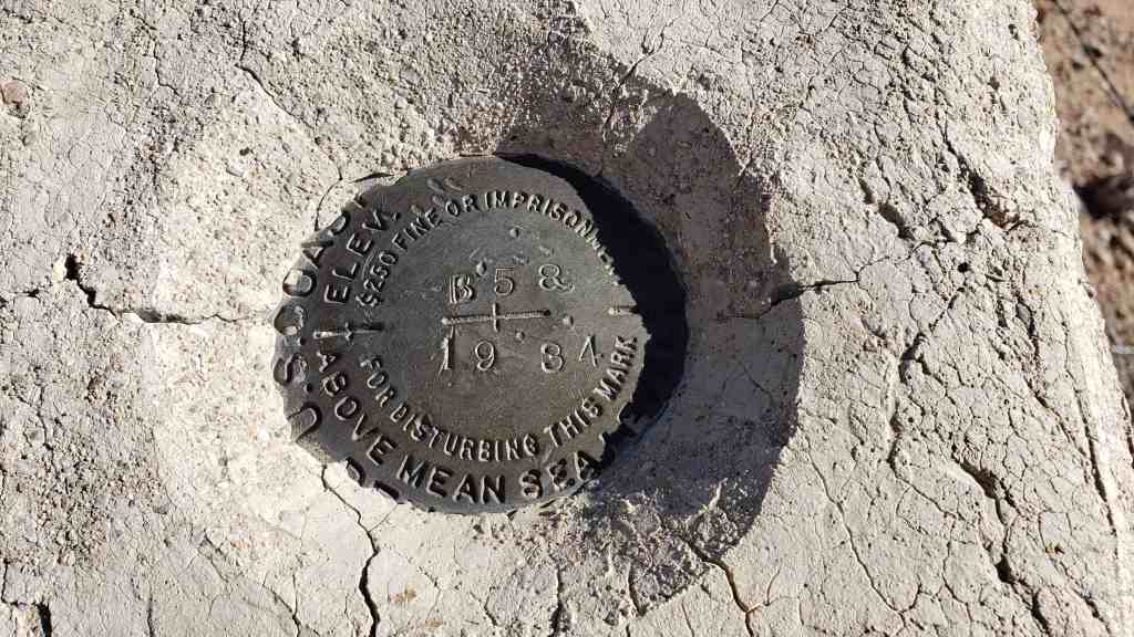
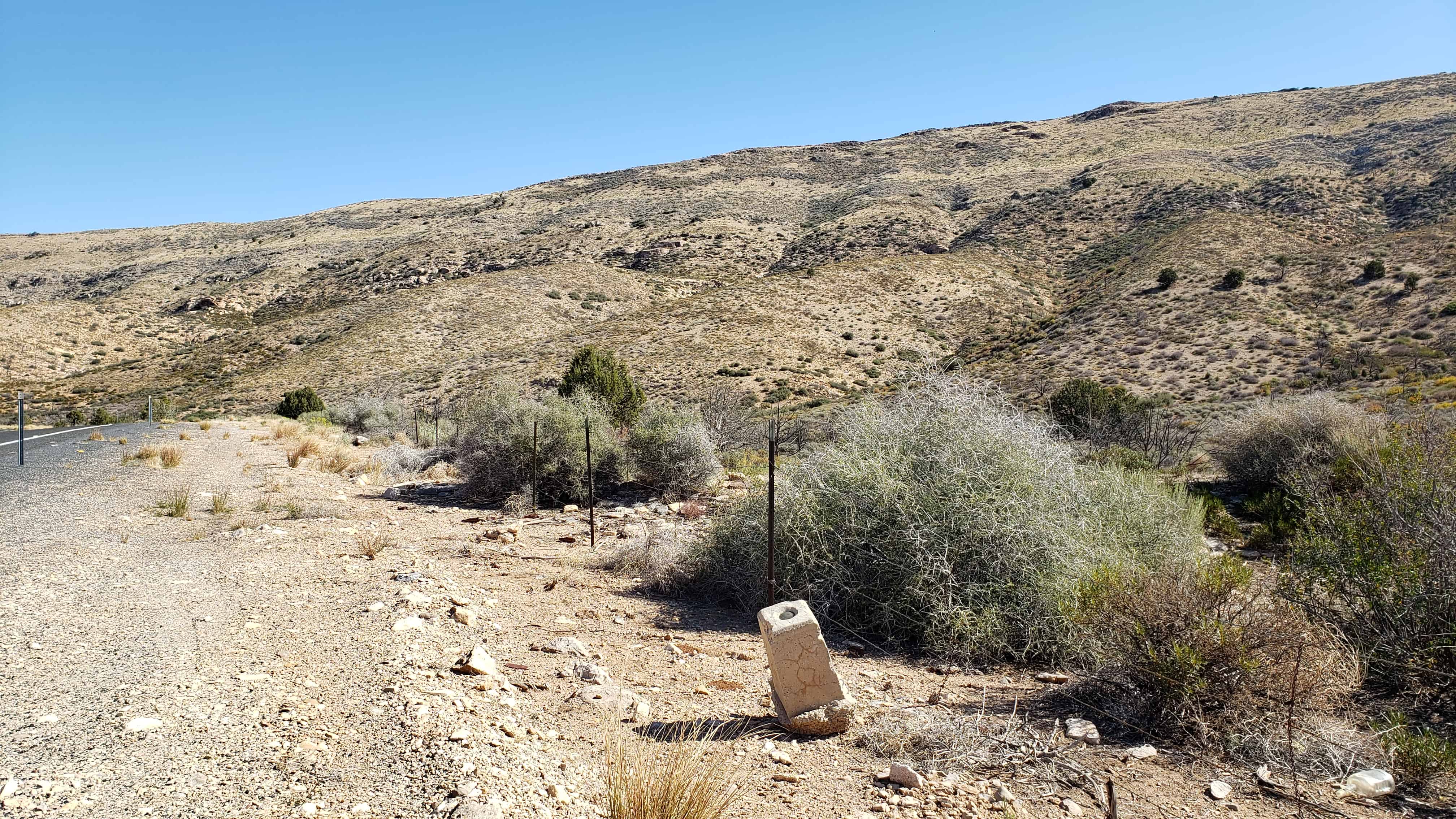
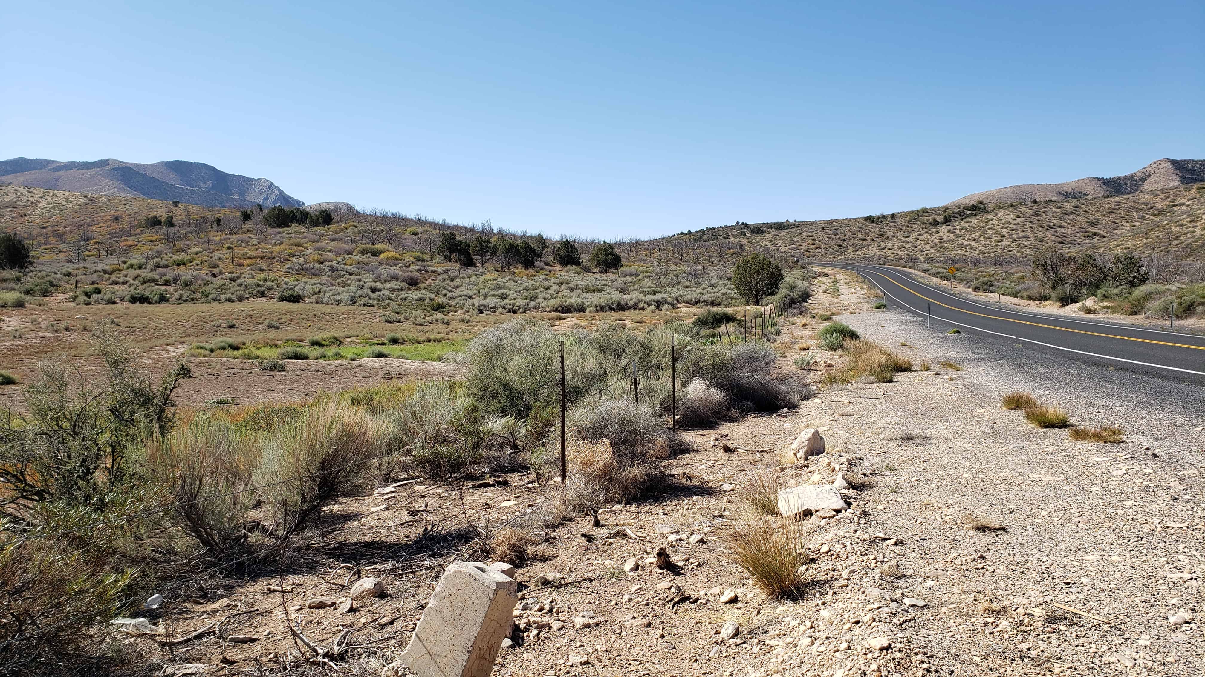
This one I found dug up out of the ground along the side of the highway at:
N 37° 07′ 03.79″ W 113° 49′ 6.36″
20 Tuesday Feb 2024
Posted in Uncategorized
Tags
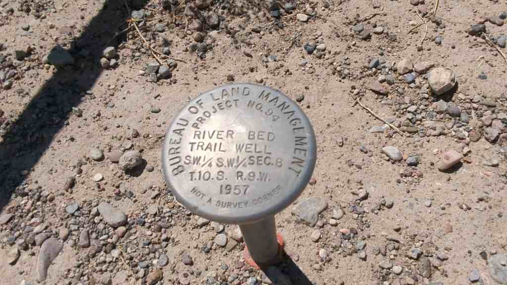
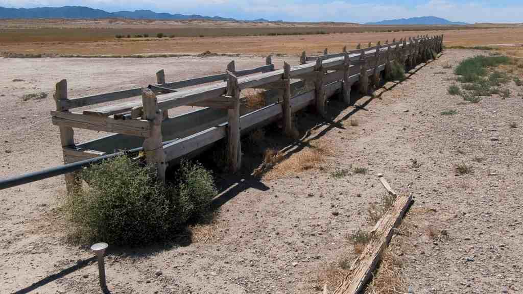
Located in section 8 of the southwest 1/4 of the southwest 1/4 of Township 10 South Range 9 West, near the Riverbed station of the pony express.
23 Wednesday Aug 2023
Posted in Uncategorized
Tags

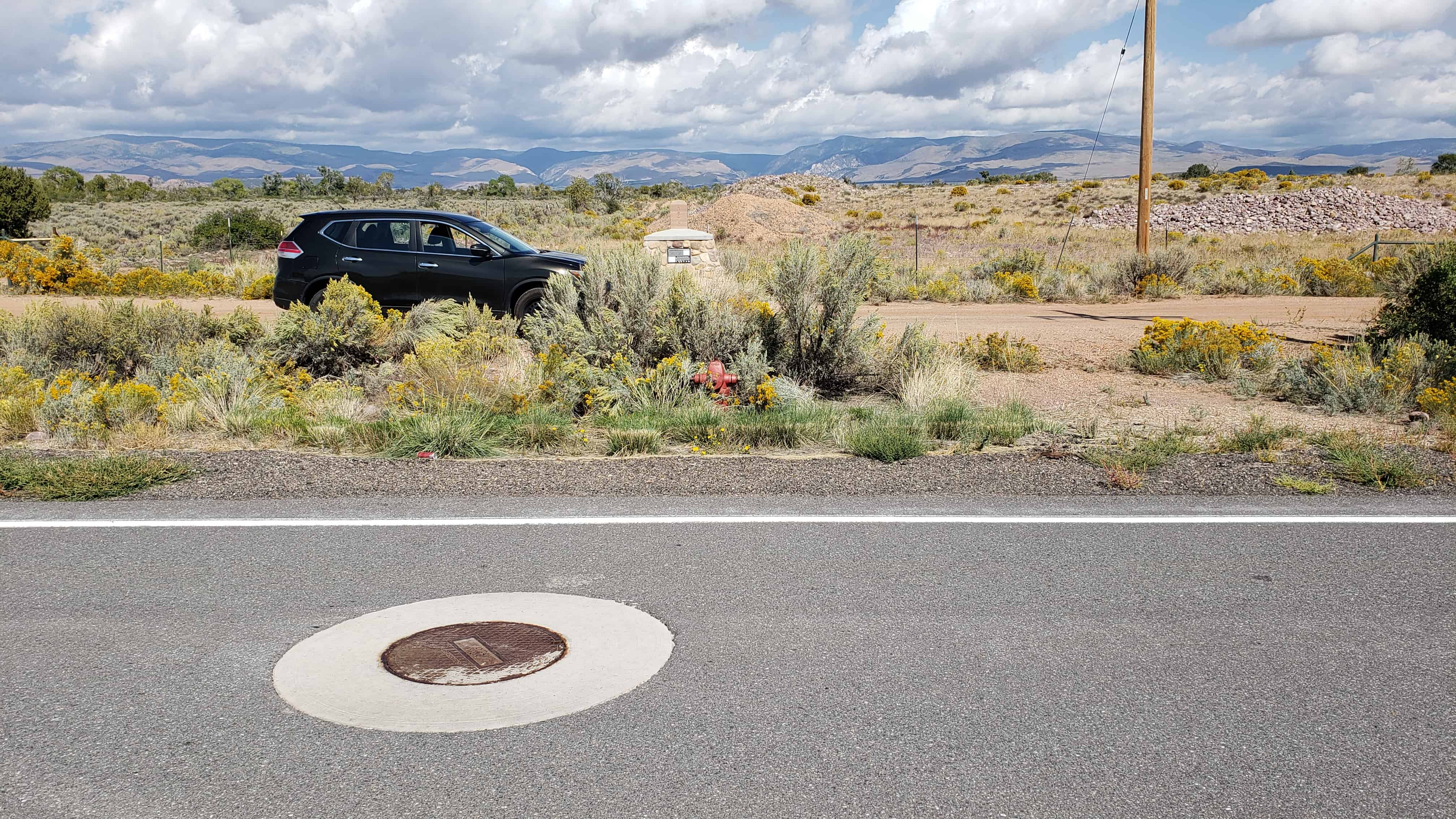
The Utah/Wyoming state line has these U.S. Department of the Interior benchmarks along it, there were a few at this cattle guard where Three Corners Road crossed the border.
Also nearby:


20 Tuesday Dec 2022
Posted in Uncategorized
Tags

Pipe Springs National Monument
Fifteen miles southwest of historic “Pipe Springs” early pioneer outpost and first telegraph station in Arizona.


This is U.P.T.L.A. historic marker #29, located in Fredonia Roadside Park in Fredonia, Arizona and erected September 2, 1933.
20 Tuesday Dec 2022
Posted in Uncategorized
Tags

Fredonia Roadside Park
Located here:


05 Saturday Nov 2022
Posted in Uncategorized
Tags

For more detailed history of the Old Brickyard Chimney visit this page.
This is a page to document the chimney as a NGS Survey Benchmark/
| 01/01/1973 by NGS (FIRST OBSERVED) |
| DESCRIBED BY NATIONAL GEODETIC SURVEY 1973 (JRS) THE POINT INTERSECTED WAS THE TOP CENTER OF THE SALT LAKE CITY INTERSTATE BRICK COMPANY, STACK THAT IS LOCATED NEAR THE INTERSECTION OF 1100 EAST AND 3100 SOUTH IN SALT LAKE CITY. THE STACK IS CONSTRUCTED OF BRICK, SQUARE IN SHAPE AND 215 FEET IN HEIGHT WITH A LIGHTNING ROD AT THE TOP OF EACH OF THE FOUR CORNERS. |
26 Saturday Mar 2022
Posted in Uncategorized
Tags
Benchmarks, Survey, Survey Markers, Uintah, Uintah Basin, utah

Initial Point of the Uintah Special Meridian
Fifty-five feet south of this marker, under a specially designed cover and marked by a 4-inch Brass Cap, lies the Initial Point for the Uintah Special Meridian, the beginning point for all surveys made on the Uintah Indian Reserve. On August 3, 1875, Nathan Kimball, Surveyor General in Salt Lake City, was authorized to enter Contract No. 64 with Charles L. DuBois as Deputy Surveyor of the Uintah Indian Reservation to “select the most available point within the reserve for an initial point and to to survey the proper base, meridian and standard parallels as a basis for his township and subdivisional surveys.” On August 30, 1875, DuBois selected the site of the Initial Point and marked it with a “mound of stone 6 feet in diameter at the base by 4 feet high, with a stone 20 x 12 x 10 on the top marked I.P. 1875” as replicated by this marker. The Initial Point being this established, Dubois surveyed and marked the meridian line north 6 miles to the base of the Uintah Mountains and 17 miles south to the Reserve boundary. He then extended and marked a base line 6 miles east and 6 miles west, then began the arduous process of subdividing the land.

The Three-mile method
Deputy Surveyor DoBois’ instructions provided for a unique survey process called the Three-mile Method, dividing the land not only into Townships measuring 6 miles by 6 miles with 36 Sections in each Township, but further dividing each section into 40-acre allotments by setting a stone monument at every corner of each 40-acre tract. By the close of the June 30, 1876 fiscal year, DuBois had run 1,300 miles of line, set over 4,000 stone markers every 1/4 mile and subdivided over 161,000 acres of the Uintah Indian Reservation land for allotment.

The Allotment Era
The period from 1870 to 1900 marked a change in Federal Indian policy which was dominated by removal, treaties, reservations, and even war. The new policy focused on breaking up communal living on reservations by granting land allotments to individual Native Americans. The General Allotment act of February 8, 1887, (The Dawes Act) provided that all Indians on (or off) a reservation would be allotted a tract of land, from 20 up to 160 acres, depending upon the type of land being allotted. The Indian Appropriations Act of May 27, 1902, required all allotments within the Uintah Reservation be completed by October 1, 1903 (later extended to September 1, 1905), and the remainder of the reservation to be restored to public domain and open for settlement.
On April 3, 1905, a commission composed of Capt. C. G. Hall, U. S. Army, acting Indian agent of the Uintah Agency; W. H. Code, chief engineer of the Indian irrigation service; and Mr. Charles S Carter, a local citizen, was appointed to allot the Indians and to select the lands to be reserved for use in connection with Indian service. By June of 1905, all allotments had been completed. By Presidential Proclamation on July 14, 1905, Theodore Roosevelt declared all unallotted lands in the Uintah Indian Reservation open for settlement under the provisions of the homestead and townsite laws. Hundreds of “non-Indian Heads of Households” lined up around the land office to pay their $1.25 per acre.. Of the original 2,080,000-acre Uintah Reservation, roughly 104,000 acres were allotted to individual Indian families and 1,072,000 acres held in trust for their benefit; the remaining 1,004,000 acres was returned to the Public Domain.

The Uintah Valley Reservation
Upon the urging of Samuel C. Stanbaugh, Surveyor General of Utah, concerning the pending survey and the settlement of the Uintah valley by white settlers, President Abraham Lincoln, on October 3, 1861, reserved “the entire valley of the Uintah River within Utah Territory, extending on both sides of said river to the crest of the first range of contiguous mountains on each side, to be reserved to the United States and set apart as an Indian reservation” encompassing 2,080,000 acres. Brigham Young’s 1861 settlement scouting party described the isolated area as “one vast contiguity of waste … valuless excepting for nomadic purposes, hunting grounds for Indians and to hold the world together.” Congress confirmed President Lincoln’s 1861 action on May 5, 1864, creating the Uintah Valley Reservation. The land was “set apart for permanent settlement and exclusive occupation of such of the different tribes of Indian of [Utah] territory as many be induced to inhabit the same.”
On June 8, 1864, a treaty was concluded with the Utah Indians of eastern Utah, in which they ceded all their land claims in eastern Utah, except the Uintah Valley which was reserved for their exclusive use and occupation. This treaty was never ratified by Congress. By 1870 most members of the Tumpanawach, San Pitch, Pahvant, Sheberetch, Cumumba, and the Uintah bands of Utes relocated to the reservation and became absorbed into the Uintah band. In 1875, news came of measuring off the land causing the Utes to speculate as to what was going to happen to them. Would they be moved again and placed in another area?

The monument is located at 3500 East 9000 North (Neola Road) in Whiterocks, Utah


24 Thursday Mar 2022
Posted in Uncategorized
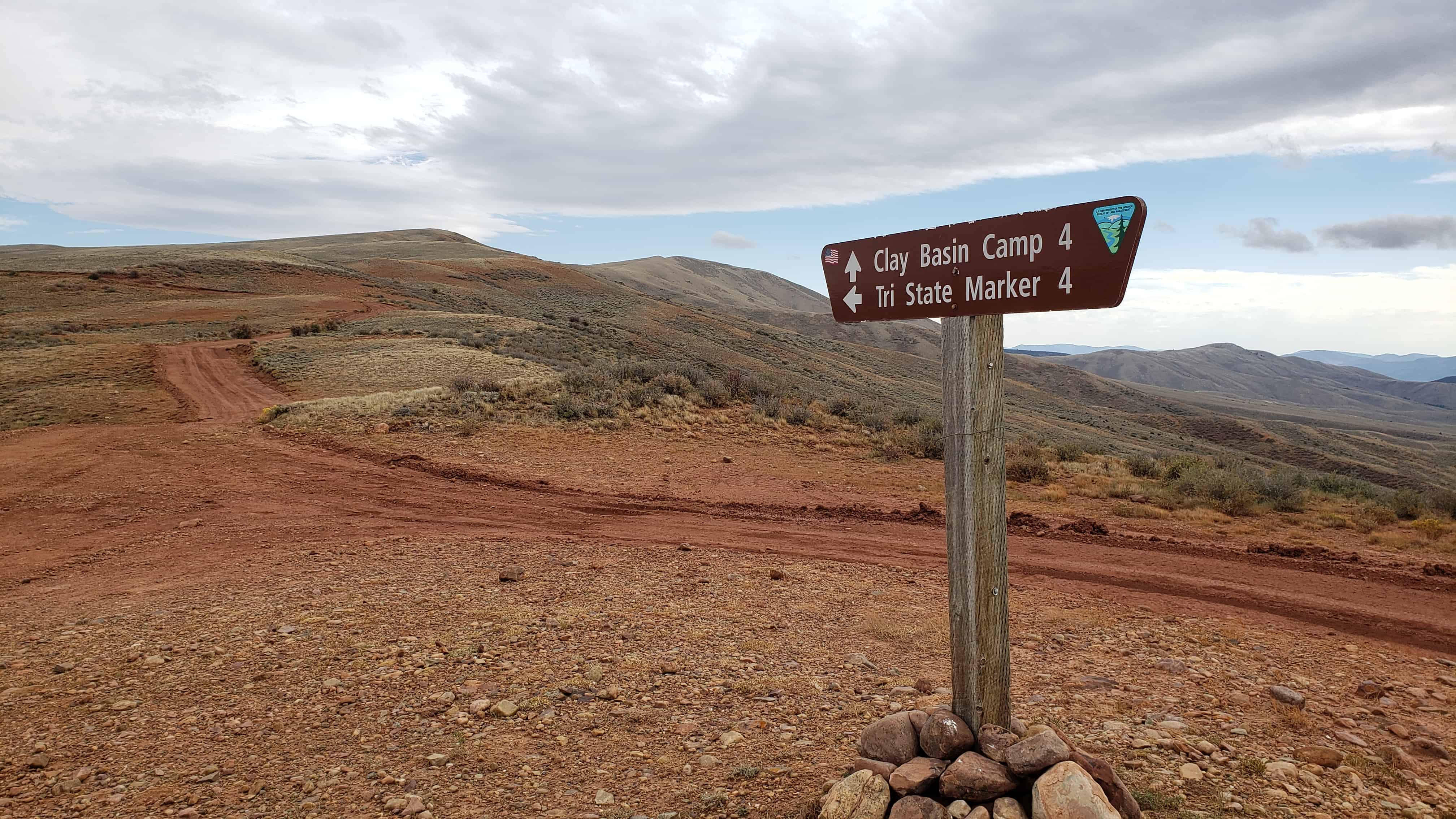
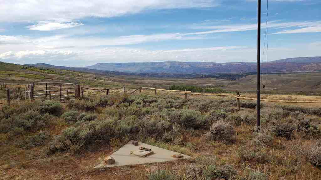
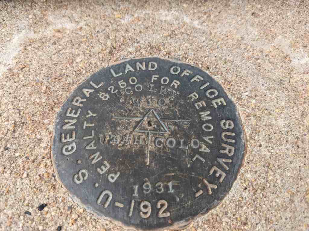
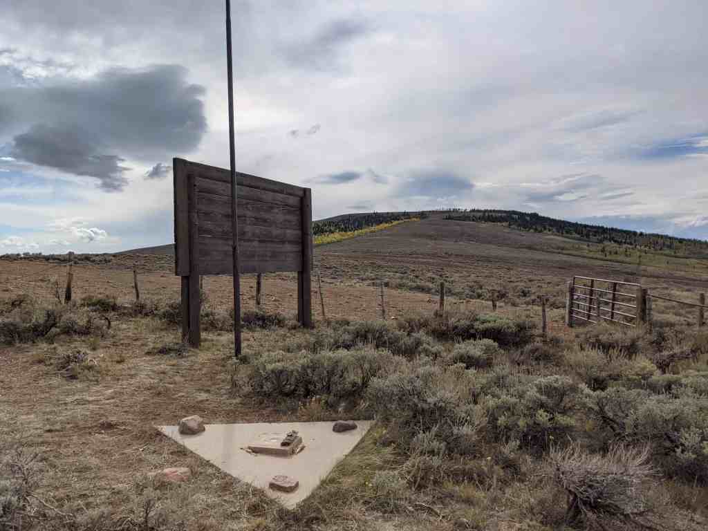
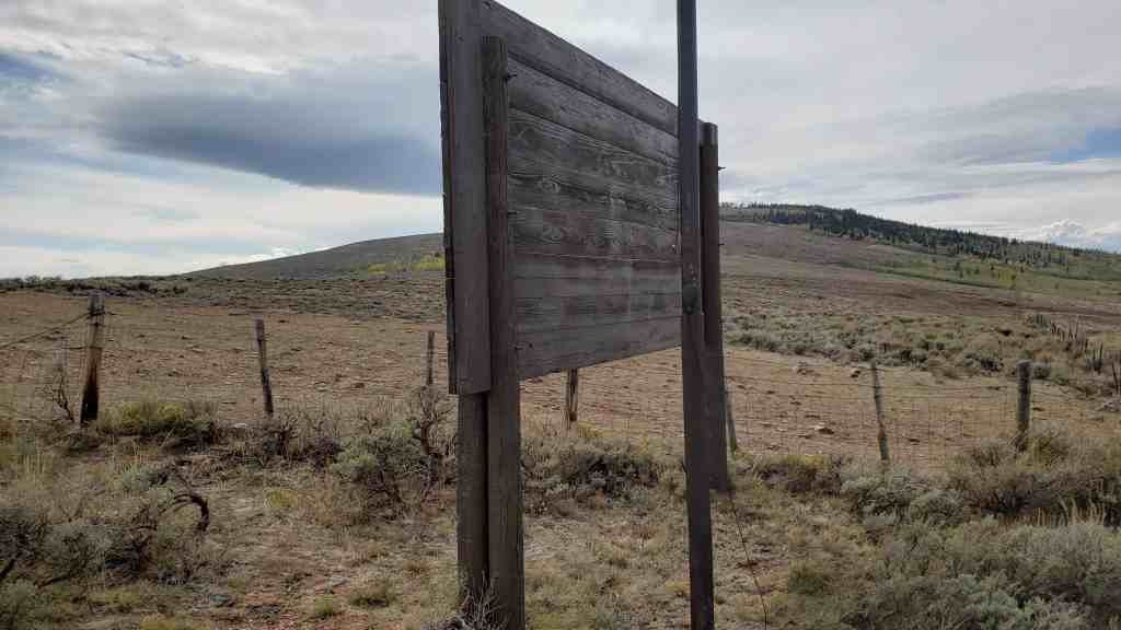
A Tri-State Marker at the corner of the state boundaries for Colorado, Utah and Wyoming.
Related:

There is a sign on site that reads:
Public Land Survey Monument
Tri-State corner of Wyoming, Utah and Colorado
Lat. 41° 00′ 42.616″ N Long. 109° 02′ 42.158″ W. Elevation 8402′
This point was monumented by U.S. surveyor, Rollin J. Reeves, on July 19, 1879, while completing the survey of the western boundary of the State of Colorado and the east boundary of Utah Territory. The boundary line separating Wyoming Territory from Colorado and Utah Territories was surveyed by U.S. surveyor, A.V. Richards in 1873. The original monument was found to be disturbed in 1931 and was remarked by U.S. Cadastral Engineer, E.V. Kimmel, with a brass tablet seated in a concrete monument. This monument is one of the corners of the national Rectangular Cadastral Survey System, inaugurated in 1785, that has aided the development and orderly settlement of the public lands in the western states. From these monuments, state and local governments and private citizens are provided with easily identifiable boundaries. Such monuments serve as a base for the work of private surveyors in making accurate land subdivisions and descriptions.
This historical tri-state monument was erected by the Kiwanis Club and Boy Scout Troop 166 of Craig, Colorado in cooperation with the Bureau of Land Management dedicated on September 18, 1999.