Located three and one-half miles north of this marker, the first storage reservoir in Utah was begun in 1871, and completed in enlarged form, after going out three times. Length of dam, 127 feet, height 28 feet, made of earth and rocks. Cost, $10,000. Reservoir length, one and a half miles. Capacity, 1,566 acre feet, original building committee, Bishop William F. Rigby, Franklin W. Young, Stephen Catt, Swen Jacobs, and John Jenkins. First caretakers and watermasters, John Griffin, A.P. Welshman and Jonas N. Beck.
Check out all of the historic markers placed by the Daughters of Utah Pioneers at JacobBarlow.com/dup
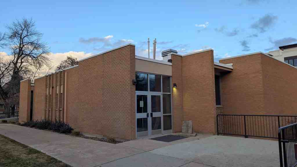
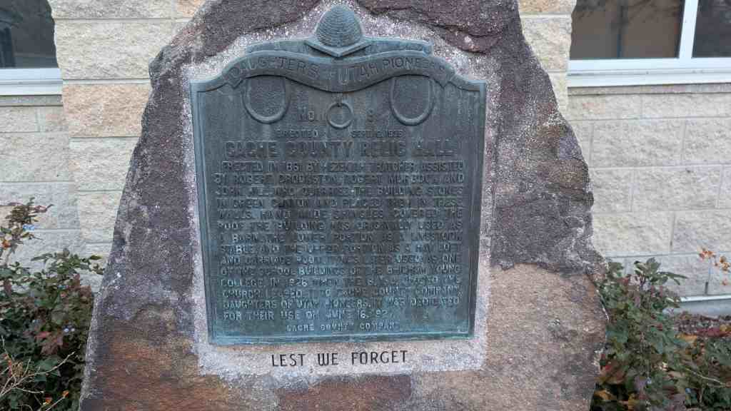
Cache County Relic Hall Erected in 1861 by Hezekiah Thatcher, assisted by Robert Murdock, Robert Crookston, and John Hill, who quarried the building stones in Green Canyon and placed them in these walls. Hand made shingles covered the roof. The building was originally used as a barn. The lower portion as livestock stable, and the upper portion as a hay loft, and carriage room. It was later used as one of the school buildings of the Brigham Young College. In 1926 when the B.Y.U. closed, the Church leased it to Cache County Company, Daughters of Utah Pioneers. It was dedicated for their use on June 16, 1927.
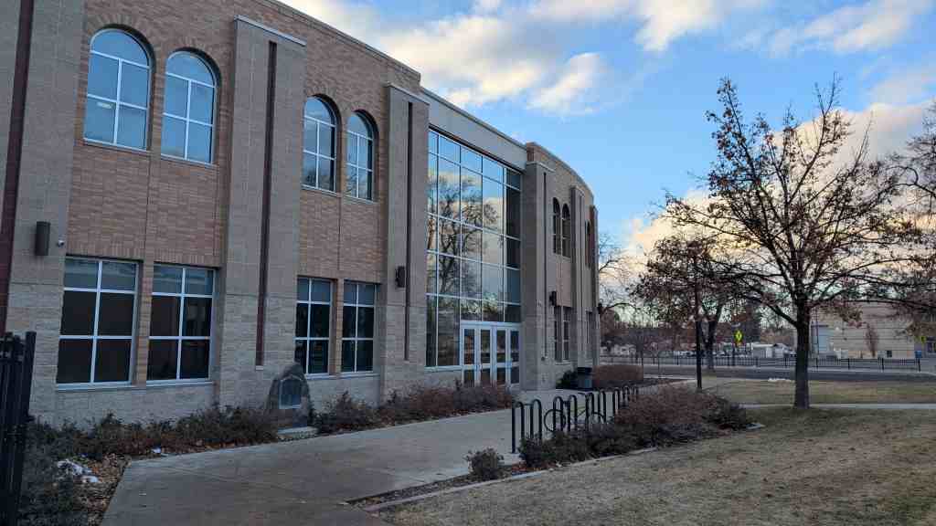
Located at Logan High School near the Seminary Building, 110 West 100 South in Logan, Utah
Benson is eight miles northwest of Logan. In l870 the Charles Reese and Israel J. Clark families settled there from Logan. On May 3, 1871, the settlement was organized by Moses Thatcher, an apostle of the Mormon Church and Bishop William B. Preston of Logan, a Mormon elder. Bishop Preston suggested a name honoring Ezra T. Benson, a presiding elder of the Mormon Church in that area.(*)
Before Benson was settled, this part of the county was used as a herd ground; in fact, the land west to Newton and as far north as Weston, was used for grazing of livestock, mostly cattle. A number of the cattle herds from Logan were grazed here.(*)
Cache Junction is ten miles northwest of Mendon, near a spring. The site was initially settled by Sylcanus Collett in 1867. The town was established in 1890 as an outgrowth of Benson and it became an important railroad junction on the union Pacific Railroad. Originally this area was divided into Petersboro No. 1 and No. 2 became Cache Junction. The railroad no longer uses the stop but a cafe and a few local residents still remain.
Thomas E. Ricks arrived in Cache Valley with his family In 1859. Between chores such as building a school and a cabin for his family, he explored Logan Canyon In search of timber. During one trek he discovered this spring which was later named for him.
Frontier communities required large quantities of lumber to build churches, businesses, homes, and fences. In 186. Thomas Ricks and other town leaders proposed building a road in Logan Canyon to that timber could be hauled to the valley. As timber supplies close to Login were exhausted, the road was pushed further up the canyon. Brigham Young, President of the Church of Jesus Christ of Latter Day Saints (Mormons), recommended in 1889 that the road be completed to Bear Lake Valley Thomas Ricks and other volunteers accepted the challenge and completed the first twenty-five miles to what is now known as Ricks Spring before winter.
For many years. Ricks Spring was believed to be pure mountain spring water. Visitors drank from the spring and filled jugs with water to take home that is until they became sick. In 1972, an ice jam on Logan River provided the answer to the origins of Ricks Spring.
Ricks Spring usually slows to a trickle in November, and begins to flow again in April as the snow melts. In 1972, however, a severe blizzard caused an ice flow to dam Logan River. Suddenly, Ricks Spring began to flow in January. When the ice jam cleared, the flow slowed. Later, bitter cold weather caused another ice jam on Logan River and the flow of Ricks Spring increased once again. Scientists placed green dye in Logan River and the dye appeared in Ricks Spring indicating that they are directly connected by an underground fracture in the rock.
This spring has always been a “childhood memory” of mine, my dad stopped here once and told us about how he came here when he was younger.
In July 1859 under the leadership of John Bair (Interpreter and Guide), sixteen families settled here. They built log cabins and dugouts between City Creek and Brower Springs. The following spring, other families arrived and a permanent fort was built for protection against Indians. The Fort consisted of two rows of houses running east and west, facing each other, with corrals and sheds for livestock back of the homes. This monument, built in honor of the Pioneers of 1859 and 1860, marks the southwest corner of the fort which ran 3000 feet east by 465 feet north.
Amalga is a cute little farm town, I enjoyed my stay there one weekend. I actually got my Jeep stuck in a ditch one night late while pulling over to find a geocache and was saved by a nice local with a tractor. I slept under the stars that night on a friends driveway and woke up the next morning to a beautiful foggy farmland. Creeks and fields as far as the eye can see, lots of fences too.
Amalga is easy to miss, it is between Smithfield and Newton if you know Cache County at all. Wikipedia says the population is 448, seems a little high to me. (ha ha) The best thing in town is the cheese factory, they make AMAZING cheese.