In March 1928, the Federal Government established the first and only experimental station in the United States devoted solely to research on the breeding and raising of rabbits on a five-acre property donated by A. B. Miller of Fontana. The station successfully pioneered new techniques of rabbit care and breeding until 1965 when the City of Fontana acquired the property for use as a senior citizens facility.
This is California Historical Landmark #950, it was located at 8384 Cypress Avenue in Fontana, California and was missing when I tried to get photos in November 2025.
El Monte, on the bank of the San Gabriel River, played a significant part in California’s early pioneer history. It was first an encampment on the Old Spanish Trail, an extension of the trail from Missouri to Santa Fe. By the 1850’s some began to call El Monte the “End of the Santa Fe Trail.” Early in that decade a permanent settlement was esablished here by immigrants from Texas. The first settlement in Southern California founded by citizens of the United States.
This is California Historical Landmark #975, it was located at 3575 Santa Anita Avenue in El Monte, California and was missing when I tried to get photos in April 2026.
The oldest settlement in Tehachapi Valley, known as ‘Old Town,’ was established here during the 1860s. It was long an important station on the road between Southern California and the San Joaquin Valley. The community began to decline when residents gradually removed to nearby Greenwich, later renamed Tehachapi, after completion of the Southern Pacific Railroad in 1876.
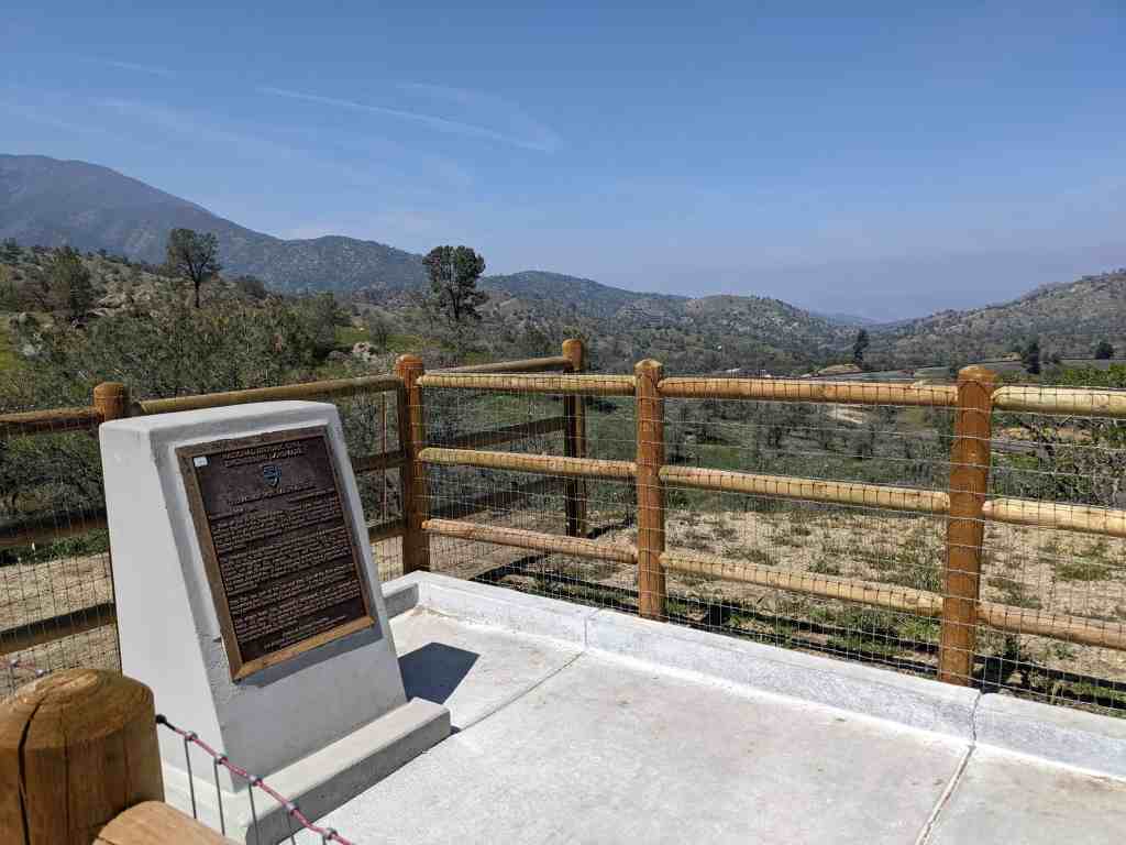
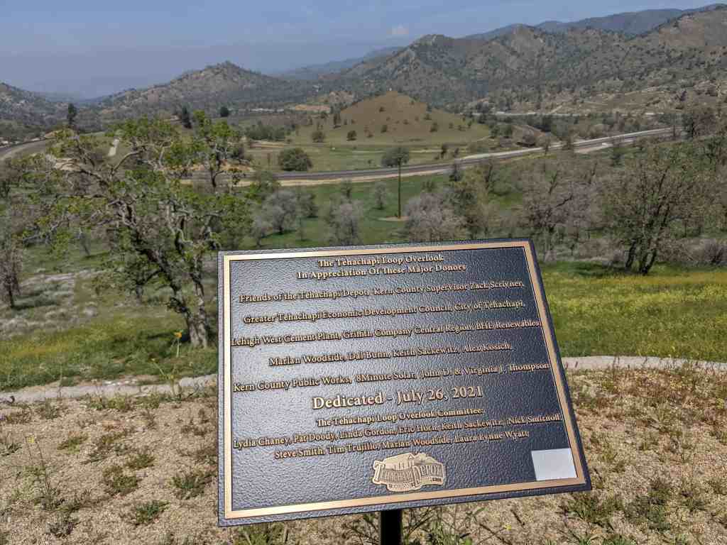
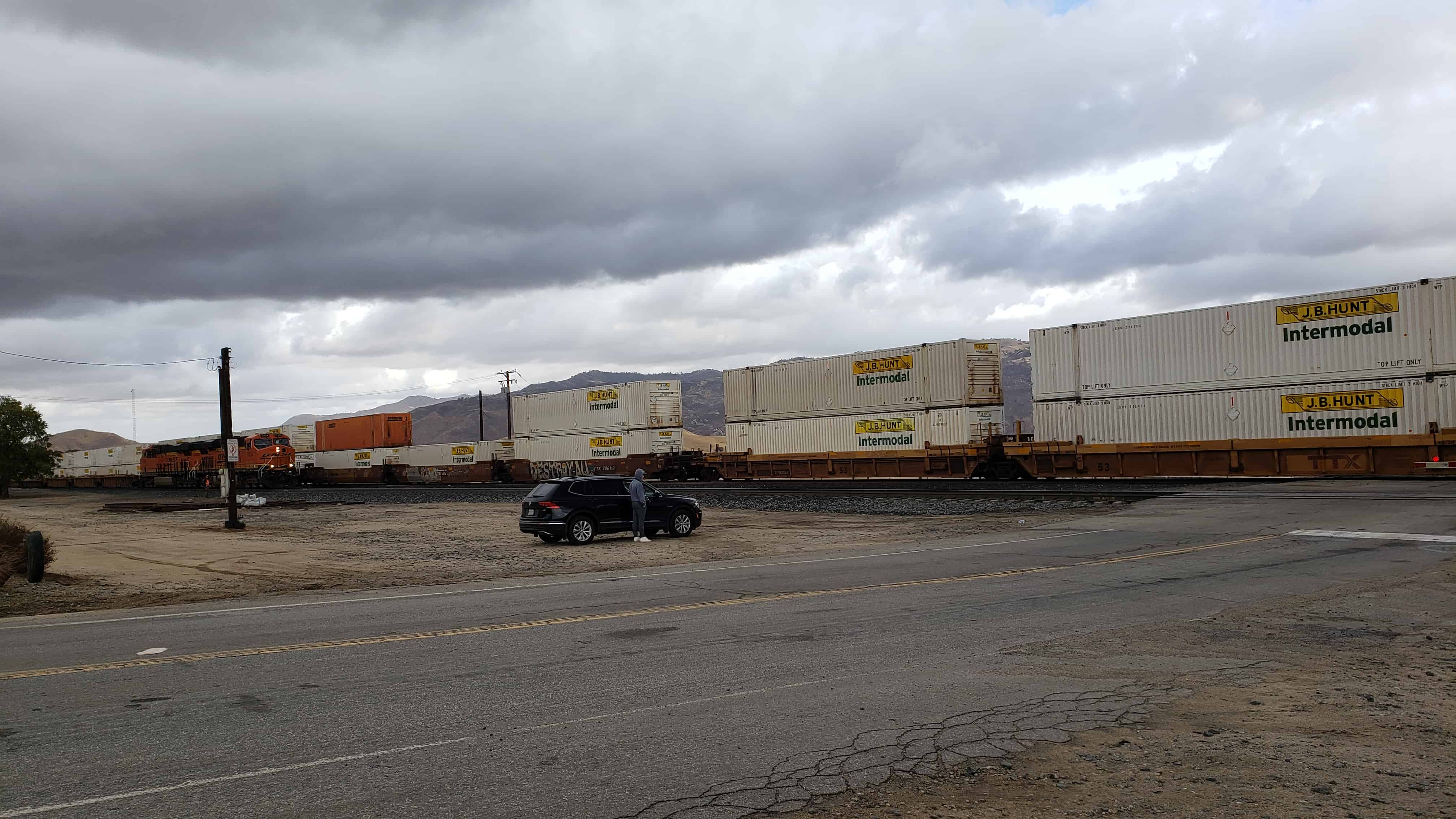
From this spot may be seen a portion of the world-renowned Loop completed in 1876 under the direction of William Hood, Southern Pacific railroad engineer. In gaining elevation around the central hill of the Loop, a 4,000-foot train will cross 77 feet above its rear cars in the tunnel below.
In front of you is the world famous Tehachapi Loop which is about halfway upgrade to the Tehachapi Pass. This steep line averages 2.2% in gradient in its 28 miles of length. This feat of civil engineering genius was crowning achievement of civil engineer William Hood of the Southern Pacific Railway Company. It is one of the seven wonders of the railroad world.
The Tehachapi Pass Railroad Line was cut through solid and decomposed granite by up to 3000 Chinese laborers from Canton, China. They used picks, shovels, horse drawn carts and blasting powder. This line, which climbs out of the San Joaquin Valley and through the Tehachapi Mountains had 18 tunnels, 10 bridges and numerous water towers for the old steam locomotives. It was completed in less than 2 years time under the leadership of civil engineer J.B. Harris, Chief of Construction, a remarkable feat.
This line was part of the last and final link of the first railroad line connecting San Francisco to Los Angeles. It was a primary factor in the early growth of the City of Los Angeles and the State of California.
This single track line, essentially unchanged, is still in constant use today, 122 years after its completion. It passes an average of 36 freight trains each day. This attests to the superior job of both engineering and construction done by the two civil engineers and the Chinese laborers.
Founded in the Spring of 1861 by Joseph and Charles Dornbach. From 1854 to 1882 it was noted for its rich hydraulic mines. In 1860 had the largest voting population in Placer County. Chinese inhabitants numbered about 2,000. Here Theodore Judah and Dr. D.W. Strong made the original subscriptions to build the First Transcontinental Railroad.
State Registered Landmark No. 397
Tablet placed by California Centennials Commission. Base furnished by Placer County Historical Society Dedicated July 23, 1950.
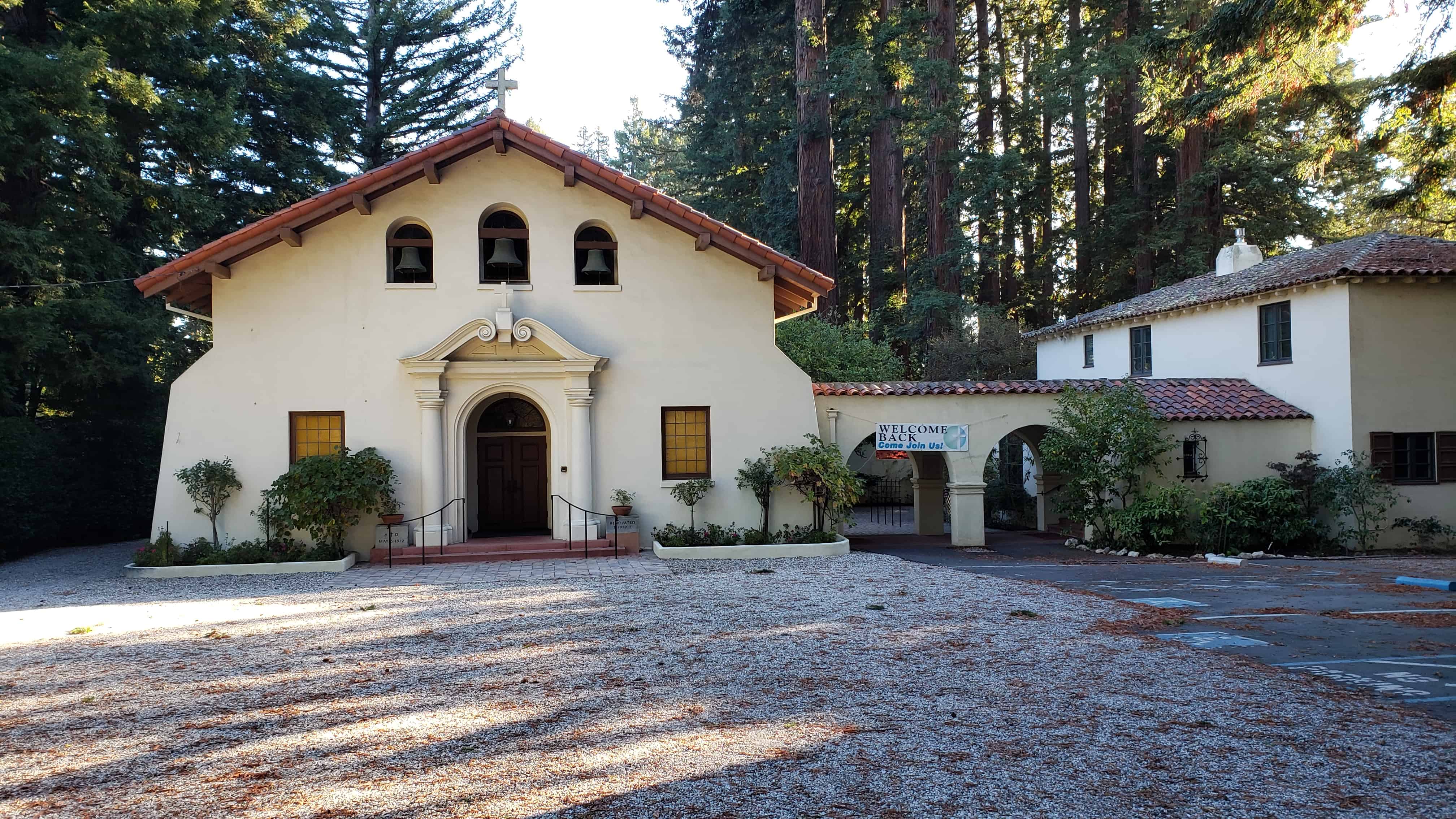
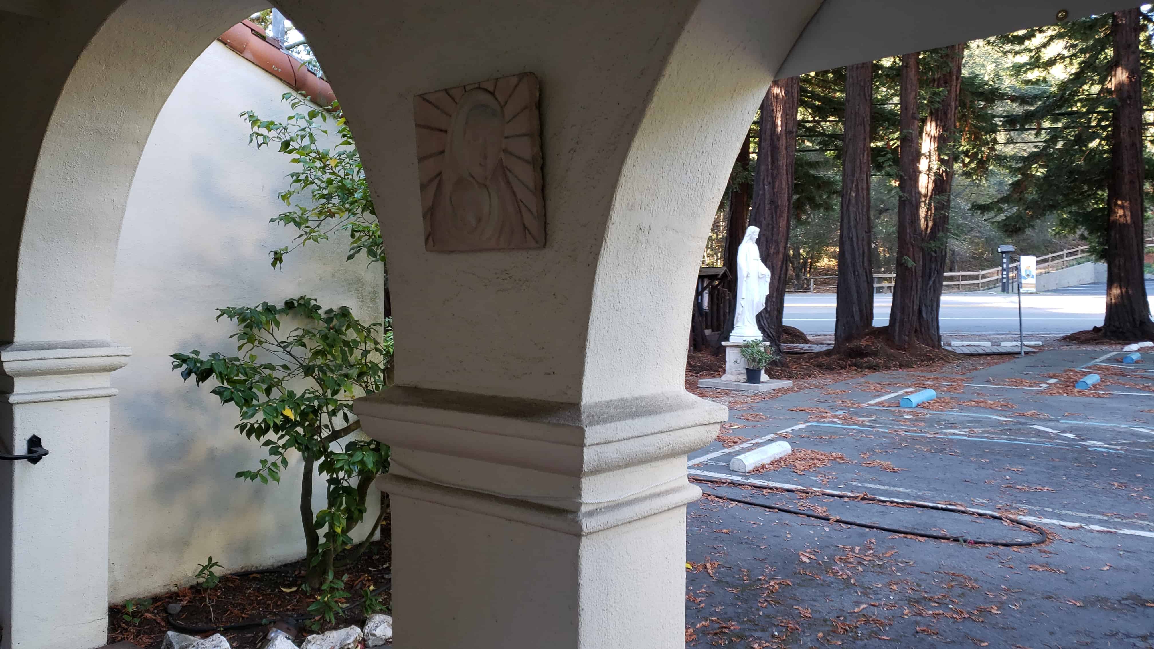
Built in 1912, this country church was the first executed design of noted architect, Timothy L. Pflueger, who had just begun work for James Miller. An awareness of the Spanish California Missions inspired the style, which contrasts with the large commercial buildings and Art Deco theaters for which Pflueger later became notable. Construction of this Catholic church was initiated by a non-denominational club, The Family.
California Historical Landmark No. 909 (see others on this page)
Plaque placed by the State Department of Parks and Recreation in cooperation with the town of Portola Valley, September 4, 1977.
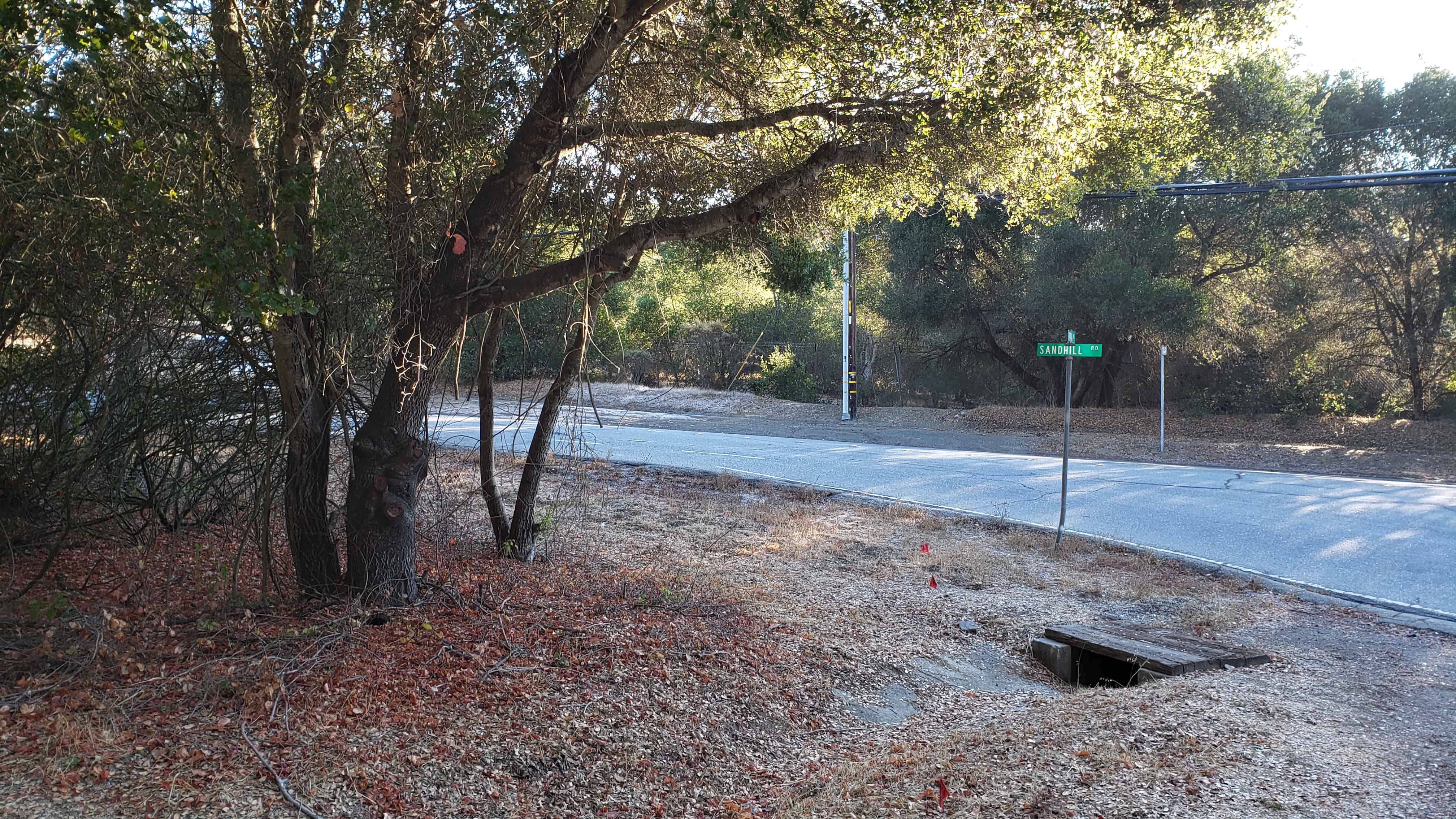
Here stood the lumbermen’s village of Searsville whose first settler, John Sears, came in 1854. Across the road westerly from this monument stood a hotel. The school, store, blacksmith shop, and dwellings were to the southeast, some on the site of the present lake and others overlooking it. Buildings were removed in 1891, as water rose behind the new dam.
State Registered Landmark No. 474 (see others on this page)
Plaque placed by the Board of Supervisors of San Mateo County in cooperation with the San Mateo County Historical Association. Dedicated June 8, 1952
Location: N 37.40264 W 122.24520 (Portola Rd and Sand Hill Rd in Woodside, CA)
Caliente, formerly Allen’s Camp was renamed when the Southern Pacific railroad established construction headquarters here in 1875 while track was laid over Tehachapi Pass. It was a freighting center for Havilah and other mining towns as well as shipping point for cattle from Walker’s Basin and Bear Mountain.
This historic marker was dedicated July 16, 1961 and placed by Kern County Historical Society.
It is California Historic Landmark #757 – see others on this page.
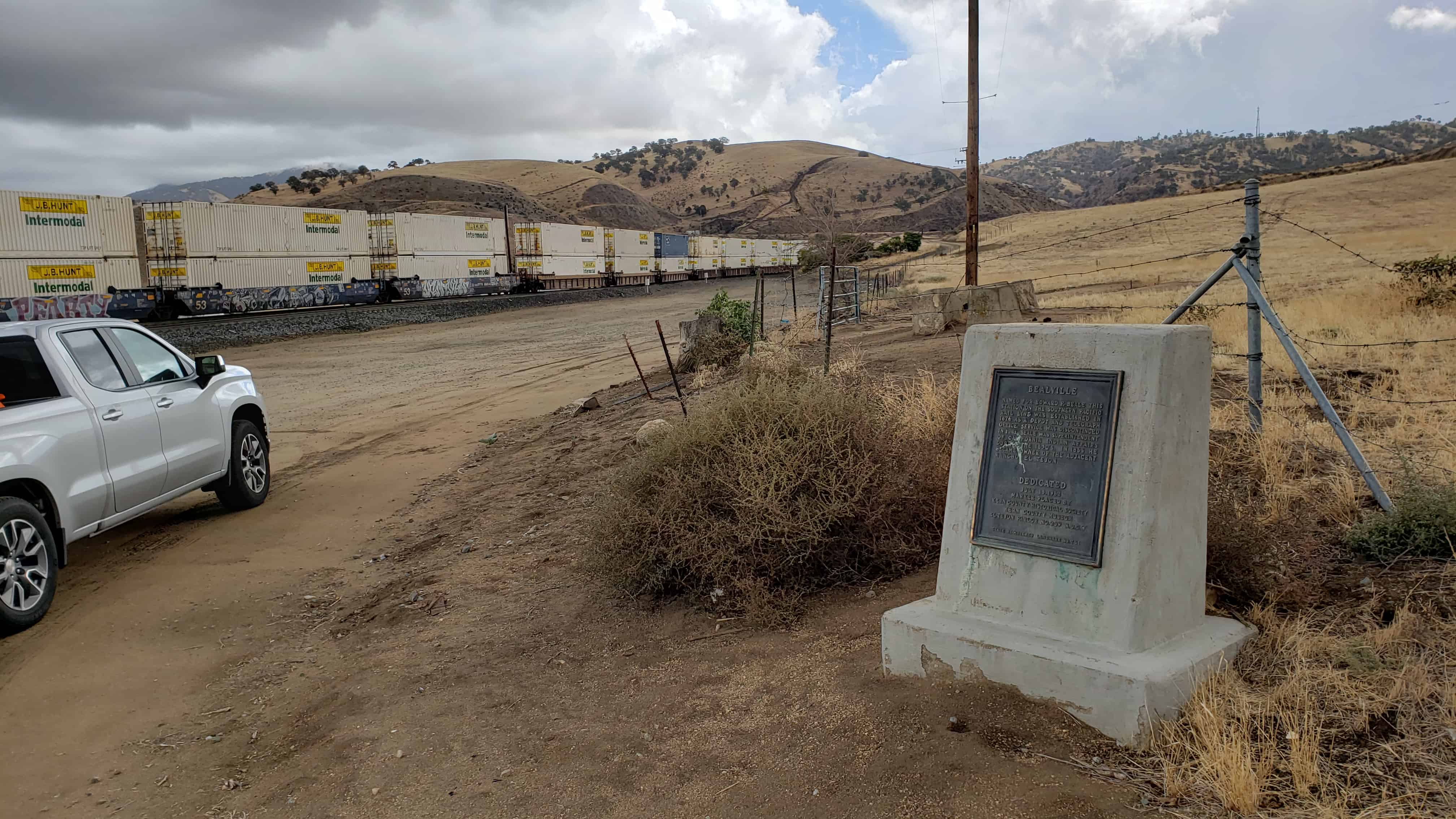
Named for Edward F. Beale, this station on the Southern Pacific rail line was established in 1876 as a depot and telegraph office. Service was discontinued in 1913. Beale was superintendent of California Indian Affairs during the 1850’s. In 1865 he became owner of the adjacent Rancho El Tejon.
This historic marker was dedicated July 15, 1962 and placed by Kern County Historical Society.
It is California Historic Landmark #741 – see others on this page.
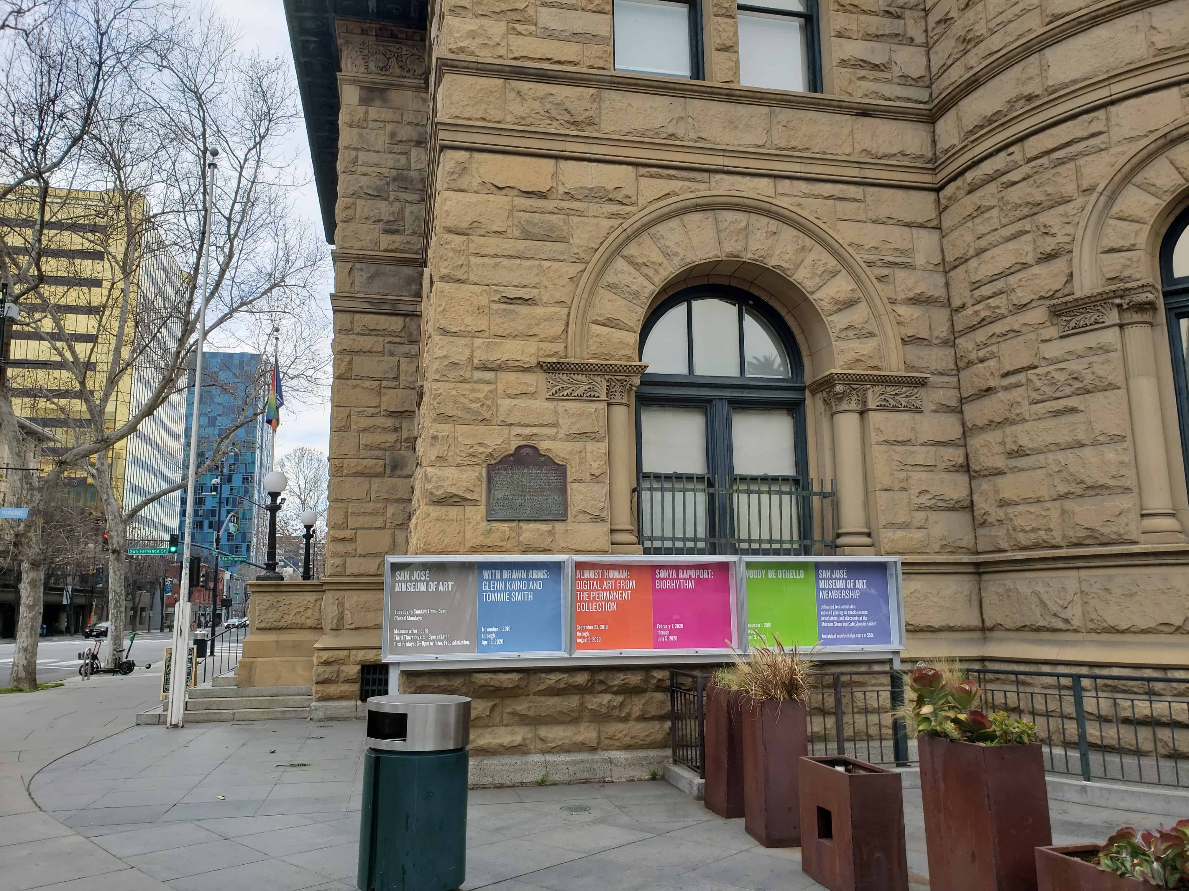
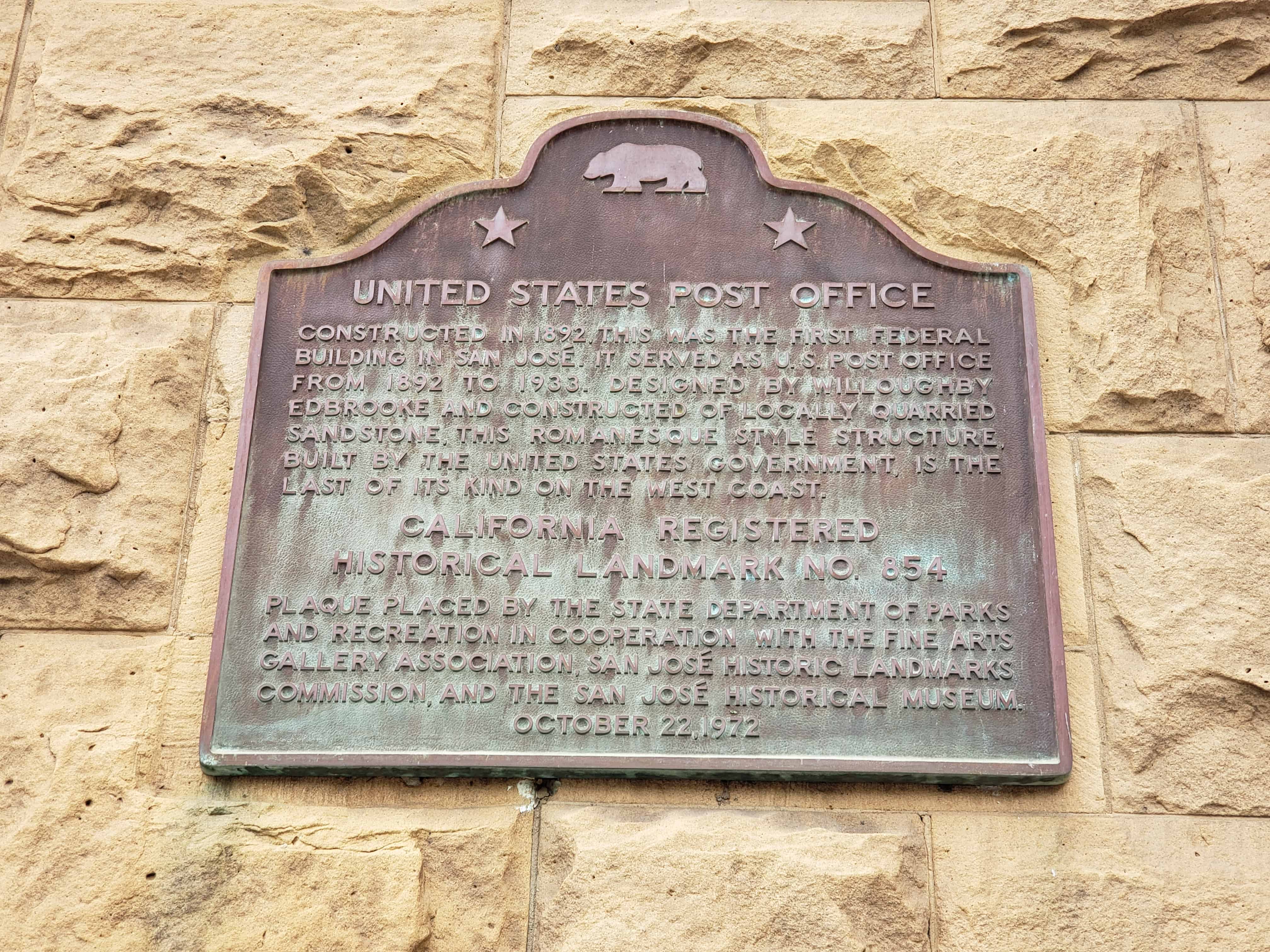
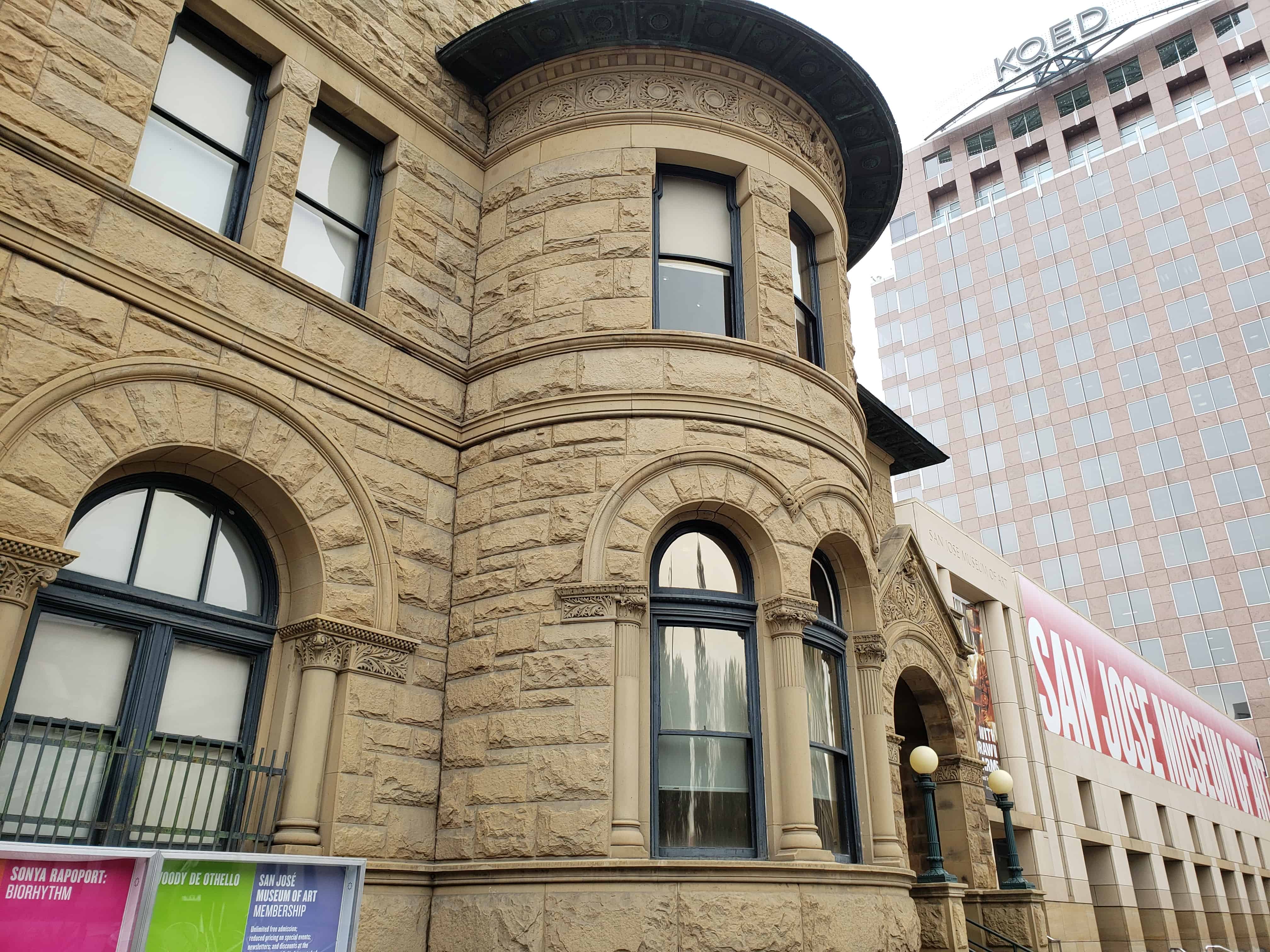
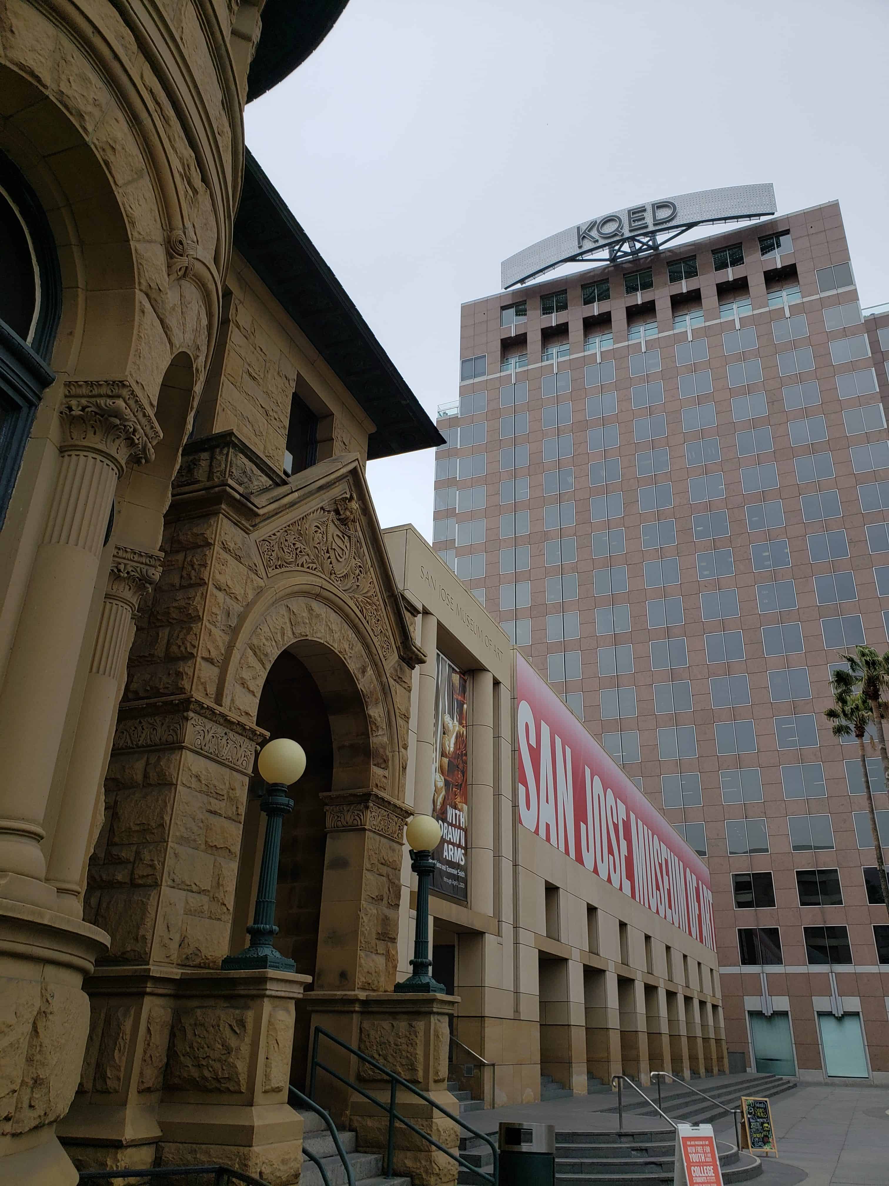
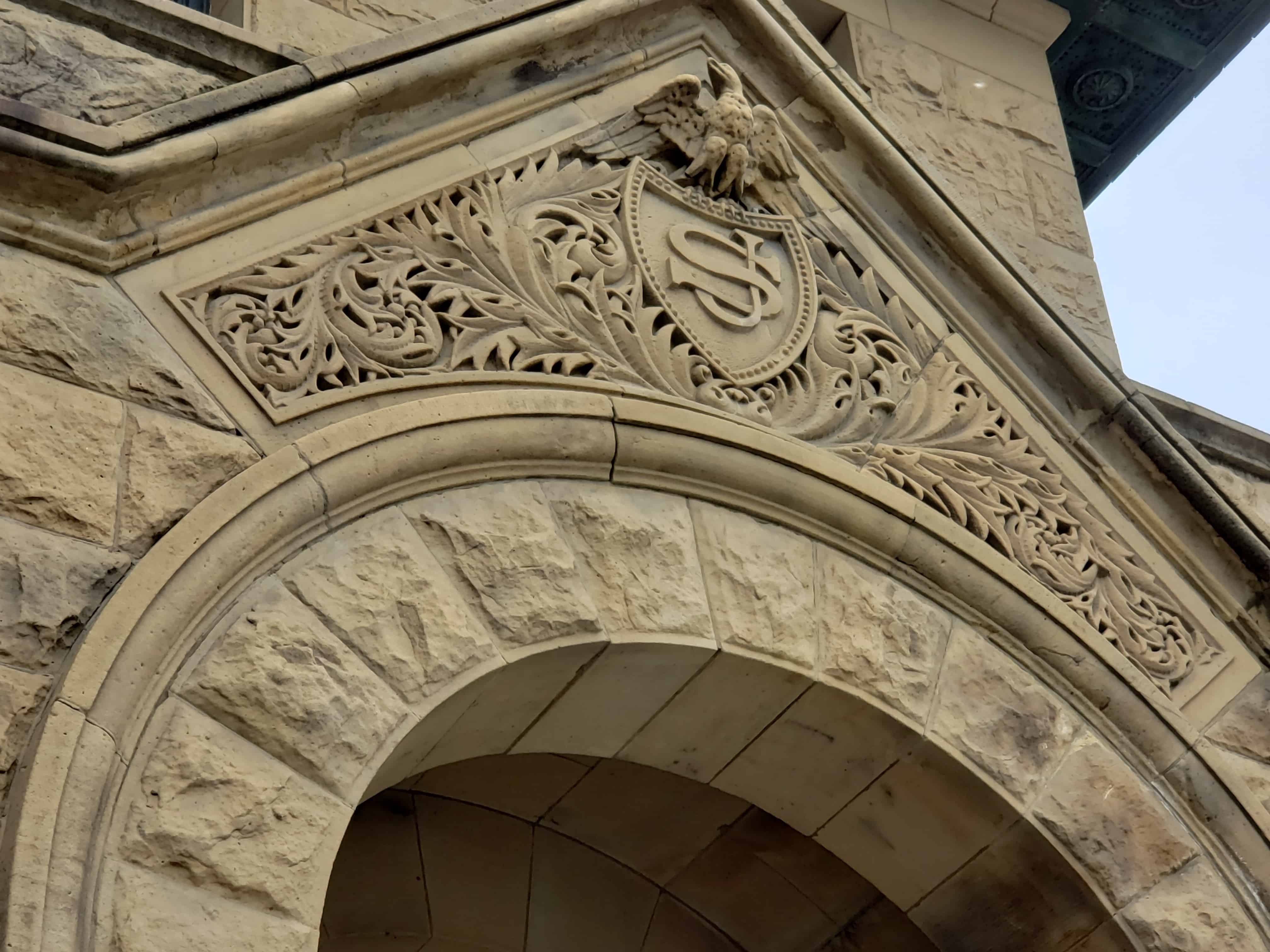
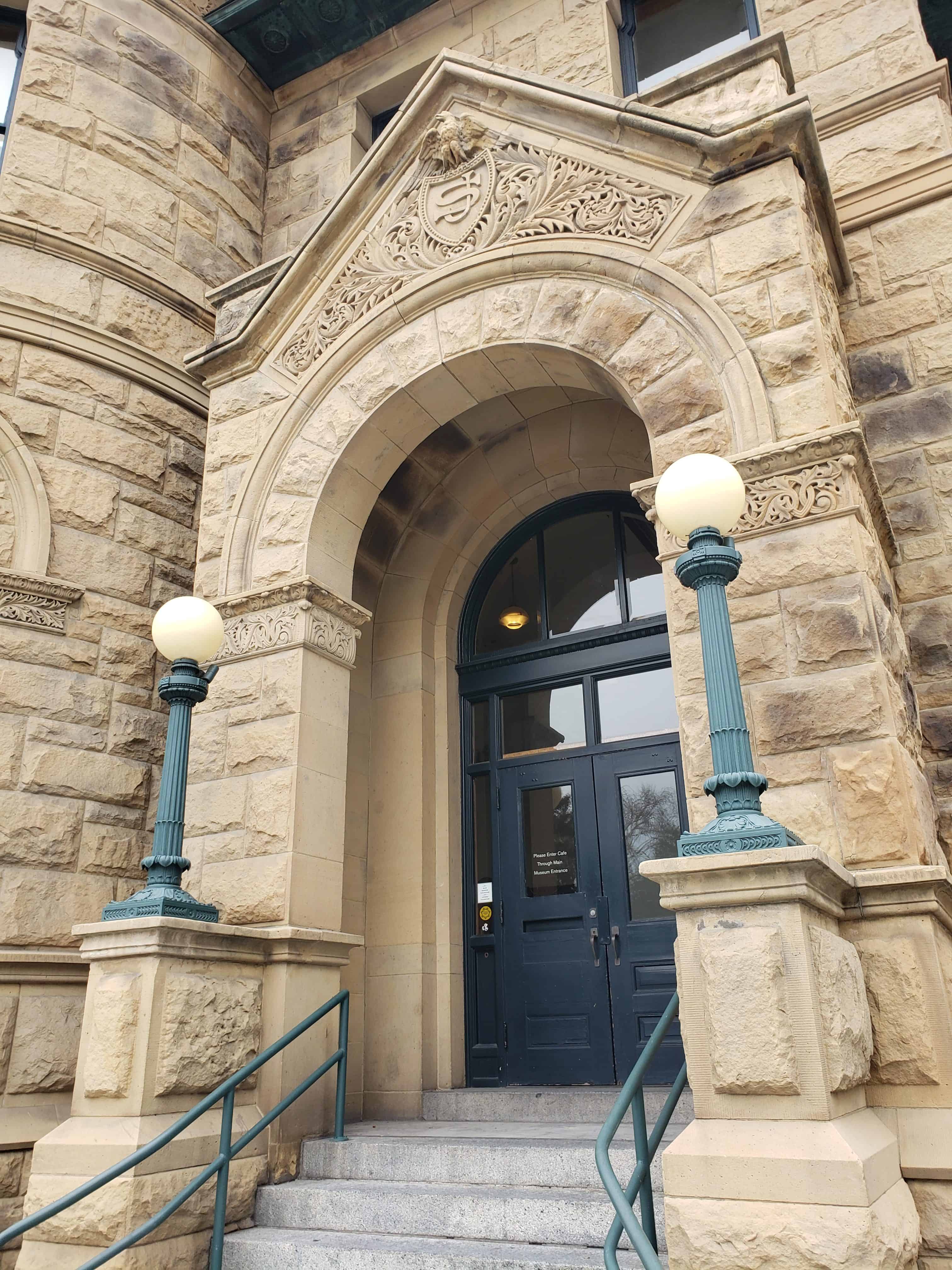
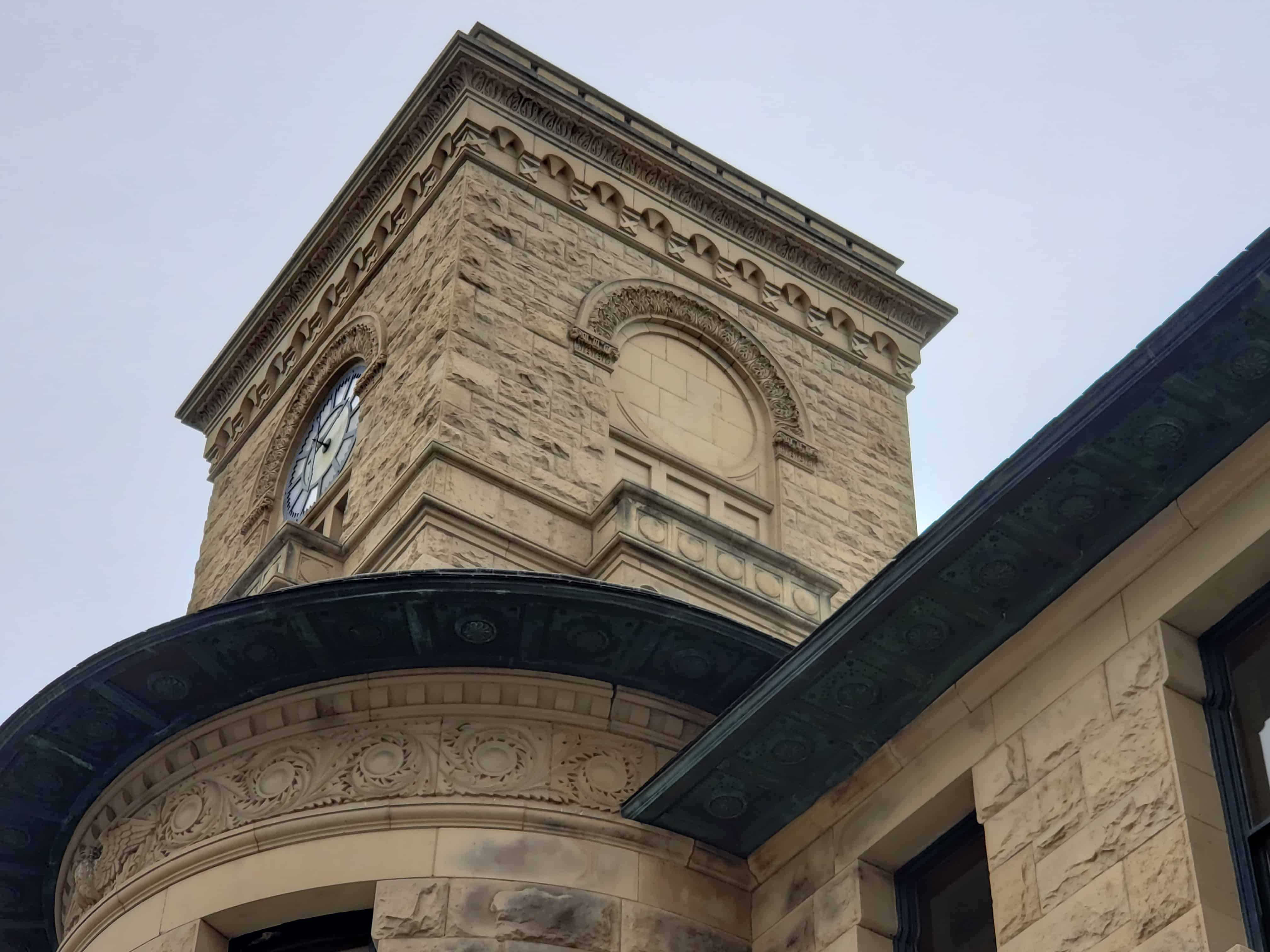
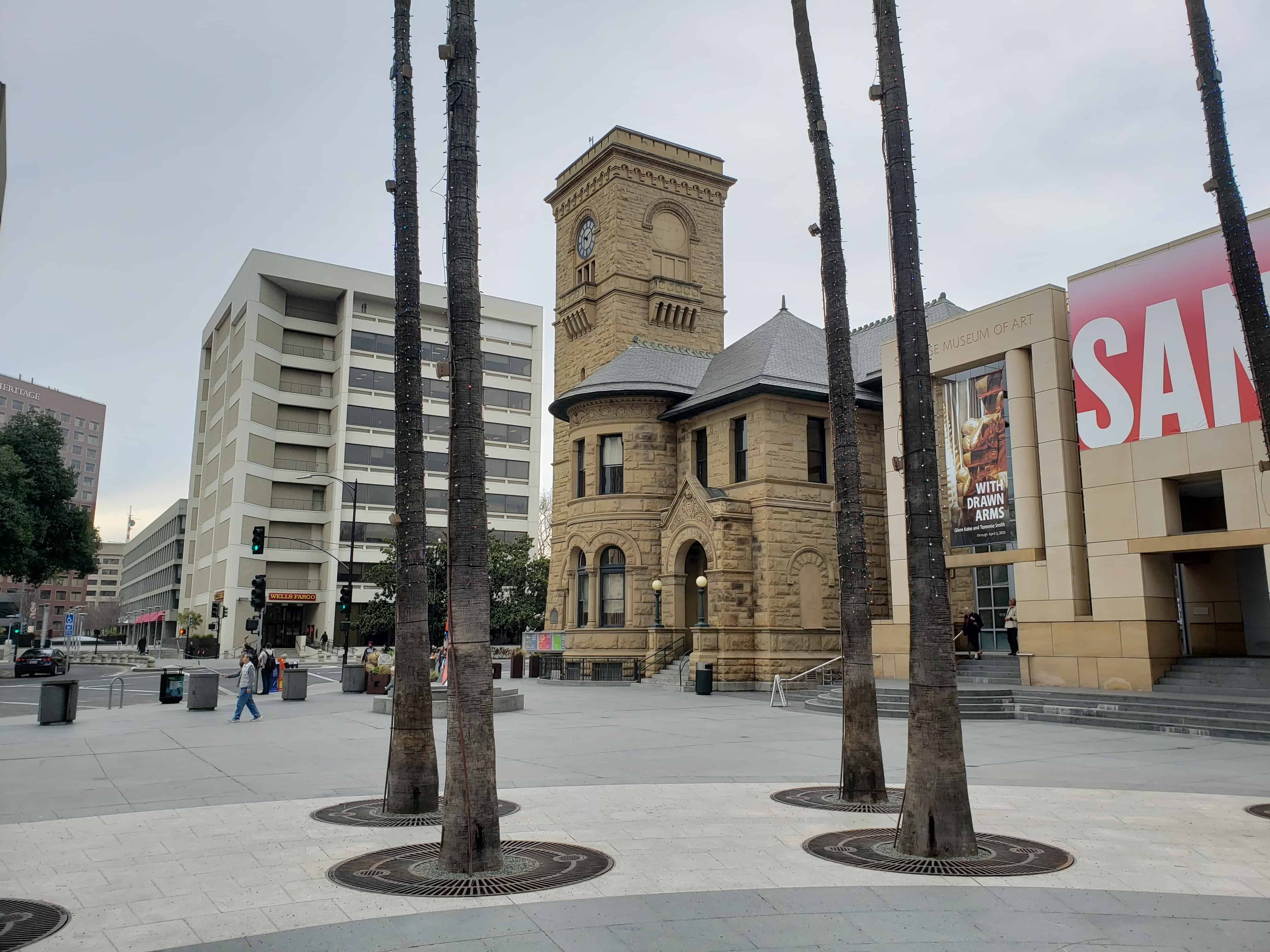
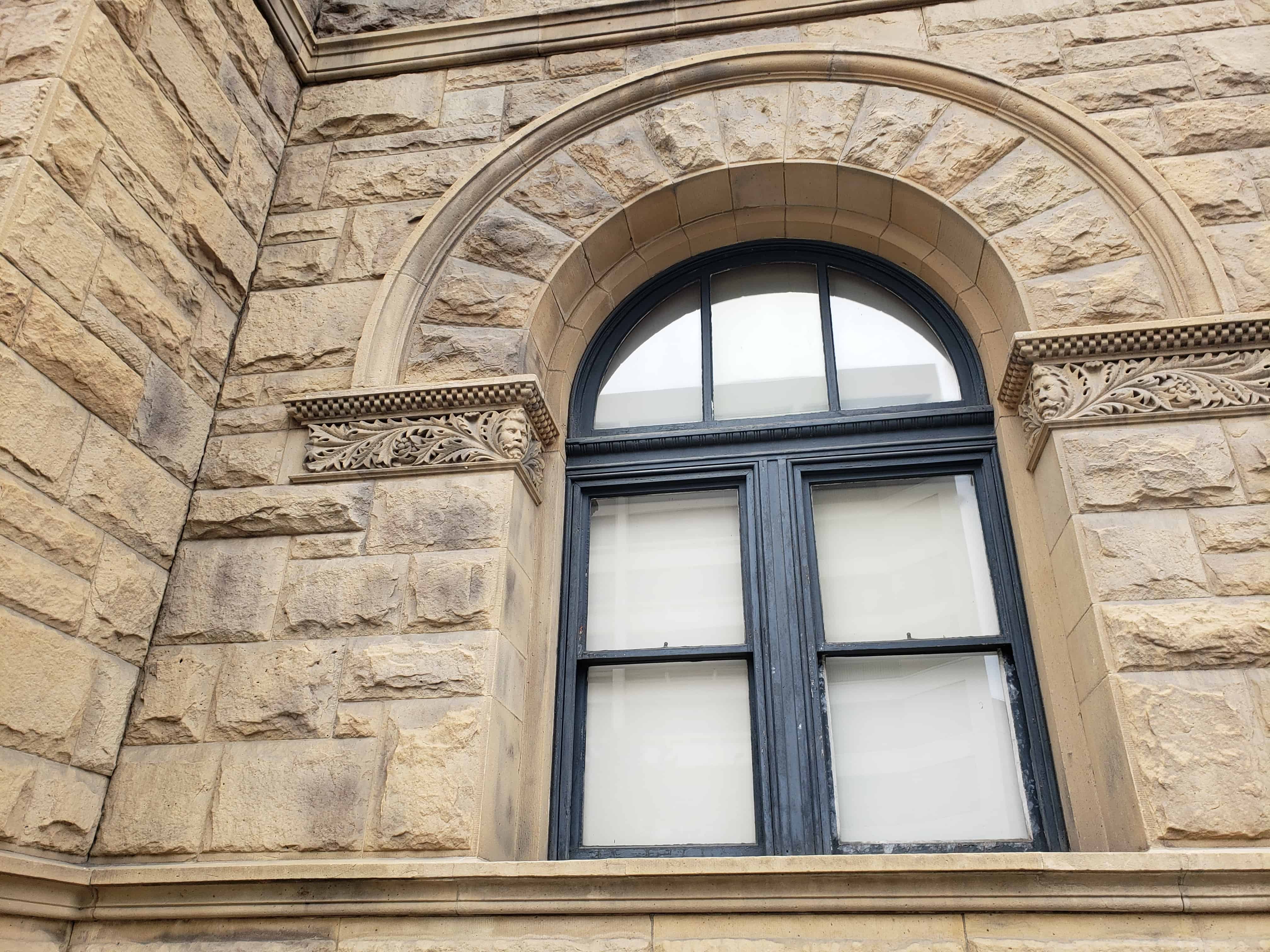
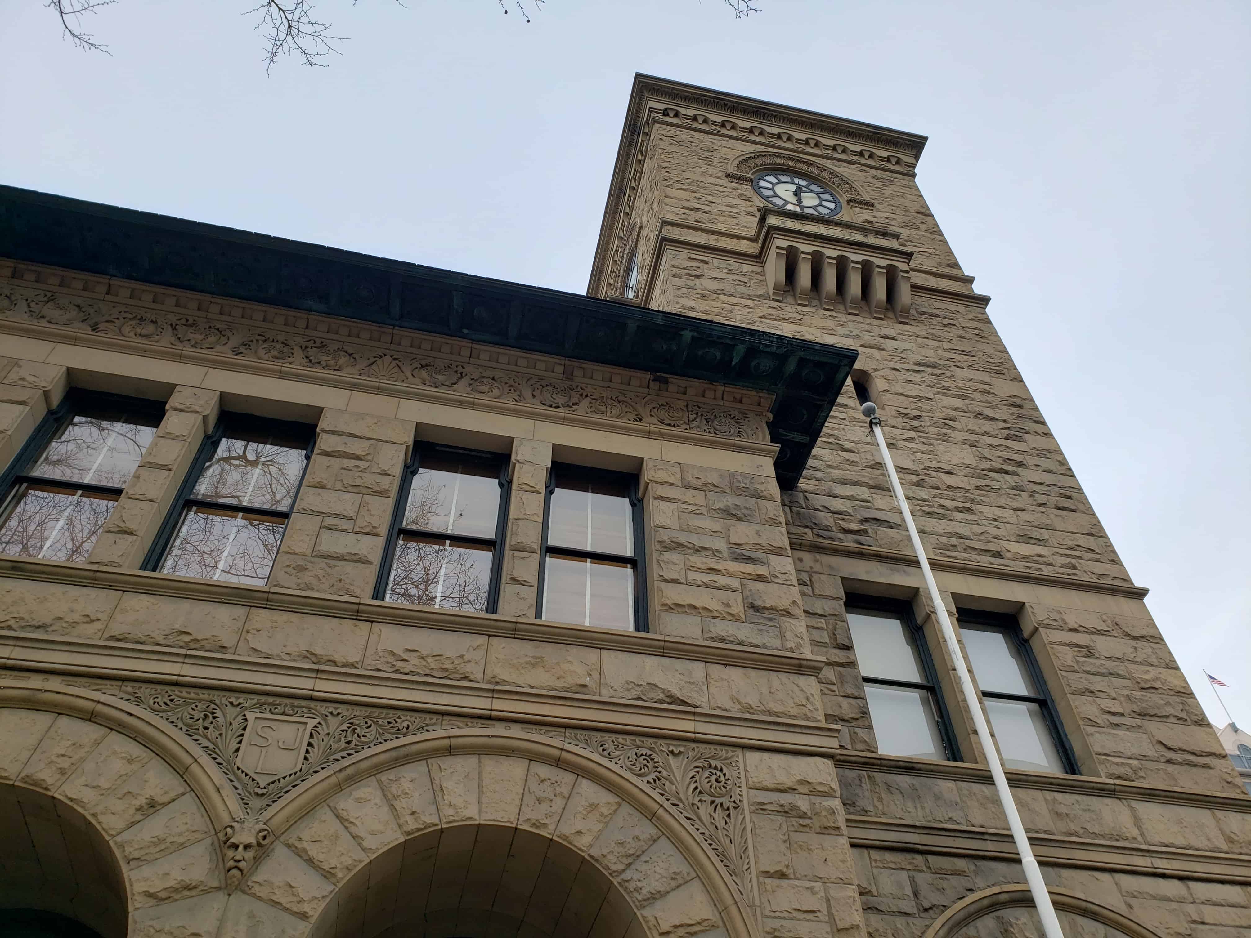
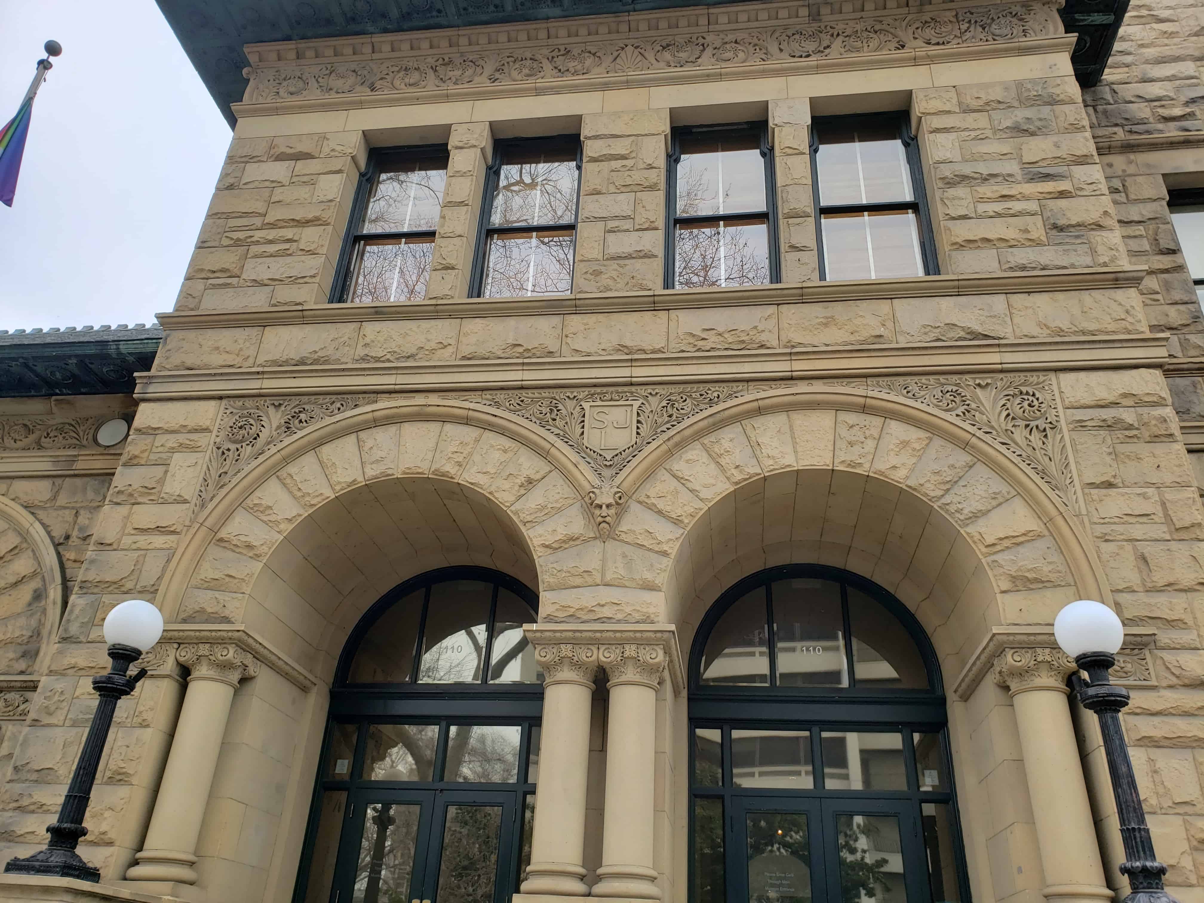
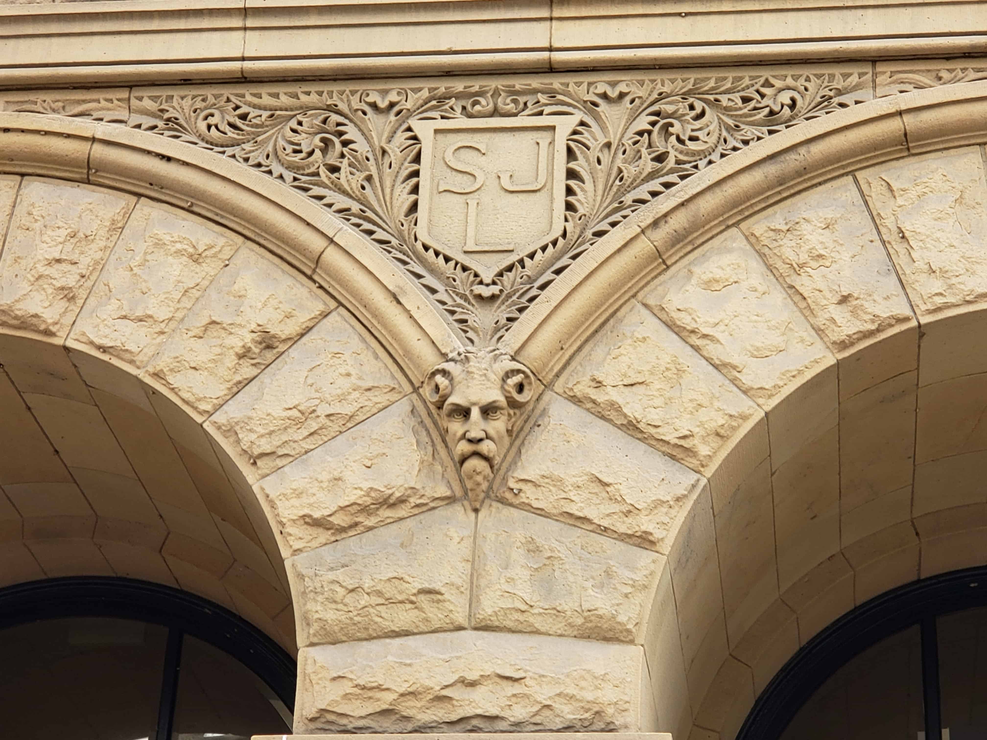
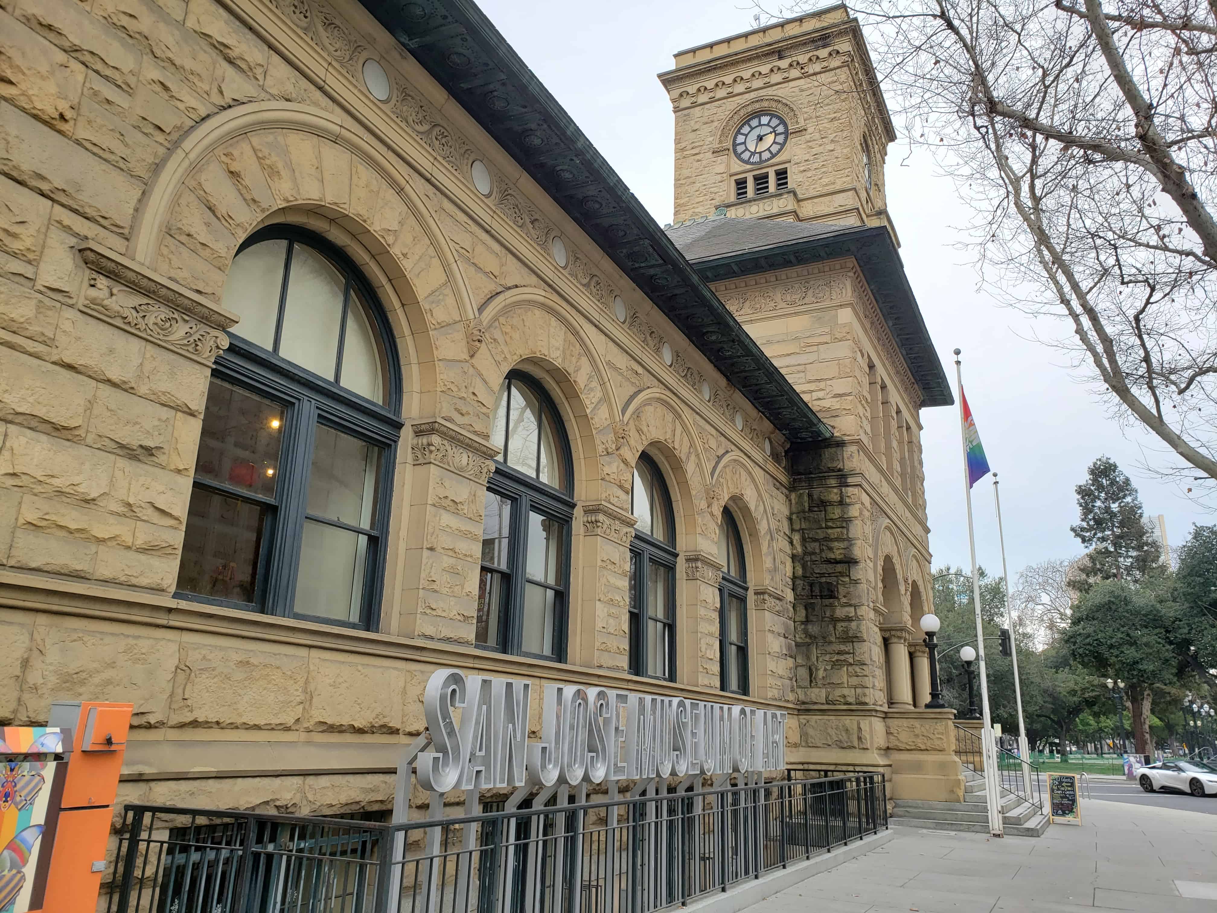
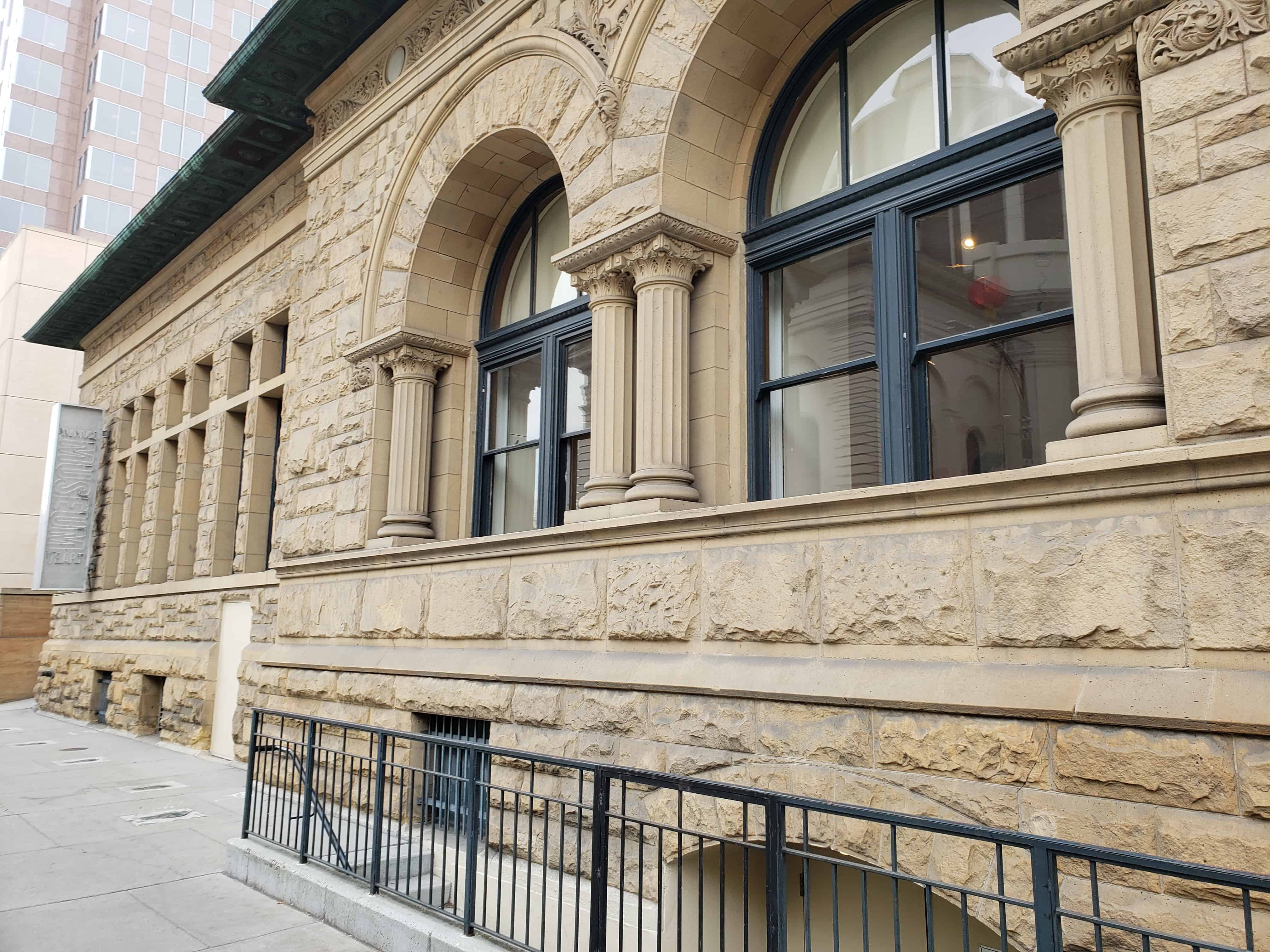
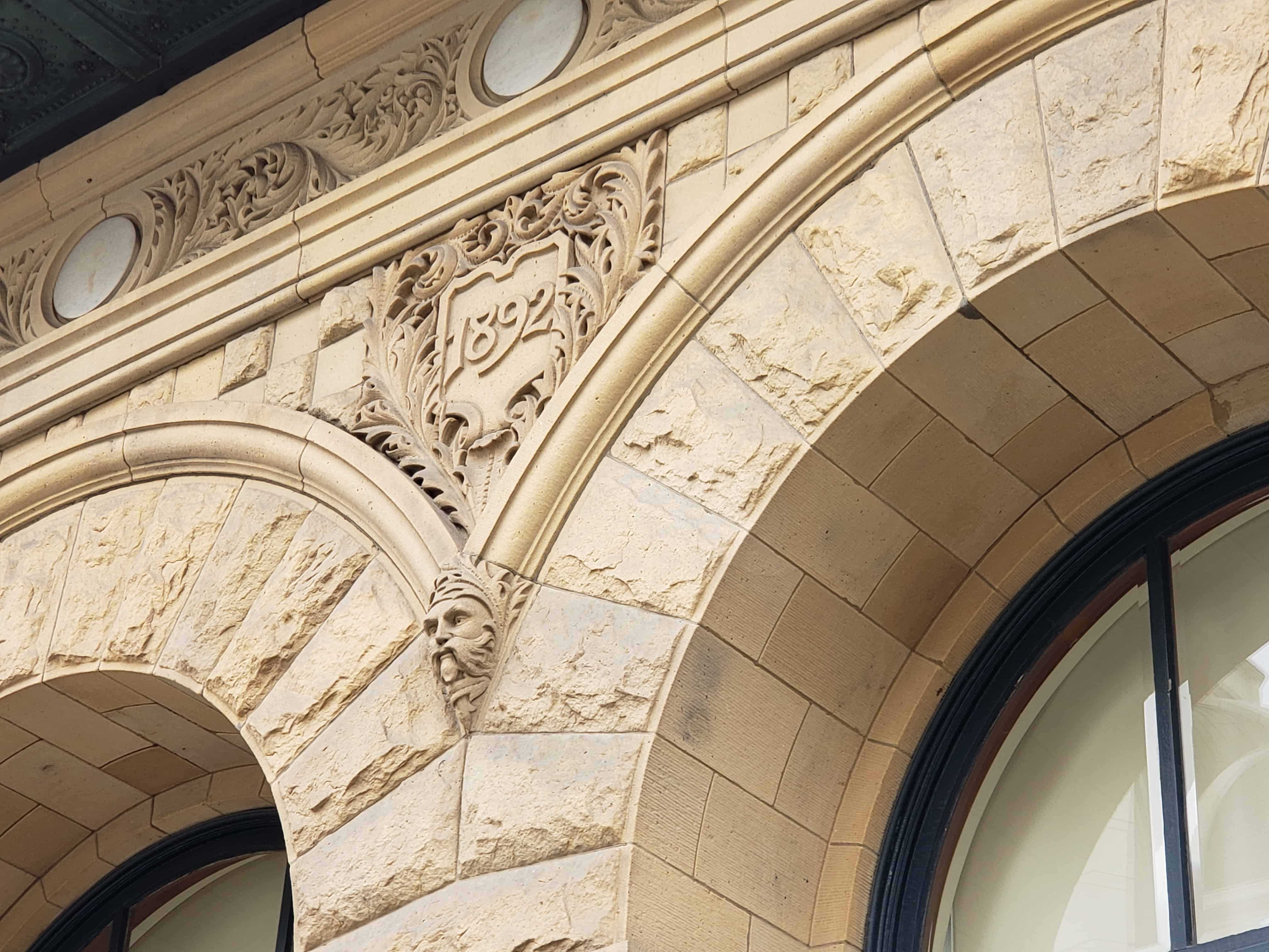
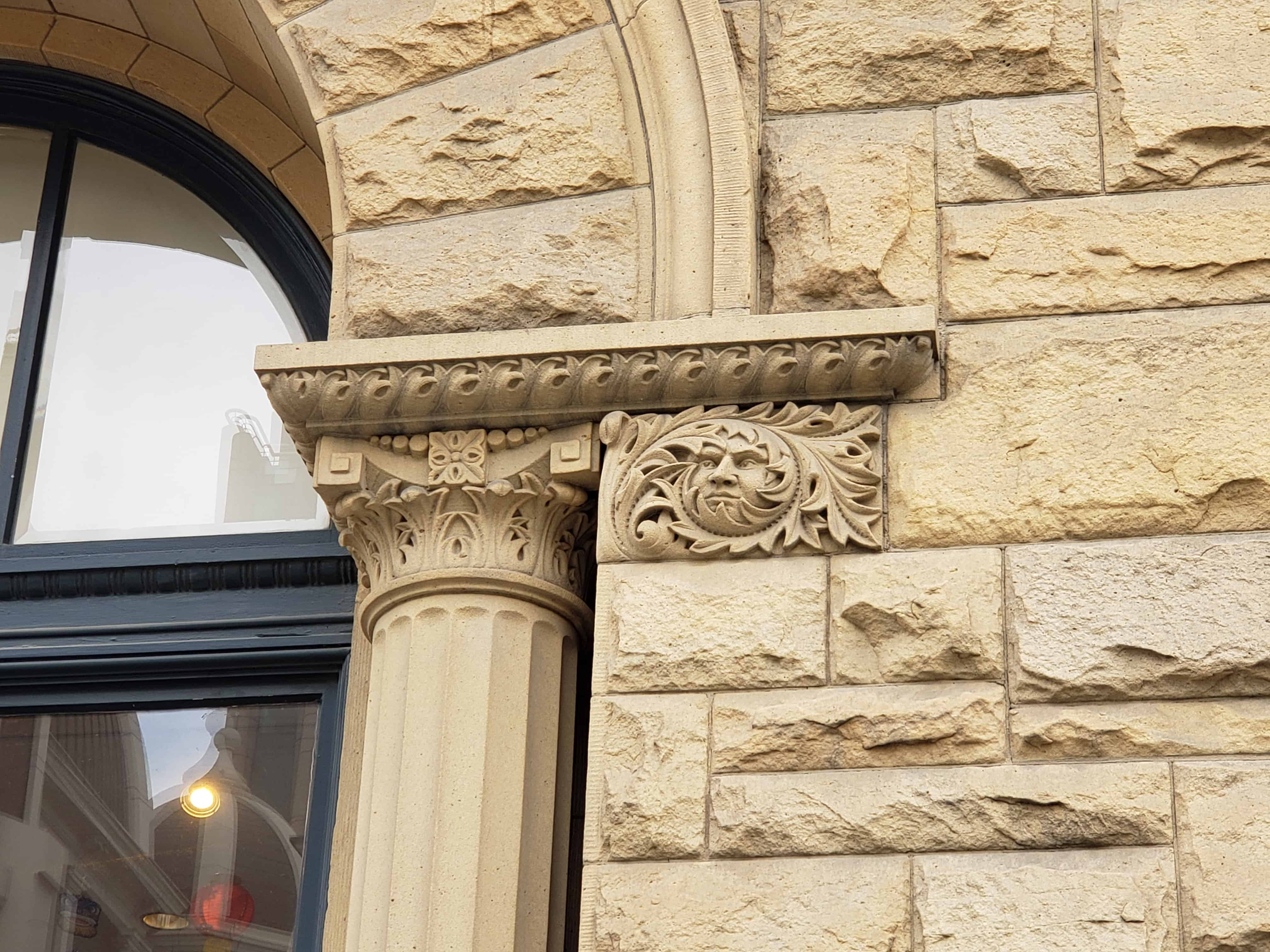
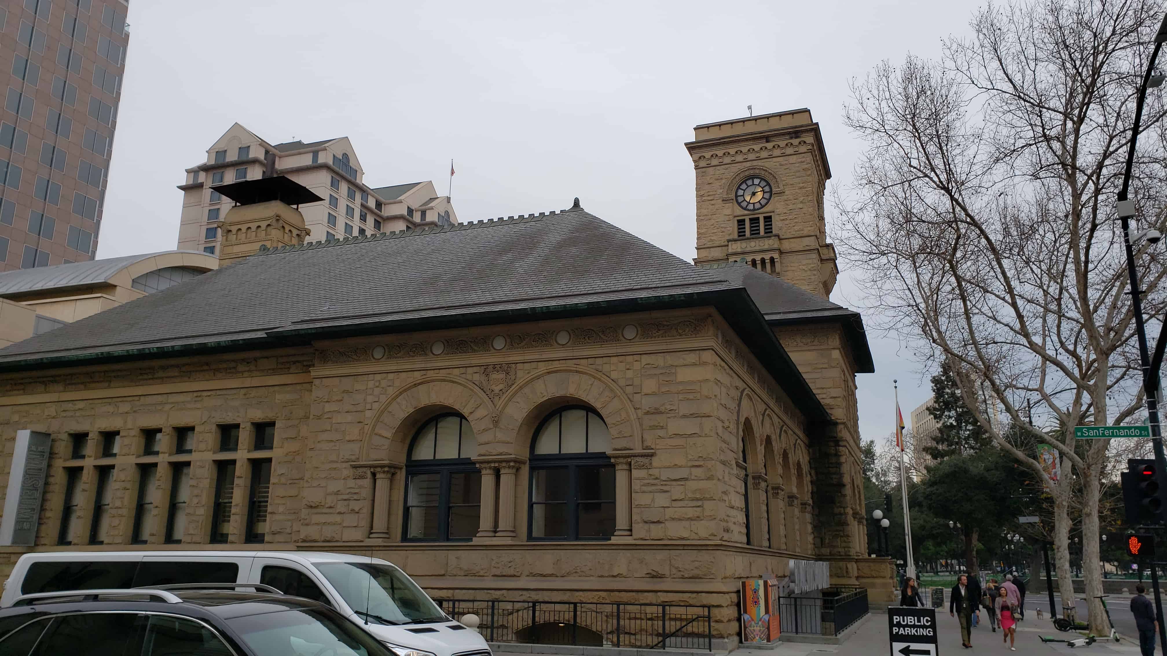
Constructed in 1892, this was the first federal building in San Jose. It served as U.S. Post Office from 1892 to 1933. Designed by Willoughby Edbrooke and constructed of locally quarried sandstone, this Romanesque style structure, built by the United States government, it the last of its kind on the west coast.
California Registered Historical Landmark No. 854
Plaque placed by the State Department of Parks and Recreation in cooperation with the Fine Arts Gallery Association, San Jose Historic Lankmarks Commission, and the San Jose Historical Museum.