• About JacobBarlow.com
  • Cemeteries in Utah
  • D.U.P. Markers
  • Doors
  • Exploring Utah Email List
  • Geocaching
  • Historic Marker Map
  • Links
  • Movie/TV Show Filming Locations
  • Oldest in Utah
  • Other Travels
  • Photos Then and Now
  • S.U.P. Markers
  • U.P.T.L.A. Markers
  • Utah Cities and Places.
  • Utah Homes for Sale
  • Utah Treasure Hunt

JacobBarlow.com

~ Exploring with Jacob Barlow

JacobBarlow.com

Tag Archives: Camp Williams

Jordan Narrows

21 Thursday Dec 2017

Posted by Jacob Barlow in Uncategorized

≈ Leave a comment

Tags

Camp Williams, Historic Markers, Pony Express, SUP, UPTLA, utah, utah county

2017-11-25 10.37.06

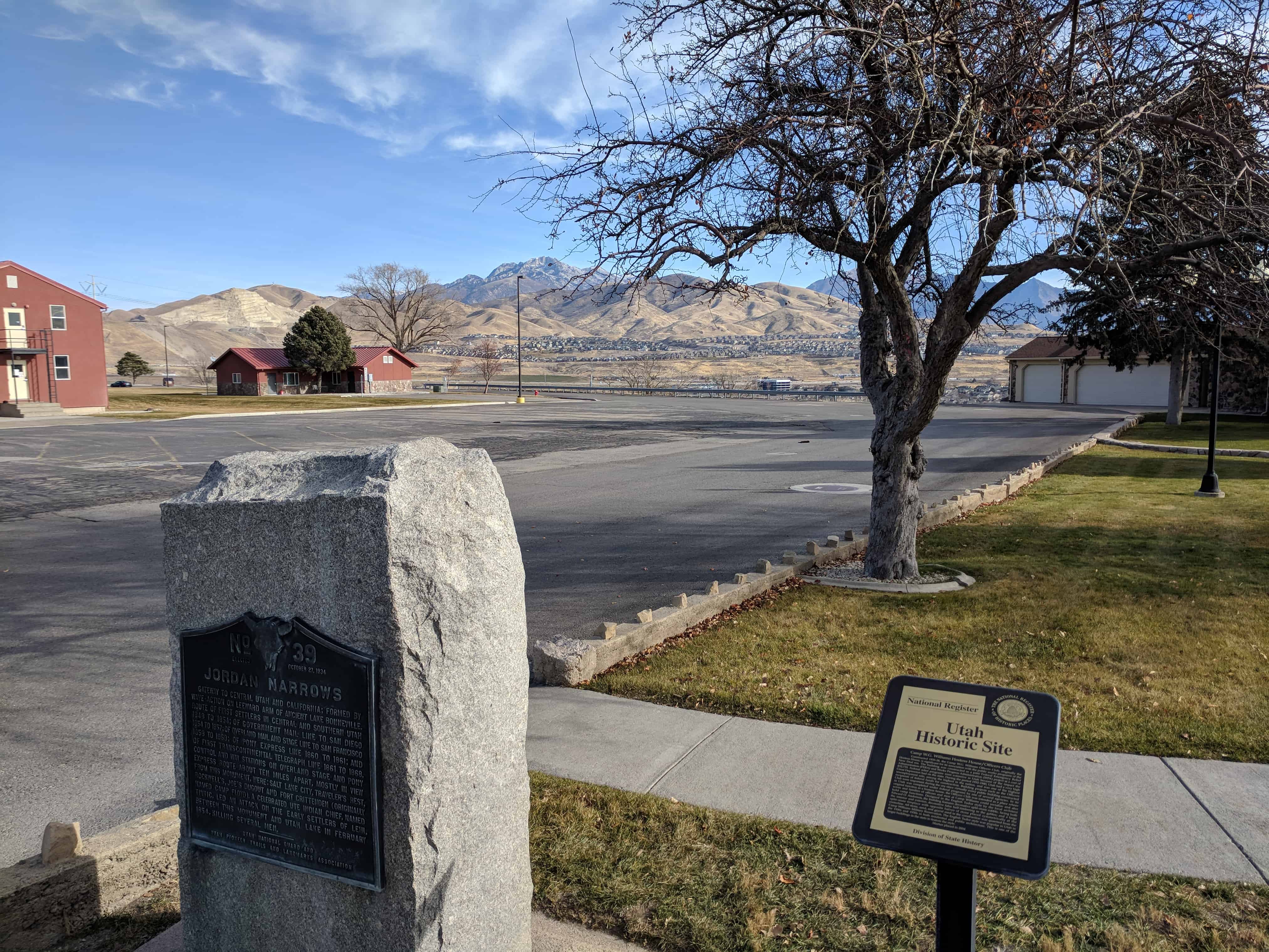
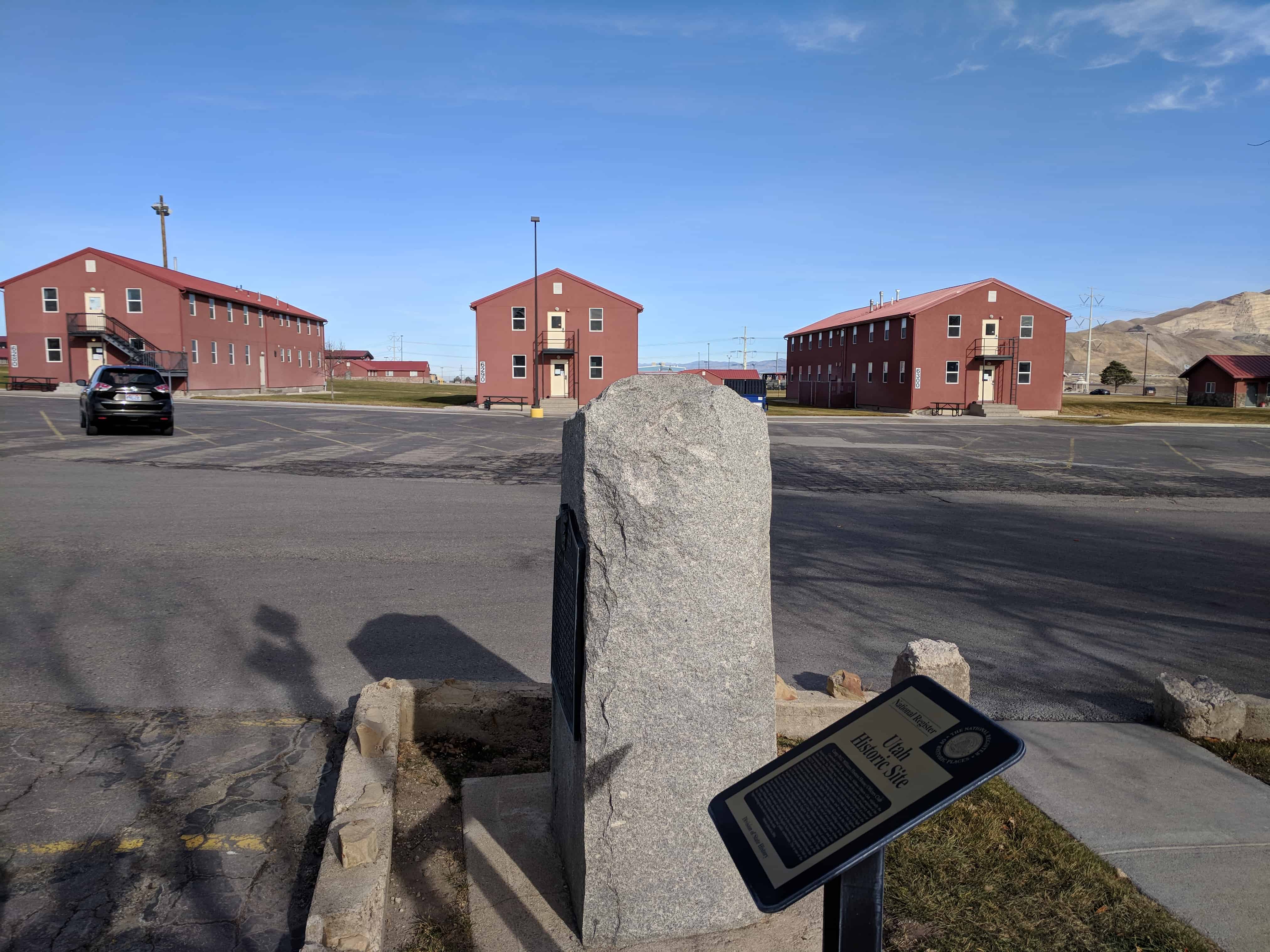
Location: Camp Williams – Utah Ave. and Officers’ Club

UPTLA Marker #39, see others in the series here.
Gateway to central Utah and California; formed by wave-action on leeward arm of ancient Lake Bonneville. Route of first settlers in central and southern Utah 1848 to 1854; of government mail line to San Diego 1854 to 1857; of Overland Mail and Stage Line to San Francisco 1858 to 1868; of Pony Express Line 1860 to 1861; and of first transcontinental telegraph line 1861 to 1868. Control and way stations on overland stage and Pony Express route about ten miles apart, mostly in view from this monument, were: Salt Lake City, Travelers Rest, Rockwell’s, Joes Dugout and Fort Crittenden (originally named Camp Floyd). A celebrated Ute Indian Chief, Named Tintic, led an attack on the early settlers of Lehi, between this monument and Utah Lake in February 1854, killing several men.

2017-11-25 10.37.14

2017-11-25 10.37.45

2017-11-25 10.40.21

2017-11-25 10.40.27

2017-11-25 10.40.35

2017-11-25 10.47.09

2017-11-25 10.48.11

Camp Williams Historic Masonry Ditch

21 Thursday Dec 2017

Posted by Jacob Barlow in Uncategorized

≈ 1 Comment

Tags

Camp Williams, First, Masonry, utah, utah county, WPA

2017-11-25 10.42.11

The Camp W.G. Williams historical masonry ditch is a concrete and rock-lined irrigation ditch system constructed for the Utah National Guard by the Works Progress Administration (WPA) during the Great Depression.  As such, a federal appropriation of $22,155 was utilized, many Utahns were provided with jobs, and the cantonment area was improved.  The project, originally proposed to the WPA in December of 1938, was completed by 1940.  The masonry ditch was designed and constructed to irrigate newly planted trees along the camp avenues as well as enhance camp aesthetics.  The stone was obtained from a local quarry located west of the cantonment area in the military reservation.  The stone and mortar workmanship is characteristic of many WPA projects.   All in all, the masonry ditch is credited as the first federally funded “curb and gutter” project in the United States.  To this day, the preserved portion of the ditch contains architectural landscape significance for its association with the WPA and early Camp W.G. Williams improvement.

2017-11-25 10.41.42

2017-11-25 10.41.53

Camp W.G. Williams

21 Thursday Dec 2017

Posted by Jacob Barlow in Uncategorized

≈ 1 Comment

Tags

Camp Williams, Military, utah, utah county

2017-11-25 10.53.05

Camp W. G. Williams, commonly known as Camp Williams, also known as Army Garrison Camp Williams, is a National Guard training site operated by the Utah National Guard. It is located south of Bluffdale, west of Lehi, and north of Saratoga Springs and Cedar Fort, approximately 25 miles south of Salt Lake City, straddling the border between Salt Lake County and Utah County in the western portion of the Traverse Mountains. Camp Williams is also home to the Non-Commissioned Officer’s Basic Leader Course, which is taught to Active, National Guard, and Reserve components. Camp Williams land comprises about 6 square miles  of flat area and 47 square miles of mountainous region.

Related posts:

  • Camp Williams Historic Masonry Ditch
  • Hostess House / Officers Club
  • Jordan Narrows

Bluffdale, Utah

31 Thursday Oct 2013

Posted by Jacob Barlow in Uncategorized

≈ 1 Comment

Tags

Bluffdale, Camp Williams, Draper, Herriman, Riverton, Salt Lake County, South Jordan, utah

Image

Bluffdale Posts:

  • Bluffdale DUP Marker
  • Bluffdale Parks
  • Early Settlers of Bluffdale
  • Olivers
  • Bluffdale posts sorted by address

Bluffdale, named for its twenty-five square miles of bluffs and dales, extends from Herriman on the west to Riverton on the north, Draper on the east and the Utah County line on the south. Originally it was part of West Jordan, first settled in 1848-1849. On July 29, 1858, Orrin Porter Rockwell paid five-hundred dollars to Evan M. Green for sixteen acres of land near the Crystal Hot Lakes (adjacent to the present Utah State Prison). This land included a hotel with dining facilities, stable, brewery, and pony express station. As the community expanded, the Bluffdale area became part of South Jordan, then Riverton. In 1883 the Bluffdale School Precinct was formed from parts of Herriman, South Jordan and Draper. On August 1, 1886, the Bluffdale Ward of The Church of Jesus Christ of Latter-day Saints was organized with Lewis H. Mousley as Bishop. For a short time the town was called Mousley. There are seven irrigation canals that originate at the Jordan Narrows in the Bluffdale area and serve the Salt Lake Valley. One of the earliest was the Utah and Salt Lake Canal started in 1862. Some of the early buildings included an adobe church, built in 1887-1888, a tithing house, and a three-room schoolhouse constructed in 1893.


Visit my list of places in Utah.


Follow Jacob

Follow Jacob

Blog Stats

  • 2,040,514 hits

Social and Other Links

BarlowLinks.com

Recent Posts

  • Hark Wales & Oscar Smith
  • Threshing Machine
  • Spencer and Helen Isom “Home”
  • Shetlar Wagon
  • Pioneer Hay Barn, Manger, and Corral

Archives


Loading Comments...