Tags
Lake Point Park
26 Wednesday Sep 2018
Posted in Uncategorized

26 Wednesday Sep 2018
Posted in Uncategorized
Tags
12 Friday Dec 2014
Posted in Uncategorized
Tags
Lake Point, Mills, Mills Junction, Milltown, Millvale, Milton, Richville, Tooele, Tooele County
Richville was located between Lake Point and Tooele near the former site of E. T. City. Saw, woolen, and flour mills were built nearby and subsequently names were developed: Mills, Milton, Millvale, and Milltown. For a short period of time Richville was the county seat. After the county seat was moved to Tooele and the mills shut down, the community was abandoned. Today it is Mills Junction.
Related posts:
Click here to see other places in Utah.
28 Friday Nov 2014
Posted in Uncategorized
Tags

The U-138 exit from I-80 leads into a brief corridor of gas stations and convenience stores and continues through present-day Lake Point and Mills Junctions, two adjacent communities whose borders essentially overlap. This corridor was an important meeting place in pioneer times.
Near here, Adobe Rock, a large outcrop at the northwest point of the Oquirrh Mountains, was a favorite pioneer rendezvous spot. Its name came from a small adobe house Captain Howard Stansbury (a U.S. surveyer of the area) had built nearby to house his herders. It was the site of many travelers’ camps and a familiar point of reference. The Donner party camped near Adobe Rock in 1846. On July 27, 1847, apostle Orson Pratt and two other men climbed to the top of the rock to get a view of the Tooele Valley. Later, when Brigham Young came to visit the settlements, this was where he was greeted.
Mormon Pioneers quickly took advantage of mountain streams in the area to power their gristmills. The mills were eventually closed, and by 1889 the town of Mills Junction was abandoned. The Benson mill, constructed in 1854 by the grandfather of Ezra Taft Benson, and LDS apostle and two-term secretary of agriculture under President Eisenhower who later became LDS Church president, has been restored and operates as a museum. The mill is open from April through October.(*)
Related posts:

Click here to see other places in Utah.
06 Wednesday Aug 2014
Posted in Uncategorized
Tags
Erda, historic, Historic Markers, Lake Point, Rush Valley, SUP, Tooele, Tooele County, utah
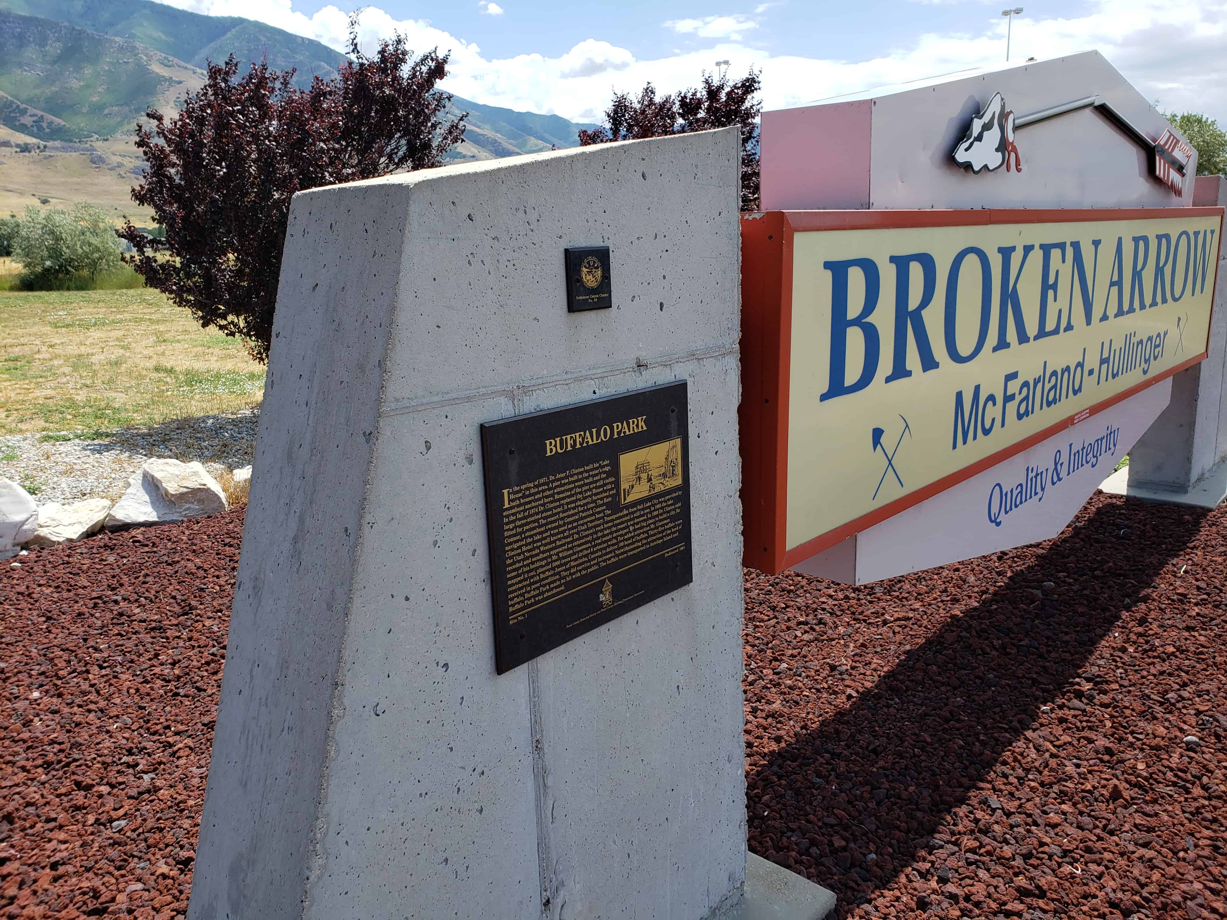
In the Spring of 1871 Dr. Jeter F. Clinton built his “Lake House” in this area. A pier was built to the water’s edge, bath houses and other attractions were built and the steamboat anchored here. Remains of the pier are still visible.

In the fall of 1874 Dr. Clinton replaced the Lake House with a large three-storied stone hotel. It was elegantly furnished and fitted for parties. The resort flourished for a time. The Kate Connor, a steamboat owned by General Patrick Connor, navigated the lake and was used as an excursion boat.

The Clinton Hotel was well known all over Utah Territory. Transportation from Salt Lake City was provided by the Utah Nevada Western Railroad. Dr. Clinton’s rock home renovated is still in use. In 1885 the lake receded and sandbars appeared so extensively in the lake the resort was doomed. In 1889 Dr. Clinton sold some of his holdings to Mr. William Glassman, a real estate developer. He had big plans to build a city. He mapped it out, planted 5,000 trees and drilled 6 artesian wells.
For added attraction Mr. Glassman contracted with Buffalo Jones of Manitoba, Canada to deliver 100 head of buffalo. Thirty-five buffalo were received in poor condition. They did survive and increase. Notwithstanding the attraction of the herd of buffalo, Buffalo Park made no hit with the public, the buffalo were transported to Antelope Island and Buffalo Park was abandoned.
There is a historic marker not far from here that was placed on a boulder taken from the Old Buffalo Ranch.
See other historic markers in the series on this page for SUP Markers.


26 Thursday Jun 2014
Posted in Uncategorized
Tags
Erda, Lake Point, Stansbury Park, Tooele, Tooele County, utah
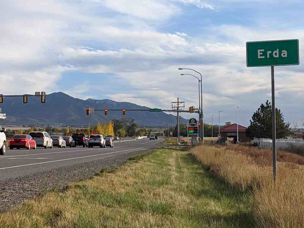
Erda is in Tooele County, Utah located just south of Stansbury Park and just north of the county seat of Tooele. The population was 4,642 at the 2010 census, a significant increase from the 2000 figure of 2,473.
Marilyn Shields, a member of the Daughters of Utah Pioneers who works at the nearby Benson Grist Mill, said there are two stories about how Erda, settled in 1851 and originally called Batesville and Rose Springs, earned its official name.
In one version, Shields says, a wheat and alfalfa farmer named Pierre Apollinaire DeRoubaix, who moved to the area in 1870, called it Erda after a town in France where he once lived. Even though there is no city or town in France named Erda, there is a small village named Erdeven which could have been Pierre Droubay’s home town.
“The other more well-known story is that the San Pedro-Salt Lake Railroad that ran along the Oquirrh Mountains named the town Erda after a German word that means earth,” says Shields.
So which story is correct?(*)
Related Posts:


06 Wednesday Nov 2013
Posted in Uncategorized
Tags
DUP, Garfield, Historic Markers, Lake Point, Railroad, Resorts, Salt Lake County, Tooele County, utah
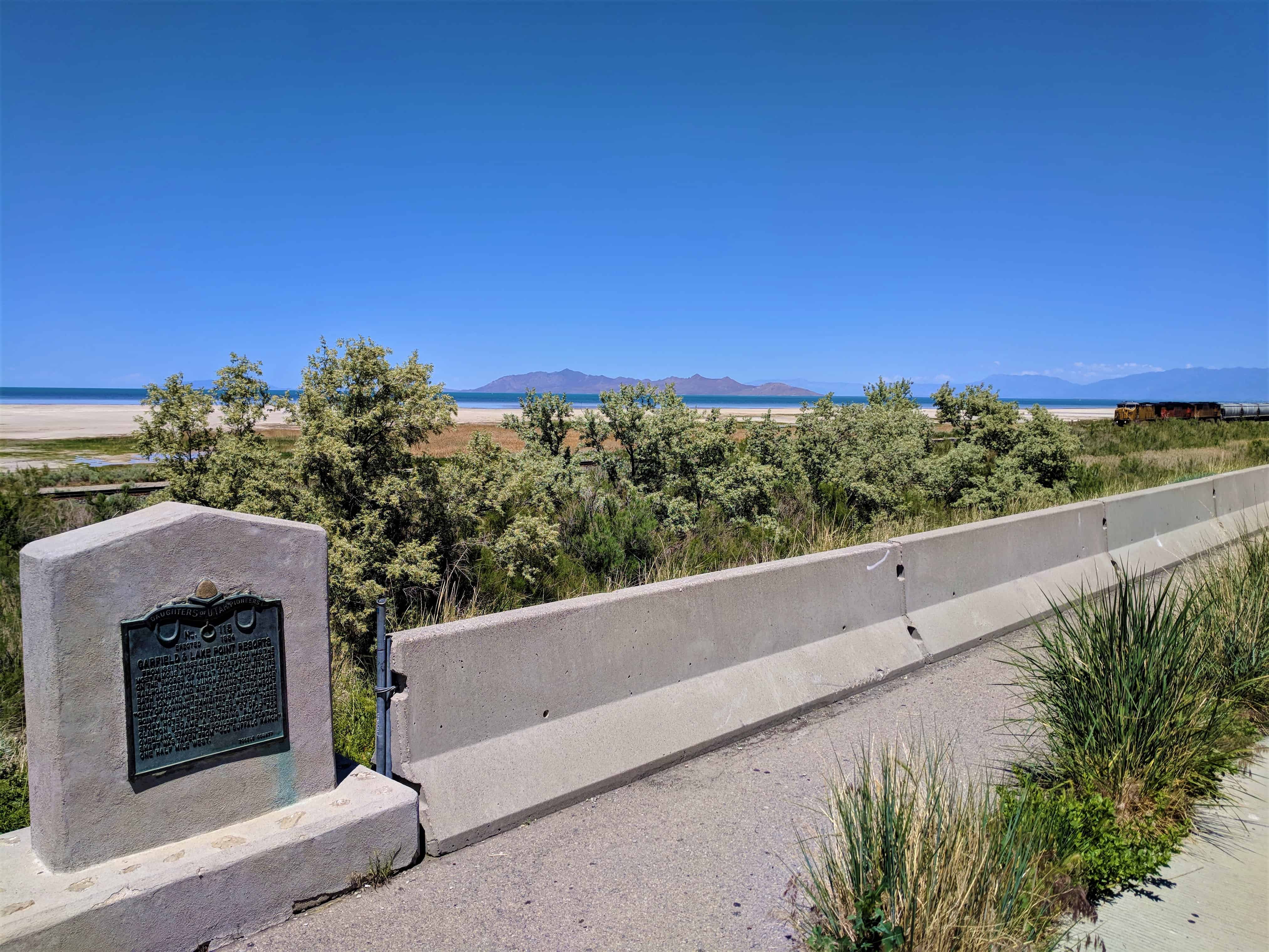
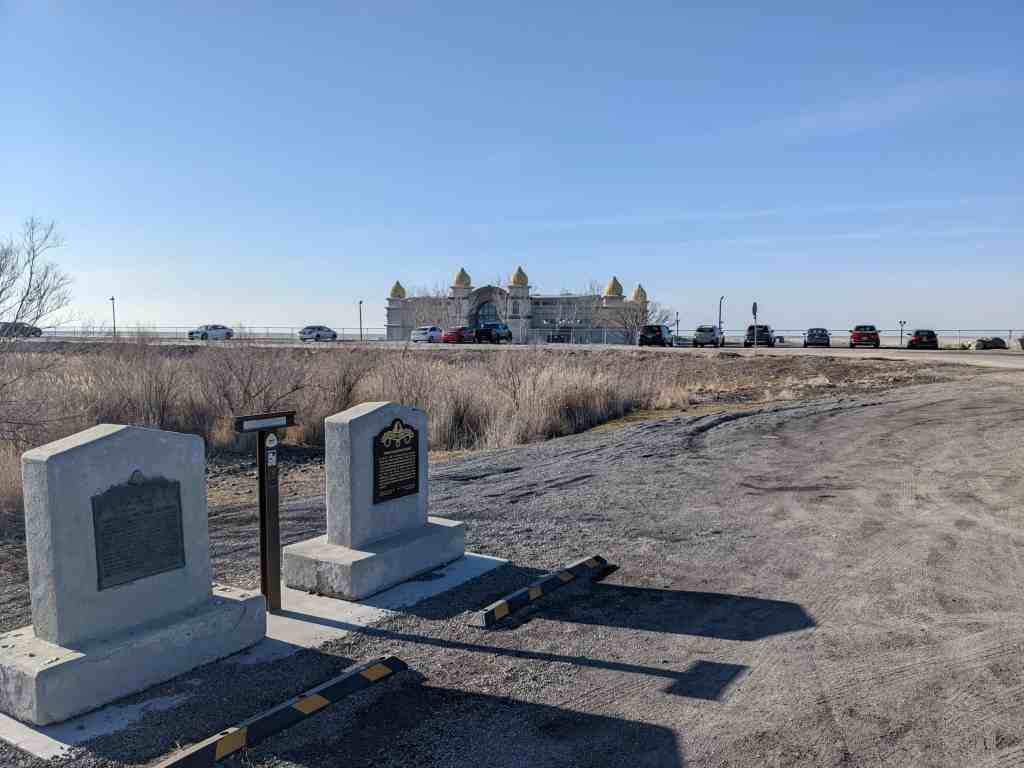
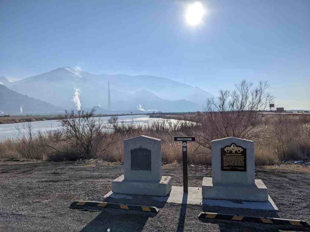
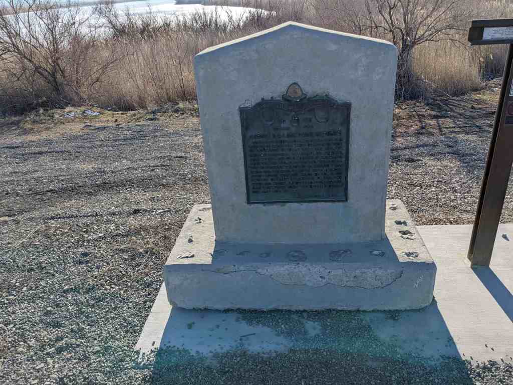
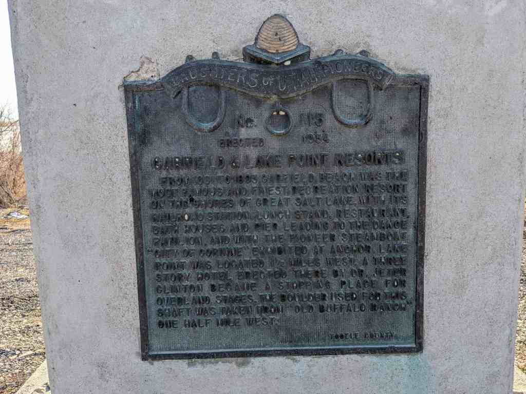
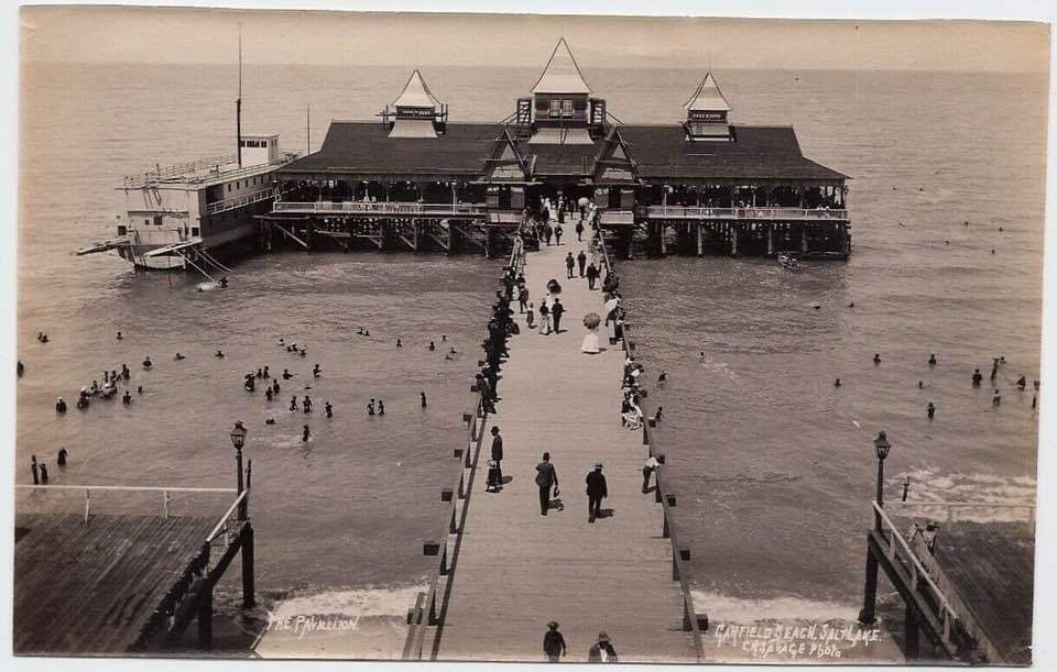
Garfield & Lake Point Resorts
From 1881 to 1893 Garfield Beach was the most famous and finest recreation resort on the shores of the Great Salt Lake, with it’s railroad station, lunch stand, restaurant, bath houses, and pier leading to the dance pavilion, and with the pioneer steamboat “City of Corinne” exhibited at anchor. Lake Point was located 1 ½ miles West. A three story hotel erected there by Dr. Jeter Clinton became a stopping place for overland stages. The boulder used for this shaft was taken from “Old Buffalo Ranch” one half mile West.
D.U.P. Marker #115 (Other markers listed here) Also located at this Interstate 80 pull-off are D.U.P. Marker #118 and Jedediah Smith’s Trail – Great Salt Lake.


The freeway pullout this was located at (N 40.71546 W 112.24008) was closed and this historic marker along with the other two also located there were moved to a new located just outside the Saltair, (N 40.74664 W 112.18543).