A part of the Great Salt Lake Desert, the Bonneville Salt Flats were formed by precipitated salt from Lake Bonneville, an ice-age lake which covered some 20,000 square miles of which the Great Salt Lake is the last remnant.
The text on this page is from the nomination form for the National Register of historic places, the race track was added to the register on December 18, 1975 (#75001826)
The raceway is just north of Interstate 1-80 and three miles ease of Wendover, Utah.
The racing area is approximately 13 miles and consists of hard salt sufficiently thick to support the heavy racing machines.
During most of the year the. racing area is either under water or too moist for racing. However, the dry Utah summer evaporates the moisture and by August and September the flats are ideal for racing. During this time a tent city of several thousand people springs up adjacent to the race area.
In 1939, Ab Jenkins enthusiastically described the quality of the Salt Flats in this manner:
“The salt beds are better than any of the existing board, brick , or cement tracks of the world because none of these is large enough. I made my first 24-hour run on the board track at Atlantic City, New Jersey in 1928, and know that on such a 1 1/2 mile circular course you can’t exceed 145 MPH because the centrifugal force would send the car over the bank unless the track were on a 90 degree grade. Another factor too, is that the pressure of the car may crash it through the timbers. Also, board tracks are seldom over 40 feet wide, which doesn’t give the driver much room to spin should he have trouble.
All of these handicaps are overcome on the salt, where there is plenty of room. The actual racing area on the flats measures about 10 by 15 miles. There would be an even larger area if it weren’.t for the dikes caused by the digging for potash on the beds during the War. [World War I]
Why are the slat beds better, then, than Daytona beach, Florida, where world racing marks were met until a few years ago? Daytona beach has a longer straightaway. It is 25 miles long. But Daytona Beach is only 100 to 200 feet wide. That doesn’t give much room to spin.
Yet, even though Daytona Beach were wider, it wouldn’t offer the safety of the salt. If your tire blows out, the rim of the wheel digs into the comparatively soft sand, and that means your car will likely go into a somersault…Never has a speed car overturned on the salt flats.
Then, too, the concrete-like salt has a cooling effect on tires which is found on no other track. However, because the salt is always a little moist, it does not furnish quite as much traction as does a dry dirt, board, or concrete track.”
There is presently concern that the nearby potash operations by the Kaiser Chemical Company are causing a deterioration of the salt flats as a raceway. Two conflicting conclusions were drawn from a study done in 1967. The Division of State Parks and Recreation is planning another geologic survey to investigate ways of preventing further deterioration.
William D. Rishel is credited with being the man who discovered the Salt Flats as an ideal speedway. In 1896, George Randolph Hearst had just started his New York Journal and felt it would be an exciting publicity stunt to send a message by bicycle from his San Francisco Examiner to his New York Journal. Rishel, then living in” Cheyenne, Wyoming, was hired by Hearst to blaze a bicycle trail from Cheyenne to Truckee, California. Accompanied by his friend C. A. Emise, Bill Rishel crossed the Salt Flats in twenty-two hours. However, their experience nearly rivaled that of the ill-fated Donner-Reed Party of 1846. In many places their bikes broke through the thin salt crust and they were forced to carry their mud-clogged bikes many miles. In addition, they ran out of drinking water and had to contend with sticky marshes and sweeping clouds of mosquitoes.
Rishel returned to the Salt Flats again in 1907. By this time he had envisioned the possibility of a highway across the flats and the opportunity for some racing. Rishel and two Salt Lake City businessmen, Frank Botterill and Wallace Bransford, started out for the Salt Flats in a four-cylinder Fierce-Arrow. As they neared the salt beds, they saw what they thought was a lake of water covering the flats. Discouraged, they returned to Salt Lake City. A short time later Rishel learned from some of the old timers that they had been fooled by a mirage.
Finally Rishel and his friend, Ferg Johnson, succeeded in driving Johnson’s Packard onto the Salt Flats via the railway ties. After driving on the smooth, flat salt beds, Rishel became fully convinced that they would make the world’s best speedway.
The following year, 1912, Rishel took A.L. Westgard, National Pathfinder for the National Trails Association, onto the salt flats and convinced the national automobile figure of the area’s potential for racing.
Westgard did not fulfill his role as a propagandist for the salt flats and it was up to local enthusiasts to seek other ways of publicizing the salt flats as a speedway.
In 1914, Ernie Morass, who had been barnstorming the country with a fleet of several racing cars, arrived in Utah. His fastest car, the Blitzen Benz s driven by Teddy Tezlaff, had set a worlds land speed record for the mile with a 140.87 MPH run at Daytona beach on April 23, 1913.
W.D. Rishel and other Salt Lake City businessmen arranged for an exhibition of the racing cars. They were able to secure the railroads help hauling the cars to the flats after one hundred railway tickets were sold. According to the stop watches of the timekeepers, lezlaff pushed the Dlitzen-Benz passed its earlier world record speed to 141.73 MPH. To the dismay of local promoters, both the American Automobile Association and the Automobile Club of America refused to acknowledge the new record.
In 1925, to commemorate the completion of 40 miles of highway constructed across the salt desert between Knolls and Handover, the Salt Lake City Rotary Club planned a special celebration. One of the events was a race between Ab Jenkins, a local racing enthusiast driving a Studebaker, and the special excursion train traveling from Salt Lake City to Wendover for the official ceremony, Jenkins won the race and in so doing became a stalwart convert to the possibilities of the Salt Flats for a speedway.
Ab Jenkins went on to set several records including the crosscountry record from New York to San Francisco, 76 hours in 1927; and the world’s stock car record of 82.5 MPH average on a board track at Atlantic City, .’Jew Jersey in 1928.
y in 1928. In 1932, Ab returned to Utah to prepare for an attempt at setting the world’s 24 hour record on the Salt Flats. Enlisting the help of the Utah State Road Commission to survey the course and some of his Utah friends, including W. D. Rishel of the Utah State Automobile Club and Gus P. Backman of the Chamber of Commerce, Jenkins set out to break the world’s record.
The course was marked off with four foot stakes placed every 100 feet and was lighted by 20 small oil flares. In describing the race Jenkins recorded:
…I remained at the wheel the full 24 hours without a relief driver. Though I stopped about 12 times to refill the gas tank, not once did I leave the seat of the car. The machine wasn’t equipped with plumbing either!
After I had driven a few hours, I was stone deaf. This, however, did not bother me so much as did other factors. The weather was ideal throughout the run, but the mirages on the salt drove me almost crazy. At night there was a bright moon. Shadows were cast over the sparkling salt. Sometimes they took the form of huge walls. I thought I was steering right into them. I could almost hear the sound of the crash.
On other occasions, the railway tracks on the beds some miles away would teasingly come off and on the course. Every once in a while the locomotive would seem to run across it, directly over my path. There was an airline beacon on a hill about ten miles from the course which seemed to change position every time I rounded the track.
Yes, the beds were like one big haunted house.
The Fierce-Arrow driven by Jenkins traveled 2,710 miles during the 24 hour period; however, the 112.92 MPH average was not officially recognized because it was not clocked by the American Automobile Association.
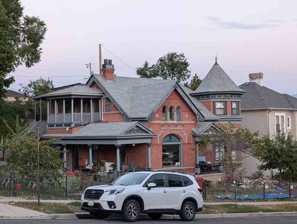
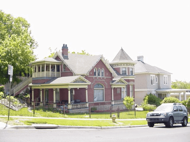
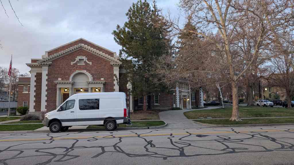
This one-and-one-half-story home is a good example of the Victorian eclectic style popular in Utah between 1885-1910 and characterized by the irregular plan, complex roof structure, and ornate moldings. The house was built in 1890 for Christian A.F. and Jartina Orlob at a cost of $4,000. Christian lived here until his death in the late 1920s and Jartina owned the house until the mid 1940s. Other members of the Orlob family lived at 133 I Street and 825 2nd Avenue.
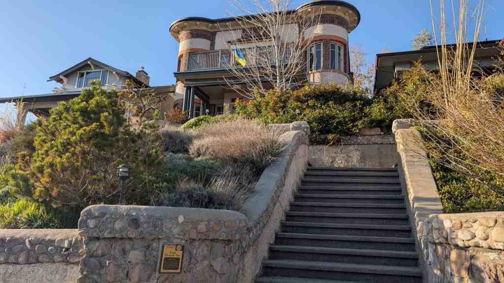
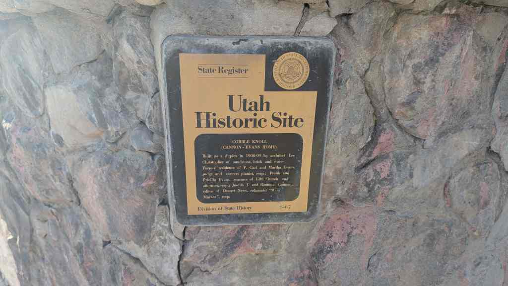
Built as a duplex in 1908-09 by architect Lee Christopher of sandstone, brick and stucco. Former residence of P. Carl and Martha Evans, judge and concert pianist, resp.; Frank and Pricilla Evans, treasures of LDS Church and attornies, resp.; Joseph J. and Ramona Cannon, editor of Deseret News, columnist “Mary Marker”, resp.
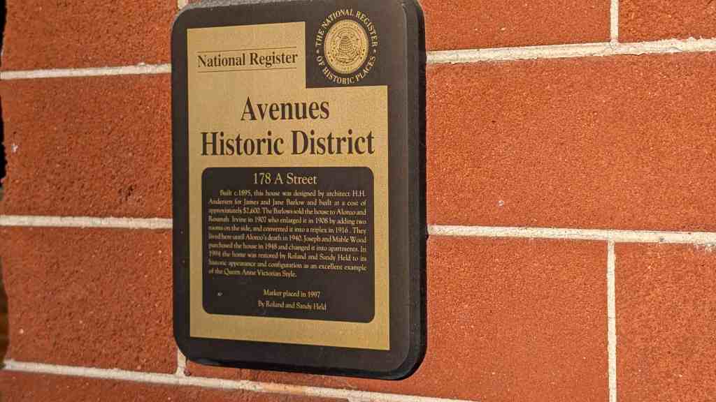
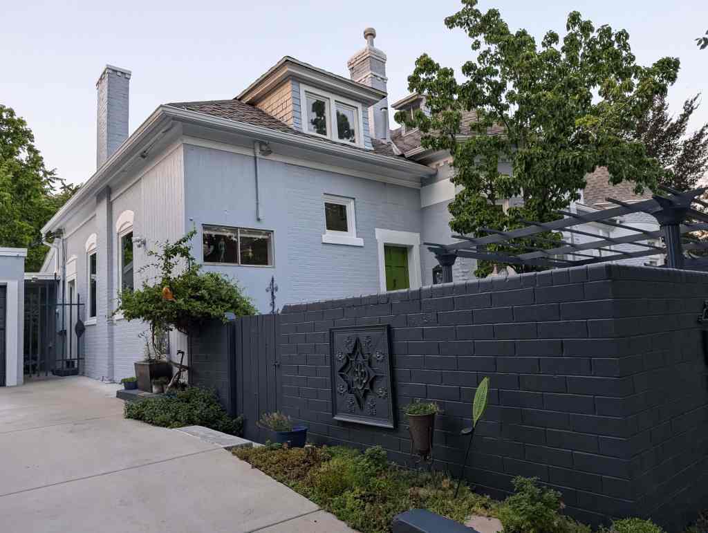
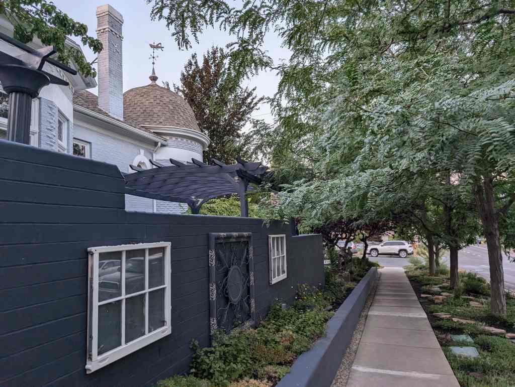
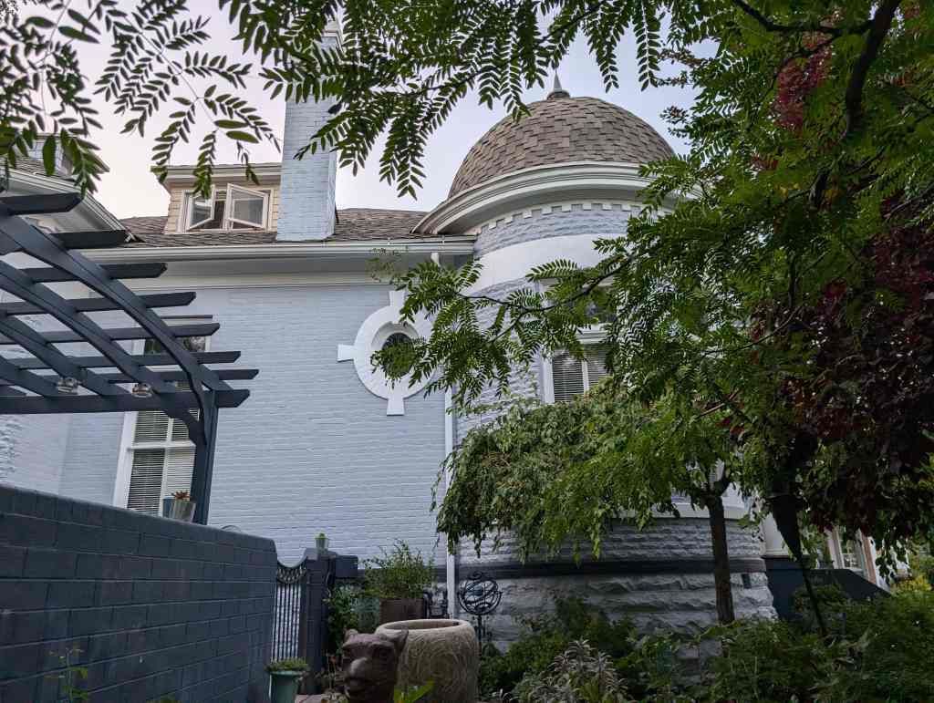
Built c.1895, this house was designed by architect H.H. Andersen for James and Jane Barlow and built at a cost of approximately $2,600. The Barlows sold the house to Alonzo and Rosanah Irvine in 1907 who enlarged it in 1908 by adding two rooms on the side, and converted it into a triplex in 1916. They lived here until Alonzo’s death in 1940. Joseph and Mable Wood purchased the house in 1948 and changed it into apartments. In 1994 the home was restored by Roland and Sandy Held to its historic appearance and configuration as an excellent example of the Queen Anne Victorian Style.
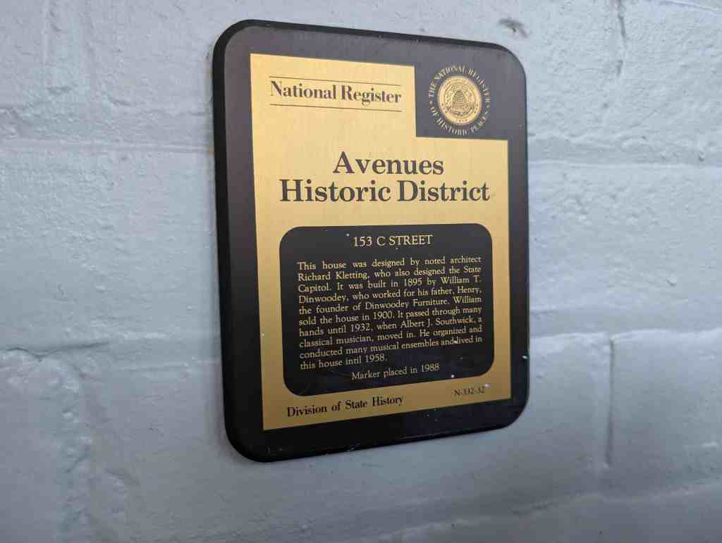
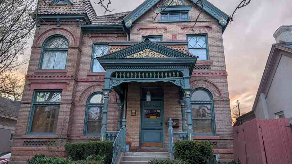
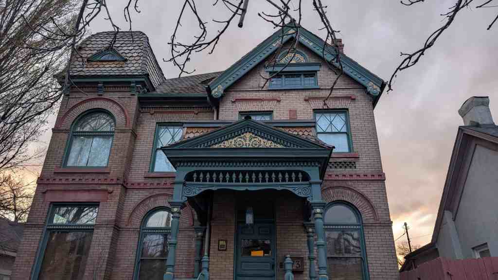
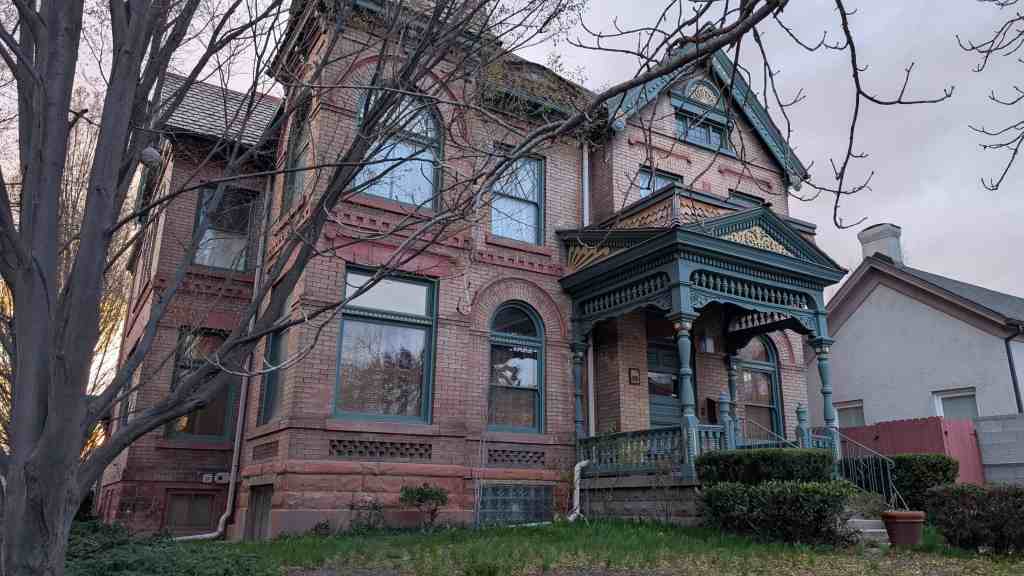
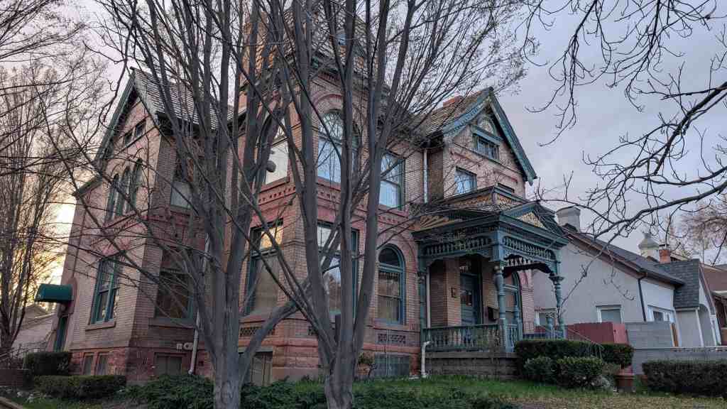
This house was designed by noted architect Richard Kletting, who also designed the State Capitol. It was built in 1895 by William T. Dinwoodey, who worked for his father, Henry, the founder of Dinwoodey Furniture. William sold the house in 1900. It passed through many hands until 1932, when Albert J. Southwick, a classical musician, moved in. He organized and conducted many musical ensembles and lived in this house until 1958.
Richard Kletting did a lot of work for the Dinwoodey family.
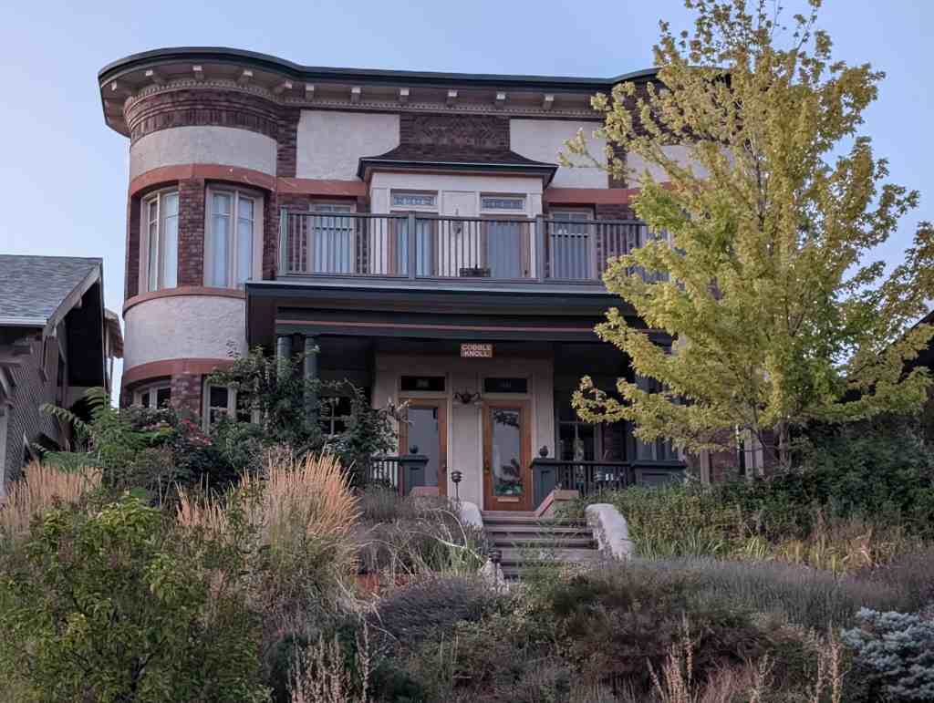
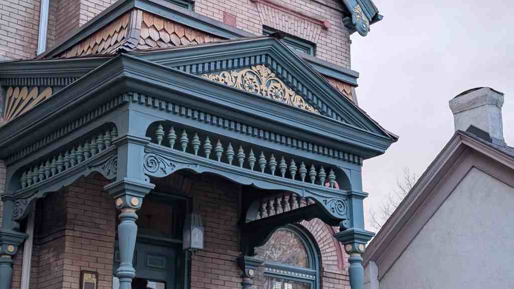
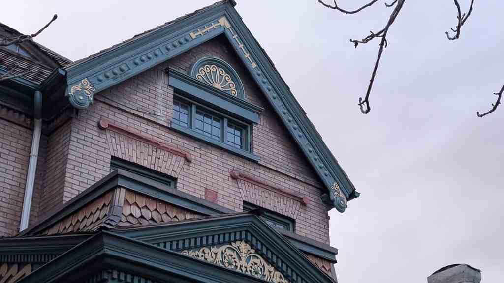
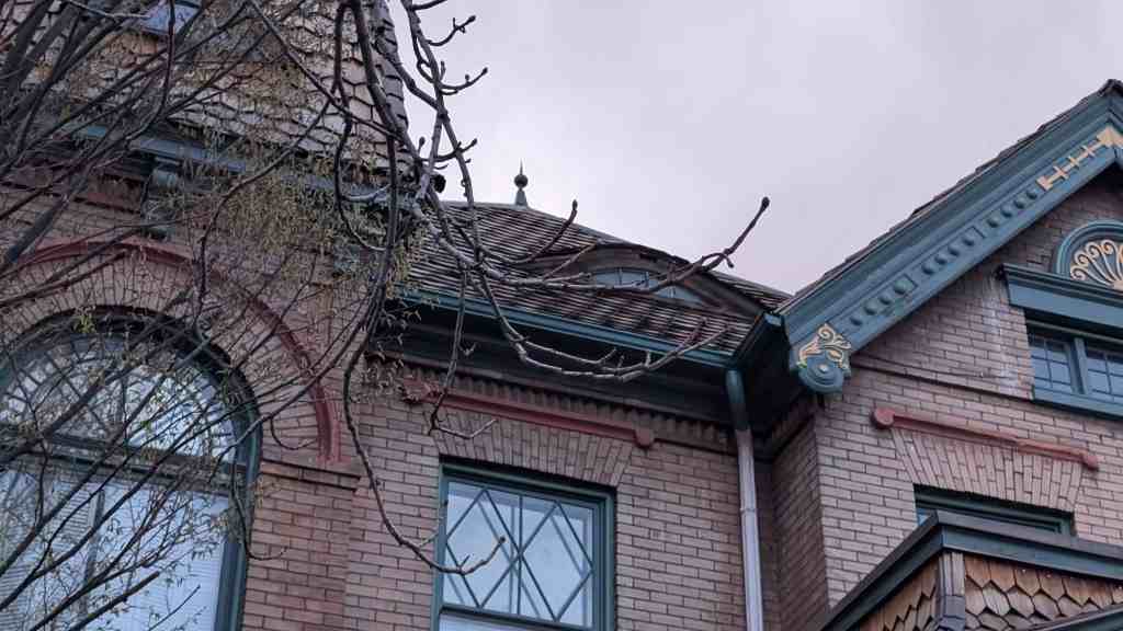
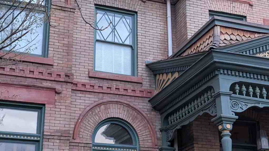
Preservation Utah‘s “Kletting in the Avenues” Historic Homes Tour said: Of the various Victorian styles, none was more popular across America and in Utah than the Queen Anne style. It reflected a new exuberance as Utah matured and moved out of its isolation to become more connected with the rest of the country. Certainly, the house is exuberant in its design with its irregular composition, variety of textures, decorative leaded windows, and prominent turret, a signature of the Queen Anne style. With all that, this house also presents a more reserved character with its Classical columns and pediment (triangular element) gracing the entry.
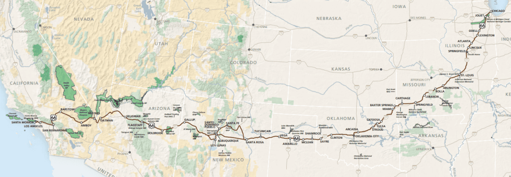
U.S. Route 66 is one of the original numbered highways in the United States and built up a reputation to be much more than that. It was established November 11, 1926 and added to the National Register of Historic Places on November 19, 1997.
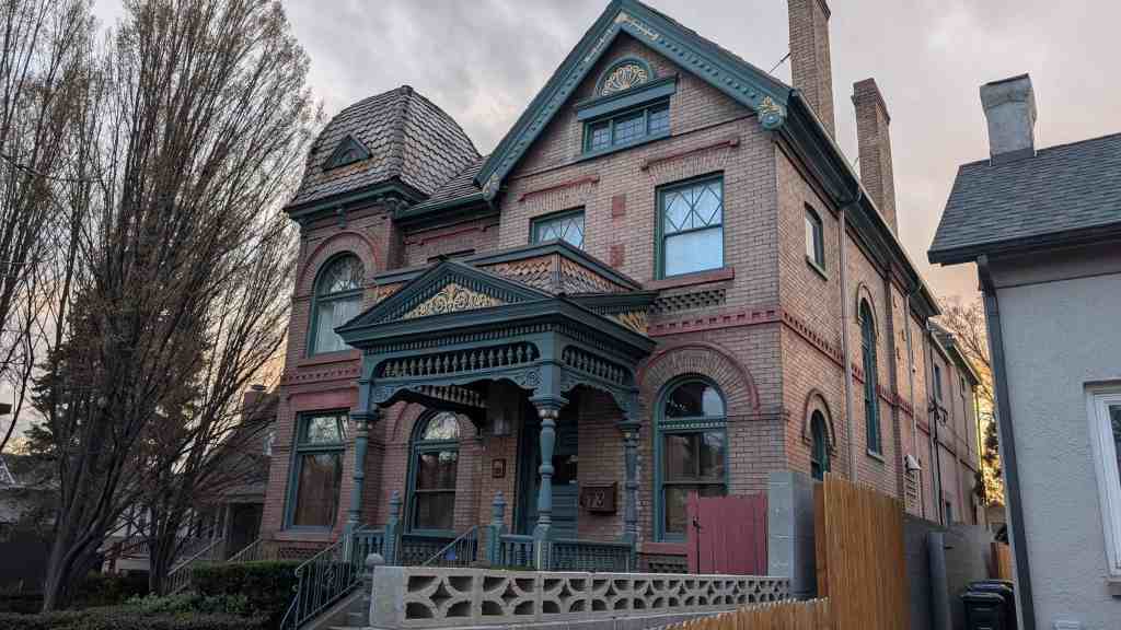
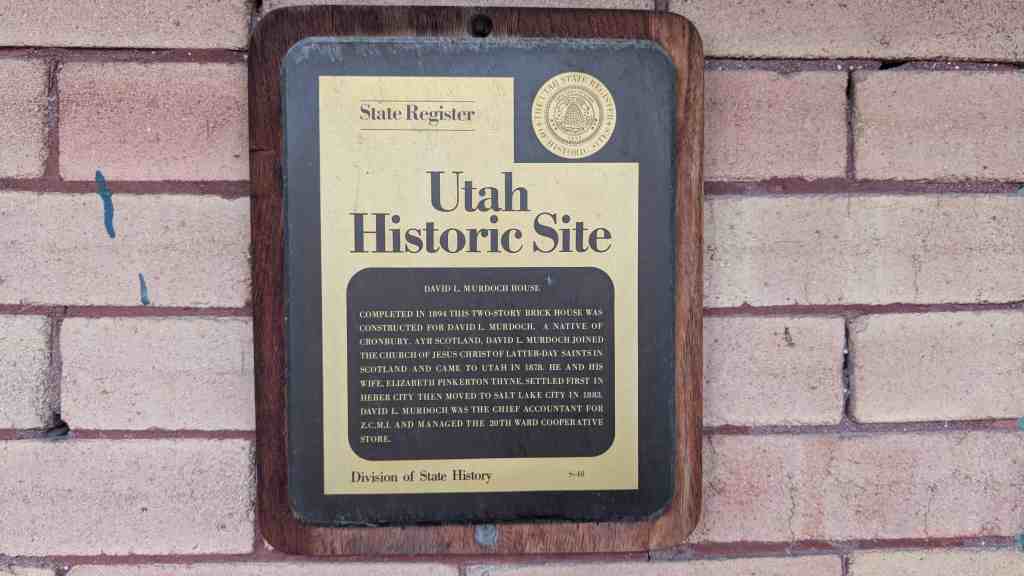
Completed in 1894 this two-story brick house was constructed for David L. Murdoch. A native of Cronbury, Ayr Scotland, David L. Murdoch joined The Church of Jesus Christ of Latter-day Saints in Scotland and came to Utah in 1878. He and his wife, Elizabeth Pinkerton Thyne, settled first in Heber City then moved to Salt Lake City in 1883. David Lennox Murdoch was the Chief Accountant for Z.C.M.I. and managed the 20th Ward Cooperative Store.
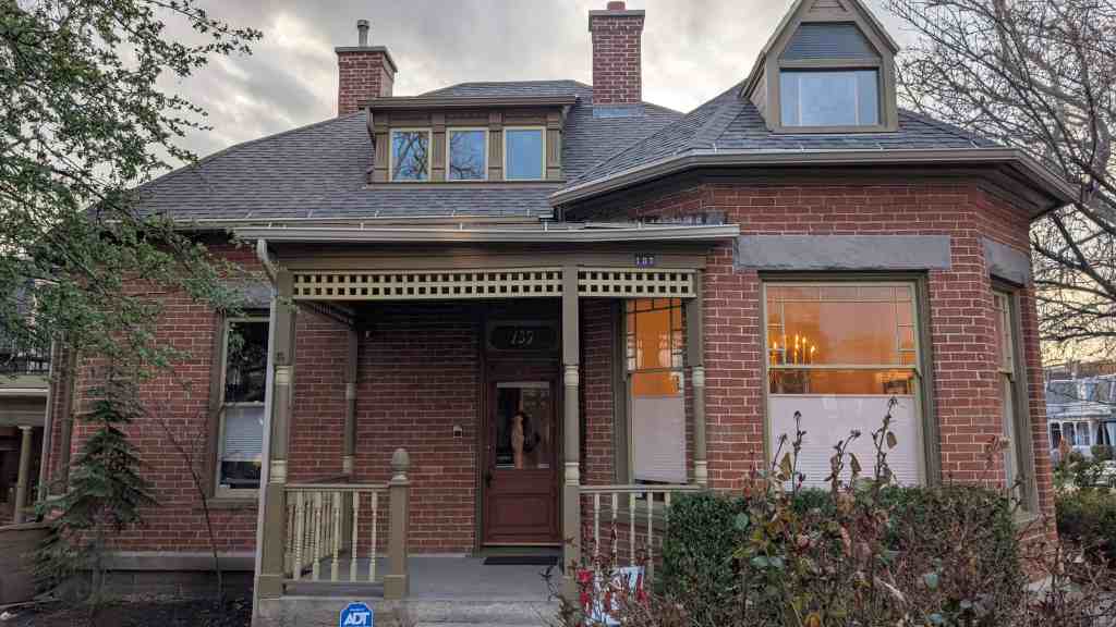
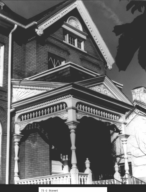
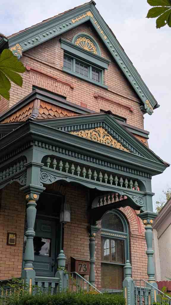
The nomination form for the national historic register mentioned the home here: While they account for less than one percent of all residences, the very large, often architect-designed homes in the Eastlake, Queen Anne and Shingle styles, and later the Prairie and Craftsman styles greatly influence the visual character of the Avenues. Some of the state’s best examples of residential architectural styles were built there, including the William Barton house, 231 B Street, (vernacular/Gothic); the Jeremiah Beattie house, 30 J Street, (Eastlake); the David Murdock house, 73 G Street, (Queen Anne); the E.G. Coffin house, 1037 First Avenue, (Queen Anne); the N.H. Beeman house, 1007 First Avenue, (Shingle style); the Vto. Mclntyre house, 257 Seventh Avenue, (Classical Revival); the James Sharp house, 157 D Street, (Craftsman); and the W.E. Ware house, 1184 First Avenue, (Colonial Revival).
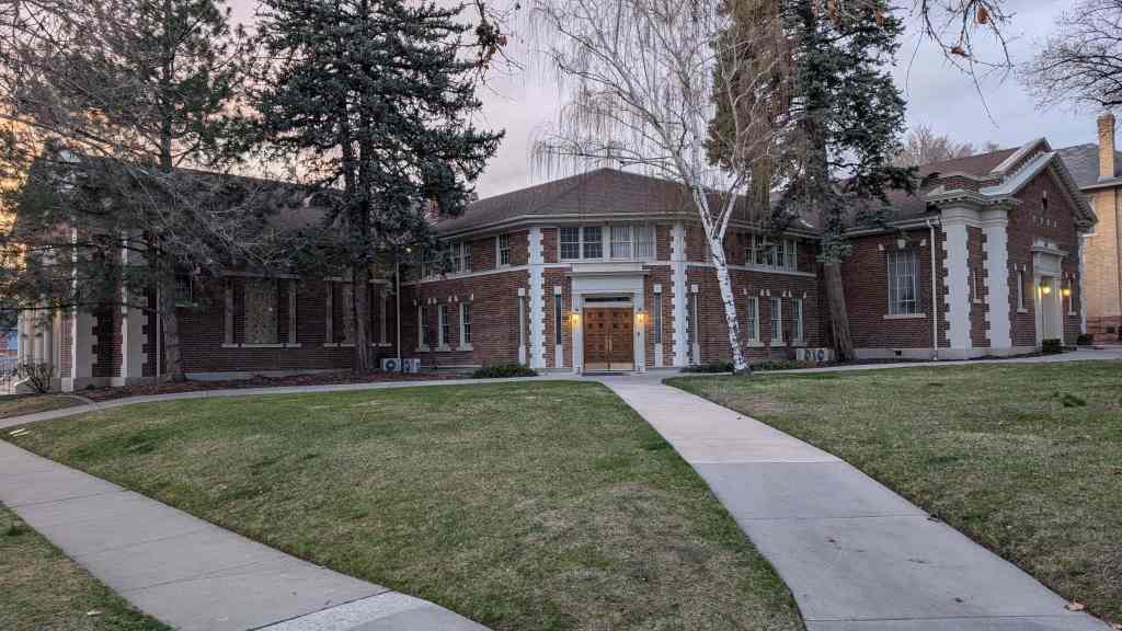
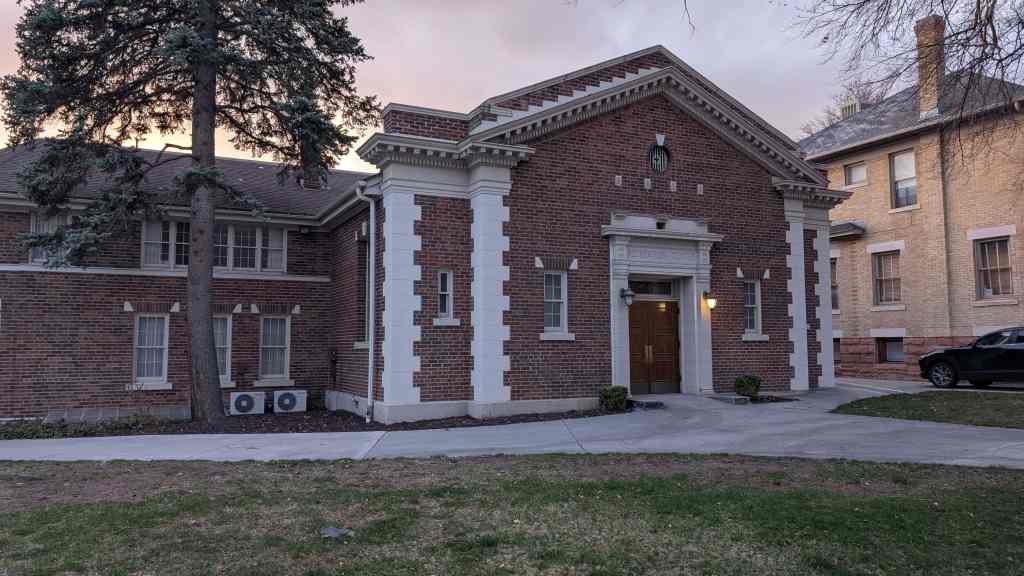
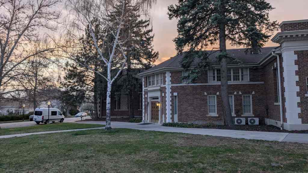
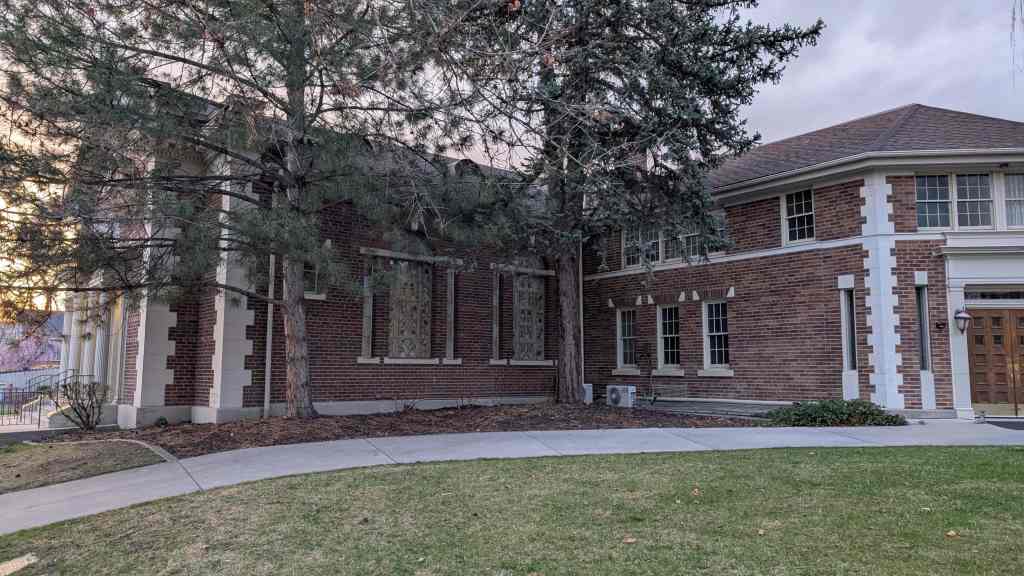
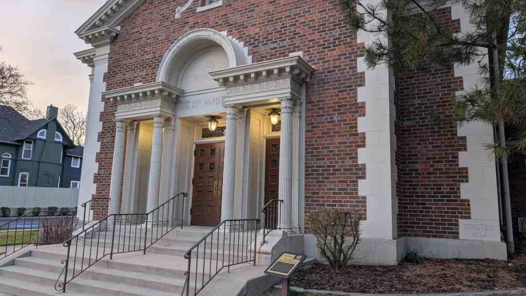
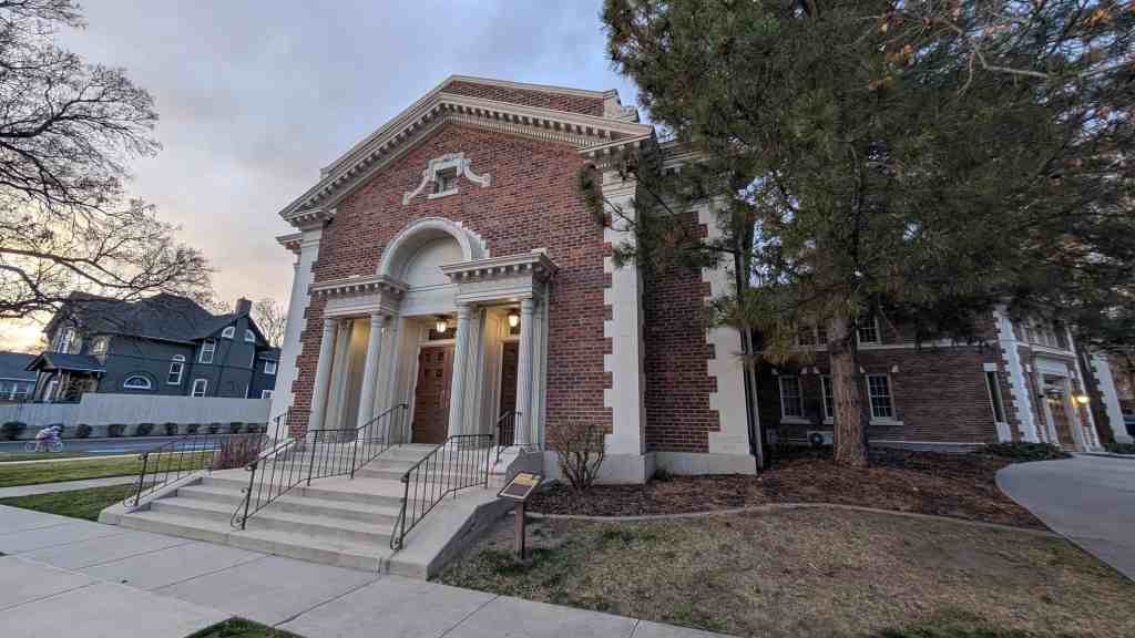
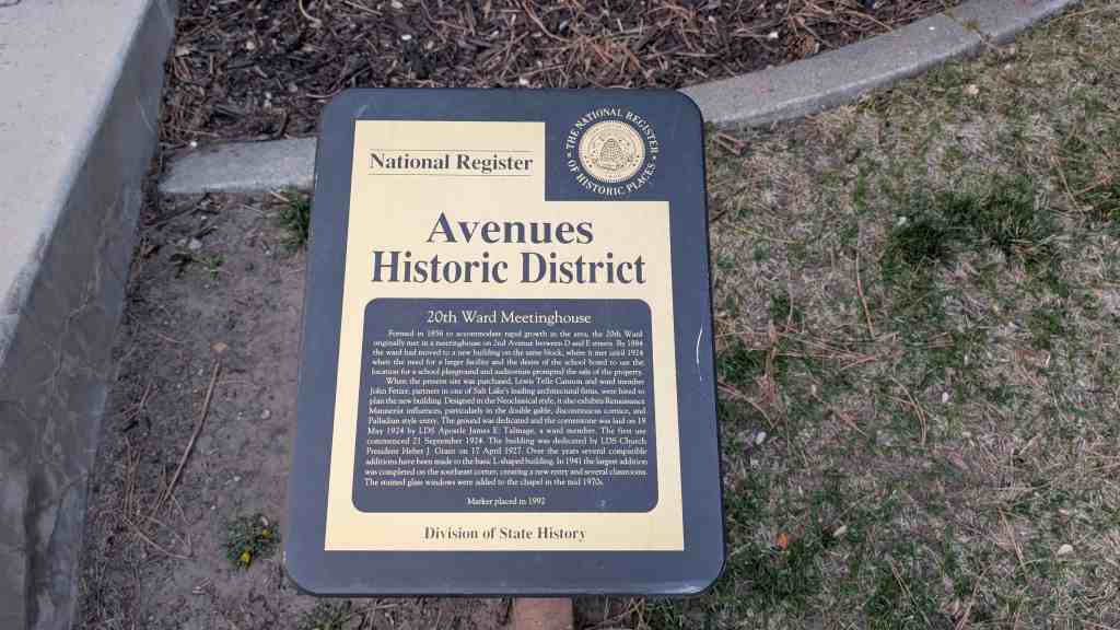
Formed in 1856 to accommodate rapid growth in the area, the 20th Ward originally met in a meetinghouse on 2nd Avenue between D and E streets. By 1884 the ward had moved to a new building on the same block, where it met until 1924 when the need for a larger facility and the desire of the school board to use the location for a school playground and auditorium prompted the sale of the property.
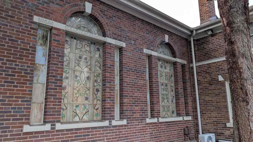
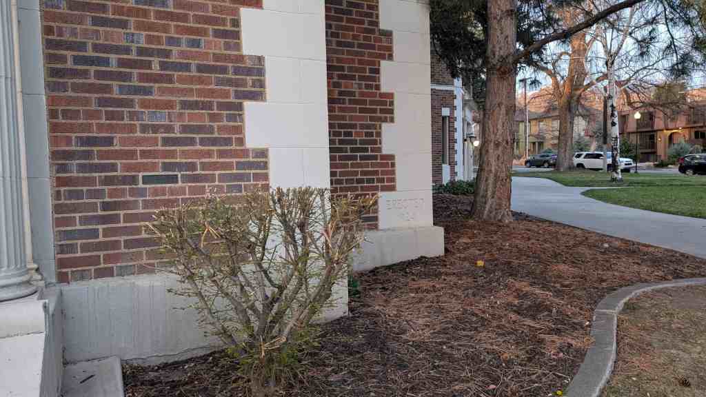
When the present site was purchased, Lewis Telle Cannon and ward member John Fetzer, partners in one of Salt Lake’s leading architectural firms, were hired to plan the new building. Designed in the Neoclassical style, it also exhibits Renaissance Mannerist influences, particularly in the double gable, discontinuous cornice, and Palladian style entry. The ground was dedicated and the cornerstone was laid on 18 May 1924 by LDS Apostle James E. Talmage, a ward member. The first use commenced 21 September 1924. The building was dedicated by LDS Church President Heber J. Grant on 17 April 1927. Over the years several compatible additions have been made to the basic L-shaped building. In 1941 the largest addition was completed on the southeast corner, creating a new entry and several classrooms. The stained glass windows were added to the chapel in the mid 1970s.
Preservation Utah‘s “Kletting in the Avenues” Historic Homes Tour said: The design of the Twentieth Ward Meetinghouse reflects a significant shift in how the LDS Church built its meetinghouses. During the 19th century, church buildings were designed and built almost entirely by individual wards with each function (chapel, recreation hall, Relief Society building, bishop’s storehouse, tithing office, et al) occupying its own building. But by the 1920s, when this building was constructed, the design of meetinghouses was becoming increasingly standardized, primarily to consolidate those various functions. Although its general layout may have been standardized, the design of the Twentieth Ward Meetinghouse showcases the high level of design available in the early 20th century to middle class wards with extra funds. The meetinghouse was designed by the firm of Cannon and Fetzer, which designed other notable buildings in Salt Lake, including the Park Building at the University of Utah and West High School.
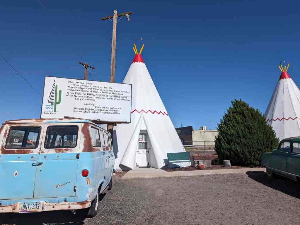
This property qualifies for listing in the National Register of Historic Places because it satisfies the registration requirements outlined in the Multiple Property Document entitled “Historic US Route 66 in Arizona (amended)” and accepted by the Keeper of the National Register on August 26,1996. The Wigwam Village #6 qualifies under the ‘Traveler Related Facilities” property type and meets the requirements of 1. Association, 2. Design, Location, and Workmanship, and 3. Feeling and Setting.
Chester E. Lewis I of Holbrook, Arizona visited a Wigwam Village in Kentucky constructed by Frank Redford. Mr. Redford had designed the architecture of his motel/café/gift shop/gas station buildings using the form and motif of Native American teepees. This use of architectural imagery by automobile service-oriented establishments along the American roadside has come to be known as place-product-packaging (Wigwam Village No. 2 National Register nomination). A detailed account of Mr. Redford’s venture can be found in Roadside America-The Automobile in Design and Culture (1990, Iowa State University Press, Jan Jennings editor, pp. 125-135). His design of wigwams or teepees was intended to be an aesthetic eye-appealing gimmick to capture the attention and patronage of the automobile masses. Mr. Redford built three villages himself and authorized the use of his blueprints for four other villages. Two of the seven were constructed along Route 66, one by Mr. Redford himself (Village #7) in San Bernardino, California, and a second by Mr. Lewis in Holbrook, Arizona. Mr. Lewis was very much impressed with Mr. Redford’s idea and success that he had observed in the 1930s, and some ten years later he visited Mr. Redford and negotiated a trade with him. For the use of his blueprints, Mr. Lewis agreed to pay Mr. Redford a royalty from his village, which was to consist of all the proceeds from the coin-operated AM radios that would be installed in the motel units at Mr. Lewis’ expense. Mr. Redford and Mr. Lewis became life-long friends.
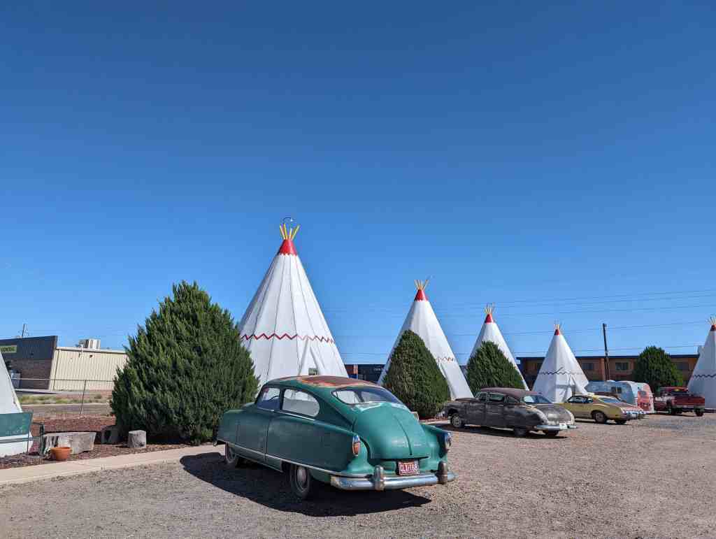
Wigwam Village #6 was located on busy Route 66 and offered a unique place to overnight as well as to refuel the family automobile. The national prosperity and the Baby Boomers of the 1950s and 1960s often choked Route 66 with traffic during the summer vacation months including eager youngsters who cried if they didn’t get to sleep in a wigwam. Many of those youngsters, now aging, return in the 21st century to experience once again one of their childhood delights or fulfill a dream if they were denied it as a child. Only three of the seven villages still stand today, Village #2 in Cave City, Kentucky, Village #6 in Holbrook, and Village #7 in California. The Cave City Wigwam Village is listed on the National Register and the California Wigwam Village is in poor repair.
Wigwam Village #6, or the Wigwam Motel was added to the National Register of Historic Places (#02000419) on May 2, 2002 and is located at 811 W Hopi Drive in Holbrook, Arizona
The motel meets the registration requirement of the MPDF in the following ways:
1. Association. This property is related to the traveling tourist industry on Historic Route US 66. Wigwam Village #6 was designed and constructed as a motel to cater to tourists and travelers on Route 66, and it has served as such since is first opened 51 plus years ago. Chester E. Lewis I of Holbrook, Arizona constructed Wigwam Village #6 in the late 1940s on Highway US 66 in Holbrook, Arizona at 811W. Hopi Drive (Route 66). The business is currently located on Historic Route US 66 (Business 1-40) at the same address in Holbrook. Mr. Lewis opened his motel for business on June 1, 1950. Navajo County Court records in the County Clerk’s office show that Mr. Lewis, or a Lewis owned Arizona corporation or L.L.C. has paid the property taxes and owned the motel until the present day. City street plans on file at Holbrook City Hall verify that Route US 66 and Historic Route US 66 have always constituted W. Hopi Dr. in Holbrook and that it passes immediately in front of the property in question.
Originally, a set of gasoline pumps stood in front of the office. The motel was shut down from 1974 till 1988 in response to the drastically reduced flow of business through the small towns that were bypassed by the interstate highway system in the early 1970s. During this era Wigwam Village #6 did not function commercially in any other capacity except to sell gasoline until 1984. In 1988 the motel reopened and has operated as such since that time.
2. Design, Location, Workmanship. The design and physical layout of the 18 contributing structures of Wigwam Village #6 is identical to its original down to the colors used to paint and highlight the sleeping units, with one exception. One of the 18 structures, the 40′ X 60′ office between the two small bathroom wigwams, was originally constructed in 1955 as a large teepee that measured 30′ X 37′. The large teepee was replaced with the rectangular office building in 1956 to better serve the need of the retail gasoline sales. Although the two-story apartment building (outside the boundary of the nominated property) is readily visible behind the teepees, the building does not infringe on the original courtyard space created by the placement of the sleeping units.
The structural workmanship of the 18 contributing structures is original and that of Mr. Chester E. Lewis I. Painting and maintenance, of course, is required, and these are carried out in such a manner as to not alter the original structure. The interior design of the motel rooms has not changed although various color schemes have been used over the years, and curtains, spreads, furniture, tile, carpet, lighting fixtures, etc. have been replaced due to wear and tear. The use of Native American motifs has been maintained by using replacement items with appropriate designs. Some gas heaters have been replaced with electric ones and plumbing fixtures must be replaced from time to time, but the bathrooms still preserve the original layout of commode, sink, and shower and have the original 1950s floor tile in place. The courtyard grounds have always had a gravel cover. Playground equipment for children has been installed and removed periodically over the decades; the original 1950 courtyard did not contain any such equipment.
3. Feeling and Setting. Wigwam Village #6 retains its feeling and setting. The design of the buildings and layout has been maintained and is quite unique. As previously stated, the motel has been the subject of numerous newspaper and magazine articles over the years, with the most recent one appearing in the Arizona Republic on December 9,2001. Some tourists today make an impromptu visit to Wigwam Village #6 while some come with reservations made months in advance to enjoy the feeling and setting preserved here of the early days of the ‘Mother Road’. One tourist will visit to escape from the modernism of the day just as visitors did decades ago, another to briefly open the nostalgic capsule of his/her childhood visit when the Baby Boomers were just toddlers, another to enjoy the Indian motif of the setting, and yet another just to photograph the novelty of the village or the dumpster behind the office in which the actor Lou Diamond Phillips discards some burning papers in a scene from the movie “Dark Wind.”
As a unique example of Route 66, travel-related facilities, Wigwam Village #6 is a significant part of the history of Holbrook, Arizona, and Route 66. This family-owned business has contributed to the aura of Route 66 since 1950 and the family continues to run the motel today. Obviously unique as roadside architecture, the continued ownership by the Lewis family for over 50 years is as much a part of the story as the sign that asks “Have you slept in a wigwam lately?”
CONDITION AND INTEGRITY
The condition of Wigwam Village #6 is very good. Seventeen of the eighteen buildings are in their original state, and the quality of their condition is evidenced by the fact that the motel is open for business year round. None of the 18 buildings has undergone any major or minor structural repairs since their construction. Only the office has undergone any remodeling, as described above.
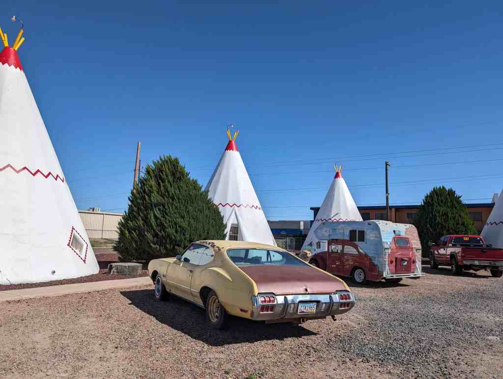
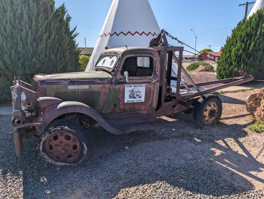
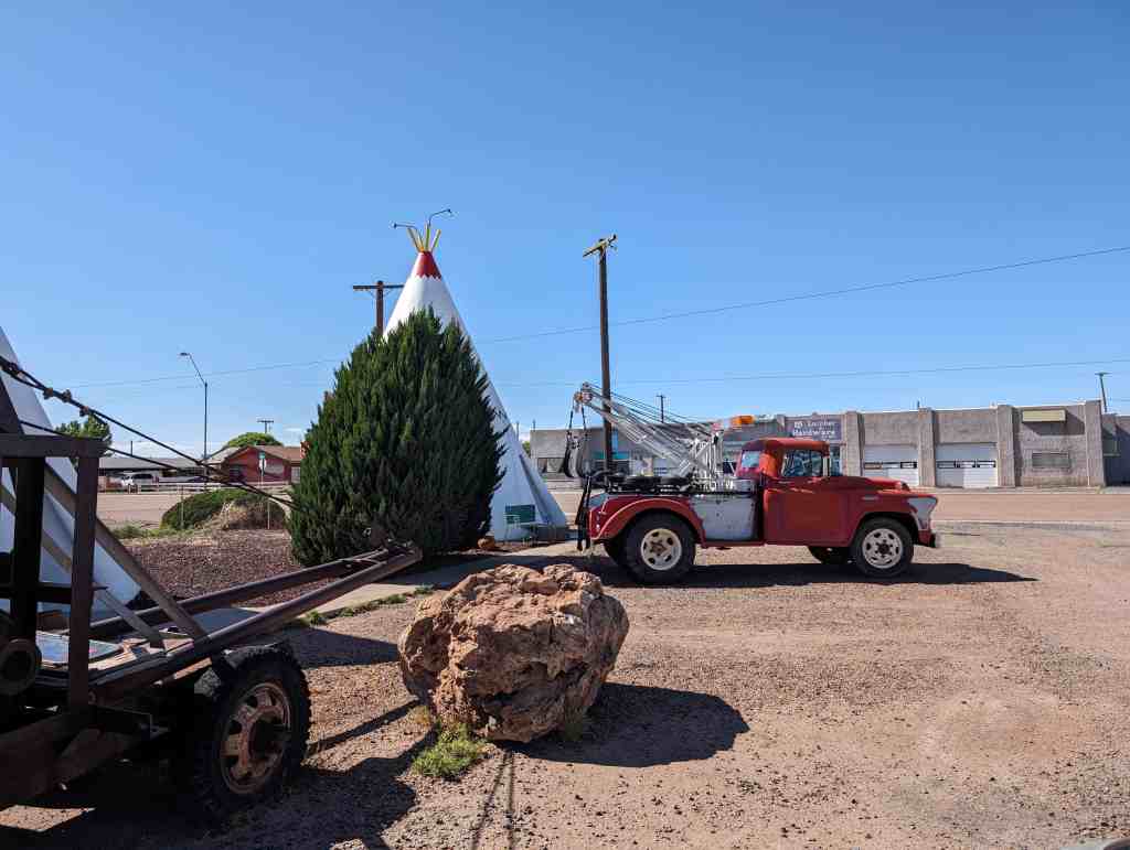
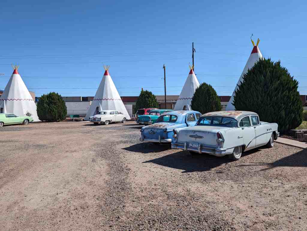
The integrity of the original motel has been maintained as there have been no significant changes to the buildings and they are in very good condition. The best evidence supporting the aesthetic integrity of the village is the feeling and association one experiences upon visiting the motel with its collection of 1950s vintage motorcars. A comparison of 1950s photographs with the village today, as well as tourists’ and residents7 testimonials, also supports the claim that the integrity of the Wigwam Village #6 is intact and well preserved, providing the same ambiance today for the traveler as in the past.
Wigwam Village #6 is nationally significant for several reasons. The Wigwam Village in Cave City, Kentucky, is the only other of these motels that yet survives intact and it is listed in the Register as nationally significant. The motel in Holbrook is related to place-product-packaging (as is the Cave City version) but moreover, it is directly related to place-product-packaging on Route 66. Acting on the idea that a unique motel would appeal to travelers on Route 66, Chester E. Lewis opened the “wigwams’7 in 1950 and this mom and pop business has been owned and operated (in some fashion) by the Lewis family ever since. Known around the world through many publications, Wigwam Village #6 is not only an icon of Holbrook and northern Arizona, but of all of Route 66, the “Mother Road.”
NARRATIVE DESCRIPTION
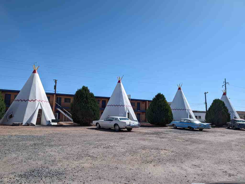
Wigwam Village #6 is located seven blocks west of downtown Holbrook, Arizona on Business 1-40, historic U.S. Route 66. The village is a motel consisting of individual non-connected, sleeping units built in the style of the teepees of the Plains Indians. The name, consequently, is perhaps a misnomer since ‘wigwams’ were hogan-like shelters with roofs of timbers, furs, and/or mud which did not culminate in a conical point typical of the teepees. The architect, Frank Redford, however, selected “Wigwam Village” for the title of his designed motel rather than “Teepee Village”. The former was more pleasing to him. The novel design and public display of Wigwam Village #6 has made it one of the most prominent man-made landmarks in the town of Holbrook and in all of Northern Arizona along old U.S. Route 66. Photographs in color and black & white of the Village have graced the covers of and appeared in periodicals, travel magazines, newspapers, history books, and calendars worldwide for more then a decade.
The lot has 270 feet of frontage on Business 1-40 and a depth of 230 feet. The motel itself consists of 18 contributing structures (units) arranged in a rectangle that occupies the majority of the lot. There are four units on each of the short sides of the rectangle and seven units on the back side for a total of 15 sleeping units. The remaining 3 units are concentrated in a cluster in the center on the frontage side of the lot on Bus. 1-40 and consist of the office (60′ X 40′) which is flanked by two smaller units (wigwams) that serve as bathrooms for the office. The three structures located along the back side of the lot behind the back row of the 7motel units consist of one two-story, 20-room apartment complex, a storage shed (which house spare fixtures and parts, tools, and shop space for the motel maintenance work), and a small residence. These buildings are not considered part of the nominated property.
The 15 large wigwams (units) are laid out in an open rectangle as described (see photographs) in order to resemble an Indian village. The office, with its flanking, smaller wigwams, represents the dwelling for the chief and his family. The office contains appropriate administrative facilities and a gift shop. The office also houses a museum that contains biographical data on Chester E. Lewis I, some of his collectables, a nice assortment of polished petrified wood slabs, a few 19th and 20th century firearms, and sundry items. Each of the 15 wigwams is identical in construction and measurements with an equal space between each. A 3 foot sidewalk follows the inside perimeter of the 15 wigwams passing 5 feet in front of each thus connecting all with a pathway. A short walkway connects the doorway of each unit with the sidewalk. The entire interior of the courtyard is dry landscaped with small gravel for parking and a driveway from the highway. There are 10 to 12 foot high juniper trees located between the wigwams.
Each of the 15 wigwams is a cone 21 feet wide at the base and 28 feet high to the top of the yellow 2′ pipes at the top. The base/foundation is a regular 16-sided polygon with the exception of the one side with extended tongue for the doorway exit. Each of the 16 sides form a triangle measuring 4 feet on the base and narrowing to inches at the crest where the pipes protrude from the top of the cone. All 16 triangles are anchored to the concrete foundation and to a V X 2″ iron pipe at the top. Each side or rib is numbered for architectural purposes starting with the door which is rib #1 and proceeding counterclockwise around the structure. Recessed windows are located at ribs #4 and #14. All ribs are regular equilateral triangles except #’s 1,4, & 14 where the door and windows are. These are customized, of course, to accommodate the structural penetration. The window is a diamond shape on the exterior rib. The doorway was the more difficult of the ribs to build. The edges of the doorway are sculpted with a wraparound fringe that gives the appearance of canvas or fur being turned back on itself at the opening. The exterior is a stucco finish on a wood frame furred or decked with 1″ lumber and covered with W chicken wire. Some of the Wigwam Villages in other locations were framed with angle iron that was welded together and then finished with stucco such as with Village #2, but Village #6 was all done in wood. The exterior is painted a bright white with latex paint. A border of red triangles highlights each window. Twelve feet above the base a red zigzag design circumscribes the unit. Mr. Lewis always referred to this as the “lightning of the wigwam.” The top 20″ of the cone is also highlighted in the same red color. One of the four protruding yellow pipes at the top supports a flood lamp light fixture that brings the village to life at night.
A standard 8-foot ceiling greets the visitor on the inside. This ceiling is a major support feature for the structure, and above it the remainder of the cone’s interior is hollow except for wiring, ventilation shafts, and sixteen horizontal 2″ X 4″ cross beams about 10 feet below the apex of the cone. The interior wall parallels the 68 degrees sloping wall and is utilized for wiring, plumbing, insulation, and a hot water heater. At the doorway the vertical interior wall is recessed far enough toward the center to allow the height of the wall to reach 7 feet instead of the 4 feet common to the rest of the room. This 7-foot wall is necessary to accommodate the door. Parallel to the doorway and twelve feet toward the opposite rib is an 8-foot partition that separates the bedroom from the bathroom. The commode is at one corner and the shower stall at the opposite with the sink in between mounted on the wall corresponding to rib #9. The bedroom floor is carpeted, the bathroom floors tiled, the ceiling has incandescent light fixtures. Two corner lamps are present, there are hickory chairs and a vanity, and one or two double beds occupy each room. The curtains, spreads, and comforters are of Indian design. One of the interior windows is square on the inside but the outside shape is a diamond. An air conditioning unit occupies the other window. The furniture consists of caned, handmade hickory beds, night tables, 5′ lamps, chairs, armchairs, vanity tables with stool, and hat racks all made in Indiana. A number of chairs and stools have been re-caned, and a few of the stools have been replaced, but 95% of the furniture in use today in the sleeping rooms is the very same original furniture placed in the rooms in 1950.
The two small wigwams next to the off ice/service station, which served as restrooms for the same, are designed and constructed in the very same fashion as the larger sleeping rooms. The interiors, of course, are finished differently. The small wigwams are 12′ in diameter and 17′ high. The entry door of the bathroom is 7′ X 28″. Parallel to the entrance is a partition 6′ high that divides the floor plan in half. The front half contains the lavatory mounted to the partition opposite the entrance and trash receptacles placed next to the lavatory. The rear half of the two interior halves is divided yet again in half by a 6′ partition forming two triangular ‘corners’ that occupy one-fourth of the total floor space. Each of these two corners contains a commode. The interior ceiling is a standard 8′ ceiling. The small bathroom wigwams have no side windows. The exterior is finished and painted just as the sleeping units. The interior of the two bathrooms is identical with one exception. The Ladies’ Room (Squaws) has two lavatories mounted on the wall opposite the entrance while the Men’s Room (Braves) has one lavatory and one urinal.
The office/service station was constructed in 1956 to replace the largest wigwam that originally served as office/service station. The large, office wigwam was about 30′ in diameter and 40′ high. Despite being the largest of the wigwams it was not large enough to handle the traffic of people in the office for both the motel and service station during peak business months of the year. The replacement office measures 55′ X 36′ on the front with an additional section 12′ X 36′ attached behind. This forms a rectangular building 55′ X 48′ with a 19′ X 12′ alcove at the southeast corner of the building. A garbage dumpster is located in this alcove of the building. The construction consists of a 4″ concrete slab floor with 18″ X 24″ footings, cast iron plumbing, and above ground wiring and telephone lines. All walls are 2″ X 4″ studded on 16″ centers, and the roof is a 5′ asymmetrical vaulted one with gabled sides and desert brown composition shingles. All exterior walls are finished with stucco over chicken wire on the sheathed 2″ X 4″ stud frame. The office is divided in three sections; a front 20′ section, a middle!6/ section, and the back 12′ section. The front 20′ section of the office has a 10′ X 20′ covered canopy on the east corner, open on two sides. The covered portion of the front 20′ section is the part of the office for the public business, and this part contains counters on the west side and north sides for registration and payment and a small gift shop. This front section of the office has remained the same since its construction in 1956 with the exception of minor changes in the arrangement of furniture. There are five large 5′ X 6′ pictures window along the street side of this section and one each on both sides. The interior walls are finished in varnished, tongue and groove pine paneling, the ceiling is 10′, and the floor is carpeted. Originally the floor had gray linoleum tile. Carpet was used to replace this when it wore out. The middle 16′ section of the office building houses the museum (16′ X 40′) and a manager’s office (16′ X 15′). The interior of the museum displays a medium grit plaster over chicken wire on the sheathed stud frame painted in natural white. The manager’s office has interior walls finished in pine paneling like the front, public section of the building. There is a partition between the museum and the manager’s office with a door for employees. The museum contains the memorabilia mentioned earlier. Originally this middle section was comprised of a storage area for the motel and service station and a bedroom/bathroom for workers. This was never opened to the public. In 1988 the middle section was remodeled as described, and the museum portion was opened to the public. The back 12′ section of the office building is divided in half; a washroom area on the east and a merchandise/filing storage area on the west. The back 12′ section has only an 8′ interior ceiling. This section has never been open to the public.
There is a 16′ X 16′ canopy extending street side from the very front of the office covering the driveway immediately in front of the office and the area where the island of gasoline pumps used to be. Above the canopy is an 8′ X 24′ billboard. This originally advertised the Texaco Station but was altered to advertise the motel when gasoline sales terminated. The asymmetrical, vaulted roof was added in 2000 since the flat, hot tar roof was continually leaking over the last three decades.
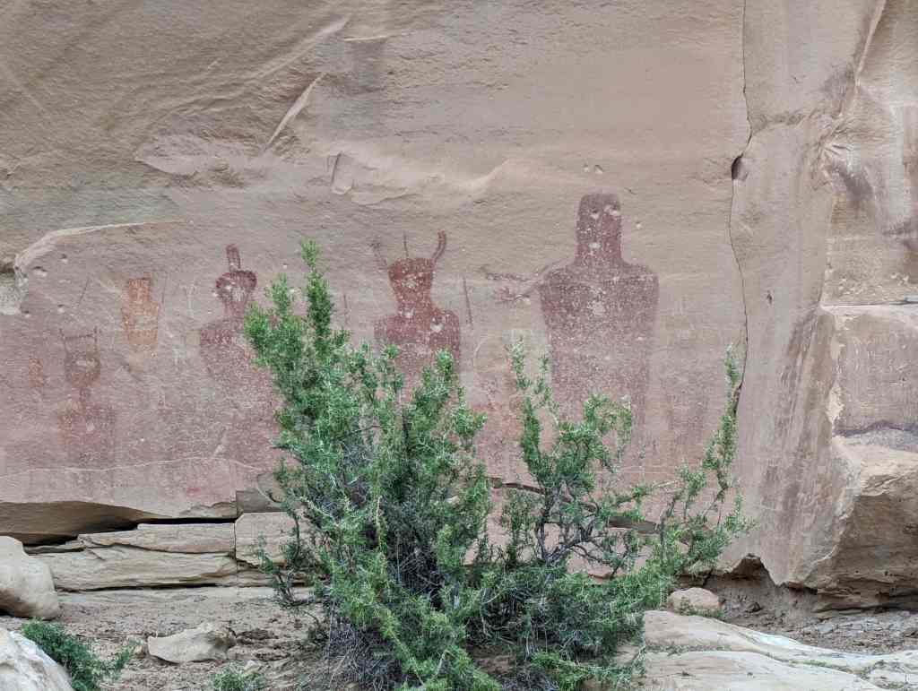
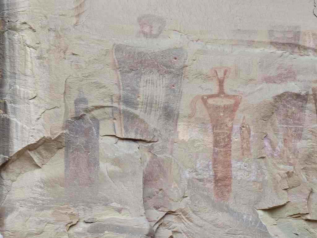
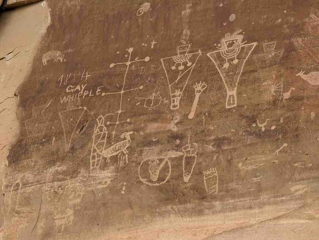
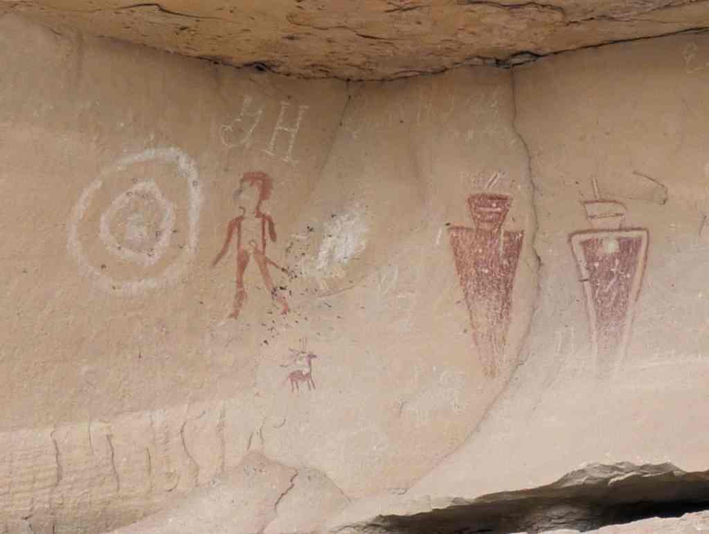
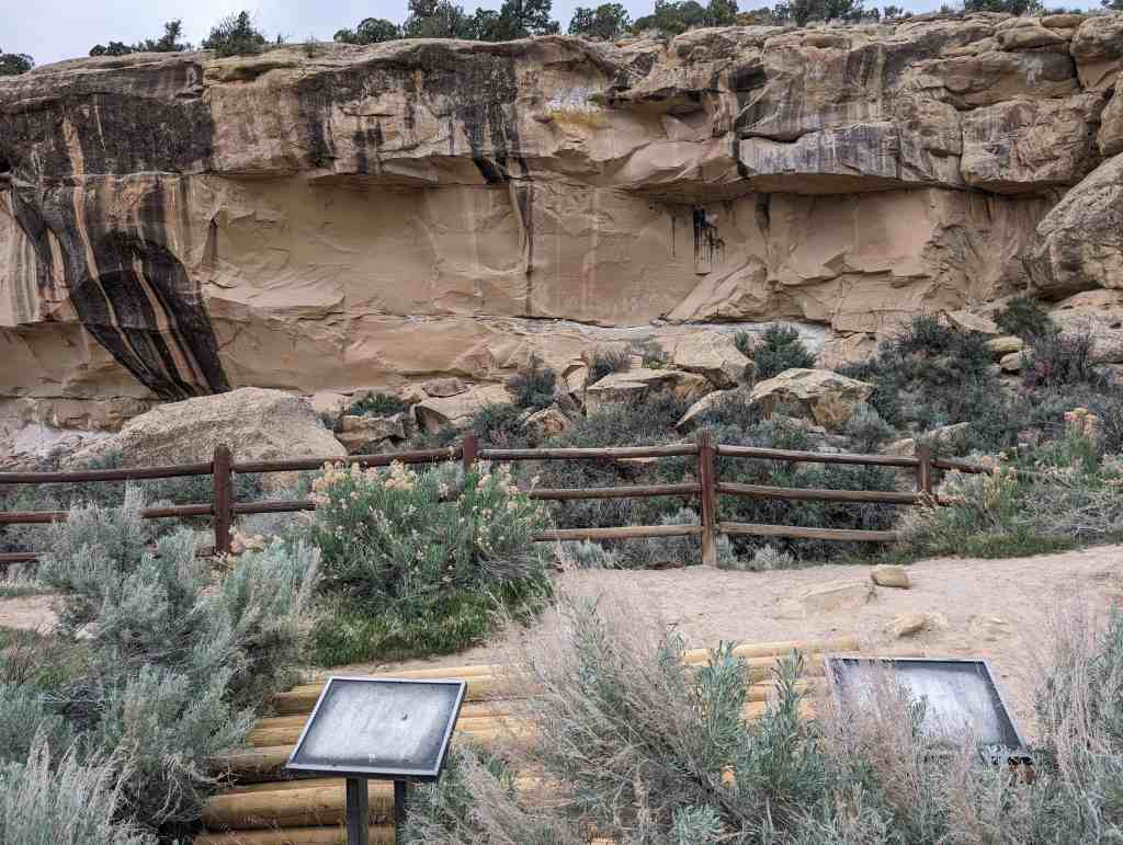
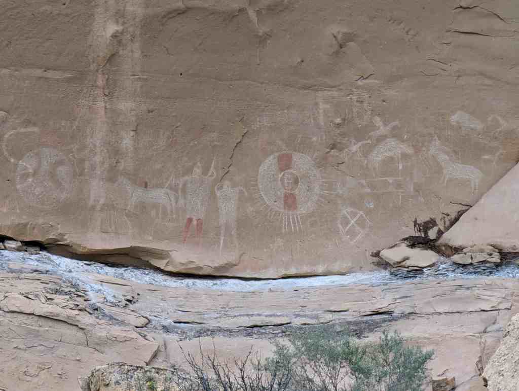
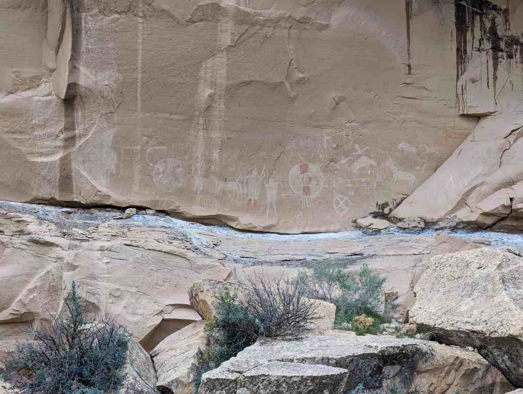
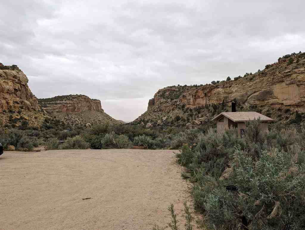
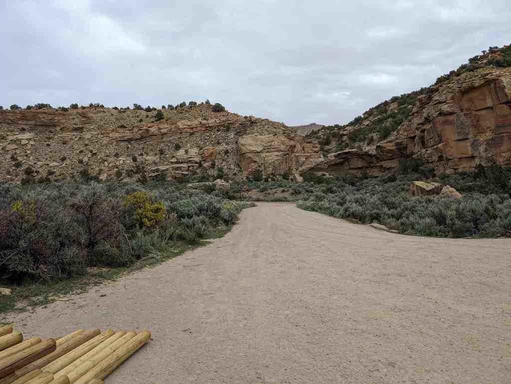
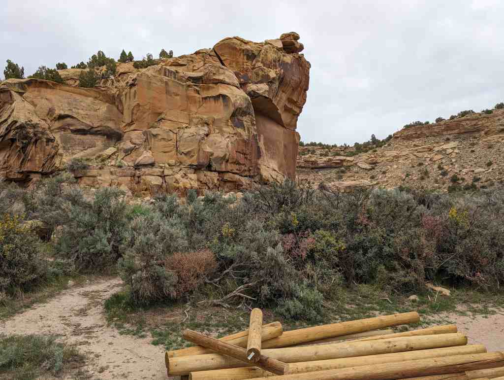
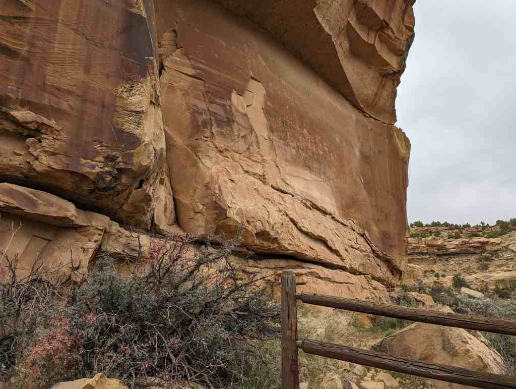
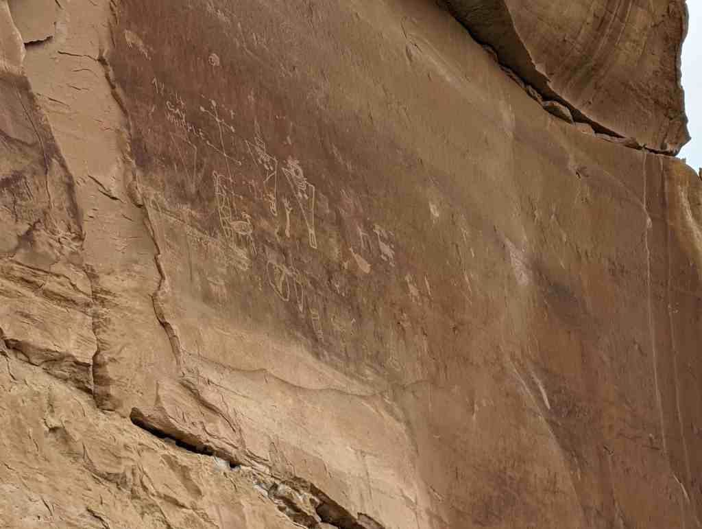
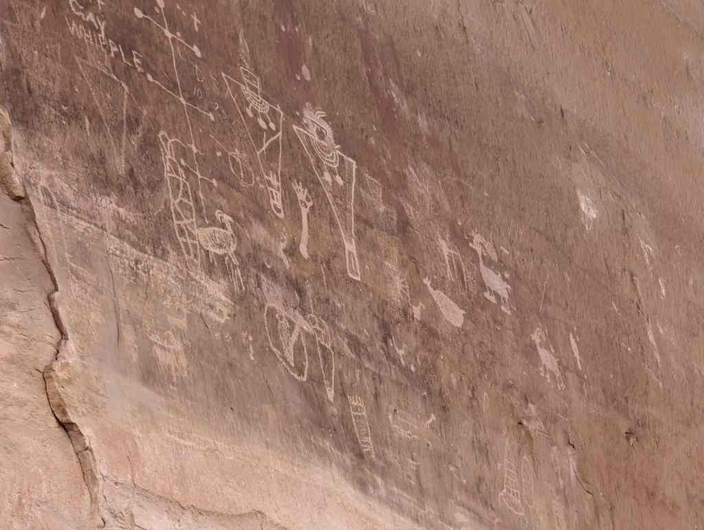
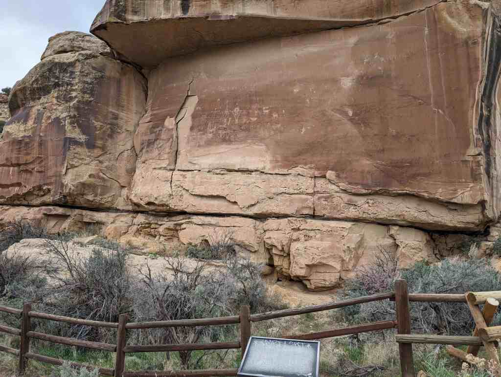
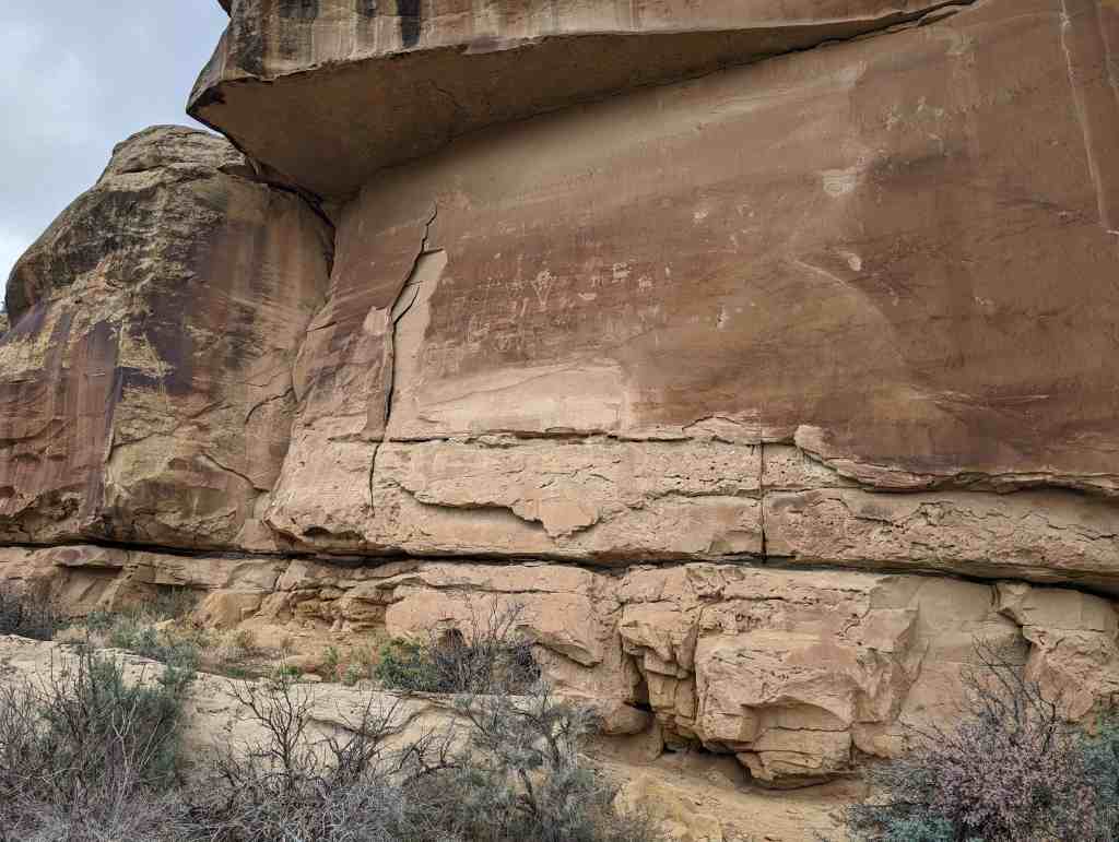
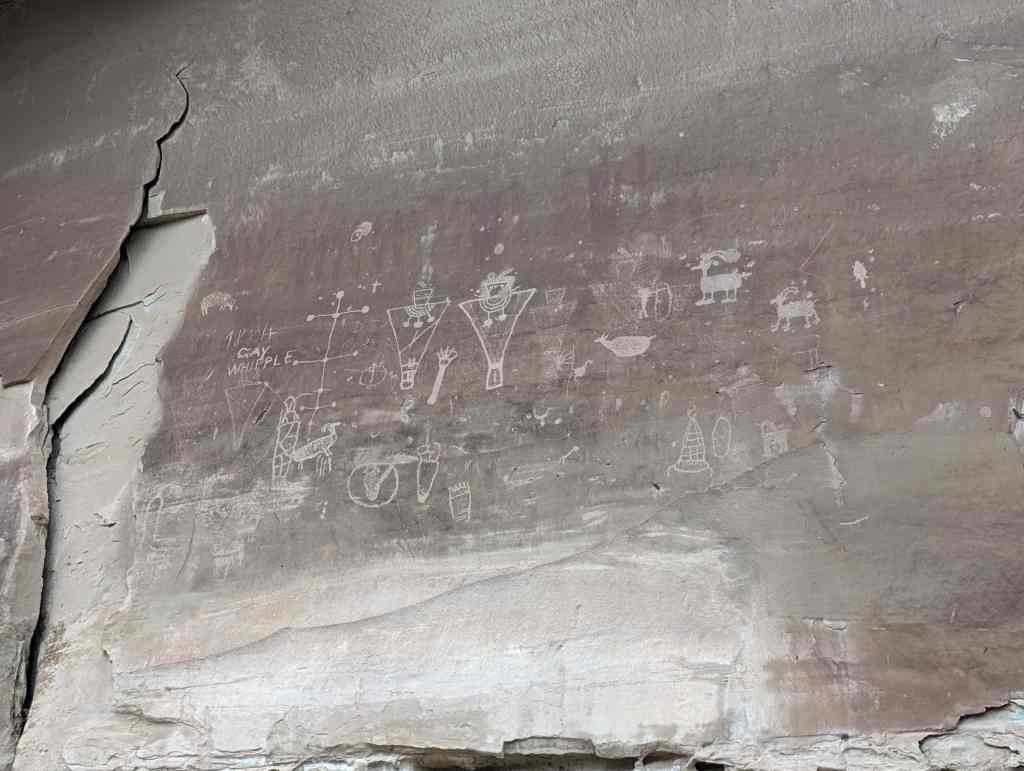
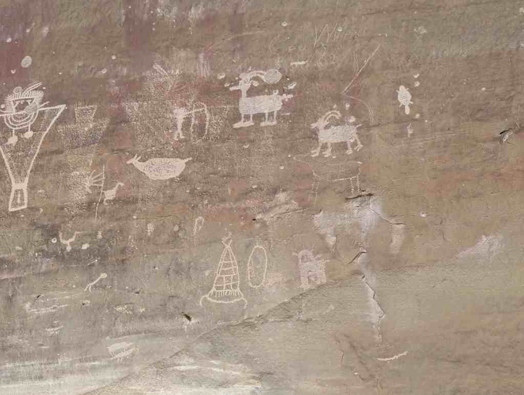
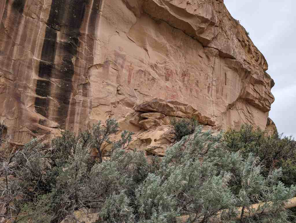
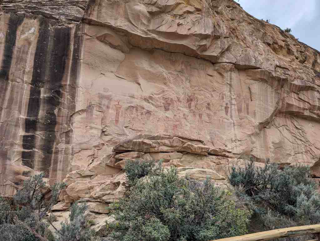
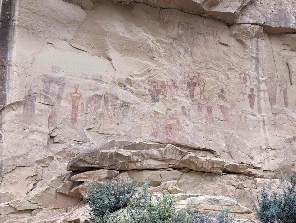
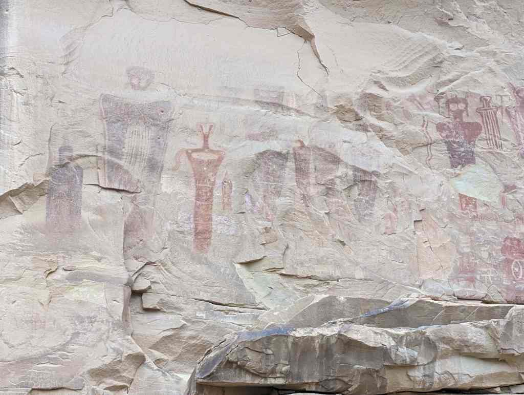
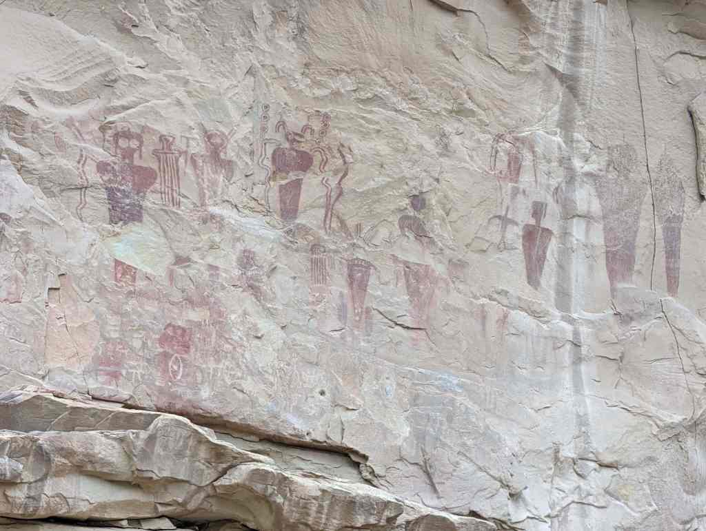
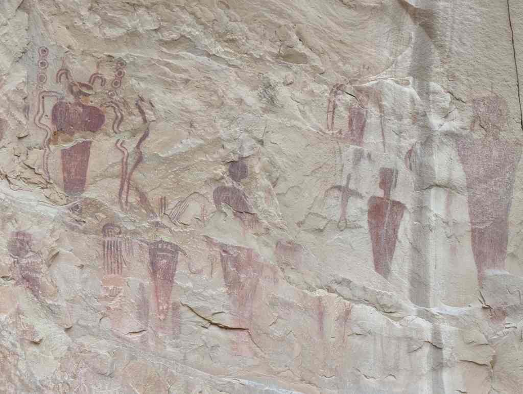
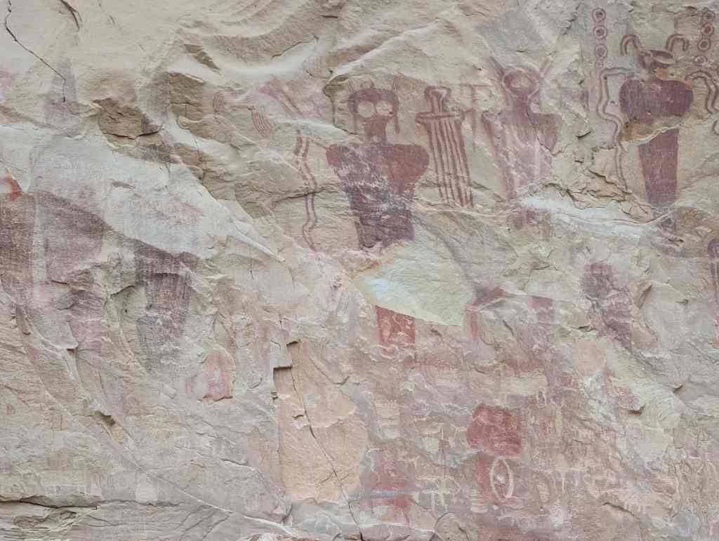
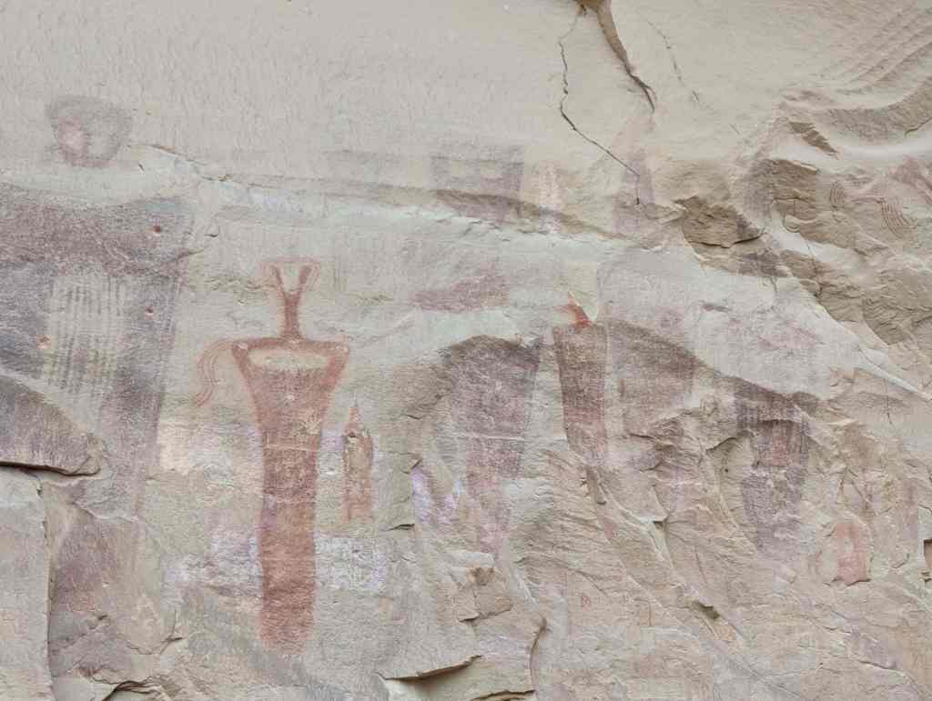
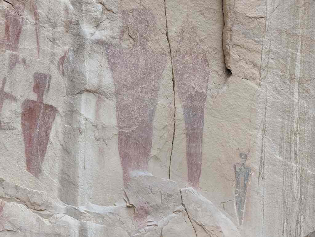
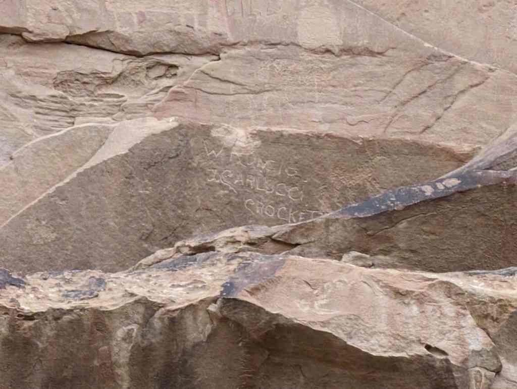
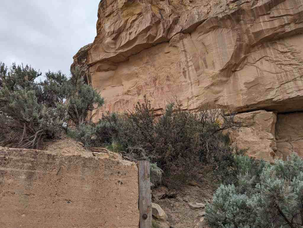
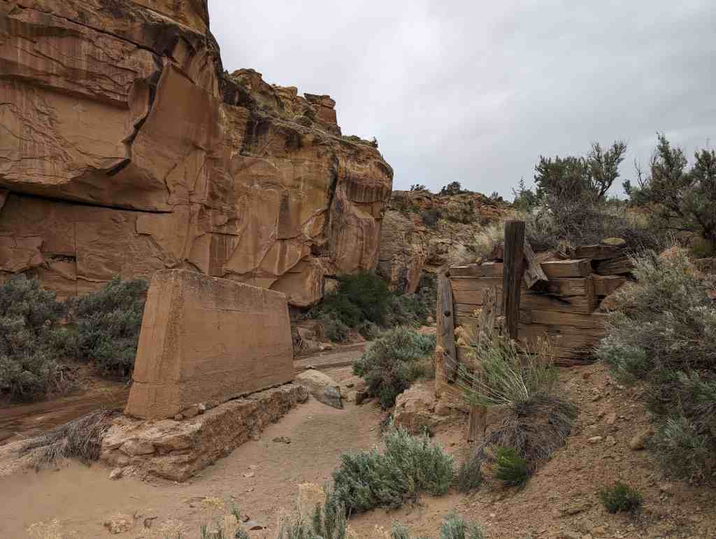
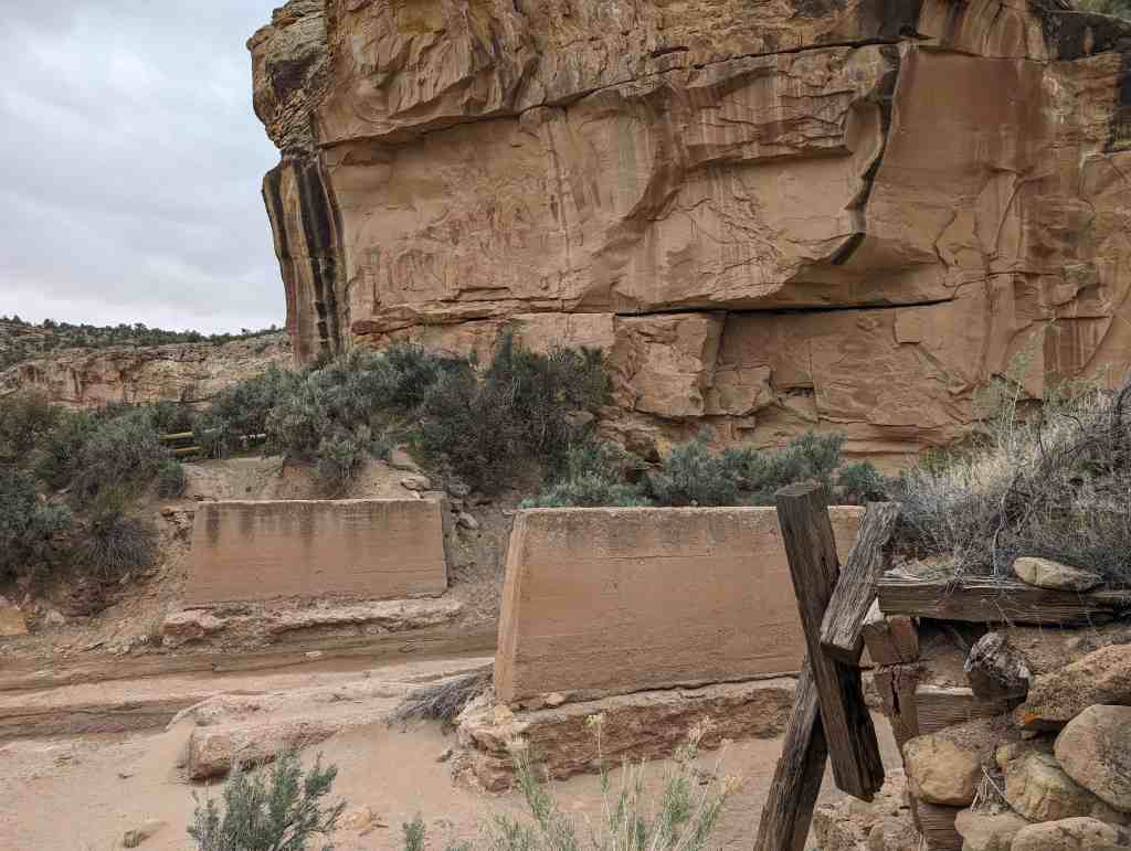
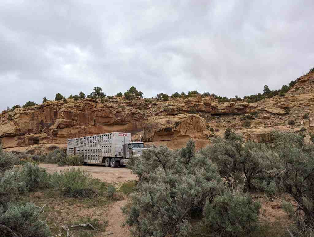
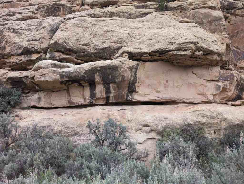
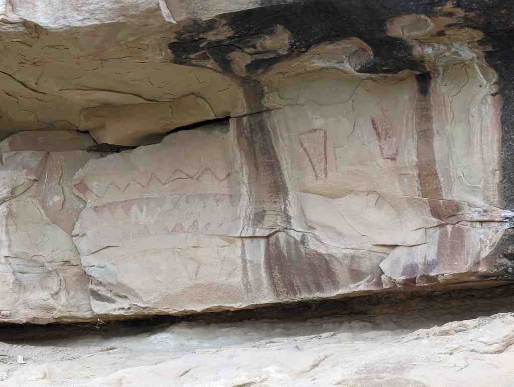
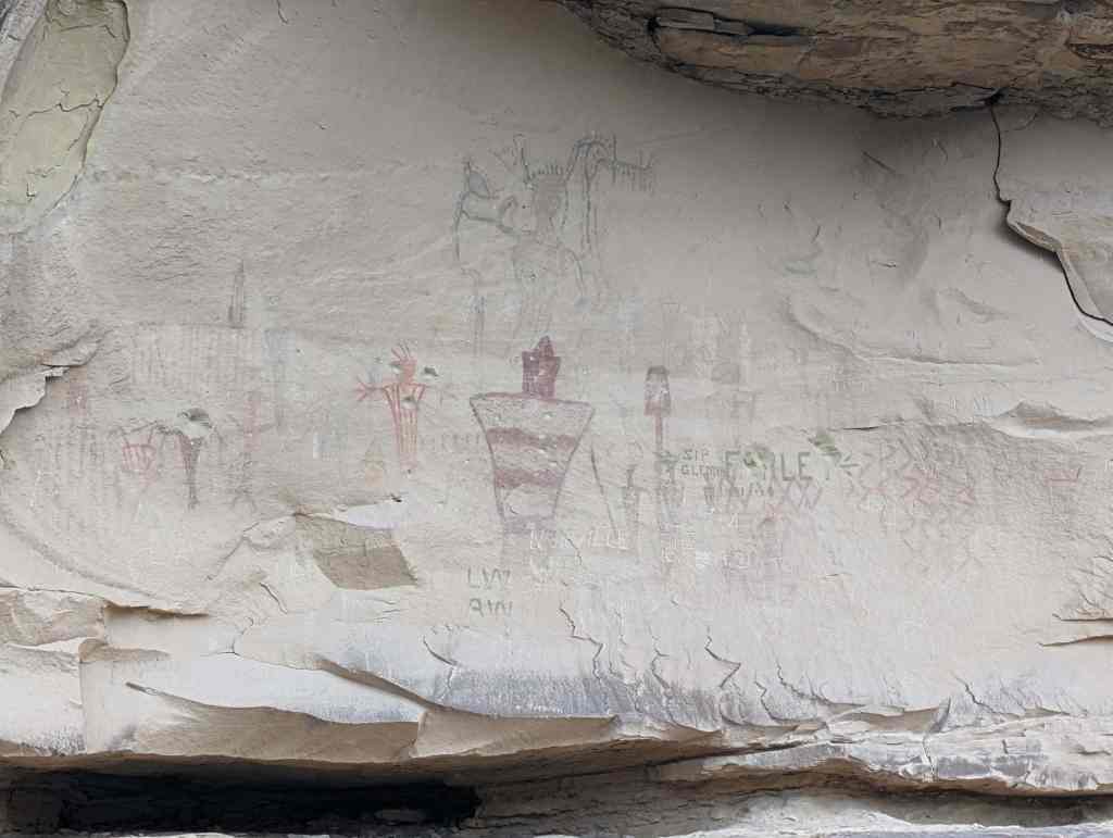
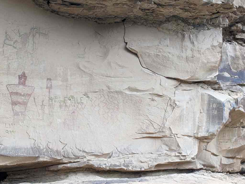
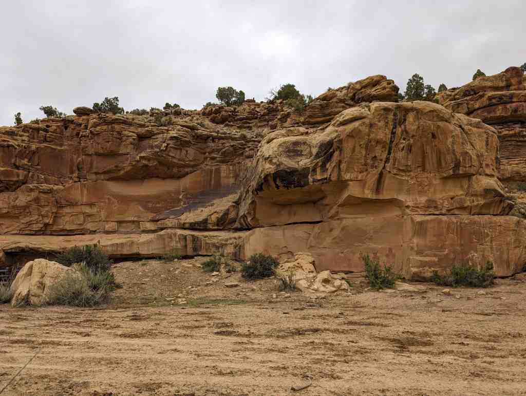
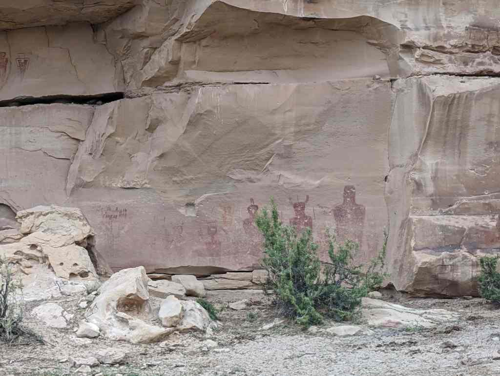
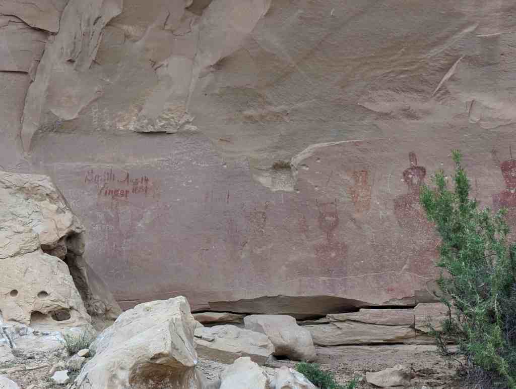
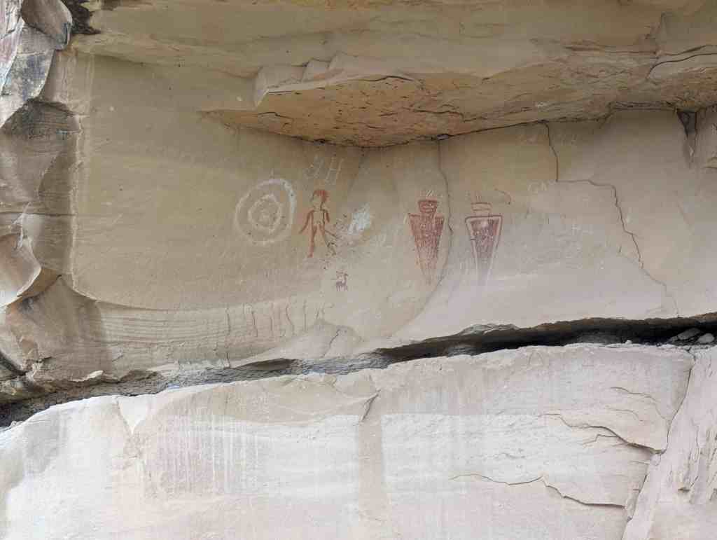
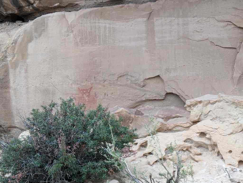
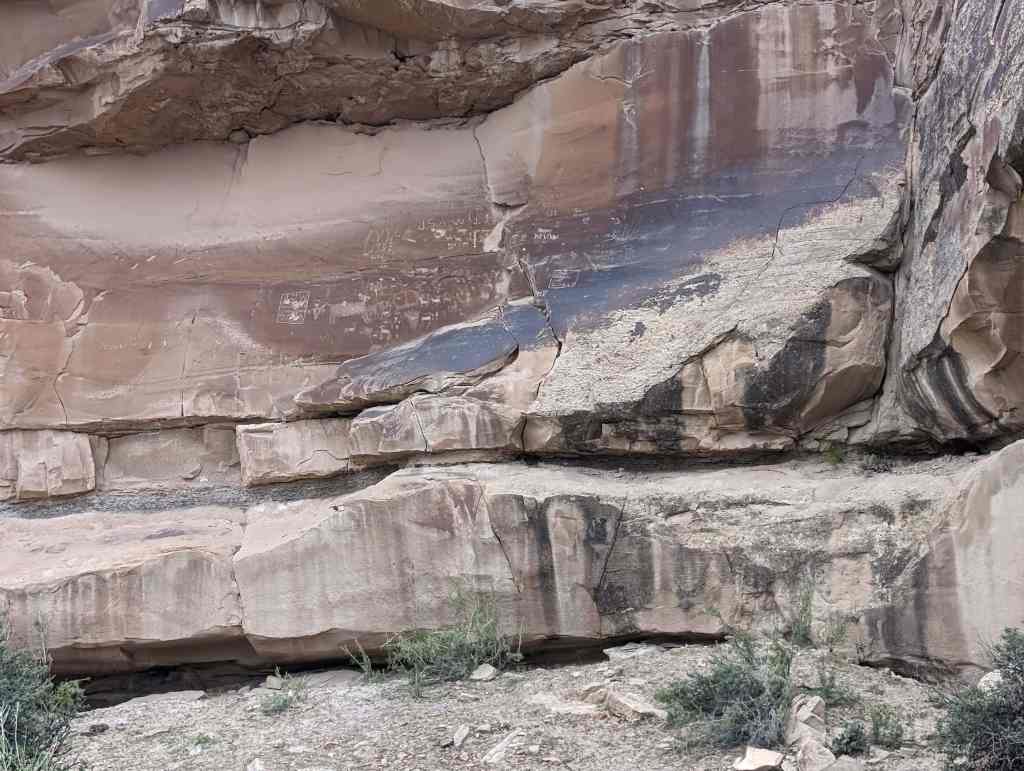
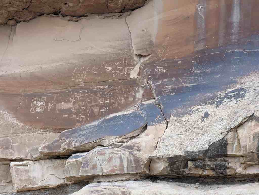
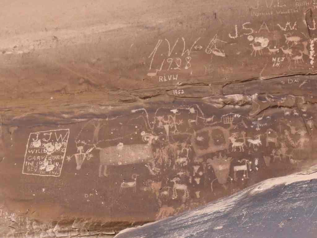
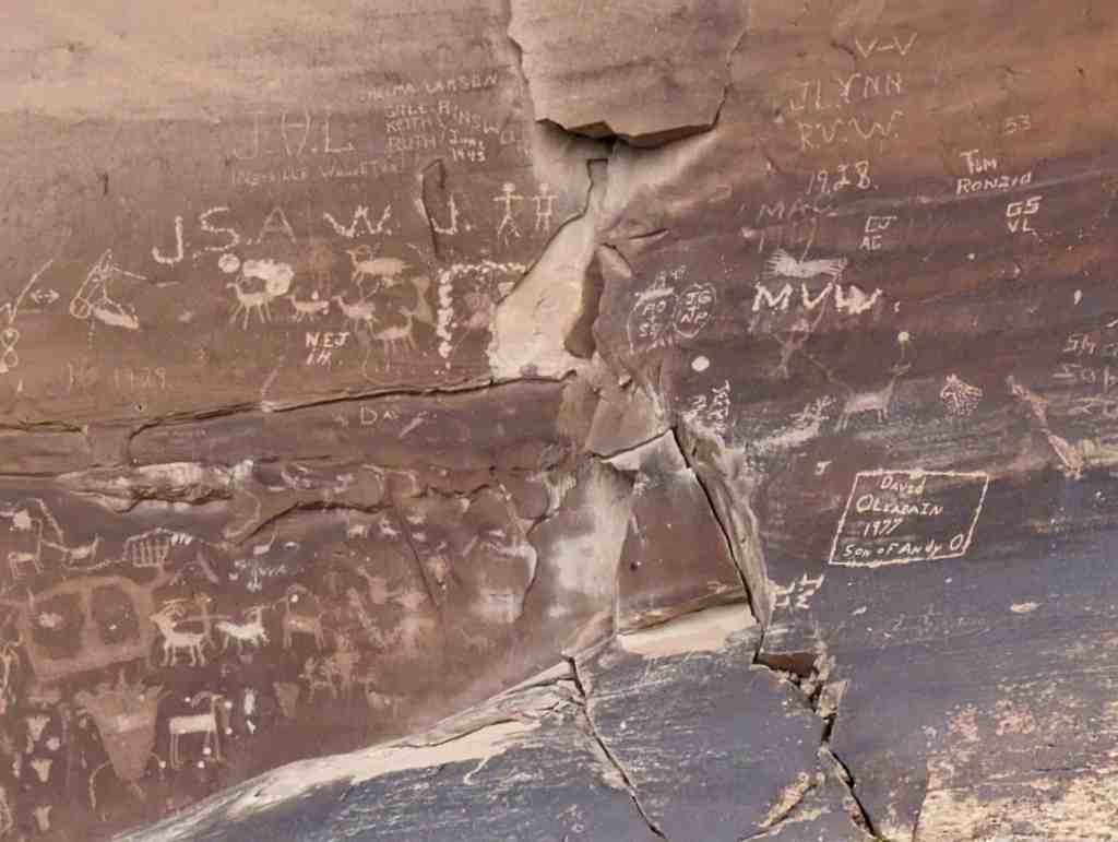
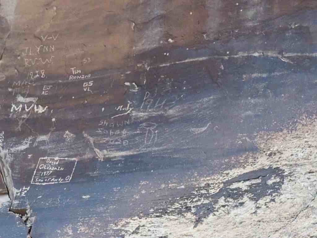
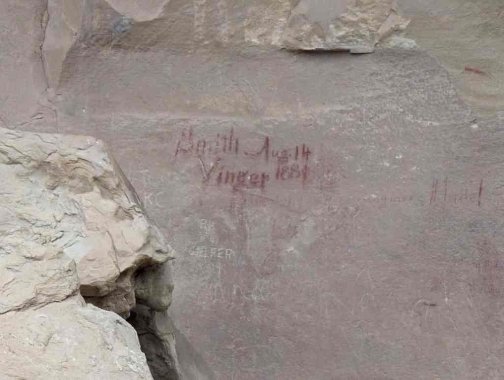
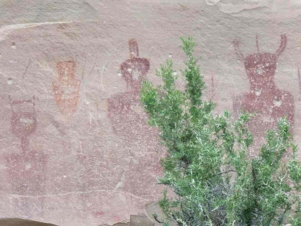
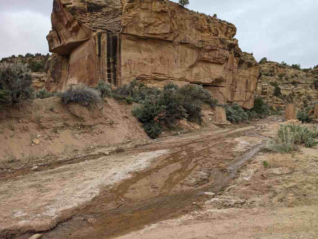
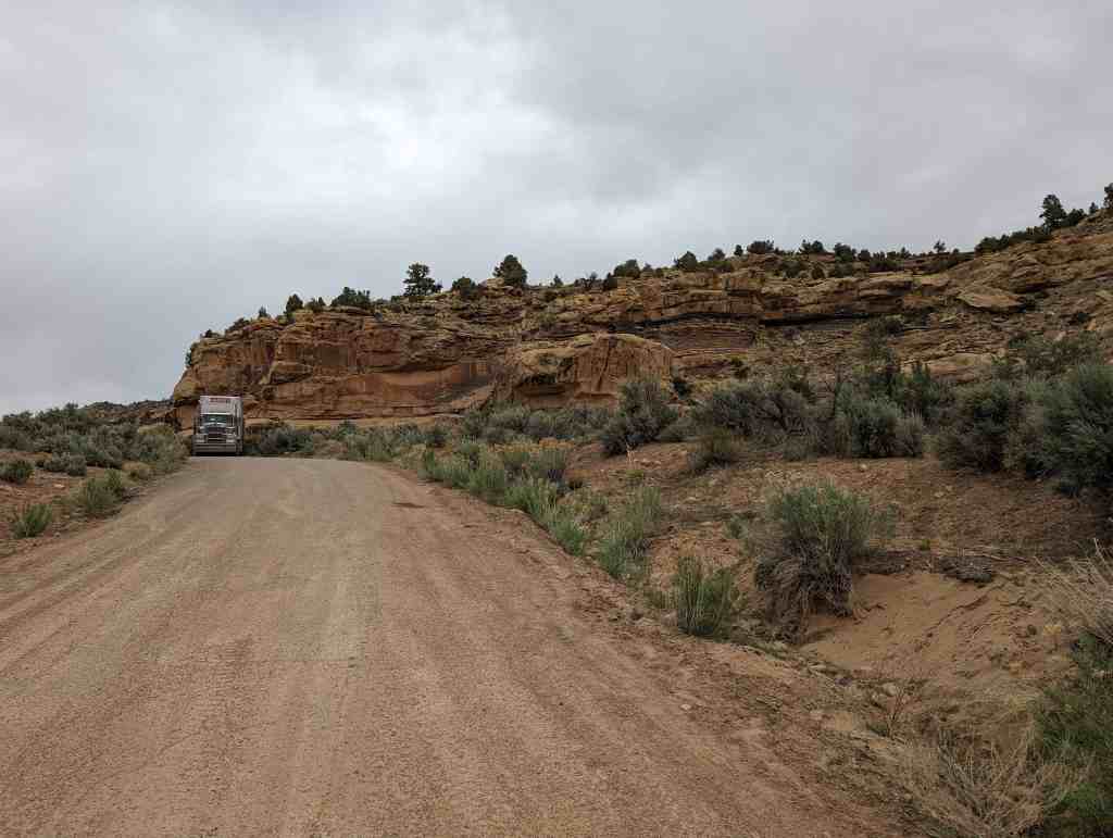
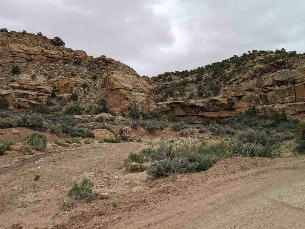
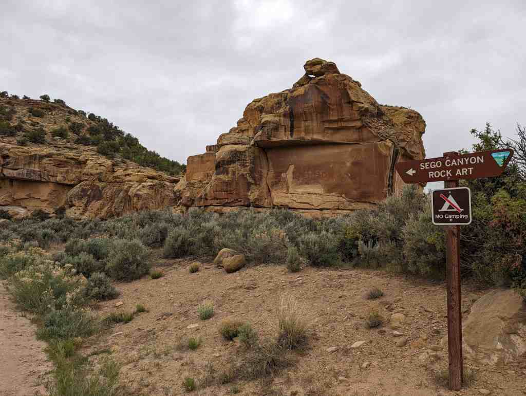
Thompson Wash Rock Art District / Sego Canyon Rock Art Interpretive Site
Sego Canyon contains three culturally distinct styles of rock art: Fremont, Ute and Barrier-style. A well preserved ghost town and ruins of a coal mine are located nearby. Visitors are advised to plan for at least a half day to explore this exciting area.*
Located in Sego Canyon near Thompson Springs, Utah. This site was added to the National Register of Historic Places (#80003909) on August 1, 1980.